Robust obstacle segmentation is essential for the safety of intelligent robots, where LiDAR-based perception systems play a fundamental role in the robot-environment interaction. While extensive LiDAR-based approaches have demonstrated high performance on common obstacles in urban scenarios, their results on tiny obstacles such as curbs, gravel, and potholes remain unsatisfactory due to the significant similarity between tiny obstacles and inherent road undulations. Moreover, their segmentation accuracy even deteriorates sharply when the LiDAR scans suffer from degradation in challenging off-road scenes. To overcome these bottlenecks, we propose LOGOS, a LiDAR-only unified tiny obstacle segmentation system, which models the road surface as a continuous mixture of 2D Gaussian primitives and distinguishes tiny obstacles via high-presicion elevation estimation. Unlike existing Gaussian splatting methods that rely on iterative RGB training, LOGOS is a backpropagation-free LiDAR-only approach. It directly estimates Gaussian parameters via a freespace-aware initialization by incrementally pruning non-road primitives using smoothness constraints. Subsequently, pointwise signed distances are computed via a novel normal-aware elevation splatting function, ensuring robustness to both flat and sloped terrains. We evaluate LOGOS on a highly heterogeneous benchmark of point cloud frames collected from urban mobility scenarios and mining haulage off-road environments. These data are practically acquired using different LiDAR sensors and exhibit large variations in point density, terrain roughness, and obstacle types. Experiments on the road and off-road scenes demonstrate that LOGOS significantly outperforms other state-of-the-art methods, particularly in degraded point cloud regions and challenging off-road scenarios, while maintaining real-time efficiency.
The Automated Valet Parking system (AVP), as one of the promising technologies, offers significant benefits in saving maneuver time and parking cost. With the increase number of vehicles using AVP system in large-scale parking lots, the overall efficiency is limited by the selfish decision-making of each individual; therefore, cooperative-AVP (C-AVP) is developed to achieve global optimization by scheduling the vehicles. Existing C-AVP methods focus only on one of the key processes in AVP, such as space allocation, trajectory planning, and electric vehicle(EV) charging. However, these factors interact with each other and are rarely considered in an entire system. Therefore, this paper aims to model the space allocation, trajectory planning, and EV charging problem in a whole framework, named APC-scheduler, and adopt it to improve the overall efficiency for large-scale parking lot with EV. The APC-scheduler comprises two parts: 1) a zone-based parking space allocation module dynamically assigns parking spaces based on real-time conditions using a hierarchical optimization strategy. It contains a charging priority estimation process to determine the EV’s charging requirement urgency; 2) a conflict-based trajectory planning module is developed to reduce trajectory overlaps and vehicle conflicts. It uses spatial-temporal path planner and speed planner to eliminate conflicts. Experiments under reasonable vehicle arrival and departure statistics have been conducted in a large-scale parking lot with 526 parking spaces. The results demonstrate that the proposed method effectively enhances parking efficiency and minimizes conflicts, particularly under high vehicle arrival frequencies and in dense traffic conditions.
Roadside multi-sensor networks, such as RGB-D camera networks, play a crucial role in Intelligent Transportation Systems (ITS). These systems rely on accurate extrinsic parameters (i.e., the relative positions and orientations) of each camera in the network. However, achieving fast and accurate large-scale extrinsic parameter calibration is challenging, especially when the overlap between camera views is limited due to cost constraints. To address this issue, we propose an automated, scalable, and marker-free calibration method that requires no human intervention. Our approach leverages dynamic rigid bodies, such as moving vehicles, as bridges to establish associations among all cameras without manual placement or supervision. The proposed method consists of three main stages: 1) calibrating camera height, roll, and pitch using the ground plane; 2) estimating each camera’s 2D position and yaw angle based on trajectories; and 3) refining these estimates by matching features on the road surface using SuperPoint and SuperGlue. Real-world experiments involving 58 roadside RGB-D cameras deployed in a parking lot demonstrate that our method significantly improves calibration efficiency while maintaining high accuracy, making it well-suited for large-scale RGB-D camera network deployment.
Complete and accurate environment 3D perception is a cornerstone of autonomous driving, and multi-vehicle cooperative perception offers a compelling solution to overcome occlusions and achieve comprehensive environmental awareness by leveraging wireless communication among neighboring agents. However, practical deployment necessitates a careful trade-off between communication efficiency and perceptual accuracy. In this work, we propose an instance-level intermediate fusion framework that achieves performance comparable to dense fusion methods while reducing communication overhead by 100 ×. Our method introduces an alignment module for spatial and temporal domain equipped with learnable position encodings to mitigate misalignments induced by inherent transmission delays and heterogeneous vehicle poses. Furthermore, we decouple the decoding process into anchor-based reference point generation and offset prediction, thereby overcoming the limited perception range constraints in existing intermediate fusion approaches. Evaluated on V2X-Real dataset, our method achieves comparable results with 54.2 mAP (IOU0.3) and 46.7 mAP (IOU0.5), demonstrating robustness under real-world conditions, including time delay and communication constraints, thereby establishing a new paradigm for efficient and scalable cooperative perception.
Intelligent Transportation Systems (ITS) require reliable environmental perception to support safe and efficient transportation. With the rapid development of Vehicle-to-everything (V2X), roadside perception has become an effective means to extend sensing coverage and improve traffic safety. However, the scarcity of large-scale annotated roadside LiDAR datasets poses a major challenge for training high-performance roadside perception models. In this paper, we introduce Vehicle-to-Roadside LiDAR Synthesis (VRS), a data synthesis framework that generates labeled roadside LiDAR datasets from vehicle-side datasets via LiDAR novel view synthesis. To mitigate the vehicle-to-roadside domain gap, VRS employs vehicle point cloud completion to compensate for missing geometry in vehicle-side observations, and introduces an occupancy-based visibility constraint to handle large viewpoint changes during cross-view rendering. The proposed framework enables flexible multi-view rendering for scalable roadside data generation. Extensive experiments on roadside 3D object detection demonstrate that the synthesized data effectively complements real roadside data, mitigates the limitations of limited real-world roadside data, and improves generalization to unseen roadside viewpoints.
Most existing Uncrewed Aerial Vehicle (UAV) and Uncrewed Ground Vehicle (UGV) cooperative systems adopt a UAV-centric paradigm, in which the UAV carries onboard sensors to search for, localize, and land on the UGV. This UAV-centric architecture increases onboard payload and reduces endurance, and makes it difficult to reliably assess the safety of the entire landing airspace in unstructured environments. To address these limitations, we propose a ground-centric UAV-UGV cooperative system, wherein a UGV-mounted LiDAR serves as the primary perception unit for launch and recovery. The perception architecture operates in two modes, namely an overhead airspace assessment mode in which the UGV evaluates the overhead airspace for UAV landing and relocates to an open area to ensure landing safety, and a tracking mode that supports guided recovery of the returning UAV. This ground-centric design introduces a coordinate alignment challenge between heterogeneous platforms, which is addressed through an online calibration based on a short flight maneuver that aligns the UAV frame with the UGV frame. Real-world experiments validate the complete autonomous launch and recovery process and demonstrate robust system performance with centimeter-level landing accuracy.
3D semantic occupancy prediction plays a vital role in fully understanding the surroundings, which has great potential in automated valet parking. Its comprehensive foreground and background awareness is well-suited for parking scenarios, which contain numerous background obstacles such as walls and pillars. During parking, the ego vehicle is often very close to these obstacles, requiring 3D fine-grained modeling of the surroundings. Therefore, considering that mass-produced vehicles are typically equipped with surround-view fisheye cameras, applying the occupancy prediction model based on fisheye cameras to parking perception is significant and promising. However, most existing works focus on applications in urban or highway scenarios, with insufficient attention given to parking scenarios. There are no available datasets or methods exploring the application of occupancy solutions in parking scenarios. To address this, we introduce a new surround-view fisheye occupancy dataset and benchmark called ParkOcc to promote research in dealing with diverse real-world parking cases. In addition, we also propose our new model, AdaptiveOcc v2, which utilizes joint forward and backward projection along with 2D and 3D auxiliary branches to achieve accurate performance. Extensive experiments validate the effectiveness and exceptional generalizability of our approach. We hope the ParkOcc benchmark will boost the development of surrounding occupancy perception algorithms. Code and dataset are available at https://github.com/yty-sky/ParkOcc
With the development of vehicle-to-infrastructure (V2I) cooperation, roadside LiDAR sensors offer a novel solution for vehicle pose estimation. This article proposes an infrastructure-based high-accuracy vehicle pose estimation method, offering a full pipeline from raw data to final estimation results. We employ nonrepetitive scanning LiDAR as the primary measuring instrument, as its novel scanning pattern can eliminate static blind zones and is more cost-efficient compared to traditional rotating multiline LiDAR. However, due to the sparsity and irregular sampling patterns of nonrepetitive scanning LiDAR, existing methods designed for rotating multiline LiDAR fail to deliver sufficient precision. To address the challenges arising from such LiDARs, we introduce an instance segmentation method tailored for nonrepetitive scanning LiDAR and propose a grid-variance-based optimization approach to construct a high-accuracy vehicle geometry template. These templates are then used in a registration-based framework for continuous vehicle pose estimation. Experiments in two real-world scenarios show that our method achieves an average position error of around 7 cm and a heading error of 1.1 degrees, outperforming existing baselines in vehicle pose estimation. The dataset and source code will be available at https://github.com/ElizabethSF/Register-Loc
Constructing traversable maps in off-road environments is of great significance for the deployment of unmanned ground vehicles (UGVs) in applications such as disaster rescue and agricultural production. However, existing approaches often rely on manually scanning the environment to generate maps, followed by labor-intensive labeling of traversable regions, which is both time-consuming and inefficient. To address this issue, this paper proposes an autonomous exploration-based UGV system capable of automatically building traversable maps. The system integrates a traversability discrimination method with an autonomous exploration strategy, enabling the vehicle to complete the mapping task independently in unknown environments. The proposed framework is implemented on a real UGV platform, and field experiments are conducted. Both qualitative and quantitative evaluations of the generated traversable maps are provided, demonstrating the effectiveness and feasibility of the proposed approach.
Reliable perception is essential for autonomous driving systems to operate safely under diverse real-world traffic conditions. However, camera- and LiDAR-based perception systems suffer from performance degradation under adverse weather and lighting conditions, limiting their robustness and large-scale deployment in intelligent transportation systems. Radar-vision fusion provides a promising alternative by combining the environmental robustness and cost efficiency of millimeter-wave (mmWave) radar with the rich semantic information captured by cameras. Nevertheless, conventional 3D radar measurements lack height resolution and remain highly sparse, while emerging 4D mmWave radar introduces elevation information but also brings challenges such as signal noise and large data volume. To address these issues, this paper proposes RadarXFormer, a 3D object detection framework that enables efficient cross-modal fusion between 4D radar spectra and RGB images. Instead of relying on sparse radar point clouds, RadarXFormer directly leverages raw radar spectra and constructs an efficient 3D representation that reduces data volume while preserving complete 3D spatial information. The "X" highlights the proposed cross-dimension (3D-2D) fusion mechanism, in which multi-scale 3D spherical radar feature cubes are fused with complementary 2D image feature maps. Experiments on the K-Radar dataset demonstrate improved detection accuracy and robustness under challenging conditions while maintaining real-time inference capability.
Visual perception in dynamic scenes is a crucial task in the fields of computer vision and autonomous driving. In this paper, we focus on monocular optical flow and expansion estimation. Optical flow describes the positional changes of pixels between two frames, while optical expansion describes local image-scale changes around pixels and their neighbourhoods. Monocular optical flow estimation has a well-established research foundation, with most existing methods achieving high-precision optical flow through image texture feature extraction and matching. However, research on optical expansion is limited. Existing optical expansion estimation methods all rely on optical flow results or model structures and do not accurately model the expansion task itself. In fact, object motion in dynamic scenes generates rich local scale information in images, which is an ideal characteristic for solving the optical expansion task. In this paper, we propose and explore methods for extracting and interacting image texture-scale features and apply them to achieve high-quality monocular optical flow-expansion estimation. We propose MonoFusion, a new formulation and learning framework for jointly estimating optical flow and optical expansion by independently extracting and fusing texture and scale features. Additionally, we introduce MonoFusion-R, which enriches the texture-scale fusion process with a recurrent framework. Our method achieves state-of-the-art (SOTA) monocular performance on four KITTI tasks, including optical flow, optical expansion, time-to-collision, and scene flow, and also shows strong optical-flow generalization on FlyingThings3D.
Shallow gas, recognized as a clean energy source with significant reserves, has attracted increasing attention in recent years. Due to its shallow burial and weak diagenesis, exploration and development are difficult, necessitating advancements in geophysical prediction techniques. The South China Sea is one of the most important shallow gas resource areas in China, with studies revealing that the cumulative thickness of the shallow gas layer in the study area reaches hundreds of meters. However, exploration of shallow gas often encounters challenges including low exploration degree, limited and uneven well information, and strong lateral heterogeneity. This study proposes a multivariate information fusion modeling method, which integrates the seismic velocity field, regional compaction trends, and well-log data to construct a more geologically reasonable initial model of seismic inversion. This method effectively incorporates the lateral seismic information while accounting for regional compaction variations vertically and integrating the sparse, localized drilling data. The pre-stack seismic simultaneous inversion results demonstrate that our method significantly improves the prediction accuracy of shallow gas reservoirs in the study area, providing new insights and technical support for oil and gas exploration. This study emphasizes the potential of seismic inversion driven by multi-information fusion modeling, which can effectively identify favorable shallow gas reservoirs and has broad applicability in similar geological settings.
Motion distortion correction is critical in LiDAR odometry. Traditional scan-based methods alleviate inner-scan motion based on constant-velocity assumptions or Inertial Measurement Units (IMUs). However, these methods treat such correction as a preprocessing, and the inevitable correction errors cannot be eliminated in subsequent stages. On the other hand, The continuous trajectory representation based on B-spline can effectively address such problems, but it typically suffers from low computational efficiency, requiring sacrificing point cloud density to achieve better real-time performance. In this study, we introduce an efficient method for implementing B-spline curves and trajectory optimization. It can achieve real-time performance without the need for feature extraction or significant downsampling of point clouds, which contributes to obtaining higher odometry accuracy and local map density. Furthermore, our method can be easily integrated into various other B-spline-based methods to help improve their computational efficiency.
In recent years, wheeled robots have been widely used in the field of logistics automation. In real-world application, the inertia of wheeled robots is not fully considered in traditional speed planning methods, and the longitudinal error of wheeled robots reaching the target area is too large to accurately complete subsequent operations, especially for large-loaded wheeled robots like autonomous forklifts. In order to deal with the above problem, this paper proposes an acceleration-awarded speed planning method based on acceleration optimization aimed at making wheeled robots reach the target area smoothly and accurately. This method first introduces acceleration information into speed planning based on dynamic constraints, and then models speed planning as an optimization problem to smooth speed changes. Experimental verification shows that the longitudinal error of wheeled robots using this method is significantly reduced, and the smoothness of speed is improved.
Automated parking stands as a highly anticipated application of autonomous driving technology. However, existing path planning methodologies fall short of addressing this need due to their incapability to handle the diverse and complex parking scenarios in reality. While non-learning methods provide reliable planning results, they are vulnerable to intricate occasions, whereas learning-based ones are good at exploration but unstable in converging to feasible solutions. To leverage the strengths of both approaches, we introduce Hybrid pOlicy Path plannEr (HOPE). This novel solution integrates a reinforcement learning agent with Reeds-Shepp curves, enabling effective planning across diverse scenarios. HOPE guides the exploration of the reinforcement learning agent by applying an action mask mechanism and employs a transformer to integrate the perceived environmental information with the mask. To facilitate the training and evaluation of the proposed planner, we propose a criterion for categorizing the difficulty level of parking scenarios based on space and obstacle distribution. Experimental results demonstrate that our approach outperforms typical rule-based algorithms and traditional reinforcement learning methods, showing higher planning success rates and generalization across various scenarios. We also conduct real-world experiments to verify the practicability of HOPE. The code for our solution is openly available on https://github.com/jiamiya/HOPE.
Robust obstacle segmentation remains critical for the safety of intelligent transportation systems (ITS), where LiDAR-based perception systems form the cornerstone of vehicle-environment interaction. Although state-of-the-art (SOTA) LiDAR-based approaches have demonstrated high performance in segmenting common obstacles, the results for tiny obstacle segmentation are still unsatisfactory. However, such tiny obstacles, e.g., curbs, gravel, and potholes, pose significant threats to ground vehicles, undermining ITS operational safety and surface transportation traffic efficiency. It is challenging for SOTA methods to distinguish tiny obstacles due to their inability to precisely model road surfaces, particularly bumpy road surfaces. To address this problem, this paper proposes a road modeling method based on the Markov random field (MRF), possessing stronger road surface modeling capability. A novel negative exponential energy function is introduced to simultaneously ensure the smoothness of the road model and the consistency with the road undulation. After the energy minimization of the MRF, the segmentation of obstacles (including both positive and negative obstacles) is achieved by computing the signed distance to the refined road model. Our proposed terrain-aware tiny obstacle segmentation (TA-TOS) method is compatible with different terrains and different LiDARs, without any prior data or pre-training. We evaluate the performance of TA-TOS on the SemanticKITTI dataset, and two self-built datasets containing tiny obstacles from actual urban mobility systems (road scenarios) and mining haulage systems (off-road scenarios), respectively. Our proposed TA-TOS method achieves much better performance than the SOTA LiDAR-based segmentation approaches, particularly on roads with pronounced undulation. The results show that the improvement is more significant for the segmentation of smaller obstacles. Our source code is publicly available at github.com/ryming2001/TA-TOS.
Multi-camera 3D semantic occupancy prediction is a critical task for autonomous driving, playing a vital role in understanding the environment. Current methods mainly rely on uniform voxel representation to encode space, which greatly limits their resolution scalability. It causes most existing methods to struggle with scaling to finer granularities, as the cubic growth nature of uniform voxel leads to a significant increase in the demand for computational and storage resources when scaling. To address this, we propose a multi-level hierarchical model AdaptiveOcc. Using the octree structure, our model can adaptively represent different parts of space with varying voxel granularity. It can selectively extend resolution only for a small subset of voxels, thus mitigating the substantial computational and storage burden brought by scaling. To endow our model with adaptability, we propose a distance-adaptive octree construction rule for generating supervised labels. Considering that the voxel granularity requirements vary for different distance ranges in environmental perception, such a construction rule results in a higher likelihood of coarser granularity for distant regions and finer granularity for nearby regions. This ensures a more efficient and rational allocation of computational resources, further reducing the inference latency. Extensive experiments on nuScenes, SemanticKITTI and Waymo dataset validate that our method can scale to finer granularities with faster speed, and less training memory compared with other state-of-the-art methods. Our code is available at https://github.com/yty-sky/AdaptiveOcc.
Multicamera vehicle tracking refers to tracking the same vehicle in multiple cameras in various locations, which aids in traffic flow analysis and prediction. But, collecting and labeling extensive multicamera vehicle tracking datasets for cities is challenging due to the spatio-temporal complexity, hindering the performance of multicamera vehicle tracking algorithm development. Simulations can produce vast, automatically labeled datasets. However, there is a significant domain gap between virtual and real vehicles, affecting style features like texture and illumination, as well as apparent features like scale and pose. We introduce VR-DataAug, a data augmentation method merging virtual and real data with consistent style and apparent features. A Background Modeling With Detection Feedback module creates a clean background and extracts vehicle instances. A Multiattribute Vehicle Apparent Modeling module utilizes a classifier to learn apparent features from various camera viewpoints, preserving scale, position, and orientation information between virtual and real vehicles. A Virtual Vehicle and Real Background Fusion module uses a generative model to ensure texture consistency and merge virtual vehicles into real traffic scenes. Extensive experiments on the CityFlow dataset demonstrate that our approach improves detection performance by 3.4% mAP, enhances the vehicle re-identification model by 3.84%, boosts multi camera vehicle tracking by increasing IDF1 metrics by 4.25%, and highlighting its potential to expand training sets while minimizing domain offset.
Vehicle localization using roadside LiDARs can provide centimeter-level accuracy for cloud-controlled vehicles while simultaneously serving multiple vehicles, enhancing safety and efficiency. While most existing studies rely on repetitive scanning LiDARs, non-repetitive scanning LiDAR offers advantages such as eliminating blind zones and being more cost-effective. However, its application in roadside perception and localization remains limited. To address this, we present a dataset for infrastructure-based vehicle localization, with data collected from both repetitive and non-repetitive scanning LiDARs, in order to benchmark the performance of different LiDAR scanning patterns. The dataset contains 5,445 frames of point clouds across eight vehicle trajectory sequences, with diverse trajectory types. Our experiments establish baselines for infrastructure-based vehicle localization and compare the performance of these methods using both non-repetitive and repetitive scanning LiDARs. This work offers valuable insights for selecting the most suitable LiDAR scanning pattern for infrastructure-based vehicle localization. Our dataset is a significant contribution to the scientific community, supporting advancements in infrastructure-based perception and vehicle localization. The dataset and source code are publicly available at: https://github.com/sjtu-cyberc3/BenchRNR.
 Ming Yang (杨明)合作论文数School of Automation and Intelligent Sensing, Shanghai Jiao Tong University196
 Bing Wang (王冰)合作论文数Shanghai Jiao Tong University98
 Yeqiang Qian (钱烨强)合作论文数School of Automation and Intelligent Sensing, Shanghai Jiao Tong University47
 Hanyang Zhuang (庄瀚洋)合作论文数Shanghai Jiao Tong University Global College34
 Liuyuan Deng合作论文数17
 hao li合作论文数16
 Ruqing Yang (杨汝清)合作论文数Research Institute of Robotics,Shanghai Jiao Tong University16
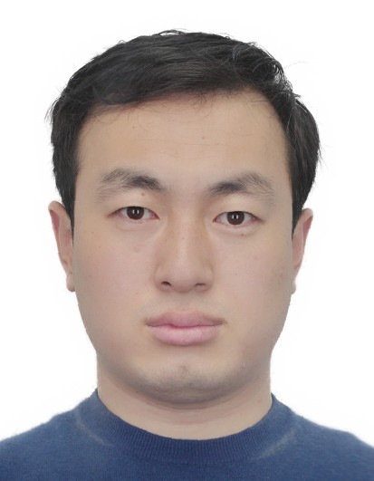 Liang Li (李亮)合作论文数College of Control Science and Engineering, Zhejiang University12
 Weihao Yan合作论文数Key Laboratory of System Control and Information Processing, Shanghai Jiao Tong University11
 Yitian Li合作论文数MoE Key Lab of Artificial Intelligence, AI Institute, Shanghai Jiao Tong University;State Key Lab of Advanced Optical Communication System and Network, Shanghai Jiao Tong University9
 Yuesheng He合作论文数9
 Lindong Guo合作论文数9
 Xinhua Weng (翁新华)合作论文数CyberC3 Intelligent Vehicle Labs, Department of Automation, School of Electronic Information and Electrical Engineering, Shanghai Jiao Tong University9Hideaki Marui合作论文数8Hengwang Zhao合作论文数Key Lab Syst Control & Informat Proc, Minist Educ China7
 Yongzhang Wang (王永章)合作论文数School of Mechatronics Engineering, Harbin Institute of Technology7Tetsuro Esaki合作论文数7
 Chenxi Yang合作论文数6
 Yueyuan Li合作论文数Shanghai Jiao Tong University, Key Laboratory of System Control and Information Processing, Ministry of Education of China, Shanghai, China6
 Mowen Xie (谢谟文)合作论文数School of Civil and Resource Engineering, University of Science and Technology Beijing6
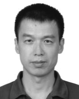 Wei Yuan (袁伟)合作论文数6Naoki Watanabe合作论文数6Songan Zhang合作论文数5Zhengchen Lu合作论文数5Qiu Cheng合作论文数5
 Zhidong Liang合作论文数Research Institute of Robotics, Shanghai Jiao Tong University, Shanghai, 200240, China5
 Hanqing Xu合作论文数5Hai-Gui Xu合作论文数5Gen Furuya合作论文数5
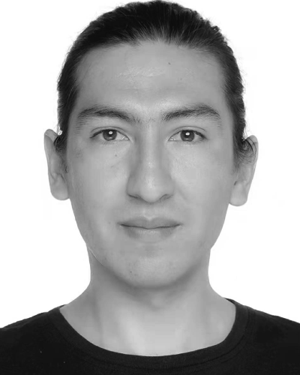 Pablo Rodrigo Gantier Cadena合作论文数4Yongkun DONG (董永坤)合作论文数4
 Wei Tang合作论文数JD.com4Linji Xue合作论文数4Guangbu Li (李光布)合作论文数4Xiaoxiao Yang合作论文数3Guang-tai MI (米广太)合作论文数3Fangjie Le合作论文数3Yunzhong Fu (付云忠)合作论文数School of Mechatronics Engineering, Harbin Institute of Technology3yikai hu (胡益恺)合作论文数3
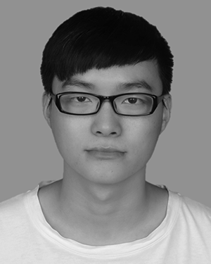 Wang Xiaoliang合作论文数3Lei Ye合作论文数3
 Snježana Mihalić Arbanas合作论文数Fac Min Geol & Petr Engn, Univ Zagreb3
 Gang Zhu合作论文数3Qiangde Xie (谢强德)合作论文数3
 Yasuhiro Mitani合作论文数Kyushu University, Kyushu University3Baoyu Tian (田宝玉)合作论文数福建师范大学生命科学学院3Changlin Li合作论文数2




