Lane detection is a fundamental task in computer vision with broad applications in autonomous driving. Recent advances have focused on line-anchor-based representations for their efficiency and high accuracy. However, most existing methods adopt anchors that are continuous in point sampling yet discrete in width and fixed in direction. This leads to geometric misalignments with real-world lane lines, which exhibit continuous width representation and smoothly varying directions. These misalignments cause symmetric point ambiguity and magnified localization errors, ultimately degrading both evaluation reliability and detection accuracy. To address these issues, we propose angle-aware rectangle anchors (ARAs), a novel representation with continuous width and adaptive directional alignment, that effectively captures the geometric variation of lane lines. In addition, we propose the three-phase angle-thresholded line-area transition (TALAT) loss, which dynamically switches between loss formulations based on angular thresholds and overlap quality, enabling a smooth transition from coarse to fine supervision. Extensive experiments on multiple standard benchmarks (TuSimple, CULane, CurveLanes, and LLAMAS) demonstrate that our approach achieves competitive or state-of-the-art (SOTA) performance. Notably, ARA exhibits superior robustness in challenging scenarios while maintaining real-time inference speed. Our code and models are publicly available at https://github.com/changehome717/ARA-Lane-Detection
Expressway unmanned aerial vehicle (UAV) pre-deployment is a geospatial decision-support task that requires reliable road-segment-level traffic flow prediction based on spatial sensing networks. However, existing spatiotemporal forecasting models remain limited in characterizing cross-segment propagation relationships, long-lag causal dependencies, and atypical traffic evolution patterns. In addition, complex models often fail to meet the computational requirements of edge-device deployment. Based on electronic toll collection (ETC) gantry data, this study proposes a causal–semantic spatiotemporal forecasting framework for long-term traffic flow prediction with a 24 h forecasting horizon. First, conditional Granger causality analysis is used to construct a directed causal prior graph that characterizes traffic propagation relationships among expressway segments. Second, scenario-semantic priors generated by a large language model are introduced to describe atypical traffic conditions. Then, causal structural priors and scenario-semantic priors are integrated into a teacher model and transferred to a lightweight student model through response-level and feature-level knowledge distillation. Experiments using expressway data from Hubei Province, China, show that the proposed model achieves the best overall performance in the typical scenario and competitive performance in the atypical scenario. The results indicate that the proposed framework can provide day-scale decision support for expressway law-enforcement UAV pre-deployment and enhance the spatial intelligence of traffic emergency management.
The integration of Global Navigation Satellite System (GNSS) and Inertial Measurement Unit (IMU) data has been extensively employed in various navigation and positioning systems. The dominant approach for GNSS/IMU integration remains the Bayesian filtering framework, particularly the extended Kalman filter (EKF). However, the performance of the EKF is highly sensitive to the accuracy of its dynamic and noise models, which are often difficult to specify precisely in real-world environments. To address the challenges of model mismatch and unknown noise statistics, this article proposes a completely split-KalmanNet (CS-KalmanNet), a completely decoupled hybrid model-based and data-driven architecture. Unlike existing split-KalmanNet, which learns the one-step state prediction error covariance and the innovation covariance, the proposed CS-KalmanNet achieves complete structural decoupling by independently learning the one-step state prediction covariance and the measurement noise covariance. This design avoids redundant representation learning and enhances robustness and estimation accuracy. Furthermore, a variational Bayesian adaptive Kalman filter is incorporated to facilitate faster convergence and improve the stability of network training. By combining the physical interpretability of the Kalman filter with the adaptive learning capability of deep networks, the proposed CS-KalmanNet achieves substantially enhanced state estimation accuracy. Its effectiveness is validated through extensive numerical simulations, public dataset evaluations, and real-world experiments conducted on a quadruped robot platform.
V2I (Vehicle-to-Infrastructure) collaborative perception enhances the ability to perceive dynamic driving environments by sharing multi-viewpoint information from the same scene through communication, gradually becoming an essential part of intelligent transportation systems. However, it inevitably introduces an inherent trade-off between communication bandwidth and perception performance. To address this bottleneck, we introduce a map-mask precisely aligned with perceptual spatial features. This mask can accurately filter out the background of the real-time perceptual feature information so as to selectively extract the perceptually critical areas as communication content. Based on this novel map-mask, we propose Map4comm, a unified map-aware collaborative perception framework, to achieve an efficient balance between communication bandwidth and perception performance. In order to save communication bandwidth, Map4comm introduces a Local Communication Area Selection (LCAS) mechanism based on map-mask to optimize the communication area selection of the system. In terms of performance, Map4comm presents an Adaptive Covoxel Feature Alignment (ACFA) strategy to achieve coarse alignment of vehicle-infrastructure-map heterogeneous low-dimensional voxel features, which in turn improves the overall perceptual performance. Based on these two approaches, Map4comm realizes an efficient trade-off between communication bandwidth and perception performance. To evaluate Map4comm, we conducted mapping and testing on the large-scale vehicle-infrastructure collaborative sequential perception dataset V2X-Seq-SPD. The experimental results show that Map4comm outperforms all other collaborative perception methods in terms of perceptual performance while realizing the least communication transmission cost compared to the state-of-the-art collaborative perception methods.
Precise positioning is critical for autonomous vehicles (AVs), which normally utilize GNSS (Global Navigation Satellite System) /IMU (Inertial Measurement Unit) integrated techniques. In urban environments, the integrated system suffers from degradation of positioning accuracy because of low signal-to-noise ratio. LiDAR (Light Detection and Ranging) and camera can also contribute to localization via LiDAR-IMU odometry (LIO) and Vision-IMU odometry (VIO), but they also suffer from repetitive structural scenes, illumination changes and interference from dynamic objects. Given that each type of sensor has different properties regarding the robustness in diverse urban environmental conditions, we propose a resilient GNSS-LiDAR-Vision-IMU odometry (GLVIO) and loop closure system to achieve high-precision simultaneous localization and mapping (SLAM). The main contributions include: 1) The system takes a resilient fusion strategy that makes real-time decisions about how each sensor contributes to the update of each state variable via factor-graph optimization, by theoretically analyzing, modeling and propagating the uncertainty of the factors, thereby enhancing the robustness and accuracy of positioning. 2) A real-time degeneration detection algorithm is proposed for LIO, which can adaptively suppress LIO factors when degeneration occurs. 3) To enhance the reliability of visual updating, semidense feature extraction is performed when feature sparsity is detected. 4) To overcome the negative effects of dynamic objects on pose estimation and mapping, a 3D object-detection-based point cloud filtering module is proposed in the front-end. The effectiveness of our method is verified by comparing with SOTA methods across multiple public urban datasets. Our code is available at https://github.com/TK72/FAST-LIVOSAM as opensource software to benefit the community.
Photogrammetric point clouds have emerged as a cost-effective solution to urban environment perception and scene understanding, significantly advancing recent research in urban-scale 3-D semantic segmentation. In contrast to well-explored indoor and road scenes, urban-scale photogrammetric point clouds exhibit more complex spatial geometries, richer texture details, and pronounced multiscale disparities between background environments and foreground objects. These challenges demand neural networks with enhanced spatial, low-level, and multiscale learning capabilities. To address these issues, we propose the multiscale pyramid network (MSPNet), a conceptually streamlined, end-to-end network for semantic segmentation of urban scenes. The proposed MSPNet comprises three key components: 1) the ellipsoid spherical position embedding (ESPE) module, which leverages learnable ellipsoid queries and spherical harmonics (SHs), rather than using a fixed ball query and a linear combination of spatial coordinates, to explicitly model position embeddings and effectively capture intricate geometric relationships; 2) the top-down information retrospection (TDIR) module, which establishes hierarchical semantic guidance through retrospective pathways, enhancing structural consistency across features at different levels; and 3) the low-rank adaptation (LoRA) fusion module, which applies matrix rank constraints during multiscale feature fusion to decompose high-level semantics into low-rank subspaces, alleviating multiscale semantic confusion. We have conducted extensive experiments on several established urban-scale photogrammetric point cloud segmentation benchmarks, including HRHD-HK, SensatUrban, and UrbanBIS. The experimental results demonstrate that MSPNet achieves significant improvements across these benchmarks, highlighting the superior ability to accurately segment urban scenes and the potential to advance urban environment perception and scene understanding.
Estimating the positioning uncertainty is important for location-based applications, such as autonomous driving and robotics, since they are safety-critical and require reliable positions whose uncertainty should be provided. Existing simultaneous localization and mapping (SLAM) frameworks focus on how to improve positioning accuracy and pay less attention to the uncertainty of vehicle positioning. In this article, we applied the multifault hypothesis solution separation (MHSS) theory in GNSS integrity monitoring, using it for an approximate estimate of the uncertainty of the newly updated state in every new scan. The estimated uncertainty in the new scan is used to propagate the covariance of the vehicle's position in the Lie group to obtain the position distribution circle of the current scan. At the same time, we consider the geometric distribution of light detection and ranging (LiDAR) measurements, proposing a low computational burden MHSS calculation method. Our approach considers both the front end and back end of the SLAM framework. Both the KITTI dataset and actual measured data verification experiments are conducted. The experimental results show that the spatial covariance propagated has good similarity with the actual vehicle positioning error in the horizontal and vertical directions, and the efficient calculation model reduces the computational burden of the system by more than 50%.
With the development of autonomous driving technology, autonomous valet parking (AVP) has become a key technology to solve the problem of urban parking. Current commercial AVP systems generally adopt solutions based on semantic maps, which achieve high-precision parking in small-scale scenarios. However, when the parking environment is expanded to large underground parking lots, semantic and occupancy grid maps face bottleneck problems such as a sharp drop in path generation efficiency and delayed parking space retrieval response. In addition, traditional High-definition maps (HD maps) rely on manual annotation and complex post-processing. In response to the above challenges, this article proposes an efficient adaptive topology plan for AVP in large-scale occupancy map: first, a scale-adaptive index model based on the R-tree structure is constructed to achieve hierarchical storage and dynamic resolution selection of grid map data; secondly, a multi - scale feature fusion topology aware method is designed to generate the environment topology; finally, a multi-path parallel hybrid A ${}^{\ast }$ algorithm is proposed for efficient planning. A comparison of our framework with both traditional and state-of-the-art methods shows that the framework is capable of enhancing planning efficiency and reducing average path generation time in large parking lots. Through simulations and real-world tests, the method has been shown to reduce path search time whilst generating paths that are easier to track with less tracking error.
In highway emergency motion planning, steering and braking simultaneously consume limited tire–road friction, making safety–stability coordination a key challenge. Existing risk-field-force methods can geometrically represent obstacles and road constraints, but their guidance may be inconsistent with the reachable domain of friction-limited vehicles, resulting in physically infeasible evasive maneuvers. We propose a highway emergency motion planner jointly guided by a physically constrained dynamic risk field and a topologically feasible safety corridor. First, a potential-field-based dynamic risk field is formulated with a friction-aware responsibility-sensitive safety model to generate continuously differentiable and adaptive risk forces consistent with high-speed vehicle dynamics. An improved hybrid vortex guidance force and a virtual-probe mechanism are introduced to mitigate local equilibrium and local-minimum problems. Second, a safety corridor is constructed for nonconvex multi-obstacle highway scenarios, transforming complex risk spaces into explicit traversable channels and reducing gradient-overlap effects. Third, a safety-corridor-constrained model predictive control framework with dynamic cost decomposition is developed to coordinate trajectory tracking, stability preservation, and friction feasibility. Equivalent cornering stiffness, longitudinal–lateral friction-circle constraints, and priority-based friction projection are incorporated to ensure stable control execution. The framework is validated in representative highway simulations and with real-world highway vehicle data. Results show that the proposed method achieves an average passing efficiency of 81.89%, while reducing the mean maximum sideslip angle, yaw rate, and front-wheel steering angle by 86.0%, 58.6%, and 62.4%, respectively. These results demonstrate improved safety, stability, and control smoothness in highway emergency planning.
Multi-agent collaborative perception enhances the perception coverage and robustness of intelligent agents in complex traffic environments by sharing and fusing information from diverse viewpoints. However, in vehicle-to-everything (V2X) scenarios, existing collaborative perception methods still face two major challenges: (i) an excessive reliance on raw sensor data to construct a global environmental representation, which causes communication bandwidth to surge dramatically as the perception range expands; and (ii) a disjoint treatment of traffic participants'trajectory and location information from sensor observations, neglecting the dual role of agents as both "perception sources" and "perception targets,"thereby limiting further improvements in collaborative perception performance. To address these issues, this paper proposes a novel position prior-driven cooperative perception framework, Posicooper. The proposed method fully leverages widely distributed positioning information and introduces two key designs: in terms of communication strategy, Posicooper constructs a global confidence map based on position priors to identify critical perception regions and selectively transmit their feature information, significantly reducing communication overhead; and in terms of perception modeling, it introduces a critical region guidance module that generates guidance maps from position priors to direct the networks' attention to important regions, thereby enhancing feature representation and improving detection accuracy. Experiments on two representative V2X collaborative perception data sets, OPV2V and V2XSet, demonstrate that Posicooper reduces communication costs by 28.6% while achieving an approximately 11.0% improvement in object detection accuracy, highlighting its strong potential for deployment in real-world traffic scenarios.
Reliable 3D environment perception forms the foundation of automated construction, where semantic segmentation of point clouds plays a crucial role in enabling accurate scene understanding. Due to historical conventions, existing point-based pipelines typically adopt the farthest point sampling (FPS) to uniformly downsample input point clouds. However, not all points are equally important for fine-grained semantic segmentation. Some points, such as boundaries, outlines, and small objects, are more important, more complex, and harder to learn than large-scale background. While these points contain significant features, they constitute only a small fraction of the entire dataset, and employing uniform FPS to both them and large-scale background can lead to object misidentification and ambiguous boundaries. Motivated by this, a neural network NUPoint-Net focusing on non-uniform learning is proposed for point cloud semantic segmentation. The key aspect of the proposed approach is to exploit a significance-aware downsampling strategy to explicitly retain key points with higher information entropy. In addition, a dilated deformable local aggregation module that dynamically adjusts the receptive field according to local point distribution and density variations, achieving adaptive learning in nonuniform point clouds is introduced. Extensive experiments have been conducted on several established point cloud segmentation benchmarks, including WHU-Railway3D, Toronto3D, SensatUrban, and S3DIS. The experimental results demonstrate that NUPoint-Net achieves competitive and robust performance on general-purpose datasets. Furthermore, an in-depth analysis of each component of NUPoint-Net is provided to demonstrate the significant enhancements brought by these paradigms.
Driving risk situation awareness is essential for the decision-making and planning of connected vehicles. However, existing driving risk models are difficult to comprehensively describe realtime dynamic evolution and spatial migration of the risk distribution. We propose a unified dynamic driving risk field (DDRF) model, which comprehensively considers the motion changes of vehicles, lane markings constraints and inter-vehicle interaction factors. Firstly, a dynamic vehicle driving risk field model based on asymmetric risk attenuation is proposed to quantify the risk impacts arising from vehicle's inherent attributes and motion states. Then, lane risk fields considering lane curvature are constructed for different types of lane markings. Finally, the intervehicle interaction risk field model is built by integrating the pseudo-distance model that considers dynamic interaction between vehicles and the extended social force model. To verify the effectiveness of the DDRF model, the model is applied to existing car-following models, with verification and analysis conducted on open-source datasets and special car-following scenarios, while the risk changes during the vehicle car-following process are analyzed. Experimental results show that: (i) In straight and curved lane environments, the car-following models based on the DDRF model can select appropriate driving strategies according to the risk impacts between vehicles, ensuring a safe inter-vehicle distance. Compared with existing car-following models, the DDRF-based car-following models exhibit reductions of 55.39%, 46.45 %, and 25.57% in the root mean square error (RMSE) of position, RMSE of speed, and RMSE of acceleration, respectively. (ii) During the vehicle car-following process, the DDRF model is compared with existing risk models, it exhibits higher sensitivity to changes in risk.
This study aims to identify weather-resilient operating corridors in a provincial expressway network and to support management decisions by combining topological accessibility with the network’s resistance, recovery, and adaptation under freezing-rain stress. A weather-resilient operating network refers to a set of safe and maintainable road segments that can be mobilized dynamically across different freezing-rain scenarios. Such a network must sustain evacuation accessibility, protect essential passenger and freight movements, and preserve capacity for emergency logistics so that urban and regional resilience is maintained during disruptive weather. We reconstruct the resilience map of Hubei’s expressways during the 1–7 February 2024 event window by integrating ETC transaction data (2021–2024) with hourly meteorological data derived from the ERA5 hourly single-level reanalysis dataset. Six performance indicators representing resistance, recovery, and adaptation are computed at the segment level and fused through an entropy-weighted TOPSIS procedure to produce county-level composite indices. Determinants are analyzed with an extended spatial regression model. The resulting network exhibits a clear west–east pattern: western mountainous areas (Hefeng, Zhuxi, Xianfeng) experience smaller losses and faster recovery, whereas the central and southeastern metropolitan corridor (Caidian, Yingcheng, Tianmen) undergoes deeper and more volatile disruptions. The extended model outperforms the conventional specification and identifies freezing-rain intensity and the duration of low temperature as dominant negative determinants of resilience, with coefficients of −0.0492 and −0.0364 (both p<0.0001). Road-network density shows a weaker but significant negative association (−0.0287,p=0.0098). Spatial dependence is marginal (ρ=−0.0376,p=0.0487), indicating limited spillover effects within the study window.
Characterizing the future risk posed by surrounding human-driven vehicles is crucial for enhancing the safety of autonomous vehicles. Existing risk field methods build spatiotemporal risk fields using mathematical models with fixed parameters, making them struggle to capture dynamic human driving behaviors such as frequent acceleration, deceleration or lane changes, and are prone to overlooking rare but critical sudden events, which leads to unstable risk assessments in complex long-term scenarios. To address the aforementioned issues, a datadriven spatio-temporal risk field framework is proposed, which builds on a Bidirectional Deep Ultra-Gated Recurrent Unit (BDUGRU) to capture the high-dimensional spatio-temporal features of nearby vehicles and precisely predict vehicle distribution patterns over extended horizons. The introduced approach manages to yield a more accurate risk field and significantly improves long-term risk assessment in complex traffic environments. Furthermore, to validate the model's practicality in engineering, we integrated Rapidly-exploring Random Tree with spatiotemporal data-driven risk field (SRF-RRT) and conducted path-planning simulations for autonomous vehicles using real-world traffic data. The results demonstrate that the proposed model excels in both prediction accuracy and reliability, and effectively reduces the measurement error based on collision time (TTC), offering strong applicability and providing a novel theoretical foundation and technological route for path planning in intelligent connected vehicles (ICVs).
Monocular 3D lane detection remains challenging due to depth ambiguity and weak geometric constraints. Mainstream methods rely on depth guidance, BEV projection, and anchor- or curve-based heads with simplified physical assumptions, remapping high-dimensional image features while only weakly encoding road geometry. Lacking an invariant geometric-topological coupling between lanes and the underlying road surface, 2D-to-3D lifting is ill-posed and brittle, often degenerating into concavities, bulges, and twists. To address this, we propose the Road-Manifold Assumption: the road is a smooth 2D manifold in ℝ^3, lanes are embedded 1D submanifolds, and sampled lane points are dense observations, thereby coupling metric and topology across surfaces, curves, and point sets. Building on this, we propose ReManNet, which first produces initial lane predictions with an image backbone and detection heads, then encodes geometry as Riemannian Gaussian descriptors on the symmetric positive-definite (SPD) manifold, and fuses these descriptors with visual features through a lightweight gate to maintain coherent 3D reasoning. We also propose the 3D Tunnel Lane IoU (3D-TLIoU) loss, a joint point-curve objective that computes slice-wise overlap of tubular neighborhoods along each lane to improve shape-level alignment. Extensive experiments on standard benchmarks demonstrate that ReManNet achieves state-of-the-art (SOTA) or competitive results. On OpenLane, it improves F1 by +8.2
 Hongjuan Zhang合作论文数20
 Qing-Quan Li (李清泉)合作论文数Shenzhen University;The Chinese University of Hong Kong, Shenzhen20
 Jinsheng Xiao (肖进胜)合作论文数Department of Information and Communication Engineering, Electronic Information School, Wuhan University18
 Chuang Qian (钱闯)合作论文数13
 Yunxiao Shan (单云霄)合作论文数School of Artificial Intelligence, Sun Yat-sen University;Southern Marine Science and Engineering Guangdong Laboratory (Zhuhai)10
 Yongxing Cao合作论文数9
 Ling Zheng合作论文数9
 Jian Zhou (周建)合作论文数State Key Laboratory of Advanced Technology for Materials Synthesis and Processing, Wuhan University of Technology7
 Zhen Dong (董振)合作论文数School of Mechanical Engineering, Guangxi University7
 Bisheng Yang (杨必胜)合作论文数State Key Laboratory of Information Engineering in Surveying, Mapping and Remote Sensing, Wuhan University7
 Wenzhuo Li合作论文数7xiaomin guo合作论文数5Weifeng Zhao合作论文数5
 Yuanxian Huang合作论文数4
 Yuan Guo合作论文数Google4
 Shen Ying (应申)合作论文数School of Resource and Environmental Sciences, Wuhan University4
 Hui Liu (刘晖)合作论文数GNSS Research Center, Wuhan University4
 Huyin Zhang (张沪寅)合作论文数School of Nursing, Wuhan University4Meixia ZHI (智梅霞)合作论文数3Shizeng CHEN (陈世增)合作论文数3Xian CHENG (程显)合作论文数3Liming Fu (付黎明)合作论文数3Hong Peng (彭红)合作论文数3
 Yufu Zang (臧玉府)合作论文数School of Remote Sensing & Geomatics Engineering, Nanjing University of Information Science & Technology3
 Wei Tian (田炜)合作论文数Institute of Intelligent Vehicles, School of Automotive Studies, Tongji University3
 Yi Cai (蔡毅)合作论文数Key Laboratory of Big Data and Intelligent Robot, School of Software Engineering, South China University of Technology3
 Long Chen (陈龙)合作论文数University of Chinese Academy of Sciences;Institute of Automation, Chinese Academy of Sciences3
 Dongpu Cao合作论文数Waterloo Cognitive Autonomous Driving Lab, University of Waterloo3
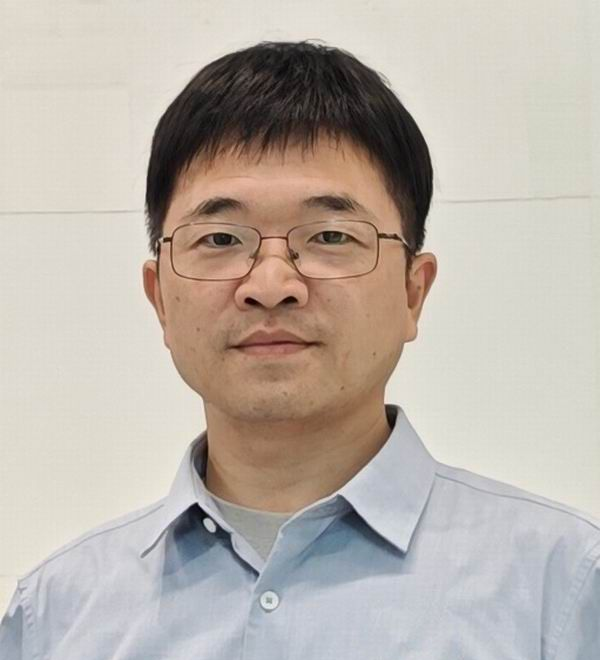 Qin Zou (邹勤)合作论文数School of Computer Science, Wuhan University;Artificial Intelligence Institute of Wuhan University3
 Qingzhou Mao (毛庆洲)合作论文数School of Remote Sensing and Information Engineering, Wuhan University;State Key Laboratory of Information Engineering in Surveying, Mapping and Remote Sensing, Wuhan University3
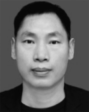 Shejie Lu合作论文数3Chengzhi Hong合作论文数2Zhi M. Lu合作论文数2Huashan Song合作论文数2
 Fuxun Liang (梁福逊)合作论文数School of Urban Design, Wuhan University2Xu Dihong合作论文数2Fancong Meng合作论文数2Song Ying合作论文数2
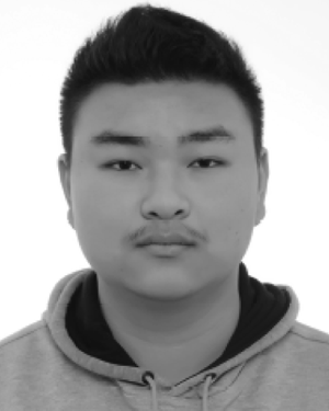 Ziyin Zeng合作论文数Sch Comp Sci, China Univ Geosci2Ling Ding合作论文数2Jiang-yun LONG (龙江云)合作论文数2Jianpei WANG (王建培)合作论文数2Cheng Chen合作论文数2Hao-da XU (徐豪达)合作论文数2
 Zejian Deng合作论文数Wuhan University of Technology, Engineering Research Center of Transportation Safety, People's Republic of China2
 Chuan Sun合作论文数Department of Electronic and Information Engineering, The Hong Kong Polytechnic University;Department of Electronic and Information Engineering, The Hong Kong Polytechnic University2Bin-bin CAI (蔡斌斌)合作论文数2




