Whiskey Flats is a mid-18th-century archaeological site on the Southern High Plains of Texas, USA. The site is within Mustang Draw and composed of two areas. Area 1 is now a dry pond (historically known as Mustang Pond) and consists of a modern bison (Bison bison) and modern feral horse (Equus caballus; known as mustangs) bonebed dated to 194 ± 20 14C BP (~1756 AD). Area 2 is a terrace within the draw adjacent to the pond that represents a drier environment where bison and horse bone were also recovered. Historic objects from Area 2 indicate temporal overlap with Area 1. Coyote (Canis latrans) is the third most prevalent species identified in both areas. Although species could not be determined, an additional canid may represent a hybrid wolf/domestic dog. Taxonomic assessment and taphonomic analysis are used to interpret paleoecological conditions at the time of deposition and to reconstruct the taphonomic history that led to the accumulation of the vertebrate assemblage. Analysis of the assemblage expands the understanding of the ecological community of the Southern High Plains during the 18th century and the taphonomic agents that affected the assemblage. Historic accounts provide further descriptions of the region that aided in interpretations of the natural environment. Results indicate that the deposit represents a typical historic grassland fauna. Because of extirpations, agricultural expansion, and urbanization, it portrays a very different biotic community from that of today. Furthermore, the character of the draw and the pond has changed, directly impacting the changeover from the 18th-century biotic community to that of the current one. Broadly, the analysis provides a greater understanding of the landscape and fauna of the Southern High Plains during the latest Holocene.
The geoheritage significance of lithic technology, particularly stone tool heat-treatment, remains an underexplored research area within geoheritage studies. The prehistoric use of Potter member quartzarenite is examined as it is a significant lithic resource derived from the Ogallala Formation in northwestern Texas. Also explored is the impact of the physical properties of Potter member quartzarenite on prehistoric populations and their reliance on heat-treatment. Further, the intentional application is investigated of heat-treatment technology and its effects on the material’s physical properties and subsequent usability for tool production during the Late Archaic period ( 4500–2000 BP) at Macy Locality 313. Experimental results highlight that Potter member quartzarenite, similar to silcrete, possesses unique geological characteristics enabling effective direct heat-treatment methods. The findings suggest that prehistoric populations strategically employed geological knowledge to mitigate thermal shock, underscoring a sophisticated understanding of material properties. By explicitly integrating geological perspectives with archaeological evidence, this study advocates for an interdisciplinary approach to geoheritage, illuminating the interconnected histories of geology and human technology.
Murrah Cave is one of a series of cave and rockshelters in the Lower Pecos Canyonlands (far eastern Trans-Pecos) that contain evidence of late Quaternary cultures, fauna, and flora. Excavated in 1937, many faunal and floral specimens from Murrah Cave remain undescribed. Among those materials are a coracoid of a Pied-billed Grebe (Podilymbus podiceps), seeds, and charcoal. The major cultural occupation now is dated between 1000 and 600 14C yr B.P. based on textiles. Charcoal dates, however, cluster earlier at around 2500 14C yr B.P. with one date at 4800 14C yr B.P. The Pied-billed Grebe represents the first occurrence in the Quaternary fossil record for the Trans-Pecos. The floral taxa are found in the Trans-Pecos Canyonlands today, part of the Chihuahuan Desert vegetation community, with some being the first known presence in the Lower Pecos Canyonlands. Two short-term mesic periods begin around 2500 14C yr B.P. and 700 14C yr B.P. denoted by the return of modern bison and expansion of the grasslands. These brief periods of increased moisture do not fundamentally alter the desert vegetation community. The floral and avian records highlight the potential available data within and the usefulness of old collections in contributing to modern studies.
This study explores the geoheritage significance of dugouts constructed by early Anglo-American settlers across the Southern High Plains and Rolling Plains of Texas. Geoheritage, which in this study emphasizes the relationship between geodiversity and cultural adaptation, provides a framework to examine how settlers used locally available geological resources for shelter in response to environmental challenges. Fieldwork and archival research has documented 11 dugouts from buffalo hunters, cattle ranchers, sheepherders, and homesteaders. Analysis includes Geographic Information Systems (GIS) and photogrammetric modeling to evaluate the impact of geodiversity on dugout placement, construction materials, and design. Results reveal that most dugouts were constructed near critical resources such as water sources and rock outcrops, with sandstone from the Dockum Group being the most commonly used building material. Terrain sheltered from wind is prioritized, with 64% of dugouts located on slopes or near valleys, highlighting strategic responses to the Southern Plains climate. The variability in dugout dimensions and materials among cultural groups underscores the diverse ways settlers interacted with available resources, reflecting both immediate needs and cultural practices. This research advances geoheritage by demonstrating that even temporary, adaptive structures like dugouts contribute to the understanding of human interaction with geodiversity. By situating these shelters within a geoheritage framework, the study provides new insights into how early settlers adapted to and modified their landscapes, adding depth to the region's cultural and geological legacy. The findings support a more inclusive view of geoheritage, encompassing permanent and transient human imprints on the landscape.
Because museum collections deteriorate due to entropy, museums can preserve their collections by mitigating entropy through collections management. Dissociation is an effect of entropy that impacts the documents within collections. Digital transcription is a useful technique in mitigating that dissociation but may be unlikely due to a lack of resources as manual transcription is time consuming. Implementing artificial intelligence (AI) to transcribe documents automatically is examined as an alternative. The applicability of Optical Character Recognition (OCR) is tested through the quantitative measurement of accuracy and efficiency using the documentation within an archaeological collection as a case study. Results indicate that the OCR program used in this research is not yet applicable to the collections management of documentation. Nevertheless, with the technology associated with OCR and its accessibility advancing at an accelerating rate, it is likely that OCR may become a cornerstone tool in the collections management of documentation in the near future.
Fires are an essential aspect of the grassland ecosystem across the Great Plains of North America. Wildfires can also transform surrounding rocks to appear like hearths or hearthstones used by prehistoric people. A grassland fire that swept through part of a historic ranch located along the eastern escarpment of the Southern High Plains of Texas has created surface features that mimicked the appearance of hearths. Fourteen wildfire features resembling hearths have been documented, and thermally modified rocks from the surface of three of these features were analyzed to investigate the impact of natural fires on the landscape. The results demonstrate that wildfires can create features resembling hearths when an adjacent shrub is burned. An excavation and detailed analysis, however, suggest that (1) the tops of thermally modified rocks from a wildfire will often have a relatively darker Munsell color value in comparison to their bottom halves, and (2) wildfire features will likely have a thinner cross-section of ash and larger pieces of charcoal produced from the incomplete combustion of the nearby shrub and deadfall. The broader implications are useful for understanding site formation processes within temperate grassland settings in other places.
This study applies UAV-based photogrammetry to map and examine the stratigraphy and archaeological artifact distribution in two localities within the Post research area in northwest Texas. A DJI Inspire 1 UAV equipped with a Zenmuse X5 camera captured nadir and oblique images. These were processed using Agisoft Metashape to generate 3D models. These models enabled the precise mapping of stratigraphic boundaries, revealing the distinctions between Triassic-age bedrock, Pleistocene-age alluvial deposits, and Holocene-age aeolian sediments. Field surveys from 2022 to 2024 documented over 5000 artifacts with sub-centimeter accuracy, including diagnostic projectile points and ceramics. This research highlights the advantages of UAV-derived 3D models in rapidly and accurately documenting stratigraphy and archaeological data. It demonstrates the value of UAV technology for visualizing landscape-scale processes and artifact contexts, offering a new approach to understanding the interactions between geomorphology and archaeology. The findings contribute to advancing UAV applications in both geomorphological and archaeological research.
Photogrammetry is a significant tool museums utilize to produce high-quality 3D models for research and exhibit content. As advancements in computer hardware and software continue, it is crucial to assess the effectiveness of photogrammetry software in producing research-quality 3D models. This study evaluates the efficacy of Apple’s Object Capture photogrammetry API to create high-quality 3D models. The results indicate that Object Capture is a viable option to create research-quality models efficiently for a variety of natural and cultural heritage objects. Object Capture is notable for its minimal need for masking backgrounds within images and its ability to create models with fewer than 100 images and process 3D models in under 10 minutes.
The geoheritage importance of the stones used in the construction of buildings in urban landscapes has been documented by several scholars around the world. Building stones can provide an ex situ cross-section of a region’s geodiversity and illuminate its cultural significance. Research at the historic Maxey Homestead (1902–1907), located along the eastern escarpment of the Southern High Plains near Post, Texas, has uncovered a rock collection gathered from local sources. In addition, rocks from the eastern escarpment were used to construct and decorate a house in 1938 (~9 km to the north) after the Maxeys moved from their original homestead. A combination of GIS and 3D mapping using an unmanned aerial vehicle were used to assess and analyze the geodiversity significance of the rock collection and rock-decorated house. Rock collecting and the use of local stones in building construction provide insights into the geodiversity of the Southern High Plains’ eastern escarpment and the historical geoheritage of northwest Texas in the early 20th century. The results of this study also demonstrate the importance of examining non-urban and historical landscapes for elucidating the significance of geodiversity to past peoples.
Advances in technology have equipped paleobiologists with new analytical tools to assess the fossil record. The functional traits of vertebrates have been used to infer paleoenvironmental conditions. In Quaternary deposits, birds are the second-most-studied group after mammals. They are considered a poor paleoambiental proxy because their high vagility and phenotypic plasticity allow them to respond more effectively to climate change. Investigating multiple groups is important, but it is not often attempted. Biogeographical and climatic niche information concerning small mammals, reptiles, and birds have been used to infer the paleoclimatic conditions present during the Late Pleistocene at San Josecito Cave (~28,000 14C years BP), Mexico. Warmer and dryer conditions are inferred with respect to the present. The use of all of the groups of small vertebrates is recommended because they represent an assemblage of species that have gone through a series of environmental filters in the past. Individually, different vertebrate groups provide different paleoclimatic information. Birds are a good proxy for inferring paleoprecipitation but not paleotemperature. Together, reptiles and small mammals are a good proxy for inferring paleoprecipitation and paleotemperature, but reptiles alone are a bad proxy, and mammals alone are a good proxy for inferring paleotemperature and precipitation. The current paleoclimatic results coupled with those of a previous vegetation structure analysis indicate the presence of non-analog paleoenvironmental conditions during the Late Pleistocene in the San Josecito Cave area. This situation would explain the presence of a disharmonious fauna and the extinction of several taxa when these conditions later disappeared and do not reappear again.
The fossil record of birds from the Quaternary Period (2.58 mya to present) of North America sheds light on modern patterns of diversity and geographical distribution. Fossils from the late Pleistocene and early Holocene document the presence of multiple species of small rails on the Southern High Plains. Black Rails, Virginia Rails and Soras occurred throughout regional drainages from ~ 11 000 to 8500 years ago. Age and palaeoenvironmental data associated with the rail remains provide temporal and ecological context. Those data link the past populations to extant populations occurring as migrants to the region today. The total record reveals that Black Rails, Virginia Rails and Soras occur on the Southern High Plains today despite major changes in climate, environments, biota and habitats since the late Pleistocene–early Holocene. Anthropogenic changes to regional wetlands in the present day threaten the occurrence of small rails across the Southern High Plains.
Kincaid Shelter (Uvalde County, Texas) contains a sequence of vertebrate and cultural remains spanning from the late Pleistocene to Historic. Kincaid Shelter perhaps is best known for its Paleoindian component, including a cobblestone floor interpreted as a Clovis habitation surface. Zone 3 lacustrine sediments are beneath that cobblestone floor and yielded a diverse late Pleistocene vertebrate fauna. Recovered in 1948, the assemblage has never been formally studied or described. The current analysis focuses on the composition, paleoecology, and taphonomy of the Zone 3 faunal assemblage to establish and clarify this important late Pleistocene record. Sixteen vertebrate taxa are represented. Large mammals predominate, but reptiles, including American alligator, and a bird also occur. The presence of Bison antiquus and Panthera atrox indicate a late Pleistocene (Rancholabrean Land Mammal Age) age for the faunal assemblage. The Zone 3 faunal composition is typical of latest Pleistocene faunas from the Great Plains and supports an interpretation of a grassland biome.
Paso Otero 1, in the Pampas of Argentina, is a stratified, riverine site containing alluvium with a sequence of buried A-horizons and two guanaco bone beds. The site is the first-recorded guanaco kill/butchering locale for the Pampas and represents at least two events during different times. Bulk organic sediment samples were taken from the three buried A-horizons and the humates assayed to produce a chronology for the site and date the cultural activities. The resultant ages indicate stable land surfaces in the Early, Middle, and Late Holocene with the kill/butchering events taking place during the Middle and Late Holocene. RESUMEN: El sitio Paso Otero 1, en la Region Pampeana de Argentina, se encuentra en sedimentos fluviales que contienen dos horizontes A enterrados en los cuales se han registrado dos niveles con hueso de guanaco. Este es el primer sitio de caza y despostamiento de guanaco hallado en la Región Pampeana y representa por lo menos dos eventos diacrónicos. Se tomaron muestras de sedimento orgánico de tres horizontes A enterrados con el objeto de obtener una cronología para el sitio y datar la actividad antropica. Las edades resultantes indican superficies de estabilización en el Holoceno temprano, medio y tardío con los eventos de caza de guanaco en el Holoceno medio y tardío.
Aerial photogrammetry is increasingly being used to discover, document, and interpret the cultural heritage of landscapes. Information on the constructed cultural heritage left behind by the first cattle ranchers in the American West is being lost as the land is transformed and modified, and stewardship of the land changes across generations. An unmanned aerial vehicle (UAV) has been used in this research to record and interpret two surface water cattle tanks constructed by Texas cowboys in the mid-1880s. Similar size rocks have been used and placed in a similar pattern across the walls of both tanks. This similarity suggests both tanks were constructed at the same time. This research also demonstrates that UAV photogrammetry can be used to rapidly record and analyze the constructed cultural heritage of American West cowboys.
San Josecito Cave (2250 m elevation) is located nearby Aramberri, Nuevo León, northeastern Mexico, with excavations occurring in 1935–1941 and 1990. It is a paleontological cave and the significance of its faunal data rests in the understanding of the Quaternary ecosystems of the Mexican Plateau and the Southern Plains. This significance is underpinned by a consideration of associated stratigraphic and geochronological data. The fauna is composed of mollusks, amphibians, reptiles, birds, and mammals. More than 30 extinct vertebrate species have been identified, constituting one of the most important Quaternary localities in the Americas. Radiocarbon dates and faunal correlations indicate the excavated deposits represent an interval of time between 45,000 and 11,000 14C years BP. The current synthesis demonstrates that the previous view of the assemblage as a single local fauna is erroneous and that, instead, several successive local faunas are present within a stratigraphic framework. This finding underscores the need for detailed studies of single localities in building paleoenvironmental models. As a corollary, results point to the necessity of including all vertebrate classes represented from a locality in building those models. In addition, the field and analytical methodologies demonstrate the importance of very detailed paleontological excavations, with precise spatial and temporal controls, to assess the taphonomic history of a locality, construct a stratigraphic and geochronological framework, and infer the paleoecological conditions during the time span considered based on the number of local faunas represented. The recognition of San Josecito Cave as an important Late Pleistocene vertebrate paleontological locality is enhanced with the consideration of its faunal data for paleoenvironment reconstruction and possible contribution to Quaternary paleoclimatic modeling.
The eastern escarpment breaks of the Southern High Plains of Texas are both a geomorphic and ecotonal transition zone from the high plains surface to the Rolling Plains below. The geoarchaeological record on the Southern High Plains surface is well documented, but few studies have investigated the sediments, soils, and geochronology of the eastern escarpment. The current investigation has targeted the discontinuous remnants of Late Quaternary deposits within Spring Creek, a tributary within the upper Brazos River basin. A total of 19 profiles, core, and isolated exposure locations placed along a transect from Macy Fork through upper Spring Creek and 40 radiocarbon ages provide a composite sequence and geochronology that also documents the Late Pleistocene to Late Holocene paleoenvironments of this drainage. The resulting record illustrates a series of major changes in sediments and local habitats over the past ~11,550 radiocarbon years (13,469–13,390 calendar years), characterized primarily by reductions in available water and increasing aridity that peaked during the middle Holocene. This sequence provides significant context to an expanding record of Late Pleistocene to middle Holocene biota and cultures. Subsequent downcutting of the drainage post-6000 14C yr B.P. (6988–6744 calendar years) removed large sections of the depositional sequence. Local topography within Spring Creek drainage greatly impacted the preservation of these deposits. The remaining record provides some different insights than those available from the Southern High Plains record.
Based on data from analyses on previously-reported carbon stable isotope data from dental enamel and dentine from tusks reported in the literature, diets were inferred for the gomphothere genera Amebelodon, Cuvieronius, Gomphotherium, Rhynchotherium, Serbelodon, and Stegomastodon (Proboscidea, Gomphotheriidae) that inhabited the Americas during the Cenozoic. Amebelodon, Gomphotherium, and Serbelodon specimens of the Barstovian and Clarendonian faunal stages fed on C3 plants; while the same Hemphillian genera consumed a mixed C3/C4 diet. Hemphillian Rhynchotherium were mixed-diet feeders while Blancan specimens of the same genus fed on C3 plants. Stegomastodon from the same Blancan period consumed a mixed C3/C4 diet, similar to Rancholabrean animals, although Lujanian specimens ate C3 plants. As for the genus Cuvieronius, Irvingtonian, Rancholabrean, and Lujanian specimens consumed a mixed C3/C4 diet. These results suggested that American gomphotheres displayed generalist feeding habits, allowing them to inhabit different environments in extensive areas of the continents, and survive to the end of the Pleistocene.
 Stance Hurst合作论文数26
 Joaquin Arroyo-Cabrales合作论文数Laboratorio de Arqueozoología;Subdirección de Laboratorios y Apoyo Académico;Instituto Nacional de Antropología e Historia;Subdirección de Laboratorios y Apoyo Académico, Instituto Nacional de Antropología e Historia23
 Vance T Holliday合作论文数College of Social & Behavioral Science, University of Arizona21
 John A. Moretti合作论文数Jackson Sch Geosci, Univ Texas Austin11
 Doug Cunningham合作论文数10Oscar J. Polaco合作论文数10n backhouse paul合作论文数6
 Briggs Buchanan合作论文数Department of Anthropology, College of Arts & Sciences, The University of Tulsa5Herbert Haas合作论文数4
 Maria Teresa Alberdi合作论文数4M Gutierrez合作论文数3Víctor Adrián Pérez-Crespo合作论文数Instituto de Geologia, Universidad Nacional Autonoma de Mexico3
 Patrick Lewis合作论文数Cohere3
 Gustavo Martinez合作论文数3Vance T. Holliday合作论文数3
 Leland Bement合作论文数3
 Jose Luis Prado合作论文数INCUAPA, Universidad Nacional del Centro Del Valle3Ismael Ferrusquía-Villafranca合作论文数3Maria A. Gutierrez合作论文数2R Knudson合作论文数2curtis d tunnell合作论文数2Jorge Gama-Castro合作论文数2
 Jose Alberto Cruz合作论文数Department of Anthropology, University of Arkansas2
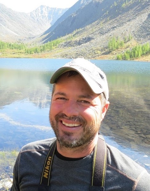 Todd Surovell合作论文数George C. Frison Institute of Archaeology and Anthropology, Department of Anthropology, University of Wyoming2
 Gustavo G. Politis合作论文数INCUAPA-CONICET-Facultad de Ciencias Sociales, la Universidad Nacional del Centro de la Provincia de Buenos Aires2William T. Hartwell合作论文数2José Ruiz-González合作论文数2
 Enrique ------- Martinez-Hernandez合作论文数2Robert Stuckenrath合作论文数2Laura R. Murphy合作论文数1Mouloud Benammi合作论文数1j roblescamacho合作论文数1Patricia De Anda-Hurtado合作论文数1Travis Conley合作论文数1Ruthann Knudson合作论文数1Russell Graham合作论文数1ana fabiola guzman合作论文数Inst Politecn Nacl, Prolongac Carpio & Plan Ayala1elizabeth louden合作论文数1JI MEAD合作论文数1
 Joseph A.M. Gingerich合作论文数1
 David W. Steadman合作论文数Florida Museum of Natural History, University of Florida1
 Antonio Santos-Moreno合作论文数1
 Gary Haynes合作论文数Department of Anthropology, University of Nevada, Reno1
 Julian A. Velasco合作论文数Instituto de Biología, Universidad Nacional Autónoma de México;Email: juvelas@gmail.com.;Instituto de Biología, Universidad Nacional Autónoma de México1
 Steven E. Churchill合作论文数Department of Evolutionary Anthropology, Trinity College of Arts & Sciences, Duke University1Ilene Hilman合作论文数1F HILL合作论文数1
 E. Chalmin合作论文数CNRS, Centre de Recherche et de Restauration des Musées de France Palais du Louvre1




