Abstract Mapping invasive species and native vegetation is crucial for effective land management and conservation, especially in pervasively invaded landscapes. It is often difficult to differentiate between species using traditional remote sensing methods. However, advances in imaging spectroscopy and machine learning techniques offer a solution by leveraging the often‐distinct spectral signatures of different plant species. This study explores the potential of high‐resolution, multi‐temporal hyperspectral data from the Airborne Visible‐Infrared Imaging Spectrometer ‐ Next Generation (AVIRIS‐NG) to map vegetation on two California preserves: The Nature Conservancy's Jack and Laura Dangermond Preserve and the University of California Natural Reserve System (UCNRS) Sedgwick Reserve. We employed machine learning algorithms to address two distinct case studies: mapping invasive iceplant (Carpobrotus edulis) at Dangermond Preserve and identifying native perennial grass patches (Stipa spp.) at Sedgwick Reserve. By analyzing AVIRIS‐NG data from February to May 2022, we found that May imagery provided the highest spectral separability for both species, likely due to phenological differences. Using a support vector machine classifier, we achieved high accuracy in mapping iceplant (87% overall accuracy). We achieved an accuracy of 59.4% for mapping native grasses in annual grass regions. Our results show that integrating multi‐temporal hyperspectral remote sensing with machine learning can provide land managers with the high‐resolution data needed to prioritize resource allocation, monitor management efficacy, and enable informed decision‐making in a changing landscape. This collaborative, technology‐driven approach provides a valuable model for biodiversity conservation.
Bark serves an important function in protecting trees from heat damage in fire-prone ecosystems. As fire increases in Mediterranean-climate systems, so does the need to understand fire adaptations of associated tree species, especially in important but understudied groups such as oaks (Quercus spp.). To determine what bark traits contribute to fire resistance in two widespread California white oak species (Q. douglasii and Q. lobata) and one red oak species (Q. agrifolia), we measured bark thickness, moisture content, and density, and related these variables to Time to Cambium Kill (τ), a metric that quantifies vulnerability to fire-induced trunk tissue death. We conducted heating experiments on the bark of live trees to record τ. We assessed τ as a function of tree trunk diameter and bark thickness, determining “safe” size thresholds for each species. We also compared our field measurements to predictions from two frequently applied τ models. We searched for evidence of species’ fire-adaptedness by comparing bark thickness:size allometry patterns at 50 cm and 137 cm heights. Bark thickness was a much stronger predictor of τ than moisture content or density. Q. agrifolia had a higher bark thickness:stem diameter ratio, lower safe diameter threshold (17.2 cm), and higher safe bark thickness threshold (2 cm) than Q. douglasii and Q. lobata. Existing models that predict τ as a function of bark properties had modest skill, and our fitted models that accounted for species differences performed better. Q. agrifolia most strongly manifested bark allometry indicative of fire-adaptedness. None of the species showed a fire-adapted pattern of bark tapering with height. Bark traits and growth patterns can confer fire adaptation in tree species. Q. agrifolia showed stronger evidence of fire-adapted bark traits than Q. douglasii or Q. lobata. More work is needed to develop reliable general models relating time to trunk tissue kill to bark traits for oaks in fire-prone ecosystems.
Conifer species of Mediterranean-type ecosystems (MTEs) are especially sensitive to coupled changes in climate and fire regime. Recently California’s MTE conifers have experienced elevated mortality, range shifts, and decreased abundance relative to broadleaf trees. Restricted-range species may be especially vulnerable to environmental change and are a high priority for climate change assessment and adaptation management. We used species distribution modeling and wildfire probability models to assess the potential vulnerability of Pseudotsuga macrocarpa (Bigcone Douglas fir, hereafter BDF), a restricted-range conifer of southern California mountains that is a species of concern because of its ecological importance and recent mortality due to drought and wildfire. We also modeled the distribution of Quercus chrysolepis (CLO), a widespread oak that can be co-dominant with BDF and that can limit fire spread and reduce crown fire risk to BDF compared to the risk from surrounding chaparral vegetation. Ensembles of MAXENT and General Boosted Models were produced for a 2.1 million ha model domain encompassing BDF’s 672,000 ha range for the period 1981–2010, and were projected to 2040–2069 and 2070–2099 using three climate models (warmer-wetter, warmer, and hotter-drier) under a high emission scenario (IPCC 5th Assessment, RCP 8.5). Wildfire projections were analyzed only for mid-century based on warmer-wetter and hotter-drier climate scenarios. Our analysis contributes several important new insights: (1) topoclimatic habitat for BDF could shrink by 19–57% by mid-century, especially for southernmost populations; (2) by mid-century, wildfire probability could increase 2–4 fold in BDF habitat, potentially diminishing the value of mid-to-high elevation sites as topoclimatic refugia; (3) CLO could play a diminishing role in providing refuge from severe wildfires as soon as mid-century but especially by end-of-century; (4) extensive areas of stable mid-century and late-century habitat are confined to national forests in the San Gabriel Mountains and Transverse Ranges. The climate and fire vulnerability of BDF could be reduced by management actions such as mechanical fuel treatments and post-fire restoration, but these are highly constrained by topography, access, and sensitive wildlife species. Our case study illustrates the rapidly increasing vulnerability of endemic conifer species in MTE forests.
We stand at the threshold of a transformative era in Earth observation, marked by space‐borne visible‐to‐shortwave infrared (VSWIR) imaging spectrometers that promise consistent global observations of ecosystem function, phenology, and inter‐ and intra‐annual change. However, the full value of repeat spectroscopy, the information embedded within different temporal scales, and the reliability of existing algorithms across diverse ecosystem types and vegetation phenophases have remained elusive due to the absence of suitable sub‐seasonal spectroscopy data. In response, the Surface Biology and Geology (SBG) High‐Frequency Time Series (SHIFT) campaign was initiated during late February 2022 in Santa Barbara County, California. SHIFT, designed to support NASA's SBG mission, addressed mission scoping, scientific advancement, applications development, and community building. This ambitious endeavor included weekly Airborne Visible InfraRed Imaging Spectrometer‐Next Generation (AVIRIS‐NG) imagery acquisitions for 13 weeks (spanning February 24 to May 29, 2022), accompanied by coordinated terrestrial vegetation and coastal aquatic data collection. We describe the rich datasets collected and illustrate how the complex sub‐seasonal patterns of change can be linked to biological science and applications, surpassing insights from multispectral observations. Leveraging open‐source processing methods and cloud‐based analysis tools, the SHIFT campaign showcases the readiness of the scientific community to harness ecological insights from remotely sensed hyperspectral time series. We provide an overview of SHIFT's goals, data collections, preliminary results, and the collaborative efforts of early career scientists committed to unlocking the transformative potential of high‐frequency time series data from space‐borne VSWIR imaging spectrometers.
This manuscript shares the lessons learned from providing scientific computing support to over 600 researchers and discipline experts, helping them develop reproducible and scalable analytical workflows to process large amounts of heterogeneous data. When providing scientific computing support, focus is first placed on how to foster the collaborative aspects of multidisciplinary projects on the technological side by providing virtual spaces to communicate and share documents. Then insights on data management planning and how to implement a centralized data management workflow for data‐driven projects are provided. Developing reproducible workflows requires the development of code. We describe tools and practices that have been successful in fostering collaborative coding and scaling on remote servers, enabling teams to iterate more efficiently. We have found short training sessions combined with on‐demand specialized support to be the most impactful combination in helping scientists develop their technical skills. Here we share our experiences in enabling researchers to do science more collaboratively and more reproducibly beyond any specific project, with long‐lasting effects on the way researchers conduct science. We hope that other groups supporting team‐ and data‐driven science (in environmental science and beyond) will benefit from the lessons we have learned over the years through trial and error.
Spatial conservation prioritization does not necessarily lead to effective conservation plans, and good plans do not necessarily lead to action. These “science-action” gaps are pernicious and need to be narrowed, especially if the international goal of conserving 30% of the planet by 2030 is to be realized. We present the Earthwise Framework, a flexible and customizable spatial decision support system (SDSS) architecture and social process to address the challenges of these science-action gaps. Utilizing case study experience from regions within California, South Africa, and British Columbia, we outline the framework and provide the Little Karoo, South Africa SDSS data, code and results to illustrate five design strategies of the framework. The first is to employ an “open science” strategy for collaborative conservation planning and action. Another is that marginal value functions allow for the continuous accounting of element (e.g., habitat) representation in prioritization algorithms, allowing for an SDSS that is more automated and saves valuable time for stakeholders and scientists. Thirdly, we program connectivity modeling integrated within the SDSS, with an algorithm that not only automatically calculates all the least cost corridors of a region, but prioritizes among them and removes the ones that do not make ecological sense. Fourth, we highlight innovations in multi-criteria decision analysis that allow for both cost-efficient plan development, like representative solution sets, but also land-use planning requirements, like site specific valuation, in what appears to be a more transparent, understandable, and usable manner than traditional approaches. Finally, strategic attention to communicating uncertainty is also advocated. The Earthwise Framework is an open science endeavor that can be implemented via a variety of software tools and languages, has several frontiers for further research and development, and shows promise in finding a better way to meet the needs of both humans and biodiversity.
Biologists have long debated why some plant species produce many seeds synchronously during some years and few during others. One hypothesis is that selection on phenological synchrony of flowering improves pollination efficiency and leads to increased fecundity. In an 11-year study of valley oak ( Quercus lobata ), we found that, indeed, trees that produced flowers during mid-season tended to produce more acorns. But, is synchrony the key factor? Here, we test the phenological synchrony hypothesis versus the alternative hypothesis that the environment principally shapes flowering phenology and acorn production. At our site, we find that a tree’s microenvironment is associated with both timing of phenology and acorn production. Timing of flowering depends on air temperature and crop size is not related to synchrony but is best predicted by relative elevation – likely a proxy for substrate quality and access to water. We conclude that microenvironment - not phenological synchrony - shapes acorn production.
Ecological land classifications serve diverse purposes including sample stratification, inventory, impact assessment and environmental planning. While popular, data-driven classification approaches can require large training samples, frequently with limited robustness to rapid environmental change. We evaluate the potential to derive useful, durable ecological land classifications from a synthesis of multi-decadal satellite imagery and geospatial environmental data. Using random forests and multivariate regression trees, we analyze 1982–2000 Landsat Thematic Mapper (L45) and 2013–2020 Harmonized Landsat Sentinel (HLS) imagery to develop and then test the predictive skill of an ecological land classification for monitoring Mediterranean-climate oak woodlands at the recently established Jack and Laura Dangermond Preserve (JLDP) near Point Conception, California. Image pixels were processed using spectral and temporal mixture models. Temporal mixture model residual scores were highly correlated with oak canopy cover trends between 2012 and 2020 ( r 2 = 0.74, p << 0.001). The resulting topoclimatic-edaphic land classification effectively distinguished areas of systematically higher or lower oak dieback during 2012–2020 severe drought, with a fivefold difference in dieback rates between land classes. Our results highlight the largely untapped potential for developing predictive ecological land classifications from multi-decadal satellite imagery to guide scalable, ground-supported monitoring of rapid environmental change.
Regrowth after fire is critical to the persistence of chaparral shrub communities in southern California, which has been subject to frequent fire events in recent decades. Fires that recur at short intervals of 10 years or less have been considered an inhibitor of recovery and the major cause of 'community type-conversion' in chaparral, primarily based on studies of small extents and limited time periods. However, recent sub-regional investigations based on remote sensing suggest that short-interval fire (SIF) does not have ubiquitous impact on postfire chaparral recovery. A region-wide analysis including a greater spatial extent and time period is needed to better understand SIF impact on chaparral. This study evaluates patterns of postfire recovery across southern California, based on temporal trajectories of Normalized Difference Vegetation Index (NDVI) derived from June-solstice Landsat image series covering the period 1984-2018. High spatial resolution aerial images were used to calibrate Landsat NDVI trajectory-based estimates of change in fractional shrub cover (dFSC) for 294 stands. The objectives of this study were (1) to assess effects of time between fires and number of burns on recovery, using stand-aggregate samples (n = 294) and paired single- and multiple-burn sample plots (n=528), and (2) to explain recovery variations among predominant single-burn locations based on shrub community type, climate, soils, and terrain. Stand-aggregate samples showed a significant but weak effect of SIF on recovery (p<0.001; R-2=0.003). Results from paired sample plots showed no significant effect of SIF on dFSC among twice-burned sites, although recovery was diminished due to SIF at sites that burned three times within 25 years. Multiple linear regression showed that annual precipitation and temperature, chaparral community type, and edaphic variables explain 28% of regional variation in recovery of once-burned sites. Many stands that exhibited poor recovery had burned only once and consist of xeric, desertfringe chamise in soils of low clay content. (C) 2020 Elsevier B.V. All rights reserved.
We explore the idea that key information about plant and soil diversity can largely be hidden in low-variance features, comparing to extensive ground truth, at a highly diverse and well-studied California field site.
Many research and monitoring networks in recent decades have provided publicly available data documenting environmental and ecological change, but little is known about the status of efforts to synthesize this information across networks. We convened a working group to assess ongoing and potential cross-network synthesis research and outline opportunities and challenges for the future, focusing on the US-based research network (the US Long-Term Ecological Research network, LTER) and monitoring network (the National Ecological Observatory Network, NEON). LTER-NEON cross-network research synergies arise from the potentials for LTER measurements, experiments, models, and observational studies to provide context and mechanisms for interpreting NEON data, and for NEON measurements to provide standardization and broad scale coverage that complement LTER studies. Initial cross-network syntheses at co-located sites in the LTER and NEON networks are addressing six broad topics: how long-term vegetation change influences C fluxes; how detailed remotely sensed data reveal vegetation structure and function; aquatic-terrestrial connections of nutrient cycling; ecosystem response to soil biogeochemistry and microbial processes; population and species responses to environmental change; and disturbance, stability and resilience. This initial study offers exciting potentials for expanded cross-network syntheses involving multiple long-term ecosystem processes at regional or continental scales. These potential syntheses could provide a pathway for the broader scientific community, beyond LTER and NEON, to engage in cross-network science. These examples also apply to many other research and monitoring networks in the US and globally, and can guide scientists and research administrators in promoting broad-scale research that supports resource management and environmental policy.
Synthesis has become ubiquitous in ecology. Despite its widespread application to a broad range of research topics, it remains unclear how synthesis has affected the discipline. Using a case study of publications (n = 2304) from the National Center for Ecological Analysis and Synthesis compared with papers with similar keywords from the Web of Science (n = 320,000), we address several questions about the comparative impact of synthesis, the role of synthesis in driving key research themes, and whether synthesis is focused on different topics than is the broader ecological literature. We found much higher citation rates for synthesis papers overall (fivefold more) and within eleven key topic themes (e.g., species richness, biodiversity, climate change, global change). Synthesis papers often played key roles in driving, redirecting, or resolving core questions and exhibited much greater cross-theme connectivity. Together, these results indicate that synthesis in science has played a crucial role in accelerating and advancing ecological knowledge.
Abstract Accelerated forest dieback has been documented at many locations around the world that have experienced severe drought, warming, and wildfires associated with global climate change. Exotic forest diseases pose a comparably large threat to wild forests. Synthesizing surveillance plot data to parameterize spatial epidemiological models, Cobb et al. (2020, https://doi.org/10.1029/2020EF001500) estimate that the introduced invasive water mold, Phytophthora ramorum (Sudden Oak Death), has already killed 43 million trees in coastal evergreen forests of northern California and southern Oregon. Their results highlight the value of long‐term surveillance networks for monitoring and modeling the spread of invasive forest pathogens and underscore the need for stronger public policy to reduce the global spread of these extremely harmful organisms.
Chaparral shrubs in southern California may be vulnerable to frequent fire and severe drought. Drought may diminish postfire recovery or worsen impact of short-interval fires. Field-based studies have not shown the extent and magnitude of drought effects on recovery, which may vary among chaparral types and climatic zones. We tracked regional patterns of shrub cover based on June-solstice Landsat Normalized Difference Vegetation Index series, compared between the periods 1984–1989 and 2014–2018. High spatial resolution ortho-imagery was used to map shrub cover in distributed sample plots, to empirically constrain the Landsat-based estimates of mature-stage lateral canopy recovery. We evaluated precipitation, climatic water deficit (CWD), and Palmer Drought Severity Index in summer and wet seasons preceding and following fire, as regional predictors of recovery in 982 locations between the Pacific Coast and inland deserts. Wet-season CWD was the strongest drought-metric predictor of recovery, contributing 34–43% of explanatory power in multivariate regressions ( R 2 = 0.16–0.42). Limited recovery linked to drought was most prevalent in transmontane chamise chaparral; impacts were minor in montane areas, and in mixed and montane chaparral types. Elevation was correlated negatively to recovery of transmontane chamise; this may imply acute drought sensitivity in resprouts which predominate seedlings at higher elevations. Landsat Visible Atmospherically Resistant Index (sensitive to live-fuel moisture) was evaluated as a landscape-scale predictor of recovery and explained the greatest amount of variance in a multivariate regression ( R 2 = 0.53). We find that drought severity was more closely related to recovery differences among twice-burned sites than was fire-return interval. Summarily, drought has a major role in long-term shrub cover reduction within xeric chaparral ecotones bounding the Mojave Desert and Colorado Desert, likely in tandem with other global change stressors.
Regional maps of vegetation structure are necessary for delineating species habitats and for supporting conservation and ecological analyses. A systematic approach that can discriminate a wide range of meaningful and detailed vegetation classes is still lacking for neotropical savannas. Detailed vegetation mapping of savannas is challenged by seasonal vegetation dynamics and substantial heterogeneity in vegetation structure and composition, but fine spatial resolution imagery (<10 m) can improve map accuracy in these heterogeneous landscapes. Traditional pixel-based classification methods have proven problematic for fine spatial resolution data due to increased within-class spectral variability. Geographic Object-Based Image Analysis (GEOBIA) is a robust alternative method to overcome these issues. We developed a systematic GEOBIA framework accounting for both spectral and spatial features to map Cerrado structural types at 5-m resolution. This two-step framework begins with image segmentation and a Random Forest land cover classification based on spectral information, followed by spatial contextual and topological rules developed in a systematic manner in a GEOBIA knowledge-based approach. Spatial rules were defined a priori based on descriptions of environmental characteristics of 11 different physiognomic types and their relationships to edaphic conditions represented by stream networks (hydrography), topography, and substrate. The Random Forest land cover classification resulted in 10 land cover classes with 84.4% overall map accuracy and was able to map 7 of the 11 vegetation classes. The second step resulted in mapping 13 classes with 87.6% overall accuracy, of which all 11 vegetation classes were identified. Our results demonstrate that 5-m spatial resolution imagery is adequate for mapping land cover types of savanna structural elements. The GEOBIA framework, however, is essential for refining land cover categories to ecological classes (physiognomic types), leading to a higher number of vegetation classes while improving overall accuracy.
Public engagement is the intentional interaction between scientists and members of the public that facilitates mutual learning to inform policy, management, education, and scientific research1 1 https://www.aaas.org/resources/communication-toolkit/what-public-engagement . Scientific societies increasingly value public engagement (Yuan et al. 2019) because it helps their members make their work more relevant to a more and more diverse society. Additionally, public engagement fosters civic engagement skills, helps scientists understand the relevance of their research to society, and recognizes the importance of multiple perspectives and domains of knowledge to scientific endeavors (Jefferson et al. 2018). Over the past several years, there has been an increase in Ecological Society of America (ESA) members' desire to engage with the public, as seen by recent editorials (Kenney et al. 2016, Lubchenco 2017), growth of sessions during the annual meeting, and the establishment of the Communication and Engagement Section2 2 https://www.esa.org/communication-engagement/ as well as the existing Policy Section3 3 https://www.esa.org/policy/ and Public Affairs Committee4 4 https://www.esa.org/about/governance/committees/public-affairs-committee/ . There has also been encouragement from ESA leadership to include public engagement themes in plenary talks and to provide members with actionable information to engage policymakers (Marsh and Anderson 2018, Mize et al. 2018, Kumar et al. 2019). Professional societies have a special role in shaping the norms and expectations of a field as well as providing the resources and incentives to be successful in meeting them (Agre and Leshner 2010). This role means ESA should support the development and recognition of excellence in public engagement efforts for the field of ecology. Here, we describe a recently developed strategy (see Appendix S1 for a full report) for increasing the ESA's public engagement efforts and provide recommendations on how the Society can enact it. In 2017, a group of approximately 30 ESA members and leaders started to identify opportunities for ecologists to engage the public in science and for the Society to support their actions. This initial exploration expanded during a 2018 workshop (supported by an ESA long-range planning grant led by M.A. Kenney and F. Davis) with public engagement leaders within ESA. The recommendations below are a synthesis of key ideas from the workshop and related discussions (Appendix S1). The recommendations fall into four categories: (1) Training, (2) Recognition and Awards, (3) Networking, and (4) Increased Visibility in ESA. One of the most powerful ways that a professional society can demonstrate the importance it places on public engagement is through awards. This year, the ESA Communication and Engagement Section launched a Communication in Practice award and a Best Poster award, funded via an ESA long-range planning grant. Currently, however, there is not a society-level award for ESA members or teams who have made an impact as a result of their public engagement. Multiple types of new awards will be necessary to recognize ESA members at different career stages and doing different kinds of public engagement (Appendix S1). Many forms of public engagement involve working with partners and teams and co-producing knowledge (Meadow et al. 2015). ESA should ensure that awards recognize teams in addition to individuals, thereby expanding members' conceptions of science communication and engagement beyond traditional, individual-driven dissemination (like op-eds or science journalism) to activities that demonstrate public impact (e.g., change in a policy decision, expansion of public agency communications to include ecological science, or a broadening of public dialogue about science). Many scientists who conduct public engagement can feel isolated. As a result, providing multiple mechanisms for meeting other ESA members and allies who are interested in public engagement would be useful to support members, provide peer-mentoring, and advance the field of science communication and public engagement. The primary networking opportunities for ESA provides are at the annual meetings, and thus, it is important, at a minimum, to continue social events (e.g., multi-section mixers). Additionally, it would be worthwhile to develop online networking opportunities for all ESA members interested in communication and public engagement, and to make peer-mentoring a requirement of any proposed public engagement fellows. Further, ESA could facilitate the option for focusing on public engagement in mentorship opportunities offered at annual meetings (e.g., mentorship programs facilitated Early Career Section, Student Section, and SEEDS). Cultivating social norms around public engagement may increase participation in such activities (Poliakoff and Webb 2007). There are three main ways ESA can increase visibility. The first is by making public engagement one of the selection criteria for the annual meeting plenary speakers. Speakers would be expected to address their public engagement and societal impact as well as their research. Over the past several years, the ESA conference had several such plenary sessions that stimulated ESA members to think about how they communicate their science and its impact. Formalizing this expectation is a valuable next step. Additionally, all participants at the meeting should be encouraged to address their engagement-focused research, broader impacts and/or public engagement activities in their talks or posters at ESA meetings. Second, via journal articles and blogs, ESA should continue soliciting and including public engagement editorials. An important first step is The Bulletin of the Ecological Society of America section "Communicating Science" edited by B.G. Merkle, launched in 2018 and the ongoing Human Dimensions series co-edited by S. Anderson, B.G. Merkle, and others (Hettinger et al. 2019). It would be ideal to elevate this type of discussion in a peer-reviewed ESA journal, too. For example, there could be a section in Frontiers in Ecology and the Environment (similar to the Exploring Ecological Careers section that ran from 2017 to 2020) which would profile effective public engagement experiences and advice to members. Third, webinars throughout the year can greatly increase conversation about science communication and public engagement beyond the annual meetings. For example, a recent webinar focused on collaborations between ecologists and national park interpreters drew nearly 300 attendees and recent online "water cooler" discussions of misinformation and storytelling5 5 www.esa.org/events/the-esa-weekly-water-cooler/water-cooler-chat-4/ and teaching science communication6 6 www.esa.org/events/the-esa-weekly-water-cooler/teaching-science-communication/ (descriptions of both and links to associated resources available online) have resulted in robust engagement including 50 + attendees. In all three of these channels, there is a need for expanded recognition of the work of ESA members who are not in traditional academic or ecological consulting roles, but are still working in ecology-allied spaces. ESA includes members doing multidisciplinary research including in environmental social sciences and/or working in policy, science journalism, science communication, land management, and other fields where public engagement is part of organizations' missions. Continued engagement of these members by ESA staff and leadership (e.g., by highlighting public engagement opportunities in communities, with organizational decision-makers, or on public lands like parks and refuges), is essential for membership retention and the ongoing relevance of our professional society. These suggestions are aimed at helping ESA be successful in supporting the society's professional development, networking, and incentives to increase the role of public engagement in the ecological community. We hope ESA and its members will set a goal to undertake public engagement as part of how we define ourselves as ecologists. Now more than ever it is critical that all scientists, including ecologists, acknowledge that science can be an exclusive field, lacking diverse perspectives; increased public engagement can play a key role in helping to broaden participation helping science become more inclusive (ESA Communication and Engagement Section 2020). Our intention is for public engagement to go beyond a set of policies or practices to follow and grow to become part of the way that we define our profession. Above all, ecology requires broadening outreach to and participation with society about topics that matter to our future. We thank the 30 ESA members and leaders, participants in the 2018 workshop, and authors of the public engagement strategy report to the ESA Board of Directors who contributed ideas to this paper or to the process. This work was supported in part by a 2018 Long Range Planning Grant from ESA to M.A. Kenney and F. Davis on the Public Affairs Committee. M.A. Kenney and K. Schwarz were partially supported as AAAS Leshner Leadership Institute Public Engagement Fellows. S.M. Anderson co-authored this manuscript in her personal capacity. The views and opinions expressed herein are solely those of the author and do not necessarily reflect the view of the United States Department of Agriculture or the United States Government. Please note: The publisher is not responsible for the content or functionality of any supporting information supplied by the authors. Any queries (other than missing content) should be directed to the corresponding author for the article.
Mediterranean-climate oak woodlands are prized for their biodiversity, aesthetics, and ecosystem services. Conservation and maintenance of these landscapes requires accurate observations of both present and historic conditions capable of spanning millions of hectares. Decameter optical satellite image time series have the observational coverage to meet this need, with almost 40 years of intercalibrated global observations from the Landsat program alone. However, the optimal approach to leverage these observations for oak ecosystem monitoring remains elusive. Temporal mixture models (TMMs) may offer a solution. TMMs use a linear inverse model based on temporal endmembers (tEMs) chosen to optimize both parsimony and information content by 1) possessing clear biophysical meaning, and 2) accurately representing the variance structure of the observations in the temporal feature space (TFS) composed of low-order Principal Components. We apply this approach to oak woodlands of the California Sierra Nevada foothills. Low-order TFS structure across the approximate to 1200 km(2) study area is consistently bounded by 4 tEM phenologies: annual grasses, evergreen perennials, deciduous perennials + shadow, and unvegetated areas. Satellite-based tEM phenologies correspond to ground-based PhenoCam time series (correlations 0.8 to 0.9). Systematic temporal decimation is conducted to simulate years with varying numbers of cloud free measurements. Fractional cover of temporal endmembers is observed to scale linearly using as few as 6 images per year and coarse feature space topology is retained with as few as 4 well-timed images per year. In comparing 10 m versus 30 m pixel resolution, linear scaling is observed with correlations of 0.78-0.95. Comparison of 10 m Sentinel-2 and LiDAR-derived tree cover estimates at San Joaquin Experimental Range shows a correlation of 0.74. Visual orthophoto validation shows accuracies of annual, deciduous, and evergreen cover fractions of 74-88% (n = 102). Multi-year analysis of August imagery at Sequoia National Park to investigate dynamics associated with the 2012-2016 drought reveals 5 tEMs corresponding to: steady growth, steady decline, early decline then regrowth, persistent vegetation, and no vegetation. Validation images are sparse, but where available show accuracies in the 88 to 91% range for decrease, growth, and persistently vegetated multiyear endmembers (n = 102). Decreases are observed in areas with oak mortality documented in a recent field-based study. Overall, our results suggest the TMM approach has promise as an accurate, explainable, and linearly scalable method for retrospective analysis and prospective monitoring of Mediterranean-climate oak landscapes.
Earth and Space Science Open Archive posterOpen AccessYou are viewing the latest version by default [v1]Evaluating Response of Southern California Chaparral Landscapes to Short-interval Fire and Drought (1984-2018)Authors Emanuel Storey iD Douglas Stow Dar Roberts Frank Davis iD John O'Leary See all authors Emanuel StoreyiDCorresponding AuthorSan Diego State UniversityiDhttps://orcid.org/0000-0001-8896-1444view email addressThe email was not providedcopy email addressDouglas StowSan Diego State Universityview email addressThe email was not providedcopy email addressDar RobertsUniversity of California Santa Barbaraview email addressThe email was not providedcopy email addressFrank DavisiDUniversity of CaliforniaiDhttps://orcid.org/0000-0002-4643-5718view email addressThe email was not providedcopy email addressJohn O'LearySan Diego State Universityview email addressThe email was not providedcopy email address
The threat of mass extinctions as a consequence of global warming joins a growing list of assaults on planetary biodiversity. The intensive collecting carried out by the Bureau of Biological Survey in the late nineteenth and early twentieth centuries forms much of the basis for our current understanding of plant and animal distribution. Existing descriptions of habitat relationships were used to predict the presence or absence of native terrestrial vertebrates in vegetation cover type. The greatest challenge facing wildlife management agencies today is recognition of the need for long-range planning for nongame wildlife species and the community and ecosystem diversity represented in their habitats. The opportunity to maintain national biodiversity through changes in management prescriptions on public lands exists primarily in the west. Through cooperation with private land owners and conservation groups, a set of Biodiversity management areas, coupled with selected endangered species reserves, could stem future extinctions in the region and serve as a model for international planning.
 David M. Stoms合作论文数Institute for Computational Earth System Science;University of California , Santa Barbara;Institute for Computational Earth System Science, University of California , Santa Barbara36
 Heather Tallis合作论文数Department of Zoology, Oregon State University15
 Michael Kearney合作论文数School of BioSciences, University of Melbourne14
 Kenneth L. Heck合作论文数Stokes School of Marine & Environmental Sciences, University of South Alabama14
 Eric P. Smith合作论文数Department of Statistics, Virginia Polytechnic Institute and State University14
 Janet Franklin合作论文数Vegetation and Landscape Ecology Lab, Center for Open Geospatial Sciences, Department of Geography, San Diego State University;Geospatial Sciences Center, University of California, Riverside14
 J. Michael Scott合作论文数Department of Fish and Wildlife Resources, University of Idaho14
 Paul A. Montagna (Paul Montagna)合作论文数Harte Research Institute for Gulf of Mexico Studies, Texas A&M University-Corpus Christi14
 David Burdick合作论文数14
 Pamela T. Plotkin合作论文数14
 Ronald Thom合作论文数Battelle Marine Sciences Laboratory, Pacific Northwest National Laboratory14
 Matthew K. Howard合作论文数14
 Peter H. Doering合作论文数14
 Loren D. Coen合作论文数Sanibel-Captiva Conservation Foundation Marine Laboratory, Sanibel-Captiva Conservation Foundation Marine Laboratory14
 Kenny Rose合作论文数Horn Point Laboratory, Center for Environmental Science, University of Maryland14Mark S. Woodrey合作论文数14
 Wang Yong合作论文数School of Resources and Environment, University of Electronic Science and Technology of China13
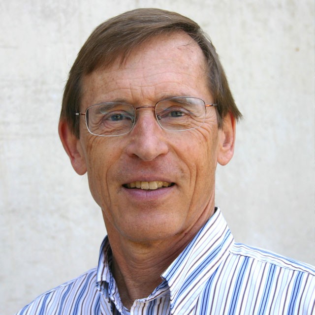 John M. Melack合作论文数Department of Ecology, Evolution and Marine Biology, University of California, Santa Barbara;Bren School of Environmental Science and Management, University of California, Santa Barbara11
 Victoria Sork合作论文数Laboratory of Victoria Sork, Department of Ecology & Evolutionary Biology, College of Life Sciences, University of California, Los Angeles10Claudia M. Tyler合作论文数Department of Biological Sciences;University of California , Santa Barbara;Department of Biological Sciences, University of California , Santa Barbara10
 Frances Gulland合作论文数School of Veterinary Medicine, UC Davis10
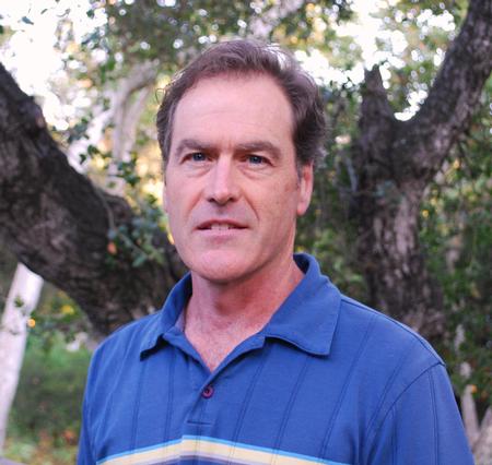 Max Alan Moritz (Max Moritz)合作论文数Moritz Lab, Bren School of Environmental Science & Management, University of California9
 Dar Roberts合作论文数Department of Geography, Bren School of Environmental Science & Management, University of California, Santa Barbara9
 Alan L. Flint合作论文数U. S. Geological Survey9Joel Michaelsen合作论文数8
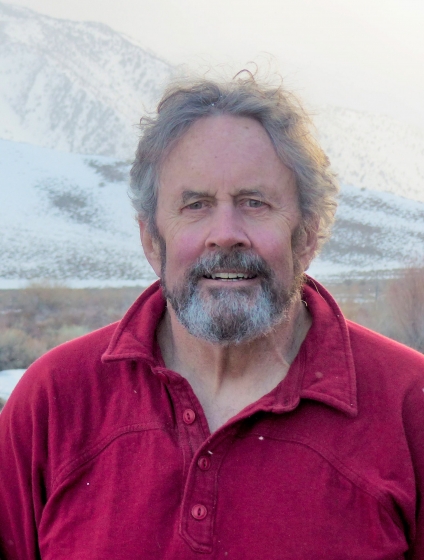 Jeff Dozier合作论文数Bren School of Environmental Science and Management, University of California, Santa Barbara8
 Dale D. Goble合作论文数Coll Law, Univ Idaho8Bruce E. Mahall合作论文数8
 Josep M Serra-Diaz合作论文数AgroParisTech, Université de Lorraine7
 Mark Friedl合作论文数Department of Earth and Environment, Boston University;Center for Remote Sensing, Boston University7
 Lorraine E Flint合作论文数Placer Hall, U.S. Geological Survey7
 Lee Hannah合作论文数Betty and Gordon Moore Center for Science and Oceans, Conservation International7Victor L. Lechtenberg合作论文数6Janet M. Mulligan合作论文数6James J. Reisa合作论文数6Peggy Tsai合作论文数6Radiah Rose合作论文数6Daniel M. Dooley合作论文数6Karen L. Imhof合作论文数6Norman Grossblatt合作论文数6Evonne P. Y. Tang合作论文数6David J. Policansky合作论文数6Austin J. Lewis合作论文数6Richard M. Gold合作论文数6Frank O'Donnell合作论文数6Robin A. Schoen合作论文数6Samuel Kacew合作论文数6Philip E. Nelson合作论文数6Terry L. Medley合作论文数6




