Underwater image enhancement (UIE) is a complex non-linear inverse problem. Traditional models rely on linear operators, which fail to fuse multi-domain degradation features effectively. This paper proposes FreqKAN, a novel dual-domain framework centered on Information Fusion principles to bridge frequency and spatial representations. We design the KANs-driven Dual-domain Collaborative Block (KDCB), which decouples global luminance/color (frequency-domain) from local structural details (spatial-domain). By leveraging the non-linear approximation of Kolmogorov-Arnold Networks (KANs), it achieves a more precise reconstruction of the amplitude spectrum than traditional linear mappings. To address the instability of underwater environments, we propose the Adaptive Fusion Block (AFB). Unlike static concatenation, AFB employs a KAN-based gating mechanism to dynamically harmonize complementary information, ensuring a synergistic balance between global color naturalness and local edge fidelity. Extensive experiments on UIEB and UCCS datasets indicate that FreqKAN significantly outperforms state-of-the-art UIE methods, with a 1.15 dB PSNR gain over the second-best method UIE-UnFold on the UIEB-T90 dataset, effectively enhancing the robustness of underwater vision systems.
Effectively modeling spatial-spectral information and local-global features is crucial for hyperspectral unmixing (HU). Some existing deep learning (DL) based unmixing methods still exhibit limitations in global spectral modeling and physical guidance, which affect both the accuracy and interpretability of unmixing. To address these issues, in this article, we propose a physics-guided encoder (PGE) module, which employs a convolutional neural network (CNN) to generate feature representations for the image of each spectral band and incorporates the linear mixing model (LMM) to ensure physical consistency. Subsequently, these features are transformed into input tokens for a transformer, enabling spectral global modeling in the representations. Based on the PGE, we propose a physics-guided vision transformer network (PGViT-Net), which eliminates the need for manually adjusting variable shapes and ensures physical guidance in feature transformation. Furthermore, by integrating more spatial information tokens, we introduce a PGViT-Net with tokens complementarity (PGViT-TC-Net). This facilitates the joint modeling of spectral-spatial information and local-global feature representations, enhancing unmixing performance. Experiments on synthetic and real-world datasets demonstrate that our approach consistently overcomes state-of-the-art methods.
Accurate detection of precipitation on a global scale is essential for advancing our understanding of the hydrological cycle and improving climate models. This study evaluates the performance of the Rain Masking Algorithm (RMA), developed for NASA's Micropulse Lidar Network (MPLNET), in detecting rainfall events and distinguishing them from non-rain events over multiple years. The RMA's effectiveness was validated against data from co-located disdrometers at two distinct MPLNET sites: the Goddard Space Flight Center (GSFC) in the United States and Universitat Polit & egrave;cnica de Catalunya (UPC) in Barcelona, Spain. Comparisons were also conducted with precipitation retrievals from the Integrated Multi-Satellite Retrievals for GPM (IMERG) project. Results indicate that the RMA is highly effective at detecting rain events, outperforming IMERG in sensitivity and accuracy at both sites, and demonstrating also unique capability in distinguishing virga, precipitation that evaporated before reaching the ground (not considered in the intercomparison). However, the algorithm shows limitations in identifying low-intensity precipitation and occasionally records false positives due to transient atmospheric artifacts. These results underscore the potential of the RMA in advancing the validation of satellite precipitation data from the ground, which is advantageous for the upcoming ESA-JAXA EarthCARE mission. Although the current analysis does not include EarthCARE data, we present the performance of RMA and a corresponding matchup strategy that are intended to facilitate next validation efforts for EarthCARE's precipitation data. This work also highlights the RMA as a promising tool for refining global precipitation monitoring and advancing meteorological and climate forecasting accuracy.
Self-supervised learning has shown strong potential for remote sensing semantic segmentation by exploiting large amounts of unlabeled data. However, existing methods face several challenges when applied to remote sensing images, including limited use of frequency-domain information, inconsistent semantics caused by conventional view generation, and suboptimal uniform masking strategies for dense scenes. To address these issues, we propose spatial-frequency contrastive learning (SFCL), a dual-domain self-supervised framework that jointly models spatial and frequency representations. SFCL enforces spatial-domain consistency to capture local structural information, frequency-domain consistency to encode global structural and spectral patterns, and cross-domain alignment to enhance semantic invariance. In addition, we introduce a routing-based hybrid masking strategy, which adaptively routes selected patches to pixel-level or patch-level masking branches, balancing fine-grained object preservation and contextual reasoning. Extensive experiments on multiple remote sensing datasets demonstrate that SFCL consistently outperforms state-of-the-art self-supervised methods on semantic segmentation tasks, validating its effectiveness in learning robust and semantically meaningful representations for remote sensing applications.
Hyperspectral pansharpening aims to reconstruct a high resolution hyperspectral (HRHS) image from a panchromatic (PAN) image and a low resolution hyperspectral (LRHS) image while preserving both spatial details and spectral fidelity. Recent diffusion based methods exploit pretrained image priors by generating a low dimensional representation and subsequently mapping it to the hyperspectral domain. However, the observed panchromatic and hyperspectral images are typically imposed only through external reconstruction objectives, limiting their direct interaction with the diffusion prior. To address this issue, we propose dual-modality image-prompted diffusion model (DIDM) for zero shot hyperspectral pansharpening. DIDM encodes the low resolution hyperspectral and panchromatic observations into spectral and spatial prompt tokens, respectively, and injects them into intermediate features of a frozen remote sensing diffusion model through cross attention, allowing complementary spectral and spatial information to directly guide diffusion feature evolution. In addition, we introduce a panchromatic guided weighted pixel aware total variation regularizer that combines low resolution hyperspectral degradation fidelity and panchromatic response fidelity with gradient adaptive structural regularization, thereby preserving structural discontinuities while suppressing spurious variations in homogeneous regions. Extensive experiments on Pavia, Chikusei, and Houston under reduced resolution protocols show that DIDM achieves the best performance across all evaluated metrics, while full resolution evaluation on FR1 yields the highest HQNR among the compared methods. These results demonstrate that internal dual modality prompting and panchromatic guided structural regularization provide an effective balance between spatial detail enhancement and spectral preservation.
An intensive observation period (IOP) for simultaneous measurements of ABLH by using radio soundings and remote sensing techniques is planned at CNR-IMAA Atmospheric Observatory (CIAO) starting from April 2024. During the IOP all the CIAO sensors relevant for the study of the ABLH will be operative 24 hours a day and seven days a week. At least 6 radiosoundings per day will be performed, adopting GRUAN (GCOS Reference Upper Air Network) procedures and algorithms. This experimental set-up will provide an optimal dataset for the characterization of ABLH using different techniques and sensors. Additionally, the measurement campaign will provide the opportunity to optimize MIPA (Morphological Image Processing Approach) algorithm for the retrieval of ABLH from lidar data.
Multimodal image registration aims to spatially align images from different modalities at the pixel level. However, due to the nonlinear relationship of radiation intensities caused by different imaging modalities, achieving high accuracy in multimodal image registration presents a significant challenge. Additionally, the presence of both global transformations (i.e., large-scale rigid affine transformations) and local distortions (i.e., small-scale nonrigid deformations) between paired images further complicates the registration process. This article addressed the challenge resulting from modality differences through modality distillation. Specifically, a teacher (i.e., a homomodal image registration model) is trained to guide the student (i.e., a multimodal image registration model). Besides, this article simultaneously aligned large-scale rigid and small-scale nonrigid deformations by predicting deformation flow from both global and local features, thereby achieving high-precision registration. Furthermore, this proposed method incorporated a deformation mask during training to mitigate the negative impact of black edges in the obtained registration results on model performance. Experimental results demonstrate that the proposed method delivers state-of-the-art registration accuracy across various multimodal datasets, with ablation studies confirming the effectiveness of each component. The codes will be available at https://github.com/2351056918/Multimodality-Image-Registration-with-Modailty-Distillation
Hyperspectral image (HSI) classification remains challenging due to high spectral dimensionality, extremely limited labeled samples, and complex spatial-spectral dependencies. Recent Transformer-based HSI models provide strong contextual modeling, yet their high-dimensional latent representations are often weakly structured under low-label regimes, which can lead to unstable class separation and limited analyzability of the decision process. In this paper, we propose CDFormer, a Transformer framework that introduces an explicit concept bottleneck to impose a structured intermediate representation for classification. CDFormer projects attention-enhanced token features into a low-dimensional concept space composed of structured latent coordinates for decision decomposition and predicts labels through a linear class-concept readout, yielding an exact logit decomposition into concept-wise contributions rather than predefined semantic attributes. To improve representation learning under scarce supervision, we train CDFormer using a composite objective that combines standard classification loss with orthogonality and sparsity regularization and a supervised contrastive term applied in concept space, encouraging reduced feature redundancy, selective coordinate activation, and improved intra-class compactness/inter-class separation. Experiments on five benchmark HSI datasets demonstrate that CD-Former achieves consistent performance compared with recent state-of-the-art baselines. The source code will be released at https://github.com/mahmad000.
This article presents the scientific results of the 2025 Data Fusion Contest organized by the Image Analysis and Data Fusion Technical Committee, the University of Tokyo, RIKEN, and ETH Zurich. The focus of the contest was to develop innovative solutions for all-weather land-cover and building damage mapping using multimodal SAR and optical EO data at submeter resolution. The contest is organized into two distinct tracks. Track 1 focuses on land-cover mapping and Track 2 is about building damage mapping. The competition presented two primary technical challenges: the effective integration of multimodal data and the development of robust models capable of handling noisy labels. The contest saw significant global engagement, with Track 1 receiving 507 registrations and 3859 successful submissions, while Track 2 followed a similar trend with 423 registered teams and 5008 successful entries. This article provides the methodologies and results achieved by the first- and second-ranked teams from each track. To promote transparency and ensure the reproducibility of results, all participating teams in this year's contest have publicly released their code. Furthermore, the dataset used in this competition has been made publicly available to the community to support and encourage further research in the field. The dataset and related resources can be accessed via the official IEEE GRSS IADF TC website1.
Remote Sensing (RS) data encapsulates rich multi-dimensional information essential for Earth observation. Its vast volume, diverse sources, and temporal continuity make it particularly well-suited for developing large Visual Foundation Models (VFMs). These models serve as powerful feature extractors, leveraging extensive RS data for pretraining and subsequent fine-tuning in various geoscientific applications. However, existing VFMs in the RS domain often concentrate on specific image characteristics, neglecting the full season-aware potential of RS data. To bridge this gap, we introduce SeaMo, a novel VFM that effectively integrates multimodal and multi-seasonal RS information. SeaMo leverages a masked image modeling framework to fully exploit the spatial, spectral, and seasonal dimensions of RS data. Specifically, we employ unaligned spatial region selection to capture spatial heterogeneity, incorporate multi-source inputs for enhanced multimodal integration, and introduce temporal-multimodal fusion blocks to assimilate seasonal variations effectively. By explicitly modeling the complex, season-dependent attributes of RS data, SeaMo enhances generalization, robustness, and adaptability across geoscientific tasks. Extensive experiments and ablation studies demonstrate its superior performance, underscoring its potential as a foundational model for Earth observation.
The oxidative potential (OP) of particulate matter (PM) reflects its ability to trigger oxidative stress in the respiratory system and is increasingly recognised as a key metric for assessing PM toxicity. Concurrently, PM has gained importance as a health indicator, leading to its inclusion in European regulations. As OP is not routinely monitored at many sites, understanding exposure and related risks remains challenging. While satellite imagery is commonly used to estimate PM mass concentration, its application to OP has not yet been explored. We present a novel deep-learning-based approach employing satellite-based surface features for OP estimation, using both OPAA and OPDTT assays on 24-hour PM10 samples collected over five years in Grenoble (France). We propose OPNet, which consists of two parts: a deep backbone that extracts surface features from one satellite image, and a predictor estimating OPAA and OPDTT using the extracted features combined with contextual variables. The architecture is trained in two stages: in the domain-adaptive task, both are jointly trained to predict daily PM10 concentration, with the backbone initialised from weights from a general classification problem. In the domain-specific task, they are jointly updated to predict either OPAA or OPDTT, with the backbone initialised from the best weights obtained in the first stage. This approach explains up to 75% of the variance in OPAA and 58% in OPDTT when using both satellite imagery and auxiliary data. It offers a cost-effective solution to improve the estimation of OP, with implications for large-scale air quality monitoring and health impact assessments.
The goal of a deep learning-based general image fusion method is to solve multiple image fusion tasks with a single model, thereby facilitating the deployment of models in practical applications. However, existing methods fail to provide an efficient and comprehensive solution from both model training and network design perspectives. Regarding model training, current approaches cannot effectively leverage complementary information across different tasks. In terms of network design, they rely on experience-based network designs. To address these issues, we propose a comprehensive framework for general image fusion using the newly proposed gradient transfer learning and fusion rule unfolding. To leverage complementary information across different tasks during training, we propose a sequential gradient-transfer framework based on the idea that different image fusion tasks often exhibit complementary structural details and that image gradients effectively capture these details. To move beyond heuristic-based network design, we evolved a fundamental image fusion rule and integrated it into a deep equilibrium model, resulting in a more efficient and versatile image fusion network capable of uniformly handling various fusion tasks. Considering three different image fusion tasks, i.e., multi-focus image fusion, multi-exposure image fusion, and infrared and visible image fusion, our method not only produces images with richer structural information but also achieves highly competitive objective metrics. Furthermore, the results of generalization experiments on previously unseen image fusion tasks, i.e., medical image fusion, demonstrate that our method significantly outperforms competing approaches.
Recently, tensor network (TN) decompositions have gained prominence in computer vision and contributed promising results to tensor recovery for their capability of compactly and efficiently representing high-order tensors. However, current TN topologies are rather being developed towards more intricate structures to pursue incremental improvements, resulting in a drastically increased number of TN ranks, which requires laborious hyper-parameter selection, especially for higher-order cases. In this paper, we propose a novel TN decomposition, dubbed tensor wheel (TW) decomposition, in which a high-order tensor is represented by a set of latent factors mapped into a specific wheel topology. Such a decomposition is constructed starting from analyzing the graph structure, aiming to more accurately characterize the complex interactions inside objectives while maintaining a lower hyper-parameter scale, theoretically alleviating the above deficiencies. The comprehensive analysis of the mathematical properties fully demonstrates that TW decomposition can be more potential in representation capabilities and more flexible in controlling both parameter storage and computational costs. To compute the TW-format decomposition, the sequential singular value decomposition (SVD)-based and the alternating least squares (ALS)-based learning algorithms are developed. Furthermore, to investigate the validity of TW decomposition, we provide its one numerical application, i.e., tensor completion (TC), yet develop an efficient proximal alternating minimization-based solving algorithm with guaranteed convergence. Experimental results on both synthetic and real-world data reveal that TW decomposition significantly outperforms other state-of-the-art tensor decompositions for incomplete-tensor inference, especially under solely few observations, thus substantiating the superiority and reliability of TW decomposition.
Hyperspectral (HS) pan-sharpening has become a vital area of research, focusing on the fusion of HS and panchromatic (PAN) images to produce high-resolution hyperspectral (HRHS) data. Although traditional methods remain essential, the swift advancements in deep learning technologies require an updated analysis of how these approaches reshape the field. One of the major challenges in HS pan-sharpening is the limited availability of robust datasets, which often hinder the generalization of models across various sensors. This constraint complicates the development of universally applicable models. To address this gap, this survey comprehensively reviews traditional and deep learning-based methodologies, categorizing them into four primary groups based on their fusion techniques. This systematic categorization facilitates a thorough exploration of the underlying mechanisms and enables an assessment of the strengths and limitations of each approach. In addition, the survey highlights the emergence of hybrid models that combine traditional and deep learning methods, showing promise in improving performance and overcoming dataset constraints. Future research directions may focus on improving model generalization, investigating unsupervised and semi-supervised learning techniques, and advancing the accuracy and reliability of HS pan-sharpening models. Finally, we discuss emerging areas and provide insights on these future research directions to conclude this survey, aiming to stimulate further progress in this essential field of study.
This article presents the scientific outcomes of the 2024 Data Fusion Contest (DFC24) organized by the Image Analysis and Data Fusion Technical Committee of the IEEE Geoscience and Remote Sensing Society, the Space for Climate Observatory, the Centre national d'etudes spatiales, the National Aeronautics and Space Administration, and the Centre Europeen de Recherche et de Formation Avancee et Calcul Scientifique. The contest aims to advance image analysis and data fusion algorithms that generate reliable flood maps from multimodal Earth observation imagery. The DFC24 provides a large-scale, multimodal flood mapping benchmarking dataset and comprises two challenging competition tracks on the flood mapping task, one based on synthetic aperture radar imagery, and another using passive-optical imagery. Additional features, such as a digital terrain model and land-use and water occurrence, are also provided to the participants. This article presents the methods and results obtained by the first and second-ranked teams of each track. During the development phase, 1935 people registered for the contest, while at the end, 46 for Track 1 and 52 for Track 2 teams competed during the test phase in the two tracks, respectively. The data of this contest are openly available to the community for further research, development, and refinement of geospatial artificial intelligence, data fusion, and flood mapping methods.
The rapid advancement of deep neural networks (DNNs) has substantially progressed image-to-image translation, yielding numerous sophisticated methods. However, most existing methods face not only the inherent pixel-level spatial misalignment resulting from divergent imaging perspectives, but also the local geometric distortion and structural incoherence stemming from inadequate cross-modal feature alignment. To address this issue, we propose CycleMamba, a cycle-consistent learning-based aerial visible-to-infrared image translation framework, which enforces geometric constraints and semantic space alignment through globally-aware bidirectional transformation, thereby alleviating pixel-level misalignment and structural distortion. Specifically, inspired by the selective structured state-space model (SSM, Mamba), a bidirectional cross-modal translation network based on multigranularity U-shaped translators (MGUTs) is constructed, which integrates Mamba's long-range modeling with convolutional neural network (CNN) local feature extraction strengths. Regarding the stability of cyclic consistency learning, a dual-stage progressive training mechanism is developed for visible-infrared-visible translation. Additionally, to enhance the alignment of cross-modal features and structural preservation, the cycle consistency constraints that collaborate with structural similarity (SSIM) and semantic consistency losses are given to reduce spatial and semantic misalignment, facilitating fidelity. Comparative experiments with state-of-the-art methods are conducted on three public datasets. The experimental results demonstrate that CycleMamba achieves superior translation performance. Extensive ablation studies further evaluate the effectiveness of the proposed method. The code will be available at https://github.com/xzhichaox/CycleMamba
Existing prompt-based methods for infrared and visible image fusion in remote sensing typically rely on a single prompt to guide the model. However, a single prompt lacks sufficient expressive power to capture complex cross-modal relationships across diverse remote sensing scenarios, often resulting in the loss of texture details of ground objects or thermal saliency. To address this limitation, we propose a novel Prompt Ensemble Fusion Network (PEFN) tailored for remote sensing imagery. Unlike previous approaches, PEFN introduces a prompt ensemble mechanism that leverages multiple diverse learnable prompts to generate robust and comprehensive semantic guidance. Specifically, a Prompt-Driven Semantic Modulation Module is designed to inject this guidance into visual features, while a Semantic-Guided Attention Module dynamically reorganizes features via a cross-attention mechanism. Furthermore, a prompt diversity loss is introduced to encourage diversity within the prompt ensemble. Extensive experiments on the remote sensing Potsdam and WHU datasets demonstrate that PEFN outperforms state-of-the-art methods in terms of objective metrics and visual quality.
Pansharpening is a vital process that aims to obtain high-resolution multispectral (HRMS) images by fusing panchromatic (PAN) and low-resolution multispectral images. With the advancement of deep learning (DL), data-driven pansharpening methods have been developed extensively, demonstrating superior performance compared to traditional approaches. However, most current DL-based studies still struggle to effectively preserve spectral properties and adequately capture spatial details, and fail to comprehensively integrate complementary information across modalities, leading to suboptimal results. To address these challenges, we propose an innovative cross-modal information aggregation network (CMIAN) with feature enhancement (FE) for pansharpening. The CMIAN comprises three core components: an FE module that enhances feature representation of both modalities through a simplify-and-enhance approach, a cross-modal feature aggregation module that aggregates intramodal features based on the characteristic differences between MS and PAN images, and a cross-modal information reconstruction module that adaptively balances large-scale features and local details of PAN images, and performs image reconstruction to yield desirable pansharpening outcomes. Experiments on the QuickBird, WorldView-2, and WorldView-3 datasets demonstrate the effectiveness and superiority of our proposed CMIAN. On the WorldView-3 dataset, for instance, our CMIAN outperforms the second-best method by 5.95% in mean peak signal-to-noise ratio and 9.41% in spectral angle mapper.
Transformers have achieved remarkable success in satellite pansharpening by effectively modeling nonlocal similarity. Self-attention focuses on modeling the global dependency among all token pairs, typically pixel pairs for pansharpening. Representative tokens with rich information are often ignored. This leads to redundant computation, especially for similar tokens. Instead, nonsimilar regions share the weights to aggregate features in a feed-forward network (FFN), leading to suboptimal performance. To address these limitations, we propose ProtoFormer, a novel transformer architecture that introduces learnable prototype tokens to capture and leverage representative image structures, featuring two key contributions: 1) Shared Prototype Attention (SPA): It exploits the high redundancy and symmetry of attention maps by computing a single shared attention map between image and prototype tokens, enabling bidirectional exchange of global self-similarity information while reducing self-attention complexity from quadratic to linear; and 2) Prototype-Guided Content-Adaptive FFN (PCAFN): It addresses the limitation of standard FFNs that use shared weights for all positions by leveraging prototype tokens to partition image tokens into similar-content regions, then applying region-specific content-adaptive convolution (CAC) and a soft mask gate, thereby enhancing spatially adaptive feature aggregation and preserving fine edges. Extensive experiments demonstrate that the proposed method outperforms state-of-the-art fusion methods through both qualitative and quantitative assessments on multiple test sets.
 Jocelyn Chanussot合作论文数Chinese Academy of Sciences;Grenoble Institute of Technology;Inria63
 Rocco Restaino合作论文数Università degli Studi di Salerno61
 P. Addesso合作论文数University of Sannio37
 Liang-Jian Deng (邓良剑)合作论文数School of Mathematical Sciences, University of Electronic Science and Technology of China32
 Simone Lolli合作论文数环境分析方法研究所25
 Mauro Dalla Mura合作论文数Tokyo Institute of Technology24
 Maurizio Longo合作论文数Dept Informat Engn Elect Engn & Appl Math DIEM, Univ Salerno21
 Tingzhu Huang (黄廷祝)合作论文数School of Mathematical Sciences, University of Electronic Science and Technology of China18
 Paolo Braca合作论文数Centre for Maritime Research and Experimentation, NATO Science and Technology Organization17
 A. Garzelli合作论文数Dipartimento di Ingegneria dell'Informazione
Universita di Siena17
A. Garzelli合作论文数Dipartimento di Ingegneria dell'Informazione
Universita di Siena17 Luciano Alparone合作论文数Laboratorio Elaborazione Segnali e Comunicazioni, Information Engineering Department, University of Florence14
 Danfeng Hong (洪丹枫)合作论文数School of Automation, Southeast University13Zhong-Cheng Wu合作论文数11
 Daniele Picone合作论文数Univ, Univ Grenoble Alpes9
 Claudio Persello合作论文数Department of Information Engineering and Computer Science;University of Trento;Department of Information Engineering and Computer Science, University of Trento9
 Giorgio Licciardi合作论文数Tor Vergata University9
 Xichuan Zhou (周喜川)合作论文数School of Microelectronics and Communication Engineering, Chongqing University;Institute of Science on Brain Inspired Intelligence, Chongqing University8
 Xiao Wu (吴潇)合作论文数School of Mathematical Sciences, University of Electronic Science and Technology of China;Mohamed Bin Zayed University of Artificial Intelligence8
 Roberto Conte合作论文数8
 Naoto Yokoya (横矢直人)合作论文数Department of Complexity Science and Engineering, Graduate School of Frontier Sciences, The University of Tokyo;Department of Computer Science, Graduate School of Information Science and Technology, The University of Tokyo;RIKEN8
 Ellsworth J Welton合作论文数Laboratory for Atmospheres, NASA Goddard Space Flight Center8
 Gelsomina Pappalardo合作论文数7Jasper R. Lewis合作论文数6Summa Donato合作论文数Dipartimento di Ingegneria e Fisica dell'Ambiente, Università degli Studi della Basilicata6Giuseppe D'Amico合作论文数6Giuseppe Scarpa合作论文数Institute for Nanoelectronics, Technische Universitat Munchen6Benedetto De Rosa合作论文数5
 Haijun Liu (刘海军)合作论文数School of Microelectronics and Communication Engineering, Chongqing University5
 Jin-Fan Hu合作论文数5
 Alberto Arienzo合作论文数Dept Informat Engn, Univ Florence5
 James R. Campbell合作论文数Naval Research Laboratory5
 Ujjwal Verma合作论文数Department of Electronics and Communication Engg, School of Electrical Engineering, Manipal Institute of Technology;Cleed5
 Peter Willett合作论文数Department of Electrical and Computer Engineering, School of Engineering, University of Connecticut5
 Ronny Hansch合作论文数Berlin University of Technology;Department of Electrical Engineering and Computer Science;Computer Vision and Remote Sensing;Department of Electrical Engineering and Computer Science, Berlin University of Technology5
 Saurabh Prasad合作论文数Department of Electrical & Computer Engineering, Cullen College of Engineering, University of Houston5
 Paolo Di Girolamo合作论文数Dipartimento di Ingegneria e Fisica dell'Ambiente (DIFA),, Universita degli Studi della Basilicata5
 Antonino Maltese合作论文数Università degli Studi di Palermo;Dipartimento di Ingegneria Idraulica ed Applicazioni;Dipartimento di Ingegneria Idraulica ed Applicazioni, Università degli Studi di Palermo5
 Michaël Sicard合作论文数Laboratoire de l’Atmosphère et des Cylones, Université de La Réunion5
 Karl Granström合作论文数Department of Electrical Engineering, Linköping University5
 Zihan Cao合作论文数4Jingchun Zhou合作论文数College of Information Science and Technology, Dalian Maritime University4
 Jin-Liang Xiao (肖金良)合作论文数School of Mathematical Sciences, University of Electronic Science and Technology of China4rita montone合作论文数4
 Dehuan Zhang合作论文数Dalian Maritime University4
 Xiaoyuan Yang (杨小远)合作论文数School of Mathematical Science, Beihang University;School of Cyber Science and Technology, Beihang University4
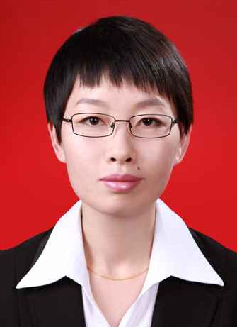 Mingyang Wang (王名扬)合作论文数College of Computer and Control Engineering, Northeast Forestry University4
 Muhammad Bilal合作论文数Architecture and City Design Department, College of Design and Built Environment, King Fahd University of Petroleum & Minerals4
 Jie Huang (黄捷)合作论文数School of Mathematical Sciences, University of Eectronic Science and Technology of China4
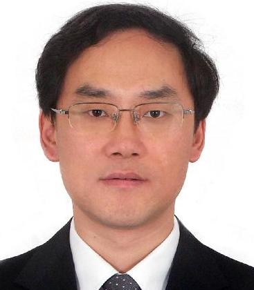 Bing Zhang (张兵)合作论文数Institute of Remote Sensing and Digital Earth, Chinese Academy of Sciences;Aerospace Information Research Institute, Chinese Academy of Sciences;University of Chinese Academy of Sciences4




