Strong and strategic collaborations among experts from academia, federal operational centers, and industry have been forged to create a U.S. IOOS Coastal and Ocean Modeling Testbed (COMT). The COMT mission is to accelerate the transition of scientific and technical advances from the coastal and ocean modeling research community to improved operational ocean products and services. This is achieved via the evaluation of existing technology or the development of new technology depending on the status of technology within the research community. The initial phase of the COMT has addressed three coastal and ocean prediction challenges of great societal importance: estuarine hypoxia, shelf hypoxia, and coastal inundation. A fourth effort concentrated on providing and refining the cyberinfrastructure and cyber tools to support the modeling work and to advance interoperability and community access to the COMT archive. This paper presents an overview of the initiation of the COMT, the findings of each team and a discussion of the role of the COMT in research to operations and its interface with the coastal and ocean modeling community in general. Detailed technical results are presented in the accompanying series of 16 technical papers in this special issue.
New advances in near-bed measurement technologies, combined with large-scale multi-institution research programs have yielded significant advances in understanding the processes that govern the suspension, transport and deposition of mud and sand on continental shelves. Advances have been made in five general, but overlapping areas: (1) bottom boundary layer hydrodynamics; (2) sediment suspension and vertical flux; (3) along-shelf flux; (4) flow-driven across-shelf flux; and (5) gravity-driven across-shelf flux and deposition. Bottom boundary layer dynamics and sediment suspension are tightly coupled, particularly during storms and over mud beds. Along-shelf sediment fluxes are reasonably well modeled in terms of interacting wind-driven flows, coastal plumes and wave agitation. Buoyant river plumes, trapped inshore of fronts, are important modes of along shelf dispersal of river-supplied mud. Recent field observations from river-nourished and sandy shelf environments show that gravity-driven transport within negatively buoyant hyperpycnal layers is an important mode of sediment transport across continental shelves.
The Waiapu River sedimentary system, New Zealand, provides a prototype for investigating the relative importance of wave- versus current-supported gravity flows on continental shelf deposition. A two-dimensional model was used to represent gravity-driven sediment transport and deposition on the Waiapu shelf over an annual cycle of storm events and associated Waiapu River floods. Model inputs of waves and wind-driven currents were derived from WAVEWATCH III hindcasts and constrained by benthic tripod data. The 12-month model run included a low-energy period (September 2003 to May 2004) with weak waves and currents and low river discharge, and a high-energy period (May to August 2004) with stronger waves and wind-driven currents and more frequent river floods. Model results suggested that during the low-energy period, riverine sediment was trapped between the 20- and 80-m isobaths. During the high-energy period, sediment was deposited obliquely across the shelf between the 60- and 120-m isobaths. The predicted deposit locations for the low- and high-energy periods, respectively, were consistent with short- and long-term observed accumulation patterns based on 7Be and 210Pb activity [Kniskern, T.A., Kuehl, S.A., Harris, C.K., Carter, L., 2010. Sediment accumulation patterns and fine-scale strata formation on the Waiapu River shelf, New Zealand. Marine Geology 270, 188–201]. Gravity flows were mainly wave-supported landward of the 60-m isobath, but became increasingly current-supported as wave orbital velocity attenuated in deeper water. Both analytical theory and numerical results indicated that wave-supported gravity currents were sensitive to local water depth and favored deposition parallel to isobaths as depth increased. In contrast, current-supported gravity currents were more sensitive to spatial variations in seabed slope, with seaward decreases in slope and along-shelf embayment of bathymetry favoring transport convergence and deposition. We conclude that the longer term (∼ 100 yr) shelf-oblique mud deposit on the Waiapu shelf mainly reflects current-supported gravity flows responding to local variations in seabed slope and curvature of isobaths.
The Study Group was asked to review the available literature and information, especially that developed since 2000, that would allow them to assess any changes and improvements in the understanding of nutrient sources and flux estimates within the Mississippi and Atchafalaya River basins (MARB) (see Fig. Fig 1.2) and the current ability to use watershed models to route and predict nutrient delivery to the Gulf of Mexico. The following sections discuss the current levels of understanding and provide brief summaries of the Study Group's key findings and recommendations.
Since 1985, scientists have been documenting a hypoxic zone in the Gulf of Mexico each year. The hypoxic zone, an area of low dissolved oxygen that cannot s- port marine life, generally manifests itse
Adaptive management offers a way to address the pressing need to take steps to manage for factors affecting hypoxia in the NGOM in the face of uncertainties. The authors of a recent study undertaken by the National Research Council of the National Academy of Sciences identified six elements of adaptive management that are directly relevant to goal setting and research needs (National Research Council, 2004): (1) resources of concern are clearly defined; (2) conceptual models are developed during planning and assessment; (3) management questions are formulated as testable hypotheses to guide inquiry; (4) management actions are treated like experiments that test hypotheses to answer questions and provide future management guidance; (5) ongoing monitoring and evaluation is necessary to improve accuracy and completeness of knowledge; and (6) management actions are revised with new cycles of learning.
The hypoxic region along the northern Gulf of Mexico (NGOM) extends up to 125 km offshore and to 60 m water depth, has substantial variability with an average midsummer areal extent of 16,500 km2 (2001–2007), and extends in some years from the Mississippi River mouth westward to Texas coastal waters (Rabalais et al., 2007). This hypoxic region (Fig. 1.1) occurs along a relatively shallow, open coastline with complex circulation and water column structure typical of many coastal regions and includes massive inputs of freshwater, weak tidal energies, seasonally varying stratification strength, generally high water temperature, wind effects from both frontal weather systems and hurricanes, and mixing of river plumes from the Atchafalaya and Mississippi Rivers and other smaller sources (DiMarco et al., 2006; Hetland and DiMarco, 2007).
Instrumented tripods deployed at depths of 40 and 60m on the shelf off the mouth of the Waiapu River on the east coast of New Zealand's North Island recorded data on waves, currents, and sediment fluxes from May 22 to August 10, 2004. Three major flood events and several wave events occurred during the deployment. Data from acoustic Doppler velocimeters and profilers revealed that downslope sediment fluxes accompanied a flood event of late June, during which near-bed downslope current speeds approached 0.5ms−1. The most pronounced downslope transport within the benthic layer occurred the day after peak flood but coincided with strong isobath-parallel currents. Suspended sediment concentrations about 1m above the bed were on the order of 2–4gl−1 at times of maximum seaward flow. Suspension of freshly discharged sediment within the hyperpycnal layer over much of the profile was maintained by the high bed stresses associated with the strong benthic currents, in contrast to the wave-supported sediment gravity flows recently reported on other river-nourished shelf systems. Nonetheless, observed concentrations and velocities were largely consistent with the dynamics of critically stratified sediment gravity flows based on equations previously applied elsewhere to wave-supported cases. Despite lower concentrations in current-supported gravity currents, the greater thickness results in similar total loads. In further contrast to earlier results, our data suggest that as sediment off the Waiapu flowed into deeper water across the seaward steepening bottom profile, auto-suspension may have aided in thickening and accelerating the gravity current.
The Southeastern Universities Research Association (SURA) has advanced the SURA Coastal Ocean Observing and Prediction (SCOOP) program as a multi-institution collaboration to design and prototype a modular, distributed system for real-time prediction and visualization of the coastal impacts from extreme atmospheric events, including hurricane inundation and waves. The SCOOP program vision is a community “cyberinfrastructure” that enables advances in the science of environmental prediction and coastal hazard planning. The system architecture is a coordinated and distributed network of interoperable, modularized components that include numerical models, information catalogs, distributed archives, computing resources, and network infrastructure. The components are linked over the Internet by standardized web-service interfaces in a service-oriented architecture (SOA). The design philosophy allows geographically disparate partnering institutions to provide complementary data-provider and integration services. The overall system enables coordinated sharing of resources, tools, and ideas among a virtual community of coastal and computer scientists. The distributed design builds on the notion that standards enable innovation, and seeks to leverage successes of the World Wide Web by creating an environment that nurtures interaction between the research community, the private sector, and government agencies working together on behalf of the nation.
This study was composed of two main elements. In Element 1, Marine Biohazards and Environmental Toxins Research, specific robust antibody probes to polycyclic aromatic hydrocarbons (PAHs) were developed that are indicative of and liberated from oil spills. Antibody probes were screened for their suitability for use within real-time sensors based on an inline florescent inhibition system. The inline technology was demonstrated to be a very robust method, and it was successfully tested for the determination of the trace presence of PAHs down to 1 part per billion and TNT contamination down to 1 part per trillion. In Element 2, Integrated Observations, Data Management and Communication, long-term buoys and shore platforms were installed and/or upgraded at multiple sites, supporting profiling current meters, wave sensors, water quality sensors, and meteorological packages. A web portal was constructed for display and down-load of real-time and archived data from these stations. A partner OPeNDAP website was established to automatically post NetCDF files for pick-up by other ocean observing systems around the nation. LONG-TERM GOALS The long-term goal of this project was to develop, establish and maintain a robust observing system for real time detection of coastal and estuarine environmental conditions of interest to hazard mitigation and rapid response. At the same time, it was intended that by establishing a robust environmental monitoring system in the lower Chesapeake Bay that provides long time series of flows, waves, water levels, water quality and water borne pollutants and toxins, we would gain new understandings of complex phenomena while providing operational users with a valuable source of timely information relevant to safety and environmental stewardship. Our observing efforts strived to be fully incorporated into the national Integrated Ocean Observing System (IOOS). For addressing specific Navy needs, we also aimed to provide the Navy with a portable suite of sensors, models and informatics techniques for detection, diagnosis, and predictions of manmade and natural water-borne hazards and threats, including water-borne pollutants and toxins in ports, bays and littoral waters.
Recent field observations from several shelf environments show that gravity-driven transport within negatively buoyant layers is an important mode of fine sediment transport across continental shelves. Specifically, Dick Sternberg, along with his students and colleagues, stimulated a paradigm shift by reporting strong evidence from the Amazon and Eel shelves that hyperpycnal layers do not require autosuspension for sustenance but can be initiated by sediment flux convergence and supported by wave and current-induced suspension within relatively thin near-bed layers. As these layers move downslope under the influence of gravity, they may deposit sediment in response to decreases in bottom orbital velocities, near-bed current velocity, and/or bed slope. Direct or indirect evidence for wave or current supported sediment gravity flows has recently been reported off other high-load rivers including the Atchafalaya, Fly, Ganges–Brahmaputra, Klamath, Mad, Mississippi, Po, Rhone, Waiapu, Waipaoa, Yangtze, and Yellow among others. Growing evidence from observational and modeling studies suggests that flux convergence followed by wave and current supported gravity driven transport is a primary cause of across-shelf transport and emplacement of flood deposits on many muddy shelves and may be a major contributor to and control on the large-scale formation and morphology of subaqueous deltas and shelf clinoforms. Recent and ongoing studies on this subject are synthesized in this paper and recommendations are offered for further study.
This study synthesized knowledge regarding waveand current-supported sediment gravity flows and their importance to shelf deposition and morphology. Data and publications from STRATAFORM, EuroSTRATAFORM and several river-nourished shelves in Asia and the Western Pacific were reviewed and models for wave-supported fluid muds and resulting gravity flows were applied. Field and modeling evidence suggests that wave and current supported gravity driven transport is a primary cause of across-shelf transport and emplacement of flood deposits on many muddy shelves and may be a major contributor to and control on the large-scale formation and morphology of subaqueous deltas and shelf clinoforms. River effluents deliver sediment to the inner shelf for subsequent remobilization by high wave and current induced bed stresses but there is little field evidence that hyperpycnal river effluents regularly traverse shelves without interruption. Model results predict that convergence of down-slope sediment transport by wave-supported gravity flows increases with bed slope but decreases with slope gradient, such that greatest deposition occurs where steep slopes first become constant with distance offshore. New field data from the 40 m and 60 m isobaths on the shelf off the mouth of the Waiapu River, New Zealand support these conclusions and highlight the additional importance of currents under some conditions.
This study was composed of two main elements. In Element 1, Marine Biohazards and Environmental Toxins Research, specific robust antibody probes to polycyclic aromatic hydrocarbons (PAHs) were developed that are indicative of and liberated from oil spills. Antibody probes were screened for their suitability for use within real-time sensors based on an inline florescent inhibition system. The inline technology was demonstrated to be a very robust method, and it was successfully tested for the determination of the trace presence of PAHs down to 1 part per billion and TNT contamination down to 1 part per trillion. In Element 2, Integrated Observations, Data Management and Communication, long-term buoys and shore platforms were installed and/or upgraded at multiple sites, supporting profiling current meters, wave sensors, water quality sensors, and meteorological packages. A web portal was constructed for display and down-load of real-time and archived data from these stations. A partner OPeNDAP website was established to automatically post NetCDF files for pick-up by other ocean observing systems around the nation.
A field study of bedforms, associated hydraulic roughness, and turbulence was conducted on the inner shelf off the east coast of New Zealand's North Island under conditions that included two significant storm events. Sharply contrasting rough and smooth beds were characterized via field mapping and deployment of instrumented benthic tripods. Rough areas of coarse sand exhibited ripples with heights and lengths of ∼25 and ∼100cm, while smooth areas supported smaller ripples with heights and lengths of ∼5cm and ∼20cm. Contacts between the two surfaces were sharp and maintained their position. Roughness contrasts were enhanced significantly during storms, which simultaneously accentuated migrating orbital ripples over the coarse bed and replaced ripples on the fine sediment bed with smoother hummocky features. Spectra of the fluctuating vertical velocity components, w′, from both smooth and rough sites showed good fits to −5/3 slopes within the inertial sub range enabling independent estimates of wave-averaged bed stress to be made via the inertial dissipation method (IDM). We also utilized the vertical fluctuation data to obtain alternative estimates of the wave friction factor, fw, following Smyth and Hay (J. Phys. Oceanography 32 (2002) 3490); SH. These two methods yielded generally similar results. Under high wave conditions, fw estimated via IDM averaged 0.027 at the rough site and 0.0045 at the smooth site while the SH method gave respective values of 0.027 and 0.013. Under low-energy conditions, fw from IDM averaged 0.0082 at the rough site and 0.012 at the smooth site, while the SH method yielded mean values of 0.0080 and 0.016. Thus, fw was much larger at the rough site than at the smooth site during storms but smaller at the rough site during fair weather. During storms, structured vortices with frequencies at the first harmonic of the swell waves formed over the rough surface and penetrated above the wave current boundary layer causing retardation of mean currents. Such storm-induced vortices were only intermittently present over the smooth surface. The application of Nielsen's (J. Geophys. Res. 86 (1981) 6467) roughness model produced some qualitatively similar trends in fw, although predicted fw was larger than observed values at the rough site. Additionally, low modelled fw over the smooth bed during high energy was based on plane bed theory rather than the inferred hummocky bed.
An analytical model is developed for equilibrium bathymetric profiles off river mouths associated with the shoreward, convex upward portion of subaqueous deltas and clinoforms. The model builds on recent field results demonstrating that gravity-driven flux of suspended mud is important on shelves provided that wave-induced suspension of sediment supports the requisite turbid hyperpycnal layer. Because the maximum sediment load is determined by the critical Richardson number, the results are independent of the properties of the suspended mud or the bed. The model assumes the equilibrium state to represent a balance between the supply of sediment by a river at the coast and the downslope bypassing of sediment to deep water within wave-supported turbid near-bed layers. Progressive seaward increases in bed slope across the convex shelf profile allow the attenuation of wave agitation with depth to be compensated for by a downslope increase in the contribution of gravity. The model is consistent with shelf profiles off the mouths of the Eel (California), Ganges-Brahmaputra (Bangladesh), Waiapu (New Zealand), Po (Italy), and Rhone (France) Rivers. The equilibrium profile is predicted to be a function of wave climate and riverine sediment supply only, with deeper and broader profiles associated with decreasing sediment supply, increasing wave height and/or increasing wave period.
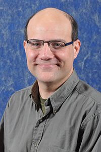 Carl T. Friedrichs合作论文数Department of Physical Sciences, Virginia Institute of Marine Science30
 Andrew Short合作论文数Faculty of Science, The University of Sydney14DB PRIOR合作论文数12W. J. Wiseman合作论文数12Brian D Bornhold合作论文数11G. H. Keller合作论文数11Zhensheng Yang合作论文数10Jm Coleman合作论文数9Seok Chan Kim合作论文数9
 John Boon合作论文数7
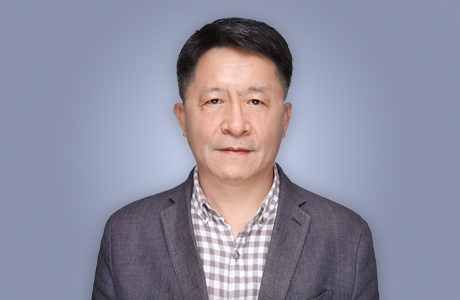 Jingping Xu (徐景平)合作论文数Southern University of Science & Technology6Joseph N Suhayda合作论文数6
 Alan F. Blumberg合作论文数HydroQual, Inc.6JPY Maa合作论文数5Clifford S. Snyder合作论文数5Holly Stallworth合作论文数5
 Catherine Louise Kling合作论文数Charles H. Dyson School of Applied Economics and Management, Cornell University;Brooks School of Public Policy, Cornell University;SC Johnson College of Business, Cornell University5
 Robert Warren Howarth合作论文数Department of Ecology and Evolutionary Biology, The College of Arts and Sciences, Cornell University5
 Daniel J. Conley合作论文数Department of Geology, Lund University5
 Virginia Dale合作论文数Environmental Sciences Division, Oak Ridge National Laboratory;Department of Forestry, Wildlife, and Fisheries, University of Tennessee Institute of Agriculture;Department of Ecology and Evolutionary Biology, College of Arts & Sciences, University of Tennessee5
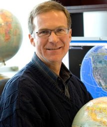 Denis Gilbert合作论文数Fisheries & Oceans Canada, Maurice Lamontagne Inst5
 Hans W. Paerl合作论文数Department of Environmental Sciences and Engineering, Gillings School of Global Public Health, University of North Carolina at Chapel Hill;Department of Marine Sciences, Gillings School of Global Public Health, University of North Carolina at Chapel Hill;Institute of Marine Sciences, University of North Carolina at Chapel Hill5
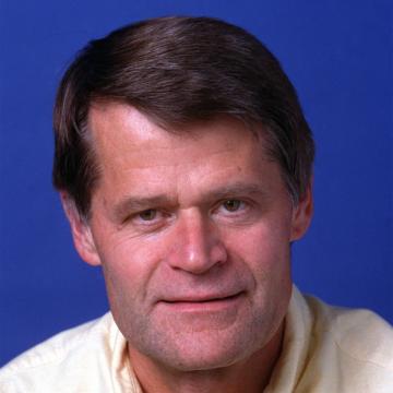 Kenneth H. Reckhow (Kenneth Reckhow)合作论文数Department of Civil and Environmental Engineering, Nicholas School of the Environment, Duke University5
 James Sanders合作论文数Benedict Estuarine Research Laboratory, The Academy of Natural Sciences5
 Mark B. David合作论文数Department of Natural Resources & Environmental Sciences, College of Agricultural, Consumer and Environmental Sciences, University of Illinois Urbana-Champaign5Kyle R. Mankin合作论文数Department of Biological and Agricultural Engineering, Kansas State University5
 Richard Lowrance合作论文数Southeast Watershed Research Lab, US Department of Agriculture5Malcolm E. Scully合作论文数Center for Coastal Physical Oceanography, Old Dominion University5Thomas Armitage合作论文数5
 Thomas S. Bianchi合作论文数Department of Geological Sciences, College of Liberal Arts and Sciences, University of Florida5
 James J. Opaluch合作论文数5William G. Crumpton合作论文数5B. G. Thom合作论文数4David Wangsness合作论文数4
 Andrew Sharpley合作论文数Crop Soil and Environmental Science Department, University of Arkansas;Watershed Research and Education Center, University of Arkansas4
 W. R. Boynton合作论文数4Jeffrey H List合作论文数4M.O Green合作论文数3Mo Green合作论文数3P Nielsen合作论文数3
 Ole S. Madsen合作论文数Department of Civil and Environmental Engineering, School of Engineering, Massachusetts Institute of Technology3
 Charles A. Nittrouer (Charles Nittrouer)合作论文数Department of Earth and Space Sciences, College of the Environment, University of Washington;School of Oceanography, College of the Environment, University of Washington3Thomas W. Simpson合作论文数3Y. B. Fan合作论文数3C.J. Sonu合作论文数3Nz Lu合作论文数3
 Linda C. Schaffner合作论文数College of William and Mary, Virginia Institute of Marine Science3J. M. Brubaker合作论文数Virginia Institute of Marine Science;College of William and Mary;College of William and Mary, Virginia Institute of Marine Science3Steve Kaattari合作论文数2




