This paper describes a power spectral density (PSD) bounding method for deriv-ing high-integrity models of stationary and nonstationary time-correlated mea-surement error processes. The method is intended for safety-critical commercial aircraft navigation where robust sensor models are required to predict error bounds on position and orientation estimates. These bounds are used both in navigation system design for integrity performance analyses and in operation to determine whether a pilot should proceed with an operation. In prior work, we used PSD upper-bounding to obtain high-integrity models of time-correlated global navigation satellite system (GNSS) measurement errors. However, the method was limited to stationary processes. In this paper, we derive an approach to expand the concept of PSD bounding to nonstationary error modeling for Kalman filter-based estimation using GNSSs and inertial navigation systems in aircraft navigation applications.
The baseline algorithm for horizontal advanced receiver autonomous integrity monitoring (HARAIM) provides a reference method for computing a horizontal protection level (HPL) for aircraft en-route navigation safety requirements. The baseline HPL bounds the radial positioning error in three steps by iteratively solving for an east protection level (PL), solving for a north PL, and then com-bining the two PLs. Each iterative process optimally allocates an integrity risk requirement across fault-free and fault hypotheses. We develop two new HPLs that require the iterative process to be performed only once. One approach is more compact, whereas the other provides a tighter bound than the baseline. Additionally, we derive a theoretical generalized chi-square horizontal reference boundary for analytical purposes. Using simplified single- and two-hypothesis examples, we assess how satellite geometry and measurement error model parameters impact the HPL bounds. Finally, we conduct a worldwide analysis comparing the proposed HPL approaches against the baseline for an example HARAIM-based aircraft navigation application.
In this paper, we develop and evaluate an autonomous, self-calibrating, receiver-independent carrier-to-noise-density ratio (C/N0)-based jamming detection algorithm capable of processing data from large receiver networks. The algorithm uses optimal detectors that target a predefined false alert rate. Using this algorithm, we processed eight months of data from hundreds of receivers and identified patterns in jamming detection consistent with intentional interference, providing an opportunity to validate the C/N0 detector. We designed a portable experimental radio frequency (RF) data collection setup and developed an optimal power-based jamming monitor to independently detect jamming. With this setup, we detected a genuine jamming event while driving on I-25 in Colorado, United States, and validated the C/N0-based detector through time-frequency analysis of wideband RF data from the event.
Deriving safe bounds on particle filter estimate is a research problem that, if solved, could greatly benefit robots in life-critical applications, a field that is facing increasing interest as more robots are being deployed near humans. In response, this article introduces a new fault detector and derives a performance measure for particle filter: integrity risk. Integrity risk is defined as the probability of having large estimate errors without triggering an alarm, all while considering measurement faults, unknown deterministic errors that cannot be modeled via normal white noise. In this work, the faults come in the form of incorrectly associated features when using the local nearest neighbors. Simulations and experiments assess the efficiency of the introduced safety metric. The results show that safety improves as map density increases as long as the number of particles is sufficient to shape the error distribution and the landmarks are well separated. Also, the results indicate that, when landmarks are poorly separated, particle filter is safer than Kalman filter, whereas, when landmarks are well separated, particle filter is often, but not always, safer than Kalman filter.
Accurate localization in GNSS-denied areas is essential for autonomous ground vehicle safety. Exteroceptive sensors can achieve high-accuracy navigation, but their availability and continuity is limited in automotive environments. Collaborative localization among connected and autonomous vehicles (CAVs) can enhance navigation performance by sharing information on surrounding features, CAV-to-CAV relative pose, and collaborating CAV pose. However, CAVs are vulnerable to sensor faults including misidentifications of landmarks in LiDAR point clouds. This paper builds upon our prior research designing collaborative fault detectors and integrity monitors, which provide probabilistic bounds on CAV pose estimation errors in the presence of nominal sensor errors and undetected faults. Two collaborative approaches are developed using Centralized Extended Kalman Filter (CEKF) and Decorrelation Minimum Variance (DMV). Both approaches improve CAV pose estimation accuracy as compared to non-collaborative navigation. CEKF achieves higher accuracy than DMV. In this paper, we identify the conditions under which CEKF integrity performance exceeds that of DMV; we also explain cases where, using an innovation-based detector under a tight false alert risk requirement, the integrity risk can become larger for CEKF versus DMV.
This paper presents a new data association method for bounding the integrity risk in landmark-based localization in ground transportation applications. Data association is the process of assigning currently-sensed landmark features to features that were previously observed or mapped. Most association methods use a nearest-neighbor criterion based on the normalized innovation squared (NIS). In contrast, we derive a new, closed-form, compact association criterion based on projections of the extended Kalman filter’s innovation vector. These innovation projections (IP) capture the impact of wrong associations on both the magnitude and direction of the innovation vector. We evaluate our newly derived IP method using simulated and experimental data for inertial-aided LiDAR localization in both indoor and outdoor environments. Compared to NIS, the proposed IP method (a) reduces the risk of wrong associations and (b) tightens the bound on predicted integrity risk.
In this paper, we develop and evaluate two new methods to derive high-integrity models of measurement error time correlation from experimental data. These models enable the determination of sequential estimation error variance bounds in safety-critical navigation applications such as aircraft localization based on global navigation satellite systems and inertial navigation systems. We achieve tight bounding models from empirical data based on lagged product distributions instead of autocorrelation functions in the time domain and based on scaled periodogram distributions instead of power spectra in the frequency domain. We bound these distributions using first-order Gauss-Markov process (FOGMP) models, which provide a means to account for error time correlation and can be easily incorporated in linear estimators. To determine bounding models, we identify theoretical probability density functions of lagged products and derive the cumulative distribution function of scaled periodograms for FOGMPs. We implement and evaluate these two methods using simulated samples and experimental Global Positioning System data collected in a mild multipath environment.
Connected autonomous vehicles (CAVs) can provide benefits over individual vehicles for precise navigation, especially in GNSS-denied environments. CAV collaboration can enhance estimation accuracy, but the safety of collaborative localization in the presence of undetected sensor faults remains underexplored. This paper introduces an integrity monitoring method for CAV collaborative localization in both centralized and decentralized implementations. Fault models for landmark and relative measurements are described, and the probability of hazardous misleading information, or integrity risk, is derived. Simulation and experimental results for notional two-CAV scenarios indicate that collaborative localization reduces integrity risk and enhances navigation safety.
This paper describes the design, analysis, and experimental evaluation of a spherical grid-based localization algorithm that leverages quantization theory to bound navigation uncertainty. This algorithm integrates data from light detection and ranging (lidar) and inertial measuring units in an iterative extended Kalman filter to estimate the position and orientation of a moving vehicle. An analytical bound is derived from the vehicle’s state estimation error, which accounts for both random measurement noise and the loss of localization information caused by gridding. The performance of the proposed approach is analyzed and compared with that of a brute-force spherical grid-based method and a landmark-based method in an indoor environment, whereas an outdoor experiment verifies the practicality of the method in a realistic driving scenario.
This paper describes the development, implementation, and testing of a GNSS jammer localizer using power measurement profiles collected during un-crewed aerial system (UAS) fly-bys. A linearized measurement equation based on the Friis power transmission formula is derived in which RF channel propagation parameters are grouped into a single parameter for estimation. Synchronized power and UAS position measurements are processed in a batch-type sequential non-linear least squares algorithm for simultaneous estimation of static jammer position and received power model parameters. We develop a low size, weight, power, and cost (SWAP-C) quad-rotor UAS test bed that can collect and time-stamp power measurements with UAS position. Since GNSS jamming is illegal, a LoRa 868 MHz transmitter is used as a surrogate GNSS jammer during field testing – providing Received Signal Strength Indicator (RSSI) measurements to the LoRa receiver onboard the UAS. Testing is conducted at the Virginia Tech Kentland Experimental Aerial Systems Lab, where emitter localization is evaluated for three different trajectories. Experimental performance analysis suggests that meter-level localization accuracy is achievable with prior knowledge on source location and by accounting for antenna gain pattern variations over time in the estimation process with a first order Gauss Markov Process.
The safety of SLAM-based estimation for mobile robots is a challenging research problem, particularly for life- or mission-critical exploratory applications. To address this problem, this work proposes a method to utilize integrity risk, a widely used performance metric in aviation, to quantify SLAM-based mobile robot’s localization safety. More importantly, the approach accounts for sensor measurement faults, unknown deterministic errors that cannot be modeled via Gaussian white noise. The method is tailored for an EKF-based SLAM estimator, a chi-squared failure detector, and a local nearest neighbors data association criterion. The results show that data association errors can cause significant positioning performance degradation that can only be predicted using the proposed integrity risk metric. Furthermore, the study demonstrates that as the map’s landmark density increases, mobile robot localization safety improves, except when the landmark map’s density is too high to make the features indistinguishable, which leads to positioning safety degradation.
 Boris S. Pervan合作论文数Department of Mechanical, Materials, and Aerospace Engineering, Armour College of Engineering, Illinois Institute of Technology90
 Samer Khanafseh合作论文数Illinois Institute of Technology24
 Matthew Spenko合作论文数Massachusetts Institute of Technology21
 Steven Langel合作论文数20
 Fang-Cheng Chan合作论文数Dept. of Mech. Mater. & Aerosp. Eng., Illinois Inst. of Technol.;c;Dept. of Mech. Mater. & Aerosp. Eng., Illinois Inst. of Technol.12
 Yawei Zhai合作论文数Sch Aeronaut & Astronaut, Shanghai Jiao Tong Univ11
 Juan Blanch合作论文数Stanford University11
 Elisa Gallon合作论文数10
 Danielle Racelis合作论文数Virginia Tech, Blacksburg, VA 24061 USA10
 Guillermo Duenas Arana合作论文数Mechanical Materials and Aerospace Engineering Department, Illinois Institute of Technology10
 Sandeep Jada合作论文数Virginia Tech, Blacksburg, VA 24061 USA9
 Ali Hassani合作论文数Virginia Tech, Kevin T Crofton Dept Aerosp & Ocean Engn, Blacksburg, VA 24061 USA9
 Garcia Crespillo, O.合作论文数Inst. of Commun. & Navig., DLR (German Aerosp. Center), Wessling, Germany;c;Inst. of Commun. & Navig., DLR (German Aerosp. Center), Wessling, Germany|c|9Michael B. Jamoom合作论文数9
 Osama Abdul Hafez合作论文数Mechanical Materials and Aerospace Engineering Department, Illinois Institute of Technology, Chicago, IL, USA7
 Todd Walter合作论文数Department of Aeronautics and Astronautics, Stanford University7
 Santiago Perea合作论文数European Space Agcy6Ilaria Martini合作论文数European Commiss, Brussels, Belgium6
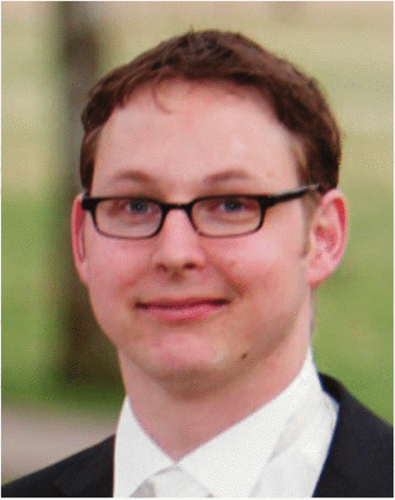 Markus Rippl合作论文数German Aerospace Center;Technische Universitat Munchen;German Aerospace Center, Technische Universitat Munchen6Stefan Stevanovic合作论文数5
 Michael Meurer合作论文数Institute of Communications and Navigation, Deutsches Zentrum für Luft- und Raumfahrt5
 Cagatay Tanil合作论文数Chicago4
 Carl D. Milner合作论文数4Lance De Groot合作论文数3
 Jaymin Patel合作论文数3Jason Burns合作论文数3
 G. Berz合作论文数3Young Lee合作论文数3
 Mark L Psiaki合作论文数Kevin T. Crofton Department of Aerospace and Ocean Engineering, College of Engineering, Virginia Polytechnic Institute and State University3
 Seebany Datta-Barua合作论文数Stanford University3
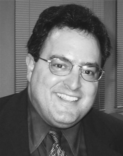 Sam Pullen合作论文数3
 Victoria Kropp合作论文数2Ken Alexander合作论文数2Juan Pablo Boyero合作论文数2
 Julian Wang合作论文数2Shahriar Kiarash合作论文数2Steve Langel合作论文数2Chen Zhu (朱宸)合作论文数2
 Adriano Canolla合作论文数Department of Mechanical, Materials and Aerospace Engineering, Illinois Institute of Technology2Birendra Kujur合作论文数MMAE Department, Illinois Institute of Technology2Laura Norman合作论文数2Norbert Suard合作论文数2Richard Duncan合作论文数2
 Per Enge合作论文数School of Engineering, Stanford University2
 Livio Gratton合作论文数Università di Bologna2John Christ合作论文数2
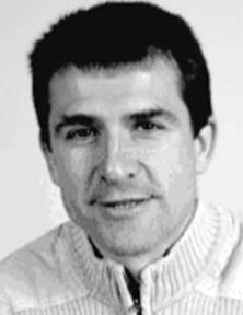 Christophe Macabiau合作论文数2
 Boubeker Belabbas合作论文数2
 Xingqun Zhan (战兴群)合作论文数School of Aeronautics & Astronautics, Shanghai Jiaotong University2




