We present new observations on the dynamics and locations of deep mantle reservoirs derived from the ages and compositions of Voyager Seamount Chain lava flows. The previously unexplored Voyager Seamount Chain trends NW-SE between the Mid-Pacific Mountains and the Northwestern Hawaiian Ridge. Volcanic samples were recovered from the chain during the Ocean Exploration Trust expedition NA134. The lava flows are alkalic to highly alkalic in composition. Ages ranged from 81 to 86 Ma (n = 8), with the oldest ages in the NW and an age-progression toward the SE. The Voyager age-progression continues southward through the Northern Line Islands region until at least 69 Ma. Mantle flowlines using absolute plate motion models indicate that the Voyagers were emplaced near the modern Marquesas Hotspot location approximately 86-69 Ma. The Sr-Nd-Pb-Hf isotope systematics show the influence of an EMII component and overlap the compositions of Pliocene volcanism from the Marquesas Islands, consistent with the plate motion age model. These data imply a long-lived plume as the source of the Voyager seamounts and the Marquesas. However, the lack of a clear and continuous seamount chain between the 86-69 Ma Voyager Seamount Chain and the 6-0 Ma Marquesas Islands implies that the mantle plume displays variable buoyancy flux over time. The surface expression of this mantle reservoir experienced a potential hiatus of up to similar to 60 m.y. These new data indicate that the mantle beneath the Marquesas Islands region has been discontinuously producing age-progressive, EMII-like hotspot volcanism since at least the Late Cretaceous.
Conducting sea-going ocean science no longer needs to be limited to the number of berths on a ship given that telecommunications, computing, and networking technologies onboard ships have become familiar mechanisms for expanding scientists’ reach from onshore. The oceanographic community routinely works with remotely operated vehicles (ROVs) and pilots to access real-time video and data from the deep sea, while onboard a ship. The extension of using an ROV and its host vessel’s live-streaming capabilities has been popularized for almost 3 decades as a telepresence technology. Telepresence-enabled vessels with ROVs have been employed for science, education, and outreach, giving a greater number of communities viewing access to ocean science. However, the slower development of technologies and social processes enabling sustained real-time involvement between scientists on-ship and onshore undermines the potential for broader access, which limits the possibility of increasing inclusivity and discoveries through a diversity of knowledge and capabilities. This article reviews ocean scientists’ use of telepresence for ROV-based deep-sea research and funded studies of telepresence capabilities. The authors summarize these studies findings and conditions that lead to defining the use of telepresence-enabled vessels for “remote science at sea.” Authors define remote science at sea as a type of ocean expedition, an additional capability, not a replacement for all practices by which scientists conduct ocean research. Remote science for ocean research is an expedition at-sea directed by a distributed science team working together from at least two locations (on-ship and onshore) to complete their science objectives for which primary data is acquired by robotic technologies, with connectivity supported by a high-bandwidth satellite and the telepresence-enabled ship’s technologies to support the science team actively engaged before, during, and after dives across worksites. The growth of productive ocean expeditions with remote science is met with social, technical, and logistical challenges that impede the ability of remote scientists to succeed. In this article, authors review telepresence-enabled ocean science, define and situate the adjoined model of remote science at sea, and some infrastructural, technological and social considerations for conducting and further developing remote science at sea.
Methane seeps are highly abundant marine habitats that contribute sources of chemosynthetic primary production to marine ecosystems. Seeps also factor into the global budget of methane, a potent greenhouse gas. Because of these factors, methane seeps influence not only local ocean ecology, but also biogeochemical cycles on a greater scale. Methane seeps host specialized microbial communities that vary significantly based on geography, seep gross morphology, biogeochemistry, and a diversity of other ecological factors including cross-domain species interactions. In this study, we collected sediment cores from six seep and non-seep locations from Grays and Quinault Canyons (46–47°N) off Washington State, USA, as well as one non-seep site off the coast of Oregon, USA (45°N) to quantify the scale of seep influence on biodiversity within marine habitats. These samples were profiled using 16S rRNA gene sequencing. Predicted gene functions were generated using the program PICRUSt2, and the community composition and predicted functions were compared among samples. The microbial communities at seeps varied by seep morphology and habitat, whereas the microbial communities at non-seep sites varied by water depth. Microbial community composition and predicted gene function clearly transitioned from on-seep to off-seep in samples collected from transects moving away from seeps, with a clear ecotone and high diversity where methane-fueled habitats transition into the non-seep deep sea. Our work demonstrates the microbial and metabolic sphere of influence that extends outwards from methane seep habitats.
The Northwestern Hawaiian Ridge is an age-progressive volcanic chain sourced from the Hawaiian mantle plume. Proximal to the Northwestern Hawaiian Ridge are several clusters of smaller seamounts and ridges with limited age constraints and unknown geodynamic origins. This study presents new bathymetric data and 40Ar/39Ar age determinations from lava flow samples recovered by remotely operated vehicle (ROV) from two east–west-trending chains of seamounts that lie north of the Pūhāhonu and Mokumanamana volcanoes. The previously unexplored Naifeh Chain (28°48′N,167°48′W) and Plumeria Chain (25°36′N, 164°35′W) contain five volcanic structures each, including three guyots in the Naifeh Chain. New 40Ar/39Ar age determinations indicate that the Naifeh Chain formed ca. 88 Ma and the Plumeria Chain ca. 85 Ma. The Cretaceous ages, coupled with a perpendicular orientation of the seamounts relative to absolute Pacific plate motion at that time, eliminate either a Miocene Hawaiian volcanic arch or Cretaceous mantle-plume origin. The seamounts lie on oceanic crust that is modeled to be 10–15 Ma older than the corresponding seamounts. Here, two models are put forth to explain the origin of these enigmatic seamount chains as well as the similar nearby Mendelssohn Seamounts. (1) Diffuse lithospheric extension results in the formation of these seamounts until the initiation of the Kula-Pacific spreading center in the north at 84–79 Ma, which alleviates the tension. (2) Shear-driven upwelling of enriched mantle material beneath young oceanic lithosphere results in an age-progressive seamount track that is approximately perpendicular to the spreading ridge. Here we show that all sampled seamounts proximal to the Northwestern Hawaiian Ridge are intraplate in nature, but their formations can be attributed to both plume and plate processes.
Nearly 3,500 methane bubble streams, clustered into more than 1,300 methane emission sites, have been identified along the US Cascadia margin, derived both from archived published data and 2011, 2016–2018 dedicated multibeam surveys using co-registered seafloor and water column data. In this study, new multibeam sonar surveys systematically mapped nearly 40% of the US Cascadia margin, extending from the Strait of Juan de Fuca in the north to the Mendocino fracture zone in the south, and bounded East–West by the coast and the base of the accretionary prism. The frequency-depth histogram of the bubble emission sites has a dominant peak at the 500 m isobar, which extends laterally along much of the Cascadia margin off Oregon and Washington. Comparisons with published seismic data on the distribution of bottom simulating reflectors (BSR), which is the acoustic impedance boundary between methane hydrate (solid phase) and free gas phase below, correlates the bottom simulating reflectors upward termination of the feather edge of methane hydrate stability (FEMHS) zone and the newly identified bubble emission sites off Oregon and Washington. The Cascadia margin off northern California, where the BSR ends seaward of the FEMHS, has fewer sites centered on the 500 m isobaths, although data are more limited there. We propose that the peak in bubble emission sites observed near the 500 m isobath results from migration of free gas from beneath the solid phase of the BSR upslope to the FEMHS termination zone, and suggest that this boundary will be useful to monitor for a change in methane release rate potentially related to a warming ocean.
Covering nearly one third of the Earth's surface, the Pacific Ocean contains many significant interconnected geologic features extending into the coastal zone and the islands themselves. Trenches, ridges, seamount chains, faults, and fracture zones are not only fundamental expressions of Earth processes but also fundamental to life. Without awareness of these features and their natural and cultural importance, marine management and global understanding will remain disjointed. The Ocean Exploration Trust (OET) will spend the next several years in the Pacific conducting scientific expeditions to better understand the ocean through seafloor mapping and ocean exploration. Western ocean science is one of many ways to perceive and value the structural features of the Pacific. Communities across Pacific islands-often volcanic peaks emerging from deep below-are interconnected by water and by the underlying seafloor. We acknowledge the knowledge from local communities and recognize the multitude of ways to conceptualize and relate to the Pacific. With the University of Rhode Island's Coastal Resources Center (CRC), OET seeks to collaborate with local communities to reveal the structural significance and interconnected nature of oceanic features, making a link to the livelihoods of Pacific islanders. Further objectives would be co- designed with partners from local communities.
First posted July 30, 2021 For additional information, contact: Pacific Coastal and Marine Science CenterU.S. Geological SurveyPacific Coastal and Marine Science Center2885 Mission St.Santa Cruz, CA 95060 The California Continental Borderland is the complex continental margin in southern California that extends from Point Conception southward into northern Baja California (Fisher and others, 2009). This colored shaded-relief bathymetry map of the northern continental borderland in southern California was generated primarily from multibeam-echosounder data collected by the University of Washington in 2016, the Ocean Exploration Trust-Nautilus Exploration Program in 2015–17, and the National Oceanic and Atmospheric Administration in 2017. These datasets were processed in part by the U.S. Geological Survey. Additional smaller amounts of publicly available multibeam-bathymetry data collected by other federal and local agencies, academic institutions, and private firms were also incorporated into this map. Since the production of this map, other multibeam-bathymetry data have been collected in this region.
NASA Ames' Exploration Ground Data Systems (xGDS) supports rapid scientific decision making by synchronizing information in time and space, including video and still images, scientific instrument data, and science and operations notes in geographic and temporal context. We have deployed xGDS at multiple NASA field analog missions over the past decade. In the last two years, we have participated in SUBSEA, a multi-institution collaborative project*. SUBSEA used the research ship E/V Nautilus along with its two remotely operated vehicles (ROVs), Hercules and Argus, to explore deep ocean volcanic vents as an analog for ocean worlds (e.g. Enceladus). This work allowed us to compare the existing oceanographic operations methods and technologies used for ocean exploration with corresponding tools and approaches developed and used at NASA. In the first year of SUBSEA we observed existing remote science operations from the Inner Space Center (ISC)**. In the second year, we deployed xGDS at ISC to complement existing capabilities with xGDS tools designed to support remote Nautilus science operations from the ISC. During operations, video, ROV position and instrument telemetry were streamed from the ship to the ISC. As the science team watched dive operations, they could annotate the data with observations that were relevant to their work domain. Later, the team members could review the data at their own pace to collaboratively develop a dive plan for the next day, which had to be delivered on a fixed daily schedule. The opportunity to compare operations under different conditions enabled us to make several key observations about conducting remote science and planning operations efficiently: (i) Reviewing data collaboratively and interactively with temporal and spatial context was critical for the remote science team's ability to plan dive operations on the Nautilus. (ii) Science team members were actively engaged with the remote dive operations because they could interact with the collected data and visualize it as they desired. (iii) Being able to replay past events at accelerated speeds, and jump to points in time and spaced based on search results, provided efficient access to critical points of interest in a massive volume of data, so the remote science team could deliver plans on time. * SUBSEA (Systematic Underwater Biogeochemical Science and Exploration Analog) is a multi-institution collaboration supported by NASA, NOAA's Office of Exploration Research (OER), the Ocean Exploration Trust (OET) and the University of Rhode Island's Graduate School of Oceanography (GSO). ** ISC is GSO's telepresence operations facility.
Earth and Space Science Open Archive PosterOpen AccessYou are viewing the latest version by default [v1]Initial Efforts Toward Coordinated Community Data Processing to Accelerate the Growth of Publicly Available Bathymetric Data ProductsAuthorsVickiFerriniiDJohnMortonLindsayGeeiDErinHeffroniDHayleyDrennoniDNicoleRaineaultiDSuzanneCarbotteSee all authors Vicki FerriniiDCorresponding Author• Submitting AuthorLamont-Doherty Earth Observatory of Columbia UniversityiDhttps://orcid.org/0000-0002-6054-5040view email addressThe email was not providedcopy email addressJohn MortonLamont-Doherty Earth Observatory of Columbia Universityview email addressThe email was not providedcopy email addressLindsay GeeiDOcean Exploration TrustiDhttps://orcid.org/0000-0003-4293-9270view email addressThe email was not providedcopy email addressErin HeffroniDOcean Exploration TrustiDhttps://orcid.org/0000-0002-0989-0121view email addressThe email was not providedcopy email addressHayley DrennoniDLamont-Doherty Earth Observatory of Columbia UniversityiDhttps://orcid.org/0000-0003-0019-6456view email addressThe email was not providedcopy email addressNicole RaineaultiDOcean Exploration TrustiDhttps://orcid.org/0000-0002-8066-7248view email addressThe email was not providedcopy email addressSuzanne CarbotteLamont-Doherty Earth Observatory of Columbia Universityview email addressThe email was not providedcopy email address
The deep sea represents the largest and least explored biome on the planet. Despite the iconic status of the Galapagos Islands and being considered one of the most pristine locations on earth, the deep-sea benthic ecosystems of the archipelago are virtually unexplored in comparison to their shallow-water counterparts. In 2015, we embarked on a multi-disciplinary scientific expedition to conduct the first systematic characterization of deep-sea benthic invertebrate communities of the Galapagos, across a range of habitats. We explored seven sites to depths of over 3,300 m using a two-part Remotely Operated Vehicle (ROV) system aboard the E/V Nautilus, and collected 90 biological specimens that were preserved and sent to experts around the world for analysis. Of those, 30 taxa were determined to be undescribed and new to science, including members of five new genera (2 sponges and 3 cnidarians). We also systematically analysed image frame grabs from over 85 h of ROV footage to investigate patterns of species diversity and document the presence of a range of underwater communities between depths of 290 and 3,373 m, including cold-water coral communities, extensive glass sponge and octocoral gardens, and soft-sediment faunal communities. This characterization of Galapagos deep-sea benthic invertebrate megafauna across a range of ecosystems represents a first step to study future changes that may result from anthropogenic impacts to the planet's climate and oceans, and informed the creation of fully protected deep-water areas in the Galapagos Marine Reserve that may help preserve these unique communities in our changing planet.
 Renato Kane合作论文数Ocean Explorat Trust, Narragansett, RI 02882 USA19Susan G. Merle合作论文数15
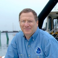 Larry A. Mayer (Larry Mayer)合作论文数Center for Coastal and Ocean Mapping, University of New Hampshire;School of Marine Science and Ocean Engineering, University of New Hampshire14Erin Heffron合作论文数13
 Tamara Baumberger合作论文数Department of Earth Sciences, ETH Zurich13
 Robert W. Embley合作论文数Earth-Ocean Interactions Program, Ocean Environment Research Division, Pacific Marine Environmental Laboratory, National Oceanic and Atmospheric Administration;College of Oceanography, Oregon State University13Lindsay Gee合作论文数12Chris Kelley合作论文数School of Ocean and Earth Science and Technology, University of Hawaii12
 M. Lubetkin合作论文数Ocean Explorat Trust, New London, CT 06320 USA11robert d ballard合作论文数9
 Katherine L. C. Bell合作论文数Ocean Discovery League9
 Marsh Leigh合作论文数9
 Sarah Seabrook合作论文数Sch Environm, Univ Auckland8
 Peter R. Girguis合作论文数Department of Organismic & Evolutionary Biology, Harvard University8
 Steven Carey合作论文数Graduate School of Oceanography, University of Rhode Island8
 Andrea Balbas合作论文数College of Earth, Ocean, and Atmospheric Sciences, Oregon State University7
 Darlene S. S. Lim合作论文数7
 Marie-Helene Cormier合作论文数Department of Geological Sciences, University of Missouri7Michael L. Brennan合作论文数7
 Arthur C. Trembanis合作论文数Department of Geological Sciences, University of Delaware7
 Timothy Shank合作论文数Institute of Marine and Coastal Sciences, Rutgers University6
 Chris Castillo合作论文数5
 Steven Auscavitch合作论文数Department of Biology, Temple University5Christopher Roman合作论文数University of Rhode Island5
 Schmidt, V.合作论文数5Miles G. Saunders合作论文数5
 Charles Fisher合作论文数Department of Biology, Eberly College of Science, Pennsylvania State University5
 Christopher R. German (Chris German)合作论文数Woods Hole Oceanographic Institution5James E. Conrad合作论文数U.S. Geological Survey5
 Chris Caldow合作论文数5
 Shannon Kobs Nawotniak合作论文数4
 Eric Chan合作论文数Univ Texas Rio Grande Valley4
 Kevin Konrad合作论文数Oregon State Univ, Coll Earth Ocean & Atmospher Sci, Corvallis, OR 97331 USA4David Lees合作论文数4V. Dorsey Wanless合作论文数Department of Geological Sciences, University of Florida4
 Andrew R. Thurber合作论文数Moss Landing Marine Laboratories4Zara Mirmalek合作论文数Department of Organismic & Evolutionary Biology, Harvard University4
 Jasper Konter合作论文数Department of Geological Sciences, University of Texas at El Paso4
 Thomas Hourigan合作论文数Department of Zoology, University of Hawaii4
 John E. Lupton合作论文数Pacific Marine Environmental Laboratory, National Oceanic and Atmospheric Administration4
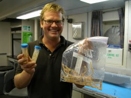 Peter J. Etnoyer合作论文数4
 Jeffrey J Marlow合作论文数Dept Earth & Planetary Sci, Washington Univ4Lila Ardor Bellucci合作论文数3Julie Bursek合作论文数3
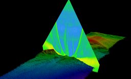 Garrett Mitchell合作论文数Fugro USA Marine Inc3
 Tamar Cohen合作论文数3
 Pelayo Salinas-de-León合作论文数Charles Darwin Foundation, Charles Darwin Research Station3
 Vincent Milesi合作论文数Sch Earth & Space Explorat, Arizona State Univ3
 Adam Skarke合作论文数3




