Deploying multiple UAVs for remote sensing enables proportional reductions in mission time, but realizing these benefits requires the fleet to coordinate at runtime: distributing sensing targets, responding to platform failures, and recovering from degraded data quality. In inspection campaigns, where mission value depends on complete coverage and the usability of every capture, a centralized ground-station coordinator is a single point of failure: a lost link or station fault leaves sensing gaps that cannot be filled without operator intervention. We propose the \textbf{SwarmLink}, an inter-agent communication infrastructure that non-invasively extends any existing aerial framework with peer-to-peer coordination capability, without modifying the host system. We apply it to photovoltaic plant inspection as a representative large-scale sensing campaign, extending Aerostack2 with a distributed auction that unifies initial sensing-target allocation, platform-failure recovery, and data-quality-triggered reassignment into a single runtime mechanism. All three disruption scenarios reduce to the same re-auction over remaining targets and active platforms, requiring zero modifications to the Aerostack2 core and no ground-station involvement during the mission.
Open-source LiDAR-inertial odometry (LIO) systems have achieved remarkable benchmark accuracy, yet current state-of-the-art implementations are primarily optimized for evaluation performance rather than the requirements of real-time closed-loop aerial control. When deployed onboard UAVs, this can introduce limitations that degrade flight performance. In this work, we identify five architectural deficiencies in a representative tightly coupled IESKF-based LIO implementation: odometry publishing tied to the LiDAR rate (10 Hz instead of the IMU's 200 Hz), missing velocity outputs, execution bottlenecks that block IMU processing, mutex contention, and synchronization race conditions. We introduce corresponding modifications including IMU-rate forward propagation, direct body-frame velocity publishing, SLERP-based smoothing, dual-executor isolation, and explicit synchronization protection. The resulting system increases odometry output from 10 Hz to a stable 200 Hz, provides a complete Twist state at every IMU sample, and preserves continuity during transient LiDAR loss. Experiments on a Livox Mid-360 / Pixhawk 4 Mini autonomous UAV with motion-capture ground truth validate the approach. Since the underlying estimator (IESKF + ikd-Tree) remains unchanged, the proposed improvements can be directly applied to FAST-LIO2-derived implementations.
Graph-based representations such as Scene Graphs enable localization in structured indoor environments by matching a locally observed graph, constructed from sensor data, to a prior map. This process is particularly challenging in environments with repetitive or symmetric layouts, where structural cues alone are often insufficient to resolve ambiguities. We propose a semantic-enhanced graph matching approach that explicitly models relations between detected objects and structural elements, such as rooms and wall planes. Objects are detected from RGB-D data and integrated into the graph, and their relations to structural elements are exploited to filter candidate correspondences prior to geometric verification, significantly reducing ambiguity and search complexity. The proposed method is integrated within the iS-Graphs framework and evaluated in synthetic and simulated environments. Results show that semantic relations significantly reduce the number of candidate matches, improve computational efficiency, and enable faster convergence, particularly in symmetric scenarios where purely geometric approaches fail.
In recent years, reinforcement learning (RL) has been applied to frontier-based exploration to enhance a robot’s decision-making policy and improve exploration performance. In this work, we address this scenario with the aim of pushing forward the finding of the optimal frontier selection policy in unknown, unstructured environments, with RL deployed for a minimal sensing drone setup. We propose a novel policy architecture, featuring an attention module that uses the global map features captured by a convolutional neural network together with local frontier features in the form of scalar values, trained end-to-end with a scoring network using the Proximal Policy Optimization algorithm over a 2D randomized unstructured environment. Our approach demonstrates improved exploration efficiency in the evaluated scenarios, as it surpasses purely heuristic-based frontier selection strategies used as baselines for other RL methods, achieving shorter paths than the Nearest Frontier, the Hybrid Approach, and the TARE local horizon, as well as one-shot sim-to-real policy deployment.
Mobile robots operating indoors must re-identify previously observed objects after long temporal gaps, significant viewpoint changes, and severe illumination variations. This remains a challenging problem: multi-object tracking methods are optimized for short-term association of pedestrians and vehicles at video rates, person and vehicle re-identification approaches lack persistent memory mechanisms, and state-of-the-art video object segmentation techniques rely on reactive distractor filtering rather than enforcing global identity consistency. To address these limitations, we present REMIND, an online tracker designed for long-term multi-object re-identification of generic indoor objects from monocular RGB imagery, requiring neither camera pose nor depth. Motivated by evidence from visual cognition that humans rely on accumulated appearance familiarity and spatial context rather than explicit self-localization, REMIND combines frozen DINOv3 features with a dual-bank multi-prototype appearance memory, part- and background-level descriptors, a neighbour-context reasoning module exploiting spatial co-occurrence, and joint Hungarian assignment with ambiguity-aware safeguards. On a purpose-built indoor dataset featuring controlled revisits and dense same-class clutter, REMIND reaches 90.35
Autonomous drone racing demands robust real-time localization under extreme conditions: high-speed flight, aggressive maneuvers, and payload-constrained platforms that often rely on a single camera for perception. Existing visual SLAM systems, while effective in general scenarios, struggle with motion blur and feature instability inherent to racing dynamics, and do not exploit the structured nature of racing environments. In this work, we present a dual pose-graph architecture that fuses odometry with semantic detections for robust localization. A temporary graph accumulates multiple gate observations between keyframes and optimizes them into a single refined constraint per landmark, which is then promoted to a persistent main graph. This design preserves the information richness of frequent detections while preventing graph growth from degrading real-time performance. The system is designed to be sensor-agnostic, although in this work we validate it using monocular visual-inertial odometry and visual gate detections. Experimental evaluation on the TII-RATM dataset shows a 56
This article details an autonomous monitoring and inspection system for photovoltaic (PV) installations, leveraging Unmanned Aerial Vehicles (UAV) collaboration and Internet of Things (IoT) technology. The system is part of a project aimed at optimizing the real-time control and operation of solar PV systems. This autonomous inspection system consists of two layers: (i) anomaly detection by on-board electronics of PV panels (referred as IoT Modules) and (ii) infrared (IR) and visual red, green, and blue (RGB) inspection by UAVs. The IoT Modules run a fault detection algorithm to identify anomalous events. Upon detection, they alert a UAV fleet equipped with RGB and IR cameras to conduct visual and thermal inspections of the affected PV panels. The inspection data is then relayed back to the IoT Modules, triggering appropriate actions. This framework enhances detection algorithms by providing rapid identification of severe issues. UAVs can quickly pinpoint hot-spots through thermographic imaging, enabling prompt intervention. Additionally, UAVs help resolve ambiguities in the detection on certain faults. Moreover, in order to make this autonomous inspection possible, a multiprotocol architecture is developed to ensure effective communication and coordination between IoT Modules and UAVs, facilitating seamless data exchange and system integration.
Collaborative Simultaneous Localization and Mapping (CSLAM) is critical to enable multiple robots to operate in complex environments. Most CSLAM techniques rely on raw sensor measurement or low-level features such as keyframe descriptors, which can lead to wrong loop closures due to the lack of deep understanding of the environment. Moreover, the exchange of these measurements and low-level features among the robots requires the transmission of a significant amount of data, which limits the scalability of the system. To overcome these limitations, we present Multi S-Graphs, a decentralized CSLAM system that utilizes high-level semantic-relational information embedded in the four-layered hierarchical and optimizable situational graphs for cooperative map generation and localization in structured environments while minimizing the information exchanged between the robots. To support this, we present a novel room-based descriptor which, along with its connected walls, is used to perform inter-robot loop closures, addressing the challenges of multi-robot kidnapped problem initialization. Multiple experiments in simulated and real environments validate the improvement in accuracy and robustness of the proposed approach while reducing the amount of data exchanged between robots compared to other state-of-the-art approaches.
Recent advances have improved autonomous navigation and mapping under payload constraints, but current multi-robot inspection algorithms are unsuitable for nano-drones, due to their need for heavy sensors and high computational resources. To address these challenges, we introduce ExploreBug , a novel hybrid frontier range-bug algorithm designed to handle limited sensing capabilities for a swarm of nano-drones. This system includes three primary components: a mapping subsystem, an exploration subsystem, and a navigation subsystem. Additionally, an intra-swarm collision avoidance system is integrated to prevent collisions between drones. We validate the efficacy of our approach through extensive simulations and real-world exploration experiments, involving up to seven drones in simulations and three in real-world settings, across various obstacle configurations and with a maximum navigation speed of 0.75 m/s. Our tests prove that the algorithm efficiently completes exploration tasks, even with minimal sensing, across different swarm sizes and obstacle densities. Furthermore, our frontier allocation heuristic ensures an equal distribution of explored areas and paths traveled by each drone in the swarm. We publicly release the source code of the proposed system to foster further developments in mapping and exploration using autonomous nano drones.
This paper presents a visual active SLAM method considering measurement and state uncertainty for space exploration in urban search and rescue environments. An uncertainty evaluation method based on the Fisher Information Matrix (FIM) is studied from the perspective of evaluating the localization uncertainty of SLAM systems. With the aid of the Fisher Information Matrix, the Cramér–Rao Lower Bound (CRLB) of the pose uncertainty in the stereo visual SLAM system is derived to describe the boundary of the pose uncertainty. Optimality criteria are introduced to quantitatively evaluate the localization uncertainty. The odometry information selection method and the local bundle adjustment information selection method based on Fisher Information are proposed to find out the measurements with low uncertainty for localization and mapping in the search and rescue process. By adopting the method above, the computing efficiency of the system is improved while the localization accuracy is equivalent to the classical ORB-SLAM2. Moreover, by the quantified uncertainty of local poses and map points, the generalized unary node and generalized unary edge are defined to improve the computational efficiency in computing local state uncertainty. In addition, an active loop closing planner considering local state uncertainty is proposed to make use of uncertainty in assisting the space exploration and decision-making of MAV, which is beneficial to the improvement of MAV localization performance in search and rescue environments. Simulations and field tests in different challenging scenarios are conducted to verify the effectiveness of the proposed method.
Maintaining the formation of complex structures with multiple UAVs and achieving complex trajectories remains a major challenge. This work presents an algorithm for implementing the flocking behavior of UAVs based on the concept of Virtual Centroid to easily develop a structure for the flock. The approach builds on the classical virtual-based behavior, providing a theoretical framework for incorporating enhancements to dynamically control both the number of agents and the formation of the structure. Simulation tests and real-world experiments were conducted, demonstrating its simplicity even with complex formations and complex trajectories.
The development of collective-aware multi-robot systems is crucial for enhancing the efficiency and robustness of robotic applications in multiple fields. These systems enable collaboration, coordination, and resource sharing among robots, leading to improved scalability, adaptability to dynamic environments, and increased overall system robustness. In this work, we want to provide a brief overview of this research topic and identify open challenges.
The development of autonomous aerial systems, particularly for multi-robot configurations, is a complex challenge requiring multidisciplinary expertise. Unlike ground robotics, aerial robotics has seen limited standardization, leading to fragmented development efforts. To address this gap, we introduce Aerostack2, a comprehensive, open-source ROS 2 based framework designed for creating versatile and robust multi-robot aerial systems. Aerostack2 features platform independence, a modular plugin architecture, and behavior-based mission control, enabling easy customization and integration across various platforms. In this paper, we detail the full architecture of Aerostack2, which has been tested with several platforms in both simulation and real flights. We demonstrate its effectiveness through multiple validation scenarios, highlighting its potential to accelerate innovation and enhance collaboration in the aerial robotics community.
This paper presents a comprehensive methodology for implementing knowledge graphs in ROS 2 systems, aiming to enhance the efficiency and intelligence of autonomous robotic missions. The methodology encompasses several key steps: defining initial and target conditions, structuring tasks and subtasks, planning their sequence, representing task-related data in a knowledge graph, and designing the mission using a high-level language. Each step builds on the previous one to ensure a cohesive process from initial setup to final execution. A practical implementation within the Aerostack2 framework is demonstrated through a simulated search and rescue mission in a Gazebo environment, where drones autonomously locate a target. This implementation highlights the effectiveness of the methodology in improving decision-making and mission performance by leveraging knowledge graphs.
Unmanned Aerial Vehicles (UAVs) have garnered significant attention among researchers due to their versatility in diverse missions and resilience in challenging conditions. However, electric UAVs often suffer from limited flight autonomy, necessitating the exploration of alternative power sources such as thermal engines. On the other hand, managing thermal engines introduces complexities and internal uncertainties into the system. In this paper, an Adaptive Robust attitude controller (ARAC) is proposed to address these challenges by drawing inspiration from helicopter solutions while minimizing mechanical intricacies. Specifically, the designed algorithm employs Thrust Vector Control (TVC) for an industrial heavy Multi-Ducted Fan (MDF), known for its superior static stability compared to conventional ducted fans. Subsequently, an integrated flap vanes system is positioned at the exhaust of the ducts for precise attitude control, effectively removing unwanted yaw moments associated with traditional propellers. This research builds on prior authors’ works to establish a proper mathematical and aerodynamic model. Also, using former simulation results to conduct real flight experiments aimed at enhancing TVC functionality. The findings highlight the effectiveness of this approach for heavy UAV applications. It is worth noting that the practical value of this research lies in its potential to significantly extend flight autonomy supplied by thermal engines and improve the resilience of UAVs in challenging real-world missions. This is particularly achievable provided that the design of flap vanes aligns closely with the dimensions of the duct system, offering a promising solution to a critical engineering challenge in the field of UAV technology.
Systematic hybrid-electric unmanned aerial vehicles (UAVs) and, especially, quadcopters are so promising due to their long flight endurance and their usage in patrol and rescue missions which gain a high interest to be under examination and test scope by researchers; however, a complete mathematical design is required to fulfill theoretical complexities such as aerodynamic analysis and flight dynamics models related. This paper investigates salient sections from hypothesis to implementation. Researchers at Drone Hopper company have conducted various calculations to perform a precise novel platform called Duty-Hopper (DH). The benefit of this design is to control the attitude by flap vanes and electrical ducted fans (EDFs) when using gasoline engines; while, the principle propellers only lift the drone. This paper examines the attitude control system of DH, once using only flaps, then by only EDFs, and eventually, by compounding both. During this research, the scientific software used is ANSYS-Fluent and MATLAB-SimScape to analyze the entire body of the DH. Furthermore, a robust fault-tolerant controller is designed to immune the DH against internal and external errors. Our research reveals that using flaps is a feasible way to control attitude when it is augmented by EDFs.
This paper introduces a method for controlling UAV swarm formations and avoiding collisions using the Virtual Spring-Damper (VSD) approach. This approach draws upon classical mechanical spring-damper systems, employing displacement and velocities to generate attractive and repulsive forces. These forces help sustain swarm formation and prevent collisions in a decentralized manner. Extensive simulations provided a systematic approach to obtain the parameters involved in the spring-damper system. Flight tests were carried out to verify the proposed method. The experimental outcomes align with our simulations, demonstrating effectiveness in collision avoidance while preserving a specified flight formation.
This study employs computer vision techniques to address beach safety concerns, with a focus on camera-equipped UAVs. The UAVs provide five channels of information that require preprocessing and image alignment to remove noise. The main challenges addressed are the identification of dangerous areas and people detection. For segmentation tasks, several lightweight models were evaluated, with YOLOv8-seg demonstrating superior efficiency and computational lightness across diverse conditions. In people detection, YOLOv8 also shows suitable results, identifying beach users, bathers, swimmers, and surfers. These solutions enable the use of UAVs for beach monitoring, providing a foundation for applications that evaluate danger for individuals on the beach. The results demonstrate the models' effectiveness and their capability to be deployed in real-time on board the UAVs.
Agile autonomous drones are becoming increasingly popular in research due to the challenges they represent in fields like control, state estimation, or perception at high speeds. When all algorithms are computed onboard the UAV, computational limitations make the task of agile flight even more difficult. One of the most computationally expensive tasks in agile flight is the generation of optimal trajectories. When these trajectories must be updated online due to changes in the environment or uncertainties, this high computational cost may result in insufficient time to reach the desired waypoints, which could cause a drone crash in cluttered environments. In this paper, we present Local Gaussian Modifiers (LGMs), a fast and lightweight way of modifying computationally heavy trajectories when recalculating them in time is not possible due to computational limitations. Moreover, we propose a strategy for deciding when is convenient to use these modifiers or recalculate the whole trajectory based on an estimation of the computational time of this trajectory generation. A trajectory blending procedure is also proposed to ensure smoothness in UAV control when a new trajectory is computed. Our approach was validated in simulation, being able to pass through a race circuit with moving gates, achieving speeds up to 16.0 m/s. Real flight validation was also performed achieving speeds up to 4.0 m/s in a fully autonomous pipeline using onboard computing.
This paper presents the development and implementation of a multi-UAV system focused on coverage path planning on multiple separated areas capable of re-planning the collective mission in case of unexpected events. For this purpose, we present a distributed-centralized architecture that uses heuristic and computationally efficient methods to perform the planning/re-planning and decision-making tasks during the control of the mission execution. We performed a computational evaluation of the algorithms, comparing them with other proposals, together with experiments in simulated and real flights. The results show that the system can distribute tasks equitably among the aircraft in an efficient way, even in the middle of the flight, when facing unexpected events; and show a higher computational efficiency when compared to multiple proposals in the state of the art.
 José Luis Sánchez-López合作论文数Centro de Automática y Robótica CAR UPM-CSIC, Universidad Politécnica de Madrid45
 Miguel Angel Olivares-Mendez合作论文数SnT- University of Luxembourg40
 Iván Fernando Mondragón合作论文数Department of Industrial Engineering, Pontificia Universidad Javeriana36
 Carol Martinez合作论文数Univ Politecn Madrid, Univ Politecn Madrid30
 Martin Molina合作论文数Department of Artificial Intelligence, Universidad Politécnica de Madrid28
 Adrian Carrio合作论文数28
 Hriday Bavle合作论文数Department of Automation, University of Luxembourg;Interdisciplinary Centre for Security, Reliability and Trust, University of Luxembourg25
 Carlos Sampedro Perez合作论文数25
 Luis Mejias合作论文数Australian Research Centre for Aerospace Automation, Queensland University of Technology25
 Miguel Fernandez Cortizas合作论文数Interdisciplinary Centre for Security, Reliability and Trust, University of Luxembourg22
 Alejandro Rodriguez-Ramos合作论文数UPM, CSIC, Comp Vis & Aerial Robot CVAR Grp, Ctr Automat & Robot, Calle Jose Gutierrez Abascal 2, Madrid, Spain22
 Jesús Pestana合作论文数Centro de Automática y Robótica, CSIC-UPM21
 Changhong Fu (符长虹)合作论文数School of Mechanical Engineering, Tongji University20
 Rafael Aracil合作论文数Universidad Politécnica de Madrid19
 Ramon Suarez-Fernandez合作论文数Centro de Automática y Robótica (CAR),, Universidad Politécnica de Madrid19
 Ignacio Mellado-Bataller合作论文数Centro de Automática y Robótica, CSIC-UPM16
 Paloma De La Puente合作论文数13
 David Perez Saura合作论文数12
 Marco Luna合作论文数12
 Javier Rodriguez-Vazquez合作论文数Computer Vision and Aerial Robotics Group, Universidad Politécnica de Madrid10
 Srikanth Saripalli合作论文数Unmanned Systems Lab, Department of Mechanical Engineering, College of Engineering, Texas A&M University10
 Ahmed Refaat Ragab合作论文数9
 Carlos Platero合作论文数8Pedro Arias-Perez合作论文数8
 Muhammad Sadeq Ale.Isaac合作论文数8
 Juan Fernando Correa合作论文数Computer Vision Group, Universidad Politécnica Madrid8
 Pablo Flores Pena合作论文数7
 Liang Lu合作论文数7José M. Sebastián合作论文数6Rafael Perez-Segui合作论文数6
 Holger Voos合作论文数University of Applied Sciences Ravensburg-Weingarten6F Penafiel合作论文数5
 C. Fernández合作论文数Dept Hlth Psychol, Miguel Hernandez Univ5
 Manuel Chica合作论文数European Centre for Soft Computing5Sergio Dominguez合作论文数Universidad Politecnica de Madrid, Madrid, Spain5
 Andres Nunez合作论文数4
 Jaime Del Cerro合作论文数Universidad Politécnica de Madrid4
 Wojciech Giernacki合作论文数4Miguel Olivares合作论文数3Diego A Moreno合作论文数3Jean-François Collumeau合作论文数Computer Vision and Aerial Robotics Group 1 1;vision4uav.com;, Centro de Automática y Robótica (CAR) UPM-CSIC, Universidad Politécnica de;Centro de Automática y Robótica (CAR) UPM-CSIC, Universidad Politécnica de3
 Daniel Pena合作论文数Universidad Carlos III de Madrid3Antonio Javier Alcamí Pertejo合作论文数Centro de Biologia Molecular Severo Ochoa, Consejo Superior de Investigaciones Cientificas;Centro de Biologia Molecular Severo Ochoa, Universidad Autonoma de Madrid3
 Jonathan P. How合作论文数Aerospace Controls Laboratory, Department of Aeronautics and Astronautics, Massachusetts Institute of Technology3
 Raúl Guantes合作论文数Departmento de Química, Universidad Autónoma de Madrid3
 Miguel Ortega-Mier合作论文数Universidad Politécnica de Madrid3
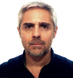 Antonio Barrientos Cruz合作论文数Centre for Automation and Robotics, Universidad Politécnica de Madrid3
 Aneesh Chauhan合作论文数IEETA, Universidade de Aveiro3
 Raquel Boix Martinez合作论文数3




