Abstract. Hydrological extremes have significant implications for riverine eutrophication as evidenced by algal (phytoplankton) blooms in European rivers during recent drought years. To assess how discharge conditions modulate nutrient-induced phytoplankton growth, we systematically analyze multi-year discharge, total phosphorus, and phytoplankton-indicating chlorophyll a data from 30 monitoring sites across Germany. We show that negative discharge anomalies consistently correspond to positive anomalies in measured chlorophyll a relative to the maximum possible chlorophyll a at the given phosphorus level. Further, we found increased algal bloom risk under below-normal discharge conditions, underlining the future challenges for water quality and eutrophication management under intensifying hydrological extremes.
Abstract. Elevated dissolved organic carbon (DOC) concentrations are a major concern for ecosystems and drinking water supply. Data-driven studies revealed variable functioning of different landscape units (upland, riparian zone, and groundwater) in catchment DOC mobilization and export. However, lumped and landscape-explicit (separating upland and riparian zone) model structures are generally calibrated to stream DOC concentrations, while the internal DOC dynamics often do not receive sufficient attention. Here, we developed a flexible model with a lumped and landscape-explicit structure for four headwater catchments in the Harz Mountains, Germany. We evaluated these models under a baseline calibration (only using stream DOC concentration) and a constrained calibration (using stream DOC and internal DOC concentrations). Under the baseline calibration, both model structures can reasonably represent stream DOC dynamics in some catchments (Kling–Gupta efficiency of some behavioural simulations > 0.6), but with unreasonably high groundwater DOC. By contrast, the constrained calibration reduces the KGE for stream DOC concentrations but ensures a more realistic representation of internal DOC dynamics. Additionally, the landscape-explicit model structure is more robust than the lumped model structure under changing boundary conditions. Our study thus highlights the necessity of representing different landscape units explicitly in combination with constraining the calibration of DOC concentrations in these landscape units.
Groundwater conflicts are increasing worldwide, particularly during droughts. While conflict dynamics have been widely studied in historically water-scarce regions, emerging hotspots in Europe remain understudied. We introduce a text-mining approach to monitor conflicts over time and apply it to Germany, where droughts have exacerbated tensions among water users. Using a corpus of over 12,000 news articles published between 2000 and 2022, we map the spatiotemporal distribution of reported conflicts and identify their drivers using a metric of reported conflict intensity combining frequency and prominence of conflict reporting. Groundwater conflicts are geographically widespread, with recurring hotspots and new conflict areas emerging during the 2018-2022 multi-year drought. While water pollution and environmental protection have diminished in importance, scarcity, agriculture, and drought have become key drivers. Reported conflicts show only moderate spatial correlations with groundwater withdrawal, recharge, and pollution, suggesting media dynamics and social context shape which conflicts become publicly visible.
Abstract. Deep learning has become a standard tool for streamflow modeling, but its application to water quality remains challenging due to sparse, irregular, and noisy in-situ observations. Yet, water-quality variables are tightly linked to discharge and to each other through shared hydrological and biogeochemical controls, suggesting that jointly modeling water quantity and quality may help compensate for limited data availability. In this study, we compare single-target, multi-target, and self-supervised LSTM models for the joint simulation of discharge and six water-quality variables (NO₃–N, PO₄–P, DO, DOC, EC, and WT) across 408 German catchments. Our results highlight that extending the baselineLSTM from single-target discharge prediction to jointly predicting discharge and all six water-quality variables does not substantially degrade discharge performance (across all baseline configurations, median KGE' = 0.84–0.87) and yields median KGE' values between 0.35 (PO₄–P) and 0.94 (WT) for the water-quality targets. Interestingly, learning discharge as a co-target consistently outperforms models that use observed discharge as an additional input, indicating that jointly learning water quantity and quality is more effective than using discharge as a predictor. A variable-averaged loss function is key to balance the strongly uneven observation densities of discharge and water-quality variables. Building on this multi-target framework, we further explore whether an alternative training strategy based on self-supervised learning can better exploit the incomplete and heterogeneous nature of environmental observations. Our evaluation reveals that the self-supervisedLSTM yields a level of predictive skill comparable to the multi-target supervised baseline under inference conditions restricted to meteorological drivers, while effectively leveraging cross-variable dependencies to enhance PO₄–P and DO reconstructions when contextual water-quality data are provided. Besides showcasing the strong performance of LSTMs in water-quality simulations with sparse and irregular data, our results demonstrate that multi-target learning provides an effective framework for coupled water quantity–quality modeling, while self-supervised learning offers additional flexibility for exploiting incomplete and heterogeneous environmental observations, yielding predictive skill comparable to, and in some cases exceeding, that of calibrated process-based water-quality models and supporting the use of LSTMs as a scalable alternative for regional water-quality simulation in data-sparse environments.
Understanding the contributions of diffuse and point sources to nitrate pollution is crucial for managing river water quality. We conducted a long-term modeling study for the Rhine and Elbe basins and their 146 subbasins from 1950 to 2021 to quantify the roles of diffuse and, in particular, point sources in driving stream NO _₃ –N concentrations. In both basins, simulated results show a decline in point source contributions from 1950 to 2000, followed by a relatively stable level at around 25% in the Rhine and fluctuations around 30% levels in the Elbe. The decline in the simulated stream NO _₃ –N concentrations in both basins after 1990 was largely driven by a decrease in point sources, and stream NO _₃ –N concentrations remained high (∼2 mg l ^−1 ) during 2010–2021, even when point sources were excluded. At the subbasin level, changes in point source contributions and stream NO _₃ –N concentrations reflected the overall trends of their respective basins, although individual subbasins exhibited diverse patterns. In subbasins with high stream NO _₃ –N concentrations during 2010–2021, point source contribution accounted for around 30% (median values across subbasins), and the fractions of agricultural, urban, and industrial land cover were relatively high. These results highlight that point source management alone is not sufficient to reduce stream nitrate to a good ecological status (< 2 mg l ^−1 ), and spatial targeted management is required to achieve good ecological status at both the regional and local levels.
Abstract. Eutrophication – i.e., biomass overproduction due to nutrient enrichment – persists as a threat to riverine ecosystems despite achievements in lowering phosphorus (P) concentrations. This study explores seasonal patterns and drivers of chlorophyll a (Chl-a) linked with P availability across a selection of human-impacted rivers in Germany. We analyzed Chl-a and total phosphorus (TP) concentration measurements from 133 river sites and quantified their relationship using the degree of realized eutrophication (αrealized) – the ratio of measured to maximum Chl-a at a given TP. By applying k-means clustering on seasonal αrealized cycles, we identified five archetypal patterns. To understand the drivers of these patterns, we examined the seasonal dynamics of total nitrogen (TN), the TN:TP ratio, and fractions of reactive P and N. We further conducted a correlation analysis of αrealized and photosynthetically active radiation (PAR), water temperature, and discharge. In addition, we compared static river network and catchment characteristics between the clusters. We found that (1) constantly high αrealized was associated with close upstream lakes, along with nutrient concentrations suggesting co-control of Chl-a by P and N. (2) High αrealized in mostly lake-free rivers throughout spring and summer were associated with light control, as indicated by a high correlation with PAR. (3) Rivers with spring peaks and low summer αrealized were explained by summer Chl-a losses through grazing. Here, differences in spring peak timing and intensity could be related to differences in land use, hinting to riparian shading as a modulator of phytoplankton growth. Therefore, we find especially high risk of phytoplankton blooms downstream of lakes throughout the vegetation period, in long rivers without effective grazer control from mid-spring to early autumn, and in rivers with a lack of riparian shading during spring. Effective management may comprise dual management of P and N, especially for locations prone to summer blooms, and targeted riparian shading as an additional measure.
Large-sample hydrology aims to identify general spatial and temporal patterns and their exceptions across diverse catchments and to infer underlying processes by linking observed responses to hydroclimatic, biogeochemical, and anthropogenic drivers. While large-sample datasets for water quantity are now well established, similarly comprehensive resources for water quality have remained limited.QUADICA (water QUAlity, DIscharge and Catchment Attributes) addresses this gap for Germany. Here, we present QUADICA v2, an extended large-sample water quality dataset covering 1386 catchments. The update expands temporal coverage to 2020, adds ecologically relevant water quality variables (including water temperature, oxygen, and chlorophyll a), and introduces long-term time series of nitrogen and phosphorus inputs from both diffuse and point sources. By linking QUADICA with CAMELS-DE, the number of stations with concurrent water quality and discharge data is effectively doubled (now 637 stations).Beyond extending data availability, QUADICA v2 enables new analyses of driver–response relationships, network-topological patterns, and ecological impact studies across gradients of climate, land use, and pollution pressure. The dataset supports comparative large-sample studies, data-driven and machine-learning approaches, and the calibration and evaluation of process-based water quality models, providing a ground for understanding and management of freshwater systems.
The QUADICA version 2 dataset significantly expands upon the first version of QUADICA (water QUAlity, DIscharge and Catchment Attributes for large-sample studies in Germany), by incorporating more recent data, additional water quality and driver variables, and more stations with concurrent water quantity data. Specifically, QUADICA v2 extends the water quality time series of the first version up to 2020 and introduces new variables, including water temperature, oxygen, and chlorophyll a concentrations, as well as concentrations of ammonium, sulfate, and geogenic solutes like calcium. These additions enable a more comprehensive understanding of ecological impacts, including eutrophication effects, and water quality dynamics across catchments. Furthermore, the number of stations with both water quality and quantity data has effectively doubled - now covering 637 out of the total 1386 stations - by integrating QUADICA with the CAMELS-DE and Caravan-DE datasets. The inclusion of time series on point and diffuse sources of both nitrogen and phosphorus allows for more thorough investigations of driver-response relationships and nutrient export from catchments. To facilitate visualization and exploration of QUADICA, we provide a user-friendly, interactive R application alongside the online data repository, as well as a browser-based web app for inspecting the dataset. This makes QUADICA v2 a comprehensive dataset that spans from driver to impact variables, offering a valuable resource for researchers and practitioners. QUADICA v2 is available at 10.4211/hs.c2866cd416b94ca386deb5758834311f (Ebeling et al., 2025).
CAMELS datasets are recognized in the hydrological community as consistent and comprehensive benchmark datasets for hydrological and meteorological analyses. CAMELS stands for "Catchment Attributes and MEteorology for Large-sample Studies”. CAMELS datasets link landscape and catchment attributes (e.g. land use, geology, soil properties), hydrological time series (e.g. water level, discharge) and meteorological time series (e.g. precipitation, air temperature) in a large number of catchment areas. They clearly indicate the uncertainties and processing of individual variables and thus enable the comparison of models and data in different landscapes, but also contribute to the general understanding of hydrological processes across landscapes. This is crucial for assessing the consequences of the climate crisis and improves the basis for water resource management decisions. Although CAMELS datasets are intensively used in other countries, such a dataset is still lacking for Germany.This contribution highlights the crucial importance of consistent and easily accessible benchmark datasets for hydrological research and education. We discuss both the challenges faced so far in compiling the dataset and the future ambitions of the project. In addition, an overview is given of the scope of the first version of the CAMELS-DE data set, which will include around 2,000 measuring stations with daily time series of discharge and water level with an average length of nearly 50 years in mainly small and medium-sized catchments. Also included are the landscape and catchment attributes as well as meteorological time series. A key focus is on the easy availability and straightforward import of data into programming environments. We discuss how such benchmark datasets not only increase efficiency in the use of environmental data, but also play a key role in ensuring the reproducibility of research results. Especially in the age of machine learning learning, they form an indispensable basis for modern, data-driven hydrology. By integrating CAMELS-DE into the research landscape, we want to emphasize that data publications and benchmark datasets are much more than a by-product of a doctoral thesis, but rather the basis and key to modern environmental science.
Machine learning (ML) is emerging as a promising tool for modeling hydro-ecological processes due to the increasing availability of large environmental data. However, the use of ML requires sufficient programming knowledge due to a lack of a graphical user interface (GUI). In this study, we introduced a GUI package, named HydroEcoLSTM, with the long short-term memory network (LSTM) as the core model, that allows non-ML experts to utilize their domain knowledge to construct complex ML models. We demonstrated the functionalities of HydroEcoLSTM with two practical examples, including (1) predictions of streamflow in both gauged and ungauged catchments and (2) predictions of multiple outputs (i.e., streamflow and isotope transport from two catchments). The simulation results obtained in both case experiments are satisfactory. In the first example, the average Nash–Sutcliffe Efficiency (NSE) for streamflow simulation during the testing period is 0.79 while the application of the trained model in two assumed ungauged catchments also achieves the average NSE of 0.68. In the second example, the average NSE for streamflow and instream isotope simulation during the testing period is 0.71. Ultimately, applications of HydroEcoLSTM with real-world examples demonstrate its potential use for practical applications and research without requiring extensive coding skills.
Nitrogen pollution in European landscapes poses persistent challenges to aquatic ecosystems, human health, and water quality. The European Union has set a goal to achieve zero pollution by 2050, including the reduction of air, water, and soil pollution to levels that no longer harm health or natural ecosystems. However, the feasibility of achieving this goal for legacy contaminants like nitrogen (N) under changing climate and land-use management is not well understood. This study employs a multimodel approach to provide a comprehensive assessment of nitrogen pollution across European river systems under varying climate emission and land-use management scenarios. We used a suite of hydrological and biogeochemical models (mHM-mQM, SWAT, and IMAGE-GNM) driven by an ensemble of climate projection datasets (CMIP) operating under diverse emission scenarios (RCPs; 2.6, 4.5, and 8.5) and shared socioeconomic pathways (SSPs; 1-5). These climate-driven runs were complemented with nitrogen input scenarios adhering to different SSPs, accounting for strategies managing agricultural land and technological innovations while considering future factors such as food production, economic growth, and environmental requirements. Ensemble hydrologic and nitrogen export simulations are constructed for the period spanning 1971 to 2070. Our analysis highlights notable progress in reducing nitrogen loads across European river systems by the 2050s compared to the 2010s. Regionally, our ensemble simulations identify Central Europe as a persistent area of concern, with relatively higher nitrogen exports projected under both conservative (SSP1-RCP2.6) and conventional development (SSP5-RCP8.5) scenarios. Despite overall improvements, many European river systems are projected to exceed critical nitrogen concentration thresholds (e.g., 2–3 mg N/L) by the 2050s. The majority of ensemble simulations consistently reveal similar hotspot regions in countries like Germany, France, Poland, Italy, and Spain. This may be linked to ongoing nitrogen exports that gradually deplete legacy reservoirs (e.g., soil and groundwater). By integrating multimodel insights, our study aims to provide a robust framework and assessment for anticipating and addressing the challenges of nitrogen pollution in pursuit of realizing EU zero-pollution goals.
Over the past seven decades, Germany has undergone transformative changes in wastewater management, largely driven by technological advancements, policy interventions, and the introduction of European Union (EU) directives targeting wastewater treatment plants (WWTPs). Simultaneously, the country has experienced profound societal transformations, notably the political and economic divergence between East and West Germany and shifts in population density, which further influenced WWTP infrastructure and management practices. This study focuses on nitrogen in effluent from WWTPs, which directly discharge into rivers, often having an immediate and localized impact. Understanding the spatial and temporal evolution of nitrogen in wastewater effluent contribution to stream water quality deterioration is essential for designing sustainable water management strategies. To this end, we combined data-driven analysis and modeling approaches, making use of recently published datasets on diffuse nitrogen sources (Batool et al., 2022), nitrogen point sources (Sarrazin et al., 2024), and a state-of-the-art water quality model (Nguyen et al., 2022). We applied the model across various German catchments with diverse agriculture and wastewater amount and treatment development from 1950 to 2020. Our results reveal a noticeable decrease in N effluents from WWTPs, leading to a decline in N contribution to instream nitrogen in the last decades. However, this declining pattern and trend varied across West and East Germany. Our study enables the identification of hot spots, helping spatially targeted management. ReferencesBatool et al., (2022). https://doi.org/10.1038/s41597-022-01693-9Nguyen et al. (2022). https://doi.org/10.1029/2022GL100278Sarrazin, et al. (2024). https://doi.org/10.5194/essd-16-4673-2024, 2024
Elevated nutrient levels in inland, coastal and marine waters have led to negative eutrophication impacts such as algal blooms and biodiversity loss. In the European Union, measures to reduce nutrient pollution have been implemented as part of the Water Framework Directive, the Nitrates Directive, the Urban Wastewater Directive and the Marine Strategy Framework Directive. However, the water quality targets defined in these frameworks are not always coherent and may be too rigid when considering the future impact of climate change on nutrient cycling. This ambiguity adds to the scientific challenge of assessing current nutrient fluxes and concentrations and their future dynamics under changing boundary conditions.Within the EU-funded project NAPSEA – N and P from Source to Sea, we address the continuum of nutrient fluxes from terrestrial sources in the Elbe and Rhine basins to the delivery in the Wadden Sea at the Dutch, German and Danish coasts. To model nitrogen (N) concentrations and fluxes, we use the water quality model (mQM, Nguyen et al. 2023) in a setting consisting of more than 500 mesoscale catchments with longer-term riverine N observations in the Elbe and Rhine basins. The model takes into account the storage, removal (denitrification) and release of N in the soil zone as a function of temperature and soil moisture. Importantly, subsurface transport and denitrification are based on a dynamic travel time approach using storage selection functions that explicitly account for N legacy effects. The model runs at an annual time-step, accounting for instream integration and retention of N, and is constrained against observations at the catchment outlets.In this contribution, we present the model results that allow us to identify the hotspots of N export in the Elbe and Rhine basins. We capture the decadal trajectories of N fluxes and concentrations and quantify the amount of N stored as biogeochemical legacy in soils and as hydrological legacy in groundwater. The model also makes it possible to disentangle the contributions of point vs. diffuse sources to N export in time and space as well as the efficiency of N retention. The calibrated model will allow for future projections of riverine N exports to estuaries and the Wadden Sea with the aim to differentiate the effects of climate change on the one hand, and different nutrient management scenarios on the other. References:Nguyen, V.T., Sarrazin, F.J., Ebeling, P., Musolff, A., Fleckenstein, J.H., Kumar, R. (2022): Toward understanding of long-term nitrogen transport and retention dynamics across German catchments. Geophys. Res. Lett. 49 (24), e2022GL100278
Interactions between groundwater (GW) and surface water (SW) play a pivotal role in influencing water quantity, quality, and associated biogeochemical and ecological processes in stream networks. Understanding the spatial pattern of gaining and losing rivers is crucial for managing water resources at catchment scale. Each method to identify losing and gaining rivers, from point to reach to catchment scale, has distinct advantages and limitations. These limitations can potentially be mitigated by combining different approaches.In this study, we combined local information from hydraulic head differences between GW and SW with the regional information derived from topography-driven groundwater flow to robustly identify and characterize the spatial pattern of gaining and losing rivers in two study areas located at Central Germany –the Bode catchment and Free State of Thuringia. Central Germany has faced a drought period in the last five years, which has impacted groundwater levels. To evaluate local head differences, we compared the measured averaged groundwater levels (GWLs) and estimated surface levels (SWLs). The GWL data were obtained from 49 and 826 groundwater monitoring wells within a 1500 m distance from rivers in the Bode catchment and Thuringia, respectively. We developed a method for estimating SWLs across river networks by correcting a coarse DEM (25 m) based on the river bed elevations and river water depths recorded at gauging stations and river network topology. Uncertainties of SWL were also estimated and considered in the classification of gaining and losing rivers. Topography-driven discharge (gaining rivers) and recharge (losing rivers) areas are derived from groundwater upward and downward flow directions according to a 3D spectral solution.The analysis of head differences reveals a widespread occurrence of losing rivers. However, when combining the losing and gaining classifications from topographical-driven groundwater flow with the classifications from head differences, the fraction of river segments having the same classification from both methods is relatively low (around 50% in both study areas). Many river segments showed contradictory classifications from the two methods, with a notable observation being that rivers have losing classifications from head differences but gaining classifications from topographic analyses. Specifically, 41% of river segments in Thuringia and 7 out of 9 (78%) in the Bode catchment fall into this category. This mismatch typically occurred in urban and mining areas, indicating anthropogenically lowered GWLs.By combining local and regional scale methods, our study contributes to a more robust representation of patterns of gaining and losing rivers. Our analysis reveals the prominence of losing rivers despite the topographical classification of a gaining river highlights the anthropogenic impacts on local groundwater levels.
Nitrate pollution in streams, although attempts have been made to combat it, remains a persistent problem, especially in highly anthropogenically impacted landscapes such as Western Europe. Nitrate concentrations and discharge typically vary with the seasons, as does the vulnerability of water bodies to high nitrate inputs. However, the degree of variability and seasonal timing vary in space and time while nitrate inputs in catchments have undergone drastic long-term changes. The changing N sources and distribution in the catchments and their variable hydrological activation suggest that different nitrate seasonality has emerged across catchments over the decades. In this study, we hypothesize that nitrate concentrations respond faster to changes in input during the high-flow season than during the low-flow season, as shallow sources are typically activated during high flow and are the first to be affected by changes in management. To test this hypothesis, we propose a hysteresis approach of long-term nitrate seasonality during low- and high-flow seasons, which we applied in 290 catchments in Germany and France with nitrate and discharge time series of 20 or more years. Our results show that in the majority of catchments, nitrate and discharge vary synchronously with peaks in winter. Deviating average nitrate-discharge typologies could be linked to topography and hydroclimatic seasonality as well as to the regionally characteristic source heterogeneity and lithology in northwestern France. Contrary to our hypothesis, we found both types of trajectories with preceding high-flow and low-flow nitrate concentrations were equally present. We could exemplarily show high-flow concentrations responded first in an agricultural catchment and low-flow concentrations reacted first in a more point source intense catchment. However, across the large number of catchments, consistency was not observed suggesting higher complexity of interacting processes. In a further step, we plan to investigate the long-term trajectories of phosphorus to account for the ratios of the major nutrients affecting the resulting impact of land-stream transfer processes on eutrophication.References: Ebeling, P., Dupas, R., Abbott, B., Kumar, R., Ehrhardt, S., Fleckenstein, J. H., & Musolff, A. (2021). Long-term nitrate trajectories vary by season in Western European catchments. Global Biogeochemical Cycles, 35, e2021GB007050. https://doi.org/10.1029/2021GB00705
Eutrophication, i.e., the enhanced primary production above the natural level due to nutrient enrichment, remains a serious problem in river ecosystems despite substantial reduction of the limiting nutrient phosphorus (P). This study investigates to which extent P can predict phytoplankton patterns and which factors beyond P are relevant on a spatial scale. We analyzed a comprehensive dataset of chlorophyll a (Chl-a) and total phosphorus (TP) concentrations from 329 German river monitoring sites spanning 2000-2019. Our approach involved: (1) examining spatial Chl-a patterns, particularly exceeding critical levels (>30μg/l), (2) quantifying the role of TP introducing the degree of realized eutrophication (αrealized), the ratio of observed to potential Chl-a (i.e., the maximum Chl-a for the given TP); and (3) employing statistics with multiple predictors to identify catchment and stream network predictors of median αrealized at all stations. Results revealed critical Chl-a levels across diverse river sizes, with the large northeastern lowland rivers exhibiting the highest concentrations, contrasting with lower concentrations in the large southern and western rivers. We found αrealized to be highly variable in space and consistently below 100%, indicating that P alone does not limit eutrophication. Our analysis pointed to distinct control patterns emerging for river length. In long rivers (>408 km), αrealized predictably increased with length, except for the Rhine river, which showed a decrease. Conversely, in shorter rivers, the presence of upstream lakes and cumulative lake residence times was a dominant control of αrealized though predictability was lower. We conclude that in longer rivers, phytoplankton growth predominates over loss, mainly controlled by residence time. The Rhine's deviation is probably attributed to concentrated TP point sources and elevated loss rates though grazing by invasive mussels. Short rivers can reach high αrealized through higher residence times caused by upstream lakes embedded in the river network. Our study implies that P reduction is unavoidable for eutrophication management in coupled river network-lake ecosystems and may become more important due to prolonged residence times in a changing climate.
The exchange between surface water (SW) and groundwater (GW) influences water availability and ecosystems in stream networks. Assessing GW-SW interactions can be based on various methods at different scales, such as point scale (e.g., local head differences, temperature profiles), reach scale (e.g., environmental tracers, water mass balance), and catchment scale (topographical-driven groundwater flow), which all have distinct advantages and limitations. In this study, we combined the analysis of local hydraulic head differences with regional topographical-driven groundwater flow to robustly reveal gaining and losing stream patterns in two study regions in Central Germany (Bode catchment and Free State of Thuringia). To evaluate local hydraulic gradients, we developed a method for estimating surface water levels across stream networks by modifying surface elevations from a coarse digital elevation model (25 m) and compared these to measured groundwater levels. Our results reveal prevalent occurrences of losing streams. Numerous stream locations are characterized by mismatching classifications from the two methods providing additional insights for understanding water cycles. The most notable discrepancy is the classification as losing based on head differences and gaining from topographic analyses accounting for 37% and 47% of the stream locations in Thuringia and in Bode catchment. This mismatch indicates anthropogenically lowered groundwater levels, typically occurring in urban and mining areas in the study areas. Our approach, combining local hydraulic head analysis and topographical-driven groundwater flow enhances the understanding of gaining and losing stream patterns at catchment scale, revealing widespread occurrences of losing streams and highlighting the significance of anthropogenic influences on water cycles.
Soil moisture (SM) plays a significant role in the earth's water balance and in optimizing land management practices. However, SM at the field scale is difficult to map from available point measurements due to the inherent heterogeneity of soil and terrain properties and temporal dynamics of weather conditions. In this study, we explored the potential of four machine learning (ML) methods (random forest, gradient boosted regression trees, support vector regression, and neural networks) to predict SM in a grassland hillslope in space and time using auxiliary variables on soil and terrain properties and weather conditions. For training and testing the ML models, we used SM point measurements obtained by a sensor network. Performance metrics varied between the ML methods and the training‐test data split ( R 2 = 0.48–0.69, root‐mean‐square error [RMSE] = 0.06–0.10). Random forests and gradient‐boosted regression trees turned out to be promising and easy to parametrize as first choices to explore the potential of ML techniques. The day of the year emerged as an important feature to predict SM across models and can thus serve as a proxy for seasonal hydroclimatic variability. To enable the transfer of the application to other contexts or sites, we provide the modeling workflow as an open‐source computational Python module.
 Andreas Musolff合作论文数25
 Rohini Kumar合作论文数UFZ Helmholtz Ctr Environm Res, Leipzig, Germany21
 Jan H. Fleckenstein合作论文数Department of Hydrology, University of Bayreuth20
 Van Tam Nguyen合作论文数Institute of Veterinary Science and Technology (IVST), Hanoi, Viet Nam10
 Fanny Sarrazin合作论文数Department of Computational Hydrosystems, Helmholtz‐Centre for Environmental Research ‐ UFZ8
 Sophie Ehrhardt合作论文数6
 Remi Dupas合作论文数Soil Agro and hydroSystem, INRA6
 Sabine Attinger合作论文数Computational Hydrosystems, Department;Helmholtz-Centre for Environmental Research;Department Computational Hydrosystems, Helmholtz-Centre for Environmental Research6
 Carolin Winter合作论文数4Alexander Wachholz合作论文数Department of Aquatic Ecosystem Analysis, Helmholtz Centre for Environmental Research - UFZ4
 Ingo Heidbuchel合作论文数4
 Bjorn Guse合作论文数3Alexander Dolich合作论文数3
 Christian Schmidt合作论文数3
 Mirko Malicke合作论文数3Michael Weber合作论文数3Ralf Loritz合作论文数Karlsruhe Inst Technol KIT, Inst Water Resources & River Basin Management3
 Larisa Tarasova合作论文数Helmholtz Centre for Environmental Research, UFZ3
 Michael Stoelzle合作论文数Umwelthydrosyst, Albert Ludwigs Univ Freiburg3
 Stefanie R. Lutz合作论文数Faculty of Earth and Life Sciences, Vrije Universiteit Amsterdam3
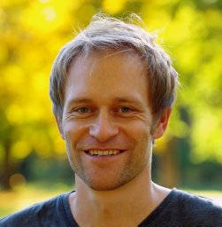 Jens Kiesel合作论文数Ecology Center, Kiel University3
 Sibylle K. Hassler合作论文数3
 Masooma Batool合作论文数2
 Hannes Muller-Thomy合作论文数Inst Hydraul Engn & Water Resources Manageme, Vienna Univ Technol2
 Soohyun Yang合作论文数2
 Benjamin W. Abbott合作论文数Brigham Young University2
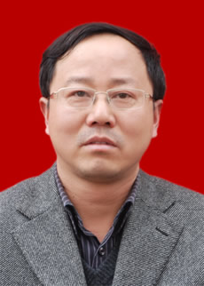 Guodong Liu (刘国东)合作论文数College of Water Resources & Hydropower, Sichuan University2
 James W. Jawitz合作论文数Soil and Water Science Department, University of Florida2
 Matthew Cohen合作论文数School of Forest Resources and Conservation;University of Florida;School of Forest Resources and Conservation, University of Florida2Jonas Götte合作论文数1
 Hoang Tran合作论文数1Felipe Saavedra合作论文数1Xiaohua Huang合作论文数1
 Jan Sodoge合作论文数1
 Yevheniia Anpilova合作论文数Institute of Telecommunications and Global Information Space, the National Academy of Sciences of Ukraine1
 Doan Van Binh合作论文数Master Program Water Technol Reuse & Management, Vietnamese German Univ1
 Joni Dehaspe合作论文数1
 Vinh Ngoc Tran合作论文数Civil and Environmental Engineering, University of Ulsan1
 Lukas Knoll合作论文数1
 Thanh Duc Dang合作论文数Singapore Univ Technol & Design, Pillar Engn Syst & Design, Singapore, Singapore1
 Mariana Madruga de Brito合作论文数Univ Bonn, Dept Geog, Bonn, Germany1
 Kimberly Van Meter合作论文数Department of Earth &Environmental Sciences, University of Waterloo;Department of Earth & Environmental Sciences, University of Waterloo1
 Giuliano Di Baldassarre合作论文数Department of Earth Sciences, Uppsala University1
 Yang Jie合作论文数Nanjing First Hospital, Nanjing Medical University;Central Clinical School, University of Sydney;Department of Neurology, Hebei Yutian Hospital;Department of Neurology, Xuzhou Central Hospital;West China Hospital, Sichuan University;and Department of Neurology, Korea University College of Medicine;Sichuan University, Korea University College of Medicine1
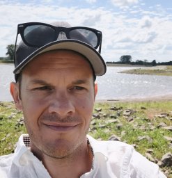 Graeber Daniel合作论文数Dept Biosci, Aarhus Univ1
 Lex Bouwman合作论文数Department of Earth Sciences-Geochemistry, Faculty of Geosciences, Utrecht University1
 Shatwell Tom合作论文数Department of Ecohydrology, Leibniz-Institute of Freshwater Ecology and Inland Fisheries (IGB),1
 Jose L. J. Ledesma合作论文数Department of Aquatic Sciences and Assessment, Swedish University of Agricultural Sciences (SLU),1
 Falk Handel合作论文数1




