Annalee Newitz's Automatic Noodle illustrates the challenges of robots operating a ghost kitchen.
Procedural issues are significant contributors to incidents in high-risk industries, yet current procedures fail to accommodate the gap between how work is prescribed and how it is actually performed. This study investigates the feasibility of developing a Real-Time Adaptive Procedure System that uses machine learning to understand procedural deviations and adapt procedures dynamically in high-risk industrial settings. Data were collected from eight workers performing three tasks at a high-fidelity petrochemical facility. Using the Skip-Order-Action framework, researchers documented procedural deviations by comparing observed behavior against prescribed procedures across 507 procedural steps. A logistic regression model was developed using features from the Multi-disciplinary Interactive Behavior Triad framework, including participant characteristics, step-level attributes derived from abstraction hierarchy levels and cognitive performance modeling, and real-time indicators such as timestamps and eye-tracking data. The model using step-level and participant-level features achieved relatively better performance (F1 = 0.49, AUC = 0.82), outperforming baseline models (F1 = 0.14-0.23). Adding real-time indicators reduced performance (F1 = 0.38), suggesting challenges in integrating real-time behavioral data. This proof-of-concept demonstrates that procedural deviations follow patterns based on task characteristics and worker attributes. The study establishes empirical foundations for machine learning-driven procedural adaptation and proposes a theoretical framework that bridges the gap between prescribed and actual work through adaptive systems rather than compliance monitoring, representing a paradigm shift toward learning-oriented procedural systems in high-risk industries.
The distinction is a matter of life and death to both a predator and a robot in the 2025 movie Predator: Badlands.
This paper presents the first known empirical investigation of annotator and reviewer performance across multi-source remotely sensed imagery, evaluating human labeling across drone, crewed aviation, and satellite views. Because existing aerial imagery datasets rely predominantly on single-source imagery, there is no currently established state of practice for efficiently allocating human labor to curate large-scale, multi-source aerial datasets. This work addresses this limitation by analyzing annotator and reviewer performance within a post-disaster building damage assessment dataset of 9 disasters, where 20041 buildings in drone, 20695 buildings in crewed aviation, and 33392 buildings in satellite imagery were labeled. These labels, provided by 187 annotators, were then refined through two successive quality-control stages: a single-reviewer pass followed by a consensus-committee review. Our analysis reveals two findings that raise questions for standard crowd-sourcing practices. First, initial annotations were revised by the final committee at rates that rise steeply from higher- to lower-resolution sources (25.27
This paper presents the largest known benchmark dataset for road damage assessment and road alignment, and provides 18 baseline models trained on the CRASAR-U-DRIODs dataset's post-disaster small uncrewed aerial systems (sUAS) imagery from 10 federally declared disasters, addressing three challenges within prior post-disaster road damage assessment datasets. While prior disaster road damage assessment datasets exist, there is no current state of practice, as prior public datasets have either been small-scale or reliant on low-resolution imagery insufficient for detecting phenomena of interest to emergency managers. Further, while machine learning (ML) systems have been developed for this task previously, none are known to have been operationally validated. These limitations are overcome in this work through the labeling of 657.25km of roads according to a 10-class labeling schema, followed by training and deploying ML models during the operational response to Hurricanes Debby and Helene in 2024. Motivated by observed road line misalignment in practice, 9,184 road line adjustments were provided for spatial alignment of a priori road lines, as it was found that when the 18 baseline models are deployed against real-world misaligned road lines, model performance degraded on average by 5.596% Macro IoU. If spatial alignment is not considered, approximately 8% (11km) of adverse conditions on road lines will be labeled incorrectly, with approximately 9% (59km) of road lines misaligned off the actual road. These dynamics are gaps that should be addressed by the ML, CV, and robotics communities to enable more effective and informed decision-making during disasters.
The 2025 novel Mechanize My Hands for War features humanoid robots for agriculture.
The Infinite Sadness of Small Appliances imagines the multiple ways domestic home robots can violate the privacy of a family.
Four science fiction works describe realistic construction and mining robots enabling human habitation of the Moon.
The Will Smith 2004 blockbuster I, Robot predicts pervasive humanoid robots in 2035; investors agree, roboticists disagree.
This paper presents the first AI/ML system for automating building damage assessment in uncrewed aerial systems (sUAS) imagery to be deployed operationally during federally declared disasters (Hurricanes Debby and Helene). In response to major disasters, sUAS teams are dispatched to collect imagery of the affected areas to assess damage; however, at recent disasters, teams collectively delivered between 47GB and 369GB of imagery per day, representing more imagery than can reasonably be transmitted or interpreted by subject matter experts in the disaster scene, thus delaying response efforts. To alleviate this data avalanche encountered in practice, computer vision and machine learning techniques are necessary. While prior work has been deployed to automatically assess damage in satellite imagery, there is no current state of practice for sUAS-based damage assessment systems, as all known work has been confined to academic settings. This work establishes the state of practice via the development and deployment of models for building damage assessment with sUAS imagery. The model development involved training on the largest known dataset of post-disaster sUAS aerial imagery, containing 21,716 building damage labels, and the operational training of 91 disaster practitioners. The best performing model was deployed during the responses to Hurricanes Debby and Helene, where it assessed a combined 415 buildings in approximately 18 minutes. This work contributes documentation of the actual use of AI/ML for damage assessment during a disaster and lessons learned to the benefit of the AI/ML research and user communities.
“Sunny,” the new Apple TV series, explores what happens if robot assistants develop emotions.
Death of the Author: A Novel imagines the influence of an experimental exoskeleton on a disabled author and her family.
Science fiction argues for specialized robots, not general-purpose humanoid robots, for unloading of cargo and parcels.
This work presents the first quantitative study of alignment errors between small uncrewed aerial systems (sUAS) georectified imagery and a priori building polygons and finds that alignment errors are non-uniform and irregular, which negatively impacts field robotics systems and human-robot interfaces that rely on geospatial information. There are no efforts that have considered the alignment of a priori spatial data with georectified sUAS imagery, possibly because straight-forward linear transformations often remedy any misalignment in satellite imagery. However, an attempt to develop machine learning models for an sUAS field robotics system for disaster response from nine wide-area disasters using the CRASAR-U-DROIDs dataset uncovered serious translational alignment errors. The analysis considered 21,608 building polygons in 51 orthomosaic images, covering 16787.2 Acres (26.23 square miles), and 7,880 adjustment annotations, averaging 75.36 pixels and an average intersection over union of 0.65. Further analysis found no uniformity among the angle and distance metrics of the building polygon alignments, presenting an average circular variance of 0.28 and an average distance variance of 0.45 pixels2, making it impossible to use the linear transform used to align satellite imagery. The study's primary contribution is alerting field robotics and human-robot interaction (HRI) communities to the problem of spatial alignment and that a new method will be needed to automate and communicate the alignment of spatial data in sUAS georectified imagery. This paper also contributes a description of the updated CRASAR-U-DROIDs dataset of sUAS imagery, which contains building polygons and human-curated corrections to spatial misalignment for further research in field robotics and HRI.
In The Downloaded, a robot cripples a roboticist for promoting Asimov's three laws of robotics.
This paper details four principal challenges encountered with machine learning (ML) damage assessment using small uncrewed aerial systems (sUAS) at Hurricanes Debby and Helene that prevented, degraded, or delayed the delivery of data products during operations and suggests three research directions for future real-world deployments. The presence of these challenges is not surprising given that a review of the literature considering both datasets and proposed ML models suggests this is the first sUAS-based ML system for disaster damage assessment actually deployed as a part of real-world operations. The sUAS-based ML system was applied by the State of Florida to Hurricanes Helene (2 orthomosaics, 3.0 gigapixels collected over 2 sorties by a Wintra WingtraOne sUAS) and Debby (1 orthomosaic, 0.59 gigapixels collected via 1 sortie by a Wintra WingtraOne sUAS) in Florida. The same model was applied to crewed aerial imagery of inland flood damage resulting from post-tropical remnants of Hurricane Debby in Pennsylvania (436 orthophotos, 136.5 gigapixels), providing further insights into the advantages and limitations of sUAS for disaster response. The four challenges (variationin spatial resolution of input imagery, spatial misalignment between imagery and geospatial data, wireless connectivity, and data product format) lead to three recommendations that specify research needed to improve ML model capabilities to accommodate the wide variation of potential spatial resolutions used in practice, handle spatial misalignment, and minimize the dependency on wireless connectivity. These recommendations are expected to improve the effective operational use of sUAS and sUAS-based ML damage assessment systems for disaster response.
One of the twists in Companion depends on faulty assumptions about the internal anatomy of a humanoid robot.
This paper audits damage labels derived from coincident satellite and drone aerial imagery for 15,814 buildings across Hurricanes Ian, Michael, and Harvey, finding 29.02% label disagreement and significantly different distributions between the two sources, which presents risks and potential harms during the deployment of machine learning damage assessment systems. Currently, there is no known study of label agreement between drone and satellite imagery for building damage assessment. The only prior work that could be used to infer if such imagery-derived labels agree is limited by differing damage label schemas, misaligned building locations, and low data quantities. This work overcomes these limitations by comparing damage labels using the same damage label schemas and building locations from three hurricanes, with the 15,814 buildings representing 19.05 times more buildings considered than the most relevant prior work. The analysis finds satellite-derived labels significantly under-report damage by at least 20.43% compared to drone-derived labels (p<1.2x10(-117)), and satellite- and drone-derived labels represent significantly different distributions (p<5.1x10(-175)). This indicates that computer vision and machine learning (CV/ML) models trained on at least one of these distributions will misrepresent actual conditions, as the differing satellite and drone-derived distributions cannot simultaneously represent the distribution of actual conditions in a scene. This potential misrepresentation poses ethical risks and potential societal harm if not managed. To reduce the risk of future societal harms, this paper offers four recommendations to improve reliability and transparency to decision-makers when deploying CV/ML damage assessment systems in practice.
A big-budget flop about terraforming Mars had a ground-aerial robot team predating Perseverance and Ingenuity.
 Cindy L. Bethel合作论文数Department of Computer Science and Engineering, Mississippi State University;Social, Therapeutic, and Robotic Systems Lab, Mississippi State University;Center for Advanced Vehicular Systems Human Performance Group, Mississippi State University;Social Science Research Center, Mississippi State University24
 Jan Dufek合作论文数Department of Computer Science and Engineering, Texas A M University22
 Thomas Manzini合作论文数Department of Computer Science, Texas A&M University19
 Jennifer L. Burke合作论文数18
 Vasant Srinivasan合作论文数Texas A&M University17
 Brittany A. Duncan合作论文数Texas A&M University17
 Xuesu Xiao合作论文数Department of Computer Science, George Mason University;Unsorted15
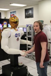 Zachary Henkel合作论文数Texas A&M University15
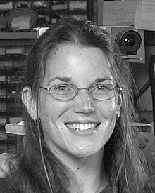 Jennifer Casper合作论文数13Jeff Hyams合作论文数10
 Jeffrey David Craighead合作论文数HSR&D/RR&D Center of Excellence, James A. Haley Veterans Hospital9A. Gage合作论文数8Kevin S. Pratt合作论文数8Satoshi Tadokoro合作论文数8David Merrick合作论文数8
 Clifford I. Nass合作论文数Graduate School of Education, Stanford University8
 Matthew Thornton Long合作论文数University of South Florida8
 Mark Micire合作论文数Ames Research Center, National Aeronautics and Space Administration;Carnegie Melon University8
 Jennifer Carlson合作论文数8Jesus Suarez合作论文数7Erika Rogers合作论文数7
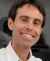 Howie Choset合作论文数Robotics Institute, School of Computer Science, Carnegie Mellon University7
 Joshua M. Peschel合作论文数Texas A&M University7
 Maryam Rahnemoonfar合作论文数Lehigh University;WiMLDS7
 Tashnim Chowdhury合作论文数Bina Lab, Univ Maryland Baltimore Cty6Justin Adams合作论文数6Jenny Burke合作论文数6
 Kimon P. Valavanis合作论文数Department of Electrical & Computer Engineering, Daniel Felix Ritchie School of Engineering & Computer Science, University of Denver6Chandler Griffin合作论文数5Grant A. Wilde合作论文数5
 Hao Su合作论文数Polytechnic Institute, Tandon School of Engineering, New York University5
 Russell Taylor合作论文数Department of Computer Science, Whiting School of Engineering, Johns Hopkins University;Department of Mechanical Engineering, Whiting School of Engineering, Johns Hopkins University;Laboratory for Computational Sensing and Technology, Johns Hopkins University;NSF Engineering Research Center for Computer-Integrated Surgical Systems and Technology, Johns Hopkins University5
 Dylan A. Shell合作论文数Department of Computer Science & Engineering, College of Engineering, Texas A&M University5Sam Stover合作论文数5
 Ronald Craig Arkin (Ronald C. Arkin)合作论文数GVU Center, College of Computing, Georgia Institute of Technology;School of Interactive Computing, College of Computing, Georgia Institute of Technology5Matt Long合作论文数5Victoria Groom合作论文数Stanford University5Aaron Gage合作论文数5
 Kristen Salomon合作论文数Department of Psychology, University of South Florida5Aaron Rice合作论文数4Ken Hughes合作论文数4
 Brandon Shrewsbury合作论文数Foundation Robotics Labs4
 S. Camille Peres合作论文数Rice University4Eric T. Steimle合作论文数4Dawn Riddle合作论文数4
 Negar Rashidi合作论文数4
 David Kortenkamp合作论文数TRACLabs Inc.4
 Lefteris Doitsidis合作论文数Technological Educational Institute of Crete, Technical University of Crete4Traci A. Sarmiento合作论文数4




