Scientific analyses often involve multiple tasks that are closely related to each other. These tasks inherently share dependencies that can be effectively modeled through multi-task learning (MTL), which enables shared representation learning and cross-task generalization. However, applying MTL to complex scientific datasets with numerous, weakly related tasks remains challenging due to the computational burden of exploring extensive task combinations and the lack of automated task selection strategies. To address these challenges, we propose Self Expert Exploration for Mixture of Experts models (SEEM), a novel MTL pruning framework that adaptively identifies and retains only the most relevant tasks during training. SEEM introduces an importance-based pruning algorithm and a two-tier grouping mechanism distinguishing primary and secondary tasks. It quantifies inter-task relationships via gating patterns, graph-based centrality, and consensus voting to drive pruning decisions. By dynamically pruning tasks, SEEM produces a compact, computationally efficient model while preserving shared learning performance and enhancing computing efficiency. We evaluate SEEM using advanced Mixture of Experts architectures across multiple scientific and real-world datasets, spanning both regression and classification tasks. Our results demonstrate that SEEM achieves superior scalability and reduced computational cost, while improving interpretability by revealing key inter-task relationships and mitigating negative transfer from weakly related tasks.
Spatiotemporal datasets hold the key to understanding complex natural and human systems. Diversity in encoding formats, resolution, and storage architectures renders them difficult to use together. In this paper we take soil-related data as a central example, not because soils are unique, but because they exemplify the challenges of integrating and exploring longitudinal data for terrestrial phenomena. Our methodology and associated framework, codenamed Hermes, builds on the principle of polyglot persistence: surveys, vector data, shapefiles, and raster imagery remain in the storage systems best suited to them. Rather than forcing these data into a single repository, Hermes provides a unifying layer that allows queries to reach across them while preserving the performance benefits of each system. Because the order of evaluation matters, we employ heuristics to prioritize predicates most likely to filter strongly or benefit from native indexes, thereby reducing both movement of data and query latency. Finally, by caching results and reweighting heuristics through selective counterfactual evaluation, the system adapts as the data evolve: growing more efficient the more it is used. We present extensive benchmarks profiling multiple facets of our methodology, demonstrating its effectiveness and performance gains; for comparable tasks, Hermes outperforms Apache Sedona and GeoPandas by factors of up to 42x and 52x respectively.
The deployment of Time-Series Foundation Models (TSFMs) in physical sciences is hindered by a critical trade-off: while these models encode rich, universal temporal dynamics, they suffer from severe distributional misalignment when applied zero-shot to specific scientific domains, and their computational cost prohibits deployment in edge-computing sensor networks. We address a fundamental challenge: How can we extract latent structural knowledge from misaligned foundation models (FM) to train lightweight, specialized forecasters? We propose Gated Uncertainty-Aware Routing for Distillation (Guard), a novel framework that reframes multiteacher distillation as an instance-wise decision process with two adaptive mechanisms: (1) a Contextual Router that dynamically selects the most relevant teacher based on local input statistics, exploiting complementarity across diverse foundation models; and (2) an Uncertainty-Gated Temperature mechanism that acts as a "circuit-breaker," automatically attenuating distillation strength when teacher confidence diverges from domain reality. We evaluate our proposed lightweight framework on four climate-critical domains: meteorology, ecosystem carbon flux, soil moisture, and energy grids. Our method significantly reduces RMSE relative to a fixed-weight multi-teacher distillation baseline, successfully distilling knowledge from pretrained FMs (teachers) even when they exhibit suboptimal zero-shot accuracy due to distribution shift between the original and target data domains. We demonstrate that these domain-misaligned teachers can still serve as critical correctives, outperforming the globally superior FMs on 28.5
Accurate prediction of extreme events remains difficult due to the scarcity of high-magnitude observations and the unreliability of conventional uncertainty estimates. We introduce XFormer, a multi-stage ensemble framework that transforms uncertainty quantification from a passive diagnostic into an active driver of model improvement. Our method trains a diverse ensemble of forecasting models in two phases: first, by cultivating complementary predictors through varied initializations and learning dynamics; and second, by exploiting ensemble disagreement to locate and refine challenging regions of the data space. By coupling uncertainty-guided sampling with extreme-aware loss functions, we construct an adaptive curriculum that progressively prioritizes high-uncertainty and rare extreme events. This uncertainty-aware training paradigm shows that incorporating ensemble disagreement during training (rather than relying on it only at inference) yields more reliable and calibrated forecasts for rare but consequential events. We demonstrate XFormer’s effectiveness across diverse domains—including ecosystem fluxes, air quality, and web traffic, achieving 91-98% detection rates for rare events (an 18-26 percentage point improvement over state-of-the-art models) while reducing prediction errors by 25-45%.
This study develops a robust ensemble machine learning methodology for predicting average annual salinity by combining multiple machine learning algorithms. Salt concentration is a crucial water quality indicator, and salinity issues cost $300 million annually in the U.S. Irrigated agricultural lands in the Upper Colorado River Basin contribute excessively to dissolved solid loads despite covering less than 2% of the basin area. The economic impact and complex relationship between irrigation practices, groundwater dynamics, and salinity levels necessitate improved predictive capabilities at river basin scales. Using twenty years of data from 150 watersheds, eleven machine learning algorithms were evaluated through both random and spatial cross-validation approaches, with Extreme Gradient Boosting, Gradient Boosting, and Random Forest emerging as top performers. Bayesian Model Averaging and stacked generalization were employed to create ensemble models, demonstrating enhanced performance validity. The BMA ensemble achieved better spatial generalization compared to individual models while requiring significantly less computational resources than stacking. Model uncertainty analysis revealed that BMA provided the most stable predictions among all approaches. Soil electrical conductivity and calcium carbonate content emerged as the most important predictors, followed by river flow. The resulting spatially distributed predictions revealed distinct patterns in sulfate loads and concentrations across sub-basins, providing insights for targeted salinity management. This study demonstrates the effectiveness of ensemble machine learning approaches for robust salinity prediction while highlighting the importance of comprehensive uncertainty assessment and spatial validation in environmental modeling applications.
Accurate prediction of soil moisture (SM) is crucial for applications in agriculture, hydrology, and climate modeling. Traditional data-driven machine learning (ML) approaches often require extensive labeled datasets and fail to incorporate the physical principles governing SM dynamics. In this study, we propose a novel science-guided learning framework to predict SM in the top 20 cm of soil using deep neural networks (DNNs). By integrating physical equations, such as Richards' equation, into the learning process, our approach ensures scientifically consistent predictions while improving model generalizability. Our empirical results show that the proposed graph-based model outperforms traditional ML approaches by more than 30% in accuracy, while predicting SM with an error of less than 5% compared to ground-truth in-situ measurements.
As data volumes have grown, they offer opportunities to extract insights from them. The class of datasets we consider are spatiotemporal i.e., data that have spatial and temporal dimensions associated with them. In this study, we describe our methodology to support distributional similarity analysis at scale. Such distributional analyses are critical in identifying overall trends in spatiotemporally evolving phenomena, and can be used to inform model calibration and decision making. Our methodology leverages a mix of statistical, algorithmic, and systems approaches to facilitate effective analyses over voluminous datasets. We profile several aspects of our methodology, and our benchmarks validate several of our design choices.
Soil salinization poses a significant threat to both ecosystems and agriculture because it limits plants' ability to absorb water and, in doing so, reduces crop productivity. This phenomenon alters the soil's spectral properties, creating a measurable relationship between salinity and light reflectance that enables remote monitoring. While laboratory spectroscopy provides precise measurements, its reliance on in-situ sampling limits scalability to regional or global levels. Conversely, hyperspectral satellite imagery enables wide-area observation but lacks the fine-grained interpretability of laboratory instruments. To bridge this gap, we introduce DeepSalt, a deep-learning-based spectral transfer framework that leverages knowledge distillation and a novel Spectral Adaptation Unit to transfer high-resolution spectral insights from laboratory-based spectroscopy to satellite-based hyperspectral sensing. Our approach eliminates the need for extensive ground sampling while enabling accurate, large-scale salinity estimation, as demonstrated through comprehensive empirical benchmarks. DeepSalt achieves significant performance gains over methods without explicit domain adaptation, underscoring the impact of the proposed Spectral Adaptation Unit and the knowledge distillation strategy. The model also effectively generalized to unseen geographic regions, explaining a substantial portion of the salinity variance.
Spatiotemporal data volumes have increased alongside a proliferation in their diversity. As a precursor to analysis, data must be reconciled and harmonized. Differences in encoding formats, spatial and coordinate reference systems, data types (points, shapes, rasters, grids), and storage strategies disrupt analytic workflows. The challenge grows more complex when analyses require “layered” datasets, in which multiple heterogeneous sources must be integrated to yield consistent insight. Here, we present a methodology that systematically harmonizes such datasets and enables their layering into federated collections. Our approach provides an ecosystem of interoperable services that perform dimensionality reduction, query evaluation, correlation analysis, normalization, and visualization. These services can be chained together, operate on distributed datasets, and integrate directly with existing large-scale computation frameworks such as Spark and MapReduce.
Masked autoencoders employ random masking to effectively reconstruct input images using self-supervised techniques, which allows for efficient training on large datasets. However, the random masking strategy does not adequately tap into information encapsulated within high-dimensional hyperspectral satellite imagery that is used in several domains. We propose a novel masking strategy, HOGMAE, based on the Histogram of Oriented Gradients that incorporates rich information inherent within satellite images during the mask creation step. Our experiments, over a hyperspectral satellite dataset, demonstrate the effectiveness of our methodology.
Masked Autoencoders struggle with hyperspectral satellite imagery containing 200+ spectral bands, as uniform masking across all channels obscures critical spatial-spectral relationships. We introduce TerraMAE, which employs an adaptive channel grouping strategy to organize bands into statistically coherent groups with independent masking. Together with a customized loss function, this data-driven grouping strategy enables TerraMAE to learn robust spatial-spectral representations from unlabeled HSI. Experiments demonstrate that TerraMAE significantly outperforms baseline Masked Autoencoder and supervised ResNet-50 on soil texture prediction, achieving 15.7% and 6.6% lower error, respectively.
Soil moisture plays a critical role in several domains and can be used to inform decision-making in agricultural settings, drought forecasting, forest fire predictions, and water conservation. Soil moisture is measured using in-situ and remote-sensing equipment. Depending on the type of equipment that is used, some challenges must be reconciled, including the density of observations, the measurement precision, and the resolutions at which these measurements are available. In particular, in-situ measurements are high-precision but sparse, while remote sensing measurements benefit from spatial coverage, albeit at lower precision and coarser resolutions. The crux of this study is to produce higher-precision soil moisture estimates at high resolutions (30m). Our methodology combines scientific models, deep networks, topographical characteristics, and information about ambient conditions alongside both in-situ and remote sensing data to accomplish this. Domain science infuses several aspects of our methodology. Our empirical benchmarks profile several aspects and demonstrate that our methodology accounts for spatial variability while accounting for both static (soil properties and elevation) and dynamically varying phenomena to generate accurate, high-precision 30m resolution soil moisture content maps.
Contrastive learning has achieved unprecedented levels of accuracy on computer vision applications in recent years. However, in this time, the image augmentations used in these frameworks have remained, for the most part, unchanged. We propose a new augmentation strategy, GenCL, a Generative Augmentation Framework for Contrastive Learning, which utilizes generative modeling to augment images for forming positive pairs. Unlike geometry and color augmentations, GenCL is able to change high-level visual features in images, such as the background, positioning, and color schemas of objects. Our results show that adding these generative augmentations to the suite of augmentations typically used in contrastive learning significantly increases downstream accuracy. In our work, we (1) outline the neural network architecture used in GenCL, (2) use ablation studies to optimize the hyperparameters used in our generative augmentations, and (3) provide a cost-benefit analysis of our implementation in a contrastive learning setting. With these findings, we show that leveraging generative models can significantly increase the performance of contrastive learning on self-supervised learning benchmarks, providing a new avenue for future contrastive learning research.
The crux of this study is to support browser-based visualizations of spatiotemporally evolving phenomena. Such phenomena arise in myriad domains spanning terrestrial, oceanic, and atmospheric processes. The data are voluminous, have diverse representational formats and projection systems, and are multivariate. We rely on a novel mix of tiling, caching, compression, perceptual limits, speculative prefetching, and dynamic generation of tiles. Our refinements at the client and server-side work in concert with each other to leverage client-side resources, minimize duplicate processing, and effective prefetching to ensure interactive explorations at scale. Our benchmarks profiled several aspects of our methodology and demonstrate the suitability of our refinements.
As high-dimensional, voluminous datasets continue to become available, they present opportunities for users to perform richer explorations that lead to insights. Most explorations are however limited by the query semantics enforced by the underlying storage system. This precludes identification of connections that exists within and across datasets. This study describes, MAGELLAN, a system that is designed for richer, iterative explorations that allow users to explore connections within and across datasets. Our methodology combines aspects of ontologies and metadata to support analysis that are domain informed and statistically richer. Our performance benchmarks demonstrate the suitability of our methodology to inform explorations interactively and at scale.
This study focuses on enabling programmatic interfaces to perform exploratory analyses over voluminous data collections. The data we consider can be encoded in diverse formats and managed using diverse data storage frameworks. Our framework, code named Scrybe, manages the competing pulls of expressive computations and the need to manage resource utilization in shared clusters. The framework includes support for differentiated quality of service allowing preferentially higher resource utilization for certain users. We have validated our methodology with voluminous data collections housed in relational, NoSQL/document, and hybrid storage systems. Our performance benchmarks profile several aspects of our methodology, and demonstrate the effectiveness of our methodology.
Growth in satellite observations and modelling capabilities has transformed drought monitoring, offering near-real-time information. However, current monitoring efforts focus on hazards rather than impacts, and are further disconnected from drought-related compound or cascading hazards such as heatwaves, wildfires, floods and debris flows. In this Perspective, we advocate for impact-based drought monitoring and integration with broader drought-related hazards. Impact-based monitoring will go beyond top-down hazard information, linking drought to physical or societal impacts such as crop yield, food availability, energy generation or unemployment. This approach, specifically forecasts of drought event impacts, would accordingly benefit multiple stakeholders involved in drought planning, and risk and response management, with clear benefits for food and water security. Yet adoption and implementation is hindered by the absence of consistent drought impact data, limited information on local factors affecting water availability (including water demand, transfer and withdrawal), and impact assessment models being disconnected from drought monitoring tools. Implementation of impact-based drought monitoring thus requires the use of newly available remote sensors, the availability of large volumes of standardized data across drought-related fields, and the adoption of artificial intelligence to extract and synthesize physical and societal drought impacts.
Gridded spatial datasets arise naturally in environmental, climatic, meteorological, and ecological settings. Each grid point encapsulates a vector of variables representing different measures of interest. Gridded datasets tend to be voluminous since they encapsulate observations for long timescales. Visualizing such datasets poses significant challenges stemming from the need to preserve interactivity, manage I/O overheads, and cope with data volumes. Here we present our methodology to significantly alleviate I/O requirements by leveraging deep neural network-based models.
Spatia1 data volumes have grown exponentially alongside the proliferation of sensing equipment and networked observational devices. In this study, we describe our framework aQua for performing visualizations and exploration of spatiotemporally evolving phenomena at scale. We validate our ideas in the context of data from the National Hydrology Database (NHD) and the Environmental Protection Agency (EPA) to support longitudinal analysis (53 years of data) for the vast majority of water bodies in the United States. Our methodology addresses issues relating to preserving interactivity, effective analysis, GPU accelerated visualizations, dynamic query generation, and scaling. We consider optimizations and refinements at the server-side, client-side, and how information exchange occurs between the client and server-side. We report both quantitative and qualitative assessments of several aspects of our tool to demonstrate its suitability. Finally, our methodology is broadly applicable to domains where visualization-driven explorations of spatiotemporally evolving phenomena are needed.
Interactive visual analytics over distributed systems housing voluminous datasets is hindered by three main factors - disk and network I/O, and data processing overhead. Requests over geospatial data are prone to erratic query load and hotspots due to users' simultaneous interest over a small sub-domain of the overall data space at a time. Interactive analytics in a distributed setting is further hindered in cases of voluminous datasets with large/high-dimensional data objects, such as multi-spectral satellite imagery. The size of the data objects prohibits efficient caching mechanisms that could significantly reduce response latencies. Additionally, extracting information from these large data objects incurs significant data processing overheads and they often entail resource-intensive computational methods. Here, we present our framework, Argus,that extracts low-dimensional representation (embeddings) of high-dimensional satellite images during ingestion and houses them in the cache for use in model-driven analysis relating to wildfire detection. These embeddings are versatile and are used to perform model-based extraction of analytical information for a set of different scenarios, to reduce the high computational costs that are involved with typical transformations over high-dimensional datasets. The models for each such analytical process are trained in a distributed manner in a connected, multi-task learning fashion, along with the encoder network that generates the original embeddings.
 Geoffrey Fox合作论文数Department of Physics, College of Arts and Sciences, Indiana University;Department of Intelligent Systems Engineering, Indiana University;Community Grid Laboratory, Indiana University;Digital Science Center of Pervasive Technology Institute;School of Engineering and Applied Science, University of Virginia82
 Sangmi Lee Pallickara合作论文数Computer Science Department, Colorado State University45
 Marlon Pierce合作论文数Indiana University28
 Matthew Malensek合作论文数Colorado State University28
 Harshawardhan Gadgil合作论文数Affirm19
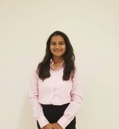 Paahuni Khandelwal合作论文数Colorado State Univ, Dept Comp Sci, Ft Collins, CO 80523 USA12
 Saptashwa Mitra合作论文数Colorado State Univ, Dept Comp Sci, Ft Collins, CO 80523 USA12
 Mazdak Arabi合作论文数Department of Civil and Environmental Engineering, Colorado State University12
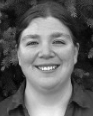 Kathleen Ericson合作论文数11
 Ahmet Uyar合作论文数department of Computer Engineering
Mersin University11
Ahmet Uyar合作论文数department of Computer Engineering
Mersin University11 Galip Aydin合作论文数* VLab: Collaborative Grid Services and Portals to Support Computational Material Science[ pdf ]11
 Hasan Bulut合作论文数10
 Daniel Rammer合作论文数Colorado State Univ, Dept Comp Sci, Ft Collins, CO 80523 USA10
 Mehmet Sıddık AKTAŞ合作论文数Computer Engineering Department, Faculty of Electrical & Electronics, Computer Engineering, Yildiz Technical University10
 F. Jay Breidt合作论文数Dept Stat, Colorado State Univ10
 Jaliya Ekanayake合作论文数Google10
 Abdul Matin合作论文数Department of Electrical & Computer Engineering, Rajshahi University of Engineering & Technology9
 Thilina Buddhika合作论文数Colorado State Univ, Dept Comp Sci, Ft Collins, CO 80523 USA9
 Menuka Warushavithana合作论文数Department of Computer Science, Colorado State University8
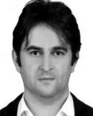 Ahmet Sayar合作论文数Indiana University8Wes Lloyd合作论文数7
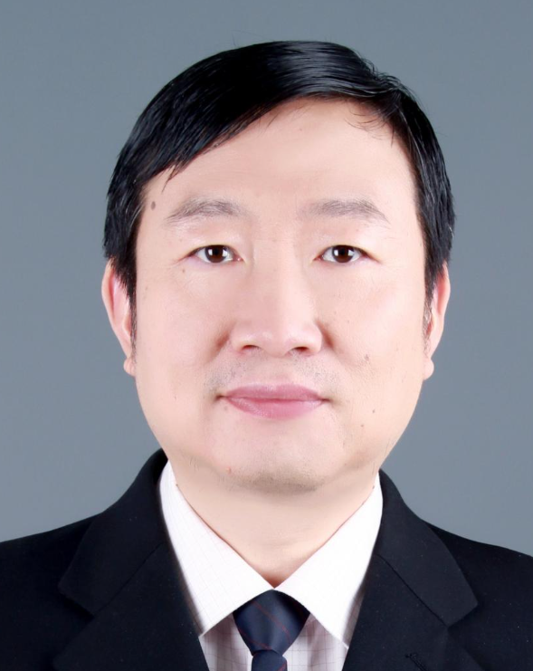 Wenjun Wu (吴文峻)合作论文数School of Artificial Intelligence, Beihang University7Neil W. Harvey合作论文数6
 Walid Budgaga合作论文数6
 Olaf David合作论文数6
 Ken Rojas合作论文数6Beytullah Yildiz合作论文数Indiana University6M Pierce合作论文数5Samuel Armstrong合作论文数Colorado State University, Fort Collins, CO, USA,5Gang Zhai (翟刚)合作论文数5Dennis Gannon合作论文数Department of Computer Science at Indiana University;Indiana Pervasive Technology Labs5Kevin Bruhwiler合作论文数4
 Aleksander Slominski合作论文数Indiana University4
 Gordon Erlebacher合作论文数Department of Scientific Computing, Florida State University;Department of Mathematics, College of Arts and Sciences, Florida State University;Visualization Laboratory, School of Computational Science & Information Technology, Florida State University;Department of Computer Science, Courtesy Appointment, Florida State University4
 Ali Can Kaplan合作论文数4Sunghoon Ko合作论文数4
 Sangyoon Oh合作论文数Division of Information & Computer Engineering at Ajou University, Korea.4D. A. Yuen合作论文数3
 John Rundle合作论文数Department of Physics and Astronomy, University of California, Davis;The Santa Fe Institute3
 Chuck Anderson合作论文数Department of Computer Science, Colorado State University;School of Biomedical Engineering, Colorado State University3Wojtek Furmanski合作论文数3
 Ryan Stern合作论文数3
 Jay Parker合作论文数3
 David W. Walker合作论文数School of Computer Science and Informatics, Cardiff University3Jim Lyon合作论文数3Ozgur Balsoy合作论文数Florida State University
400 Dirac Science Library3Evan F. Bollig合作论文数3
David W. Walker合作论文数School of Computer Science and Informatics, Cardiff University3Jim Lyon合作论文数3Ozgur Balsoy合作论文数Florida State University
400 Dirac Science Library3Evan F. Bollig合作论文数3 Robert Granat合作论文数The City College of New York3




