Abstract The Orbiting Carbon Observatory‐2 and ‐3 (collectively termed “OCO‐2/3,” hereafter) missions, together, provide precise and accurate global data records that contribute to a better understanding of the variability in atmospheric carbon dioxide (CO 2 ). The retrieval algorithm used to process the satellite data, Atmospheric Carbon Observations from Space (ACOS), continues to be updated. The latest v11.2 OCO‐2 and v11 OCO‐3 data releases include significant improvements compared to past data versions. The Total Carbon Column Observing Network (TCCON), a network of ground‐based Fourier Transform Spectrometers (FTS), has historically, been the validation data source for OCO‐2/3. The COllaborative Carbon Column Observing Network (COCCON), an emerging network of ground‐based portable Fourier Transform Infrared Spectrometers (EM27/SUN), aids satellite validation efforts by providing observations in geographic locations where there are no TCCON measurements being made. This study provides the first global comparison between the OCO‐2/3 data sets and the COCCON observations. Currently, the COCCON data set, most useful for global analysis, is version 1 (v1), which our analysis shows is typically lower than the satellites by ∼0.50–1.00 ppm, with scatter against OCO‐2/3 roughly similar to TCCON versus OCO‐2/3. This analysis includes comparisons of results from the latest v2.x COCCON data version for the sites with the data available. Comparisons with the v2.x COCCON data version generally show improved comparisons against OCO‐2/3. Our analysis illustrates the ways in which the COCCON data set, used globally, regionally, or in specific locations, can provide insight into the quality of satellite observations of atmospheric CO 2 .
Abstract Space‐based monitoring of urban carbon dioxide (CO2) emissions is essential for climate policy, but systematic measurement biases can compromise emission quantification accuracy. NASA's Orbiting Carbon Observatory‐3 (OCO‐3) provides unique Snapshot Area Mapping (SAM) mode observations that can capture city‐scale CO2 plumes in single overpasses, yet some SAMs exhibit swath‐based XCO2 biases of 1–3 ppm that can mask or artificially enhance true emission signals. Here, we develop a machine learning framework to identify and correct these artifacts while preserving genuine atmospheric CO2 variations. We trained a random forest classifier on 1,723 manually labeled SAMs spanning August 2019 to February 2025 to distinguish scenes requiring bias correction from those with legitimate spatial gradients in XCO2. The model uses five key diagnostic features identified through systematic feature selection: inter‐swath XCO2 discontinuity, scene homogeneity, coarse‐ and fine‐mode aerosol optical depths, and spectral alignment corrections. A median‐alignment algorithm then removes detected biases by adjusting swath‐level offsets while conserving total column CO2. The classifier achieves a precision and recall of 79% and 63%, respectively, prioritizing the avoidance of false corrections that could otherwise remove true atmospheric signals. Applied to the complete OCO‐3 SAM record, consisting of 19,839 unique SAMs, we estimate that approximately 9% have an identifiable swath bias. This work addresses a critical OCO‐3 data quality issue that has hindered the operational use of OCO‐3 SAMs for urban fossil fuel emissions monitoring. The proposed correction framework enhances OCO‐3 data reliability for use in updating emission inventories and provides methodological insights for future greenhouse gas satellite missions.
The Orbiting Carbon Observatory-2 and -3 (collectively termed "OCO-2/3," hereafter) missions, together, provide precise and accurate global data records that contribute to a better understanding of the variability in atmospheric carbon dioxide (CO2). The retrieval algorithm used to process the satellite data, Atmospheric Carbon Observations from Space (ACOS), continues to be updated. The latest v11.2 OCO-2 and v11 OCO-3 data releases include significant improvements compared to past data versions. The Total Carbon Column Observing Network (TCCON), a network of ground-based Fourier Transform Spectrometers (FTS), has historically, been the validation data source for OCO-2/3. The COllaborative Carbon Column Observing Network (COCCON), an emerging network of ground-based portable Fourier Transform Infrared Spectrometers (EM27/SUN), aids satellite validation efforts by providing observations in geographic locations where there are no TCCON measurements being made. This study provides the first global comparison between the OCO-2/3 data sets and the COCCON observations. Currently, the COCCON data set, most useful for global analysis, is version 1 (v1), which our analysis shows is typically lower than the satellites by similar to 0.50-1.00 ppm, with scatter against OCO-2/3 roughly similar to TCCON versus OCO-2/3. This analysis includes comparisons of results from the latest v2.x COCCON data version for the sites with the data available. Comparisons with the v2.x COCCON data version generally show improved comparisons against OCO-2/3. Our analysis illustrates the ways in which the COCCON data set, used globally, regionally, or in specific locations, can provide insight into the quality of satellite observations of atmospheric CO2.
The Orbiting Carbon Observatory 2 (OCO‐2) is NASA's first Earth observation satellite mission dedicated to studying the sources and sinks of carbon dioxide (CO 2 ) on a global scale. The observations of reflected sunlight are inverted in a retrieval algorithm to produce estimates of the dry air mole‐fractions of CO 2 (X CO2 ). The OCO‐2 Level 2 data release, version 11.1 (v11.1) retrievals from the Atmospheric Carbon Observations from Space (ACOS) algorithm, includes significant improvements in the X CO2 data product compared to older OCO‐2 data versions. This work compares the v11.1 X CO2 from OCO‐2 against X CO2 estimates collected from a global ground‐based network known as the Total Carbon Column Observing Network (TCCON), OCO‐2's primary validation source. The OCO‐2 project provides a version of the Level 2 data product, called “lite” files that include calibrated and bias‐corrected X CO2 values, accessible together with all OCO‐2 data products through the NASA Goddard Earth Sciences Data and Information Services Center (GES DISC). This work shows that OCO‐2 X CO2 observations made between September 2014 and December 2023, after quality filtering and the application of an averaging kernel correction, agree well with coincident TCCON data for all OCO‐2 observational modes of land (nadir, glint, target) and ocean (glint). The aggregated, bias‐corrected, and quality‐filtered absolute average bias values are less than or equal to 0.20 parts per million (ppm) globally for all OCO‐2 observation modes, where the biases do not indicate a statistically significant time dependence. The land nadir/glint mode has the lowest bias value of −0.03 ± 0.85 ppm.
Knowledge of surface pressure is essential for calculating column-averaged dry-air mole fractions of trace gases, such as CO2 (XCO2). In the NASA Orbiting Carbon Observatory 2 (OCO-2) Atmospheric Carbon Observations from Space (ACOS) retrieval algorithm, the retrieved surface pressures have been found to have unacceptable errors, warranting a parametric bias correction. This correction depends on the difference between retrieved and a priori surface pressures, which are derived from a meteorological model that is hypsometrically adjusted to the surface elevation using a digital elevation model (DEM). As a result, the effectiveness of the OCO-2 bias correction is contingent upon the accuracy of the referenced DEM. Here, we investigate several different DEM datasets for use in the OCO-2 ACOS retrieval algorithm: the OCODEM used in ACOS v10 and previous versions, the NASADEM+ (a composite of SRTMv4, ASTER GDEMv3, GIMP, and RAMPv2 DEMs) used in ACOS v11, the Copernicus GLO-90 DEM (GLO-90 DEM), and two polar regional DEMs (ArcticDEM and REMA). We find that the NASADEM+ (ASTER GDEMv3) has a persistent negative bias on the order of 10 to 20 m across most regions north of 60° N latitude, relative to all the other DEMs considered (OCODEM, ArcticDEM, and GLO-90 DEM). Variations of 10 m in DEM elevations lead to variations in XCO2 of approximately 0.4 ppm, meaning that the XCO2 from OCO-2 ACOS v11 retrievals tends to be 0.4 to 0.8 ppm lower across regions north of 60° N than XCO2 from OCO-2 ACOS v10. Our analysis also suggests that the GLO-90 DEM has superior global continuity and accuracy compared to the other DEMs, motivating a post-processing update from OCO-2 v11 Lite files (which used NASADEM+) to OCO-2 v11.1 by substituting the GLO-90 DEM globally. We find that OCO-2 v11.1 improves accuracy and spatial continuity in the bias-corrected XCO2 product relative to both v10 and v11 in high-latitude regions while resulting in marginal or no change in most regions within ± 60° latitude. In addition, OCO-2 v11.1 provides increased data throughput after quality control filtering in most regions, partly due to the change in DEM but mostly due to other corrections to quality control parameters. Given large-scale differences north of 60° N between the OCODEM and NASADEM+, we find that replacing the OCODEM with NASADEM+ yields a ∼ 100 TgC shift in inferred carbon uptake for the zones spanning 30 to 60° N and 60 to 90° N, which is on the order of 5 % to 7 % of the estimated pan-Arctic land sink. Changes in inferred fluxes from replacing the OCODEM with the GLO-90 DEM are smaller, and given the evidence for improved accuracies from this DEM, this suggests that large changes in inferred fluxes from the NASADEM+ are likely erroneous.
Abstract. Knowledge of surface pressure is essential for calculating column average dry-air mole fractions of trace gases, such as CO2 (XCO2). In the NASA Orbiting Carbon Observatory 2 (OCO-2) Atmospheric Carbon Observations from Space (ACOS) retrieval algorithm, the retrieved surface pressures have been found to have unacceptable errors, warranting a parametric bias correction. This correction depends on the difference between retrieved and a priori surface pressures, which are derived from a meteorological model that is hypsometrically adjusted to the surface elevation using a digital elevation model (DEM). As a result, the effectiveness of the OCO-2 bias correction is contingent upon the accuracy of the referenced DEM. Here, we investigate several different DEM datasets for use in the OCO-2 ACOS retrieval algorithm: the OCODEM used in ACOS v10 and previous versions, the NASADEM+ used in ACOS v11, the Copernicus DEM, and two polar regional DEMs (ArcticDEM and REMA). We find that variations of 10 m in DEM elevations lead to variations in XCO2 of approximately 0.4 ppm. Given large-scale differences north of 60° N between the OCODEM and NASADEM+, we find that replacing the OCODEM with NASADEM+ yields a ∼ 100 TgC shift in inferred carbon uptake for the zones spanning 30–60° N and 60–90° N, which is on the order of 5–7 % of the estimated pan-Arctic land sink. Our analysis suggests that the Copernicus DEM has superior global continuity and accuracy compared to the other DEMs, motivating a post-processing update from OCO-2 v11 lite files (which used NASADEM+) to OCO-2 v11.1 by substituting the Copernicus DEM globally. We find that OCO-2 v11.1 improves accuracy and spatial continuity in the bias-corrected XCO2 product relative to both v10 and v11 in high latitude regions, while resulting in marginal or no change in most regions within ± 60° latitude. In addition, OCO-2 v11.1 provides increased data throughput after quality control filtering in most regions, partly due to the change in DEM, but mostly due to other corrections to quality control parameters.
The version 10 (v10) Atmospheric Carbon Observations from Space (ACOS) Level 2 full-physics (L2FP) retrieval algorithm has been applied to multiyear records of observations from NASA's Orbiting Carbon Observatory 2 and 3 sensors (OCO-2 and OCO-3, respectively) to provide estimates of the carbon dioxide (CO2) column-averaged dry-air mole fraction (XCO2). In this study, a number of improvements to the ACOS v10 L2FP algorithm are described. The post-processing quality filtering and bias correction of the XCO2 estimates against multiple truth proxies are also discussed. The OCO v10 data volumes and XCO2 estimates from the two sensors for the time period of August 2019 through February 2022 are compared, highlighting differences in spatiotemporal sampling but demonstrating broad agreement between the two sensors where they overlap in time and space. A number of evaluation sources applied to both sensors suggest they are broadly similar in data and error characteristics. Mean OCO-3 differences relative to collocated OCO-2 data are approximately 0.2 and −0.3 ppm for land and ocean observations, respectively. Comparison of XCO2 estimates to collocated Total Carbon Column Observing Network (TCCON) measurements shows root mean squared errors (RMSEs) of approximately 0.8 and 0.9 ppm for OCO-2 and OCO-3, respectively. An evaluation against XCO2 fields derived from atmospheric inversion systems that assimilated only near-surface CO2 observations, i.e., did not assimilate satellite CO2 measurements, yielded RMSEs of 1.0 and 1.1 ppm for OCO-2 and OCO-3, respectively. Evaluation of uncertainties in XCO2 over small areas, as well as XCO2 biases across land–ocean crossings, also indicates similar behavior in the error characteristics of both sensors. Taken together, these results demonstrate a broad consistency of OCO-2 and OCO-3 XCO2 measurements, suggesting they may be used together for scientific analyses.
The Atmospheric Carbon Observations from Space (ACOS) retrieval algorithm has been delivering operational column-averaged carbon dioxide dry-air mole fraction (XCO2) data for the Orbiting Carbon Observatory (OCO) missions since 2014. The ACOS Level 2 Full Physics (L2FP) algorithm retrieves a number of parameters, including aerosol and surface properties, in addition to atmospheric CO2. Past analysis has shown that while the ACOS retrieval meets mission precision requirements of 0.1 %–0.5 % in XCO2, residual biases and some sources of error remain unaccounted for (Wunch et al., 2017; Worden et al., 2017; Torres et al., 2019). Forward model and other errors can lead to systematic biases in the retrieved XCO2, which are often correlated with these additional retrieved parameters. The characterization of such biases is particularly essential to urban- and local-scale emissions studies, where it is critical to accurately distinguish source signals relative to background concentrations (Nassar et al., 2017; Kiel et al., 2021). In this study we explore algorithm-induced biases through the use of simulated OCO-3 snapshot area mapping (SAM) mode observations, which offer a unique window into these biases with their wide range of viewing geometries over a given scene. We focus on a small percentage of SAMs in the OCO-3 vEarly product which contains artificially strong across-swath XCO2 biases spanning several parts per million, related to observation geometry. We investigate the causes of swath bias by using the timing and geometry of real OCO-3 SAMs to retrieve XCO2 from custom simulated Level 1b radiance spectra. By building relatively simple scenes and testing a variety of parameters, we find that aerosol is the primary driver of swath bias, with a complex combination of viewing geometry and aerosol optical properties contributing to the strength and pattern of the bias. Finally, we seek to understand successful mitigation of swath bias in the new OCO-3 version 10 data product. Results of this study may be useful in uncovering other remaining sources of XCO2 bias and may help minimize similar retrieval biases for both present missions (GOSAT, GOSAT-2, OCO-2, OCO-3, TanSat) and future missions (e.g., MicroCarb, GeoCarb, GOSAT-GW, CO2M).
Tropical lands play an important role in the global carbon cycle yet their contribution remains uncertain owing to sparse observations. Satellite observations of atmospheric carbon dioxide (CO) have greatly increased spatial coverage over tropical regions, providing the potential for improved estimates of terrestrial fluxes. Despite this advancement, the spread among satellite-based and in-situ atmospheric CO flux inversions over northern tropical Africa (NTA), spanning 0-24◦N, remains large. Satellite-based estimates of an annual source of 0.8-1.45 PgC yr challenge our understanding of tropical and global carbon cycling. Here, we compare posterior mole fractions from the suite of inversions participating in the Orbiting Carbon Observatory 2 (OCO-2) Version 10 Model Intercomparison Project (v10 MIP) with independent in-situ airborne observations made over the tropical Atlantic Ocean by the NASA Atmospheric Tomography (ATom) mission during four seasons. We develop emergent constraints on tropical African CO fluxes using flux-concentration relationships defined by the model suite. We find an annual flux of 0.14 ± 0.39 PgC yr (mean and standard deviation) for NTA, 2016-2018. The satellite-based flux bias suggests a potential positive concentration bias in OCO-2 B10 and earlier version retrievals over land in NTA during the dry season. Nevertheless, the OCO-2 observations provide improved flux estimates relative to the in situ observing network at other times of year, indicating stronger uptake in NTA during the wet season than the in-situ inversion estimates.
The tropics is the nexus for many of the remaining gaps in our knowledge of environmental science, including the carbon cycle and atmospheric chemistry, with dire consequences for our ability to describe the Earth system response to a warming world. Difficulties associated with accessibility, coordinated funding models and economic instabilities preclude the establishment of a dense pan-tropical ground-based atmospheric measurement network that would otherwise help to describe the evolving state of tropical ecosystems and the associated biosphere-atmosphere fluxes on decadal timescales. The growing number of relevant sensors aboard sun-synchronous polar orbiters provide invaluable information over the remote tropics, but a large fraction of the data collected along their orbits is from higher latitudes. The International Space Station (ISS), which is in a low-inclination, precessing orbit, has already demonstrated value as a proving ground for Earth observing atmospheric sensors and as a testbed for new technology. Because low-inclination orbits spend more time collecting data over the tropics, we argue that the ISS and its successors, offer key opportunities to host new Earth-observing atmospheric sensors that can lead to a step change in our understanding of tropical carbon fluxes.
The Thermal And Near infrared Sensor for carbon Observation – Fourier Transform Spectrometer (TANSO-FTS) on the Japanese Greenhouse gases Observing SATellite (GOSAT) has been returning data since April 2009. The version 9 (v9) Atmospheric Carbon Observations from Space (ACOS) Level 2 Full Physics (L2FP) retrieval algorithm (Kiel et al., 2019) was used to derive estimates of carbon dioxide (CO2) dry air mole fraction (XCO2) from the TANSO-FTS measurements collected over its first 11 years of operation. The bias correction and quality filtering of the L2FP XCO2 product were evaluated using estimates derived from the Total Carbon Column Observing Network (TCCON) as well as values simulated from a suite of global atmospheric inversion systems (models) which do not assimilate satellite-derived CO2. In addition, the v9 ACOS GOSAT XCO2 results were compared with collocated XCO2 estimates derived from NASA's Orbiting Carbon Observatory-2 (OCO-2), using the version 10 (v10) ACOS L2FP algorithm. These tests indicate that the v9 ACOS GOSAT XCO2 product has improved throughput, scatter, and bias, when compared to the earlier v7.3 ACOS GOSAT product, which extended through mid 2016. Of the 37 million soundings collected by GOSAT through June 2020, approximately 20 % were selected for processing by the v9 L2FP algorithm after screening for clouds and other artifacts. After post-processing, 5.4 % of the soundings (2×10⁶ out of 37×106) were assigned a “good” XCO2 quality flag, as compared to 3.9 % in v7.3 (<1 ×10⁶ out of 24×106). After quality filtering and bias correction, the differences in XCO2 between ACOS GOSAT v9 and both TCCON and models have a scatter (1σ) of approximately 1 ppm for ocean-glint observations and 1 to 1.5 ppm for land observations. Global mean biases against TCCON and models are less than approximately 0.2 ppm. Seasonal mean biases relative to the v10 OCO-2 XCO2 product are of the order of 0.1 ppm for observations over land. However, for ocean-glint observations, seasonal mean biases relative to OCO-2 range from 0.2 to 0.6 ppm, with substantial variation in time and latitude. The ACOS GOSAT v9 XCO2 data are available on the NASA Goddard Earth Science Data and Information Services Center (GES-DISC) in both the per-orbit full format (https://doi.org/10.5067/OSGTIL9OV0PN, OCO-2 Science Team et al., 2019b) and in the per-day lite format (https://doi.org/10.5067/VWSABTO7ZII4, OCO-2 Science Team et al., 2019a). In addition, a new set of monthly super-lite files, containing only the most essential variables for each satellite observation, has been generated to provide entry level users with a light-weight satellite product for initial exploration (CaltechDATA, https://doi.org/10.22002/D1.2178, Eldering, 2021). The v9 ACOS Data User's Guide (DUG) describes best-use practices for the GOSAT data (O'Dell et al., 2020). The GOSAT v9 data set should be especially useful for studies of carbon cycle phenomena that span a full decade or more and may serve as a useful complement to the shorter OCO-2 v10 data set, which begins in September 2014.
Abstract. The Thermal And Near infrared Sensor for carbon Observation – Fourier Transform Spectrometer (TANSO-FTS) on the Japanese Greenhouse gases Observing SATellite (GOSAT) has been returning data since April 2009. The version 9 (v9) Atmospheric Carbon Observations from Space (ACOS) Level 2 Full Physics (L2FP) retrieval algorithm (Kiel et al., 2019) was used to derive estimates of carbon dioxide (CO2) dry air mole fraction (XCO2) from the TANSO-FTS measurements collected over it's first eleven years of operation. The bias correction and quality filtering of the L2FP XCO2 product were evaluated using estimates derived from the Total Carbon Column Observing Network (TCCON) as well as values simulated from a suite of global atmospheric inverse modeling systems (models). In addition, the v9 ACOS GOSAT XCO2 results were compared with collocated XCO2 estimates derived from NASA's Orbiting Carbon Observatory-2 (OCO-2), using the version 10 (v10) ACOS L2FP algorithm. These tests indicate that the v9 ACOS GOSAT XCO2 product has improved throughput, scatter and bias, when compared to the earlier v7.3 ACOS GOSAT product, which extended through mid 2016. Of the 37 million (M) soundings collected by GOSAT through June 2020, approximately 20 % were selected for processing by the v9 L2FP algorithm after screening for clouds and other artifacts. After post-processing, 5.4 % of the soundings (2M out of 37M) were assigned a “good” XCO2 quality flag, as compared to 3.9 % in v7.3 (< 1M out of 24M). After quality filtering and bias correction, the differences in XCO2 between ACOS GOSAT v9 and both TCCON and models have a scatter (one sigma) of approximately 1 ppm for ocean-glint observations and 1 to 1.5 ppm for land observations. Similarly, global mean biases are less than approximately 0.2 ppm. Seasonal mean biases relative to the v10 OCO-2 XCO2 product are of order 0.1 ppm for observations over land. However, for ocean-glint observations, seasonal mean biases relative to OCO-2 range from 0.2 to 0.6 ppm, with substantial variation in time and latitude. The ACOS GOSAT v9 XCO2 data are available on the NASA Goddard Earth Science Data and Information Services Center (GES-DISC). The v9 ACOS Data User's Guide (DUG) describes best-use practices for the data. This dataset should be especially useful for studies of carbon cycle phenomena that span a full decade or more, and may serve as a useful complement to the shorter OCO-2 v10 dataset, which begins in September 2014.
The GOSAT TANSO-FTS sensor has been collecting high spectral resolution measurements of reflected solar radiation in the Oxygen A-band (0.76 microns) and two shortwave-infrared carbon dioxide (CO2) absorption bands (1.6 and 2.0 microns) since April, 2009. The measured radiances allow for estimates of the total column carbon dioxide (XCO2) via retrieval inversion. An eleven year long record of XCO2 retrieved via NASA’s Atmospheric Carbon Observations from Space (ACOS) build 9 software suite is analyzed and discussed. The v9 XCO2 data has been publicly available on the NASA Goddard Earth Sciences Data and Information Services Center (GES DISC) since the spring of 2020. The ACOS GOSAT v9 XCO2 is evaluated against CO2 flux inversion models, observations from the Total Carbon Column Observation Network (TCCON), as well as against collocated measurements from NASA’s OCO-2 satellite. The results indicate a product that agrees with OCO-2 and models within approximately 0.25 ppm with less than 1 ppm standard deviation (σ). Agreement with TCCON is within approximately 0.1 ppm with approximately 1 ppm σ for daily overpass mean aggregated data. The ACOS GOSAT v9 XCO2 product will allow CO2 flux inversion modelers and terrestrial ecologists to address questions about long term (decadal) carbon cycle dynamics related to net and gross carbon fluxes.
While initial plans for measuring carbon dioxide from space hoped for 1-2 ppm levels of accuracy (bias) and precision in the CO2 column mean dry air mole fraction (XCO2), in the past few years it has become clear that accuracies better than 0.5 ppm are required for most current science applications. These include measuring continental (1000+ km) and regional scale (100s of km) surface fluxes of CO2 at monthly-average timescales. Considering the 400+ ppm background, this translates to an accuracy of roughly 0.1%, an incredibly challenging target to hit. Improvements in both instrument calibration and retrieval algorithms have led to significant improvements in satellite XCO2 accuracies over the past decade. The Atmospheric Carbon Observations from Space (ACOS) retrieval algorithm, including post-retrieval filtering and bias correction, has demonstrated unprecedented accuracy with our latest algorithm version as applied to the Orbiting Carbon Observatory-2 (OCO-2) satellite sensor. This presentation will discuss the performance of the v10 XCO2 product by comparisons to TCCON and models, and showcase its performance with some recent examples, from the potential to infer large-scale fluxes to its performance on individual power plants. The v10 product yields better agreement with TCCON over land and ocean, plus reduced biases over tropical oceans and desert areas as compared to a median of multiple global carbon inversion models, allowing better accuracy and faith in inferred regional-scale fluxes. More specifically, OCO-2 has single sounding precision of ~0.8 ppm over land and ~0.5 ppm over water, and RMS biases of 0.5-0.7 ppm over both land and water. Given the six-year and growing length of the OCO-2 data record, this also enables new studies on carbon interannual variability, while at the same time allowing identification of more subtle and temporally-dependent errors. Finally, we will discuss the prospects of future improvements in the next planned version (v11), and the long-term prospects of greenhouse gas retrievals in the coming years.
The Orbiting Carbon Observatory 3 (OCO-3) was installed on the International Space Station (ISS) in May 2019 and will continue the observation of global CO2 and solar-induced chlorophyll fluorescence (SIF) observations using the flight spare instrument from OCO-2. This talk will focus on the science data products, early operations, abd a few highlights from early mission data. The low-inclination ISS orbit lets OCO-3 sample the tropics and sub-tropics across the full range of daylight hours with dense observations at northern and southern mid-latitudes (+/- 52º). The combination of these dense CO2 and SIF measurements provides continuity of data for global flux estimates as well as a unique opportunity to address key deficiencies in our understanding of the global carbon cycle. The instrument utilizes an agile, 2-axis pointing mechanism (PMA), providing the capability to look towards the bright reflection from the ocean and validation targets. The PMA also allows for the collection of dense datasets over 80km by 80km areas called snapshot area maps (SAMs). The in-orbit check out of the instrument was conducted through July 2019. In this phase the engineering team verified the performance of all systems, the calibration team began collecting the needed calibration data, and the mission operations team verified the performance of all measurement modes and the mission operations planning tools. Since August 2019, OCO-3 has been collecting routine nadir, glint, target, and SAM data. Target mode observations over surface-based Total Carbon Column Observing Network (TCCON) sites help to identify and minimize potential instrument biases in the OCO-3 data. Other validation activities include direct comparisons to XCO2 estimates from OCO-2 and comparisons to predictions from near-real-time models. These comparisons will be discussed and early results will be presented. In addition, several hundred SAMs have been collected over (mega-)cities, powerplants, volcanos, and other terrestrial carbon focus areas. The steadily growing number of SAM observations provides a unique dataset for scientific studies on local scales. We discuss the potential of these observations, alone and in conjunction with simultaneous observations from other space-based sensors, to yield greater insights into carbon cycle science.
The Orbiting Carbon Observatory-3 (OCO-3) was successfully launched on May 4, 2019 from Kennedy Space Center via a Space-X Falcon 9. One week later, the instrument was installed as an external payload on the International Space Station (ISS). OCO-3 extends NASA’s study of carbon and measures the dry-air mole fraction of column carbon dioxide (XCO2) in the Earth’s atmosphere from space.These space-based measurements are compared to ground-based observations from the Total Carbon Column Observing Network (TCCON). TCCON is a global network of high-resolution ground-based Fourier Transform Spectrometers that records spectra of the sun in the near-infrared spectral region. From these spectra, accurate and precise column-averaged abundances of atmospheric constituents including CO2 are retrieved. TCCON data are tied to the WMO scale and serve as the link between calibrated surface in situ measurements and OCO-3 measurements.OCO-3’s agile 2-D pointing mirror assembly (PMA) allows the instrument to stare at a TCCON station as it passes overhead - providing information about the quality, biases, and errors in the OCO-3 data. Here, we show early comparisons between the OCO-3 XCO2 dataset collected during target mode observations and coincident TCCON measurements and discuss site-dependent biases and its potential origins.
With three imaging grating spectrometers, the Orbiting Carbon Observatory-2 (OCO-2) measures high spectral resolution spectra ( λ / Δ λ ≈ 19,000) of reflected solar radiation within the molecular oxygen (O 2 ) A-band at 0.765 μ m and two carbon dioxide (CO 2 ) bands at 1.61 and 2.06 μ m. OCO-2 uses onboard lamps with a reflective diffuser, solar observations through a transmissive diffuser, lunar measurements, and surface targets for radiometric calibration and validation. Separating calibrator aging from instrument degradation poses a challenge to OCO-2. Here we present a methodology for trending the OCO-2 Build 8R radiometric calibration using OCO-2 nadir observations over eight desert sites and nearly simultaneous observations from Moderate Resolution Imaging Spectroradiometer (MODIS) with sensor viewing zenith angles of 15 ± 0.5 ∘ . For the O 2 A-band, this methodology is able to quantify a drift of −0.8 ± 0.1% per year and capture a small error in correcting the aging of the solar calibrator. For the other two OCO-2 bands, no measurable changes were seen, indicating less than 0.1% and less than 0.3% per year drift in the radiometric calibration of Band 2 and Band 3, respectively.
The NASA Orbiting Carbon Observatory-3 (OCO-3) was launched on May 4, 2019 to the International Space Station and has been taking measurements since August. OCO-3, like its predecessor OCO-2, makes hyperspectral measurements of reflected sunlight in three near-infrared bands. However, one of the unique features of OCO-3 is its ability to scan large contiguous areas on the order of 80 km by 80 km using a pointing mirror assembly. This capability, known as snapshot area mapping (SAM) mode, is being used to look at cities, forests, volcanos, and multiple other areas that are of interest to the carbon dioxide (CO2) and solar-induced chlorophyll fluorescence (SIF) scientific communities. For example, OCO-3 can measure column-mean CO2 (XCO2) over the entire Los Angeles, CA basin during the span of only two minutes. With several hundred SAMs having been collected so far and upwards of 25 possible per day, there is a wealth of data to investigate for scientific features and for any potential instrument biases. Additionally, this type of dense sampling will be a proof-of-concept for multiple future wide-swath CO2 missions. Here, we present several OCO-3 SAM mode measurements and discuss interesting features, XCO2 results, and future mission plans.
 Chris O'Dell合作论文数Cooperative Institute for Research in the Atmosphere, Colorado State University42
 David Crisp合作论文数Jet Propulsion Laboratory, California Institute of Technology;NASA29
 Annmarie Eldering合作论文数National Institute of Standards and Technology;Eldering Consulting, LLC29
 Kiel Matthäus合作论文数Department of Epileptology, University of Bonn20
 Brendan Fisher合作论文数Earth Science Section, Jet Propulsion Laboratory, California Institute of Technology20
 Robert Rosenberg合作论文数Jet Propulsion Laboratory, California Institute of Technology, Pasadena, CA, USA16
 Kei Shiomi合作论文数15
 Aronne Merrelli合作论文数14
 Paul Wennberg合作论文数Ronald and Maxine Linde Center for Global Environmental Science, California Institute of Technology;Laboratory for the Study of Atmospheric Composition, California Institute of Technology13
 Akihiko Kuze合作论文数Japan Aerospace Exploration Agency13
 Abhishek Chatterjee合作论文数11
 Vivienne Payne合作论文数Jet Propulsion Laboratory, California Institute of Technology;Orbiting Carbon Observatory 2;Orbiting Carbon Observatory 311
 Carol Bruegge合作论文数Jet Propulsion Laboratory, California Institute of Technology, NASA11
 F Kataoka合作论文数10
 Debra Wunch合作论文数Division of Geological and Planetary Sciences, California Institute of Technology10
 Christian Frankenberg合作论文数Division of Geological and Planetary Sciences, California Institute of Technology;Jet Propulsion Laboratory10
 Peter Somkuti合作论文数AC2T Res GmbH, A-2700 Wiener Neustadt, Austria9
 Robert M. Nelson合作论文数9
 Justus Notholt合作论文数Department of Physics, University of Bremen9
 Isamu Morino合作论文数Earth System Division, Satellite Observation Center, National Institute for Environmental Studies9
 D. M. O'Brien合作论文数9
 Rigel Kivi合作论文数Greenhouse Gases and Satellite Methods group, Finnish Meteorological Institute9Joshua L. Laughner合作论文数Univ Calif Berkeley, Dept Chem, Berkeley, CA 94720 USA8
 Ryan Pavlick合作论文数Max Planck Institute for Biogeochemistry, D-07745 Jena, Germany8
 Coleen Roehl合作论文数Division of Geological and Planetary Sciences, California Institute of Technology8
 Michael Gunson合作论文数8
 Nicholas M. Deutscher合作论文数School of Chemistry, University of Wollongong8
 Florian M. Schwandner合作论文数Department of Geological Sciences, Arizona State University8Gregory B. Osterman合作论文数8
 Hiroshi Suto合作论文数8
 David W. T. Griffith (David Griffith)合作论文数Centre for Atmospheric Chemistry, University of Wollongong;School of Chemistry and Molecular Bioscience, University of Wollongong;Faculty of Science, Medicine and Health, University of Wollongong;School of Chemistry and Centre For Atmospheric Chemistry, University of Wollongong7
 Laura Iraci合作论文数Earth Science Division, Ames Research Center, National Aeronautics and Space Administration7
 Hirofumi Ohyama合作论文数7Heather Q. Cronk合作论文数6Yao Te合作论文数6
 Mahesh Kumar Sha合作论文数Royal Belgian Inst Space Aeron BIRA IASB6Richard A. M. Lee合作论文数6
 ralph r basilio合作论文数6
 Kimberly Strong合作论文数Department of Physics, Faculty of Arts and Science, University of Toronto6
 Ralf Sussmann合作论文数6
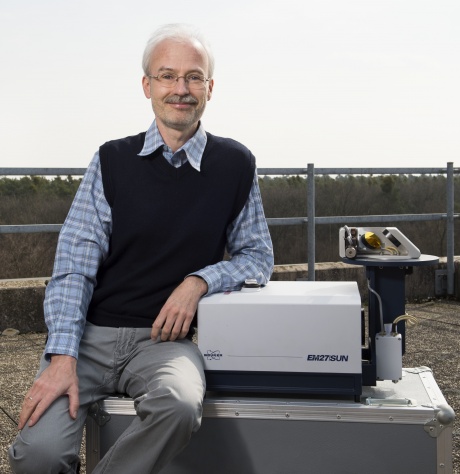 Frank Hase合作论文数Forschungszentrum Karlsruhe6
 Fabiano Oyafuso合作论文数6
 Manvendra Dubey合作论文数Los Alamos National Laboratory;Physics Department, New Mexico Institute of Mining and Technology6
 Frédéric Chevallier合作论文数Laboratoire des Sciences du Climat et de I'Environnement6
 Vijay Natraj合作论文数Jet Propulsion Laboratory, California Institute of Technology;Joint Institute for Regional Earth System Science and Engineering, University of California, Los Angeles6Thomas P. Kurosu合作论文数6
 Randy Pollock合作论文数California Institute of Technology;Jet Propulsion Laboratory;Jet Propulsion Laboratory, California Institute of Technology6
 Lukas Mandrake合作论文数Jet Propulsion Laboratory, California Institute of Technology6Omaira García合作论文数Centro de Investigación Atmosférica de Izaña, Agencia Estatal de Meteorología6




