Rewetting of drained agricultural land is expanding across Europe to meet climate and biodiversity targets, yet the relative roles of post‐rewetting management and restoration age in shaping vegetation remain poorly resolved. We surveyed vascular plant communities and soils in 69 plots across 12 rewetted former croplands (6–22 years since rewetting) in Central to Northern Jutland, Denmark. Plots were subject to three management regimes: summer grazing, mowing or no active management. We quantified species richness, Shannon diversity, community uniquity (prevalence of regionally uncommon species), and the forb:graminoid ratio, and related these metrics to management, restoration age and soil conditions (pH, C:N ratio, plant-available P, Ellenberg indicators). Canonical correspondence analysis and PERMANOVA showed that management and soil gradients jointly structured species composition, with distinct assemblages in grazed, mown and unmanaged plots. Generalised linear mixed models revealed that summer grazing and mowing significantly increased plant species richness, Shannon diversity and community uniquity relative to unmanaged plots, whereas restoration age had no detectable effect on any vegetation metric within the 6–22 year timeframe. The forb:graminoid ratio was largely unaffected by management and increased with plant-available P. Our results indicate that, on intensively farmed soils, active management after rewetting is more important than time since restoration for promoting diverse, conservation-relevant wetland plant communities. Designing rewetting projects without explicit plans for grazing or mowing is therefore likely to limit biodiversity outcomes.
This perspective paper draws on insights from a 2024 symposium entitled ‘Exploring methods for researching shifts in knowledge production for agroecology transition’. The symposium critically examined emerging conceptual and methodological challenges arising from combining agroecology with living labs and research infrastructures as key instruments promoted within EU policy to strengthen Agricultural Knowledge and Innovation Systems (AKIS). Through presentations, group discussions, and iterative reflections, we identified four key tensions: structural constraints limiting farmers’ agency within living lab approaches, the problematic nature of AKIS as supposedly neutral frameworks, the oversimplification of transition frameworks as linear rather than overlapping categories, and risks of definitional dilution or cooptation. We then demonstrate that these tensions are not unique to agroecology, bridging the concepts and methods within agroecology research with those used in other fields of sustainable food system transition research, such as transdisciplinary research and sustainable transitions. This conceptual mapping of shared tensions reveals opportunities for mutual learning. Bridging these fields would help create clarity at the conceptual and methodological levels, ultimately strengthening the theoretical foundations and enabling more nuanced approaches to food system transition research.
Constructed dune lakes and slacks are increasingly used to restore wetland biodiversity in stabilized European dune landscapes, yet their ecological equivalence to natural systems remains unclear. We surveyed vascular plant communities and water chemistry in 78 dune wetlands in western Jutland, Denmark (39 constructed, 39 natural). Species frequency data were Hellinger-transformed and analyzed with redundancy analysis (RDA), variance partitioning, and mixed models to identify environmental and contextual drivers of community assembly, richness and diversity. Communities in constructed and natural lakes differed significantly (overall RDA: p = 0.001, R(2)adj = 0.288). pH, total nitrogen (TN), and fine benthic organic matter (FBOM), together with lake origin and area, were the strongest predictors of species composition. Variance partitioning showed a dominant site effect (pure site fraction approximate to 15% of total variance), with smaller but significant pure fractions for environment (similar to 6%) and lake origin (similar to 3%), and substantial shared fractions among these components. Generalized linear mixed models indicated that constructed lakes supported higher plant richness and Shannon diversity than natural lakes (richness IRR approximate to 2.5; both p < 0.001). Additionally, diversity increased with lake area and pH and decreased with nitrate; grazing had only marginal effects, likely reflecting low replication. Overall, constructed dune wetlands support diverse but compositionally distinct, early-successional plant species assemblages. Rather than replacing natural systems, they complement them at the landscape scale. Effective restoration should couple water-quality management (especially nitrogen control and pH buffering) with landscape-level planning to address strong site effects and dispersal limitations.
European agrifood systems face many challenges and dilemmas regarding sustainability, resilience and competitiveness. Through consultations with scientific experts, we identified five systemic lock-ins (governance and policy fragmentation; behavioural and dietary challenges; political economy and market dynamics; unaccountability and environmental degradation; disruption and unpredictability as the new norm) hindering agrifood systems transformation. Based on concrete examples, we propose five guiding principles that, in various combinations, can help address lock-ins and guide effective changes towards more healthy and sustainable food systems. Their successful implementation requires strong, experience-inspired, science-based political and business leadership supported by a revised research and innovation agenda.
Agroforestry and the presence of trees in agricultural landscapes produce a multitude of potential environmental, climate, and farm system benefits. To unlock these potentials, farmers and landowners’ perceptions of trees are important to consider. Most attempts to understand the barriers and opportunities for agroforestry experienced by European farmers have, so far, dealt with farmers as a homogenous group. This study analyses the diversity of perceptions among groups of farmers, to understand their varying capacities for and interest in agroforestry. Key differences were identified by applying farm typologies to a large questionnaire dataset on Danish farmers’ perceptions of drawbacks, benefits and multi-functional values of incorporating trees on their farms. Patterns in the data are assessed using χ2-tests of independence and correspondence analyses. The four groups of farmers compared were conventional full-time farmers, organic full-time farmers, conventional part-time farmers, and organic part-time farmers. Comparison revealed that both full- and part-time organic farmers are more likely to believe that agroforestry is a more climate- and environment-friendly way to farm than conventional full-time farmers. Conventional full-time farmers perceived barriers and costs of trees in fields to be larger than the two organic groups, and conventional part-time farmers were most inclined to find agroforestry questions irrelevant. We conclude that the potential for increasing agroforestry in Denmark might be most easily reached by targeting policies toward organic farmers.
Climate-smart agriculture (CSA) has emerged as a promising strategy for sustainably addressing the impacts of climate change by enhancing productivity and adaptability, reducing greenhouse gas (GHG) emissions, and ensuring food security. While research has examined the benefits, effects, and barriers to the widespread adoption of CSA practices, knowledge of the temporal perspective influencing adoption decisions in Africa remains limited. This study aims to identify the most widely adopted CSA practices, understand how farmers’ temporal perspectives shape decision-making, and examine the influence of financial, institutional, market, and policy mechanisms on CSA adoption. The study examined 55 core articles on CSA in Africa, using the PRISMA framework to search for and select the documents. Data were obtained from the Web of Science and Scopus databases. The findings revealed a diverse range of CSA practices implemented in different countries across Africa. These include conservation agriculture (63
Agricultural expansion, intensification, and specialization improved human well-being over centuries, but they also contributed to current sustainability challenges. While historical transitions in agricultural production systems have significantly shaped present-day land-use patterns, their long-term legacy effects remain underexplored in sustainability research. Addressing this gap, our study provides a novel and comprehensive analysis of the spatial and temporal dynamics of agricultural land-use transitions in Denmark from 1861 to 1907, compared to recent times. We developed a method to trace and map the trends and patterns of transitions and investigate how historical changes in agricultural land management influence contemporary land-use patterns in Denmark, providing insights relevant to sustainability transitions more broadly. Using detailed parish-level agricultural statistics, we identified archetypes of historical agricultural systems based on dominant production types. We then assessed legacy effects by linking these past system archetypes to present-day land-use patterns using random forest regression and correlation analysis, while controlling for soil quality, population density, and market accessibility. We define land-use legacies as enduring impacts of historical agricultural system characteristics that continue to shape present-day land-use patterns. Our findings reveal positive correlations between historical and present indicators of feed crop yields and livestock densities (cattle and pigs), showing strong regional continuity, influencing modern agricultural patterns, and confirming the persistence of land-use legacies in Denmark. A major historical transition from mixed and plant-based systems to specialized livestock-intensive systems is confirmed by negative correlations and regional differences in crop production. These findings demonstrate that historical agricultural practices exert a long-lasting influence on current land use. Recognizing such legacy effects is critical for designing adaptive, regionally tailored policies and management strategies that support sustainable food system transitions. More broadly, our study contributes to international debates on path dependence, resilience, and transformation in agri-food systems, offering lessons that extend beyond the Danish case.
CONTEXT: Intensive agriculture is a complex, partially industrial and partially circular system that stretches outside the boundaries of fields, herds, and farms. Increasing circularity in agriculture for both environmental and economic reasons requires ex-ante assessment tools designed to operate at the same scale and level of complexity. OBJECTIVE: To address this, we developed the CIRKUL AE R model, which evaluates system-wide climate and environmental effects of changing agricultural practices at a highly interconnected regional scale. METHODS: The model estimates inputs, outputs, emissions and the flow of biomass, C, N, P, K and energy from crop cultivation and animal production to storage and processing of biomass. We demonstrate the capabilities of CIRKUL AE R in a case study based in Denmark, which explored the substitution of cereals with protein crops followed by different storage and utilization steps. We considered twelve scenarios, each involving one of four protein crops (grass-clover, organic grass-clover, alfalfa and faba beans) in one of three soil types (coarse sand, irrigated sand and clay). RESULTS AND CONCLUSIONS: The greatest differences from business-as-usual baseline were seen in grassclover, organic grass clover and alfalfa scenarios. Here, biomass processing led to reduced soya imports and increased biogas production, an increase in direct and indirect farm-related GHG emissions and a considerable increase in soil carbon sequestration which, combined, resulted in a decrease in net farm-related GHG emissions. Finally, out-of-farm GHG emissions increased for grass-clover, while a reduction in alfalfa and faba bean was driven by lower N fertilizer imports. SIGNIFICANCE: These findings represent valuable insights for planning future incentives and policies in agriculture. In addition, the wide range of scenarios that can be evaluated by the CIRKULfER model underpin the potential of the model to support decision makers.
The utility of remotely sensed data is becoming increasingly relevant for agroecological studies and practical agricultural applications, promoting a more sustainable development. Advancements in satellite technology continue to progress, offering higher spatial resolutions, a greater variety of sensors, and improved temporal frequencies. These developments enhance the accessibility and applicability of remote sensing data, enabling more precise monitoring of agricultural systems and providing new perspectives for implementing more efficient, environmentally friendly practices. This review aims to present a selection of current remote sensing applications in agriculture, with a focus on their potential to facilitate a transition towards more sustainable management practices. A systematic approach was used to identify, select, and synthesize relevant studies that demonstrate different applications of remote sensing methods in agriculture. The selected studies were examined within three key areas of sustainable agricultural management: i) nutrient management, ii) the environmental impacts of production, and iii) food security. The findings highlight that while remote sensing technologies offer valuable insights into agricultural sustainability, challenges remain in terms of data integration, accuracy, and scalability. Overcoming these challenges will require interdisciplinary collaboration, advancements in data processing techniques, and the integration of remote sensing with other agricultural management tools, ultimately enabling implementation of data-driven decision-making that promotes long-term sustainability in agriculture.
Agricultural intensification is increasingly putting pressure on biodiversity, aquatic environments, and the climate, with impacts varying by landscape vulnerability. Integrated approaches that account for spatial variation and optimize multifunctionality are essential for sustainable land management under competing demands. This study applied high-resolution farm and geographical data within a simple, easily replicable geospatial method to assess single and multiple benefits across selected indicators, Environment, Climate, Nature, Economy, and Policy, when implementing a land-use change, exemplified by a theoretical beef system at the landscape scale, where the required land area was estimated to meet a predefined production goal. Agricultural fields were selected in an accumulative, stepwise manner, beginning with those most suitable according to the five indicators, until the target land area was reached. Prioritizing the most suitable fields revealed synergies between Climate and Nature indicators, as well as between Nature and fields with low economic value. While targeting multiple benefits (three or more indicators) reduced the total area selected and associated national-scale gains, it increased per-hectare benefits and maintained significant local advantages. This study demonstrates that integrating multiple indicators into land-use prioritization can enhance per-hectare benefits and maintain substantial local advantages, even when national-scale gains decline. The proposed method provides a practical, transparent tool for identifying multifunctional land-use opportunities and initiating dialogue with stakeholders, supporting more sustainable and context-sensitive land management under competing demands.
To evaluate the environmental impact across multiple dairy farms cost-effectively, the methodological framework for environmental assessments may be redefined. This article aims to assess the ability of various statistical tools to predict impact assessment made from a Life Cyle Assessment (LCA). The different models predicted estimates of Greenhouse Gas (GHG) emissions, Energy (E) and Nitrogen (N) intensity. The functional unit in the study was defined as 2.78 MJMM human-edible energy from milk and meat. This amount is equivalent to the edible energy in one kg of energy-corrected milk but includes energy from milk and meat. The GHG emissions (GWP100) were calculated as kg CO2-eq per number of FU delivered, E intensity as fossil and renewable energy used divided by number of FU delivered, and N intensity as kg N imported and produced divided by kg N delivered in milk or meat (kg N/kg N). These predictions were based on 24 independent variables describing farm characteristics, management, use of external inputs, and dairy herd characteristics. All models were able to moderately estimate the results from the LCA calculations. However, their precision was low. Artificial Neural Network (ANN) was best for predicting GHG emissions on the test dataset, (RMSE = 0.50, R2 = 0.86), followed by Multiple Linear Regression (MLR) (RMSE = 0.68, R2 = 0.74). For E intensity, the Supported Vector Machine (SVM) model was performing best, (RMSE = 0.68, R2 = 0.73), followed by ANN (RMSE = 0.55, R2 = 0.71,) and Gradient Boosting Machine (GBM) (RMSE = 0.55, R2 = 0.71). For N intensity predictions the Multiple Linear Regression (MLR) (RMSE = 0.36, R2 = 0.89) and Lasso regression (RMSE = 0.36, R2 = 0.88), followed by the ANN (RMSE = 0.41, R2 = 0.86,). In this study, machine learning provided some benefits in prediction of GHG emission, over simpler models like Multiple Linear Regressions with backward selection. This benefit was limited for N and E intensity. The precision of predictions improved most when including the variables "fertiliser import nitrogen" (kg N/ha) and "proportion of milking cows" (number of dairy cows/number of all cattle) for predicting GHG emission across the different models. The inclusion of "fertiliser import nitrogen" was also important across the different models and prediction of E and N intensity.
Anthropogenic production of reactive nitrogen (N _r ) amplifies the negative impact of excess N _r on the environment, causing harm to both ecosystems and human health. N-footprint tools offer a valuable method for predicting N _r emissions, helping to identify leakage points across the entire production chain, from farm to plate. This study estimates the N-footprint of an average Danish individual based on population-based consumption patterns. The results indicate an annual N-footprint of 27.5 kg N cap ^−1 yr ^−1 . Food production and consumption account for 82% of the N-footprint, with agricultural production and consumption at 22.7 Kg N cap ^−1 yr ^−1 . Goods and services constitute 12% of the footprint (3.2 kg N cap ^−1 yr ^−1 ), followed by transport at 4% (1.1 kg N cap ^−1 yr ^−1 ) and housing at 2% (0.5 kg N cap ^−1 yr ^−1 ). Denmark has implemented extensive environmental policies that have successfully mitigated part of the N _r load to the environment. While top–down regulatory frameworks play a crucial role, this study emphasizes the significance of individual agency in shaping consumption patterns and reducing N _r emissions. A holistic approach to N _r management is essential, integrating stringent regulations with community-driven initiatives. The study highlights three key abatement strategies for Denmark: (1) shifting Danish meat and meat derived consumption (71% of the diet) towards more plant-based alternatives, (2) improving nitrogen use efficiency at the farm gate level and (3) reducing waste and enhancing recycling throughout the entire farm-to-plate supply chain. By combining policy-driven measures with individual actions, Denmark can further mitigate the environmental impact of N _r .
Irrigation unintentionally delivers reactive nitrogen to croplands via nitrate-rich water (NIrrig), yet this input remains largely absent from nitrogen budgets and policies. Here, we compile over 1300 field observations of NIrrig to quantify its magnitude and agronomic relevance, and upscale its global contribution. While the median inputs reached 19 kg N ha-1 yr-1, 10% of observations exceeded 100 kg N ha-1 yr-1. Globally, we estimate that irrigation supplies 14 Tg N yr-1, equivalent to 14% of synthetic fertilisers in croplands. Hotspots emerge in regions with intensive irrigation and high inputs, highlighting NIrrig as a substantial but underused nitrogen source. Our findings expose a major overlooked component of agricultural nitrogen budgets, offering a pathway to reduce fertiliser overuse, enhance nitrogen use efficiency and promote nitrogen circularity in irrigated systems.
The Danish EPA has in the 3rd River Basin Management Plan (RBMP) under the Water Framework Directive set target nitrogen loads for each coastal water for how to reach the reduction needed from coastal catchments to be implemented in 2027. In this context four locally based pilotprojects have been initiated to engages stakeholders to find local solutions for the RBMP. One of these new pilots are focusing on the Hjarbæk estuary situated in Limfjorden being one of the coastal water bodies in Denmark that needs the highest reductions in nitrogen loadings to be achieved before 2027 (ca. 65 %). This new project involving a coastal water board with all main stakeholders in the region being represented was initiated in February 2023 and has delivered proposals for 2 scenarios by the end of 2023 that can assure that the Hjarbæk estuary reach the target of achieving good ecological conditions.Because of the high reductions in nitrogen loadings needed it is necessary to reduce all sources and both nitrogen and phosphorus to reach the goal. Focus in the RBMP has so far been to reduce the total nitrogen (TN) loadings. In the locally based scenarios phosphorus has gained greater focus. Our calculations show that every ton of phosphorus that is removed corresponds to removing 22 tons of nitrogen in Hjarbæk Fjord. To be most cost-effective the effort will be carried out based on the principle of achieving the greatest possible effect per area unit. For that a detailed mapping of nitrogen (N) attenuation in the catchment have been conducted at a scale of ca. 15 km2 (ID15 sub-catchments) including mapping of both N-retention in groundwater and surface waters as well as N-delays in groundwater in Karst sub-catchments. The mapping shows huge differences in N-retention in both groundwater and surface waters within the ID15 sub-catchment (80 %).The local engagement of stakeholders representing all sectors in the catchment and estuary have worked together to set up two scenarios that includes: i) marine mitigation measures such as mussel farming and eelgrass planting; ii) reductions in point source loadings; iii) use of a new portfolio of N mitigation measures to be adopted at source (e.g. catch crops, early seeding, set a side, afforestation, etc.); iv) use of transport mitigation measures from field to surface water (several types of constructed wetlands, riparian buffers and restored wetlands); v) the possible use of different phosphorus mitigation strategies in the catchment (lowering bank erosional P-losses, buffer strips, afforestation, etc.).
Natural environments face substantial challenges from human activities related to food, feed, and energy production. Unsustainable nutrient management is a key issue, with excess nutrients leaching into the groundwater cycle or escaping intended cropland through other pollution pathways ending up in the atmosphere or in nearby coastal systems. This nutrient loss depletes soil health, contributes to the climate crisis and impacts water quality, especially when combined with intensive farming practices lacking conservation efforts. Innovative mitigation actions, such as the Nature-based Solutions framework, designed to enhance water quality and advance sustainability in agricultural management, require thorough assessment and monitoring to encourage stakeholder participation in these strategies. Conducting research to explore the extent of their effects is thus essential, with a deeper understanding of the nutrient cycle playing a pivotal role in achieving these goals.With the cumulatively increasing availability of remote sensing data sources and advancements in machine learning technologies, automating monitoring and assessment efforts has become a hot and important topic. The challenge is to construct transparent and transferable models capable of working with real-time data to accurately predict crop types, crop status or other desired features. The primary goal of this study is to investigate how an automated multisource data analysis approach, with a focus on remotely sensed data, can support the quantification and mapping of sustainability efforts in agricultural crop management while enhancing the understanding of nutrient flow within large-scale agricultural catchments. Centered on the Hjarbæk Fjord in Denmark, the study also aims to assess the transferability of its models across different sites in Europe. This research is part of a broader project investigating the potential of integrating permanent grasslands into crop rotations as a Nature-based Solution in the catchments surrounding Hjarbæk Fjord. The project aims to develop a decision support tool to guide the planning and optimization of grassland implementation in terms of extend and location. This tool is designed to maximize benefits across various parameters, including the number of stakeholders impacted, economic considerations, crop yield, biodiversity, and other critical factors. The output of the current study, involving the training of a deep learning model to predict cropland trends related to grassland implementation, can in turn be integrated as input for the described decision support tool.This is an explorative study that relies on the availability of accurate ground truth data to train and validate a deep learning model, providing insights into trends associated with the implementation of sustainable management strategies. A key challenge lies in acquiring knowledge of and access to comprehensive datasets that capture relevant parameters, such as actual yield values, quantitative values of nutrients in different stages of the growth season and different nutrient pools within the cropland environment, accurate accounts of management actions and other contributors to the nutrient cycle. Additional challenges involve preprocessing satellite data to establish a robust pipeline for the automated collection of satellite imagery, ensuring a coherent time series. This includes addressing temporal and spatial data gaps through extrapolated estimations to create a consistent dataset.
The impact of climate change on agriculture in sub-Saharan Africa has been significant in recent years, particularly affecting smallholder farmers in semi-arid regions in Tanzania. Although research on climate-smart agriculture (CSA) practices has grown, the synergies and potential trade-offs from such practices among smallholder farmers in Tanzania's semi-arid regions have received little attention. To address this, 299 households were interviewed and path analysis was used to analyze the data collected. Correlations between CSA practices used in maize farming in semi-arid areas of Tanzania were analysed as well as direct and indirect effects of access to credit, non-governmental organizations (NGOs) assistance, Membership in organisations, distance to market and CSA training on increasing maize yields. The results showed that access to credit, assistance from NGOs, membership in an organization, distance to market, and CSA training act as mediating factors between CSA practices and an increase in maize yield. The study found that improved varieties were positively correlated with changes in planting date, use of animal manure, minimum tillage, intercropping, mixed cropping, and livestock diversification (P<0.05). The study emphasizes the importance of implementing these practices together to generate a positive impact and increase smallholder farmers' crop yields and resilience to climate change in semi-arid regions. The study recommends that in order to increase synergies and minimize trade-offs between climate-smart agriculture (CSA) practices the government and non-governmental organizations strengthen the extension system, promote access to CSA training, and make affordable credit available through financial organizations.
 Jørgen E. Olesen合作论文数Department of Agroecology, Aarhus University55
 Nicholas J. Hutchings合作论文数Faculty of Agricultural Sciences, University of Aarhus (AU),41
 Chris Kjeldsen合作论文数Faculty of Agricultural Sciences, University of Aarhus39
 Morten Graversgaard合作论文数Department of Agroecology, Aarhus University30
 Uffe Jørgensen合作论文数Dept Agroecol, Aarhus Univ30
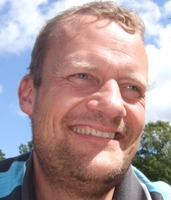 Henrik Vejre合作论文数Department of Geosciences and Natural Resource Management, Faculty of Science, University of Copenhagen16
 Peter Stubkjær Andersen合作论文数Department of Geosciences and Natural Resource Management, Faculty of Science, University of Copenhagen15
 Brian H. Jacobsen合作论文数Department of Food and Resource Economics, Faculty of Science, University of Copenhagen15
 W (Wim) de Vries合作论文数Wageningen University & Research15Jerzy Bieńkowski合作论文数14
 Mette Vestergaard Odgaard合作论文数14Ulrike Dragosits合作论文数Centre for Ecology and Hydrology Edinburgh, Bush Estate, Edinburgh, Scotland EH26 0QB, UK14
 Jens-Christian Svenning合作论文数Center for Ecological Dynamics in a Novel Biosphere, Department of Biology, Aarhus University;Center for Sustainable Landscapes under Global Change, Department of Biology, Aarhus University;Aarhus Institute of Advanced Studies, Aarhus University;15. Juni Fonden13
 Mark Theobald合作论文数Centre for Ecology;Research Station, Edinburgh;Centre for Ecology, Edinburgh Research Station12
 Niels Halberg合作论文数International Centre for Research in Organic Food Systems12Pierre Cellier合作论文数12
 Ranjan Parajuli合作论文数11
 Marie Trydeman Knudsen合作论文数Dept. of Agroecology, Aarhus University11
 Berit Hasler合作论文数National Environmental Research Institute, Aarhus University11
 Christen Duus Børgesen合作论文数Department of Agroecology, Aarhus University11
 Peder Klith Bøcher合作论文数Ecoinformatics & Biodiversity Group, Aarhus University11
 Albert Bleeker合作论文数Öko-Data GmbH;Institute of Navigation;Stuttgart University10
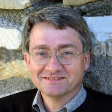 Mark Sutton合作论文数Institute of Global Change, School of GeoSciences, The University of Edinburgh9
 Beate Strandberg合作论文数National Environmental Research Institution, University of Aarhus9
 Durand Patrick合作论文数INRA AgroCampus Ouest9
 Kirsten Schelde合作论文数Department of Agroecology, Danish Institute of Agricultural Sciences9
 Hansen Birgitte合作论文数Department of Quaternary and Groundwater Mapping, Geological Survey of Denmark and Greenland (GEUS),8Marianne Bruus合作论文数8
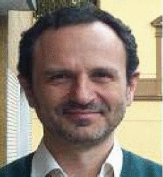 Vincenzo Magliulo合作论文数Institute for Mediterranean Agriculture and Forest Systems, National Research Council8Inge Toft Kristensen合作论文数7siri pugesgaard合作论文数7
 Mette Termansen合作论文数Department of Food and Resource Economics, Faculty of Science, University of Copenhagen7
 Lærke Thorling合作论文数7
 Jan Kofod Schjørring合作论文数Section for Plant and Soil Sciences, Department of Plant and Environmental Sciences, University of Copenhangen7Marchi Chiara合作论文数7
 Ole Hertel合作论文数Faculty of Technical Sciences, Aarhus University;Department of Ecoscience, Aarhus University;Roskilde University7
 Lisbeth Mogensen合作论文数7
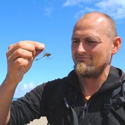 Kent Olsen合作论文数7
 Ib Sillebak Kristensen合作论文数7Liselotte Wesley Andersen合作论文数aarhus university7
 Eva Boegh合作论文数Institute of Geography, University of Copenhagen7Kathrin Happe合作论文数7
 Steen Brock合作论文数Department of Philosophy and the History of Ideas, Aarhus University7
 Erling Andersen合作论文数Forest and Landscape, University of Copenhagen7Kristoffer Piil合作论文数6katrine grace turner合作论文数6
 Fatemeh Hashemi合作论文数Department of Agroecology, Aarhus University6
 Jesper Brandt合作论文数6
 Lutz Breuer合作论文数Psychiatrische und Psychotherapeutische Klinik, Friedrich-Alexander-Universität Erlangen-Nürnberg6




