Automatic target recognition has been one of the hottest research in synthetic aperture radar (SAR) data processing. Noticing that popular recognition methods cannot utilize multiple features of SAR complex data, a method fused scattering center feature and deep convolutional neural network (CNN) feature is proposed in this letter. This method contains three key parts, namely, scattering center extraction and reconstruction block, CNN feature extraction block, and final feature fusion and classification block. In this process, the scattering center feature and CNN feature are fused at the level of feature maps, which retain the space information of 2-D feature maps. What is more, the proposed half end-to-end strategy realizes the automatic update of weighting parameters in feature extraction network and subnetwork, which promotes a better recognition efficiency. Experimental results on measured SAR data show that the proposed method can achieve better accuracy than other single feature-based methods and feature fusion methods.
Multiple azimuth channels (MACs) synthetic aperture radar (SAR) can theoretically achieve high azimuth resolution and wide swath (HRWS). Nevertheless, in practice, channel mismatch will lead to ghost or azimuth ambiguities, which will degrade the imaging quality. This article proposes a novel idea for estimating the channel mismatch of MACs SAR in the image domain. First, we found that the degree of freedom (DOF) of MACs signals doubles after signal reconstruction and imaging. As a result, when the channel number is not great enough, the subspace method for error estimation is unable to be implemented. To deal with this problem, we introduce a DOF compression method based on spectral filtering. This method can decrease the image-domain DOF. Finally, an image-domain subspace method is proposed to estimate the channel phase error, using the focused data and selecting the high SNR region of SAR images. The proposed method has advantages for the channel phase error estimation. Simulated space-borne MACs SAR data and real measured airborne SAR data are processed to demonstrate the effectiveness of the proposed method.
Spaceborne synthetic aperture radar (SAR) can operate at various modes, including stripmap mode, spotlight mode, sliding spotlight mode, and Terrain observation by progressive scans (TOPS) mode. These four imaging modes can be regarded as unified, differing in rotation-center ranges. To uniformly focus the data of these four imaging modes in real-time, this article proposes a real-time unified focusing algorithm (RT-UFA) for the multi-mode SAR via azimuth sub-aperture complex-valued image combining and scaling. The imaging processing can be performed while the data are being recorded. In the first stage of imaging, sub-aperture complex-valued images with relative low-resolution can be obtained by the cascade of the extended chirp scaling (ECS) and azimuth dechirp. Then, these complex-valued images are coherently combined by shifting the integer number of pixels, and thus the full-resolution image of all the recorded data can be obtained. The azimuth scaling and the pixels shifting in the RT-UFA are analyzed in detail. Simulation and SAR data results are presented to validate the analysis and RT-UFA.
Ship motions during long coherent processing interval (CPI) have six degrees of freedom, and the oscillatory motions are roughly periodical. The traditional ship imaging methods usually use a short time interval to form an image, while the image quality may suffer from low resolution, poor signal-to-noise ratio (SNR), and scatter scintillation. Using a longer CPI to generate an image may improve the quality but, however, largely increase the focusing difficulty. In this article, we investigate the focusing challenges of oscillatory ships with long CPI. Through analyzing the relative motion between the radar and the ship, the properties of wavenumber domain support (WDS) and point spreading function (PSF) of oscillatory ship imaging are studied. It is illustrated that the WDS is a 3-D sparse curved surface generated by the complex relative motion, with a time-variant energy density, nonparallel spectrum boundaries, and a complex structure. The PSF of an oscillatory ship may have a 3-D resolution but also multiple high-level sidelobes. The relationship between the WDS and the nonideal PSF is illustrated with the projection slice theorem (PST). Moreover, it is discussed that the scatterers distributed on a 3-D ship cannot be focused uniformly on a 2-D imaging plane (IP) due to the variation of the slant-range plane (SRP). The projection relationships of the resolutions and focusing positions between the SRP and the IP are also derived. Simulation results are presented to validate the analyses throughout this article.
The water body detection in high-resolution synthetic aperture radar (SAR) images is a challenging task due to the changing interference caused by multiple imaging conditions and complex land backgrounds. Inspired by the excellent adaptability of deep neural networks (DNNs) and the structured modeling capabilities of probabilistic graphical models, the cascaded fully-convolutional network (CFCN) is proposed to improve the performance of water body detection in high-resolution SAR images. First, for the resolution loss caused by convolutions with large stride in traditional convolutional neural network (CNN), the fully-convolutional upsampling pyramid networks (UPNs) are proposed to suppress this loss and realize pixel-wise water body detection. Then considering blurred water boundary, the fully-convolutional conditional random fields (FC-CRFs) are introduced to UPNs, which reduce computational complexity and lead to the automatic learning of Gaussian kernels in CRFs and the higher boundary accuracy. Furthermore, to eliminate the inefficient training caused by imbalanced categorical distribution in the training data set, a novel variable focal loss (VFL) function is proposed, which replaces the constant weighting factor of focal loss with the frequency-dependent factor. The proposed methods can not only improve the pixel accuracy and boundary accuracy but also perform well in detection robustness and speed. Results of GaoFen-3 SAR images are presented to validate the proposed approaches.
This article presents a fast back-projection (BP) algorithm based on subaperture (SA) image coherent combination in a downsampled Cartesian coordinate grid for high squint diving terrain observation by progressive scans (HSD-TOPS) synthetic aperture radar (SAR) ground plane imaging. A two-step spectrum compression (SC) method is proposed to coherently combine the aliasing SA images by exploiting the relationship between the wavenumber and the image frequency. The first-step SC is introduced to align the spectrum support region centers. The second-step SC effectively corrects the space-variant spectrum inclination. The proposed algorithm does not need interpolation in the process of image combination, which ensures the accuracy and the efficiency of the algorithm. Furthermore, the SC method is well-modified to suppress the sidelobes of the focused image. Simulation and measured data processing verify the effectiveness of the proposed method.
The microwave photonic (MWP) radar technique is capable of providing ultrawide frequency bandwidth waveforms to generate ultrahigh-resolution (UHR) inverse synthetic aperture radar (ISAR) imagery. Nevertheless, conventional ISAR imaging algorithms have limitations in focusing UHR MWP-ISAR imagery, where high-precision high-order range cell migration (RCM) and phase correction are crucially necessary. In this article, a UHR MWP-ISAR imaging algorithm integrating rotation estimation and high-order motion terms compensation is proposed. By establishing the relationship between parametric ISAR rotation model and high-order motion terms, an average range profile sharpness maximization (ARPSM) is developed to obtain rotation velocity by using nonuniform fast Fourier transform (NUFFT). Second-order range-dependent RCM is corrected with parametric compensation model by using the rotation velocity estimation. Furthermore, the spatial-variant high-order phase error is extracted to compensation by the entire image sharpness maximization (EISM). A new imaging framework is established with two one-dimensional (1-D) parameter estimations: ARPSM and EISM. Extensive experiments demonstrate that the proposed algorithm outperforms traditional ISAR imaging strategies in high-order RCM correction and azimuth focusing performance.
For high speed maneuvering platforms, multichannel synthetic aperture radar (SAR) can realize wide swath imaging more flexibly at a high squint. In this mode, the signal reconstruction and imaging is a challenging task because the direction of the channel array vector is time-variant and inconsistent with the radar velocity vector. In this paper, the properties of space time spectrum are analyzed in detail at first. It is found that the space time spectrum of the signal is irregular, in which the space time spectral lines are nonlinear and there is a massive Doppler spectrum shift. Therefore, a range-dependent signal reconstruction method based on space time spectrum correction is proposed to obtain the unambiguous Doppler spectrum. For wide-swath data processing, an improved Omega-K approach based on time domain spectrum compression is further proposed to obtain a well-focused image. A modified Stolt mapping is used to address the range variations of range cell migration (RCM). Subsequently, a time domain spectrum compression function is used to eliminate the time domain aliasing of small-aperture data without zero-padding. Simulation results and real data processing are presented to validate the proposed algorithm. ? 2021 Elsevier B.V. All rights reserved.
In this article, a quality of service constrained-resource allocation (QoSC-RA) scheme is built for multiple target tracking (MTT) in radar sensor network. This QoSC-RA scheme can not only divide radar sensors into several groups to illuminate multiple targets separately but also optimize the transmit resource of the radar sensors in different groups. In such a case, we can minimize the total resource consumption of a radar sensor network while achieving the desired MTT accuracy. The QoSC-RA scheme is formulated as a mathematical optimization problem and is shown to possess two sets of conflict constraints (the QoS constraints and the resource constraints). When the problem is feasible, we analyze its optimality based on the Karush-Kuhn-Tucker conditions and subsequently design appropriate solution methods to solve it efficiently. When the problem is infeasible, we relax it as a feasible one by enlarging its feasible domain and use a gradient projection method to achieve a compromise solution. Simulation results demonstrate that the QoSC-RA process can achieve predetermined MTT performance with smaller resource consumption than the uniform allocation scheme.
Since path curvature becomes severer for higher orbit synthetic aperture radar (SAR), the stripmap mode may not provide a reliable azimuth resolution under different look angles or at different positions. Beam steering is especially valuable herein for adjusting the azimuth resolution under different observation conditions by designing the antenna steering rate. Moreover, considering that the large range migration and center range variation in the squint mode may increase the echo length and reduce the achievable scene width, we proposed a novel 2-D beam steering (TDBS) method, which promises not only a required azimuth resolution but also a wide swath (or shortened echo length) at squint when cooperated with the variable interpulse time (VIPT) technique. The simulation results obtained under different look directions are shown to validate the effectiveness of the proposed beam controlling method.
Dual satellite TDOA/FDOA localization is achieved by the TDOA hyperboloid and FDOA hyperboloid. The accuracy of localization is affected by TDOA/FDOA accuracy. In order to measure accurately the TDOA/FDOA, a method of TDOA/FDOA measurement based on short synthetic aperture is presented. This method improves the measurement accuracy by using a certain length of synthetic aperture. For narrowband signals, the method has the ability to estimate a single satellite Doppler frequency, and the frequency difference can be obtained from the results estimated by the two satellites. For wideband signals, high-precision estimates of frequency differences can be obtained by dual satellite data interference. For short-term stable radar signals, the processing results of STK simulation data confirm the effectiveness of the proposed method.
This letter proposes a new method for focusing ground maneuvering targets and estimating the motion parameters with a synthetic aperture radar (SAR) system. In this method, the Hough transform is applied to estimate the cross-track velocity from the slope of the range walk (RW) trajectory, and the RW and Doppler centroid shift are compensated. The second-order Keystone transform is performed to correct the additional range curve caused by the along-track velocity and cross-track acceleration. Then, we adopt the adaptive polynomial Fourier transform to estimate the second-and third-order Doppler parameters from a 1-D parameter interval, and the corresponding motion parameters are calculated. Finally, the moving target is well focused after the motion parameters compensation because the second- and third-order Doppler parameters are efficiently eliminated. Both the simulated and real data processing results are presented to demonstrate the validity of the proposed algorithm.
The curved trajectory and long synthetic aperture time of medium-Earth-orbit (MEO) synthetic aperture radar (SAR) lead to a 2-D spatial variation in the signals. Traditional methods treat the range and azimuth variations separately and usually suffer from high computational complexities. In this article, we investigate the Doppler rate distribution across a large scene and exploit an optimal imaging coordinate system, in which the MEO SAR signals satisfy the azimuth-shift-invariant property. Thus, the additional processing of the azimuth spatial variation in MEO SAR imaging algorithms can be avoided, and the efficiency of the image formation processor can be obviously improved. The Doppler linearization is used to address the higher-order Doppler parameters to achieve more precise focusing, and at the same time, addresses the azimuth time shift caused by the changes of signal distribution. Finally, processing results of simulated stripmap-mode data with the 2-m resolution are presented to validate the proposed algorithm.
The rigid oscillation and flexible deformation baseline errors occur in dual-antenna unmanned aerial vehicle (UAV) SAR interferometry (InSAR). The errors caused by airflow disturbances and UAV platform mechanical oscillation will lead to interferometric phase undulation. Measuring the errors has high requirements for length and time accuracy for the equipment. In this paper, a time-varying baseline error (TBE) estimation and compensation method based on continuous time-domain subaperture data is proposed. Firstly, we model the TBE and derive its expression in each subaperture image focused by the chirp scaling dechirp (CS-dechirp) algorithm. Then it is possible to extract the estimated differential TBE (D-TBE) from the differential interferogram of overlapping scenes in subaperture images. Further, the full-aperture TBE can be obtained through an integration of the estimated D-TBE. Finally, the full-aperture compensation can be accomplished by a phase correction after the range variation estimation. Taking advantage of the time-domain subaperture, the D-TBE phases are sampled at each subaperture center time, and the proposed method can be well combined with a motion compensation algorithm in the processing flow for UAV InSAR. Furthermore, the case of low coherence is overcome. The results of simulation and real measured airborne single-pass dual-antenna data validate the proposed approach.
In reality, multiple radar system (MRS) may have some limited resource, such as the data computation capacity of the fusion center and the transmit energy of each radar. To better exploit its limited system resource, a collaborative detection and power allocation (CDPA) scheme is developed for the application of target tracking in clutter. The basis of the CDPA scheme is to use optimization technique to control the false alarm rate (FAR) and transmit power of each radar in view of the aforementioned resource constraints, while achieving better target state estimation accuracy. The Bayesian Cramer-Rao lower bound is derived, relaxed, and subsequently utilized, as the optimization criterion for the CDPA strategy. The resulting nonlinear and nonconvex optimization problem consists of two adaptable vectors, one for FAR selection and the other for power allocation. By introducing an auxiliary vector, a fast two-step solution technique is presented to jointly select the FAR and distribute the transmit power. Simulation results demonstrate that, with given data computation capability and system total power budget, the CDPA scheme can evidently expand the detection range, increase the resource utilization efficiency of the MRS, and improve the target tracking accuracy.
To facilitate the ability of phased array radar to manage both its search and track (SAT) tasks simultaneously within a predetermined illumination time budget, a resource allocation (RA) scheme for integrated SAT application is built in this paper. We formulate the RA scheme as a bi-objective constrained optimization framework, and use Pareto's theory to determine its multiple Pareto optimal solutions. With these Pareto solutions, one can find a suitable tradeoff between SAT tasks, and correspondingly choose an illumination scheme, for an arbitrary application demand. By exploiting the unique structure of the bi-objective optimization problem, we strictly prove that the multiple Pareto solutions with cardinality $M$ can be obtained by parallelly solving $M + 1$ convex minimax problems. These problems are shown to correlate with the SAT tasks independently, and are correspondingly solved by the well-known linear programming methods and a proposed minimax solving algorithm, respectively. Finally, some numerical results are provided to illustrate the effectiveness and reveal the intrinsic mechanism of the Pareto theory based bi-objective RA strategy.
Traditional clutter suppression methods are mainly studied under the condition that the pulse repetition frequency (PRF) of the system is not less than the Nyquist frequency. Whereas in the high-resolution and wide-swath (HRWS) multichannel synthetic aperture radar (SAR) system, a low PRF is used to break through the minimum antenna area constraint. The low PRF case brings new challenges to the traditional clutter suppression methods. In this letter, a subspace projection clutter suppression method is proposed based on the fact that moving targets and the clutter consist in different signal subspaces. This method can be directly applied to the HRWS multichannel SAR system, and it shows better performance compared to the space-time adaptive processing (STAP) when the moving target components cannot be ignored in the clutter covariance matrix calculation. Simulated data and airborne measured data are processed to verify its effectiveness.
Multi-mode spread-Doppler clutter (SDC), caused by a stratified ionosphere, affects the detection performance of over-the-horizon radar on slow ships. To improve a multiple-input multiple-output over-the-horizon radar (MIMO-OTHR) system's performance and to mitigate the lingering effect of SDC, a novel multi-mode SDC suppression method based on full-mode spatial separation is proposed here. Furthermore, authors' method can estimate the elevation angle of direction of departure (DOD) and direction of arrival (DOA), contributing to mode localisation. By applying the bi-orthogonality of matrices, the cost function of single-mode component analysis is constructed under a least square criterion. By iteratively solving for the cost function, and by applying a systematic multistage decomposition, the elevation DOD and DOA and the slow-time Doppler information of each mode are obtained sequentially. Compared with classical SOBI and SS-SOBI methods, the proposed method improves the output signal-to-clutter-plus-noise ratio for spatial filtering. The estimated DOD and DOA do not need to be paired, reducing the angle error inherent in the SR method while performing the transmit-receive cascade refinement searching step. Simulation results demonstrate the excellent performance of the proposed method, which is beneficial to improve the ability of MIMO-OTHR to detect slow ships and determine the propagation mode.
Considering the difficulty of pulse repetition frequency (PRF) design in multi-angle SAR when using ultra-high speed platforms, a multi-angle SAR imaging system in a unified coordinate system is proposed. The digital multi-beamforming is used in the system and multi-angle SAR data can be obtained in one flight. Therefore, the system improves the efficiency of data recording. An improved range migration algorithm (RMA) is used for data processing, and imaging is made in a unified imaging coordinate system. The resolution of different view images is the same, and there is a fixed delay between the images. On this basis, the SAR image fusion is performed after image matching. The results of simulation and measured data confirm the effectiveness of the system and the method.
A squinted observation geometry along with long integration time significantly aggravates the range walk and spatial variation of a medium-earth-orbit (MEO) synthetic aperture radar (SAR) signal. Variable pulse repeating frequency (PRF) is recommended to avoid the blockage in echo recording and save storage space. The existing wavenumber algorithms cannot handle the nonlinear and range-azimuth-coupled spatial variation (RACSP) over a large scene. In this paper, we propose a modified Stolt mapping method along with a modified joint time and Doppler resampling (JTDR) for highly squinted MEO SAR data processing. An azimuth timescale transformation is used to deal with the nonlinear spatial variation of the azimuth frequency-modulation (FM) rate. An extended Omega-K is used to linearize the range frequency and achieve range cell migration correction (RCMC). To address the RACSP, the Doppler is linearized in the range-Doppler domain using a range-dependent Doppler scale transformation. The computational complexity and geometry distortion correction (GDC) are also discussed. Simulation results are shown to verify the effectiveness of the developed focusing approaches.
 Mengdao Xing (邢孟道)合作论文数School of Electronic Engineering, Xidian University;Academy of Advanced Interdisciplinary Research, Xidian University377
 Hongwei Liu (刘宏伟)合作论文数National Key Laboratory of Radar Signal Processing, Xiidian University113
 Guangcai Sun (孙光才)合作论文数School of Electronic Engineering, Xidian University;National Lab of Radar Signal Processing, Xidian University79
 Zhenfang Li (李真芳)合作论文数School of Electronic Engineering, Xidian University65
 Guisheng Liao (廖桂生)合作论文数Hangzhou Institute of Technology, Xidian University;National Key Laboratory of Radar Signal Processing, Xidian University61
 Lei Zhang (张磊)合作论文数School of Electronics and Communication Engineering, Sun Yat-Sen University;School of Electronic Engineering, Xidian University59
 Yachao Li (李亚超)合作论文数Xidian University54
 Tong Wang (王彤)合作论文数School of Electronic Engineering, Xidian University;National Key Laboratory of Radar Signal Processing, Xidian University53
 Feng Zhou (周峰)合作论文数西安电子科技大学雷达信号处理重点实验室41
 Peng-Lang Shui (水鹏朗)合作论文数National Lab of Radar Signal Processing, Xidian University32
 Lan Du (杜兰)合作论文数School of Electronic Engineering, Xidian University;National Laboratory of Radar Signal Processing, Xidian University31
 Xiang-Gen Xia (夏香根)合作论文数Department of Electrical and Computer Engineering, University of Delaware30
 Zhiyong Suo (索志勇)合作论文数School of Electronic Engineering, Xidian University;National Key Laboratory of Radar Signal Processing, Xidian University29
 Junkun Yan (严俊坤)合作论文数School of Electronic Engineering, Xidian University26
 Yanyang Liu (刘艳阳)合作论文数24
 Yi Liang (梁毅)合作论文数National Key Laboratory of Radar Signal Processing, School of Electronic Engineering, Xidian University24
 Hongtao Su (苏洪涛)合作论文数National Lab of Radar Signal Processing, Xidian University24
 Licheng Jiao (焦李成)合作论文数School of Artificial Intelligence, Xidian University;Key Laboratory of Intelligent Perception and Image Understanding of Ministry of Education of China, Xidian University23
 Xueru Bai (白雪茹)合作论文数School of Electronic Engineering, Xidian University23
 Da-Zheng Feng (冯大政)合作论文数School of Electronic Engineering, Xidian University21
 Qisong Wu (武其松)合作论文数School of Information Science and Engineering, Southeast University20
 Bo Jiu (纠博)合作论文数School of Electronic Engineering, Xidian University17
 Bo Chen (陈渤)合作论文数National Key Laboratory of Radar Signal Processing, Xidian University17
 Shouhong Zhang (张守宏)合作论文数西安电子科技大学电子工程学院17
 Junying Zhang (张军英)合作论文数School of Computer Science and Technology, Xidian University17
 Ziqiang Meng合作论文数16
 Lei Yang合作论文数15
 Jianxin Wu (吴建鑫)合作论文数School of Artificial Intelligence, Nanjing University15Wei Jing合作论文数14
 Linrang Zhang (张林让)合作论文数School of Electronic Engineering, Xidian University14Zhenhua Zhang合作论文数14
 Xianda Zhang (张贤达)合作论文数Xidian University14
 Gang Xu (徐刚)合作论文数School of Information Science and Engineering, Southeast University;State Key Laboratory of Millimeter Waves, Southeast University13
 Wenqiang Pu (蒲文强)合作论文数Shenzhen Research Institute of Big Data12
 Shichao Chen (陈士超)合作论文数School of Electronics and Information, Northwestern Polytechnical University12
 Baochang Liu (刘保昌)合作论文数School of Marine Sciences, Nanjing University of Information Science & Technology12
 Jun Yang合作论文数12
 YingHui Quan (全英汇)合作论文数西安电子科技大学雷达信号处理国家级重点实验室11
 Taoli Yang (杨桃丽)合作论文数School of Resources and Environment, University of Electronic Science and Technology of China11
 Rui Guo (郭瑞)合作论文数School of Energy and Environment, Southeast University11
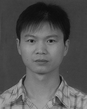 Yufeng Wu合作论文数11Jianwen Chen (陈建文)合作论文数11
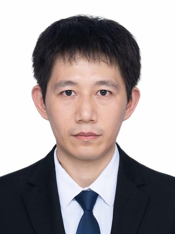 Song Zhou (周松)合作论文数School of Information Engineering, Nanchang University10
 Zhenyu Li合作论文数National Laboratory of Radar Signal Processing, Xidian University, Xi’an, China10
 Jinshan Ding (丁金闪)合作论文数School of Electronic Engineering, Xidian University10
 Hao-lin Li合作论文数10
 Chengwei Qiu (仇成伟)合作论文数Department of Electrical and Computer Engineering, College of Design and Engineering, National University of Singapore10




