As global shipping density increases, maritime traffic in complex waterways exhibits pronounced dynamic and multi-scale characteristics, while traditional static assessments struggle to support proactive risk warning. To address this gap, this study proposes a novel, unified framework that integrates prediction, clustering, microlevel complexity quantification, and Shapley-based cross-scale fusion into a single methodology. First, a Bidirectional Gated Recurrent Unit Sequence to Sequence (Bi-GRU Seq2Seq) model with a fusion attention mechanism is constructed to achieve short term vessel trajectory prediction based on AIS data. Second, predicted trajectories are clustered using the density based spatial clustering of applications with noise algorithm to identify potential encounter clusters. Third, a micro level complexity model is developed from four dimensions, namely motion trend, relative distance, distance at closest point of approach, and relative bearing, to quantify vessel interaction risk. Finally, Shapley value theory is utilized to realise nonlinear cross scale fusion from vessels to clusters and to the regional level, enabling marginal contribution analysis and interpretable macro level assessment. A case study in the Laotieshan Channel of the Bohai Sea demonstrates that the prediction model achieves a Root Mean Square Error of 84.99 m, with a maximum error reduction of 76 per cent compared with baseline models. The proposed framework effectively identifies risk hotspots and captures the aggregation and diffusion patterns of traffic complexity. By enabling a transition from static assessment to proactive risk warning, this study provides a quantifiable and interpretable methodological basis for intelligent maritime supervision, refined vessel traffic services management, and proactive traffic risk warning.
With the rapid development of Internet of Things (IoT) technology, unmanned surface vehicles (USVs), as critical nodes in distributed maritime sensing networks, have seen their autonomous collision avoidance capabilities become central to enabling coordination among multiple devices and real-time decision-making. Based on this, this article presents an intelligent strategy for collision and obstacle avoidance in USVs during multitarget encounter scenarios. A collision risk model based on the International Regulations for Preventing Collisions at Sea (COLREGs) and common practices of sailors is constructed, with it being used as a constraint for the differential evolution (DE) algorithm. The objective function is decomposed geometrically and in terms of states, transforming the evaluation of the entire path into evaluating individual path points. In this way, high-quality path points are fully utilized, and a fitness function is built based on each individual path point. The population initialization operation of the DE algorithm is improved through a chaotic multipopulation parallel optimization strategy, with a chaotic matrix being introduced to enhance search traversal. Additionally, a parameter randomization strategy is introduced in mutation and crossover operations to avoid local optima, and each subpopulation is optimized in parallel to obtain the best collision avoidance route. Finally, the simulation experiments results demonstrate that the improved DE algorithm demonstrates superior performance in both collision avoidance efficiency and path optimization, confirming the effectiveness of the approach in complex multitarget encounter scenarios.
The real-time acquisition of vessel information is essential for improving safety in maritime navigation. This research integrates camera-equipped Unmanned Surface Vehicles (USVs) with buoy-based edge computing systems to mitigate collision risks by enabling the real-time collection and preprocessing of marine environmental data. Nevertheless, the two-dimensional images obtained from cameras present challenges in precise target localization and lack comprehensive contextual information about the surrounding environment. Furthermore, frequent foggy conditions at sea generate substantial volumes of data. Given that accurate and timely dynamic vessel data are critical for navigation, the sparse distribution of maritime communication nodes hampers data transmission efficiency, thereby failing to satisfy the real-time demands of navigation support systems. To address these issues, this study proposes a marine vessel visual data edge-computing network comprising buoys and multiple USVs, accompanied by a task allocation strategy. By leveraging buoys as edge nodes to process visual data collected from USVs, the approach seeks to optimize latency and energy consumption under dynamic maritime conditions. The multi-objective optimization problem is tackled through the application of a Deep Q-Network (DQN) algorithm. By jointly scheduling USV sensing tasks and buoy edge resources, the strategy guarantees that vessel data and point-cloud maps are delivered to the shore base station within strict latency bounds, furnishing passing ships with up-to-date navigational information and reducing collision risk. Numerical simulations demonstrate the efficacy and robustness of the proposed algorithm across a range of parameter settings.
This study combines association rule mining and complex network theory to explore the key risk influential factors (RIFs) of container ship accidents and their interrelationship. Firstly, based on the 103 container ship accident investigation reports, five categories of accident RIFs such as human factors, ship factors, cargo factors, environmental factors and management factors are identified. Second, the Apriori algorithm is applied to find out the correlation between accident RIFs and the correlation between RIFs and each type of accident. Third, complex network theory is then applied to establish a vector-weighted network of container ship accident RIFs, and comprehensive network visualization is subsequently conducted. Finally, topological feature analysis is applied to comprehensively examine associations between RIFs, and robustness analysis is used to find the key container ship accident RIFs. The analysis reveals that collisions and groundings are the most frequent accidents in container ship accidents, with human factors (e.g. negligent lookout) and management factors (e.g. improper bridge resource management) being the primary RIFs. The interaction between human and management factors is most significant. Network topology analysis highlighted high-degree RIFs, enabling targeted risk mitigation strategies. This study aids in disrupting accident RIFs networks and supports intelligent shipping safety mechanisms and risk management optimization for maritime companies.
The identification of marine traffic complexity is critical for the development and implementation of intelligent maritime transportation systems. Analyzing extensive data on ship movements enhances situational awareness and aids Vessel Traffic Services Operators (VTSOs) in the real-time monitoring of complex ship behaviors in waterways. However, the predominant systems-based analysis of marine traffic predominantly utilizes undirected Marine Traffic Situation Complex Network (MTSCN), which is inconsistent with the actual navigation situation. Firstly, a directed MTSCN is constructed in this study, which accounts for the asymmetry of navigational influences between ships. Secondly, a Node Importance Evolution Model (NIEM) is developed for the directed network of marine traffic, employing two indicators: the comprehensive degree and the comprehensive strength. Finally, the evaluation performance of the NIEM is substantiated through case studies and robustness analysis. The research results show that the construction of the directed MTSCN takes into account the differences in traffic complexity between ships, the evaluation indicators consider the transmission contributions of ship nodes within the network, and therefore fits the actual nautical situation better than the undirected MTSCN. The findings confirm that the newly developed model significantly aids VTSOs in identifying high-complexity ships requiring closer supervision, thereby enhancing marine traffic management and improving maritime safety.
With the growing demand for safe obstacle avoidance and precise trajectory tracking in the autonomous navigation of unmanned surface vessels (USVs), this paper investigates an adaptive differential evolution approach for integrated path planning and tracking control. In the path planning stage, an elite archive mechanism is first incorporated into the mutation process, and the scaling factor F and crossover rate CR are adaptively adjusted to enhance population diversity and global search capability. Then, the International Regulations for Preventing Collisions at Sea (COLREGs) are embedded into the algorithmic framework to reinforce collision avoidance performance in complex encounter scenarios. A multi-objective fitness function combining six performance criteria is subsequently constructed to evaluate individual path points, thereby identifying high-quality solutions that ensure both safe navigation and route efficiency. In the tracking control stage, the optimally generated reference trajectory is then employed as the input command for the vessel's motion control subsystem. A fuzzy logic system is introduced to approximate unknown nonlinear dynamics, and an adaptive fuzzy logic controller is designed to guarantee accurate tracking of the planned path. Finally, simulation tests are used to show the algorithm's efficiency and usefulness.
Planning a reasonable path and avoiding collisions with surrounding obstacles are among the most critical aspects of Unmanned Surface Vehicle (USV) navigation, which has drawn considerable attention from researchers in recent years, with various heuristic and intelligent optimization algorithms being applied to path planning. However, most existing algorithms have not sufficiently integrated safety and economy, leading to the planned paths that may not align with maritime practice. Therefore, to tackle the aforementioned issues, this paper introduces a differential evolution algorithm (DE) with an adaptive crossover factor for path planning and collision avoidance in USV. The collision risk index (CRI) is integrated with the DE, and the CRI is improved by introducing a restriction factor. The experimental results demonstrate that, compared with the other three algorithms, the improved DE exhibits greater advantages in terms of closest distance to the encountered ship, closest distance to obstacles, and total yaw distance, thereby validating the effectiveness of the algorithm.
Due to the complex geographical conditions within the port waters, it is necessary to take pilotage operations. The embarkation and disembarkation (E&D) of marine pilots is the riskiest phase of pilotage work, with accidents occurring frequently. In order to examine the key Risk Influential Factors (RIFs) of E&D accident of marine pilots, in this study, a novel complex network model of RIFs of marine pilots during the E&D process is proposed. Firstly, based on the E&D accident investigation report of marine pilots, the causal chain of E&D accidents is extracted, and the RIFs leading to E&D accidents are identified. Secondly, a complex network model of RIFs of marine pilots during the E&D is constructed based on the complex networks theory, and the network reliability is verified. Finally, by comprehensive use of topology characteristics analysis, robustness analysis and module analysis, the key RIFs of pilot E&D accidents are identified. The research results show that pilot and management factors have important impact on pilot safety, 'insufficient pilot ladder strength' is the most critical RIF. It should be focused on RIFs with high connectivity between modules and within modules, and the risk evolution can be blocked through the control of those RIFs.Abbreviations: BNs: Bayesian Networks; CDM: Critical Decision Method; DEMATEL: Decision-making Trial and Evaluation Laboratory; E&D: Embarkation and Disembarkation; FSA: Formal Safety Assessment; RIFs: Risk Influential Factors; RPD: Recognition-Primed Decision; SHERPA: Systematic Human Error Reduction and Prediction Approach; SOLAS: International Convention for the Safety of Life at Sea; VTS: Vessel Traffic Services; TECHR: Technique for Early Consideration of Human Reliability.
As the receiving terminal of liquefied natural gas (LNG), the efficient emergency response of the floating storage and regasification unit (FSRU) is crucial to ensure the safety of LNG transportation at sea. However, few existing literature study the risk issues of FSRUs during emergency operations. In order to improve the emergency response capability of FSRU, this study proposes an innovative assessment method to identify hazards, quantify and rank the risks associated with emergency response and disposal operations of FSRU accidents. Firstly, a comprehensive index hierarchy system applicable to human, equipment, environment, and management aspects of emergency response and disposal operations of FSRU accident is established through an extensive literature review, analysis of accident reports, and expert judgments. Secondly, based on the concept of Intuitionistic Fuzzy Numbers, the Intuitionistic Fuzzy Hybrid Weighted Euclidean Distance (IFHWED) operator is used to enhance the conventional FMEA approach. This method considers the varying levels of expert confidence and integrates subjective and objective weights of risk influential factors (RIFs), and the efficacy is validated through sensitivity analysis. Finally, a comprehensive evaluation model employing the Analytic Hierarchy Process (AHP) and fuzzy comprehensive evaluation algorithms is used to aggregate the risk values of RIFs. The findings of this study offer decision-makers insights into risks during emergency operation, provide valuable guiding strategies for FSRU accident management, and improve the capability for emergencies at sea.
Unmanned surface vessel (USV) has a wide range of applications in oceanographic research, resource development, environment detection, and security rescue due to its advantages of maneuverability, flexibility, fast response, and intelligence. The ability of USVs to autonomously and effectively avoid obstacles in highly dynamic and uncertain marine environments is a prerequisite for the successful completion of their tasks. Therefore, in this article, a USV collision avoidance based on International Regulations for Preventing Collisions at Sea and the Collision Risk Model with the Improved Differential Evolution Algorithm (CRI-DE) has been considered. Based on the International Regulations for Preventing Collisions at Sea (COLREGs) and common practices of seafarers, an improved ship collision risk model is proposed. Specifically, the model is innovatively combined with the differential evolution algorithm (DE) as a constraint condition to further realize path planning in complex situations. Moreover, chaotic multi-population parallel optimization, parameter adaptive adjustment strategy, and the construction of fitness function based on individual path points are added to the DE. In this way, the ability to escape from local optima and enrich population diversity can be guaranteed. Finally, experiments based on the proposed CRI-DE are conducted and the results indicate the efficiency and effectiveness of the proposed method.
Path planning and collision avoidance issues are key to the autonomous navigation of unmanned surface vehicles (USVs). This study proposes an adaptive differential evolution algorithm model integrated with the analytic hierarchy process (AHP-ADE). The traditional differential evolution algorithm is enhanced by introducing an elite archive strategy and adaptively adjusting the scale factor F and the crossover factor CR to balance global and local search capabilities, preventing premature convergence and improving the search accuracy. Additionally, the collision risk index (CRI) model is optimized and combined with the quaternion ship domain, enhancing the precision of CRI calculations and USV autonomous collision avoidance capabilities. The improved CRI model, the International Regulations for Preventing Collisions at Sea, and the optimal collision avoidance distance were incorporated as evaluation factors in a fitness function assessment, with weights determined through the AHP to enhance the rationality and accuracy of the fitness function. The proposed AHP-ADE algorithm was compared with the improved particle swarm algorithm, and the performance of the algorithm was comprehensively evaluated using safety, economy, and operational efficiency. Simulation experiments on the MATLAB platform demonstrated that the proposed AHP-ADE algorithm exhibited better performance in scenarios involving multiple ship encounters, thus proving its effectiveness.
面向高等教育数字化转型的需求,以航海类专业研究生现代控制理论课程为例,该文通过对当前课程教学现状的分析,从授课方式、教学内容、实验教学和课程考核方面进行教学改革,探讨提出具有航海特色的研究生现代控制理论课程多元化线上教学课堂设计方案,以提高课程教学质量和数字化水平,培养航海类新工科人才.
提升研究生导师的指导能力是推进研究生教育质量的重要举措.通过分析研究生导师能力的内涵、研究研究生导师指导能力提升存在的困境,从加强师德师风建设、提升政治素养、完善管理机制、弘扬创新培养理念、推动指导模式创新、建立培训基地等六个方面提出研究生导师的指导能力提升的路径.
随着新时代社会环境的变化,新时代研究生学术文化建设呈现出学术成果日趋泛化、学术能力逐步退化、学术生态日渐恶化的异化表征.基于此,提出新时代研究生学术文化建设路径:高校及社会要以规范学术制度、加强道德修养、净化学术环境为着力点,共同实现研究生学术文化建设的"善态"愿景.
With the increasing complexity of marine traffic environment, the traditional management method of manually and subjectively identifying traffic status can not meet the needs of current marine traffic management. The Real-time traffic flow data were used to automatically identify the channel traffic state and understand the maritime traffic mode is the development direction of maritime traffic management mode in the future. This paper objectively evaluates the existing research on maritime traffic state recognition at home and abroad, compares it with the research status of road traffic from three aspects: channel congestion, real-time traffic state recognition and traffic complexity. It is pointed out that traffic state recognition has formed a research system to meet different traffic requirements in road traffic, in the follow-up study of maritime traffic state recognition should further combine the road research results with the characteristics of maritime traffic, and further discuss the three key problems of maritime traffic state recognition: data processing, evaluation index selection and discrimination method selection. Finally, the prospect of marine traffic state recognition is expected.
随着我国境外办学政策的变化,以及"一带一路"教育行动的推进,新时期航海教育对外开放面临新形势.在调研航海院校境外办学现状的基础上,分析航海院校境外办学存在的问题,提出改善航海教育境外办学的建议,包括强化政策支持、完善培养方案、建设师资队伍、推动教材建设、加强课程建设等.
针对中国海港引航员培训模拟器训练要求尚未形成统一标准、各培训机构的具体做法也存在差异的问题,为促进海港引航员培训模拟器训练的规范化、标准化,提升适任培训质量,在梳理国内外海港引航员培训模拟器训练现状及相关文件规定和建议的基础上,参考交通运输行业标准《海船船员培训模拟器训练要求》,从训练目标、训练内容、训练方案、训练任务表、训练记录表等方面提出海港引航员培训模拟器的训练要求.
舵设备是重要的船舶航行安全设备.根据SOLAS公约的规定,辅助操舵装置能在主操舵装置失效时迅速投入工作,故有人称其为应急舵;在操舵装置控制系统中有随动操舵、自动操舵和手柄操舵三种操舵模式,有人称手柄操舵为应急舵;还有人称应急操舵程序为应急舵.针对驾引人员对应急舵的不同理解,根据SOLAS公约的相关要求和实船的配置,详细解读辅助操舵装置、手柄操舵和应急操舵.驾引人员正确理解应急舵,避免混淆概念,可以更有效地保证船舶航行安全.
以"500总吨及以上二/三副、GMDSS通用操作员"为例,结合大连海事大学航海技术专业课程体系现状,分析海船船员培训大纲对航海技术专业课程体系的要求,通过现行的专业课程体系与培训大纲的比对研究,从专业课程体系的课程结构、课程内容和培训学时三个方面,对航海技术专业课程符合性进行分析,得出现行航海技术专业课程基本满足培训大纲要求的结论,并提出航海技术专业课程改革建议.
In this paper,we have collected 284 samples of ship grounding accidents that have happened in the six MSA administration zones in China coastal waters,trying to analyze such aground events.Of all such ship aground accidents,as the cases of Liaoning MSA,Hebei MSA,Shandong MSA,Shanghai MSA,Zhejiang MSA,Fujian MSA,the reasons for the aground accidents can be divided into three categories and 18 kinds through the primary analysis of the events.First of all,the factors that account for the ship grounding should be attributed to the human navigation factors,the ships own construction factors and the environment-affecting factors,when the network nodes can be determined by eliminating some less relevant factors.And,secondly,there is a great need to trace and determine the grounding accident chains of each ship step by step consequently.It is just because of all the above reasons that we have established causative chains and consulting expertise,the Bayesian network model about the ship grounding while deleting the little probability chains and the conditional probability of all the nodes through the synthetic analysis of the parameters exploitation of the samples concerned.And,next,we have simulated the ship aground accidents are by Bayesian network model and 21 ship aground accidents chosen to validate the model,which can help to ensure the validity of the model of ship aground and to demand reasoning.And,last of all,we have managed to gain the probability of the influential factors and the maximum causation chain of ship grounding accidents with the software named HUGIN.Thus,it can be concluded that the maximum causation chain can be obtained in the following descending order:the improper outlook→ the information inadequacy→the inadequate risk assessment→ failure to take measures in time→ human interference factors→ the result of aground.At the same time,it has to be pointed out that human controlling factors,the improper lookout and unfamiliar with the channel situation should account for the biggest share for the aground accidents.As to the ship equipment factors,the steering gear equipment failure can account for a quite great proportion,in case when the environmental factors,such as wind/wave/current waves,may also take the greatest share of the failure event.Thus,it can be seen that the results of our analysis can be expected to serve as the principal reasons for the ship-aground and therefore highly useful for the relevant managers and researchers to prevent from aground accidents and improve the maritime transportation and communications safety.
 Xinjian Wang合作论文数Dalian Maritime Univ, Nav Coll, Dalian 116026, Peoples R China6
 Jun Ning (宁君)合作论文数4
 Wei Li (李伟)合作论文数Marine Engineering College of Dalian Maritime University4
 Zhengjiang Liu (刘正江)合作论文数Navigation College of Dalian Maritime University4
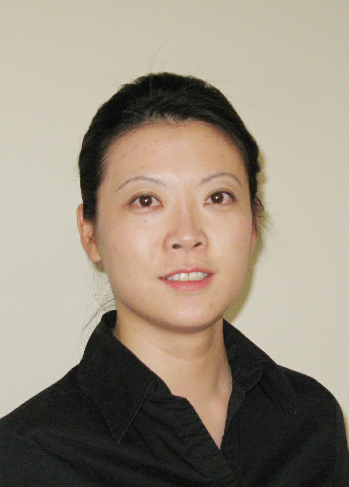 Bin Lin (林彬)合作论文数Information Science and Technology College, Dalian Maritime University3xiaofeng liu (刘晓丰)合作论文数2HuiJun Teng (滕慧君)合作论文数2Zhongqiang Ma (马忠强)合作论文数2
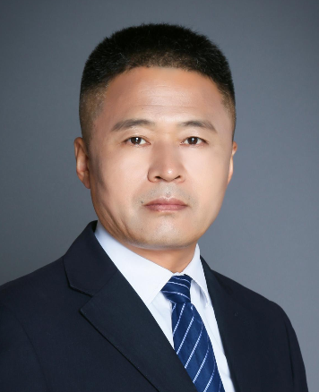 Tieshan Li (李铁山)合作论文数School of Automation Engineering, University of Electronic Science and Technology of China2Baoyi Hou合作论文数1
 Yinwei Feng (冯胤伟)合作论文数1
 Dapei Liu合作论文数1Xinzhu Lu合作论文数1Yuhao Cao合作论文数1Siming Fang合作论文数1shan li (李闪)合作论文数1Feifei Yu合作论文数1yanjun li (李彦军)合作论文数1Renhai Yu合作论文数Navigation College, Dalian Maritime University, Dalian, Liaoning 116026, China1
 Huanxin Wang合作论文数Dalian Maritime University(Dalian Maritime University),Dalian,China1daping fu (傅大平)合作论文数1Zhen-qi LIU (刘祯祺)合作论文数1LI Jiuling (李九玲)合作论文数1jiashun sun (孙加顺)合作论文数1Yu-xi ZHANG (张玉喜)合作论文数1JunPo Liu (刘军坡)合作论文数1FaMing Zhao (赵发明)合作论文数1ChunPing Wu (吴春平)合作论文数1
 Guoshuai Li (李国帅)合作论文数1Shuang Zhang (张爽)合作论文数1Meiling Han (韩美玲)合作论文数Navigation College of Dalian Maritime University1
 Qihe Shan (单麒赫)合作论文数Navigation College of Dalian Maritime University1Hongbin Xie (谢洪彬)合作论文数Navigation College of Dalian Maritime University1
 Xinyu Zhang (张新宇)合作论文数Navigation College of Dalian Maritime University;Jiangsu Jinhaixing Navigation Technology Co., Ltd1
 Mingyang Pan (潘明阳)合作论文数Navigation College, Dalian Maritime University1Xiaohui Yang合作论文数1Haibo Jiang (姜海波)合作论文数1Zifu Li (李子富)合作论文数集美大学航海学院1Liangkun Xu (徐良坤)合作论文数集美大学航海学院1Xiaoming Zhou (周晓明)合作论文数1Chunyang Zhao (赵春阳)合作论文数1Wentao Zhou (周文涛)合作论文数1




