Accurate bathymetric mapping in inland water bodies presents significant challenges for conventional optical remote sensing due to complex water quality conditions and variable bottom types. This study introduces a novel Spectral-Geospatial XGBoost Regression (SG-XGBoost) model that revolutionizes depth estimation by integrating comprehensive spectral transformations with explicit geographic coordinates through gradient boosting methodology. Applied to Sancha Lake, a morphologically complex reservoir in China's Upper Yangtze watershed, the model achieved exceptional performance with R2=0.91 and RMSE=1.66m, representing 70% improvement over traditional empirical methods (Stumpf, Log-Linear) and 21% advancement beyond Random Forest. The iterative error correction and sophisticated regularization of the gradient boosting methodology not only enable the effective exploitation of spatial-spectral interactions but also ensure better accuracy is maintained across all depth ranges (2-31m). The feature importance analysis revealed an unexpected finding, the geographic coordinates dominated predictive power (85% contribution), while spectral features contributed minimally, challenging fundamental assumptions about optical bathymetry. The iterative error correction and sophisticated regularization of the gradient boosting methodology not only enable the effective exploitation of spatial-spectral interactions but also ensure better accuracy is maintained across all depth ranges (2-31m). Bathymetric maps generated by SG-XGBoost successfully captured fine-scale morphological features invisible to conventional approaches, including channels <30m wide and subtle depth variations of 1-2m. Despite limitations in extreme turbidity and site-specificity requiring readjustment for new water bodies, this research establishes gradient boosting with spatial-spectral integration as a transformative approach for inland water bathymetry, with broader implications for aquatic remote sensing applications including water quality monitoring and habitat mapping.
Satellite-derived bathymetry (SDB) in turbid waters suffers from physical bottlenecks of spectral saturation and attenuation, frequently causing traditional spectral-only methods to fail systematically. To address this, we propose a Spectral–Geospatial Random Forest Regression (RSG-RFR) framework that elevates geospatial descriptors, such as longitude and latitude, to first-class predictors. Operating under the constraints of localized spectral features, the framework executes non-linear inference to serve as a physically motivated information compensation channel against optical saturation. Model validation using in-situ acoustic sounding data across three highly dynamic and heterogeneous environments—an inland reservoir, a fluvial confluence, and a deepwater port—demonstrates exceptional performance, with coefficients of determination (R2) reaching 0.82–0.92. Crucially, the model effectively eliminates the systematic deep-water under-prediction biases characteristic of conventional empirical approaches. Furthermore, SHapley Additive exPlanations (SHAP) analysis confirms that geospatial variables dominate the predictive mechanism, contributing 55%–75% of the cumulative importance by accurately capturing the underlying geomorphic spatial coherence. The continuous bathymetric surfaces rendered by the RSG-RFR model exhibit remarkable morphological fidelity, while the generated spatial residuals manifest an unstructured, zero-centered random distribution. This spatial independence successfully prevents the systematic accumulation and amplification of errors in downstream engineering applications, such as digital twin reservoir capacity tracking or precise port dredging volume calculations. Ultimately, this framework establishes an optimized engineering trade-off between predictive accuracy and spatial transferability, providing a concise, robust, and highly efficient solution for high-frequency operational monitoring in geographically fixed domains.
Accurate bathymetric mapping is vital for coastal management and navigation, yet traditional sonar remains costly and limited in shallow areas. This study evaluates a Transformer model using Sentinel-2 satellite imagery to estimate water depth in the turbid coastal waters of Nanshan Port, China. We compared the Transformer against Stumpf, log-linear, and neural network models using approximately 4,000 field-measured control points.Outperforming all other methods, the Transformer achieved a coefficient of determination (R2) of 0.90, mean absolute error (MAE) of 0.55 m, mean relative error (MRE) of 0.11 m, and root mean square error (RMSE) of 0.81 m. Although error rates increased across all models at depths exceeding 9 meters, the Transformer maintained robust performance. These findings demonstrate that integrating advanced machine learning with satellite remote sensing provides a cost-effective, accurate solution for bathymetric mapping in challenging turbid environments.
Satellite-derived bathymetry (SDB) in turbid rivers remains difficult because suspended sediment, optical mixing, and weak bottom visibility disrupt the monotonic spectral-depth relations assumed by classical empirical models. This letter presents a strictly synchronous benchmark at the Yellow River-Yiluo River confluence using GF-1 WFV1 imagery and in situ depth measurements acquired on June 15, 2024. Two empirical baselines, two spectral tree-ensemble models, and two coordinate-augmented tree-ensemble models are evaluated under a unified preprocessing and independent validation workflow. A total of 2000 samples are used for training, and 1816 nonoverlapping samples are reserved for independent validation, yielding a validation proportion of 47.6%. Results show a clear separation between model families: Stumpf and log-linear regression produce compressed depth estimates and low explanatory power, whereas the random forest model and LightGBM model preserve much stronger nonlinear depth sensitivity. Adding longitude and latitude further improves within-reach validation accuracy for both the random forest model and LightGBM model, with Geo_LightGBM model achieving the best accuracy (R-2=0.938 , RMSE = 0.387 m, MAE = 0.249 m). This gain is interpreted as within-reach assistance. The benchmark, therefore, provides a controlled testbed for separating model behavior from temporal mismatch in optically complex inland waters.
Accurate bathymetric mapping in turbid river environments remains a considerable challenge for traditional remote sensing methods, particularly in dynamic systems like the Yellow River, where high sediment loads disrupt optical signals. This study proposes an Extra Trees model integrated with geographical parameters to improve depth estimation at the confluence of the Yellow River and Yiluo River. Using GaoFen-1 wide field of view 1(GF-1WFV1) satellite imagery (acquired June 15, 2024) and 2000 in-situ depth measurements from an Acoustic Doppler Current Profiler (ADCP) River Ray system, we evaluated the model against conventional approaches, including the Stumpf model, Log-Linear model, and Random Forest model. The Extra Trees model achieved superior accuracy with a coefficient of determination (R²) of 0.91, mean absolute error (MAE) of 0.26 m, and root mean square error (RMSE) of 0.46 m, outperforming the Stumpf (R² = 0.01, RMSE = 1.51 m), Log-Linear (R² = 0.00, RMSE = 1.51 m), and Random Forest (R² = 0.75, RMSE = 0.76 m) models. Feature importance analysis revealed that geographical parameters (longitude and latitude) were more influential than spectral features in depth prediction, highlighting the critical role of spatial context in capturing complex bathymetric patterns. The model demonstrated consistent performance across depth ranges (0–10 m) and excelled in resolving subtle morphological features, such as channels and shoals, that traditional methods missed. Comparative analysis with XGBoost further showed that the Extra Trees model maintained spatial continuity in depth predictions, avoiding artificial boundaries. These results suggest that integrating geographical parameters with ensemble learning enhances bathymetric mapping accuracy in turbid rivers, offering valuable tools for monitoring river morphology and supporting water resource management.
This study proposes a Spectral-Geospatial XGBoost Regression (RSG-XGBoost) model for bathymetric mapping in complex river confluences, demonstrated at the Yellow River-Yiluohe River junction. The method fuses multispectral GF-1 WFV1 imagery with geospatial variables to estimate water depth from limited in-situ observations. Using depth measurements collected by an RDI 600 kHz ADCP River Ray, we benchmark RSG-XGBoost against the Stumpf model, a log-linear model, and a standard Random Forest across multiple depth intervals and heterogeneous channel morphologies.RSG-XGBoost delivers the best performance, achieving an overall RMSE of 0.45 m and maintaining higher accuracy in challenging depth ranges where traditional empirical models degrade. The resulting bathymetric maps capture fine-scale underwater topography and subtle geomorphic features that competing approaches fail to resolve. The gradient boosting framework effectively models non-linear relationships between spectral responses, spatial context, and depth, improving robustness in optically and morphologically complex reaches. We also discuss uncertainties and limitations, including sensitivity to environmental conditions and the transferability of trained models to other river systems. These results support more reliable river bathymetry for management, navigation, and ecological applications.
Obtaining accurate bathymetric maps is crucial for various applications like marine monitoring and planning. However, bathymetric inversion is influenced by water quality conditions and bottom reflections exhibiting spatial similarity. This study explores the spatial perspective in designing bathymetric inversion networks, proposing a Multi-Scale Graph Attention Network (MSGAN) model. MSGAN utilizes spectral bands and field data to extract bathymetric features by establishing graph adjacency matrices. Experimental data are collected from Nanshan Port, Visakhapatnam Beach, and Qilianyu Island to evaluate MSGAN's performance. Results demonstrate MSGAN outperforms existing methods like Stumpf, log-linear regression and random forest, achieving enhanced depth estimation accuracy even in turbid water bodies. Notably, MSGAN provides more detailed bathymetric maps for deep-water areas compared to traditional algorithms. This study introduces an efficient approach for satellite-derived bathymetry inversion, enhancing shallow water mapping capabilities. Overall, MSGAN offers a promising technique for bathymetric mapping from remote sensing data, with wide applications in hydrological and environmental monitoring.
Conventional pixel-wise satellite-derived bathymetry (SDB) models face dual challenges: physical ambiguity from variable water quality and spatial incoherence from ignoring geographic context. This study addresses these limitations by proposing and validating OptiFusionStack, a novel two-stage physio-spatial synergistic framework that operates without in situ optical data for model calibration. The framework first generates diverse, physics-informed predictions by integrating Quasi-Analytical Algorithm (QAA)-derived inherent optical properties (IOPs) with multiple base learners. Critically, it then constructs a multi-scale spatial context by computing neighborhood statistics over an experimentally optimized 9 × 9-pixel window. These physical priors and spatial features are then effectively fused by a StackingMLP meta-learner. Validation in optically diverse environments demonstrates that OptiFusionStack significantly surpasses the performance plateau of pixel-wise methods, elevating inversion accuracy (e.g., R2 elevated from 0.66 to >0.92 in optically complex inland waters). More importantly, the framework substantially reduces spatial artifacts, producing bathymetric maps with superior spatial coherence. A rigorous benchmark against several state-of-the-art, end-to-end deep learning models further confirms the superior performance of our proposed hierarchical fusion architecture in terms of accuracy. This research offers a robust and generalizable new approach for high-fidelity geospatial modeling, particularly under the common real-world constraint of having no in situ data for optical model calibration.
Mangrove ecosystems play a crucial role in coastal environments. However, due to the complexity of mangrove distribution and the similarity among different categories in remote sensing images, traditional image segmentation methods struggle to accurately identify mangrove regions. Deep learning techniques, particularly those based on CNNs and Transformers, have demonstrated significant progress in remote sensing image analysis. This study proposes TCCFNet (Two-Channel Cross-Fusion Network) to enhance the accuracy and robustness of mangrove remote sensing image semantic segmentation. This study introduces a dual-backbone network architecture that combines ResNet for fine-grained local feature extraction and Swin Transformer for global context modeling. ResNet improves the identification of small targets, while Swin Transformer enhances the segmentation of large-scale features. Additionally, a Cross Integration Module (CIM) is incorporated to strengthen multi-scale feature fusion and enhance adaptability to complex scenarios. The dataset consists of 230 high-resolution remote sensing images, with 80% used for training and 20% for validation. The experimental setup employs the Adam optimizer with an initial learning rate of 0.0001 and a total of 450 training iterations, using cross-entropy loss for optimization. Experimental results demonstrate that TCCFNet outperforms existing methods in mangrove remote sensing image segmentation. Compared with state-of-the-art models such as MSFANet and DC-Swin, TCCFNet achieves superior performance with a Mean Intersection over Union (MIoU) of 88.34%, Pixel Accuracy (PA) of 97.35%, and F1-score of 93.55%. Particularly, the segmentation accuracy for mangrove categories reaches 99.04%. Furthermore, TCCFNet excels in distinguishing similar categories, handling complex backgrounds, and improving boundary detection. TCCFNet demonstrates outstanding performance in mangrove remote sensing image segmentation, primarily due to its dual-backbone design and CIM module. However, the model still has limitations in computational efficiency and small-target recognition. Future research could focus on developing lightweight Transformer architectures, optimizing data augmentation strategies, and expanding the dataset to diverse remote sensing scenarios to further enhance generalization capabilities. This study presents a novel mangrove remote sensing image segmentation approach—TCCFNet. By integrating ResNet and Swin Transformer with the Cross Integration Module (CIM), the model significantly improves segmentation accuracy, particularly in distinguishing complex categories and large-scale targets. TCCFNet serves as a valuable tool for mangrove remote sensing monitoring, providing more precise data support for ecological conservation efforts.
Remote sensing monitoring and geomorphologic change analysis of coral reefs are of great practical significance for the ecological protection and sustainable development of coral reef area resources. A WBMD scheme is proposed to better extract coral reef information from island environments of Xisha, China. Satellite imagery, after preprocessing, is subjected to water depth correction to mitigate the influence of water depth on reflectance. A maximum likelihood classification model is then used for geomorphological classification, followed by refinement through a decision tree classification model, forming the WBMD scheme. The overall accuracy of geomorphological classification for Xisha Chau and Zhaoshu Island based on the WBMD scheme was 97.07% and 95.07%. Using this scheme to analyze the geomorphology of Xisha Chau and Zhaoshu Island from 2014 to 2018 reveals that the degradation of coral reef on Xisha Chau is mainly distributed in the lagoon slope and around the lagoon, and the lagoon area on Zhaoshu Island has been shrinking year by year, while the area of the gray sand island has increased, and the areas of other geomorphological types exhibit fluctuating changes. Previous studies on coral reefs have indicated that coral reefs are mainly distributed in the lagoon slope area, where significant coral reef degradation has also been observed, raising an alarm for coral reef conservation efforts in China.
Accurate bathymetry estimation is essential for coastal management, resource exploration, and ecological conservation. However, traditional depth measurement methods are often time-consuming, expensive, and logistically challenging, particularly for large-scale marine surveys. These limitations have driven the development of Satellite-Derived Bathymetry (SDB), which leverages high-resolution satellite imagery and advanced computational techniques to provide a more efficient, cost-effective, and scalable solution. This study utilizes Sentinel-2 satellite data combined with various algorithmic approaches to estimate bathymetry in the Nanshan Port area. Among these methods, the Backpropagation (BP) neural network demonstrates outstanding performance in shallow water and coastal environments, effectively addressing light attenuation and water scattering challenges in turbid waters. The results indicate that, compared to traditional depth measurement techniques, BP neural network predictions are smoother, more detailed, and highly accurate, offering a refined and comprehensive representation of underwater topography. Beyond validating the feasibility of satellite remote sensing for bathymetric estimation, this study highlights key future directions, including algorithm optimization, multi-source data fusion, and enhanced deep learning models. The integration of high-resolution optical and LiDAR data, along with improved AI-driven models, holds great potential to further enhance the precision and reliability of bathymetric mapping. These advancements are expected to revolutionize marine research and coastal zone management, enabling more effective environmental monitoring, disaster risk assessment, and sustainable development. As remote sensing technologies continue to evolve, their integration with adaptive deep learning techniques, such as backpropagation neural networks, will further enhance the accuracy and automation of oceanographic studies, unlocking new possibilities for global marine exploration
Nearshore bathymetry is critical for coastal management and ecology. While airborne hyperspectral remote sensing provides high-resolution image data, obtaining rapid and accurate bathymetric inversion in coastal areas lacking in situ data remains challenging. The widely used Hyperspectral Optimization Process Exemplar (HOPE) achieves high accuracy but suffers from computational inefficiency, making it impractical for large-scale, high-resolution datasets. By contrast, HOPE-Pure Water (HOPE-PW) offers computational efficiency but exhibits limitations in capturing fine-scale spatial patterns of bottom reflectance (ρ), and its applicability in transitional waters between Case I and II types requires further validation. Against this background, we employed machine learning-based substrate classification (support vector machine, random forest, maximum likelihood) in Wenchang coastal waters, China, to constrain ρ estimation in HOPE-PW, with validation using ICESat-2 data that extends its conventional application scenarios. Results demonstrate that when constrained by the optimal classifier (random forest), HOPE-PW achieves comparable accuracy to HOPE in shallow water while reducing runtime by 56% and memory usage by 68%. However, HOPE-PW exhibits slight underestimation in deeper areas, likely because simplification reduces sensitivity to water optical properties. Future research will focus on this issue. This study proposes an efficient and reliable framework for monitoring and evaluating water depth in areas lacking in situ data, offering a practical solution for integrated coastal zone management.
Accurate water depth estimation is crucial in coastal environmental management, resource exploration, and ecological protection. Traditional water depth measurement methods are often time-consuming and costly, especially in vast sea areas where their application is limited. However, with the rapid development of remote sensing technology, particularly the widespread use of high-resolution satellite imagery, water depth remote sensing has emerged as a more efficient, economical, and widely applicable solution. In this study, we utilized Sentinel-2 satellite data and applied various algorithms to accurately estimate water depth in the Nanshan Port area. The results showed that the Gradient Boosting Machine (GBM) model excelled in monitoring shallow water and coastal environments, effectively addressing challenges such as light attenuation and water scattering in turbid waters. Compared to traditional methods, GBM-generated predictions were smoother and more detailed. This study not only demonstrates the significant potential of satellite remote sensing for water depth measurement but also points to future directions for algorithm optimization and the integration of remote sensing technologies. It is expected to bring revolutionary progress to oceanic scientific research and coastal management.
Bathymetry estimation is essential for various applications in port management, navigation safety, marine engineering, and environmental monitoring. Satellite remote sensing data can rapidly acquire the bathymetry of the target shallow waters, and researchers have developed various models to invert the water depth from the satellite data. Geographically weighted regression (GWR) is a common method for satellite-based bathymetry estimation. However, in sediment-laden water environments, especially ports, the suspended materials significantly affect the performance of GWR for depth inversion. This study proposes a novel approach that integrates GWR with Random Forest (RF) techniques, using longitude, latitude, and multispectral remote sensing reflectance as input variables. This approach effectively addresses the challenge of estimating bathymetry in turbid waters by considering the strong correlation between water depth and geographical location. The proposed method not only overcomes the limitations of turbid waters but also improves the accuracy of depth inversion results in such complex aquatic settings. This breakthrough in modeling has significant implications for turbid waters, enhancing port management, navigational safety, and environmental monitoring in sediment-laden maritime zones.
Remote sensing data has found widespread applications in areas such as military monitoring, environmental management, and urban planning. However, the sensitive nature and commercial value of such data make them vulnerable to security risks like unauthorized access, piracy, and tampering. To protect the confidentiality and integrity of remote sensing data, researchers have explored various encryption techniques, including traditional ciphers, chaotic mapping, and deep learning. While some progress has been made, there is still a lack of comprehensive end-to-end solutions that effectively address the security challenges in remote sensing data distribution and utilization. This research proposes a novel encryption scheme that leverages facial features to enhance security and facilitate seamless interactions between users and distribution endpoints, providing a new perspective for the secure dissemination and application of remote sensing data. The study integrates facial information throughout the entire remote sensing data encryption process. Experimental results demonstrate strong encryption efficiency and reconstruction quality. To advance this field, future research should explore the integration of biometric features, blockchain technology, and edge computing into remote sensing data encryption schemes. By doing so, researchers can develop more efficient and robust solutions, promoting the eventual secure application of remote sensing data in various fields and fully unleashing its scientific, commercial, and social potential.
Accurate bathymetry information is crucial for safe navigation and efficient management of the Yangtze River Channel, a vital shipping corridor in China. Traditional bathymetric surveying methods are time-consuming and labor-intensive, limiting their application in largescale and real-time monitoring. This study proposes a novel approach for bathymetry inversion in the Yangtze River Nantong Channel by integrating geolocational features obtained from the ZY-1E satellite with high-resolution multibeam data using the random forest algorithm. Our approach incorporates geographical coordinates enhancing the predictive capabilities of conventional models. The random forest with longitude/latitude (RF-Lon./Lat.) model, which incorporates geographical information, outperformed conventional methods, achieving an R2 of 0.57, MAE of 1.99 m, and RMSE of 2.96 m. The successful application of the RF-Lon./Lat. model highlights the effectiveness of integrating geolocational features with machine learning algorithms for accurate bathymetry inversion in the complex and turbid waters of the Yangtze River Channel. This innovative approach offers a promising solution for precise and efficient water depth estimation, which is essential for various applications in the Yangtze River Basin, including channel management, waterway maintenance, and hydrological studies. The insights gained from this study contribute to the growing body of knowledge on the application of machine learning and remote sensing techniques for bathymetric mapping in complex river environments, particularly in the context of the Yangtze River Channel. (c) 2024 Optica Publishing Group under the terms of the Optica Open Access Publishing Agreement
Obtaining accurate bathymetric maps is very valuable for marine environment monitoring, port planning, and so on. Accurately estimating water depth in turbid coastal waters using satellite remote sensing encounters challenges originating from low water transparency, but it is limited by the quantity, quality, and water quality of samples. This study introduces a fast feature cascade learning model (FFCLM) to enhance the accuracy of bathymetric inversion from multispectral satellite images, particularly when limited field samples are available. FFCLM leverages spectral bands and in situ data to derive effective inversion weights through feature concatenation and cascade fitting. Field experiments conducted at Nanshan Port and Rushikonda Beach gathered water depth, satellite, and in situ data. Comparative analysis with conventional machine learning algorithms, including support vector machine, random forest, and gradient boosting trees, indicates that FFCLM achieves lower errors and demonstrates more robust performance across study areas. This is especially more pronounced when using small training samples (n < 100). Examination of key parameters and water depth profiles highlights FFCLM’s advantages in generalization and deep-water inversion. This study presents an efficient solution for small-sample bathymetric mapping in turbid coastal waters, utilizing spectral and physical information to overcome sample size limitations and enhancing satellite remote sensing capabilities for shallow water monitoring.
Mangroves play a crucial ecological and economic role but face significant threats, particularly on Hainan Island, which has the highest mangrove species diversity in China. Remote sensing and AI techniques offer potential solutions for monitoring these ecosystems, but challenges persist due to difficult access for field sampling. To address these issues, we propose a novel model combining a Mangrove Rough Extraction Decision Tree (MREDT) and a Dynamic Attention Convolutional Network (DACN-M). Initially, we used drones and field surveys to conduct multiple observations in Dongzhaigang Nature Reserve, identifying the boundaries of the mangroves. Based on these features, we constructed the MREDT model to mitigate model failure caused by light instability, simplifying transfer to other study areas without requiring annotated samples or extensive field surveys. Next, we developed the DACN-M model, which refines the rough extraction features from MREDT and incorporates contextual information for more accurate detection. Experimental results demonstrate that our proposed method effectively differentiates mangroves from other vegetation, achieving F1 Scores above 75% and IoU values greater than 60% across six study areas. In conclusion, our proposed method not only accurately identifies and monitors mangrove distribution but also offers the significant advantage of being transferable to other study areas without the need for annotated samples or field surveys. This provides a robust and scalable solution for protecting and preserving critical mangrove ecosystems and supports effective conservation efforts in various regions.
This study introduces an innovative water depth estimation method for complex coastal environments, focusing on Yantian Port. By combining Random Forest algorithms with a Coordinate Attention mechanism, we address limitations of traditional bathymetric techniques in turbid waters. Our approach incorporates geographical coordinates, enhancing spatial accuracy and predictive capabilities of conventional models. The Random Forest Lon./Lat. model demonstrated exceptional performance, particularly in shallow water depth estimation, achieving superior accuracy metrics among all evaluated models. It boasted the lowest Root Mean Square Error (RMSE) and highest coefficient of determination (R²), outperforming standard techniques like Stumpf and Log-Linear approaches. These findings highlight the potential of advanced machine learning in revolutionizing bathymetric mapping for intricate coastal zones, opening new possibilities for port management, coastal engineering, and environmental monitoring of coastal ecosystems. We recommend extending this research to diverse coastal regions to validate its broader applicability. Additionally, exploring the integration of additional geospatial features could further refine the model’s accuracy and computational efficiency. This study marks a significant advancement in bathymetric technology, offering improved solutions for accurate water depth estimation in challenging aquatic environments. As we continue to push boundaries in this field, the potential for enhanced coastal management and environmental stewardship grows, paving the way for more sustainable and informed decision-making in coastal zones worldwide.
 Zhihua Mao (毛志华)合作论文数State Key Laboratory of Satellite Ocean Environment Dynamics, Second Institute of Oceanography, Ministry of Natural Resources;Shanghai Institute of Technical Physics, Chinese Academy of Sciences;School of Oceanography, Shanghai Jiao Tong University17
 Shulei Wu (吴淑雷)合作论文数15
 Wei Shen (沈伟)合作论文数College of Engineering Science and Technology, Shanghai Ocean University14
 Huandong Chen合作论文数5Yaowei QIU (邱耀炜)合作论文数5
 Haiqing Huang合作论文数3
 Muyin Chen合作论文数2Xianliang Zhang合作论文数2Yuchen Zhao合作论文数2Qian JI (纪茜)合作论文数2
 Dapeng Yuan合作论文数2Xiaolei GUO (郭晓雷)合作论文数2
 Kuifeng Luan (栾奎峰)合作论文数College of Oceanography and Ecological Science, Shanghai Ocean University2
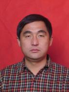 Zhenge Qiu (邱振戈)合作论文数College of Marine Sciences, Shanghai Ocean University2JI Qian (纪茜)合作论文数1
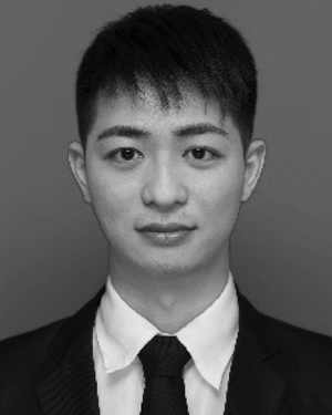 Youzhi Li合作论文数1Zilin Yue (岳子琳)合作论文数1
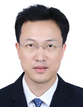 Wei Zhang (张巍)合作论文数School of Earth Sciences and Engineering, Nanjing University;Institute of Earth Exploration and Sensing, Nanjing University;Institute of Underground Space and Geological Environment, East China Geological Exploration Bureau for Non-ferrous Metals, Nanjing University1Yukai Chen合作论文数1
 Jiaqi Wang合作论文数1
 Zhao Dongqing合作论文数1
 Lei Daxing合作论文数1Zheng WANG (王正)合作论文数1
 BinCai Cao (曹彬才)合作论文数1
 Weidong Zhu (朱卫东)合作论文数College of Marine Sciences, Shanghai Ocean University1
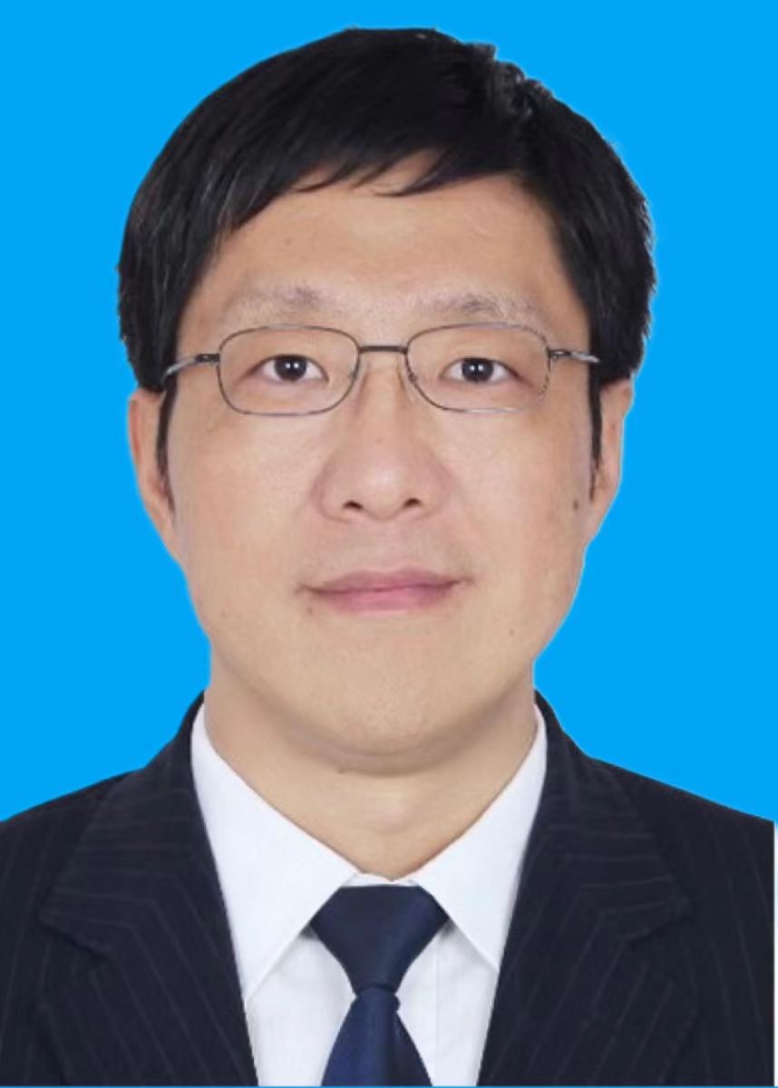 Xin Li (李新)合作论文数Institute of Tibetan Plateau Research, Chinese Academy of Sciences;University of Chinese Academy of Sciences1
 Fuli Xiang合作论文数Lawson Health Research Institute1
 Qiankun Zhu合作论文数1
 Bangyi Tao (陶邦一)合作论文数Second Institute of Oceanography, Ministry of Natural Resources1




