We study the extreme behavior of six central Chile glacier mass balance series facing significant retreats and ice wastage due to climate variability and change. This has led to reduced meltwater availability in dry seasons, increasing competition for downstream water resources. Understanding glacier mass balances is crucial for predicting future water availability in scenarios with higher water demands. We used Extreme Value Theory tools to analyze the data and identify extreme events. The main objective of this study is to statistically analyze glacier mass losses in Chile, using mass balance data collected from both national and international sources. The results show high heterogeneity in the extreme behavior of glaciers, with some showing an approximately exponential tail (Guanaco Glacier), others exhibiting stability with slight tails (Echaurren Norte and Mocho Glaciers) and one (Amarillo Glacier) with a highly unstable structure. The other analyzed glaciers (Juncal Norte and Juncal Sur) have slight and potentially limited tails. These results confirm the high importance of studying glaciers in the Andes in order to better understand their responses to climate change, an important and relevant aspect for the future management of glacier melt water resources.
Patagonia and Tierra del Fuego (Austral Andes) are the most glacierised regions in the Southern Hemisphere, where glaciers have experienced significant mass changes in recent decades. Understanding glacier–climate–water interactions is crucial for addressing future climate challenges. Open-access data play a key role in advancing geoscience research, improving models, and assessing the impacts of hazards and sea-level rise impacts. Here, we present QFuego-Patagonia, a free glacier-related GIS dataset and web portal covering Patagonia and Tierra del Fuego, which provides essential geospatial information across four scientific topics: Glaciology, Atmosphere, Terrain Models, and Glacial Geology and Geomorphology. This initiative aims to foster interdisciplinary research and collaboration, synthesise current knowledge, and establish an advanced glacier data repository that will be continuously updated as new data and insights become available.
To date, the Icelandic Ice Sheet (IIS) and Patagonian Ice Sheet (PIS) have been poorly understood with regard to their configuration, dynamics, and evolution during the last glacial cycle. The few glaciological modelling studies of the IIS and PIS to date have placed minimal attention on addressing model uncertainties. As such, their inferential value is poorly interpretable. To address this, we present the results of history matchings of the 3D Glacial Systems Model (GSM) against curated sets of paleo constraints for the last glacial cycle IIS and PIS. History matching identifies a set of model simulations that are not ruled out given available data constraints and robust uncertainty analysis (including both model and data uncertainties). As such, it aims to “bracket reality” as opposed to the much more difficult task of determining a meaningful most likely chronology.The GSM is a thermo-mechanically coupled glaciological model with hybrid shallow ice and shallow shelf/stream physics. The climate forcing consists of a fully coupled energy balance climate model and glacial indexed climate forcing using the results of PMIP3 (Paleo Model Intercomparison Project). Approximate 30 GSM ensemble parameters partially account for uncertainties in climate, basal drag, and marine ice processes. The GSM configuration includes fully coupled visco-elastic glacio-isostatic adjustment enabling physically self-consistent relative sealevel predictions. Our presentation focuses on bracketing chronologies for the last glacial cycle IIS and PIS as well as disentangling the relative contribution of atmospheric and marine forcings on mass loss during the deglaciation.
The two vast Patagonian icefields are a global hotspot for ice-loss. However, not much is known about the total ice volume they store - let alone its spatial distribution. One reason is that the abundant record of direct thickness measurements has never been systematically exploited. Here, this record is combined with remotely-sensed information on past ice thickness mapped from glacier retreat. Both datasets are incorporated in a state-of-the-art, mass-conservation approach to produce a well-informed map of the basal topography beneath the icefields. Its major asset is the reliability increase of thicknesses values along the many marine- and lake-terminating glaciers. For these, frontal ice-discharge is notably lower than previously reported. This finding implies that direct climatic control was more influential for past ice loss. We redact a total volume for both icefields in 2000 of 5351 km 3 . Despite the wealth of observations used in this assessment, relative volume uncertainties remain elevated.
The Southern Patagonian Icefield is experiencing rapid retreat and thinning in its calving glaciers. To better understand the dynamics of these changes, we generated ice flow line maps for the Viedma, Upsala, and Pio XI glaciers during 2017-2018. An evenly spaced streamline placement algorithm, integrating topographic and flow curvature criteria, was employed to calculate over 2,700 streamlines per glacier at a 50-meter resolution. The algorithm's performance was assessed by comparing the generated flow lines with manually digitized reference lines, resulting in a mean error, standard deviation, and root mean square error of 57.35, 33.62, and 66.46 meters, respectively. The resulting maps reveal detailed flow structures, highlighting flow lines from accumulation to ablation zones, increased velocities in central areas, tributary flows merging with main channels, and regions of flow convergence and divergence. Additionally, the glaciers' 3D lengths were estimated by identifying the longest ice flow lines, with Pio XI measuring 62.27 km, Viedma 54.49 km, and Upsala 51.24 km. We consider that the methodology used, along with the generated maps, provides excellent visual and analytical tools for identifying glacier areas, lengths, and shapes, defining ice origins and glacier catchment boundaries, and analysing zones of flow convergence and divergence-parameters that are critically important for understanding the dynamics, geometry, and evolution of glaciers in this region.
The Southern Patagonian Icefield shows rapid retreat and thinning with variability in magnitude and timing among individual glaciers. To better understand these heterogeneous changes, we estimated the ice thickness distribution within the middle and lower basins of Perito Moreno, Upsala, and Viedma freshwater calving glaciers during the 2017-2018 period. We employed a surface velocity inversion method that incorporates glacier motion through internal deformation and basal slip. Additionally, we applied a directional smoothing filter to estimate surface slope and a calibration process to improve model accuracy. Based on the estimated bed elevation, we introduced an index of relative terminus stability, calculated as the ratio between the height of the ice cliff at the calving front and the water depth at the glacier terminus. Our results show a good performance of model, with a mean RMSE of 77.5 m and correlations >0.89 between observed and modeled ice thickness. Perito Moreno glacier shows ice thickness ranging from 200 to 700 m along its centerline, from the calving front to 15 km upstream. It also displays a stability index four times higher than the other two glaciers, which may explain its relatively stable behavior. In contrast, the Upsala and Viedma glaciers exhibit much thicker ice both at the terminus and higher elevations, with stability indexes close to floating near the calving front. We found that retreat rates of 200 m a-1, coupled with thinning rates of 10 m a-1, can propagate the close to floating conditions of the ice up-glacier. The Upsala and Viedma glaciers have reached these values, which can account for their rapid mass loss. Our results and methodology contribute to the understanding and monitoring of calving glaciers' stability in the region.
The retreat of glaciers has led to increasing in natural hazards due, for example, by emptying of lakes dammed by unconsolidated glacial deposits (moraines) or ice, which are susceptible to catastrophic erosion, generating rapid floods, phenomena known as "Glacial Lake Outburst Floods" (GLOFs). Current systems that warn of the occurrence of a GLOF are activated when the emptying begins, which leaves little time to act, so they should be considered early alarm systems. The challenge is to predict the onset of the flood allowing the generation of an early warning system. To address this problem, SAGAZ ultimately aims to develop a system capable of identifying periods of increased GLOF risk using a predictive model fed by weather forecasts and monitoring station data. This system identifies a period of higher risk, which allows informing authorities several days in advance. This paper presents the results of the first phase of SAGAZ implementation, which aimed to (1) develop and validate a prototype monitoring station and deploy a network of stations on glacial lakes across southern Patagonia, (2) collect the necessary data for the development, training and validation of predictive models and (3) begin the implementation and testing of the predictive model. As a result, a network of 10 monitoring stations was installed in the Aysen and Magallanes regions of Chile and 1 in the Province of Santa Cruz in Argentina, of which 6 are currently operational and transmitting data in real time. The rest went off due to power failures and icebergs damaging sensors. The measures we have taken to avoid station's failures are described, as well as some characteristics of the implemented prototype, the installed networks and the data obtained so far.
The Southern Patagonian Icefield (SPI) is the largest continuous ice mass in the Southern Hemisphere outside Antarctica. It has been shrinking since the Little Ice Age (LIA) period, with increasing rates in recent years. An uplift of crustal deformation in response to this deglaciation process has been expected. The goal of this investigation is to analyze the crustal deformation caused by ice retreat using time-series data from continuous GPS stations (2015–2020) in the northern area of the SPI. For this purpose, we installed two continuous GPS stations on rocky nunataks of the SPI (the GRCS near Greve glacier and the GBCS close by Cerro Gorra Blanca). In addition, ice elevation changes (2000–2019) were analyzed by the co-registration of the SRTM digital elevation model and ICESat elevation data points. The results of the vertical components are positive (36.55 ± 2.58 mm a−1), with a maximum at GBCS, indicating the highest rate of crustal uplift ever continuously recorded in Patagonia; in addition, the mean horizontal velocities reached 11.7 mm a−1 with an azimuth of 43°. The negative ice elevation changes detected in the region have also accelerated in the recent two decades, with a median Δh (elevation change) of −3.36 ± 0.01 m a−1 in the ablation zone. The seasonality of the GPS signals was contrasted with the water levels of the main Patagonian lakes around the SPI, detecting a complex interplay between them. Hence, the study sheds light on the knowledge of the crustal uplift as evidence of the wastage experienced by the SPI glaciers.
Although over 600 Antarctic subglacial lakes have been identified using radar and satellite observations, the bathymetry and bed properties, which are key to understanding conditions within the lake, have been determined in very few localities. We present measurements of water column thickness and lakebed properties from Lago Subglacial CECs (SLC), located beneath 2653 m of ice at the Rutford-Institute-Minnesota divide in Antarctica. Seismic profiles indicate a maximum water column thickness of 301.3 ± 1.5 m, at the widest part of the lake, with an estimated lake volume of 2.5 ± 0.3 km 3 . Seismic imaging and measurements of the reflection strength at the ice base and lakebed indicate >15 m of high-porosity fine-grained sediment in the central section of the lakebed, consistent with a depositional sequence with an age of up to 0.5 Ma. These observations, along with previous radar measurements and modelling, indicate a low-energy sedimentary environment with a long water-residence time. As such, SLC is a suitable target for exploration via direct access to recover sediment records of ice sheet and climate history and investigate microbial life with long periods of isolation.
Patagonian glaciers (41°–56°S) have experienced strong volume losses and retreats during recent decades in response to the climatic changes affecting this part of Chile, contributing significantly to global sea level rise. These changes have had an impact on the region’s ecosystems, due to processes such as the expansion of fjords and lakes, altered hydrology and geology risks, higher sediment loads contributed to rivers, and changes in the altitude and composition of nearby vegetation. These factors affecting the ecosystem services provided by glaciers, such as runoff and flood regulation, slope stability, biodiversity, and cultural services they generate as one of the few remaining pristine components of the Earth. The recent changes in glacier volume make them highly vulnerable to the adverse effects of ongoing climate change, a condition that affects other Subantarctic natural systems of Chile. We emphasize the need to enhance the systematic monitoring of glacier volume and surface extent in Patagonia.
Glacier fronts are retreating across the globe in response to climate warming, revealing valleys, fiords, and proglacial lakes. The piedmont lobe of San Quintín, the largest glacier of the Northern Patagonia Icefield, in southern Chile, has recently entered a catastrophic phase of frontal retreat, where its terminus is rapidly disintegrating into large tabular icebergs calving into a new proglacial lake. We present results of a unique airborne GPR survey of the terminus of this large Patagonian glacier (763 km2 in 2017), complemented with an analysis of ice flow velocity, satellite imagery, and ice elevation change to show that the ongoing retreat is caused by recent detachment of a floating terminus from the glacier bed and may shortly lead to the disappearance of the last existing piedmont lobe in Patagonia. Finally, we discuss how the observations of San Quintín’s ongoing collapse may give insights into processes governing frontal retreat of fast-flowing temperate glaciers and the quasi-stability of the floating termini.
Over the past 60 years, scientists have strived to understand the past, present and future of the Antarctic Ice Sheet. One of the key components of this research has been the mapping of Antarctic bed topography and ice thickness parameters that are crucial for modelling ice flow and hence for predicting future ice loss and ensuing sea level rise. Supported by the Scientific Committee on Antarctic Research (SCAR), the Bedmap3 Action Group aims not only to produce new gridded maps of ice thickness and bed topography for the international scientific community, but also to standardize and make available all the geophysical survey data points used in producing the Bedmap gridded products. Here, we document the survey data used in the latest iteration, Bedmap3, incorporating and adding to all of the datasets previously used for Bedmap1 and Bedmap2, including ice-bed, surface and thickness point data from all Antarctic geophysical campaigns since the 1950s. More specifically, we describe the processes used to standardize and make these and future survey and gridded datasets accessible under the ‘Findable, Accessible, Interoperable and Reusable’ (FAIR) data principles. With the goals to make the gridding process reproducible and to allow scientists to re-use the data freely for their own analysis, we introduce the new SCAR Bedmap Data Portal (bedmap.scar.org, last access: 18 October 2022) created to provide unprecedented open access to these important datasets, through a user-friendly webmap interface. We believe that this data release will be a valuable asset to Antarctic research and will greatly extend the life cycle of the data held within it. Data are available from the UK Polar Data Centre: https://data.bas.ac.uk.
AbstractGlaciers in the Southern Patagonia Icefield (SPI) have been shrinking in recent decades, but due to a lack of field observations, understanding of the drivers of ablation is limited. We present a distributed surface energy balance model, forced with meteorological observations from a west–east transect located in the north of the SPI. Between October 2015 and June 2016, humid and warm on-glacier conditions prevailed on the western side compared to dry and cold conditions on the eastern side. Controls of ablation differ along the transect, although at glacier-wide scale sensible heat (mean of 72 W m−2 to the west and 51 W m−2 to the east) and net shortwave radiation (mean of 54 W m−2 to the west and 52 W m−2 to the east) provided the main energy sources. Net longwave radiation was an energy sink, while latent heat was the most spatially variable flux, being an energy sink in the east (−4 W m−2) and a source in the west (20 W m−2). Ablation was high, but at comparable elevations, it was greater to the west. These results provide new insights into the spatial variability of energy-balance fluxes and their control over the ablation of Patagonian glaciers.
We have investigated the source and role of light-absorbing impurities (LAIs) deposited on the glaciers of the Olivares catchment, in Central Chile. LAIs can considerably darken (lowered albedo) the glacier surface, enhancing their melt. We combined chemical and mineralogical laboratory analyses of surface and ice core samples with field-based spectral reflectance measurements to investigate the nature and properties of such LAIs. Using remote sensing-based albedo maps, we upscaled local information to glacier-wide coverage. We then used a model to evaluate the sensitivity of surface mass balance to a change in ice and snow albedo. The across-scale surface observations in combination with ice core analysis revealed a history of over half a century of LAIs deposition. We found traces of mining residuals in glacier surface samples. The glaciers with highest mass loss in the catchment present enhanced concentrations of surface dust particles with low reflectance properties. Our results indicate that dust particles with strong light-absorbing capacity have been mobilized from mine tailings and deposited on the nearby glacier surfaces. Large-scale assessment from satellite-based observations revealed darkening (ice albedo lowering) at most investigated glacier tongues from 1989 to 2018. Glacier melt is sensitive to ice albedo. We believe that an accelerated winter and spring snow albedo decrease, partially triggered by surface impurities, might be responsible for the above-average mass loss encountered in this catchment.
Abstract. Over the past 60 years, scientists have strived to understand the past, present and future of the Antarctic Ice Sheet. One of the key components of this research has been the mapping of Antarctic bed topography and ice thickness parameters that are crucial for modelling ice flow and hence for predicting future ice loss and ensuing sea level rise. Supported by the Scientific Committee on Antarctic Research (SCAR), the Bedmap3 Action Group aims not only to produce new gridded maps of ice thickness and bed topography for the international scientific community, but also to standardize and make available all the geophysical survey data points used in producing the Bedmap gridded products. Here, we document the survey data used in the latest iteration, Bedmap3, incorporating and adding to all of the datasets previously used for Bedmap1 and Bedmap2, including ice-bed, surface and thickness point data from all Antarctic geophysical campaigns since the 1950s. More specifically, we describe the processes used to standardize and make these and future survey and gridded datasets accessible under the ‘Findable, Accessible, Interoperable and Reusable’ (FAIR) data principles. With the goals to make the gridding process reproducible and to allow scientists to re-use the data freely for their own analysis, we introduce the new SCAR Bedmap Data Portal (bedmap.scar.org, last access: 18 October 2022) created to provide unprecedented open access to these important datasets, through a user-friendly webmap interface. We believe that this data release will be a valuable asset to Antarctic research and will greatly extend the life cycle of the data held within it. Data are available from the UK Polar Data Centre: https://data.bas.ac.uk.
Blue ice is found in areas of Antarctica where katabatic winds, focussed by steep surface slopes or by topography around nunataks, cause enhanced surface ablation. This process draws up deeper, older ice to the ice sheet surface, often bringing with it englacial sediment. Prevailing theories for dynamically stable moraine surfaces in East Antarctica suggest that: (i) it is this material, once concentrated, that forms blue-ice moraines (BIM), (ii) that the moraine formation can be dated using cosmogenic isotope approaches, and that, (iii) since we expect an increase in exposure age moving away from the ice margin towards bedrock, dating across the moraine can be used to constrain ice-sheet history. To test this lateral accretion model for BIM formation we visited Patriot, Marble and Independence Hills in the southern Heritage Range, West Antarctica. Detailed field surveys of surface form, sediment and moraine dynamics were combined with geophysical surveys of the englacial structure of the moraines and cosmogenic nuclide analysis of surface clasts. Results suggest sediment is supplied mainly by basal entrainment, supplemented by debris-covered valley glaciers transferring material onto the ice sheet surface, direct deposition from rock-fall and slope processes from nunataks. We find that once sediment coalesces in BIM, significant reworking occurs through differential ablation, slope and periglacial processes. We bring these processes together in a conceptual model, concluding that many BIM in West Antarctica are dynamic and, whilst they persist through glacial cycles, they do not always neatly record ice sheet retreat patterns since linear distance from the ice margin does not always relate to increased clast exposure age. Understanding the dynamic processes involved in moraine formation is critical to the effective interpretation of the typically large scatter of cosmogenic nuclide exposure ages, opening a deep window into the million-year history of the West Antarctic Ice Sheet.
Current climatic conditions in Central Andes (CA) (31-36 degrees S) have triggered the reduction of glacier area. Although CA are geographically circumscribed to an area under the same macroclimatic domain, their rugged topography creates several topoclimates as response to the effects of elevation, slope and aspect (morphometric factors). This study explores the impact of morphometric factors on the evolution of the glacial surface located above of Maipo volcano (34 degrees 09'50" S; 69 degrees 49'53" W). Through the use of 11 LANDSAT images (MSS, TM and OLI), the spatiotemporal evolution of the glacier area was reconstructed (period 1976-2020). On this period, glacier area was reduced by 6 +/- 0.5 km(2) (-0.14 +/- 0.01 km(2)a(-1)), equal to 63% of 1976 glacial area (9.6 +/- 0.5 km(2)). Fifty percent of the reduction occurred between 3,900 and 4,400 m elevation, with absolute losses towards lower elevations. In addition, it was detected that for every 100 m of ascent the relative area loss rate decreased 0.1 %a(-1) (R-2=0.81; p-value<0.05). Also, it was observed that south's glacial surface (SE and SW too) concentrated between two and three times more surface area than the rest. There, the greatest loss glacier's area took place (1.3 km(2)), although in relative terms it represented 55% of the initial area (0.9%a(-1)). On the contrary, north slope's glacial surface was disappeared. Glacial area's change as an elevation function showed the largest differences against glacial area's total change, suggesting the difficulty of assuming mean elevations as descriptors of glacial change, especially at elevations higher than 4,700 m. The reduction of uncovered glaciers located on the steep slopes of the Maipo volcano has led to an increase in debris on the remaining glacier surface and the expansion of covered glaciers.
The Patagonian Icefields are among the biggest worldwide glaciers contributors to sea level rise. In spite of ongoing deglaciation in Patagonia, climatic models are estimating that the icefields surface mass balances during at least the last 4 decades has been neutral or even positive. The main mass losses are therefore, mainly related to frontal ablation, namely surface ablation, calving and subaquatic melting. These are the predominant factors in almost every single calving glacier in the region, especially among the eastern glaciers of the Southern Patagonia Icefield that are ending into deep lakes. The only and most remarkable exception to this trend on the eastern side of the SPI is the well-known stable and even advancing state of glaciar Perito Moreno. In spite of the relatively benign surface mass balances modelled for the last 4 decades, during the 2010’s several freshwater calving glaciers experienced strong retreats, and in some cases, the collapse of the whole ice fronts with losses mounting several square kilometers of ice in single events or during a series of huge calving events. In order to study the glacier-lake interactions in the area, a collaborative research program was initiated in 2013 by Chilean and Argentinean scientists allowing the installation of a network of Automatic Weather Stations, fixed photographic cameras, water level pressure sensors and GPS stations at both sides of the international border. Since 2013 several field campaigns were conducted to the area including the survey of lake waters nearby several retreating glaciers. In most of the studied cases were detected very deep bathymetries (up to 600 m in places), and in some cases, a vertical structure of the lake water indicating a highly stratified condition that we estimate is responsible for very low subaquatic melting favoring the presence of glacier foots extending tens or even few hundreds of meters beyond the subaerial ice walls. The most remarkable recent collapses took place at glaciares O’Higgins and Viedma, whilst the rest or our studied glaciers (Chico, Upsala and Dickson) also experienced retreats with smaller rates. In this presentation we will show novel data collected in the main freshwater calving glaciers of the SPI and will discuss the local conditions explaining the recent glacier behavior.
 Gino Casassa合作论文数Centro de Estudios Científicos64
 Francisca Bown合作论文数25
 Claudio Bravo合作论文数23Rodrigo Zamora合作论文数21Jose Andres Uribe合作论文数20
 Eric Rignot合作论文数Department of Earth System Science, School of Physical Sciences, University of California, Irvine19César Acuña合作论文数18
 Jonathan Oberreuter合作论文数16Jens Wendt合作论文数12Anja Wendt合作论文数11
 Guisella Gacitua合作论文数11
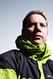 John Woodward合作论文数Biotechnology Unit, The University of Leeds11
 Martin Siegert合作论文数University of Exeter;The Grantham Institute for Climate Change, Faculty of Natural Sciences, Imperial College London;School of Geosciences, University of Edinburgh10
 Ben W. Brock合作论文数university of milan9
 Jorge Clavero合作论文数9Hugh Corr合作论文数British Antarctic Survey9María Gabriela Lenzano合作论文数8Neil Ross合作论文数Newcastle University, Newcastle University8
 David Etheridge合作论文数Division of Atmospheric Research;Industrial Research Organization;Division of Atmospheric Research, Industrial Research Organization8
 Jonathan Bamber合作论文数Technical University of Munich8
 Juan Carlos Aravena合作论文数Centro de Estudios Cuaternarios (CEQUA),, Universidad de Magallanes8
 Javier G. Corripio合作论文数Centre d'Etudes de la Neige;Department of Geography;University of Zurich;Centre d'Etudes de la Neige, University of Zurich8
 Richard Hindmarsh合作论文数British Antarctic Survey;Department of Geography, Durham University8
 C. J. Fogwill合作论文数university of new south wales8
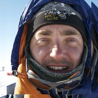 Christian S. M. Turney(Chris Turney)合作论文数Earth and Sustainability Science Research Centre, School of Biological, Earth and Environmental Sciences, Faculty of Science, The University of New South Wales8R. Zamora合作论文数7Sebastián Cisternas合作论文数7
 David Vaughan合作论文数British Antarctic Survey7
 Mike Bentley合作论文数Department of Geography, Durham University7
 Edward C. King合作论文数Substance Abuse and Mental Health Services Administration;Lewin Group;Actuarial Research Corporation;Substance Abuse and Mental Health Services Administration, Actuarial Research Corporation7Luis E. Lenzano合作论文数7
 Ricardo Villalba合作论文数Instituto Argentino de Nivologia, Glaciologia y Ciencias Ambientales, Consejo Nacional de Investigaciones Cientificas y Tecnicas7Robert H. Thomas合作论文数6
 Daniel Falaschi合作论文数Dept Geog FFyL, Univ Nacl Cuyo6
 M. Gabriela Lenzano合作论文数6Andrew D. Moy合作论文数Inst Marine & Antarctic Studies, Univ Tasmania6
 Siva Prasad Gogineni合作论文数Department of Aerospace Engineering and Mechanics, College of Engineering, The University of Alabama;Department of Electrical and Computer Engineering, College of Engineering, The University of Alabama6
 Frank Paul合作论文数Department of Geography;University of Zurich;Department of Geography, University of Zurich6A.M. Smith合作论文数6William B Krabill合作论文数6
 Jorge F. Carrasco合作论文数Direcc Meteorol Chile6
 Mark Curran合作论文数Antarctic Climate and Ecosystems Cooperative Research Centre;Australian Antarctic Division6
 Thomas Loriaux合作论文数5
 Esteban Lannutti合作论文数5
 Alan Cooper合作论文数Gulbali Institute, Charles Sturt University;Blue Sky Genetics5
 Margit Schwikowski合作论文数Paul Scherrer Institut5
 Michael Bird合作论文数Centre for Tropical Environmental and Sustainability Science, College of Science & Engineering, James Cook University5Hamish D. Pritchard合作论文数British Antarctic Survey5
 Wilfried Haeberli合作论文数Department of Geography, University of Zurich5




