The crater of Mount St. Helens has undergone significant changes since the end of the 2004-2008 eruption cycle. Heat output from the new lava dome has decreased constantly in different phases of cooling. At the same time, the lava dome morphology changed, including substantial subsidence. Herein we present long-term dome evolution within the St. Helens crater by combining field investigations and remote sensing data. Repeated surveys of subglacial caves provide evidence for a new phase of dome cooling and reduced fumarolic activity. While the caves remained consistent or became larger before 2022, the latest field campaigns in 2023 indicated a strong volume reduction. One example is Mothra Cave, which reduced from 797.4 to 189.8 m in surveyed length in one year (2022 to 2023). These observations are supported by decreasing fumarole temperatures in/near the cave systems located at the dome flanks (trending towards 0 degrees C) as well as decreasing fumarole temperatures at the dome summit (similar to 380 degrees C in 2014/2015, similar to 90 degrees C in 2021; similar to 60 degrees C in 2024). Although ASTER data similarly revealed an overall cooling of the lava dome, field investigations enabled a more precise determination of the temperature distribution. As revealed by LiDAR data, the new 2004-2008 lava dome decreased in elevation more than 35 m from 2009 to 2019. In contrast, almost no elevation change was observed at the old 1980-1986 dome. The elevation loss is strongly related to initial dome growth structures. Drone images further characterized structures on the new dome, demonstrating correlations between fumarolic areas and substrate and morphology. Since lava dome degradation is associated with numerous hazards, information about their long-term development as well as the comparison between various parameters and their response time can contribute to hazard forecasts.
The twin summit craters of Mount Rainier, Washington, USA host the largest known glaciovolcanic caves in the world and at 4382 m, the highest elevation caves in the USA. The caves are formed in ice at the glacier-rock interface by volcanogenic gases and atmospheric advection. However, the way in which discrete caves are formed and evolve remains poorly understood. Surveys of the cave systems in 1970−1973 and 1997−1998 in both the West and East Craters documented cave passage morphology. Field expeditions from 2014−2017 comprehensively surveyed the Rainier summit caves and undertook thermal imaging and temperature monitoring. Significant changes had occurred. In the East Crater, documented cave length has nearly doubled since 1973 to 3593 m of passage spanning 144 m of depth, revealing a new subglacial lake, and now nearly circumnavigating the East Crater. Of the reported increase in length, some 600 m of the mapped passage is possibly newly formed. Across 47 years of observation, certain sections of the cave appear to be preserved in form and position through time, while others are more actively being lost or forming. Conserved passages are generally sub-horizontal, passages following the curvilinear crater contours, show low temperature variability, and are dependent on perennial fumarolic activity or distributed heat flux emanating from warm bedrock and sediment floors. Transient passages are smaller diameter dendritic passages following the slope of the ice-rock interface towards entrance zones and normal to the circum-crater passage. They also show higher variability in temperature and airflow and are subject to seasonal weather and mechanical collapse, which may contribute to transience. Additional research is required to confirm the mechanisms maintaining conserved passages and formation of transient passages.
Interactions between volcanoes and glaciers provide insight to the evolution of a volcanic edifice and may be an indicator for renewed volcanic activity. At Mount St. Helens, Crater Glacier, which has formed in the volcanic crater after the eruption in 1980, is one of the world’s last expanding glaciers and provides a unique opportunity to characterize the evolution of a glacier expanding onto an area of significant thermal flux. We combine photographic documentation and glaciovolcanic cave surveys with remote sensing data from Google Earth, UAS, and LiDAR to analyze the present state of Crater Glacier and reconstruct its development since the emplacement of the 2004–2008 lava dome. Our results show that snow accumulation has caused Crater Glacier to grow from 2009 to 2019 by approximately 13.8 × 10 6 m 3 , during which time the glacier toe advanced by several hundred meters. The glacier-dome interface shift toward higher elevations against the 2004–2008 lava dome and subsequent encroachment onto thermally active areas led to glacier modification via extensive subglacial cave system formation. Analysis of subglacial tephra layers revealed the existence of juvenile material from the 2004–2008 eruption cycle, providing insights about glacier subsidence of ~ 40 m since 2004/2005 in spite of net growth. Although the lava dome is cooling, the glacier-dome interface seems to have become increasingly stable in the past few years. Our results suggest that glacier development in the accumulation area adjacent to the dome is now being affected by the thermal characteristics of the lava dome itself, making monitoring internal glacier development via tracking glaciovolcanic cave expansion a potentially important volcano monitoring tool.
Glaciovolcanic cave systems, including fumarolic ice caves, can present variable atmospheric hazards. The twin summit craters of Mount Rainier, Washington, USA, host the largest fumarolic ice cave system in the world. The proximity of fumarole emissions in these caves to thousands of mountaineers each year can be hazardous. Herein we present the first assessment and mapping of the atmospheric hazards in the Mount Rainier caves along with a discussion on the microclimates involved in hazard formation and persistence. Our results are compared to applicable life-safety standards for gas exposure in ambient air. We also describe unique usage of Self-Contained Breathing Apparatus (SCBA) at high altitude. In both craters, subglacial CO2 traps persist in multiple locations due to fumarole output, limited ventilation, and cave morphology. CO2 concentrations, calculated from O2 depletion, reached maximum values of 10.3 % and 24.8 % in the East and West Crater Caves, respectively. The subglacial CO2 lake in West Crater Cave was persistent, with atmospheric pressure as the main factor influencing CO2 concentrations. O2 displacement exacerbated by low O2 partial pressure at the high summit altitude revealed additional cave passages that can be of immediate danger to life and health (IDLH), with O2 partial pressures as low as 68.3 mmHg. Planning for volcanic research or rescue in or around similar cave systems can be assisted by considering the implications of atmospheric hazards. These findings highlight the formation mechanisms of hazardous atmospheres, exploration challenges, the need for mountaineering and public awareness, and the broader implications to volcanic hazard assessment and research in these environments.
Recent speleoclimatological research has shed new light on air pressure dynamics inside barometric caves by identifying pressure-modifying processes and resulting systematic differences between cave and surface air pressure. Based on these new findings, a multi- step quantitative model is developed and explored to predict air pressure inside Wind Cave and Jewel Cave – two major barometric cave systems in the Black Hills of South Dakota, USA – from external surface measurements. Therefore, each identified speleoclimatological pressure process is translated into a mathematical operation. Model evaluation based on Pearson correlation and mean (absolute) deviation between model outputs and control measurements yields good to excellent results: Depending on the location, the presented model predicts 99.2% to 99.7% of measured air pressure inside Wind Cave compared to 90.3% and 99.4% inside Jewel Cave, thus proving that the previously identified and now modeled processes adequately and comprehensively describe the speleoclimatological pressure dynamics inside barometric caves. Slightly weaker model performance is observed at the lower elevator level inside Wind Cave and at Deep Camp inside Jewel Cave due to irregular pressure disturbances caused by elevator operation and unique morphological features in the deeper parts of Jewel Cave, respectively. Comparative spatial analyses of model constants and model accuracies at all investigated locations reveal significant differences in pressure patterns between the caves, thus demonstrating the effect of morphological characteristics on air pressure propagation and resulting modifications. The findings also support earlier research in Wind Cave and Jewel Cave as they provide speleoclimatological background for previously observed differences in airflow dynamics between both caves. Therefore, this study presents an important contribution to understanding the complex speleoclimatology of barometric caves.
Glacial environments can have significant impacts on the surrounding landscape and nearby populations when affected by volcanic activity. As such, glaciovolcanic interactions and related hazards have received substantial attention during the last few decades. In contrast, the study of void spaces created by these interactions—glaciovolcanic cave systems—remains underrepresented. This review outlines the global distribution of glaciovolcanic caves and describes examples of both historical and ongoing research advances, most of which are limited to volcanoes of the Cascade Volcanic Arc and Antarctica. Examples range from a largely static fumarolic ice cave system in the crater of Mount Rainier to glaciovolcanic cave genesis and evolution in the crater of Mount St. Helens, where the advancing glacier ice is interacting with ongoing fumarolic activity and generating new cave systems. This review includes various volcanic subfields and also brings together additional disciplines including speleology, microbiology, and astrobiology. Due to the importance of glaciovolcanic caves in the hydrothermal cycle of volcanic systems, the global fight against antibiotic resistance, and their implications for understanding volcano-ice interactions beyond Earth, research on these systems is expanding. Kamchatka, Alaska, and Iceland have notable potential for further studies, while known research sites still hold open questions, including better understanding of the environmental parameters affecting cave genesis and persistence, the effect of glaciovolcanic cave development on underlying hydrothermal systems, and cataloging the biodiversity of glaciovolcanic cave environments.
Mount St. Helens, one of the highest-risk volcanoes in the Cascade Volcanic Arc, hosts a novel system of glaciovolcanic caves that has formed around the 2004−2008 lava dome. From 2014 to 2021 a multidisciplinary research team systematically explored and mapped these new caves to ascertain their characteristics. Air and fumarole temperatures, volume flow rates, and wind regimes were also monitored. More than 3.0 km of cave passages have formed in a semicircular pattern in the volcanic crater and provide an opportunity to (1) observe cave development over time, (2) identify low temperature fumaroles as the main driving force for cave formation, (3) verify the impact of seasonal snow accumulation on cave climate, and (4) assess heat distribution in subglacial and subaerial portions of the new lava dome. Glaciovolcanic cave systems on Mount St. Helens are comparatively young (<10 years) and the most dynamic in the Pacific Northwest. Observed cave expansion during the study suggests ongoing genesis and future formation of interconnected systems. However, further expansion may also be limited by increasing fumarole temperatures towards the upper parts of the lava dome, cave instability due to snow overload, or variable subglacial volcanic heat output. New glaciovolcanic cave system development provides a unique barometer of volcanic activity on glacier-mantled volcanoes and to study the subglacial environment. We present the results of eight years of initial study within this dynamic cave system, and discuss a pathway towards future longitudinal analyses.
Recent research on air pressure propagation through barometric caves has revealed various speleoclimatological processes, which cause a more complex relationship between surface air pressure changes and resulting pressure gradients between cave and surface air than previously assumed. So far, however, studies on barometric cave airflow have only been based on surface air pressure measurements. Thus, this study investigates and compares airflow at the openings of Wind Cave and Jewel Cave – two major barometric cave systems in South Dakota, USA – as a response to surface air pressure changes and air pressure gradients. Based on high-resolution long-term air pressure measurements from the surfaces and several locations inside the caves, as well as ultra-sonic airflow measurements at the openings, the analysis proves that for both caves, cave airflow velocity can be predicted more accurately by air pressure gradients than by previous surface air pressure changes. An inter-cave comparison also reveals substantial differences in cave airflow dynamics between Wind Cave and Jewel Cave, with the relevant period of surface air pressure variations for cave airflow velocity and the cave reaction times being significantly longer at Jewel Cave compared to Wind Cave. Therefore, the findings of this study demonstrate the effects of cave morphology on airflow and significantly contribute to a better understanding of the speleoclimatological mechanisms and dynamics of compensating airflow at the openings of barometric caves.
Combining photogrammetric reconstruction (close-range photogrammetry, CRP) and airborne photogrammetry through the structure from motion method (SFM) with terrestrial three-dimensional (3D) laser scanning (TLS), Maelstrom Cave on Big Island, Hawaii (USA), was mapped in three dimensions. The complementary properties of the two methods generated an overall model that depicted significant features of the cave both spatially and visually. Through various processes, the complex geometric quantities were derived from the model that can be used to answer microbiological and climatological questions. In this report, the procedure for the three-dimensional acquisition of the terrain surface above Maelstrom Cave as well as the interior of the cave with TLS and SFM is described. It is shown how the different data sets were combined and contrasted, including a comparison of geometries from the different survey operations. Finally, the editing processes used to quantify and simplify the cave geometry are presented, as well as the analysis of the ellipses generated accordingly to determine the geometric quantities. Through the analysis of the cave geometry, important geometric properties of the Maelstrom Cave could be quantified and categorized. In this way, an effective tool was developed to directly correlate the structure of the cave system with climatological and microbiological parameters in order to answer the corresponding questions.
In barometric caves, air pressure gradients between the outside atmosphere and the cave induce strong bidirectional compensating currents, which control almost all elements of speleoclimatology, including air temperature, humidity, and CO2 dynamics. Therefore, this study set out to investigate air pressure propagation through Wind Cave and Jewel Cave – two major barometric cave systems in the Black Hills of South Dakota, USA. Based on high-resolution air pressure data from both the surface and several measurement sites inside the caves, four systematic changes of pressure waves during their journey through the caves and their related speleoclimatological processes were identified and discussed: Compared to the outside atmosphere, the pressure signals within Wind Cave and Jewel Cave showed (1) an absolute displacement due to different altitudes of the measuring sites, (2) a delay related to the travel times of the pressure wave to the measuring sites, (3) a smoothing effect, and (4) a damping effect due to long response times of the caves to external pressure changes. The spatial distribution of the changes observed in this study shows that for Wind Cave, the cave opening and the narrow entrance area represent the main obstacle for pressure propagation, while for Jewel Cave, the deep areas have the greatest influence on the development of air pressure gradients. Our analyses provide completely new insights into the processes and mechanisms inside barometric caves, which will significantly contribute to the understanding of pressure-related airflow dynamics and all related elements of speleoclimatology.
The fumarole ice caves of Mount Rainier in the Cascade Volcanic Arc in Washington, USA, provide unique insight into the dynamic equilibrium between thermal flux of fumaroles on volcanic edifices and snow accumulation on summit glaciers. More than 3.5 km of surveyed cave passage nearly circumnavigate the East Crater, reaching within 19 m of the 4,392 m summit and extending to 144 m depth along the glacier‐crater boundary. The large circum‐crater passage connects entrances on the crater rim to steep transverse passages, and cave morphology is maintained by fumarole gas convection and advection. A melt‐ and condensate‐formed lake, Lake Adélie, occupies a portion of the circum‐crater passage. Hourly data were collected between August 2016 and August 2017 and included the measured temperatures at three fumaroles, the cave air temperature and pressure, the lake water temperature and depth, and the outside temperature and snow depth at Paradise Visitors Center. Time‐series analyses of these data reveal complex associations between synoptic to seasonal weather, fumarole activity, and lake level. On seasonal and longer scales, fumarole temperatures follow independent pathways connected to spatial and temporal changes in volcanic heat flux and the circulation of glacial melt. Major snowfall seals the cave entrances, increasing cave air temperature and pressure from fumarole output and causing rising lake levels from increased melt until entrances reopen. Repeating freeze‐thaw cycles observed in the cave monitoring data are a primary cause of crater mass wasting. Despite these transient variations, the scale and morphology of the caves is preserved over decadal or longer scales.
Abstract. A new and extensive system of glaciovolcanic caves has developed around the 2004–2008 lava dome in the crater of Mount St. Helens, Washington, USA. These systems offer a rare view into a subglacial environment and lead to a better understanding of how glaciers and active volcanoes interact. Here, we present first results from geodetic and optical surveys done between 2014 and 2019 as well as climatologic studies performed between 2017 and 2019. Our data show that volcanic activity has altered subglacial morphology in numerous ways and formed new cave systems that are strongly affected by heat flux from several subglacial fumaroles. More than 2.3 km of cave passages now form a circumferential pattern around the dome, some several hundred meters long. Air and fumarole temperature measurements were conducted in two specific caves. Whereas air temperatures reveal a strong seasonal dependency, fumarole temperatures are affected to a minor extent and are primarily regulated by changes in volcanic heat flux or the contribution of glacial melt. Related studies from Mount Hood, Oregon, and Mount Rainier, Washington, are used as comparison between glaciovolcanic cave systems. Fumarolic heat and resulting microclimates enable further genesis of this dynamic system. Already one of the largest worldwide, it is very likely that the system will continue to expand. As Mount St. Helens is the Cascade Volcano most likely to erupt again in the near future, these caves represent a unique laboratory to understand glaciovolcanic interactions, monitor indicators of recurring volcanic activity and to predict related hazards.
Gaining information on climatic conditions in subway tunnels is the key to predicting the propagation of smoke or toxic gases in these infrastructures in the case of a fire or a terrorist attack. As anemometer measurements are not economically suitable, the employment of alternative monitoring methods is necessary. High-resolution temperature sensing with Raman optical frequency domain reflectometry (OFDR) using optical communication fiber cables shows great potential as it allows the surveillance of several kilometers of underground transport facilities without the need for installing sensing equipment in the tunnels. This paper presents first results of a study using this approach for monitoring subway tunnels. In the Berlin subway, temperature data gathered from newly installed as well as pre-installed communication cables were evaluated and compared to reference data from temperature loggers. Results are very promising as high correlations between all data can be achieved showing the potential of this approach.
In the following chapter we present an overview on the ice cave sites in Germany in the past and today. The focus is on the Berchtesgaden Alps, since the majority of the caves today are known in this area. Furthermore we present some basic facts about the systematic research done so far.
 Christian Stenner合作论文数13
 Julia Ringeis合作论文数12Eduardo Cartaya合作论文数10
 Linda Sobolewski合作论文数10
 Markus Brune合作论文数10David Holmgren合作论文数8Brian Agnew合作论文数7
 Lee J. Florea合作论文数Department of Geology, University of South Florida7m killingheinze合作论文数5
 Artur Ionescu合作论文数Fac Environm Sci & Engn, Babes Bolyai Univ5
 Valter Maggi合作论文数Dipart. di Scienze della Terra, Via Mangiagalli 34, Milano 20133, Italy5jacek piasecki合作论文数4
 Christiane Meyer合作论文数4Annika K. Gomell合作论文数4
 Lee Florea合作论文数Washington State Department of Natural Resources;Midwest Karst Consultants3Wilhelm Furian合作论文数3Edgar U. Zorn合作论文数German Res Ctr Geosci GFZ3Tobias Berghaus合作论文数2Stan Allison合作论文数2stephen m smith合作论文数2
 Roberto Anitori合作论文数Oregon Health &, Institute of Environmental Health;Science University Portland;Institute of Environmental Health, Oregon Health & Science University Portland2
 Norbert Schörghofer合作论文数Planetary Science Institute2
 Wieland Hill合作论文数ZENT INST PHYS CHEM, ACAD SCI GDR2
 Glyn Williams-Jones合作论文数Department of Earth Sciences;Simon Fraser University;Department of Earth Sciences, Simon Fraser University2
 Thor H. Hansteen合作论文数2Rodney D. Horrocks合作论文数2Dirk Carstensen合作论文数1Anupam Misra合作论文数1Charlotte Hüser合作论文数1
 Jan Cermak合作论文数1
 Michael Kogel合作论文数Fraunhofer IMWS1Tayro E Acosta-Maeda合作论文数1
 Zi Qian合作论文数1M. Telus合作论文数1
 James Charlton合作论文数Northumbria Univ, Dept Architecture & Built Environm, Newcastle Upon Tyne, Tyne & Wear, England1
 Richard E Davis合作论文数NASA, Texas State Univ1
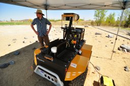 michael paton合作论文数Fac Appl Sci Engn, Univ Toronto Inst1
 Rappé Michael S合作论文数Hawaii Inst Marine Biol, Univ Hawaii Manoa1
 Sean Patrick Jungbluth合作论文数School of Ocean and Earth Science and Technology, University of Hawaii Kaneohe;School of Ocean and Earth Science and Technology, University of Hawaii Honolulu;University of Hawaii Kaneohe, University of Hawaii Honolulu1Rancourt Kenneth合作论文数1
 Ulrich Meyer合作论文数1
 Eric Hellebrand合作论文数Department of Earth Sciences, Utrecht University1
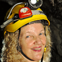 Diana E Northup合作论文数Department of Biology, University of New Mexico;Centennial Library, University of New Mexico1
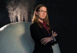 Morgan Cable合作论文数Harriet L. Wilkes Honors College, Florida Atlantic University1
 Bogdan P. Onac合作论文数“Emil Racoviţă” Institute of Speleology, Clinicilor 5, Cluj Napoca, 400006, Romania1
 Jay Nadeau合作论文数1




