Mangroves are salt-tolerant coastal trees that sequester carbon, filter water, act as buffers from storms, and provide habitat for wildlife. In Florida, three native species—Rhizophora mangle (red mangrove), Avicennia germinans (black mangrove), and Laguncularia racemosa (white mangrove)—each with unique adaptations to salinity and hydrology, thrive along distinct zones of the intertidal gradient. As mangrove ecosystems migrate northward with climate change, their ecological value and economic value grow. But they face growing threats from development, pollution, and mismanagement. Improper trimming practices can harm mangroves' health and resilience, especially along developed coastlines. This publication aims to educate landowners, property managers, and the public on the ecological importance of mangroves, while providing best practices for responsible trimming and long-term preservation.
Soil Organic Matter (SOM) decomposition, vital to the carbon cycle, is influenced by land cover, hydrological conditions, and soil properties. However, understanding of how hydrolytic enzymes involved in SOM turnover vary under these factors remains limited. To address this, a study was conducted in a sub-tropical preserve in South Florida to assess hydrolytic enzyme activities across 23 diverse land covers (Categorized into five ecosystems: A-Upland Forests, B-Wetland ecosystems, C-Shrub ecosystems, D-Range Areas, and E-Barren ecosystems) during wet and dry seasons. The assessed enzymes were β-1,4 glucosidase (βG), β-1,4-N-acetyl glucosaminidase (β-NAG), Acid Phosphatase (AP), and Aryl Sulfatase (AS). A weighted index termed the Hydrolytic Enzyme Decomposition Indicator (HEDI) was derived using principal component analysis to summarize overall enzymatic activity as an indicator of decomposition. The results showed that among the land covers, βG, β-NAG, AP, and AS activities during the dry season ranged from 18.40 to 327.20, 14.71–351.90, 302.89–10,185.80, and 26.51–1,745.75 μg PNP/g soil/hr, respectively, while in the wet season, the activities for all enzymes except AS were higher, ranging from 4.08 to 398.66, 21.72–1,118.97, 372.38–11,960.36, and 28.26–1,475.09 μg PNP/g soil/hr. Among ecosystems, βG and β-NAG showed seasonal variability, with β-NAG consistently higher in A-Upland Forests, B-Range Areas, and C-Shrub. AP and AS showed minimal variation, with all enzymes showing lower activity in D-Barren ecosystems. HEDI values in the dry season A-Upland Forests exhibited the widest range (−0.962–1.613), indicating diverse decomposition rates, while Barren ecosystems showed consistently low activity (−0.928 to −0.916), suggesting lower decomposition. Correlation analysis revealed positive relationships between enzymatic activities and soil properties such as SOM (0.51–0.59), active carbon (0.46–0.58), soil protein (0.27–0.40), and cation exchange capacity (0.28–0.40), while bulk density showed negative correlations (−0.31 to −0.50). Overall, this study highlights the necessity of considering the complex interactions between soil properties, vegetation, moisture, and enzymatic activity in understanding SOM decomposition.
IntroductionRestoration of ecotone specialists can be challenging, since ecotones are defined by steep environmental and competition gradients. Restoration success is enhanced by understanding the factors that limit the range of ecotone specialists in the transition zone.MethodsWe examined conditions affecting the restoration success of coastal gumplant, Grindelia stricta, a salt marsh-upland ecotone specialist in California. We planted transplants in experiments testing the impacts of facilitation, soil amendment, and elevation on Grindelia survival and health. We also surveyed the seaward boundary of Grindelia at a restored versus natural marsh.ResultsWe found that facilitation by Salicornia pacifica greatly improved outplanting success at stressful elevations, but that soil amendment had little impact. Restoration success appeared to be limited by physical stress at lower elevations and competition at higher elevations, as predicted by the stress gradient hypothesis. Our survey revealed that Grindelia's lower limit is close to the king tide line.ConclusionsThis study provides a model of how restoration science and experiments can enhance the success of species living in ecotones. Results on this ecotone specialist delineate the zone of likely plant success and highlight the potential value of including facilitation to decrease the stressors near the edge of the ecotone.
In subtropical preserve ecosystems, natural factors combined with anthropogenic activities have led to significant seasonal changes, including distinct dry and rainy seasons. These changes can potentially impact soil health indicators, which are keystone properties that control ecosystem services across terrestrial landscapes. Few studies have evaluated the impact of seasonal changes on soil health within non-agronomic landscapes, such as preserves. As part of this study, we collected topsoil samples (0-15 cm) from twenty-three land cover types within a 109 km² preserve in central Florida during two different seasons (dry and wet) to advance the understanding of how soil health responds to seasonal changes and to explore the environmental factors controlling soil health within non-agronomic landscapes. Ten soil indicators were analyzed and incorporated into the total dataset (TDS). From the TDS, a minimum dataset was derived using Principal Component Analysis, which was then used to calculate the Soil Health Index (SHI) for soil health assessment. Our findings showed that changes in soil indicators, their relationships, and the SHI across seasons depend on land cover type. Based on soil health classification grades, soil health status either improved, declined, or remained constant between seasons, depending on land cover type. The regression analysis of eight selected environmental factors, such as soil profile moisture (SPM), surface soil wetness (SSW), precipitation (P), soil temperature (T), elevation (El), slope gradient (S), global horizontal irradiance (GHI) and surface albedo (ALB), showed that only slope gradient significantly explains variations in SHI during wet season, whereas other environmental factors do not show significant explanatory power for SHI variations in either dry or wet season. These findings highlight the dominant influence of slope gradient on soil health within non-agronomic landscapes, while indicating that other evaluated environmental factors may have limited relevance in this context. Furthermore, the non-significant findings among soil indicators across seasons may be attributed to the study's small sample size (i.e., three replications), a limitation stemming from constrained funding. This highlights the importance of future research incorporating larger sample size to validate the findings of this study.
The structure, function, and dynamics of Earth's terrestrial ecosystems are profoundly influenced by how often (frequency) and how long (duration) they are inundated with water. A diverse array of natural and human-engineered systems experience temporally variable inundation whereby they fluctuate between inundated and non-inundated states. Variable inundation spans extreme events to predictable sub-daily cycles. Variably inundated ecosystems (VIEs) include hillslopes, non-perennial streams, wetlands, floodplains, temporary ponds, tidal systems, storm-impacted coastal zones, and human-engineered systems. VIEs are diverse in terms of inundation regimes, water chemistry and flow velocity, soil and sediment properties, vegetation, and many other properties. The spatial and temporal scales of variable inundation are vast, ranging from sub-meter to whole landscapes and from sub-hourly to multi-decadal. The broad range of system types and scales makes it challenging to predict the hydrology, biogeochemistry, ecology, and physical evolution of VIEs. Despite all experiencing the loss and gain of an overlying water column, VIEs are rarely considered together in conceptual, theoretical, modeling, or measurement frameworks and approaches. Studying VIEs together has the potential to generate mechanistic understanding that is transferable across a much broader range of environmental conditions, relative to knowledge generated by studying any one VIE type. We postulate that enhanced transferability will be important for predicting changes in VIE function in response to global change. Here we aim to catalyze cross-VIE science that studies drivers and impacts of variable inundation across Earth's VIEs. To this end, we complement expert mini-reviews of eight major VIE systems with overviews of VIE-relevant methods and challenges associated with scale. We conclude with perspectives on how cross-VIE science can derive transferable understanding via unifying conceptual models in which the impacts of variable inundation are studied across multi-dimensional environmental space.
People alter the earth’s surface in diverse and prolific ways, from enhancing physical and chemical erosion to controlling water transport across drainage networks. These modifications are often faster, more extensive, and wholly novel when compared to natural landscape evolutionary processes. Existing literature largely portrays people as independent of a landscape’s geologic and climatic context. However, we suggest that humans are fundamentally embedded within the geomorphic system. Anthropogenic alteration of the earth’s surface results in landscapes that reflect both the socio-economic-technological settings driven by human need and the underlying climate and geology. Given that human impacts create similar novel combinations of landforms across the world, we suggest an opportunity for focused study of these “novel landforms.” Distinctly anthropogenic landscapes without natural analogues, novel landforms cannot be explained without incorporation of people as an explicit geomorphic process. We propose a unifying framework for the study of novel landforms and demonstrate the opportunities available for more systematic, generalizable research on human-coupled geomorphology.
Download This Paper Open PDF in Browser Add Paper to My Library Share: Permalink Using these links will ensure access to this page indefinitely Copy URL Copy DOI
Urbanization of shorelines has altered the structure, function, and dynamics of coastal ecosystems. Consequently, these areas are less resilient to sea-level rise and coastal flooding. To protect vulnerable property, coastal residents often harden their shorelines using traditional approaches like seawalls and bulkheads. Nature-based solutions, such as living shorelines, are an alternative method to prevent erosion while providing additional benefits but are less common than hardened shorelines. Because decisions regarding private shoreline management often fall on the homeowner, there is a need to understand perceptions of shoreline management options. We conducted an address-based survey of waterfront property owners in Florida to explore their satisfaction with their current shoreline and driving factors behind how they manage and protect their shoreline. Perceived effectiveness was the most important factor driving shoreline management decisions. Most respondents were satisfied with their shoreline regardless of shoreline type (mean f SD = 7.5 f 2.3 of 10), but satisfaction was significantly higher among homeowners with natural shorelines (8.22 f 2.13) than those with armored shorelines (7.38 f 2.19). Owners of living and natural shorelines reported spending less time and money on their shorelines and recognized the environmental benefits by assigning significantly higher environmental ratings to their shorelines (4.20 f 0.75 and 4.29 f 0.20 of 5, respectively) in comparison to homeowners with armored shorelines (3.22 f 0.79). However, respondents perceived natural and living shorelines to be significantly less effective at shoreline protection (mean protection score of 3.46 f 1.10 and 3.49 f 0.66 of 5, respectively) compared to armored shorelines (mean protection score = 4.0 f 0.75). Analyses revealed a strong influence of neighboring shoreline type, though only 21.5% of waterfront property owners in our survey self- identified this as a major driver of their decisions. Moreover, there appears to be a general lack of understanding about how shoreline management decisions affect adjacent properties, with only 34.7% of respondents believing that a neighboring shoreline influenced their own. Owners of armored and hybrid shorelines exhibited a general belief that their shoreline benefitted neighboring properties (ratings of 3.59 f 0.91 and 3.45 f 0.86 of 5, respectively) while owners of natural shorelines rated their shoreline's influence as most neutral (2.67 f 0.65). Further research into the effectiveness of different living shoreline designs compared to hardened shorelines to prevent erosion and storm damage may lead to greater adoption of living shorelines. Strategic communications focusing on aspects most misunderstood or most valued by homeowners, such as effectiveness, longevity, and cost, could increase the salience of living shorelines as an advantageous shoreline management approach.
Salt marshes exist at the terrestrial-marine interface, providing important ecosystem services such as nutrient cycling and carbon sequestration. Tidal inputs play a dominant role in salt marsh porewater mixing, and terrestrially derived freshwater inputs are increasingly recognized as important sources of water and solutes to intertidal wetlands. However, there remains a critical gap in understanding the role of freshwater inputs on salt marsh hydrology, and how this may impact marsh subsurface salinity and plant productivity. Here, we address this knowledge gap by examining the hydrologic behavior, porewater salinity, and pickleweed (Sarcocornia pacifica also known as Salicornia pacifica) plant productivity along a salt marsh transect in an estuary along the central coast of California. Through the installation of a suite of hydrometric sensors and routine porewater sampling and vegetation surveys, we sought to understand how seasonal changes in terrestrial freshwater inputs impact salt marsh ecohydrologic processes. We found that salt marsh porewater salinity, shallow subsurface saturation, and pickleweed productivity are closely coupled with elevated upland water level during the winter and spring, and more influenced by tidal inputs during the summer and fall. This seasonal response indicates a switch in salt marsh hydrologic connectivity with the terrestrial upland that impacts ecosystem functioning. Through elucidating the interannual impacts of drought on salt marsh hydrology, we found that the severity of drought and historical precipitation can impact contemporary hydrologic behavior and the duration and timing of the upland-marsh hydrologic connectivity. This implies that the sensitivity of salt marshes to climate change involves a complex interaction between sea level rise and freshwater inputs that vary at seasonal to interannual timescales.
A significant proportion of Florida's population lives on the coast and is directly impacted by alterations to the coastal zone, weather disasters (e.g., hurricanes, erosion, flooding), or changes to ecosystem services. Data collected in Florida waters (including water quality, habitat health, bathymetry, and fisheries data) are important for the maintenance of coastal waters, communities, and ecosystems. Yet benthic data collected by a variety of stakeholders are often not shared or openly available, with little metadata to ease data reuse, and are often stored in incompatible formats. To assess the needs of government agencies, private companies, academic researchers, and data managers, we conducted a survey and organized an expert focus group to determine the current state of coastal and marine data usage and distribution in Florida. Through the survey, we asked participants to describe the types of data they use or collect, how they use that data, what limitations they encounter with data sharing, how and when they share their data, and what sorts of metadata standards they use in their work. We determined that many data producers and users are unaware of data standards and often do not follow best management practices for data collection and sharing. The sector of activity of the individual respondent (government, academic, non-profit) determined how data users were interacting with or collecting data and what standards they followed when sharing data. Our expert panel largely echoed our findings, with consistent, well-documented, and standardized datasets being the most important components for data integration in projects. To advance accessibility and reusability of benthic data, our project highlights the need for additional training of stakeholders on data standardization, collaboration and integration, which needs to be applied across institutions. A major need that was identified is tools that make data sharing and metadata creation easier and more efficient.
The United States (U.S.) coastal plain is subject to rising sea levels, land subsidence, more severe coastal storms, and more intense droughts. These changes lead to inputs of marine salts into freshwater-dependent coastal systems, creating saltwater intrusion. The penetration of salinity into the coastal interior is exacerbated by groundwater extraction and the high density of agricultural canals and ditches throughout much of the rural U.S. landscape. Together saltwater intrusion and sea level rise (SWISLR) create substantial changes to the social-ecological systems situated along the coastal plain. Many scholars and practitioners are engaged in studying and managing SWISLR impacts on social, economic, and ecological systems. However, most efforts are localized and disconnected, despite a widespread desire to understand this common threat. In addition to variable rates of sea level rise across the U.S. outer coastal plain, differences in geomorphic setting, water resources infrastructure and management, and climate extremes are resulting in different patterns of saltwater intrusion. Understanding both the absolute magnitude of this rapid environmental change, and the causes and consequences for its spatial and temporal variation presents an opportunity to build new mechanistic models to link directional climate change to temporally and spatially dynamic socio-environmental impacts. The diverse trajectories of change offer rich opportunities to test and refine modern theories of ecosystem state change in systems with exceptionally strong socioecological feedbacks.
Salt marshes are dynamic hydrologic systems where terrestrial groundwater, terrestrial surface water, and seawater mix due to bi-directional flows and pressure gradients. Due to the counteracting terrestrial and marine forcings that control these environments, we do not comprehensively understand water fluxes in these complex coastal systems. To understand the water sources, flow directions, and velocities in salt marsh porewater, we employed a combination of geochemical tracers and analytical models across a hillslope-to-salt marsh continuum in a salt marsh experiencing daily inundation of estuarine surface water (SW) from tides and mixing of fresh seasonal groundwater. We used tritium ( 3 H) as a hydrologic tracer to assess porewater ages and stable water isotope ( δ 2 H and δ 18 O) analyses to separate isotopically distinct estuarine and terrestrial groundwater across different depths and landscape positions in the study transect. We employed electrical conductivity to constrain the role of source mixing and evapotranspiration in salt marsh hydrology. Salinity and stable isotopes revealed that transpiration, rather than evaporation, increased subsurface water salinity to concentrations above estuarine SW during summer. Elevated salinity at depth indicated that salt marsh subsurface water is recharged during the dry growing season. Seasonal recharge patterns drive long-term deep subsurface water dynamics across the salt marsh, with 3 H ages of 3–7 years, and daily tidal cycles drive short-term shallow porewater dynamics with 3 H ages of 0 ± 3.6 years. Our conceptual understanding of the spatiotemporal changes in SW-subsurface water interactions at the terrestrial-marine interface quantifies the hydrological constraints we are missing to improve our understanding of biogeochemical cycles within the salt marsh.
Florida has many ecosystems that are thought of as especially important such as springs, coasts, dry prairies, and the Everglades. One of the ways importance is measured is through value. The term ecosystem services describes the benefits ecosystems and their components provide humans. This publication describes some of the ways to measure ecosystem services and explains how the different approaches to assess ecosystems might be selected, depending on what is most important to the user. This publication should help Extension and outreach agents, as well as agency personnel better understand ecosystem services values and explain them to the public. It should also help interested members of the public who wish to learn more about ecosystem services for themselves.
Researchers in Earth and environmental science can extract incredible value from high- resolution (sub-meter, sub-hourly or hyper-spectral) remote sensing data, but these data can be difficult to use. Correct, appropriate and competent use of such data requires skills from remote sensing and the data sciences that are rarely taught together. In practice, many researchers teach themselves how to use high-resolution remote sensing data with ad hoc trial and error processes, often resulting in wasted effort and resources. In order to implement a consistent strategy, we outline ten rules with examples from Earth and environmental science to help academic researchers and professionals in industry work more effectively and competently with high-resolution data.
Salt marshes remove terrestrially derived nutrients en route to coasts. While these systems play a critical role in improving water quality, we still have a limited understanding of the spatiotemporal variability of biogeochemically reactive solutes and processes within salt marshes. We implemented a high-frequency sampling system to monitor sub-hourly nitrate (NO3-) concentrations in salt marsh porewater at Elkhorn Slough in central California, USA. We instrumented three marsh positions along an elevation gradient subjected to different amounts of tidal inundation, which we predicted would lead to varied biogeochemical characteristics and hydrological interactions. At each marsh position, we continuously monitored porewater NO3- concentrations at depths of 10, 30, and 50 cm and porewater levels measured at 70 cm depth over seven deployments of similar to 10 days each that spanned seasonal wet/dry periods common to Mediterranean climates. We quantified tidal event hysteresis between NO3- and water level to understand how NO3- concentrations and sources fluctuate across tidal cycles. In dry periods, the NO3--porewater level relationship indicated that the NO3- source was likely estuarine surface water that flooded the transect during high tides and the salt marsh was a NO3- sink. In wet periods, the NO3--porewater level relationship suggested the salt marsh was a source of NO3-. These findings suggest that tidal and seasonal hydrologic fluxes together control NO3- porewater dynamics and export and influence ecological processes in coastal environments.
The growing push for open data resulted in an abundance of data for coastal researchers, which can lead to problems for individual researchers related to data discoverability. One solution is to explicitly develop services for coastal researchers to help curate data for discovery, hosting discussions around reuse, community building, and finding collaborators. To develop the idea of a coastal data curation service, we investigate aspects of the UNESCO International Coastal Atlas Network member sites that could be used to build a curation service. We develop a minimal example of a coastal data curation service, deploy this as a website, and describe the next steps to move beyond the prototype phase. We envision a coastal data curation service as a way to cultivate a community focused on coastal data discovery and reuse.
Increasingly, coastal managers are placing artificial reefs in marine waters. These long-lasting habitat alterations have measurable effects on fish, fishers, divers, fisheries, and marine social ecological systems. Understanding how artificial reefs function is necessary to make good decisions about future artificial reefs. Scientific research on many aspects of artificial reefs is not always summarized and explained. In response to this need, we designed a 4-part series called Artificial Reefs 101. This publication, part 2 of the Artificial Reefs series, explains how artificial reefs affect fish populations. It will help the interested public understand more about the ecological effects of artificial reefs and provide detailed information to stakeholders including management agencies, local governments, artificial reef manufacturers, and Extension agents, to allow for better-informed decisions about building and managing artificial reefs.
Salt marshes are hotspots of nutrient processing en route to sensitivecoastal environments. While our understanding of these systems hasimproved over the years, we still have limited knowledge of thespatiotemporal variability of critical biogeochemical processes withinsalt marshes. Sea-level rise will continue to force change on salt marshfunctioning, highlighting the urgency of filling this knowledge gap. Ourstudy was conducted in a central California estuary experiencingextensive marsh drowning and relative sea-level rise, making it a modelsystem for such an investigation. Here we instrumented three marshpositions with different degrees of inundation (6.7%, 8.9%, and 11.2%of the time for the upper, middle, and lower marsh positions,respectively), providing locations with varied geochemicalcharacteristics and hydrological interaction at the site. Wecontinuously monitored redox potential (Eh) at depths of 0.1, 0.3, and0.5 m, subsurface water levels (WL), and temperature at each marshposition to understand how drivers of subsurface biogeochemicalprocesses fluctuate across tidal cycles, using wavelet analyses toexplain the interactions between Eh and WL. We found that tidal forcingsignificantly affects biogeochemical processes by imparting controls onEh variability, likely driving subsurface hydro-biogeochemistry of thesalt marsh. Wavelet coherence showed that the Eh-WL relationship isnon-linear, and their lead-lag relationship is variable. We found thatprecipitation events perturb Eh at depth over timescales of hours, eventhough WL show relatively minimal change during events. This workhighlights the importance of high-frequency measurements, such as Eh, tohelp explain factors that govern subsurface geochemistry andhydrological processes in salt marshes.
Recruitment is a very important life stage for fish which has direct impacts on size of the whole fish population. During this phase, the mortality juvenile fish experience is affected by their density because of competition for the available resources. How much fish density affects mortality in recruitment is itself affected by many factors, but one of the most important is the structural habitat available to juvenile fish. Structurally complex habitats like oyster reefs are thought to have a particularly strong influence on the recruitment process of certain species. Here we describe the ways that habitat can alter recruitment success. We focus on how oyster reefs affect recruitment of fish in Florida and the particular issues related to management of this important habitat.
 Erin Seybold合作论文数Kansas Geol Survey, Univ Kansas9
 Margaret A. Zimmer合作论文数Dept Earth & Planetary Sci, Univ Calif Santa Cruz9
 Stefan Leyk合作论文数Department of Geography, College of Arts and Sciences, University of Colorado Boulder;Institute of Behavioral Science, University of Colorado Boulder9
 Tatariw Corianne合作论文数Department of Biological Sciences, University of Alabama8
 Bhavna Arora合作论文数Water Management & Hydrological Sciences;Texas A&M University;Water Management & Hydrological Sciences, Texas A&M University7
 Emilio Grande合作论文数Dept Earth & Planetary Sci, Univ Calif Santa Cruz6
 Angela Collins合作论文数Fish and Wildlife Research Institute Florida Fish and Wildlife Conservation Commission6
 Ate Visser合作论文数TNO-Netherlands Institute of Applied Geoscience6
 Johannes H. Uhl合作论文数Joint Research Centre, European Commission6
 Dylan Connor合作论文数Arizona State Univ, Sch Geog Sci & Urban Planning, 975 S Myrtle Ave, Tempe, AZ 85281 USA5Andrew Ropicki合作论文数Food & Resource Econ Dept, Univ Florida5
 Maya Montalvo合作论文数4
 Lisa Chong合作论文数University of Florida Health4
 Holly Abeels合作论文数4
 James Heffernan合作论文数Environmental Sciences & Policy, Nicholas School of the Environment, Duke University4
 Maxwell B. Joseph合作论文数Department of Ecology and Evolutionary Biology, University of Colorado4
 Edward Camp合作论文数School of Forest Resources and Conservation, University of Florida4
 Jennifer Balch合作论文数Department of Geography, College of Arts and Sciences, University of Colorado Boulder4Ed Camp合作论文数3
 Caitlin Mcshane合作论文数3John Haskins合作论文数3Matthew W. Rossi合作论文数3Virginia Iglesias合作论文数3
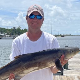 Scyphers Steven B合作论文数Department of Marine Sciences, University of South Alabama3
 Gittman Rachel K合作论文数Institute of Marine Sciences, University of North Carolina at Chapel Hill3
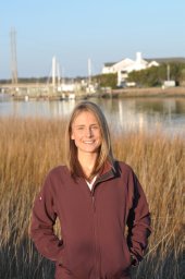 Ashley R. Smyth合作论文数Inst Marine Sci, Univ N Carolina3L. Scott Jackson合作论文数3
 Travis Williams合作论文数2
 Gabrielle Love合作论文数2Joe McGlinchy合作论文数2
 Abul Rabbany合作论文数2
 Ana Zangroniz合作论文数2
 Victoria M. Scholl合作论文数US Geol Survey, Geosci & Environm Change Sci Ctr2Charlie Endris合作论文数2
 Kendra E Kaiser合作论文数Dept Geosci, Boise State Univ2Christa Kelleher合作论文数2
 Julia Guimond合作论文数Dept Civil & Resource Engn, Dalhousie Univ2
 Noel Manirakiza合作论文数Dept Soil Sci & Plant Nutr, Selcuk Univ2
 Adam L. Mahood合作论文数Agriculture Research Service, United States Department of Agriculture2
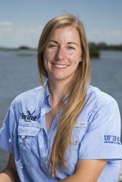 Savanna C. Barry合作论文数Nat Coast Biol Stn, Florida Sea Grant2
 Megan L. Fork合作论文数Dept Biol, West Chester Univ2
 Michael J Koontz合作论文数Univ Calif Davis, Grad Grp Ecol, Davis, CA 95616 USA2
 Megan E. Cattau合作论文数2
 François Birgand合作论文数Cemagref de Rennes, 17 avenue de Cucillé, CS 64427, 35044 Rennes Cedex, France2
 Jehangir H. Bhadha合作论文数Soil and Water Sci. Dep., Univ. Florida2R. Chelsea Nagy合作论文数2
 Laura Reynolds合作论文数Department of Environmental Sciences, University of Virginia2
 Lise Ann St. Denis合作论文数Earth Lab, University of Colorado Boulder1Kate Tully合作论文数1




