Anomalous behavior detection plays a vital role in public safety, enabling timely identification and intervention of dangerous events in crowded places like metro stations. However, challenges such as severe occlusion, dispersed action areas, and the scarcity of abnormal behavior samples make reliable detection difficult. This paper focuses on fighting detection in metro scenarios and proposes DSVLM, a novel multimodal large-model-based approach. Built on InternVL2.5-8B, DSVLM enhances contextual understanding through a prompt fusion strategy and employs low-rank matrix adaptation to reduce data requirements during fine-tuning. Additionally, a dynamic image segmentation method improves the model’s ability to capture fine-grained details in high-resolution footage. Experiments conducted on a custom metro dataset show that DSVLM achieves 99.17% accuracy in recognizing normal behaviors while successfully detecting all fighting incidents, demonstrating its effectiveness. To address the issue of excessive visual token redundancy introduced by dynamic segmentation, we further propose PruneVLM, a training-free visual token pruning method. By combining binary search with a greedy algorithm, PruneVLM minimizes attention distribution deviation and accelerates inference. Experiments under various pruning ratios confirm that with up to 70% token reduction, detection accuracy remains comparable while inference speed nearly doubles, verifying the practicality and stability of the proposed solution.
Real-time and accurate traffic prediction can help traffic managers better understand the future changing trend of traffic state, thus enabling them to better manage and plan transportation. However, due to the dynamic, nonlinear and periodic changes of traffic states, designing a prediction model presents significant challenges. This paper proposes a traffic prediction model called MCSTC which integrates multiple cycle features and spatio-temporal correlation to achieve more accurate predictions. The proposed model consists of three parallel branches, which are used to learn the recent changes, daily periodic changes and weekly periodic changes, respectively. Each branch is a spatio-temporal feature learning network that uses a spatial learning module and a temporal learning module to mine the spatio-temporal correlation information contained in traffic data. They are then fused through an adaptive fusion module. We evaluate MCSTC on several real-world traffic datasets of in different cities. Results show that the proposed MCSTC outperforms existing methods in both short-term and long-term predictions in all datasets.
Accurate traffic flow prediction can help traffic platform managers to dispatch resources, so as to better meet people's travel needs, and reduce traffic jams and accidents. This paper proposes a traffic flow prediction model so called DGNN based on dynamic graph feature learning. It consists of four parts: spatio-temporal embedding module, temporal convolution module, dynamic graph feature learning module and prediction module. The key idea of DGNN is to construct dynamic adjacency matrices through real-time traffic state information, then pass the matrices and the input sequence through a dynamic graph convolution network to extract dynamic spatial features. Experiments are established on three real-world public datasets with different data scale and number of sensor nodes, and compared with several baseline methods. The results show that DGNN outperforms baseline methods in both short term and long term traffic prediction tasks.
Large scale stencil images used for surface mount technology (SMT) always have more than ten thousand closed graphics(stencil holes). It is difficult to find corresponding information from those graphics in stencil image registration. Here, we propose a novel method which is based on two-node tree, differed from traditional ones. The two-node tree is special, which has only two nodes in a layer. It functions as selecting feature points. The set of feature points with the erroneous can find the most reasonable projection transformation model by the simplified RANSAC algorithm. We adopt different types of defective stencil images to verify the proposed method. Experimental results fully show its robustness and high-tolerant rate.
Since the stencil image used for surface mount technology (SMT) always has various defects such as less holes and burrs in the laser processing and imaging, it is indispensable to detect those flaws with high accuracy. An automatic registration lies at the root of identifying defects. In this paper, a novel automatic registration algorithm for stencil images is proposed. According to the distribution probability density of the coordinates of gravity center points in a stencil image, the adaptive parameter DBSCAN clustering algorithm is adopted to classify those points. As a result, we could find corresponding gravity center points (feature points) in the stencil image and its standard design file respectively. A transformation matrix between the stencil image and its standard design file is obtained by the feature points. Experiments have shown that this automatic registration algorithm can be well adapted to the stencil images with random defects.
Nowadays, most modern parking lots integrate IoT technologies such as license plate recognition, mobile payment and automatic entrance/exit control to improve the convenience of the drivers and parking lot managers. However when searching for a vacant parking space becomes normally difficult in a metropolitan area, a more advanced "Smart Parking System" that can predict vacancy, enable reservation and differentiate pricing is even more needed. In this sense, understanding the parking behavior of customers has great significance to the manager of the parking estate, the drivers and the urban administrations. This paper explores the patterns and predictability of differential parking flows. With the license plate recognition and mobile payment system deployed in the parking lots, we collect about 14 million parking records of more than 300 parking lots in a big metropolitan in China. The time of every vehicle entering and exiting the parking lot is recorded along with its plate number. We first extract some features from these records and use K-means cluster algorithm to categorize the vehicle-parking lot pairs into three clusters empirically. The three clusters of parking behaviors are interpreted as regular parking users, long time visiting users and short time visiting users. Secondly, based on the parking lot's historical occupancy patterns, we designed several methods to predict the occupancy of the parking lot for different types of parking. The occupancies from the three types of vehicles can be used for making differential pricing policies or reservation policies.
Bus service is an important public transportation. Besides the major goal of carrying passengers around, providing accurate and reliable travel information for passengers is also an important business consideration. The route and its traveling time can directly affect the number of people choosing the line. Traditional approaches to obtain route and its traveling time rely on historical experience, which are both nonscalable and incomplete. The wide adoptions of GPS tracing systems in public transportation provide new opportunities. In this paper, we associate it with station locations to derive the consumed time between two stations, and make a short forecast. To our best knowledge, this is the first paper which utilizes bus GPS data to design route and give its consumed time for a passenger.
In recent years, with the development of Internet big data, the popularity of mobile terminals, and the extensive services of the LBS platform, mass-level trajectory data has been formed. Due to the large amount of data, various types, different sampling frequency, and storage of point sequences of spatio-temporal data, researchers often need to perform a series of processing to convert the original data into available data for trajectory mining and analysis. In this paper, we study the management of multi-scale trajectories and provide an ordered KNN query for it. In our paper, we first propose a data model based on trajectory segments(DMTS) for multi-scale trajectories. The model converts the trajectory from the original sampling point to a form of trajectory segment that is easy to understand and organize. Next, we propose a fast ordered KNN query based on DMTS, and verify the correctness and efficiency of the algorithm by several experiments. The innovations in this paper mainly include: (1) Propose DMTS-based organization and management for trajectory data, which will effectively improve the efficiency of trajectory mining and analysis. By dividing the trajectory into moving objects, point objects, and trajectory objects, the DMTS will be applied to multi-scale heterogeneous trajectory data. (2) A fast ordered KNN query based on DMTS is proposed. Firstly, we use shape-based compression to reduce the amount of data and complexity of calculation. Secondly, we approve the measurement of trajectory distance from point-to-point distance to point-to-segment projection distance, which improves the accuracy and efficiency of querying heterogeneous trajectory data.
Three soft-input-soft-output (SISO) detection methods for dual-polarized quadrature duobinary (DP-QDB), including maximum-logarithmic-maximum-a-posteriori-probability-algorithm (Max-log-MAP)-based detection, soft-output-Viterbi-algorithm (SOVA)-based detection, and a proposed SISO detection, which can all be combined with SISO decoding, are presented. The three detection methods are investigated at 128 Gb/s in five-channel wavelength-division-multiplexing uncoded and low-density-parity-check (LDPC) coded DP-QDB systems by simulations. Max-log-MAP-based detection needs the returning-to-initial-states (RTIS) process despite having the best performance. When the LDPC code with a code rate of 0.83 is used, the detecting-and-decoding scheme with the SISO detection does not need RTIS and has better bit error rate (BER) performance than the scheme with SOVA-based detection. The former can reduce the optical signal-to-noise ratio (OSNR) requirement (at BER = 10(-5)) by 2.56 dB relative to the latter. The application of the SISO iterative detection in LDPC-coded DP-QDB systems makes a good trade-off between requirements on transmission efficiency, OSNR requirement, and transmission distance, compared with the other two SISO methods. (C) 2018 Society of Photo-Optical Instrumentation Engineers (SPIE)
Dual-polarized quadrature duobinary (DP-QDQ) has so high spectral efficiency that it can realize super-Nyquist-wavelength-division-multiplexing (super-Nyquist-WDM) transmission. In order to promote BER performance, binary Low-density parity-check (LDPC) codes are used in DP-QDQ systems. Two detection methods for DP-QDQ, which can be combined with corresponding LDPC decoding, are presented. LDPC-coded DP-QDQ systems based on these two detection methods are investigated at 128Gb/s five-channel WDM systems by simulations.
Software Defined Networking (SDN) is a revolutionary network architecture that separates out network control functions from the underlying equipment and is an increasingly trend to help enterprises build more manageable data centers where big data processing emerges as an important part of applications. To concurrently process large-scale data, MapReduce with an open source implementation named Hadoop is proposed. In practical Hadoop systems one kind of issue that vitally impacts the overall performance is know as the NP-complete minimum make span problem. One main solution is to assign tasks on data local nodes to avoid link occupation since network bandwidth is a scarce resource. Many methodologies for enhancing data locality are proposed such as the HDS and state-of-the-art scheduler BAR. However, all of them either ignore allocating tasks in a global view or disregard available bandwidth as the basis for scheduling. In this paper we propose a heuristic bandwidth-aware task scheduler BASS to combine Hadoop with SDN. It is not only able to guarantee data locality in a global view but also can efficiently assign tasks in an optimized way. Both examples and experiments demonstrate that BASS has the best performance in terms of job completion time. To our knowledge, BASS is the first to exploit talent of SDN for big data processing and we believe it points out a new trend for large-scale data processing.
Nowadays the energy consumption has become one of the most urgent issues for Data center networks. For general network devices, the power is constant and independent from the actual transfer rate. Therefore the network devices are energy efficient when they are in full workload. The flow scheduling methods based on the exclusive routing can reduce the network energy consumption, as the exclusive routing paths can fully utilize all their links. However, these methods will no longer guarantee the energy efficiency of switches, as they handle flows in priority order by greedily choosing the path of available links instantaneously. In a previous work we proposed an extreme case of flow scheduling based on both link and switch utilization. Herein we consider general scenarios in data center networks and propose a novel energy efficient flow scheduling and routing algorithm in SDN. This method minimizes the overall energy for data center traffic in time dimension, and increases the utilization of switches and meet the flow requirements such as deadline. We did a series of simulation studies in the INET framework of OMNet++. The experiment results show that our algorithm can reduce the overall energy with respect to the traffic volume and reduce the flow completion time on average.
Bus service is the most important function of public transportation. Besides the major goal of carrying passengers around, providing a comfortable travel experience for passengers is also a key business consideration. To provide a comfortable travel experience, effective bus scheduling is essential. Traditional approaches are based on fixed timetables. The wide adoptions of smart card fare collection systems and GPS tracing systems in public transportation provide new opportunities for using the data-driven approaches to fit the demand of passengers. In this paper, we associate these two independent data sets to derive the passengers’ origin and destination. As the data are real time, we build a system to forecast the passenger flow in real time. To the best of our knowledge, this is the first paper, which implements a system utilizing smart card data and GPS data to forecast the passenger flow in real time.
Nonintrusive load monitoring technologies are gaining popularity for their low energy monitoring costs. In the article, the authors present a simple event-detection algorithm based on maximum and minimum points. Then, they use a variant of hidden Markov model as the appliance model and combine it with event detection to reduce the input. Specifically, they propose a simplified Viterbi algorithm, which considers fewer state transitions each time than the traditional Viterbi. The experiment results show that their work can achieve higher than 90 percent accuracy for most high-power devices and 60-80 percent accuracy for most low-power devices. Meanwhile, the computational complexity could be much lower than with the traditional Viterbi algorithm.
A high-linearity directly-modulated analog photonic link (APL) with simultaneous suppression of the even-order intermodulation distortion, third-order intermodulation distortion (IMD3), and cross-modulation distortion (XMD) is proposed and experimentally demonstrated by the corporation of push–pull structure and an adaptive compensation algorithm. In the proposed directly-modulated APL system, the push–pull structure is introduced to effectively eliminate all the even-order nonlinear distortions, including the second-order intermodulation distortion and the second-order harmonic distortions. To further simultaneously suppress the IMD3 and XMD, an adaptive compensation algorithm is designed and adopted at the receiver. The experimental results show that the second-order spurious-free dynamic range and the third-order spurious-free dynamic range is improved by 19.8 and 12.4 dB, respectively, corresponding to 7.15% error vector magnitude performance improvement for a 120 Mb/s 64QAM-OFDM RF signal transmission when the input RF power is 13 dBm.
Spread spectrum techniques have recently been widely used in digital audio watermarking. In this paper, the multiple orthogonal sequence spread spectrum watermarking scheme for audio signals is presented, where multiple orthogonal sequences are used to embed parallel watermarks to improve the channel capacity. The channel capacity for the proposed scheme is derived, and the optimum number of the sequence for the maximal channel capacity is obtained. The analysis shows that the channel capacity of the proposed scheme is larger than that of the existing improved spread-spectrum (ISS) scheme.
With the rapid development of urbane-centered economy, urban area has gone through strong but heterogeneous sprawl. In such complex urban systems, it is impossible to established teaching centers of night school in every district of city for continuing education programs. Part-time students tend to be educated in popular locations of city due to convenience. Since call logs and geographical nature of mobile phone data can provide an opportunity to measure human behavior and social dynamics, we investigate how to infer urban popular locations with large-scale quasi-social network for avoiding the limitation of data collection and even privacy problems. A large-scale quasi-social network model is developed via measuring the number of shared-user between zones, which is different from previous models for social network. We first verify whether or not this model also can show the social structure of given data, the ranking of places in the model have been calculated based on eigvalue metric. To understand the connections between popular locations of human activity and spatial structure, we present a method to infer the core zones in given region, and then we use a simple metric to evaluate the most popular locations of human activity.
In this paper, we analyse the performance of a decode-and-forward (DF) multi-relay system over Nakagami-m fading channels. First, the closed form expression for the symbol error rate (SER) for both M phase shift keying (MPSK) and M quadrature amplitude modulation (MQAM) signals is derived using the concept of moment generating function (MGF) in the high signal to noise ratio (SNR) and determining a tight SER lower bound that converges to the same limit as the theoretical upper bound. Next, by optimising SER, we can identify the optimal amount of power that should be allocated at the source and relay nodes to develop an optimal power allocation (OPA) technique to reduce the SER. The validation of the theoretical analysis is corroborated by the simulation results of the proposed model over Nakagami-m fading compared to the various schemes regarding the performance in terms of the model's achievable SER and OPA.
 Lai Tu (涂来)合作论文数School of Electronic Information and Communications, Huazhong University of Science and Technology37
 Bin Dai (戴彬)合作论文数School of Electronic Information and Communications, Huazhong University of Science and Technology34
 Shuhua Xu合作论文数25
 Furong Wang (王芙蓉)合作论文数Tongji Hospital, Tongji Medical College, Huazhong University of Science & Technology23
 Yijun Mo (莫益军)合作论文数School of Computer Science & Technology, Huazhong University of Science and Technology21
 Fan Zhang (张帆)合作论文数Faculty of Computer Science and Control Engineering, Shenzhen University of Advanced Technology;Shenzhen Institutes of Advanced Technology, Chinese Academy of Sciences;Shenzhen Institute of Beidou Applied Technology20
 Fei Wang (王非)合作论文数School of Electronic Information and Communications, Huazhong University of Science and Technology13
 Zhengguang Xu (徐正光)合作论文数School Of Automation And Electeical Engineering, University of Science and Technology Beijing13
 Bo Zhang (张波)合作论文数Shanghai Institute of Microsystem and Information Technology, Chinese Academy of Sciences11
 YuChun Huang (黄玉春)合作论文数School of Remote Sensing Information Engineering, Wuhan University10Kui Xu (徐奎)合作论文数8Xiaolei Lu (鲁晓磊)合作论文数8
 Wei Li (李蔚)合作论文数7
 Deming Liu (刘德明)合作论文数School of Optical and Electronic Information, Huazhong University of Science and Technology7
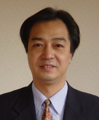 Jianhua Ma (馬建華)合作论文数Faculty of Computer & Information Sciences, Hosei Univerity;Multimedia Ubiquitous Smart Things Laboratory7ZaiLu Huang (黄载禄)合作论文数6Qian Lv (吕谦)合作论文数6
 Hassan M. Ahmed合作论文数Nonlinear Modelling Laboratory, Boston, MA6Ning Zou合作论文数5Chun Chang合作论文数5Chen HUANG (黄辰)合作论文数5
 Jun Yang (杨军)合作论文数School of Electrical and Electronic Engineering, Huazhong University of Science and Technology5Lina Xu合作论文数5
 Laurence Tianruo Yang (杨天若)合作论文数School of Computer and Artificial Intelligence, Zhengzhou University;School of Computer Science and Technology, Huazhong University of Science and Technology5
 Jinjun Wang (王进军)合作论文数Institute of Artificial Intelligence and Robotics, Department of Automation, School of Electronic and Information, Xian Jiaotong University5
 Duan Hu (胡耑)合作论文数Tongji Hospital, Tongji Medical College, Huazhong University of Science and Technology5Yi Wang (王怿)合作论文数The Department of Electronics and Information Engineering, Huazhong University of Science and Technology5Shu Chen合作论文数5
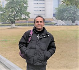 Muhammad Azhar Iqbal合作论文数Department of Electronics and Information Engineering, Huazhong University of Science and Technology5Ruoyun Yang (杨若筠)合作论文数4Yi Liya合作论文数4wei zhang合作论文数4Xiaoling Wang合作论文数4daoyuan song (宋道元)合作论文数4Jie Wen合作论文数4
 Peng Qin合作论文数North China Elect Power Univ, Sch Elect & Elect Engn, State Key Lab Alternate Elect Power Syst Renewabl, Beijing 102206, Peoples R China4ZHU Jiang (朱江)合作论文数4Yan Wang (汪雁)合作论文数4Jian Zhang (张剑)合作论文数4Hasan Abdulwahid合作论文数4
 Zijing Chen合作论文数4
 Junze Wang (王君泽)合作论文数College of Public Administration, Huazhong University of Science and Technology4
 Kecheng Yang (杨克成)合作论文数School of Optical and Electronic Information, Huazhong University of Science and Technology4
 Min Xia (夏珉)合作论文数School of Optical and Electronic Information, Huazhong University of Science and Technology4
 Hai Hu (胡海)合作论文数School of Resource and Environmental Sciences, Wuhan University4




