From 2004 to 2017, an effort was undertaken to integrate space-borne sensing and in situ sensing in an automated system to improve global volcano activity monitoring. This paper reviews a sensor web concept in which a number of volcano monitoring systems were linked together to more accurately monitor volcanic activity, and used this activity measurement to automatically task space assets to acquire further satellite imagery of the detected volcanic activity. This paper discusses the space and ground sensors and how they were linked together as triggers and responses. Over a 13-year period, more than 160,000 alerts coming from various sources lead to 9050 observations by NASA's Earth Observing-1 spacecraft-imaging about 218 volcanoes. This paper describes the science products automatically produced onboard the satellite and on the ground such as temperature maps and lava discharge volume estimates that are automatically delivered to subscribing users. To evaluate the effectiveness of an out-tasked volcano monitoring system, this study compares the hit rate of our tasked monitoring system to the systematic monitoring system MODVOLC.
Space-based assets have been integrated into a sensor web to monitor flooding in Thailand. In this approach, the moderate resolution imaging spectrometer data from the Terra and Aqua satellites are used to perform broad-scale monitoring for flood tracking at the regional level (250 m/pixel) to generate flood detections/alerts. Based on these alerts, the Earth Observing-1 (EO-1) mission is autonomously tasked to acquire higher-resolution (10-30 m/pixel) advanced land imager data, and a number of other assets have imagery automatically requested, with yet further assets requested only in a semiautomated fashion. Based on these alerts, these data are then automatically processed to derive products such as surface water extent and volumetric water estimates in shapefile formats to enable interpretation in geographic information systems. These products are then automatically pushed to organizations in Thailand for use in damage estimation, relief efforts, and damage mitigation. To date, Terra, Aqua, EO-1, Landsat, Ikonos, WorldView-1, WorldView-2, GeoEye-1, and Radarsat-2 have been used in some fashion in the sensor web. The overall autonomous detection, tasking, data acquisition, and processing sensor web framework are described, as well as ongoing work to extend to in situ sensor networks. How the automatic triggering of targeted higher-resolution observations enables higher temporal and spatial resolution tracking of flooding events is also documented.
We deployed three new data analysis algorithms onboard the Earth Observing 1 (EO-1) spacecraft and evaluated their performance over a five-month period. The algorithms include two cloud detectors and an unsupervised novelty detector. Together they provide the first demonstration of ensemble, Bayesian, and novelty detection methods onboard EO-1. Onboard performance on a diverse collection of targets was similar to or better than that observed in ground testing. These algorithms can be used to benefit future missions by aiding onboard decisions about data prioritization to optimize the use of limited downlink as well as potentially to enable autonomous response actions.
The distribution of ice, liquid, and mixed phase clouds is important for Earth's planetary radiation budget, impacting cloud optical properties, evolution, and solar reflectivity. Most remote orbital thermodynamic phase measurements observe kilometer scales and are insensitive to mixed phases. This under-constrains important processes with outsize radiative forcing impact, such as spatial partitioning in mixed phase clouds. To date, the fine spatial structure of cloud phase has not been measured at global scales. Imaging spectroscopy of reflected solar energy from 1.4 to 1.8 µm can address this gap: it directly measures ice and water absorption, a robust indicator of cloud top thermodynamic phase, with spatial resolution of tens to hundreds of meters. We report the first such global high spatial resolution survey based on data from 2005 to 2015 acquired by the Hyperion imaging spectrometer onboard NASA's Earth Observer 1 (EO-1) spacecraft. Seasonal and latitudinal distributions corroborate observations by the Atmospheric Infrared Sounder (AIRS). For extratropical cloud systems, just 25 % of variance observed at GCM grid scales of 100 km was related to irreducible measurement error, while 75 % was explained by spatial correlations possible at finer resolutions.
The Volcano Sensor Web (VSW) is a globe-spanning net of sensors and applications for detecting volcanic activity. Alerts from the VSW are used to trigger observations from space using the Earth Observing-1 (EO-1) spacecraft. Onboard EO-1 is the Autonomous Sciencecraft Experiment (ASE) advanced autonomy software. Using ASE has streamlined spacecraft operations and has enabled the rapid delivery of high-level products to end-users. The entire process, from initial alert to product delivery, is autonomous. This facility is of great value as a rapid response is vital during a volcanic crisis. ASE consists of three parts: (1) Science Data Classifiers, which process EO-1 Hyperion data to identify anomalous thermal signals; (2) a Spacecraft Command Language; and (3) the Continuous Activity Scheduling Planning Execution and Replanning (CASPER) software that plans and replans activities, including downlinks, based on available resources and operational constraints. For each eruption detected, thermal emission maps and estimates of eruption parameters are posted to a website at the Jet Propulsion Laboratory, California Institute of Technology, in Pasadena, CA. Selected products are emailed to end-users. The VSW uses software agents to detect volcanic activity alerts generated from a wide variety of sources on the ground and in space, and can also be easily triggered manually.
NASA’s Deep Space Network (DSN) is a unique facility responsible for communication and navigation support for over forty NASA and international space missions. For many years, demand on the network has been greater than its capacity, and so a collaborative negotiation process has been developed among the network’s users to resolve contention and come to agreement on the schedule. This process has become strained by increasing demand, to the point that oversubscription is routinely as high as 40% over actual capacity. As a result, DSN has started investigating the possibility of moving to some kind of prioritization scheme to allow for more automated and timely resolution of network contention. Other NASA networks have used strict static mission priorities, but if this were applied in the same way to the DSN, some missions would fall out of the schedule altogether. In this paper we report on analysis and experimentation with several approaches to DSN prioritization. Our objectives include preserving as much of each each mission’s requested contact time as possible, while allowing them to identify which of their specific scheduling requests are of greatest importance to them. We have obtained the most promising results with a variant of Squeaky Wheel Optimization combined with limiting each mission’s input based on historical negotiated reduction levels.
Rosetta is a European Space Agency (ESA) cornerstone mission that entered orbit around the comet 67P/Churyumov-Gerasimenko in August 2014 and will escort the comet for a 1.5 year nominal mission offering the most detailed study of a comet ever undertaken by humankind. The Rosetta orbiter has 11 scientific instruments (4 remote sensing) and the Philae lander to make complementary measurements of the comet nucleus, coma (gas and dust), and surrounding environment. The ESA Rosetta Science Ground Segment has developed a science scheduling system that includes an automated scheduling capability to assist in developing science plans for the Rosetta Orbiter. While automated scheduling is a small portion of the overall Science Ground Segment (SGS) as well as the overall scheduling system, this paper focuses on the automated and semi-automated scheduling software (called ASPEN-RSSC) and how this software is used.
The Deep Space Network (DSN) comprises three sites, located in California, Spain, and Australia; each site operates one 70m and multiple 34m antennas that provide communications and navigation services to highly elliptical and deep space missions. The DSN is operated by JPL for NASA, and serves both US and international missions. As part of a multiyear upgrade in automation of the network, JPL has undertaken a project called “Follow the Sun Operations” (FtSO), which will fundamentally change the operations paradigm of the DSN. In this new operations model, each one of the three sites will operate the entire network during their day shift, handing off control to the next site as their day ends. This is in contrast to the current approach, wherein each site operates only their local antennas and equipment, but does so 24 hours/day, 7 days/week. The FtSO model offers the potential for significant operations cost savings, but poses some unique challenges as operations shifts from local to remote. This paper discusses some of these FtSO challenges in the areas of increased automation related to complexity management, reactive rescheduling, and improved monitoring and situational awareness.
The challenging timeline for DARPA's Orbital Express mission demanded a flexible, responsive, and (above all) safe approach to mission planning. Mission planning for space is challenging because of the mixture of goals and constraints. Every space mission tries to squeeze all of the capacity possible out of the spacecraft. For Orbital Express, this means performing as many experiments as possible, while still keeping the spacecraft safe. Keeping the spacecraft safe can be very challenging because we need to maintain the correct thermal environment (or batteries might freeze), we need to avoid pointing cameras and sensitive sensors at the sun, we need to keep the spacecraft batteries charged, and we need to keep the two spacecraft from colliding … made more difficult as only one of the spacecraft had thrusters. Because the mission was a technology demonstration, pertinent planning information was learned during actual mission execution. For example, we didn't know for certain how long it would take to transfer propellant from one spacecraft to the other, although this was a primary mission goal. The only way to find out was to perform the task and monitor how long it actually took. This information led to amendments to procedures, which led to changes in the mission plan. In general, we used the ASPEN planner scheduler to generate and validate the mission plans. ASPEN is a planning system that allows us to enter all of the spacecraft constraints, the resources, the communications windows, and our objectives. ASPEN then could automatically plan our day. We enhanced ASPEN to enable it to reason about uncertainty. We also developed a model generator that would read the text of a procedure and translate it into an ASPEN model. Note that a model is the input to ASPEN that describes constraints, resources, and activities. These technologies had a significant impact on the success of the Orbital Express mission. Finally, we formulated a technique for converting procedural information to declarative information by transforming procedures into models of hierarchical task networks (HTNs). The impact of this effort on the mission was a significant reduction in (1) the execution time of the mission, (2) the daily staff required to produce plans, and (3) planning errors. Not a single misconfigured command was sent during operations.
This article describes the Deep Space Network (DSN) scheduling engine (DSE) component of a new scheduling system being deployed for NASA's Deep Space Network. The DSE provides core automation functionality for scheduling the network, including the interpretation of scheduling requirements expressed by users, their elaboration into tracking passes, and the resolution of conflicts and constraint violations. The DSE incorporates both systematic search‐ and repair‐based algorithms, used for different phases and purposes in the overall system. It has been integrated with a web application that provides DSE functionality to all DSN users through a standard web browser, as part of a peer‐to‐peer schedule negotiation process for the entire network. The system has been deployed operationally and is in routine use, and is in the process of being extended to support long‐range planning and forecasting and near real‐time scheduling.
Rosetta is an ESA cornerstone mission that will reach the comet 67P/Churyumov-Gerasimenko in 2014 and will escort the comet for approximately 1 year offering the most detailed study of a comet ever undertaken by humankind. The Rosetta orbiter has 11 scientific instruments (4 remote sensing) and the Philae lander to make complementary measurements of the comet nucleus, coma (gas and dust), and surrounding environment. The ESA Rosetta Science Ground Segment is developing a science planning and scheduling system that includes an automated scheduling capability to assist in developing science plans for the Rosetta Orbiter. While automation is a small portion of the overall Science Ground Segment (SGS) as well as the overall scheduling system, this paper focuses on the automated and semi-automated scheduling software and process. Prior to arrival at the comet, the Rosetta mission is developing skeleton plans, which are pre-developed plans to conduct sets of measurement campaigns. Automated planning is being developed to support the skeleton planning process by generating plans for given trajectories and science campaigns. During encounter operations, segments of the skeleton plan, referred to as “bones,” will be refined and possibly swapped (for different bone segments). The plan segments will be refined and made operational as part of a long term planning process. Subsequent adaptation as additional information becomes available and earlier observations of the comet will alter science measurement priorities. When these plans are made operational, automated planning will assist the science planning team in adapting and adjusting science plans. In this usage, the automated science planner can be used to evaluate alternative trades by changing the science campaign and observation priorities, constraints, and parameters and generating alternate plans. Introduction Rosetta is an extremely ambitious mission by the European Space Agency [ESA, Factsheet] to conduct the most detailed exploration of a comet ever performed. The Rosetta spacecraft was launched in March 2004 and has circled the sun almost four times in a ten-year journey to comet 67P/Churyumov-Gerasimenko. Its trajectory has included Mars (2007) and three Earth (2005, 2007, 2009) flybys. Its path has also included a flyby of the Steins (2008) and Lutetia (2010) asteroids. The Rosetta spacecraft was approximately 3000kg at launch and is approximately 2.8 x 2.1 x 2.0 meters with two 14 m long solar panels with a total of 64 meters squared of solar panel area for power generation. Science planning for the Rosetta mission is extremely complex with each of the eleven science instruments conducting multiple science campaigns and presenting numerous operational constraints on the spacecraft to achieve their science measurement including geometry, illumination, position, spacecraft pointing, instrument mode, timing, and observation cadence. Because of the challenges in effectively planning science instrument operations, ESA has a highly skilled team of liaison scientists and instrument operations engineers who work with the instrument teams using the SGS to develop science plans for the Rosetta mission. Copyright © 2013. All rights reserved. Portions of this work were carried out by the Jet Propulsion Laboratory, California Institute of Technology, under a contract with the National Aeronautics and Space Administration. In order to smooth science planning during operations, significant elements of the science operations are pre-planned by derivation of so called bones of the skeleton plan. In effect, a bone plan is a segment of science plan that is pre-derived for a specific context (e.g. operations and science phase of the missions). By preplanning a range of likely contingencies in advance it is expected that a significant portion of escort operations will be adapting already developed and checked plans rather than constructing and vetting plans from scratch. However this strategy requires the pre-generation of the skeleton bones. During escort operations, the current baseline plan will be modified and adapted to science, comet, and spacecraft conditions. In some cases this may result in significant modifications to the plan. Because this is the first extended mission to a comet, there is much to be learned about the dynamic cometary environment. Therefore the science planning team must be prepared for the possibility that previously developed plans will have to be significantly modified. The overall science planning process involves managing significant planning related information to support the planning process. For example, ESA is developing the Observation Manager (OBM) software to enable development and storage of science campaigns, observations, and scheduling rules and constraints. Additionally, campaign management and tracking is required to maintain an overall situational awareness of how past, current, and planned observations will and will not satisfy requirements for science campaigns. Additionally, the SGS team is leading the development of the pointing, slewing, and simulation capabilities for the SGS. The Rosetta mission is developing an automated science scheduling capability to support both skeleton plan development and operational plan refinement. While this scheduling system, called the Rosetta SGS Scheduling Component (RSSC) is but one part of the overall Science Ground Segment, this paper focuses on the RSSC because of the target audience. Readers interested in other components of the SGS are directed to other papers. In the remainder of this paper we first describe the two operational usages of automated science planning: (1) skeleton plan generation and (2) refinement of plans as they progress through long term planning, medium term planning, and short term planning. We then briefly survey some of the challenges in automating Rosetta science planning. Finally we describe the current state of the implementation of the automated scheduling component of the Rosetta SGS. Rosetta Science Planning Rosetta science planning can be broken into two types of planning: (1) skeleton plan generation and (2) operational plan development. Skeleton Plan Generation Skeleton plan generations involves considering a reference spacecraft trajectory in the context of specific spacecraft and comet conditions, and science priorities. From the perspective of automated scheduling, an input trajectory, spacecraft state, exogenous conditions (such as downlinks), and science campaigns with priorities. The scheduler can be used by the mission science team to enhance exploration of possible science plans by repeatedly running the scheduler with variations of trajectory, exogenous conditions, and science campaigns. Operational Planning In operational planning, a reference science plan already exists as s proposed bone from the skeleton plan. As this plan progresses from the long term planning cycle to the medium term and short term planning cycle it is adapted based on updates to starting conditions, exogenous events, spacecraft state, and changing science priorities. In this context automated scheduling accepts and input schedule and uses it as a guide to generate a new schedule accommodating input updates as will occur during operations. As a schedule progress closer to execution, certain aspects of the schedule become harder or impossible to change. At a relatively early phase the trajectory is frozen. Next the rough spacecraft pointing is frozen, only allowing for minor changes to reflect navigation updates. Finally, observation activities themselves are frozen only allowing minor parameter changes. Scheduling Constraints In Rosetta science planning there are a significant number of constraints and preferences that must be accommodating in generating science instrument schedules. In this section we describe a number of these constraints and how they are handled. Science Campaign Definition Rosetta science is organized into a number of science themes relating to the scientific questions to be answered by science measurements/observations. Science campaigns are sets of observations that are directed at collecting data to enable the science team to answer these questions and refine relevant theories and models. Three primary structures exist for scheduling unit observations. “Repeat while repetition” requires scheduling of an observation (or set of observations) a number of times with temporal relationships among adjacent observations. “Repeat/insert while obs/window” enables scheduling of observations while a condition is met, such as a geometric configuration (observation opportunity) or concurrent with another observation. “Start/end when Start/end” enables scheduling of one type of observation with a defined temporal relation to a different type of observation. Another complexity in science campaigns is campaign expansion into schedulable observations. For example, a science campaign may be to map the surface of the nucleus of the comet at a pre-specified spatial resolution, at two varying illumination conditions. The spatial coverage may be represented by expanding the campaign to replicate over a list of point targets and restriction on the distance to the comet. The iteration over the varying illumination conditions is handled by expansion of the previous target set replicating a request for each illumination condition. In general, these expansions are handled by replicating the observation requests over all of the point instances and the cross product of the applicable conditions. This results in an exhaustive enumeration of the observation requests that is then input to the scheduler. Monitoring campaigns are somewhat different. These campaigns are active over extended periods of time and intend to achieve a specified duration level. Monitoring campaigns may interrupted to acquire competing observations that have incompatible pointing or state constraints. Monitor
The Earth Observing One (EO-1) mission has been a pathfinder in demonstrating autonomous operations paradigms. In 2010-2012 (and continuing), EO-1 has been supporting sensorweb operations to enable autonomous tracking of flooding in Thailand. In this approach, the Moderate Imaging Spectrometer (MODIS) is used to perform broad-scale monitoring to track flooding at the regional level (500 m/pixel) and EO-1 is autonomously tasked in response to alerts to acquire higher resolution (30 m/pixel) Advanced Land Imager (ALI) data. This data is then automatically processed to derive products such as surface water extent and volumetric water estimates. These products are then automatically pushed to relevant authorities in Thailand for use in damage estimation, relief efforts, and damage mitigation. EO-1 has served as a testbed and pathfinder to this type of sensorweb operations. Beginning with EO-1, these techniques for monitoring are being extended to other space sensors (such as Radarsat-2, Landsat, Worldview-2, TRMM) and integrated with hydrological models, and integration with in-situ sensors.
Between 24 March and 5 June 2010, the Hyperion hyperspectral imager and Advanced Land Imager (ALI) on NASA's Earth Observing 1 (EO‐1) spacecraft obtained an unprecedented sequence of 50 observation pairs of the eruptions at Fimmvörðuháls and Eyjafjallajökull, Iceland. This high acquisition rate was possible only through the use of data flow streamlined by using the autonomously operating NASA Volcano Sensor Web (VSW). The VSW incorporates notifications of volcanic activity from multiple sources to retask EO‐1 and process Hyperion data to extract eruption parameters from high spatial and spectral resolution visible and short‐wavelength infrared data. Physical changes in eruption style and magnitude were charted as the eruptions ran their course. Rapid data downlink and automatic data‐processing algorithms generated a variety of products which are compared with estimates from ground‐based observations and post‐eruption in situ measurements. Estimates of effusion rate from heat loss measurements underestimate actual effusion rate (while still following broad eruption rate trends) but are closer to in situ estimates for effusive eruptions (Fimmvörðuháls) than explosive, ash‐rich eruptions (Eyjafjallajökull). During the later stages of the 2010 eruption, VSW‐generated products were rapidly delivered to end‐users in Iceland to aid in the assessment of risk and hazard. The success of the VSW led to Icelandic Meteorological Office (IMO) in situ sensors being incorporated into the VSW, and in May 2011 an IMO seismic alert autonomously triggered EO‐1 observations of a new eruption at Grímsvötn volcano. Finally, the VSW demonstrates an autonomy‐driven, multi‐asset, spacecraft retasking and data processing system that maximizes science return, a desirable capability for future NASA missions.
NASA has recently deployed a new mid-range scheduling system for the antennas of the Deep Space Network (DSN), called Service Scheduling Software, or S 3 .This system is architected as a modern web application containing a central scheduling database integrated with a collaborative environment, exploiting the same technologies as social web applications but applied to a space operations context.This is highly relevant to the DSN domain since the network schedule of operations is developed in a peer-to-peer negotiation process among all users who utilize the DSN (representing 37 projects including international partners and ground-based science and calibration users).The initial implementation of S 3 is complete and the system has been operational since July 2011.S 3 has been used for negotiating schedules since April 2011, including the baseline schedules for three launching missions in late 2011.S 3 supports a distributed scheduling model, in which changes can potentially be made by multiple users based on multiple schedule "workspaces" or versions of the schedule.This has led to several challenges in the design of the scheduling database, and of a change proposal workflow that allows users to concur with or to reject proposed schedule changes, and then counter-propose with alternative or additional suggested changes.This paper describes some key aspects of the S 3 system and lessons learned from its operational deployment to date, focusing on the challenges of multi-user collaborative scheduling in a practical and mission-critical setting.We will also describe the ongoing project to extend S 3 to encompass long-range planning, downtime analysis, and forecasting, as the next step in developing a single integrated DSN scheduling tool suite to cover all time ranges.
Imaging spectrometers are valuable instruments for space exploration, but their large data volumes limit the number of scenes that can be downlinked. Missions could improve science yield by acquiring surplus images and analyzing them onboard the spacecraft. This onboard analysis could generate surficial maps, summarizing scenes in a bandwidth-efficient manner to indicate data cubes that warrant a complete downlink. Additionally, onboard analysis could detect targets of opportunity and trigger immediate automated follow-up measurements by the spacecraft. Here, we report a first step toward these goals with demonstrations of fully automatic hyperspectral scene analysis, feature discovery, and mapping onboard the Earth Observing One (EO-1) spacecraft. We describe a series of overflights in which the spacecraft analyzes a scene and produces summary maps along with lists of salient features for prioritized downlink. The onboard system uses a superpixel endmember detection approach to identify compositionally distinctive features in each image. This procedure suits the limited computing resources of the EO-1 flight processor. It requires very little advance information about the anticipated spectral features, but the resulting surface composition maps agree well with canonical human interpretations. Identical spacecraft commands detect outlier spectral features in multiple scenarios having different constituents and imaging conditions.
A generic software framework analyzes data from broad coverage sweeps or general larger areas of interest. Change detection methods are used to extract subsets of directed swath areas that intersect areas of change. These areas are prioritized and allocated to targetable assets. This method is deployed in an automatic fashion, and has operated without human monitoring or intervention for sustained periods of time (months).
 Steve A. Chien合作论文数Jet Propulsion Laboratory, California Institute Technology83
 Ashley Davies合作论文数Jet Propulsion Laboratory, California Institute of Technology50
 Gregg Rabideau合作论文数Artificial Intelligence Group, Jet Propulsion Laboratory, California Institute of Technology44
 Rebecca Castano合作论文数Machine Learning Systems Group at Jet Propulsion Laboratory39
 Stuart Frye合作论文数30
 Joshua Doubleday合作论文数30
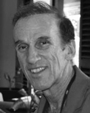 Daniel J. Mandl合作论文数29
 Benjamin Cichy合作论文数19
 Mark D. Johnston合作论文数California Institute of Technology · Jet Propulsion Laboratory · Artificial Intelligence15Seth Shulman合作论文数13
 Rob Sherwood合作论文数Connectivity Group, Intel Corporation12b cichy合作论文数11Dan Mandl合作论文数11shu chien合作论文数10
 David R. Thompson合作论文数Jet Propulsion Laboratory, California Institute of Technology;Arizona State University10T. Doggett合作论文数10David Mclaren合作论文数9
 Ronald Greeley合作论文数Ronald Greeley Center for Planetary Studies, Arizona State University;School of Earth and Space Exploration, Arizona State University9Darrell Boyer合作论文数9
 Victor R. Baker合作论文数College of Science Hydrology & Atmospheric Sciences, University of Arizona9
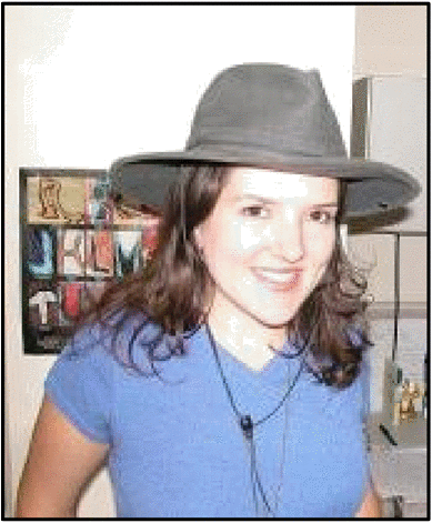 Caroline Chouinard合作论文数8
 Lukas Mandrake合作论文数Jet Propulsion Laboratory, California Institute of Technology8
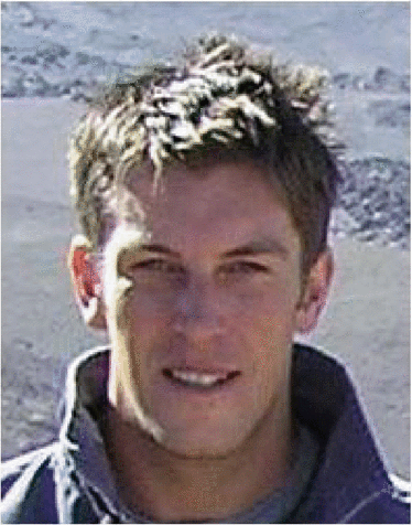 Robert Wright合作论文数7
 Steve Schaffer合作论文数Jet Propulsion Laboratory, California Institute of Technology7
 Veerachai Tanpipat合作论文数7
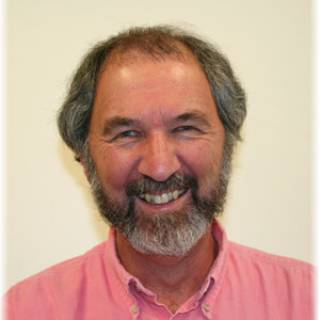 Philip Kyle合作论文数Department of Earth and Environmental Science, New Mexico Institute of Mining and Technology7
 Grailing Jones合作论文数7L. Scharenbroich合作论文数7steve schaffer合作论文数6Bruce Trout合作论文数6
 Stephen Ungar合作论文数Earth Sciences Division, Goddard Space Flight Center, National Aeronautics and Space Administration6Belinda Arroyo合作论文数6ramon abel castano合作论文数5Robert Sherwood合作论文数5
 Robert Pappalardo合作论文数Planetary Science Section, Science Division, Jet Propulsion Laboratory, California Institute of Technology5
 James M. Dohm合作论文数Department of Hydrology and Water Resources;University of Arizona;Department of Hydrology and Water Resources, University of Arizona5
 Russell Lee Knight合作论文数5
 Russell Knight合作论文数Artificial Intelligence Group, Jet Propulsion Laboratory, California Institute of Technology5Porranee Thanapakpawin合作论文数5
 Kiri L. Wagstaff合作论文数Oregon State University5Jeff D'Agostino合作论文数5
 Brian Bue合作论文数5Jim Van Gaasbeck合作论文数4thomas w brakke合作论文数4f ip合作论文数4
 Sharon Kedar合作论文数4
 Lawrence Ong合作论文数4
 Pat Cappelaere合作论文数4




