The Hajj pilgrimage is one of the largest and most significant religious gatherings in the world, attracting millions of Muslims belonging to various backgrounds, annually to Makkah and Madinah. Despite its spiritual significance, the event poses a range of challenges such as logistical, navigational, communication, and safety etc. Addressing these challenges requires a mobile application consisting of state-of-the-art technological solutions. This study proposes a Delphi-guided methodology to identify, evaluate, and prioritize mobile application features aimed at supporting Hajj pilgrims. The process began by identifying core challenges faced by pilgrims and proposing 15 features along with its mapping with the identified challenges. These features were then evaluated by a panel of nine domain experts across two phases. The first phase assessed the features’ relevance to addressing pilgrim challenges, while the second phase evaluated each feature across four feasibility dimensions: infrastructure, development, regulatory compliance, and environmental suitability. The study presents a validated and prioritized set of mobile application features, offering actionable guidance for developers, policymakers, and Hajj organizers. These findings support the design of a mobile application that can enhance the Hajj experience by improving communication, navigation, safety, and accessibility.
Congestion in public places is one of the major problems in public transportation systems and causes a high level of discomfort for the commuters. Traditionally, overcrowding is detected by manually monitoring and analyzing the video streams from the surveillance cameras, which might lead to errors due to limited human activity. On the other hand, current machine learning models for automatic congestion detection require a massive amount of labeled data to train the network. These models suffer from the over-fitting problem and cannot be generalized to novel scenes. First, we propose a novel synthetic dataset for congestion detection in public places to address these problems. Secondly, we propose a Bidirectional Long-short-term-memory (Bi-LSTM) model that exploits synthetic datasets to boost the performance of congestion detection in the wild. We adopt a domain adaptation strategy to bridge the gap between the real and synthetic data by pre-train the model on the synthetic dataset and then fine-tuning the model on real data. From experiment results, we observe that the proposed framework achieves a significant performance boost on the real datasets after training on the synthetic dataset.
People often communicate with auto-answering tools such as conversational agents due to their 24/7 availability and unbiased responses. However, chatbots are normally designed for specific purposes and areas of experience and cannot answer questions outside their scope. Chatbots employ Natural Language Understanding (NLU) to infer their responses. There is a need for a chatbot that can learn from inquiries and expand its area of experience with time. This chatbot must be able to build profiles representing intended topics in a similar way to the human brain for fast retrieval. This study proposes a methodology to enhance a chatbot's brain functionality by clustering available knowledge bases on sets of related themes and building representative profiles. We used a COVID-19 information dataset to evaluate the proposed methodology. The pandemic has been accompanied by an "infodemic" of fake news. The chatbot was evaluated by a medical doctor and a public trial of 308 real users. Evaluations were obtained and statistically analyzed to measure effectiveness, efficiency, and satisfaction as described by the ISO9214 standard. The proposed COVID-19 chatbot system relieves doctors from answering questions. Chatbots provide an example of the use of technology to handle an infodemic.
Managing events pose a unique challenge to the stakeholders and authorities to control the crowd in all three phases of the event (pre, during and post), ensuring crowd safety. One of the fundamental keys to provide crowd safety is to consider the mobility infrastructure hosting the crowd, i.e., routes, areas, entrances and exits. During Hajj, where millions of pilgrims worldwide fulfil the annual event’s rites, mina encampment incorporates pilgrims performing recurring stoning ritual conducted over multi-level Jamarat bridge. Pilgrims mobility through the available complex road network, to and back from the Jamarat bridge, forces upon authorities in charge to set out mobility plans which may require off and on modification as per attendees’ preferences and organizational needs. This paper presents a basis for mathematical modelling of pilgrims’ mobility pattern in Mina by considering available corridors’ capacity, limited times, group size restrictions, and road segment connectivity. The developed mathematical model can generate an efficient schedule to control the flow through these corridors, assess crowd management risks when corridors’ capacity is affected by any emergency, and scientifically estimate each corridor’s maximum allowable occupants
In high-density gatherings, crowd disasters frequently occur despite all the safety measures. Timely detection of congestion in human crowds using automated analysis of video footage can prevent crowd disasters. Recent work on the prevention of crowd disasters has been based on manual analysis of video footage. Some methods also measure crowd congestion by estimating crowd density. However, crowd density alone cannot provide reliable information about congestion. This paper proposes a deep learning framework for automated crowd congestion detection that leverages pedestrian trajectories. The proposed framework divided the input video into several temporal segments. We then extracted dense trajectories from each temporal segment and converted these into a spatio-temporal image without losing information. A classification model based on convolutional neural networks was then trained using spatio-temporal images. Next, we generated a score map by encoding each point trajectory with its respective class score. After this, we obtained the congested regions by employing the non-maximum suppression method on the score map. Finally, we demonstrated the proposed framework's effectiveness by performing a series of experiments on challenging video sequences.
Vehicular ad hoc Network (VANET) is a collection of vehicles and associated roadside infrastructure which provide mobile wireless communication services. One of the significant use-cases is to transmit the images using VANET during emergencies like road accidents, traffic congestion, fire, or traffic hazards. Priority-based routing allows the network to route critical data on priority. This paper proposes a Priority-based Routing Framework for Image Transmission (PRoFIT) for VANETs. PRoFIT for VANETs delivers critical image features at high priority to the sink node for early processing. Simulations were carried out that use PRoFIT for VANETs during the mobility of vehicles in emergency scenarios. The detailed experiments show the impact of priority-based routing during the mobility of vehicles. Both grid topology and vehicular topology were simulated. Packet end-to-end delay and delivery ratios were analyzed. A comparison of results of critical image information delivery with PRoFIT and without PRoFIT shows the impact of using PRoFIT for VANETs.
Large gatherings which are commonly allied with spatial and temporal constraints possess several managerial challenges. As far as walking is considered as a sustainable mode of pedestrian movement with crowd safety as the core objective, hosting authorities put relentless efforts to analyze crowd dynamics and provide with pre- and during event mobility plans. In this paper, we present our ongoing research about analyzing pedestrian movement of a very large annual gathering, the Hajj, where topographical nature of the hosting city Makkah proffer complex network of straight, circular, Y, L, T shape transfer corridors. Moreover, Hajj crowd diversity in terms of race, age and language makes it more laborious for the hosting authorities to tackle pedestrians crossflow to avoid any possible stampede. As a part of our study, we have analyzed the mobility of a group of pilgrims approaching the Jamarat bridge through a less complicated route that contained a L-shape transfer corridor. Pilgrims’ movement was recorded through GPS sensory data with a timestamp by deploying a mobile phone application, during the Hajj 2019 event. The initial outcomes led us to go on modelling and then simulating multiple scenarios of pedestrians’ movement through the network of complex corridors. We aim that our findings will support in designing optimized mobility plans by considering routes’ capacity and available time to accommodate all groups.
Smart cities have been on the rise since the last decade. These cities can only be effective and sustainable when acquiring error-free information from multiple aspects and sources. Prone to errors and mistakes, traditional tools and observation methods require new assessment strategies to provide a clear perspective in simulation and a systematic evaluation for decision-making to be aligned with Industry 4.0. Digital Twin can offer an efficient solution to this problem under the cyber-physical system entity by creating a virtual space identical to the physical region and providing predictive information on the city's current state. Such systems offer accurate representation in a virtual environment while taking input from the real world and simulating them for future predictions. These near-identical systems are constructed at a very high cost, and the cost increases as more intricate details are added to the environment. This paper presents selective technologies that can potentially contribute to developing a low-cost intelligent environment and smarter urban management framework. It looks into the analysis of the impact of different scenarios on a public event in three dimensions that will be crucial to the decision and policymaker before a plan is approved. The proposed framework will be able to guide present and upcoming potential solutions against the administrative challenges.
The ability of dynamic reconfigurability, quick response and ease of deployment has made Unmanned Aerial Vehicles (UAVs), a paramount solution in several areas such as military applications. Flying ad-hoc network (FANET) is a network of UAVs connected wirelessly and configured continuously without infrastructures. Routing on its own is not significant, but the mobility sequence of a UAV in FANETs is a more significant factor and an interesting research topic. The routing protocols gives us a certain and better perception of routing structure for FANETs. In this paper, routing protocols such as Ad-hoc On-Demand Vector (AODV), Dynamic Source Routing (DSR), Temporally Ordered Routing Algorithm (TORA), Geographic Routing Protocol (GRP) and Optimized Link State Routing (OMR) are compared using performance parameters such as number-of-hops, packet loss ratio, throughput, end-to-end delay and throughput. The mobility models like Pursue Mobility Model (PRS), Semi-Circular Random Movement (SCRM), Manhattan Grid Mobility Model (MGM) and Random Waypoint Mobility (RWPM). The evaluation is carried out with three scenarios including one sender node and one receiver node, all senders one receiver and all senders all receivers are considered for above protocols and mobility models. For all evaluation scenarios, the performance of OMR is the most efficient among the five routing protocols under four different performance parameters due to its proactive nature which makes the routing information up to date with the help of MPR (Multi Point Relay) in the network, resulting in the reduction of routing overhead in the network.
Managing a massive crowd at a large event is a challenging task for the crowd managers. To deal with different levels of the Crowd, the decision-making authorities need a good understanding of sound knowledge and hands-on practice of crowd handling scenarios under different situations. The objective of this paper is to build an interactive evaluation framework for decision-makers or stakeholders to evaluate their level of decision-making skills dealing with intensive crowd scenarios in different environments. The proposed tool will facilitate crowd managers to gain mindset, skillset, and toolset for the flow of knowledge by experiencing different crowd scenario patterns, which will help them to take on spot better faster, and accurate decisions in real-life crowd scenarios. This research develops a conceptual evaluation tool that hypothesizes a positive and significant relationship between knowledge capture and knowledge implementation, which in turn contributes to the enhanced performance of decision-makers to handle any level of the mass crowd gathering events like political rallies, sports, or any religious gatherings across the globe.
In the last few years, the massive development in wireless networks, high internet speeds and improvement in car manufacturing has shifted research focus to Vehicular Ad-HOC Networks (VANETs). Consequently, many related frameworks are explored, and it is found that security is the primary issue for VANETs. Despite that, a small number of research studies have taken into consideration the identification of performance standards and parameters. In this paper, VANET security frameworks are explored, studied and analysed which resulted in the identification of a list of performance evaluation parameters. These parameters are defined and categorized based on the nature of parameter (security or general context). These parameters are identified to be used by future researchers to evaluate their proposed VANET security frameworks. The implementation paradigms of security frameworks are also identified, which revealed that almost all research studies used simulation for implementation and testing. The simulators used in the simulation processes are also analysed. The results of this study showed that most of the surveyed studies used NS-2 simulator with a percentage of 54.4%. The type of scenario (urban, highway, rural) is also evaluated and it is found that 50% studies used highway urban scenario in simulation.
Hajj, the fifth pillar of Islam, is held annually in the month of Dhul Al-Hijjah, the twelfth month, in the Islamic calendar. Pilgrims travel to Makkah and its neighbouring areas—Mina, Muzdalifah, and Arafat. Annually, about 2.5 million pilgrims perform spatiotemporally restricted rituals in these holy places that they must execute to fulfil the pilgrimage. These restrictions make the task of transportation in Hajj a big challenge. The shuttle bus service is an essential form of transport during Hajj due to its easy availability at all stages and ability to transport large numbers. The current shuttle service suffers from operational problems; this can be deduced from the service delays and customer dissatisfaction with the service. This study provides a system to help in planning the operation of the service for one of the Hajj Establishments to improve performance by determining the optimal number of buses and cycles required for each office in the Establishment. We will also present a case study in which the proposed model was applied to the non-Arab Africa Establishment shuttle service. At the same time, we will include the mechanism for extracting the information required in the tested model from the considerably large GPS data of 20,000+ buses in Hajj 2018.
The aim of this study is to understand the collective movements of individuals and to observe how individuals interact within a physical environment in a crowd dynamic, which has drawn the attention of many researchers. We conducted an experimental study to observe interactions in the collective motions of people and to identify characteristics of pedestrians when passing obstacles of different sizes (bar-shaped, 1.2 m, 2.4 m, 3.6 m and 4.8 m), going through one narrow exit and employing three different flow rates in walking and running conditions. According to the results of our study, there were no differences in collision-avoidance behaviour of pedestrians when walking or running. The pedestrians reacted early to the obstacles and changed the direction in which they were walking by quickly turning to the left or to the right. In terms of the speed of the pedestrians, the average velocity was significantly affected while performing these tasks, decreasing as the size of the obstacle increased; therefore, the size of obstacles will affect flow and speed levels. Travel time was shorter when participants were in the medium-flow rate experiments. In terms of the distance of each individual’s travel, our data showed that there was no significant difference in all the flow rate experiments for both speed levels. Our results also show that when the pedestrians crossed an obstacle, the lateral distance averaged from 0.3 m to 0.7 m, depending on the flow rate and speed level. We then explored how the body sways behaved while avoiding obstacles. It is observed that the average sway of the body was less in the high-speed conditions compared to the low-speed conditions – except for the HF & 4.8 m experiment. These results are expected to provide an insight into the characteristics of the behaviour of pedestrians when avoiding objects, and this could help enhance agent-based models.
Flying Adhoc Network (FANET) is a particular type of Mobile Adhoc Network (MANET) that consists of flying drones or unmanned aerial vehicles (UAVs). MANETs are especially useful in rural and remote areas, where the lack of public networks necessitates data delivery through mobile nodes. Additionally, FANETs provide better coverage where there is a lack of roads. Generally, the goal of FANETs is to provide multimedia data to applications such as search and rescue operations, forest fire detection, surveillance and patrol, environmental monitoring, and traffic and urban monitoring. The above applications’ performance and efficiency depend on the quality and timely delivery of these essential data from an area of interest to control centers. This paper presents a Priority-based Routing Framework for Flying Adhoc Networks (PRoFFAN) for the expedited delivery of essential multimedia data to control centers. PRoFFAN reduces the FANET application’s response time by prioritizing the sending and forwarding of critical image data from the UAV to the control center. Our motivation application is crowd management; we believe that having important image features as early as possible will save lives and enhance the crowd’s safety and flow. We integrated PRoFFAN over the RPL routing layer of Contiki-NG’s IPv6 network stack. We used simulations in Cooja to demonstrate the benefit of PRoFFAN over conventional ZigBee.
Traffic analysis of vehicles in densely populated areas and places of public gathering can provide interesting insights into crowd behavior. Hajj is a spatio-temporally bound religious activity that is held annually and attended by more than 2 million people. More than 17,000 buses are used to transport pilgrims on fixed days to fixed locations. This poses great challenges in terms of crowd management. Using Global Positioning System (GPS) and Automatic Vehicle Location (AVL) sensors attached to buses, a large amount of spatiotemporal vehicle data can be collected for traffic analysis. In this paper, we present a study whereby driver behavior was extracted from an analysis of vehicle big data. We have explained in detail how we collected data, cleaned it, moved it to a big data repository, processed it and extracted information that helped us characterize driver behavior according to our definition of aggressiveness. We have used data from 17,000 buses that has been collected during Hajj 2018.
In recent years, research in Underwater Wireless Sensor Network (UWSN) was the interest of many research groups as it can be used for many important applications such as disaster management, marine environment monitoring, fish farming, and military surveillance. There are many challenges in underwater acoustic communication: strong signal attenuation, limited bandwidth, long propagation delay, high transmission loss, and energy consumption. In this paper, we present a simple flow of mathematical models for the underwater acoustic channel for the underwater acoustic communication channel. We also investigate the influence of different parameters governing the communication channel's performance, such as temperature and wind speed. We also show the importance of selecting the optimal communication frequency to increase communication SNR. We implemented the mathematical model in MATLAB and made it available online for other researchers. We found out that selecting the optimal frequency is very crucial when wind speed is high.
Millions of Muslims from different races, sectors, and cultures travel to Makkah Al-Mukarramah, Saudi Arabia, every year to perform Hajj. Because of their diversity, they act and behave uniquely from each other. Studying and understanding their behaviour is the key element to solve many crowd problems and to provide them with high satisfaction services. In this paper, we used smartphones as an instrument to collect crowd data during the Hajj. We developed a smartphone application to collect data from the pilgrim's location while performing a stoning ritual in Mina during the three days of their stay. Every day pilgrims walk to Jamarat building to perform the rituals from their respective camps in groups of 250s. The collected data has been analyzed in space and time domains to identify the path used, starting time of the trip, the duration of the trip, and the speed of the movement. This analysis will help different researchers to understand the behaviour of the large crowd by using invasive and straightforward technology.
A Visual Sensor Network (VSN) is a specialized Wireless Sensor Network (WSN) equipped with cameras. Its primary function is to capture images, videos and send them to power rich sink nodes for processing. As image data is much larger than scalar data sensed by a typical WSN, applications of VSN require much bigger amount of data to be transferred to the sink. Due to constraints of WSN such as low energy, limited CPU power and scarce memory, transmission of large amount of data becomes challenging. On the other hand, some VSN applications require critical image features sooner than the entire image to take action. In this paper, we provide the details of experiments done using our proposed Priority-based Routing Framework for Image Transmission (PRoFIT). PRoFIT is designed to deliver critical image features at high priority to the sink node for early processing. Peak signal-to-noise ratio (PSNR) analyses show that PRoFIT improves VSN application response time as compared to priority-less routing. This paper also contains the design of our VSN testbed. Multiple indoor and outdoor experiments were performed to validate the framework. This framework also improves the energy efficiency of the network. The results show that the PRoFIT is 40% efficient in terms of energy consumption.
The utilization of Unmanned Aerial Vehicles (UAVs) as aerial relays for the Internet of Drones (IoD) network has several advantages such as civilian and military applications. A Flying Ad-Hoc Network (FANETs) is a group of Unmanned Aerial Vehicles (UAVs) which can complete their function without human intervention. FANET is considered as a subset of MANET, however, due to high mobility and rapid topology changes in FANET applying routing protocols in FANET is a big challenge. In this paper, we have extensively evaluated existing Ad-Hoc routing protocols such as OLSR, AODV, DSR, TORA& GRP for FANET environment. The performance of those protocols was evaluated using an OPNET 17.5 network simulator. We have compared the protocols using packet dropped ratio, end to end delay, number of hops and throughput in different moving speeds and mobility models such as Random Waypoint Mobility (RWPM), Manhattan Grid Mobility Model (MGM), Semi-Random Circular Movement (SCRM) and Pursue Mobility Model (PRS). For all evaluation scenarios, the results indicate that OLSR and GRP perform better than AODV, DSR, and TORA on average. This paper shows that the variation of the network topology caused by the relative speed of nodes is the main reason for the fluctuation of network performance. Also, we found that the (MGM) greatly affects the packet dropped ratio for all protocols. As we increase mobility speed, we found that End-to-End delay decreases in MGM, PRS and RWPM, while it is high in SCRM.
 Adil A. Sheikh合作论文数30
 Faizan Ur Rehman合作论文数Computer Science Department, Umm Al-Qura University17
 Saad Qaisar合作论文数Sch Elect Engn & Comp Sci, Natl Univ Sci & Technol15
 Faisal Karim Shaikh合作论文数Dept Telecommun Engn, Mehran Univ Engn & Technol15
 Atif Naseer合作论文数14
 Eylem Ekici合作论文数Dreese Laboratory, Department of Electrical and Computer Engineering, The Ohio State University8
 Akhlaq Ahmad合作论文数Coll Engn & Islamic Architecture, Umm Al Qura Univ8
 Abdelmajid Khelil合作论文数Landshut University of Applied Sciences7
 Salman Ali合作论文数School of Electrical Engineering & Computer Science, National University of Science & Technology6
 Sidra Rashid合作论文数5
 Sardar Asad Ali Biabani合作论文数Sci & Technol Unit, Umm Al Qura Univ5
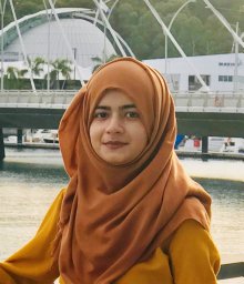 Anum Talpur合作论文数5
 Ahmed Lbath合作论文数5
 Saeed Husnain合作论文数School of Electrical Engineering and Computer Science (SEECS),, National University of Sciences and Technology (NUST),5
 Muhamad Felemban合作论文数5
 Muhammad Asif Manzoor合作论文数5
 Bilal Sadiq合作论文数KACST GIS Technol Innovat Ctr, Umm Al Qura Univ4
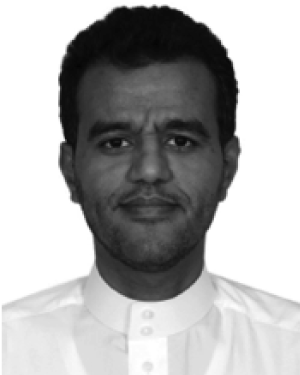 Saleh Basalamah合作论文数4
 Mukhtar Ghaleb合作论文数4
 Umair Mujtaba Qureshi合作论文数Institute of Communication Technologies, Mehran University of Engineering and Technology4
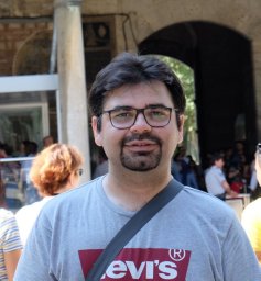 Mohsin Murad合作论文数NWFP UET, N-W.F.P. University of Engineering & Technology4
 Nafeesa Bohra合作论文数3
 Sangjoon Park合作论文数Information & Media Technology Institute, Soongsil University3
 Robert Murawski合作论文数Physics Department, Fordham University3
 Ehsan Ullah Warriach合作论文数University of Groningen3
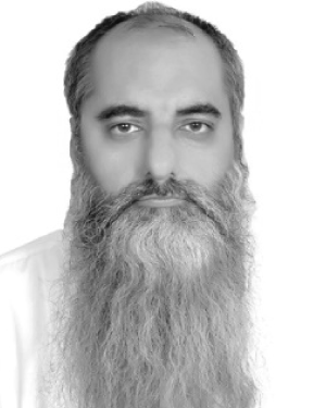 Ahmad Muaz Qamar合作论文数Computer Engineering Department, Umm Al-Qura University3
 Zuneera Aziz合作论文数3
 Serdar Vural合作论文数Canonical3marwan alkhemi合作论文数2
 Muhammad Arif合作论文数2
 Abdur Rahman Muhammad Abdul Majid合作论文数Lab Informat Grenoble, Univ Grenoble Alpes2
 Ali, S.合作论文数IICT, Mehran Univ. of Eng. & Technol.;c;IICT, Mehran Univ. of Eng. & Technol.2Natasha Baloch合作论文数2Saudi Arabia合作论文数2
 Sultan Daud Khan合作论文数2
 Zeeshan Hameed Mir合作论文数Qatar Sci. & Technol. Park (QSTP),, Qatar Mobility Innovations Center (QMIC),;c;Qatar Sci. & Technol. Park (QSTP),, Qatar Mobility Innovations Center (QMIC),2
 Chang-Gun Lee合作论文数Real-time Ubiquitous System Lab, Department of Computer Science and Engineering, College of Engineering, Seoul National University2
 Bhawani Shankar Chowdhry合作论文数Southampton University2
 Youngbag Moon合作论文数2
 Thomas Newe合作论文数University of Limerick, Ireland
T. Coffey University of Limerick, Ireland
Publisher Trinity College Dublin2
Thomas Newe合作论文数University of Limerick, Ireland
T. Coffey University of Limerick, Ireland
Publisher Trinity College Dublin2 Basem Y. Alkazemi合作论文数2Abdulrahman Majrashi合作论文数1Ehsan U. Waraich合作论文数1
 Anas Alkhatieb合作论文数1Hassan Wadood合作论文数1Shoaib Shahzad Obaidi合作论文数1
 Abdullah Alhawsawi合作论文数1Jianyu Wang合作论文数1
 Ali M. Al-Sharafi合作论文数Coll Comp & Informat Technol, Univ Bisha1




