This paper presents a new cognitive agent design approach integrating spatial knowledge representation and reasoning in agent-based modeling dedicated to land use simulations. A deep motivation for our agent-centric contribution is the ever-increasing development of spatially explicit agent simulation platforms. We build on this technological evolution and topology theory to endow the agent with human’s spatial representation and reasoning following a Belief–Desire–Intention architecture. A pilot implementation of the methodology with simulation experiments on a hunting model was carried out in GAMA platform to assess agent performances. Simulations display a consistent trend of animal population dynamics and also confirm a high model sensitivity to the integration of spatial knowledge and reasoning in agent-based models of human actor. These results demonstrate a successful implementation and the importance of spatial dimension in the expressive power and the validity of agent-based models. Future research efforts should therefore emphasize on designing human knowledge representation and incorporating learning abilities to improve models efficiency.
Nowadays, there is an increasing need to rapidly build more realistic models to solve environmental problems in an interdisciplinary context. In particular, agent-based and spatial modeling have proven to be useful for understanding land use and land cover change processes. Both approaches include simulation platforms often used in several research domains to develop models explaining and analyzing complex phenomena. Domain experts generally use an ad hoc approach for model development, which relies on a code-and-fix life cycle, going from a prototype model through progressive refinement. This adaptive approach does not capture systematically actors’ knowledge and their interactions with the environment. The development and maintenance of resulting models become cumbersome and time-consuming. In this article, we propose an actor and architecture-driven approach that relies on relevant existing methods and satisfies the needs of spatially explicit agent-based modeling and implementation. We have designed an Agent Global Experiment framework incorporating a meta-model built from actor, agent architecture, and spatial concepts to produce an initial model from specifications provided by domain experts and system analysts. An engine is built as a tool to support model transformation. Domain knowledge including spatial specifications is summarized in a class diagram which is later transformed into the agent-based model. Finally, the XML file representing the model produced is used as input in the transformation process leading to code. This approach is illustrated on a hunting and population dynamic model to generate a running code for GAMA, an agent-based and spatially explicit simulation platform.
In order to have reliable information on the extent of forest degradation and deforestation for adequate decision-making, the spatial and temporal dynamics of the protected area, Missahohe Classified Forest, were studied from Landsat imagery for the years 1986, 2001 and 2018.A diachronic analysis of the land cover (between 1986 and 2001, on the one hand, and 1986 and 2018 on the other hand) was carried out to analyze ecosystems dynamics.The drivers of forest degradation and deforestation linked to the anthropogenic pressure observed following the invasion of the protected area in the 1990s have been identified.A supervised classification was carried out by applying the "maximum likelihood" algorithm under the ENVI 5.1 software.The overall accuracy of the resulted maps measured from the Kappa index vary from 0.8 to 0.87.The conversions experienced by the different units of land use were analyzed.This analysis shows that forest strata decreased from 1432 ha to 1221.57ha between 1986 and 2018, a loss of about 210 ha, particularly to crops and human settlements that did not exist in 1986.Riparian forests and dense forests are the forest strata that have experienced more regression over the past three decades (from 28.73% in 1986 to 3% in 2018 and from 24.63% in 1986 to 22% in 2018 respectively).While the annual rate of deforestation is estimated at 0.5%.Agriculture, logging, carbonization and honey harvesting are the four main factors of vegetation cover alteration in the study area.All of these results are necessary for the choice of the appropriate protection strategy option for the protected area.
We evaluated the dynamics of land use in the Bouba Ndjidda National Park (BNNP) and adjacent areas, in northern Cameroon. Using a maximum likelihood supervised classification of satellite images from 1990 to 2016, coupled with field and a socio-economic survey, we performed a robust land-use classification. Between 1990 and 2016, the area included eight classes of land use, with the largest in 1990 being the woody savannah (42.9%) followed by the gallery forest (20.2%) and the clear forest (16.3%). Between 1990 and 1999, the gallery forest lost 64.8% of its area mostly to the benefit of woody savannahs. Between 1999 and 2016, the largest loss of area was that of the clear forest, which decreased generally by 43.2% in favor of woody savannah. Rates of increase of crop field areas were 59.6% and 78.8% respectively for the periods of 1990 to 1999 and 1999 to 2016 to the detriment of woody savannahs. We attribute the changes in land use observed mainly to the increasing human population and associated agriculture, overgrazing, fuelwood harvesting and bush fires. The exploitation of non-timber forest products and climatic factors may also have changed the vegetation cover. We recommend the implementation of farming techniques with low impact on the environment such as agroforestry.
This chapter presents the lessons and challenges in land change modeling that emerged from years of reflection and numerous panel discussions at scientific conferences concerning a collaborative cross-case comparison in which the authors have participated. We summarize the lessons as nine challenges grouped under three themes: mapping, modeling, and learning. The mapping challenges are: to prepare data appropriately, to select relevant resolutions, and to differentiate types of land change. The modeling challenges are: to separate calibration from validation, to predict small amounts of change, and to interpret the influence of quantity error. The learning challenges are: to use appropriate map comparison measurements, to learn about land change processes, and to collaborate openly. To quantify the pattern validation of predictions of change, we recommend that modelers report as a percentage of the spatial extent the following measurements: misses, hits, wrong hits and false alarms. The chapter explains why the lessons and challenges are essential for the future research agenda concerning land change modeling.
Dynamic spatial models are important tools for the study of complex systems like environmental systems. This paper presents an integrated model that has been designed to explore land use trajectories in a small region around Maroua, located in the far north of Cameroon. The model simulates competition between land use types taking into account a set of biophysical, socio-demographic and geo-economics driving factors. The model includes three modules. The dynamic simulation module combines results of the spatial analysis and prediction modules. Simulation results for each scenario can help to identify where changes occur. The model developed constitutes an efficient knowledge support system for exploratory research and land use planning. Les modèles spatiaux dynamiques sont des outils de très grande importance pour l'étude des systèmes complexes comme les systèmes environnementaux. De plus, une approche intégrée est indispensable lorsqu'on veut avoir une compréhension plus complète du comportement de ces systèmes. Cet article décrit les bases d'un modèle intégré développé pour explorer les trajectoires d'utilisation de l'espace dans la région autour de Maroua, à l'Extrême Nord du Cameroun. Le modèle simule la compétition entre différentes catégories d'utilisation de l'espace en prenant en compte l'influence d'un ensemble de facteurs biophysiques, sociodémographiques et géoéconomiques. On distingue trois principaux modules. Le module de simulation dynamique combine les résultats des modules d'analyse spatiale et de prédiction. La calibration et la validation du modèle ont été effectuées pour la période entre 1987 et 1999, et la simulation des changements entre 1999 et 2010. Trois scénarios ont été formulés en s'appuyant sur l'analyse des tendances observées et les hypothèses de transition du système d'utilisation de l'espace. Les principales dynamiques observées concernent le développement de la culture maraîchère et l'extension de la culture du sorgho de contre saison qui induisent une compétition plus importante et des conflits. Les résultats de simulation pour chaque scénario permettent d'identifier des zones prioritaires pour toute intervention allant dans le sens de l'intensification ou d'une gestion intégrée et plus durable de l'espace. Le modèle développé constitue ainsi un outil de recherche exploratoire et un support de connaissances utilisable pour la planification de l'utilisation de l'espace. Une utilisation est envisageable pour initier toute concertation ou négociation entre les acteurs concernés par la gestion de l'espace.
The contribution made by geomatics to village land management in the savannas of Central Africa. Over the past few decades, the savannas of Central Africa have undergone major demographic, social, territorial and environmental changes. These changes have left their mark on space, thus posing the problem of territorial management in most regions. This paper aims to show how geomatics can help in the analysis of village land dynamics with a view to understanding the processes and to help decision-making. The concept of territory was defined before being applied to the geographic research, which was conducted in a set of rural territories representative of the dynamics of the savanna in Cameroon, the Central African Republic and Chad. The data used were obtained from topographic maps, satellite images, GPS field surveys and socio-economic surveys. The geo- referenced data were processed using an organised set of geomatic tools and materials. The statistical and cartographic results can be applied to archiving spatio-temporal data, as well as to the understanding of the area's historical evolution and to forecast analysis, which is useful for decision-making. However, geomatics are dependent on human resources and logistics.
An Integrated model for exploring land use trajectories in the dry savannah zone of Cameroon. Dynamic spatial models are important tools for the study of complex systems, such as environmental systems. In addition, an integrated approach is essential for a more comprehensive understanding of how these systems behave. This paper describes the basis of an integrated model that has been developed to explore land use trajectories in the region around Maroua, in the far north of Cameroon. The model simulates the competition between different categories of land use, taking into account the influence of a set of biophysical, socio-demographic and geo-economic factors. The model has three main modules. The dynamic simulation module combines results from the spatial analysis and forecasting modules. The model was calibrated and validated for the period 1987-1999. The simulation of change was performed between 1999 and 2010. Three scenarios were formulated, based on the analysis of the main trends observed and the hypotheses relating to the transition of the land use systems. The major dynamics observed concern the development of horticultural production and the extension of dry season sorghum, which induce greater competition and conflicts. The simulation results for each scenario are useful for identifying priority areas for each intervention involved in intensification or more sustainable and integrated land management. Thus, the model developed constitutes a tool for exploratory research and a knowledge base that can be applied to land use planning. It could also be used to initiate any discussion or negotiation between the stakeholders involved in land management.
Les modeles spatiaux dynamiques sont des outils de tres grande importance pour l'etude des systemes complexes comme les systemes environnementaux. De plus, une approche integree est indispensable lorsqu'on veut avoir une comprehension plus complete du comportement de ces systemes. Cet article decrit les bases d'un modele integre developpe pour explorer les trajectoires d'utilisation de l'espace dans la region autour de Maroua, a l'Extreme Nord du Cameroun. Le modele simule la competition entre differentes categories d'utilisation de l'espace en prenant en compte l'influence d'un ensemble de facteurs biophysiques, sociodemographiques et geoeconomiques. On distingue trois principaux modules. Le module de simulation dynamique combine les resultats des modules d'analyse spatiale et de prediction. La calibration et la validation du modele ont ete effectuees pour la periode entre 1987 et 1999, et la simulation des changements entre 1999 et 2010. Trois scenarios ont ete formules en s'appuyant sur l'analyse des tendances observees et les hypotheses de transition du systeme d'utilisation de l'espace. Les principales dynamiques observees concernent le developpement de la culture maraichere et l'extension de la culture du sorgho de contre saison qui induisent une competition plus importante et des conflits. Les resultats de simulation pour chaque scenario permettent d'identifier des zones prioritaires pour toute intervention allant dans le sens de l'intensification ou d'une gestion integree et plus durable de l'espace. Le modele developpe constitue ainsi un outil de recherche exploratoire et un support de connaissances utilisable pour la planification de l'utilisation de l'espace. Une utilisation est envisageable pour initier toute concertation ou negociation entre les acteurs concernes par la gestion de l'espace.
This paper applies methods of multiple resolution map comparison to quantify characteristics for 13 applications of 9 different popular peer-reviewed land change models. Each modeling application simulates change of land categories in raster maps from an initial time to a subsequent time. For each modeling application, the statistical methods compare: (1) a reference map of the initial time, (2) a reference map of the subsequent time, and (3) a prediction map of the subsequent time. The three possible two-map comparisons for each application characterize: (1) the dynamics of the landscape, (2) the behavior of the model, and (3) the accuracy of the prediction. The three-map comparison for each application specifies the amount of the prediction’s accuracy that is attributable to land persistence versus land change. Results show that the amount of error is larger than the amount of correctly predicted change for 12 of the 13 applications at the resolution of the raw data. The applications are summarized and compared using two statistics: the null resolution and the figure of merit. According to the figure of merit, the more accurate applications are the ones where the amount of observed net change in the reference maps is larger. This paper facilitates communication among land change modelers, because it illustrates the range of results for a variety of models using scientifically rigorous, generally applicable, and intellectually accessible statistical techniques.
 Denis Gautier合作论文数Cirad Tera7
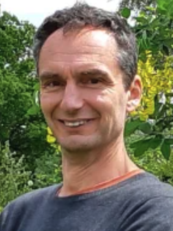 Peter Verburg合作论文数Institute for Environmental Studies, Faculty of Science, Vrije Universiteit Amsterdam6
 Eric Koomen合作论文数Vrije Universiteit Amsterdam4
 K (Kasper) Kok合作论文数Environmental Change Institute, University of Oxford;Department of Environmental Systems Analysis, Wageningen University & Research;Department of Soil Geography and Landscape, Wageningen University & Research4
 Noah Goldstein合作论文数4
 Christopher D. Lippitt合作论文数School of Geography, Clark University4
 c floret合作论文数3frederic reounodji合作论文数3christian seignobos合作论文数3l seiny boukar合作论文数3
 Zengqiang Duan (段增强)合作论文数College of Land Sclence and Technology, China Agricultural University3
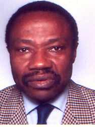 Maurice Tchuente合作论文数University of Yaounde I;Pan-African Scientific Research Council, Princeton University3
 Robert Gilmore Pontius合作论文数Graduate School of Geography, Clark University3
 William J. McConnell合作论文数3
 Ton de Nijs合作论文数3Mama Ntoupka合作论文数3Wouter T. De Groot合作论文数Institute of Environmental Sciences, Leiden University3
 Jean-Paul Cheylan合作论文数French National Centre for Scientific Research;Université d´Avignon et des Pays du Vaucluse3
 Jean-Christophe Castella合作论文数Institut de Recherche pour le Développement3
 Bryan Pijanowski合作论文数Department of Forestry and Natural Resources, College of Agriculture Purdue University3
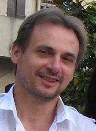 Jeanyves Jamin合作论文数Cirad-UMR G-Eau3
 Alias Mohd Sood合作论文数2
 Tom Veldkamp合作论文数Faculty ITC, University of Twente2Michel Tchotsoua合作论文数2Elvire José Djiongo Boukeng合作论文数1Marie Louise Avana合作论文数1
 Eric K.G. Agbessi合作论文数1
 Keith Clarke合作论文数Department of Geography, University of California, Santa Barbara1Mouhaman Arabi合作论文数Department of Environmental Sciences, University of Maroua1
 Andre Desrochers合作论文数Department of Earth and Environmental Sciences Ottawa, ON, Canada1B. Mathieu合作论文数1Tran Ngoc Trung合作论文数1Moussa Aboubakar合作论文数1Damase Khasa合作论文数Department of Renewable Resources, University of Alberta1
 Gabriel Hoinsoude Segniagbeto合作论文数1Guy-Florent Ankogui-Mpoko合作论文数1
 Antonie Veldkamp合作论文数1Sean P Sweeney合作论文数1
 Louis Zapfack合作论文数1H. Verburg合作论文数1Boniface Ganota合作论文数1Félix Mainam合作论文数1Snehal Pithadia合作论文数1Charles Dietzel合作论文数1Alfred Bangara合作论文数1




