Ocean knowledge is crucial for shaping policies that enable sustainable development, adaptation, and well-being at all levels, as everyone—either directly or indirectly—depends on the ocean, which today faces escalating threats from climate change, pollution, and biodiversity loss, pushing us beyond critical planetary boundaries. Ocean indicators are crucial for translating ocean science and data into practical metrics, guidance, and tools informing on the state and health of the ocean that can be directly applied by policymakers, practitioners, and the public. Despite their critical importance, ocean indicators trail behind those for continental areas, limiting effective monitoring and policy integration. Developing reliable, comparable, and regularly updated ocean indicators, backed by a unified international framework, is essential for delivering coherent, actionable insights that can guide global goals and protect the ocean's future. This paper establishes a scientific foundation for ocean indicators through international and multidisciplinary collaboration, presenting defined criteria and a set of pilot indicators for the ocean’s physical, biogeochemical, biodiversity, and ecosystem aspects. The proposed framework offers a solid foundation for generating indicators that not only track the ocean state but also provide outputs for application in informing policy and decision-making.
This study assessed heat vulnerability in the city of Ponce, Puerto Rico, by integrating satellitederived land surface temperature (LST) data with demographic and socioeconomic indicators. Spatial analysis, principal component analysis (PCA), and multivariate regression were applied to develop a Heat Vulnerability Index (HVI) that maps heat risk across urban neighborhoods. Environmental variables, LST, Normalized Difference Vegetation Index (NDVI), impervious surface cover, slope, and elevation, were analyzed alongside indicators such as age, disability, living alone, poverty, and unemployment to identify key drivers of heat exposure, social isolation, and vulnerability. Multivariate regression analysis showed that lower vegetation, greater impervious surface, lower elevation, and a small cooling effect from slope were significantly associated with higher LST, explaining over 80 % of temperature variability. Results show that census tracts classified as High Vulnerability consistently experienced elevated temperatures and were characterized by higher concentrations of elderly individuals, people with disabilities, and socially isolated residents. These high vulnerability census tracts, where extreme heat and social disadvantage converge, represent areas where immediate heat mitigation actions may be most effective. Green infrastructure investments (e.g., urban greening), targeted adaptation strategies (e.g., cooling centers, community outreach), and urban planning policies are likely to reduce risk and improve resilience in high vulnerability areas. This research provides actionable insights for city planners, public health officials, and policymakers to protect the lives, health, and well-being of residents in Ponce amid a changing environment.
IntroductionThe effective implementation of the Agreement on the Conservation and Sustainable Use of Marine Biological Diversity of Areas Beyond National Jurisdiction (BBNJ Agreement) depends on how information related to ocean data and marine genetic resources (MGRs) is collected, shared, and accessed across institutions and jurisdictions. Central to this effort is the Clearing-House Mechanism (CHM), an open digital platform established under the Agreement to facilitate information exchange across its four pillars: MGRs, area-based management tools (including marine protected areas), environmental impact assessments, and capacity-building and transfer of marine technology (CBTMT). However, the design of the CHM presents significant challenges related to governance, technical architecture, financing, reporting functions, and the effective management of MGR-related data. These issues are analogous to those encoun-tered in efforts to establish and operate a Clearing House for the Convention on Biological Diversity (CBD) Nagoya Protocol on Access and Benefit-sharing, which covers areas within national jurisdiction.MethodsThis paper examines the data-related challenges that the CHM will need to consider to function effectively, without duplicating existing global efforts. Particular attention is paid to issues of interoperability, data fragmentation, and the movement of MGR-related samples, data, and derived information across jurisdictions, repositories, and stages of utilization. Drawing on the ongoing work of the Data for Ocean Biodiversity Observing Working Group under the Future Ocean Program of the Sasakawa Global Ocean Institute of the World Maritime University (WMU), the paper develops an expert informed conceptual synthesis of the data-centric capacities required to support CHM implementation, with particular attention to notification workflows, provenance metadata, identifier propagation, repository interoperability, and responsible reuse of MGR-related data.Results & DiscussionWe recommend that, as efforts go forward with the design of the CHM, the international community seek to implement similar and interoperable data management and data standardization strategies for the clearing houses of the Nagoya protocol, the International Treaty on Plant Genetic Resources for Food and Agriculture, and of the Biodiversity of Areas Beyond National Jurisdiction (BBNJ) Agreement. Further, the CBD and the UN Division for Ocean Affairs and the Law of the Sea should coordinate in engaging the academic, private, and public sectors to increase awareness about rules and treaties that govern the use of genetic resources.
There are thousands of codes of conduct in workplaces. However, most are general for all employees and do not address the behaviour of scientists conducting fieldwork and associated activities. Thus, through consultation with many colleagues within and outside the Global Earth Observation Biodiversity Observation Network, we synthesised a proposed code of practice for researchers. This is applicable to people working in environmental sciences, including ecology, biogeography, geology and associated subjects involving fieldwork. Highlights This code of conduct recommends that scientists: Respect all people, nature and laws Challenge inappropriate behaviour and misinformation Maintain their integrity and be accountable Minimise impacts on wildlife and habitats Publish their findings with full acknowledgements
The need for ocean information has never been greater. From climate change to food security and extreme events, we need to understand the role of the ocean and better predict change and impact. This is only possible with the sustained collection of a key set of ocean observations. The Global Ocean Observing System (GOOS) coordinates international efforts to collect these Essential Ocean Variables (EOVs), which span physics, biogeochemistry, biology and ecosystem realms. Guided by three expert panels, these EOVs are used to define the needs and design of a sustained, fit for purpose global ocean observing system, aimed at maximizing investments in observing infrastructure. As the GOOS EOVs are increasingly used, it has become important to discuss and refine the understanding of this framework, to ensure that the right balance is struck between their essential nature and the need to expand to new domains and integrate with key global policies. In this paper we provide a description of the EOV framework, discuss some of the challenges in implementing it, and identify a set of recommendations for GOOS and the ocean observing community to take forward. These recommendations include increasing the transparency of the EOV adoption process, and the need to periodically assess the EOVs in consultation with observing communities and with the entities managing other global essential variable frameworks in cross cutting realms such as climate and biodiversity. This will contribute to building a useful and responsive global ocean observing system that delivers the observations required to meet societal needs.
With the rapid uptake of environmental DNA (eDNA) metabarcoding for a wide range of conservation and management uses, there is a growing need for guidance and best practices for species identification. A range of methodological and interpretive decisions influences taxa assignment. Here we provide a review and perspective of pitfalls and issues that can impact accurate taxonomic assignment across the full eDNA metabarcoding workflow: primer selection, lab handling, bioinformatics, taxonomic assignment, and communication of results. This paper addresses the complexities and challenges of the metabarcoding-based species identification process, offering recommendations for robust workflows and effective communication of findings. Accurate interpretation and communication of eDNA metabarcoding results requires an acknowledgment of methodological limitations such as incomplete reference databases, contamination risks, ambiguous sequences, and detection biases. Thus, we argue that transparency of methods and limitations, alongside proactive alignment of decisions with project objectives are critical for the successful application of eDNA metabarcoding in conservation and management decisions. We provide guidance for developing protocols that support species identification from eDNA metabarcoding sequences, and give recommendations on communication strategies for stakeholders and end users. To support these recommendations, we outline steps in the workflow that can impact species identification, with a discussion of the strengths and weaknesses at each stage. Ultimately, this guidance can improve the accuracy, reliability, and usability of eDNA and other metabarcoding and amplicon sequencing approaches to species identification while fostering trust and understanding among diverse end users.
ABSTRACT Fragmented systems for monitoring and assessing biodiversity and ecosystem services limit the ability to track progress at local and national scales in international multilateral environmental agreements (MEAs). This greatly challenges coordinated actions to meet agreed‐upon global commitments. Filling this gap requires integrated and concerted design of data‐to‐decision workflows. The Essential Biodiversity Variables (EBVs) and Essential Ecosystem Service Variables (EESVs) are tools that can coordinate structured and consistent monitoring, generate harmonized and scalable data products, and facilitate reporting that is useful for multiple purposes. Specifically, EBV/EESV data products are intended to synthesize information to serve the needs of the Global Biodiversity Framework (GBF), the System of Environmental‐Economic Accounts Ecosystem Accounting (SEEA‐EA), and assessments of the Intergovernmental Science‐Policy Platform on Biodiversity and Ecosystem Services (IPBES) while also informing regional, national, and sub‐national conservation policy. This integrative approach works if local data collection is designed to be interoperable, and it is fundamental to improve models, forecasts, and indicators required in key policy and decision processes. Through application cases, we demonstrate the use of EBVs and EESVs in national assessments and scenario analyses for strategic policy and spatial planning with scalable and repeatable workflows from primary data to indicators for decision support.
In June 2020, the tropical Atlantic and the Caribbean Basin were affected by a series of African dust outbreaks unprecedented in size and intensity. These events, informally named "Godzilla," coincided with CALIMA, a large field campaign, offering a rare opportunity to assess the impact of African dust on air quality in the Greater Caribbean Basin. Network measurements of respirable particles (i.e., PM10 and PM2.5) showed that dust significantly degraded regional air qual-ity and increased the risk to public health in the Caribbean, the southern United States, northern South America, and Central America. CALIMA examined the meteorological context of Godzilla dust events over North Africa and how these conditions might relate to the greatly increased dust emissions and enhanced transport to the Americas. Godzilla was linked to strong pressure anomalies over West Africa, resulting in a large-scale geostrophic wind anomaly at 700 hPa over North Africa. We used surface-based and columnar measurements to test the performance of two frequently used aerosol forecast models: the NASA Goddard Earth Observing System (GEOS) and Weather Research and Forecasting Model coupled with Chemistry (WRF-Chem) models. The models showed some skills but differed substantially between their forecasts, suggesting large uncertainties in these forecasts that are critical for issuing early warnings of health-threatening dust events. Our results demonstrate the value of an integrated approach in characterizing the spatial and temporal variability of African dust transport and assessing its impact on regional air quality. Future studies are needed to improve models and to track the long-term changes in dust transport from Africa under a changing climate. SIGNIFICANCE STATEMENT: Every year, vast quantities of African dust are transported across the Atlantic to the Caribbean Basin. During these events, respirable dust concentrations often exceed the air quality standards established by the United States EPA and the World Health Organization. We discuss the record-breaking June 2020 "Godzilla" dust events in terms of measurements made during a large-scale surface-based field campaign (CALIMA). During CALIMA, we made aerosol measurements at sites throughout the Caribbean Basin. We used satellite and aerosol model products to interpret the data and understand the meteorological processes that affect dust emissions in Africa and the subsequent transport to the Americas. Models could provide advanced warnings of health-threatening dust events, thereby enabling public health officials to issue health risk alerts.
Plankton, a diverse group of aquatic organisms, make Earth livable, regulate aquatic life, and provide benefits to human societies such as access to clean water, food security, and well-being. They also support economies and inspire biotechnological innovations. This article aims to raise awareness of the value of plankton to humanity and serves as an informative guide for aquatic professionals, policymakers, and anyone interested in plankton. We present the value of plankton across six themes of human interest: biogeochemistry; ecology; climate; the evolution of science; economy; and culture, recreation, and well-being. Guided by the 2022 Intergovernmental Science-Policy Platform on Biodiversity and Ecosystem Services values assessment, we introduce the six themes under the Life Framework of Values to offer a comprehensive summary of the significance of plankton to humanity. In addition, we provide examples of plankton variables used in policy frameworks and recommendations for enhancing understanding of their value through long-term sustainable research and monitoring.
The North Atlantic is an ocean basin with a diversity of deep-sea ecosystems. Here we provide a summary of the topography and oceanography of the North Atlantic including the Gulf of Mexico and Caribbean Sea, provide a brief overview of the history of scientific research therein, and review the current status of knowledge of each of 18 pelagic and benthic deep-sea ecosystems, with a particular focus on knowledge gaps. We analyse biodiversity data records across the North Atlantic and highlight spatial data gaps that could provide important foci for future expeditions. We note particular data gaps in EEZs of nations within and bordering the Caribbean Sea. Our data provide a baseline against which progress can be tracked into the future. We review human impacts caused by fishing, shipping, mineral extraction, introduction of substances, and climate change, and provide an overview of international, regional and national measures to protect ecosystems. We recommend that scientific research in the deep sea should focus on increasing knowledge of the distribution and the connectivity of key species and habitats, and increasing our understanding of the processes leading to the delivery of ecosystem services. These three pillars - distribution, connectivity, ecosystem function - will provide the knowledge required to implement conservation and management measures to ensure that any deep-sea development in the future is sustainable. Infrastructure and capacity are unevenly distributed and implementation of strategies that will lead to more equitable deep-sea science is required to ensure that essential science can be delivered.
Challenge 2 of the UN Ocean Decade focuses on protecting and restoring marine ecosystems and biodiversity as a fundamental requirement to achieve sustainable development. Addressing this challenge requires reliable and timely information on biodiversity and ecosystems. To achieve this, academic, government, and private groups should engage in a process of co-design that aims to facilitate decision-making at the local and national level, and agree on common and interoperable practices for the collection and curation of biology and ecosystem information. Implementing the flow of data to enable the management of human activities and sustainable development will require the sharing of capacity. An all-hands-on-deck effort will help us ensure a better future for ourselves. A positive step would be to identify the minimum essential ocean variables that can serve multiple relevant regional and international frameworks and to link and harmonize the required data and information flow (i.e., for frameworks including the Convention on Biological Diversity Kunming-Montreal Global Biodiversity Framework, the United Nations Framework Convention on Climate Change Paris Agreement, the Biodiversity Beyond National Jurisdiction Agreement, the International Seabed Authority, the Convention on the Conservation of Antarctic Marine Living Resources, the Intergovernmental Science-Policy Platform on Biodiversity and Ecosystem Services, and deep and national ocean fisheries policies). A key strategy is to support and build on existing local and national networks for biodiversity observation. With this information, local communities and nations can better understand and manage how they use marine life and also report on progress toward Sustainable Development Goals.
The proliferation of holopelagic Sargassum spp. (Sargassum) in the tropical North Atlantic Ocean is of concern for populations and coastal ecosystems in the Caribbean Sea, Gulf of Mexico, and West Africa. Satellite detections have enabled rough assessments of the quantity of algae that drifts seasonally in the open ocean, with seasonal peaks of Sargassum biomass reaching 10 to 20 million tons since 2018. Although the impacts on the coast have been widely publicized, there are no estimates of the quantities of Sargassum that accumulate on the coasts. This study proposes novel vulnerability indicators that combine information on Sargassum stranded biomass, ecosystem and socioeconomic factors to assess risks posed by Sargassum on coastal regions. Quantities of Sargassum that accumulate in the coastal strip at the regional scale were derived by combining the satellite detections in the open ocean with an algal growth-transport-stranding model. It shows that the amount of Sargassum accumulating on the Atlantic coast is of the order of 10% of the biomass estimated offshore and has accumulated between 2 and 10 million tons per year over the last five years. Vulnerability indices identify the Mexican Caribbean, northern Lesser Antilles, and eastern Great Antilles as the most vulnerable regions, facing significant ecosystemic and socioeconomic pressures from Sargassum influxes.
The critical role of biology Essential Ocean Variables (EOVs) in advancing our understanding of marine ecosystems underscores the need for sophisticated observation tools like Autonomous Underwater Vehicles (AUVs), Unmanned Aerial Vehicles (UAVs), Maritime Autonomous Vehicles (MAVs). However, the integration of these technologies in Marine Scientific Research (MSR) has surfaced significant legal and policy challenges. This study, informed by insights from forty-six experts across academia, oceanographic institutions, industry, and intergovernmental organizations, identifies six principal legal challenges relevant to the: operation and navigation of AUVs, data collection, security, environmental impact, animal tagging, and intellectual property rights. Effectively addressing these challenges requires a coordinated, multi-stakeholder approach among the scientific community, policymakers, and international bodies. States may promote an initiative to drive progress in ocean observation while laying the groundwork for advancements. To address the operational and regulatory complexities, States may coordinate collaboration through involvement of the Intergovernmental Oceanographic Commission (IOC), the International Maritime Organization (IMO), and the World Meteorological Organization (WMO), for example. Additionally, coordination with frameworks such as the BBNJ Agreement, UNCLOS, the Convention on Biological Diversity’s Kunming-Montreal Global Biodiversity Framework (CBD KM-GBF), and regional organizations like the Commission for the Conservation of Antarctic Marine Living Resources (CCAMLR) would ensure a comprehensive and inclusive approach.
Climate change is a threat to human health, impacting the cancer control continuum. Frequent extreme weather events in the US Caribbean (Puerto Rico [PR] and US Virgin Islands [USVI]) have harmed human health and socioecological ecosystems and have disrupted cancer prevention and control efforts. This has unveiled the vulnerabilities of critical infrastructure systems, which, when disrupted, cause catastrophic failures with fatal and long-lasting consequences. Addressing these challenges is crucial for promoting resilient and healthy island communities, mitigating cancer risk, and sustaining cancer control infrastructure. The Caribbean Climate Change, Cancer, and Health Disparities Research Center (CARIB-CARES) is a regional initiative aimed at tackling these critical issues, with the participation of a multidisciplinary team of experts in environmental health, climate, oceanography, and cancer research. A partnership between the University of PR Comprehensive Cancer Center, the University of PR-Medical Sciences Campus, and the University of the Virgin Islands together with other institutions in the continental US, government agencies, health clinics, and non-governmental organizations, CARIB-CARES seeks to address the impact of multi-hazard climate-related stressors on the cancer control continuum and increase research and adaptation capacity in the field. Funded in September 2024, CARIB-CARES has initiated capacity-building initiatives, delivering webinars on climate change, health, and the cancer control continuum to over 100 community members, health professionals, and students across PR, USVI, and mainland US. Student engagement and mentorship has initiated, supporting more than 15 students from various academic backgrounds (public health, nursing, and biology) and different career levels (undergrad, grad, and post-doc) and from underrepresented populations as mentees, providing them with research opportunities on the intersection of climate change and cancer. Research projects are also underway, evaluating environmental disparities and cancer risk across the US Caribbean and climate change awareness among oncology health professionals. Community partnerships are being reinforced, developing a Community Coalition of Partners that includes academic institutions, nonprofits, and government agencies, leading to actionable collaborations in addressing cancer-related disparities within the context of climate change. Through its comprehensive approach, CARIB-CARES has begun building a robust framework to advance research, strengthen governance, and build equitable adaptation to effectively address the challenges of climate change and cancer control across vulnerable and underserved small islands in the Caribbean. Funding NIH Award: 1P20CA294096-01. Ana P. Ortiz, Noreen Michael, Nancy R. Cardona-Cordero, Marievelisse Soto-Salgado, Polaris N. Torres, LaVerne E. Ragster, Leticia Nogueira, Frank E. Muller-Karger, Zack Guido, Tracy E. Crane, Pablo Méndez-Lázaro. CARIB-CARES: the first exploratory research center addressing the intersection of climate and the cancer control continuum [abstract]. In: Proceedings of the American Association for Cancer Research Annual Meeting 2025; Part 1 (Regular Abstracts); 2025 Apr 25-30; Chicago, IL. Philadelphia (PA): AACR; Cancer Res 2025;85(8_Suppl_1):Abstract nr 985.
The Blue-Green Action Platform (BlueGAP) information system (IS) is an intelligent cyberinfrastructure framework designed to support large-scale water quality assessments in the context of demographic statistics and community stories about water issues. The system prioritizes collaboration with interested parties in three pilot watersheds with test cases implemented in US locations including Iowa, Tampa, and the U.S. Virgin Islands. The BlueGAP IS leverages Artificial Intelligence (AI) technologies with large language models based on regional nutrient management issues and community knowledge to provide access to water quality information. The current focus of the system is on nitrate in drinking water, rivers, and waterways, and can be expanded to incorporate other water quality information. BlueGAP identifies possible partnerships and promotes collaborations among diverse stakeholders to facilitate effective evaluation of nitrogen-related analytes, guide action to address possible pollution, and outline sustainable water management practices. The BlueGAP IS also emphasizes its educational mission by connecting water quality data with inclusive and accessible educational content through AI technology. By integrating nitrogen data and water quality issues into educational resources, BlueGAP fosters a deeper understanding of water quality issues across diverse communities, empowering users to make informed decisions and contribute to sustainable water management practices.
We examined the feasibility of monitoring interannual and intra-annual changes in seagrass extent in Tampa Bay, Florida between 1987 and 2023 using remote sensing with the Landsat 5, Landsat 7, Landsat 8, and Sentinel-2 satellite sensor series. This study filled gaps and extended the time series developed for the period 1990-2021 by Lizcano-Sandoval et al. (2022). Seagrass extent was evaluated for six Tampa Bay segments: Hillsborough Bay (HB), Old Tampa Bay (OTB), Middle Tampa Bay (MTB), Lower Tampa Bay (LTB), Boca Ciega Bay (BCB), Manatee River + Terra Ceia Bay (MRTC). Results were compared with reference data from the biennial mapping program conducted by the Southwest Florida Water Management District (SWFWMD). Overall, seagrass showed long-term increases in extent in Tampa Bay. The highest increasing rates over 1987-2023 were observed in HB (+5.7 % yr(-1)) and OTB (+3.5 % yr(-1)). Smaller increases were observed in BCB (0.9 % yr(-1)). However, in HB and MRTC seagrass extent showed decreases in particular years between 2015 and 2023 (34 % and 11 %, respectively), and in OTB between 2017 and 2023 (41 %). Intra-annual changes in seagrass extent were observed during 2021-2023. Intra-annual coefficient of variation was estimated to be as low as 3 % in BCB and as high as 60 % in HB. Seagrass extent estimated by remote sensing was highly correlated with the reference data (r > 0.74), except in the MRTC segment (r = -0.29). A Google Earth Engine app was developed to allow public access to the temporal and spatial changes of seagrass extent and distribution in Tampa Bay. The results showed that seagrass extent assessments to complement existing field and airborne seagrass monitoring programs are feasible at low cost with public satellite imagery in the cloud.
The Marine Biodiversity Observation Network Pole to Pole of the Americas (MBON Pole to Pole) brought together 30 participants from 10 countries in Patagonia, Argentina, to strengthen observing capacity of coastal biodiversity across the Americas. The network held a five-day workshop focused on three core components: standardized rocky intertidal photo-quadrat surveys, low-cost environmental DNA (eDNA) sampling, and affordable plankton imaging tools. Participants included researchers, park rangers, and conservation practitioners fostering a collaborative and inclusive environment. Key outcomes included field validation of protocols, identification of context-specific methodological adaptations (e.g., for low tidal amplitude areas), adoption of novel tools for monitoring marine life, and strategies for broader participation and data harmonization. The workshop highlighted the potential of simple, replicable methods to support long-term monitoring, and emphasized the value of shared protocols, tools, and open data for building a more connected and resilient regional observation network.
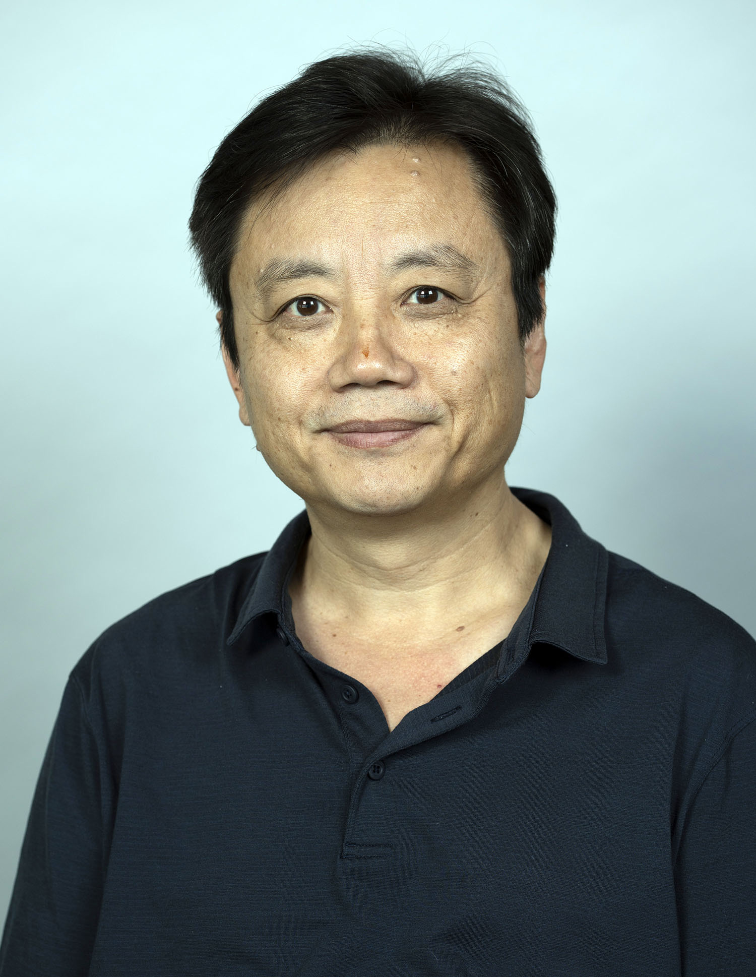 Chuanmin Hu合作论文数College of Marine Science, University of South Florida75
 Ramon Varela合作论文数51
 Yrene Astor合作论文数50
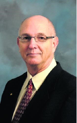 Robert Thunell合作论文数University of South Carolina50
 Enrique Montes合作论文数Univ S Florida, Coll Marine Sci, St Petersburg, FL 33701 USA41Laura Lorenzoni合作论文数33
 Digna Tibisay Rueda Roa合作论文数University of South Florida32
 Gordon T. Taylor合作论文数School of Marine and Atmospheric Sciences, Stony Brook University28
 Mary I. Scranton合作论文数27Gabrielle Canonico合作论文数23
 Claudia Benitez-Nelson合作论文数School of the Earth, Ocean and Environment, McCausland College of Arts and Sciences, University of South Carolina20
 Kendall L. Carder合作论文数College of Marine Science, University of South Florida20
 John J. Walsh合作论文数College of Marine Science, University of South Florida19
 Patricia Miloslavich合作论文数Simon Bolivar University19
 Francisco P. Chavez合作论文数Monterey Bay Aquarium Research Institute18
 Maria Kavanaugh合作论文数College of Oceanic and Atmospheric Sciences, Oregon State University17Serge Andréfouët合作论文数16
 Matthew Mccarthy合作论文数16
 Jay Pearlman合作论文数15
 Eric J. Tappa合作论文数Department of Geological Sciences;University of South Carolina;Department of Geological Sciences, University of South Carolina15Daniel B. Otis合作论文数15
 Ward Appeltans合作论文数Flanders Marine Institute (VLIZ),, InnovOcean Site15
 J. Emmett Duffy (Emmett Duffy)合作论文数Tennenbaum Marine Observatories Network, Smithsonian Institution13
 Pier Luigi Buttigieg合作论文数Max Planck Institute for Marine Microbiology, Jacobs University Bremen gGmbH13
 Kent Fanning合作论文数13Méndez-Lázaro Pablo合作论文数Graduate School of Public Health, University of Puerto Rico12
 Mitchell A. Roffer合作论文数Roffer's Ocean Fishing Forecasting Service, Inc. (ROFFS™), West Melbourne, FL 32904, USA12
 Eduardo Klein合作论文数Universidad Simón Bolívar Departamento de Estudios Ambientales, Centro de Biodiversidad Marina.12
 I. Soto合作论文数College of Marine Science, University of South Florida11
 Heidi M Sosik合作论文数11Turner Woody合作论文数10
 Luis Troccoli合作论文数Escuela de Ciencias Aplicadas del Mar ( ECAM );Núcleo de Nueva Esparta;Escuela de Ciencias Aplicadas del Mar ( ECAM ), Núcleo de Nueva Esparta10S. Andréfouët合作论文数9
 Mark Costello合作论文数Faculty of Biosciences and Aquaculture, Nord University9
 Robert H. Weisberg合作论文数College of Marine Science, University of South Florida9
 Laurencia Guzman合作论文数9
 Raphael M Kudela合作论文数Ocean Sciences Department, University of California Santa Cruz;Institute of Marine Sciences, University of California Santa Cruz9
 Sergio Cerdeira-Estrada合作论文数9
 Eduardo Santamaria-Del-Angel合作论文数Subdirección del Sistema de Información y Análisis Marino Costero, Comisión Nacional para el Conocimiento y Uso de la Biodiversidad, Gobierno de México9
 Nic Bax合作论文数Commonwealth Scientific and Industrial Research Organisation9
 Eric J Hochberg合作论文数Hawaii Institute of Marine Biology, University of Hawaii9
 Johannes Karstensen合作论文数Leibniz-Institut für Meereswissenschaften an der Universität Kiel9D. B. Otis合作论文数8Sonia D. Batten合作论文数8
 Abigail Benson合作论文数Science Analytics and Synthesis, U.S. Geological Survey8
 David Obura合作论文数Tel.: +254415486473; fax: +254415480117.8
 Saul Alvarez-Borrego合作论文数8
 Isabel Sousa Pinto合作论文数Ciimar - Interdisciplinary Centre for Marine and Environental Research Research Group Lead of the Coastal Biodiversity Lab;Department of Biology, Faculty of Sciences, University of Porto;GEO BON - Group on Earth Observation - Biodiversity Observation Network8John T. Lamkin合作论文数8




