The accessibility of flying drones (unmanned aerial vehicles) presents reproducible and cost-effective methods to monitor submerged aquatic vegetation. In particular, drone-borne topobathymetric LiDAR provides high-resolution (cm-scale), three-dimensional information about the geometry and structure of surveyed areas, allowing for quantification of vegetation volume in addition to bathymetry. For seagrasses, this information can advance research regarding the structure of canopies in relation to blue carbon storage and biodiversity. Here, we demonstrate how drone-borne LiDAR can be used to estimate the habitat volume of eelgrass (Zostera marina) within a sheltered bay in Norway. After classifying LiDAR points using a Random Forest model, we created a Digital Terrain Model of the sea floor and a Digital Surface Model of the eelgrass canopy. From these models, we showed that eelgrass canopy volume can be estimated (between 862 and 1099 m3 across the small study area) and the above-ground carbon stock in living tissue can be quantified (between 96 and 122 kg C). To our knowledge, this is the first study to utilise drone-borne LiDAR to quantify the habitat volume and carbon-storage potential of a marine habitat-forming species like eelgrass, demonstrating a novel methodology for providing reproducible and high-resolution data of submerged aquatic habitats.
Terrestrial primary production is acknowledged as a major contributor to atmospheric carbon transformation and storage. In contrast, marine primary production, especially the contribution from kelp forests, remains less studied and accounted for. To facilitate studies on marine kelp and organic carbon, we here introduce an environmental DNA-based approach for tracing two common kelp species in Nordic marine sediments, establishing a basis for estimating the organic carbon buried from the targeted species. We developed and tested species-specific quantitative PCR (qPCR) assays for Saccharina latissima and Laminaria hyperborea. Next, we applied the assays on 79 marine surface (0–2 cm) sediment samples along the Norwegian coast (58° N to 72° N), ranging from shallow nearshore (8.1 m) to deep offshore locations (1334 m). Kelp DNA was detected in 87% of the locations, with DNA from S. latissima and L. hyperborea detected in 73% and 72% of the locations, respectively. DNA from both species were detected together in 58% of the locations. Spatial analysis revealed higher kelp DNA concentrations in shallow, coastal areas, particularly for S. latissima while kelp DNA was largely absent at the offshore locations. Both species exhibited a strong correlation with the sediment total organic carbon (TOC) concentration. Interestingly, kelp eDNA concentrations and TOC concentrations were lower in areas where kelp forests were impacted by sea urchin grazing compared to non-impacted areas. Our study presents a novel method for tracing key kelp species and provides a framework to estimate their potential contributions to sediment carbon pools and assessing kelp carbon sequestration. This framework has the potential to improve assessment of blue carbon contributions in sediments and should also be applicable to other organisms beyond kelp.
Statistical and machine learning models, trained with in situ species observations and continuous covariate data, are commonly used to produce marine habitat maps by predicting ecological features over large areas. Here we systematically compare such approaches based on species distribution models (SDM) and more recent remote sensing (RS) models for mapping coastal habitats spanning seven European marine regions. We implemented each model using conventional approaches and data on species occurrences as well as covariates from 1) environmental maps (SDM), 2) Sentinel-2 satellite images and bathymetry (RS), and 3) commercial very high resolution multispectral images and bathymetry (RS – only two areas). We measured each model's predictive performance using cross-validation and analysed how it changed with data quality, depth and water opacity. The SDM approach generally outperformed the Sentinel-2-based RS approaches, being superior in five out of seven areas. However, SDMs performed poorly in the Mediterranean Sea likely due to small variability in the available environmental covariates. RS showed promise for producing benthic habitat maps even though it required larger in-situ datasets and reusing historical survey data proved more challenging than with SDMs. The performance of the SDMs depended on the availability of high-quality, ecologically relevant covariate maps and the taxonomic resolution of the in-situ data. The present study offers an in-depth comparison of the advantages and disadvantages between the approaches, especially on how they perform across different areas for coastal habitat mapping, providing practical guidance on their use, as well as suggestions for further development and co-use.
Marine and salt marsh sediments contain large amounts of organic carbon (OC) and are therefore important in the global carbon cycle. Here, we collated previously published and unpublished measurements of sediment OC in marine and salt marsh sediments in European regional seas (EURO-CARBON; available at https://doi.org/10.5281/zenodo.14905489). To the extent possible the OC data were complemented by variables such as sediment porosity and dry bulk density. The EURO-CARBON dataset holds 61306 individual data entries of sediment OC content from different regions of European regional seas. Around three quarters (76%) were collected in coastal and deep sea bare sediments, 18% from salt marshes, 7% from seagrass habitats, and 0.03% from macroalgal habitats. For all habitats and sediment depth layers the OC content varied between <0.1 and 41.56 % (avg.: 2.47 ± 3.37 %; median: 1.39 %), with the content generally decreasing in the following sequence: salt marsh (5.01 ± 5.96 %; 3.03 %) > seagrass (2.37 ± 5.96 %; 3.03 %) > bare sediment (1.88 ± 2.03 %; 1.20 %). The EURO-CARBON dataset will serve as a basis for future work, and it will be an important resource for researchers, managers, and policymakers working towards protecting sediment OC pools.
Human activities at sea can produce pressures and cumulative effects on ecosystem components that need to be monitored and assessed in a cost-effective manner. Five Horizon European projects have joined forces to collaboratively increase our knowledge and skills to monitor and assess the ocean in an innovative way, assisting managers and policy-makers in taking decisions to maintain sustainable activities at sea. Here, we present and discuss the status of some methods revised during a summer school, aiming at better management of coasts and seas. We include novel methods to monitor the coastal and ocean waters (e.g. environmental DNA, drones, imaging and artificial intelligence, climate modelling and spatial planning) and innovative tools to assess the status (e.g. cumulative impacts assessment, multiple pressures, Nested Environmental status Assessment Tool (NEAT), ecosystem services assessment or a new unifying approach). As a concluding remark, some of the most important challenges ahead are assessing the pros and cons of novel methods, comparing them with benchmark technologies and integrating these into long-standing time series for data continuity. This requires transition periods and careful planning, which can be covered through an intense collaboration of current and future European projects on marine biodiversity and ecosystem health.
The coastal ocean represents an important global carbon sink and is a focus for interventions to mitigate climate change and meet the Paris Agreement targets while supporting biodiversity and other ecosystem functions. However, the fate of the flux of carbon exported from seaweed forests-the world's largest coastal vegetated ecosystem-is a key unknown in marine carbon budgets. Here we provide national and global estimates for seaweed-derived particulate carbon export below 200 m depth, which totalled 3-4% of the ocean carbon sink capacity. We characterized export using models of seaweed forest extent, production and decomposition, as well as shelf-open ocean water exchange. On average, 15% of seaweed production is estimated to be exported across the continental shelf, which equates to 56 TgC yr-1 (range: 10-170 TgC yr-1). Using modelled sequestration timescales below 200 m depth, we estimated that each year, 4-44 Tg seaweed-derived carbon could be sequestered for 100 years. Determining the full extent of seaweed carbon sequestration remains challenging, but critical to guide efforts to conserve seaweed forests, which are in decline globally. Our estimate does not include shelf burial and dissolved and refractory carbon pathways; still it highlights a relevant potential contribution of seaweed to natural carbon sinks. Coastal seaweed transported to the open ocean contributes up to 3-4% of the particulate organic carbon sinking into the deeper ocean, according to combined ecological and biogeochemical modelling.
AbstractSeagrass meadows are well-known for their capacity to capture and store blue carbon in sediments. However carbon stocks vary significantly between meadows, spanning more than three orders of magnitude on both local and global scales. Understanding the drivers of seagrass carbon stocks could help improve strategies for incorporating blue carbon into management plans. Here, we measured sediment carbon stocks in eelgrass (Zostera marina) meadows and unvegetated areas along the Norwegian coast, spanning wide gradients in temperature, wave exposure, water depth, salinity, and eelgrass biomass. Carbon stocks were generally higher in eelgrass meadows than in adjacent unvegetated areas, yet they displayed considerable variation (400 − 30 000 g C m−2 at 50 cm sediment depth) even among nearby sites. Overall, the highest carbon stocks were found in deeper, muddier, sheltered meadows near river mouths. These sites likely have the highest input and retention of carbon from different sources. Consequently, they should be prioritized as conservation targets for preserving coastal blue carbon stocks. Despite ever-increasing efforts to quantify seagrass blue carbon globally, high uncertainties still persist, partly due to differing methodologies, processes, and environmental context. Blue carbon stock estimates could be improved through the coordination of standardised mapping and sampling methods.
Indicators can be powerful tools to measure progress towards achieving societal goals, and many indicators have been developed for sustainability goals nationally and internationally. When indicators are developed solely through top-down approaches without engaging local knowledge, they often fall short of capturing local perceptions and concerns relevant to decision-making. The aim of this project was to co-create a Coastal Barometer and its component indicators, together with local knowledge-holders and communities, using the Ocean Health Index as a framework. As a first step, local knowledge-holders from six communities dispersed across Northern Norway were invited to articulate local sustainability goals and the required knowledge for eight broad topics pertaining to global OHI goals: small-scale fisheries, food production, sense of place, tourism, food production, clean waters, carbon storage and economy and livelihoods. In this paper, our main focus is the co-design phase of the Coastal Barometer, namely eliciting sustainability goals. We thus, present locally desired sustainability goals and sub-goals and the process of eliciting these goals. We also include suggestions from local knowledge-holders on how to reach these goals (i.e. proposed management measures), along with researchers’ assessment of data availability (part of the co-production process) for developing indicators to measure progress towards these goals. Finally, we discuss the benefits and challenges of co-developing sustainability goals and indicators with local knowledge-holders. We conclude that co-design can increase the quality of sustainability assessments by enriching the view of coastal sustainability. This knowledge can subsequently be used to align indicators with local sustainability goals as well as to the local context where the indicators will be applied.
Aerial drone imaging is an efficient tool for mapping and monitoring of coastal habitats at high spatial and temporal resolution. Specifically, drone imaging allows for time- and cost-efficient mapping covering larger areas than traditional mapping and monitoring techniques, while also providing more detailed information than those from airplanes and satellites, enabling for example to differentiate various types of coastal vegetation. Here, we present a systematic method for shallow water habitat classification based on drone imagery. The method includes:•Collection of drone images and creation of orthomosaics.•Gathering ground-truth data in the field to guide the image annotation and to validate the final map product.•Annotation of drone images into - potentially hierarchical - habitat classes and training of machine learning algorithms for habitat classification.As a case study, we present a field campaign that employed these methods to map a coastal site dominated by seagrass, seaweed and kelp, in addition to sediments and rock. Such detailed but efficient mapping and classification can aid to understand and sustainably manage ecologically and valuable marine ecosystems.
A growing need for food is causing increased interest for seaweed farming globally. This requires the knowledge of the industry’s effects on the marine environment. We therefore aimed to explore the communities hosted by a kelp farm compared to that of wild kelp forests. The study was performed in mid-western Norway. Kelp associated fauna were collected from farmed kelp ( Saccharina latissima and Alaria esculenta ), in wild kelp forests ( S. latissima , A. esculenta , and Laminaria hyperborea ), and from fauna traps in the water column. The study showed that the kelp farm had lower taxa abundance and richness and a lower biodiversity than the wild kelp forests. Nonetheless, the farmed kelp hosted many associated species, with communities different from what was found on ropes without kelp (i.e., in the water column). The fauna communities among the farmed kelp were more similar to what was found in the wild L. hyperborea kelp forest than to its wild counterparts. The difference between the fauna communities of ‘old’ and ‘young’ farmed kelp (grown for 3 and 7 months, respectively) was not significant, but the fauna was dominated by the isopod species Idotea pelagica in the young forest and by amphipods, mainly belonging to the genus Caprella , in the older. The study contributes to our knowledge of kelp farms’ ecological role in the marine environment, which is of importance for today’s management as well as for ensuring a sustainable future development of the kelp farming industry.
Data on phosphorus, color, cyanobacteria biovolume, total phytoplankton biovolume and cyanobacteria proportion of the total phytoplankton biovolume used for GAMM
Macroalgae and seagrass wash ashore by tidal waters and episodic events and create an ocean-to-land transport of carbon and nutrients. On land, these deposits (beach wrack) are consumed by macrofauna, remineralized by microorganisms, or washed back to the sea, during which recycling of carbon and nitrogen affect the biochemical cycles in coastal zones. Manual quantification of beach wracks is time-consuming and often difficult due to complex topography and remote locations. Here, we present a novel method using Unoccupied Aerial Vehicle (UAV) photogrammetry combined with in situ measurements of carbon and nitrogen contents of wrack to quantify marine carbon and nutrient deposits in beach zones. The UAV method was tested against placed cubes ranging from 125 to 88,218 cm3 and demonstrated a high accuracy (R2 > 0.99) for volume acquisition when compared to manual measurements. Also, the UAV-based assessments of the cross-sectional area of beach deposits demonstrated a high accuracy when compared to manual and high-precision GNSS (Global Navigation Satellite System) measurements without significant differences between the methods. This demonstrated that UAVs can provide detailed spatial maps, three-dimensional (3D) surface models, and accurate volumetric assessments of beach wrack deposits. In three case studies, combined with carbon and nitrogen measures, total organic carbon and nitrogen deposits in beach wracks were quantified ranging from 4.3 to 9.7 and from 0.3 to 0.5 kg per meter coastline, respectively. In conclusion, this UAV method demonstrated an effective tool to quantify ecosystem carbon and nitrogen deposits relevant to ecosystem assessments and quantification of blue carbon stocks. The method is optimal when the terrain below beach wrack deposits is known, as in the case with before-and-after or repeated surveys. Further, UAVs display strong time- and cost-effective advantages over manual methods which is amplified with increasing project scale. We propose it as a valuable method for multiple scientific and commercial applications related to environmental monitoring and management, including marine resource exploration and exploitation.
Lakes worldwide are affected by multiple stressors, including climate change. This includes massive loading of both nutrients and humic substances to lakes during extreme weather events, which also may disrupt thermal stratification. Since multi-stressor effects vary widely in space and time, their combined ecological impacts remain difficult to predict. Therefore, we combined two consecutive large enclosure experiments with a comprehensive time-series and a broad-scale field survey to unravel the combined effects of storm-induced lake browning, nutrient enrichment and deep mixing on phytoplankton communities, focusing particularly on potentially toxic cyanobacterial blooms. The experimental results revealed that browning counteracted the stimulating effect of nutrients on phytoplankton and caused a shift from phototrophic cyanobacteria and chlorophytes to mixotrophic cryptophytes. Light limitation by browning was identified as the likely mechanism underlying this response. Deep-mixing increased microcystin concentrations in clear nutrient-enriched enclosures, caused by upwelling of a metalimnetic Planktothrix rubescens population. Monitoring data from a 25-year time-series of a eutrophic lake and from 588 northern European lakes corroborate the experimental results: Browning suppresses cyanobacteria in terms of both biovolume and proportion of the total phytoplankton biovolume. Both the experimental and observational results indicated a lower total phosphorus threshold for cyanobacterial bloom development in clearwater lakes (10-20 μg P L-1 ) than in humic lakes (20-30 μg P L-1 ). This finding provides management guidance for lakes receiving more nutrients and humic substances due to more frequent extreme weather events.
Kelp forests are productive coastal ecosystems that provide a range of ecosystem services. Mapping the distribution and area occupied by kelp forests is a critical step to identify their ecosystem functions and services, including their role in the carbon cycle, and to detect changes in their distribution. We compiled quantitative data of the dominant genera Laminaria and Saccharina across the Nordic region, allowing us to separate kelp forests (areas with dense or moderately dense kelp coverage) from occurrences of single or few individuals. By fitting boosted regression trees to the compiled data, we modelled and predicted the distribution of kelp forests across the Nordic region. Despite the large scale of the analyses, the models captured well the kelps’ environmental affinities and predicted the presence of kelp forests with high accuracy. Dense kelp forests are found along the rocky shores of all the Nordic countries, except in the brackish Baltic Sea, with largest areas in Norway, Greenland and Iceland. The results of this study set the scene for future studies on the importance of kelp forests in the Nordic region, including their contribution to the marine carbon budget.
Aim Macroalgal habitats are believed to be the most extensive and productive of all coastal vegetated ecosystems. In stark contrast to the growing attention on their contribution to carbon export and sequestration, understanding of their global extent and production is limited and these have remained poorly assessed for decades. Here we report a first data-driven assessment of the global extent and production of macroalgal habitats based on modelled and observed distributions and net primary production (NPP) across habitat types. Location Global coastal ocean. Time period Contemporary. Major taxa studied Macroalgae. Methods Here we apply a comprehensive niche model to generate an improved global map of potential macroalgal distribution, constrained by incident light on the seafloor and substrate type. We compiled areal net primary production (NPP) rates across macroalgal habitats from the literature and combined this with our estimates of the global extent of these habitats to calculate global macroalgal NPP. Results We show that macroalgal forests are a major biome with a global area of 6.06-7.22 million km(2), dominated by red algae, and NPP of 1.32 Pg C/year, dominated by brown algae. Main conclusions The global macroalgal biome is comparable, in area and NPP, to the Amazon forest, but is globally distributed as a thin strip around shorelines. Macroalgae are expanding in polar, subpolar and tropical areas, where their potential extent is also largest, likely increasing the overall contribution of algal forests to global carbon sequestration.
Vegetated coastal and marine habitats in the Nordic region include salt marshes, eelgrass meadows and, in particular, brown macroalgae (kelp forests and rockweed beds). Such habitats contribute to storage of organic carbon (Blue Carbon – BC) and support coastal protection, biodiversity and water quality. Protection and restoration of these habitats therefore have the potential to deliver climate change mitigation and co-benefits. Here we present the existing knowledge on Nordic BC habitats in terms of habitat area, C-stocks and sequestration rates, co-benefits, policies and management status to inspire a coherent Nordic BC roadmap. The area extent of BC habitats in the region is incompletely assessed, but available information sums up to 1,440 km 2 salt marshes, 1,861 (potentially 2,735) km 2 seagrass meadows, and 16,532 km 2 (potentially 130,735 km 2 , including coarse Greenland estimates) brown macroalgae, yielding a total of 19,833 (potentially 134,910) km 2 . Saltmarshes and seagrass meadows have experienced major declines over the past century, while macroalgal trends are more diverse. Based on limited salt marsh data, sediment C-stocks average 3,311 g C org m -2 (top 40-100 cm) and sequestration rates average 142 g C org m -2 yr -1 . Eelgrass C-stocks average 2,414 g C org m -2 (top 25 cm) and initial data for sequestration rates range 5-33 g C org m -2 , quantified for one Greenland site and one short term restoration. For Nordic brown macroalgae, peer-reviewed estimates of sediment C-stock and sequestration are lacking. Overall, the review reveals substantial Nordic BC-stocks, but highlights that evidence is still insufficient to provide a robust estimate of all Nordic BC-stocks and sequestration rates. Needed are better quantification of habitat area, C-stocks and fluxes, particularly for macroalgae, as well as identification of target areas for BC management. The review also points to directives and regulations protecting Nordic marine vegetation, and local restoration initiatives with potential to increase C-sequestration but underlines that increased coordination at national and Nordic scales and across sectors is needed. We propose a Nordic BC roadmap for science and management to maximize the potential of BC habitats to mitigate climate change and support coastal protection, biodiversity and additional ecosystem functions.
Submarine tailing disposal (STD) in fjords from land-based mines is common practice in Norway and takes place in other regions worldwide. We synthesize the results of a multidisciplinary programme on environmental impacts of STDs in Norwegian fjords, providing new knowledge that can be applied to assess and mitigate impact of tailing disposal globally, both for submarine and deep-sea activities. Detailed geological seafloor mapping provided data on natural sedimentation to monitor depositional processes on the seafloor. Modelling and analytical techniques were used to assess the behaviour of tailing particles and process-chemicals in the environment, providing novel tools for monitoring. Toxicity tests showed biological impacts on test species due to particulate and chemical exposure. Hypersedimentation mesocosm and field experiments showed a varying response on the benthos, allowing to determine the transition zone in the STD impact area. Recolonisation studies indicate that full community recovery and normalisation of metal leakage rates may take several decades due to bioturbation and slow burial of sulfidic tailings. The results are synthesised to provide guidelines for the development of best available techniques for STDs.
Information about the distribution of a study object (e.g., species or habitat) is essential in face of increasing pressure from land or sea use, and climate change. Distribution models are instrumental for acquiring such information, but also encumbered by uncertainties caused by different sources of error, bias and inaccuracy that need to be dealt with. In this paper we identify the most common sources of uncertainties and link them to different phases in the modeling process. Our aim is to outline the implications of these uncertainties for the reliability of distribution models and to summarize the precautions needed to be taken. We performed a step-by-step assessment of errors, biases and inaccuracies related to the five main steps in a standard distribution modeling process: (1) ecological understanding, assumptions and problem formulation; (2) data collection and preparation; (3) choice of modeling method, model tuning and parameterization; (4) evaluation of models; and, finally, (5) implementation and use. Our synthesis highlights the need to consider the entire distribution modeling process when the reliability and applicability of the models are assessed. A key recommendation is to evaluate the model properly by use of a dataset that is collected independently of the training data. We support initiatives to establish international protocols and open geodatabases for distribution models.
This protocol was established for the Nordic Blue Carbon Project (2017–2020) for tracking the presence of kelp DNA in marine sediments, providing preliminary quantitative information on the original kelp biomass. Nordic blue forests are coastal vegetated habitats, such as kelp forests, eelgrass meadows and rockweed beds, that are important natural sinks for carbon and thereby climate regulation. They also play an important role in climate adaptation. Simultaneously, blue forests are at high risk from climate change and other human impacts, such as eutrophication and coastal development. The advent of eDNA methods for tracking animal or vegetal organisms in water or sediment matrices, has enabled not only geographical detection without collection of the organism but also temporal study of their presence in dated sediment cores. The fate of eDNA and its persistence in the environment is intimately related to its biophysical surroundings. eDNA entrapped in sediments may be preserved on long time scales, up to centuries, enabling historical tracking of the presence of a species on a site. The present protocol was developed for tracking eDNA of a predominant Norwegian kelp species, Laminaria hyperborea, in dated marine sediment cores. This approach enables confirmation of species specific contribution to carbon sequestration in an effort to evaluate marine sediments operating as carbon sinks. This work was financed by the Norwegian Environment Agency (Miljødirektoratet) contract #17080044 and published in a NIVA report ISBN 978-82-577-7384-7, Norwegian Environment Agency Report M-2090|2021, Blue Carbon eDNA – A novel eDNA method to trace macroalgae carbon in marine sediments. .
 Trine Bekkby合作论文数Norwegian Institute for Water Research;AquaBiota Water Research;AquaBiota Water Research, Norwegian Institute for Water Research29
 Kasper Hancke合作论文数Institute of Biology and Nordic Center for Earth Evolution, University of Southern Denmark23
 Hartvig Christie合作论文数Norwegian Institute for Nature Research21
 Eli Rinde合作论文数Norwegian Institute for Nature Research20
 Harry P. Andreassen合作论文数College Department of Forestry and Wildlife Management, Hedmark University16
 Kjell Magnus Norderhaug合作论文数Norwegian Institute for Water Research15
 Janne Kim Gitmark合作论文数Sect Marine Biol, Norwegian Inst Water Res NIVA10Camilla With Fagerli合作论文数8
 Guri Sogn Andersen合作论文数Department of Biosciences, University of Oslo8
 Hilde Cecilie Trannum合作论文数Akvaplan-niva AS7Gunhild Borgersen合作论文数NIVA – Norwegian Institute for Water Research7Erling J. Solberg合作论文数Norwegian Institute for Nature Research7Mats Walday合作论文数NIVA ), Norwegian Institute for Water Research7Helene Frigstad合作论文数Norwegian Inst Water Res NIVA6
 Barbara Zimmermann合作论文数College Department of Forestry and Wildlife Management, Hedmark University6Torstein Storaas合作论文数6
 Stein Fredriksen合作论文数Department of Biology, University of Oslo6
 Jos M Milner合作论文数Department of Forestry and Wildlife Management, Hedmark University College6
 Dorte Krause-Jensen合作论文数Department of Ecoscience, Aarhus University;Department of Bioscience, Arctic Research Centre, Aarhus University6Petter Wabakken合作论文数6
 Jonas Thormar合作论文数Department of Biosciences, University of Oslo5
 Jon M Arnemo合作论文数Norwegian School of Veterinary Science5Marc Anglès d'Auriac合作论文数5H. Tunón合作论文数4G Sogn Andersen合作论文数4
 Kristina Øie Kvile合作论文数4
 Eva Ramirez-Llodra合作论文数REV Ocean;Norwegian Institute for Water Research4
 Ane Eriksen合作论文数University of Oslo Centre for Ecological and Evolutionary Synthesis (CEES), Department of Biology PO Box 1066 Blindern 0316 Oslo Norway4
 Frithjof E Moy合作论文数4
 Erlend B. Nilsen合作论文数Faculty of Forestry;College, Hedmark University;Faculty of Forestry, Hedmark University College4T. Mustonen合作论文数3P. Norling合作论文数3M. Kvarnström合作论文数3Lise Tveiten合作论文数3
 Michael Poulsen合作论文数Department of Biology, Faculty of Science, University of Copenhagen3
 Carlos Escudero合作论文数Inst Energy Technol IFE3André Staalstrøm合作论文数Norwegian Institute for Water Research (NIVA), Gaustadalléen 21, 0349, Oslo, Norway.3
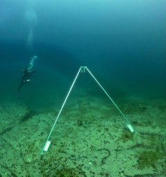 Karen Filbee-Dexter合作论文数Sch Biol Sci, Univ Western Australia3
 Jorge Assis合作论文数CIMAR-Laboratório Associado, University of Algarve3
 Karine Gagnon合作论文数Department of Biology, University of Turku3
 Carlos M. Duarte合作论文数Biological and Environmental Science and Engineering Division, King Abdullah University of Science and Technology3
 Eva Roth合作论文数3Morten Schaanning合作论文数Norwegian Institute for Water Research Gaustadal3
 Isabel Sousa Pinto合作论文数Ciimar - Interdisciplinary Centre for Marine and Environental Research Research Group Lead of the Coastal Biodiversity Lab;Department of Biology, Faculty of Sciences, University of Porto;GEO BON - Group on Earth Observation - Biodiversity Observation Network3
 Jon Albretsen合作论文数Norwegian Meteorological Institute3
 Preben Clausen合作论文数Department of Wildlife Ecology and Biodiversity, National Environmental Research Institute3
 Lars Gamfeldt合作论文数Department of Marine Ecology, University of Gothenburg3
 Jacob Tornfeldt Sørensen合作论文数DHI Water & Environment3
 Morten Foldager Pedersen合作论文数Department of Life and Sciences & Chemistry, Roskilde University3




