Quantitative reflection tomography of common-offset (CO) and common-midpoint (CMP) ground penetrating radar (GPR) data offers a robust way to explore soil water dynamics with impressive sand temporal detail. Synthetic modelling illustrated the sensitivity of reflection tomography to changes in water contents and subsurface lithology. The laboratory experiment reinforced the strength of the reflection tomography under realistic conditions of infiltration and redistribution. The combination of tomographic techniques succeeded in imaging not only the propagation of wetting fronts but also the subsequent lateral and vertical variation in soil moisture and providing estimates of volumetric water content by integrating residual reflection redundancy (RRR) minimisation into the inversion procedure; the process delivers superior velocity models and depth-migrated images. Collectively, this work establishes reflection tomography as a viable, and indeed, highly non-invasive method for characterising transient hydrological processes, with strong possibilities for soils, hydro geophysics, and environmental monitoring.
Absence of traces tends to reduce the quality and reliability of ground penetrating radar (GPR) data due to equipment, sensor coverage and acquisition limitations. This is a significant limitation to full waveform inversion and reverse time migration (RTM) advanced imaging techniques, which rely on dense and continuous data. To address this challenge, we propose an effective interpolation method using the Projection onto Convex Sets (POCS) algorithm, originally developed for seismic data reconstruction. The algorithm is formulated in a compressed sensing framework, taking advantage of Fourier sparsity and iterative thresholding in the time domain to iteratively update spectral coefficients during reconstruction. We compare its performance on synthetic and real GPR data with various percentages of missing data. Results indicate that the POCS algorithm, in addition to reconstructing missing traces at high precision, significantly improves subsequent RTM imaging structural resolution. We also compare POCS with conventional Kriging and a deep learning-based interpolation model (DL-Net) to benchmark its performance. The proposed method achieves superior reconstruction quality and stability, particularly under high sparsity conditions. This study highlights the practical potential of POCS in enhancing GPR image fidelity and interpretation under real-world acquisition limitations.
Detecting pavement subsidence and underground cavities is critical for infrastructure safety, and Ground Penetrating Radar (GPR) is a preferred method due to its high precision, efficiency, and real-time imaging capabilities. However, traditional full waveform inversion (FWI) methods often suffer from reduced accuracy and reliability when the transmitting source wavelet is inaccurately estimated. To address this issue, we propose a convolution-type objective function FWI algorithm. Using synthetic data models, we compare the inversion results of our proposed method with those of traditional FWI for road subsidence and underground cavity detection. The results demonstrate that the convolution-based objective function FWI achieves robust inversion performance even with an imprecise source wavelet estimation, confirming its effectiveness. Furthermore, we apply the algorithm to two different sets of real GPR field data, analyzing the inverted relative permittivity distributions of subsurface media. The findings validate the practicality of our convolutional objective function FWI for real-world data, providing a theoretical foundation for detecting subsurface anomalies beneath roadbeds.
Ground-penetrating radar (GPR) attributes are essential in analyzing geologic features, such as subsurface feature arrangement, lithology, and porosity. However, because GPR can capture several geologic factors at once, it is still difficult to distinguish individual factors, especially the subtle ones. In this paper, a neural network framework is developed for disentangling and defining geologic factors from GPR data. It decomposes the geologic information into a focused factor and residual components using a new feature-swapping strategy to improve interpretability. For these subtle geographic factors, it leverages a triplet loss function to increase the feature differentiation. In addition, a cotraining method is conducted by integrating synthetic and real-world field data to reduce the impact brought about by discrepancies during the data transition from simulations to field applications. Our approach is demonstrated by experimental studies that show its potential to enhance geologic interpretation using GPR data.
Ground-penetrating radar (GPR) attributes are essential in analyzing geologic features, such as subsurface feature arrangement, lithology, and porosity. However, because GPR can capture several geologic factors at once, it is still difficult to distinguish individual factors, especially the subtle ones. In this paper, a neural network framework is developed for disentangling and defining geologic factors from GPR data. It decomposes the geologic information into a focused factor and residual components using a new feature-swapping strategy to improve interpretability. For these subtle geographic factors, it leverages a triplet loss function to increase the feature differentiation. In addition, a cotraining method is conducted by integrating synthetic and real-world field data to reduce the impact brought about by discrepancies during the data transition from simulations to field applications. Our approach is demonstrated by experimental studies that show its potential to enhance geologic interpretation using GPR data.
Detecting pavement subsidence and underground cavities is critical for infrastructure safety, and ground-penetrating radar (GPR) is a preferred method due to its high precision, efficiency, and real-time imaging capabilities. However, traditional full-waveform inversion (FWI) methods often suffer from reduced accuracy and reliability when the transmitting source wavelet is inaccurately estimated. To address this issue, we develop a convolution-type objective function FWI algorithm. Using synthetic data models, we compare the inversion results of our method with those of traditional FWI for road subsidence and underground cavity detection. The results demonstrate that the convolution-based objective function FWI achieves robust inversion performance even with an imprecise source wavelet estimation, confirming its effectiveness. Furthermore, we apply the algorithm to two different sets of real GPR field data, analyzing the inverted relative permittivity distributions of subsurface media. The findings validate the practicality of our convolutional objective function FWI for real-world data, providing a theoretical foundation for detecting subsurface anomalies beneath roadbeds.
Fujian Province in China is primarily characterized by low- to medium-temperature geothermal resources, but the deep thermal control processes and conditions remain insufficiently understood. In the area near Guanqiao Town, Quanzhou City, Fuijan Province, gravity and broadband electromagnetic methods were employed to investigate the subsurface structure. Five major faults and ten secondary faults were surveyed and the distribution of depression areas was delineated. The convective geothermal system in Guanqiao, follows a “ternary” heat accumulation model comprising heat reservoir rock bodies, heat-conducting faults, and heat-preserving cap layers. Based on this model, the intersection zones of primary faults F31 and F8 were identified as first-order geothermal target areas, while the intersections of GQ-F2 with GQ-F3 and GQ-F4, GQ-F7 with F29, F1 with F30, and GQ-F10 with GQ-F11 were classified as second-order geothermal target areas. In the first-order target area, borehole DR02 revealed that within the depth range of 0–300 m, the water temperature first increased rapidly and then slowed down, stabilizing at 48°C below 300 m depth. Geothermal verification boreholes confirmed the validity of the heat accumulation model and the delineated target areas, providing important support for the development and utilization of geothermal resources in Guanqiao, Quanzhou.
Due to the complex reservoir conditions and rapid changes in lithological facies in seismic exploration, predicting coalbed methane (CBM) reservoirs is quite challenging. Conventional inversion methods are not highly effective at predicting reservoir thickness, and cannot keep up with current demands. Our aim is to demonstrate how seismic data can be used to forecast coal thickness, as well as the distribution and orientation of subtle structures that may be linked to enhanced permeability zones. In this study, we used a nonlinear stochastic inversion method based on making full use of seismic data and constraining it with known information, such as drilling and logging analysis. This method has been successfully applied in a mining area in Wuxiang County in the southeastern part of Shanxi Province. Compared with the actual geological data, it is found that the prediction accuracy is consistent with the drilling results, and the distribution of the predicted CBM reservoir thickness is consistent with the geological information. Furthermore, due to the randomness of the subsurface medium, the accuracy of reservoir prediction can be increased by observing the target layer seismic reflection wave amplitude, frequency, and other properties.
Prior to the establishment of a coal mine, a high-resolution three-dimensional (3D) seismic survey was carried out. For seismic exploration of steep coal seams with an inclination angle more than 45 degrees, the selection of the data gathering system is essential. The time disparity that remains when the traditional acquisition technology acquires 3D seismic data will be rather significant. The relationship between coal seam inclination, remaining time difference, and reflection coefficient is investigated in light of the presence of steeply inclined coal seams. When the direction of the generation surveying line is parallel to the coal seam, it is suggested as a vertical data acquisition system. To create a vertical data gathering system, the point is situated on the down-dipping side of the coal seam and a predetermined distance is kept between shooting points and detection points. A vertical data collection system was used to implement 3D seismic data acquisition in the Muli Coalfield in northern Qinghai. As a solid foundation for the future processing and analysis of 3D seismic data, valuable observation data with high resolution were successfully obtained. The study came to the conclusion that a vertical data collecting system is helpful in promoting effective coal mine output.
In some unconventional gas enrichment regions, the topography undergoes extreme undulation, and the surface lithology is considerably altered. This, in turn, has a great impact on seismic exploration. The main difficulty in the acquisition stage has been the selection of effective resonant frequencies and receiving parameters. This study applies a method blending micro logging and refraction to achieve a fine examination of shallow surface structures, as well as to determine a sufficient excitement layer according to the micro logging data, and thus ensure that the grain on the base or consolidated clay layer is generated. The results of this study show that the excitement and reception parameters selected can suppress interference waves, such as surface waves and multiple reflections, and in turn resolve the problem of the low signal-to-noise ratio (SNR) in the mountainous areas of the region, particularly low-noise areas.
Seismic data reconstruction plays a crucial role in seismic exploration and imaging, facilitating accurate subsurface characterization and geological interpretation. In this study, we propose a novel approach for reconstructing seismic data using the accelerated linearized Bregman method (ALBM) in conjunction with the iterative soft thresholding algorithm (ISTA). This combined method, referred to as ALBM+ISTA, aims to exploit the complementary strengths of ALBM's accelerated convergence properties and ISTA's sparsity-promoting capabilities. The proposed approach is evaluated through theoretical simulations and case studies, wherein specific quantitative metrics such as signal-to-noise ratio (SNR), structural similarity index, root mean square error, peak signal-to-noise ratio, and edge preservation index are employed to assess reconstruction quality and accuracy. Results demonstrate that ALBM+ISTA offers improved performance in terms of noise suppression, structural fidelity, and edge preservation compared to existing reconstruction techniques. Furthermore, the method exhibits adaptability to diverse seismic acquisition geometries and noise levels, making it a promising tool for enhancing seismic data processing in various geological science applications.
One of the major difficulties in processing and interpreting seismic data is the contamination of seismic signals by noise from numerous sources. Conventional denoising methods are mostly used for processing 2D seismic data, but noise also exists in the 3D data space, resulting in poor results using conventional denoising methods. Consequently, here, for seismic data denoising, a multiscale and multidirectional 3D curvelet transform was adopted. Our study combined the core principle of the 3D curvelet approach with the threshold iteration method to denoise simulated and actual seismic data with varying signal-to-noise ratios, and the results were quantitatively compared with the processing outcomes of existing denoising methods. The effectiveness of our method is illustrated using both genuine 2D and 3D post-stack seismic data, and synthetic 2D sections with added white and colored noise. Finally, we demonstrate how to prepare the data for frequency-domain full-waveform inversion using curvelet denoising. Despite the complexity of the procedure used to create the training samples, testing results using synthetic and real seismic data demonstrate that this method has mastered the capacity to suppress Gaussian and super-Gaussian noise from various training samples.
When a coal seam is weathered and oxidized, the quality of the coal deteriorates. These processes can introduce new risks to the safety of coal mines. It is important to determine the extent of the weathered and oxidized zones in affected coal seams. This article depicted the physical and geophysical characteristics of the weathered and oxidized zones, including material, structure, engineering geological, and electromagnetic characteristics. The characteristics of the transient electromagnetic method (TEM) were briefly described, and then the TEM detection method with data processing steps was introduced. It found that the electromagnetic characteristics (secondary field potential and resistivity) of weathered and oxidized coal seams were significantly affected, resulting in a high secondary field potential and low resistivity. The data from Shixin Minefield in Shanxi, China was used for experimental verification, and it demonstrated that the use of TEM could provide accurate detections of the weathered and oxidized zones of coal seams successfully. At last, the possible reasons for detecting weathered and oxidized zones using TEM were discussed from the aspects of physics and chemistry.
In this research, our focus lies in exploring the effectiveness of a frequency-velocity convolutional neural network (CNN) in the efficient and non-intrusive acquisition of 2D wave velocity visuals of near-surface geological substances, accomplished through the analysis of data from ground-penetrating radar (GPR). To learn complex correlations between antenna readings and subsurface velocities, the proposed CNN model makes use of the spatial features present in the GPR data. By employing a network architecture capable of accurately detecting both local and global patterns within the data, it becomes feasible to efficiently extract valuable velocity information from GPR readings. The CNN model is trained and validated using a substantial dataset consisting of GPR readings along with corresponding ground truth velocity images. Diverse subsurface settings, encompassing different soil types and geological characteristics, are employed to gather the GPR measurements. In the supervised learning approach employed to train the CNN model, the GPR measurements serve as input, while the associated ground truth velocity images are utilized as target outputs. The model is trained using backpropagation and optimized using a suitable loss function to reduce the difference between the predicted velocity images and the actual images. The experimental results demonstrate the effectiveness of the proposed CNN method in accurately deriving 2D velocity images of near-surface materials from GPR antenna observations. Compared to traditional techniques, the CNN model exhibits superior velocity calculation precision and achieves high levels of accuracy. Moreover, when applied to unseen GPR data, the trained model exhibits promising generalization abilities, highlighting its potential for practical subsurface imaging applications.
Spectral transform, known as a curvelet, enables sparse representations of complex data. Denoising wave propagation in disordered media and pattern recognition are just a few of the numerous domains in which denoising has a potential application. Based on directional basis functions, this spectral method represents objects with discontinuities along a smooth curve. In this study, we used this technique to eliminate ground roll, an unwanted feature signal that can be seen in seismic data obtained by sonating the earth's geological formations. Additionally, we improved the curvelet transform threshold denoising method combined with a fast non-local mean to remove seismic random noise. First, cyclic translation and block complex domain threshold methods were introduced into the curvelet transform threshold denoising, and the traditional curvelet threshold denoising method was improved to obtain the best denoising results; Subsequently, the removed noise was filtered using a fast non-local mean method to obtain a valid signal. Finally, the data obtained in the above two steps were added to obtain the final denoising result. The results of the model tests and actual seismic data denoising showed that the denoising results obtained using this method had a higher signal-to-noise ratio and fidelity than that using the other methods.
The first step in processing the determination of near-surface velocity structures is critical. In addition to improper static adjustments, a poor near-surface velocity model causes the rays predicted by the model to deviate from their actual ray paths. Due to the cumulative nature of this ray path deviation, even a small error in the near-surface velocity model can result in momentous errors in calculating the ray path and travel time. Furthermore, the deviation can notably degrade the seismic image at depth, particularly in regions with significant lateral velocity variations. A seismic model with significant lateral velocity variations and bare bedrock was built to perform theoretical calculations. The concept of first arrival tomographic static correction was also examined. Numerical simulation techniques were used to study the conditions and application consequences of the first arrival tomographic static correction, providing a reference for the static correction of challenging surface coal bed methane (CBM) seismic data. The findings demonstrate that tomographic static correction is better suited for processing complicated surface CBM seismic data and can effectively handle the problems of surface undulation and lateral velocity fluctuation, which are critical for improving the accuracy of CBM exploration.
Revealing the Moho structure in Tibet Area has important geodynamic significance for understanding the origin of the subduction of the Middle Tethys oceanic crust and the South Qiangtang Depression. Based on deep reflection seismic data across the Bangong Lake-Nujiang River Suture Zone (BNS), the depth seismic reflection migration profile, layer velocity field and high-resolution Moho structure are obtained, by using medium-to-long wavelength static correction, noise suppression, optimized stack and pre-stack depth migration (PSDM). According to the depth domain profile, Moho in the BNS is located 65–80 km below the surface and presents a trend of discontinuous northward uplift, indicating that there are lithospheric upper mantle fault steps between the Lhasa block and the South Qiangtang Block, with a maximum step of 15 km. After analyzing the Moho morphology on both sides of the suture zone, it is believed that these fault steps are jointly driven by terranes from the north and south sides, the upper mantle of the lithosphere of the Lhasa terrane is on the south side, and the upper crust of the Qiangtang Block is on the north side. The Moho structure under the BNS indicates that with the closing of the Tethys Ocean (in the Late Jurassic-Early Cretaceous period), the South Qiangtang terrane was transformed from marginal Marine sediments into a foreland basin and formed the South Qiangtang Depression.
The ability of ground-penetrating radar (GPR) to produce three-dimensional data about features preserved underground, such as buildings, burials, and building rubble, makes it a valuable and trustworthy research tool that is widely used in archaeology. This paper uses handheld ground-penetrating radar to establish an anomaly recognition algorithm for subsurface feature extraction. The distance measure is used, and the background statistics are updated adaptively. This theoretical investigation provided insight into how anomalies can be easily detected. Additionally, data from the test site is collected using the Ekko pulse GPR system. For 3D visualization, the acquired data is processed using the same algorithm. As proposed in the theoretical section, evident anomalies have been discovered. The 3D model was used to locate a companion burial Arcelogical plot as well as potential leachate plumes beneath and surrounding test site. Both were undetectable in the 2D model, demonstrating the utility of 3D modeling in the detection of subsurface structures. Our findings are expected to be useful in all other GPR studies, particularly in geoforensic and archaeological applications.
Adequate knowledge of velocity is required for accurate data imaging and depth conversion, as well as for quantifying the distribution of soil water content. Without complementary borehole information in the form of dielectric permittivity and/or porosity logs along the profile, it is currently impossible to reliably estimate the high-frequency electromagnetic velocity distribution in the probed subsurface region. Here, we present a new method for calculating the precise subsurface velocity structure from ground penetrating radar (GPR) reflection data that does not require boreholes or log data. This study investigates the ability of the pulse_EKKO PRO GPR system to predict a vertical profile for the possible velocity estimation of a layered and contaminated geophysical test site in Hangzhou, China. All data were acquired and saved on the GPR system in various files (projects) before analysis using GPR software to obtain approximated velocity modelling using common midpoint (CMP) gathers. Using the velocity spectrum analysis, a vertical profile of the interval velocities can be derived from each CMP gather. The findings of this study indicate that the proposed method is effective and sustainable. Furthermore, owing to the efficacy of the method in terms of field effort and computational complexity, it can easily be expanded to 3D GPR velocity exploration, increasing its importance in comparison to standard offset-based techniques for estimating velocity using GPR.
One of the significant challenges in processing and analyzing seismic data is the contamination of the seismic signal with noise from various sources. Coherent or incoherent noise, multiples, and other types of noise can all be eliminated using a number of techniques, but it is still complicated to attenuate random noise to the desired level. The non-homogeneous curvelet transform is first applied in this study, and the regularized calculation is then carried out using the inverted operator. Following the application of the linear calculation method, the threshold value is modified to remove the coefficient noise during the iteration process, allowing the homogeneous coefficients and noise-free seismic data to be obtained. We choose some real data as an example and apply the suggested curvelet theory to obtain homogeneous data in order to verify the denoising effect. Tests on real data show that, when the suggested approach interpolates sampled data to be homogeneous, random noise can be effectively reduced. The important benefit of this approach is that features like multi-resolution, and locality introduce minimal overlapping between coefficients representing signal and noise in curvelet domain.
 Tianyu Zhang合作论文数11Xiong Bin合作论文数7Sanxi Peng合作论文数7Mingkun Jia合作论文数6
 Gang Tian (田钢)合作论文数School of Earth Sciences, Zhejiang University5Xiaokang Yin合作论文数4Siwei Zhao合作论文数4Fangbo Chen合作论文数3Jiabao Wang合作论文数3
 Umar Ashraf合作论文数Inst Ecol Res & Pollut Control Plateau Lakes, Yunnan Univ3
 Aqsa Anees合作论文数Sch Ecol & Environm Sci, Yunnan Univ3
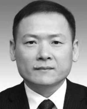 Bin Xiong合作论文数College of Earth Sciences, Guilin University of Technology, Guilin, Guangxi, China3Jie Zhu合作论文数2Zahid Masood合作论文数2Lu Liu合作论文数2Dayong Zhen合作论文数2Yang Yang合作论文数2Siqin Liu合作论文数2
 Amr Abd El-Raouf合作论文数School of Earth Sciences, Zhejiang University2
 Amjad Ali合作论文数Zhejiang University2
 Xiaonan Zhang合作论文数Inst Ecol Res & Pollut Control Plateau Lakes, Yunnan Univ2
 Hung Vo Thanh合作论文数Sch Earth & Environm Sci, Seoul Natl Univ2
 Wang Honghua (王洪华)合作论文数2Wanzhong Shi (石万忠)合作论文数School of Earth Resources, China University of Geosciences2
 Hucai Zhang (张虎才)合作论文数Institute for Ecological Research and Pollution Control of Plateau Lakes, Yunnan University2
 Zhejiang Wang (王者江)合作论文数College of Geoexploration Science and Technology, Jilin University2Ping Li (李平)合作论文数2
 Jar Ullah合作论文数1
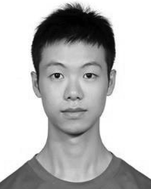 Yuguo Lu合作论文数1Ren Jiang合作论文数1SUN Han-Wu (孙汉武)合作论文数1
 Osman M. Badran合作论文数Fac Sci, Damanhour Univ1Qinghua Peng合作论文数1
 Nafees Ali合作论文数University of Chinese Academy of Sciences1Xingfu Huang合作论文数1
 Huimei Shan合作论文数1
 Muhammad Ali合作论文数Inst Geophys & Geomat, China Univ Geosci1
 Amin Khan合作论文数COMSATS Institute of Information Technology - MA Jinnah Campus1
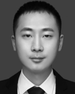 Yu Liu合作论文数1
 Ghazanfer Raza Abbasi合作论文数Sch Engn, Edith Cowan Univ1
 Julia Meister合作论文数Inst Geog & Geol, Univ Wurzburg1JianLiang Wen (温建亮)合作论文数1
 Wenke Zhao (赵文轲)合作论文数School of Earth Sciences, Zhejiang University1
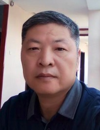 Zhusheng Zhou (周竹生)合作论文数School of Geosciences and Info-Physics, Central South University1
 Shikun Dai (戴世坤)合作论文数School of Geosciences and Info-physics, Central South University1Jie Liu合作论文数1
 Yong Li (李勇)合作论文数1
 Shucheng Tan (谈树成)合作论文数Department of Geology, School of Earth Sciences, Yunnan University1




