Autonomous systems across diverse domains have underscored the need for drift-resilient state estimation. Although satellite-based positioning and cameras are widely used, they often suffer from limited availability in many environments. As a result, positioning must rely solely on inertial sensors, leading to rapid accuracy degradation over time due to sensor biases and noise. To counteract this, alternative update sources-referred to as information aiding-serve as anchors of certainty. Among these, the zero-velocity update (ZUPT) is particularly effective in providing accurate corrections during stationary intervals, though it is restricted to surface-bound platforms. This work introduces a controlled ZUPT (C-ZUPT) approach for aerial navigation and control, independent of surface contact. By defining an uncertainty threshold, C-ZUPT identifies quasi-static equilibria to deliver precise velocity updates to the estimation filter. Extensive validation confirms that these opportunistic, high-quality updates significantly reduce inertial drift and control effort. As a result, C-ZUPT mitigates filter divergence and enhances navigation stability, enabling more energy-efficient hovering and substantially extending sustained flight-key advantages for resource-constrained aerial systems.
Autonomous underwater vehicles (AUVs) have become indispensable for deep-sea exploration, spanning critical scientific research and commercial applications. The rapid attenuation of electromagnetic waves renders satellite radio signals unavailable, while the dynamic unpredictability of the marine environment presents formidable navigation challenges. This chapter explores recent advancements in AI-aided AUV positioning, specifically focusing on advanced sensor fusion architectures that integrate inertial navigation systems with Doppler velocity logs and cameras. Beyond traditional model-based filtering, we examine the transformative emergence of AI-driven learning approaches in enhancing inertial dead-reckoning tasks and adaptive fusion algorithms. By addressing these recent milestones, this chapter provides a comprehensive roadmap for achieving the high-precision navigation essential for autonomous underwater missions.
Accurate and robust localization remains a fundamental challenge for autonomous ground vehicles. In this work, we propose a hybrid neural inertial navigation framework that integrates a wheel-mounted inertial sensors, enforced periodic trajectories, and a simple, efficient neural network capable of regressing vehicle displacement with GNSS position updates in an error-state extended Kalman filter. The periodic trajectories increase the inertial signal-to-noise ratio, allowing the network to use only inertial readings to estimate displacement. The approach is validated through real-world experiments using multiple wheel-mounted inertial sensors. Experimental results demonstrate that the proposed method achieves a significant improvement in positioning accuracy, reducing the position root mean squared error by approximately 46
Inertial navigation systems (INS) are widely used in both manned and autonomous platforms. One of the most critical tasks prior to their operation is to accurately determine their initial alignment while stationary, as it forms the cornerstone for the entire INS operational trajectory. While low-performance accelerometers can easily determine roll and pitch angles (leveling), establishing the heading angle (gyrocompassing) with low-performance gyros proves to be a challenging task without additional sensors. This arises from the limited signal strength of Earth's rotation rate, often overridden by gyro noise itself. To circumvent this deficiency, in this study we present a practical deep learning framework to effectively compensate for the inherent errors in low-performance gyroscopes. The resulting capability enables gyrocompassing, thereby eliminating the need for subsequent prolonged filtering phase (fine alignment). Through the development of theory and experimental validation, we demonstrate that the improved initial conditions establish a new lower error bound, bringing affordable gyros one step closer to being utilized in high-end tactical tasks.
Autonomous Underwater Vehicles (AUVs) rely heavily on the fusion of inertial sensors and Doppler velocity logs (DVLs) for navigation. In standard autonomous navigation systems, the DVL measures four beam velocities, thereby enabling the estimation of the AUV velocity vector. However, during real-world missions, the DVL may receive noisy or incomplete beam measurements due to marine obstacles, seabed reflections, or environmental disturbances. Furthermore, some low-cost underwater platforms operate without inertial sensors to reduce system complexity and cost. In such cases, reliable estimation of the AUV velocity vector in real-world missing beam scenarios becomes challenging, leading to degraded navigation solutions. To circumvent these challenges and enable resilient underwater navigation, we propose DVL-DeepONet, a physics-guided deep neural operator framework along with three variants. The proposed models are designed to estimate DVL-based velocity information under multiple operational scenarios, including (i) noise-resilient estimation in coupled inertial/DVL measurements, (ii) DVL-only learning, and (iii) beam measurement recovery. By learning a nonlinear operator that maps temporal inertial/DVL observations directly to vehicle velocity while enforcing DVL measurement physics through a consistency constraint, the proposed approach enables robust velocity estimation even under degraded sensing conditions. The proposed framework is validated using real-world AUV experiments, comprising a cumulative path length of approximately 10,000 m. Experimental results demonstrate that the proposed DVL-DeepONet architectures outperform baseline model-based approaches and learning-based algorithms by 40
Canine gait analysis using wearable inertial sensors is gaining attention in veterinary clinical settings, as it provides valuable insights into a range of mobility impairments. Neurological and orthopedic conditions cannot always be easily distinguished even by experienced clinicians. The current study explored and developed a deep learning approach using inertial sensor readings to assess whether neurological and orthopedic gait could facilitate gait analysis. Our investigation focused on optimizing both performance and generalizability in distinguishing between these gait abnormalities. Variations in sensor configurations, assessment protocols, and enhancements to deep learning model architectures were further suggested. Using a dataset of 29 dogs, our proposed approach achieved 0.96 accuracy in the multiclass classification task (healthy/orthopedic/neurological) and 0.85 accuracy in the binary classification task (healthy/non-healthy) when generalizing to unseen dogs. Our results demonstrate the potential of inertial-based deep learning models to serve as a practical and objective diagnostic and clinical aid to differentiate gait assessment in orthopedic and neurological conditions.
Inertial sensors are integral components in numerous applications, powering crucial features in robotics and our daily lives. In recent years, deep learning has significantly advanced inertial sensing performance and robustness. Deep-learning techniques are used in different domains and platforms to enhance network performance, but no common benchmark is available. The latter is critical for fair comparison and evaluation in a standardized framework as well as development in the field. To fill this gap, we define and thoroughly analyze 13 data-driven techniques for improving neural inertial regression networks. A focus is placed on three aspects of neural networks: network architecture, data augmentation, and data preprocessing. Extensive experiments were made across six diverse datasets that were collected from various platforms including quadrotors, doors, pedestrians, and mobile robots. In total, over 1079 minutes of inertial data sampled between 120-200Hz were analyzed. Our results demonstrate that data augmentation through rotation and noise addition consistently yields the most significant improvements. Moreover, this study outlines benchmarking strategies for enhancing neural inertial regression networks.
A fundamental requirement for full autonomy for mobile robots is accurate navigation even in situations where satellite navigation or cameras are unavailable. In such practical scenarios, relying only on inertial sensors will result in navigation solution drift due to inherent noise and error terms. One of the emerging solutions to mitigate drift is to maneuver the robot in a snake-like slithering motion to increase the inertial signal-to-noise ratio, allowing the regression of the mobile robot position. In this work, MoRPI-PINN, a physics-informed neural network framework, has been proposed for inertial-based mobile robot navigation. These investigations are crucial for gaining deeper insights into the mobile robot’s pure inertial navigation solution. By embedding physical laws and constraints into the training process, MoRPI-PINN provides an accurate and improved navigation solution. Using real-world experiments, we show accuracy improvements of over 80% compared to other baseline approaches for unseen trajectories. Moreover, MoRPI-PINN is a lightweight approach that can be implemented even on edge devices and used in any typical mobile robot application.
The Doppler velocity log (DVL) velocity measurements are critical to the accuracy of autonomous underwater vehicle (AUV) navigation solutions and, consequently, to mission success. To ensure accurate measurements, the DVL is commonly calibrated before mission start while the AUV sails on the water surface, receiving global navigation satellite system (GNSS) signals that provide accurate reference measurements. Conventionally, Kalman filter-based approaches are employed during calibration to estimate the scale factor and misalignment errors. However, in certain environments, GNSS signals may be unavailable, rendering conventional calibration impossible and forcing the use of uncalibrated DVL measurements, which degrades navigation performance. To address this limitation, this work proposes information-aided calibration (IAC) with two main contributions: first, improving the accuracy of conventional Kalman filter-based calibration in GNSS-enabled environments, and second, enabling GNSS-free DVL self-calibration. Using real-world AUV datasets, the proposed IAC models achieve up to a 20
Modern canine applications span medical and service roles, while robotic legged dogs serve as autonomous platforms for high-risk industrial inspection, disaster response, and search and rescue operations. For both, accurate positioning remains a significant challenge due to the cumulative drift inherent in inertial sensing. To bridge this gap, we propose three algorithms for accurate positioning using only inertial sensors, collectively referred to as dog dead reckoning (DDR). To evaluate our approaches, we designed DogMotion, a wearable unit for canine data recording. Using DogMotion, we recorded a dataset of 13 minutes. Additionally, we utilized a robotic legged dog dataset with a duration of 116 minutes. Across the two distinct datasets we demonstrate that our neural-aided methods consistently outperform model-based approaches, achieving an absolute distance error of less than 10%. Consequently, we provide a lightweight and low-cost positioning solution for both biological and legged robotic dogs. To support reproducibility, our codebase and associated datasets have been made publicly available.
Accurate and reliable navigation is essential for autonomous ground vehicle operations. Standard INS/GNSS fusion relies on GNSS position updates, which provide limited observability of orientation and inertial sensor error states, particularly during low-dynamic motion. In this work, we propose utilizing past GNSS measurements alongside a motion model to extract meaningful vehicle acceleration information. This acceleration measurement is then integrated into the INS/GNSS filter to improve its robustness and accuracy. The proposed approach is evaluated on two real-world unmanned ground vehicle datasets collected from different mobile platforms and inertial sensor grades. Results demonstrate consistent positioning accuracy improvements relative to the standard position-aided filter, with mean position root mean square error improvements of 11.40
Magnetic field mapping is an essential tool in geoscience, for identifying anomalies and understanding subsurface structures, requiring systematic and methodical data acquisition. The use of smartphones' built-in magnetometers for this task offers advantages such as cost-effectiveness, accessibility, and simplicity. Recent works relied on model-based interpolation techniques significantly limited by sparse data collection, sensor noise, orientation-dependent distortions, and overall low data quality. As a result, magnetic maps were often noisy and unreliable for practical applications. In this work, we aim to fill this gap by introducing a deep learning (DL) approach to overcome these challenges and produce accurate, high-resolution magnetic field maps from smartphone data. To address the limitations of extensive real-world data collection, we developed an innovative two-stage simulation framework to generate the required training datasets. First, the theoretical magnetic field produced by ferromagnetic objects in a 30 m x 30 m area was computed to serve as ground truth data for the network. Second, a simulation model was implemented to replicate the data acquisition process of smartphone magnetometers. This model included real-world survey protocols, noise factors, sensor behavior, and simulated trajectories based on real world recorded data. Compared to the model-based baseline, our method improves anomaly localization, reduces noise, and enhances accuracy. At the 80th percentile the MSE and LPIPS metrics showed 75% and 55% improvements respectively, further validated by visual analysis of the reconstructed maps.
Autonomous underwater vehicles rely on precise integration of inertial navigation systems and Doppler velocity logs for successful missions where satellite navigation is unavailable. The effectiveness of this integration critically depends on accurate alignment between sensor reference frames. Standard model-based alignment methods suffer from lengthy convergence times, dependence on prescribed motion patterns, and over-reliance on external positioning infrastructure such as satellite signals or acoustic positioning systems, significantly limiting operational flexibility. To address these limitations, this paper presents ResAlignNet, a data-driven approach using 1D ResNet-18 architecture that transforms the alignment problem into deep neural network optimization. Operating as an in-situ solution, ResAlignNet requires only onboard sensors without external positioning aids or complex vehicle maneuvers while achieving rapid convergence in seconds. The approach demonstrates Sim2Real transfer learning capabilities, enabling training on synthetic data while deploying on operational sensor measurements. Experimental validation using the Snapir autonomous underwater vehicle demonstrates that ResAlignNet achieves alignment accuracy within 0.8 degrees using only 25 seconds of data collection, representing a 65% reduction in convergence time compared to standard velocity-based methods. The trajectory-independent solution eliminates motion pattern requirements and enables immediate vehicle deployment without lengthy pre-mission procedures, advancing underwater navigation through robust sensor-agnostic alignment that scales across different operational scenarios and sensor specifications.
Inertial navigation systems are specialized navigation apparatuses that equip almost all autonomous underwater and surface vehicles. They require precise initial alignment, i.e., determination of their initial attitude, which is typically achieved: (a) in quasi-static conditions (whenever possible); and (b) in two stages: Coarse Alignment (CA), using methods like TRI-axis Attitude Determination (TRIAD), and Fine Alignment (FA), via Zero Velocity Update (ZVU)-based Extended Kalman Filtering (EKF). However, conventional methods suffer from slow convergence and limited bias estimability. In response, this paper introduces: (a) an optimized version of a recently proposed CA method, namely, TRIAD with Coarse Bias Estimation (TRIAD-CBE); and (b) a novel FA EKF observation model that incorporates Non-Orthonormality (NON) error constraints derived from TRIAD, directly linking these errors to the inertial sensor biases. As validated through extensive Monte Carlo (MC) simulations, as well as real-world experiments using two Inertial Measurement Units (IMUs) of different grades, our approaches substantially accelerate the convergence of misalignment and bias estimates (from minutes to seconds), while maintaining accuracy/precision comparable to traditional techniques.
The unscented Kalman filter (UKF) is a commonly used algorithm capable of estimating the states of nonlinear dynamic systems. It carefully chooses a set of sample points, called sigma points that capture the nonlinear system states posterior mean and covariance. The filter is based on the scaled unscented transform, where the scaling parameters impact the spreading of the sigma points, determining the estimated model capturing. In its current form, the UKF employs a single set of scaling parameters shared by all sigma points. Because states in multi-dimensional models often exhibit substantially different behaviors, this imposes a critical limitation: the standard UKF parameters cannot be tuned to extend the spread for one dimension while reducing it for another. To bridge this gap, we propose the multi-scaled UKF to enable spreading differently per state, while maintaining the key properties of the sigma points and UKF. A rigorous mathematical foundation is provided, introducing a novel theoretical approach to multi-scaling. The benefits of this approach are demonstrated through two distinct nonlinear dynamic systems. Consequently, our multi-scaled UKF captures the nonlinear behavior of multi-dimensional states more effectively, leading to improved estimation accuracy.
Low-cost gyroscope calibration is essential for ensuring the accuracy and reliability of gyroscope measurements. Stationary calibration estimates the deterministic parts of measurement errors. To this end, a common practice is to average the gyroscope readings during a predefined period and estimate the gyroscope bias. Calibration duration plays a crucial role in performance, therefore, longer periods are preferred. However, some applications require quick startup times and calibration is therefore allowed only for a short time. In this work, we focus on reducing low-cost gyroscope calibration time using deep learning methods. We propose an end-to-end convolutional neural network for the application of gyroscope calibration. We explore the possibilities of using multiple real and virtual gyroscopes to improve the calibration performance of single gyroscopes. To train and validate our approach, we recorded a dataset consisting of 186.6 h of gyroscope readings, using 36 gyroscopes of four different brands. We also created a virtual dataset consisting of simulated gyroscope readings. The six datasets were used to evaluate our proposed approach. One of our key achievements in this work is reducing gyroscope calibration time by up to 89% using three low-cost gyroscopes. Our dataset is publicly available to allow reproducibility of our work and to increase research in the field.
The unscented Kalman filter is an algorithm capable of handling nonlinear scenarios. Uncertainty in process noise covariance may decrease the filter estimation performance or even lead to its divergence. Therefore, it is important to adjust the process noise covariance matrix in real time. In this paper, we developed an adaptive neural unscented Kalman filter to cope with time-varying uncertainties during platform operation. To this end, we devised ProcessNet, a simple yet efficient end-to-end regression network to adaptively estimate the process noise covariance matrix. We focused on the nonlinear inertial sensor and Doppler velocity log fusion problem in the case of autonomous underwater vehicle navigation. Using a real-world recorded dataset from an autonomous underwater vehicle, we demonstrated our filter performance and showed its advantages over other adaptive and non-adaptive nonlinear filters.
Monocular simultaneous localization and mapping (SLAM) algorithms estimate drone poses and build a 3D map using a single camera. Current algorithms include sparse methods that lack detailed geometry, while learning-driven approaches produce dense maps but are computationally intensive. Monocular SLAM also faces scale ambiguities, which affect its accuracy. To address these challenges, we propose an edge-aware lightweight monocular SLAM system combining sparse keypoint-based pose estimation with dense edge reconstruction. Our method employs deep learning-based depth prediction and edge detection, followed by optimization to refine keypoints and edges for geometric consistency, without relying on global loop closure or heavy neural computations. We fuse inertial data with vision by using an extended Kalman filter to resolve scale ambiguity and improve accuracy. The system operates in real time on low-power platforms, as demonstrated on a DJI Tello drone with a monocular camera and inertial sensors. In addition, we demonstrate robust autonomous navigation and obstacle avoidance in indoor corridors and on the TUM RGBD dataset. Our approach offers an effective, practical solution to real-time mapping and navigation in resource-constrained environments.
Maintaining accurate navigation during GNSS outages remains a significant challenge for autonomous systems relying on low-cost inertial sensors. While classical smoothing methods, such as the two-filter smoother and Rauch-Tung-Striebel smoother, exploit measurements collected before and after an outage, their performance remains limited by the accuracy of conventional GNSS measurements. This paper presents Bayesian learning-enhanced navigation with deep smoothing (BLENDS), a transformer-based framework that augments Bayesian smoothing with learned covariance adaptation and state correction. The proposed method preserves the statistical foundations of Bayesian estimation while leveraging data-driven learning to improve navigation accuracy. Evaluations on the quadrotor dataset with GNSS outages demonstrate that BLENDS consistently outperforms both model-based smoothers, achieving up to 25.6
Reliable vehicle navigation in urban environments remains a challenging problem due to frequent satellite signal blockages caused by tall buildings and complex infrastructure. While fusing inertial reading with satellite positioning in an extended Kalman filter provides short-term navigation continuity, low-cost inertial sensors suffer from rapid error accumulation during prolonged outages. Existing information aiding approaches, such as the non-holonomic constraint, impose rigid equality assumptions on vehicle motion that may be violated under dynamic urban driving conditions, limiting their robustness precisely when aiding is most needed. In this paper, we propose a dual-branch information aiding framework that fuses equality and inequality motion constraints through a variance-weighted scheme, requiring only a software modification to an existing navigation filter with no additional sensors or hardware. The proposed method is evaluated on four publicly available urban datasets featuring various inertial sensors, road conditions, and dynamics, covering a total duration of 4.3 hours of recorded data. Under Full GNSS availability, the method reduces vertical position error by 16.7
 Daniel Engelsman合作论文数Hatter Dept Marine Technol, Univ Haifa15
 Nadav Cohen合作论文数Corresponding author.9
 Sagi Filin合作论文数Technion - Israel Institute of Technology9
 Yaakov Bar-Shalom合作论文数Electrical & Computer Engineering Department, School of Engineering, University of Connecticut9
 Ilan Rusnak合作论文数Rafael Advanced Defense Systems/Haifa Institute of Technology8Zeev Yampolsky合作论文数7
 Barak Or合作论文数6Yeshaya Lipman合作论文数6
 Tomer Toledo合作论文数Faculty of Civil and Environmental Engineering, Technion-Israel Institute of Technology6
 Aviad Etzion合作论文数5
 Yakov Miron合作论文数Bosch Center for Artificial Intelligence (BCAI), Haifa, Israel5
 Dotan Di Castro合作论文数Yahoo Research5Yuval Goldfracht合作论文数4
 Guy Revach合作论文数4
 Pini Gurfil合作论文数Department of Aerospace Engineering, Israel Institute of Technology4Alexander Tsukerman合作论文数3Shunit Truzman合作论文数3Yaakov Libero合作论文数3
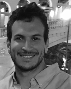 Mor Yona合作论文数3
 Artur Shurin合作论文数3Yuval Solaz合作论文数3
 Holger Volk合作论文数Department of Veterinary and Animal Sciences, Faculty of Health and Medical Sciences, University of Copenhagen3Morel Groper合作论文数3
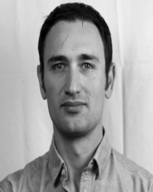 Yevgeni Gutnik合作论文数Hatter Dept Marine Technol, Univ Haifa3
 Eran Vertzberger合作论文数3E. Vaknin合作论文数3
 Adi Manos合作论文数3
 Sebastian Meller合作论文数Department of Small Animal Medicine and Surgery, University of Veterinary Medicine3
 Nir Shlezinger合作论文数Department of Electrical & Computer Engineering, Ben-Gurion University of the Negev;School of Electrical and Computer Engineering, Faculty of Engineering Sciences, Ben-Gurion University of the Negev3
 Reuven Katz合作论文数University Michigan Ann Arbor, University of Michigan3
 Gilad Even-Tzur合作论文数3
 Roee Diamant合作论文数The Hatter Department of Marine Technologies, The Leon H. Charney School of Marine Sciences, University of Haifa;The Underwater Acoustics and Navigation Lab, University of Haifa;FER;Nobel Energy3
 Tamir Hazan合作论文数Sunbit;Technion - Israel Institute of Technology3
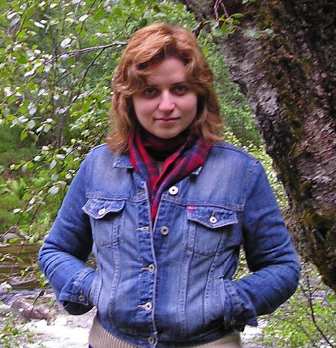 Anna Zamansky合作论文数Jerusalem College of Engineering;Dept. of Software Engineering3
 Ariel Larey合作论文数2Guy Ohayon合作论文数2Aviram Borko合作论文数2
 Eliel Aknin合作论文数Faculty of Industrial Engineering, Technion - Israel Institute of Technology2
 Nati Daniel合作论文数Dept Physiol Biophys & Syst Biol, Technion Israel Inst Technol2
 Uriel Nusbaum合作论文数Autonomous Syst Program, Technion Israel Inst Technol2
 Omri Asraf合作论文数Technion - Israel Institute of Technology,Department of Aerospace Engineering,Haifa,Israel,320002
 Chana Ross合作论文数Bosch Center for Artificial Intelligence (BCAI), Haifa, Israel2
 Simak, V.合作论文数2
 Yiqing Yao (姚逸卿)合作论文数School of Instrument Science and Engineering, Southeast University2
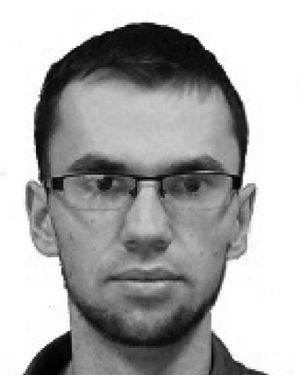 Dusan Nemec合作论文数2Roger Alimi合作论文数2
 David K. Geller合作论文数Mechanical and Aerospace Engineering, Utah State University2
 Nitzan Dahan合作论文数1Shlomi Amitai合作论文数1




