Habitat connectivity transformation is a prominent reflection of the global biodiversity crisis. Although recognised in policy documents, it remains insufficiently integrated into spatial planning. We developed a reusable workflow for evaluating terrestrial habitat connectivity, applicable across various spatial and temporal scales. The pre-processing stage enhances land-use/land-cover datasets with historical OpenStreetMap data. Connectivity indices are calculated using Graphab and MiraMon software for target species with varying ecological parameters, and harmonised and aggregated results are visualised and analysed within user-defined mapping units. The workflow was applied to regional (Catalonia) and local (Albera Natural Park) cases (1987-2022) to explore the effects of spatial resolution on connectivity outcomes. Alongside established historical trends, such as increased connectivity for forest-dwelling small mammals, several significant effects were observed. Edge effect of biodiversity stressors can affect connectivity indices by up to 2.9-fold, while low spatial resolution underestimates the role of ‘stepping stones’. Individual filtering of OpenStreetMap features was essential for less granular datasets (spatial resolution > 30 m). All input data specifications indicated a decline in Testudo hermanni habitat connectivity, with a sharp drop in 2012 due to wildfires. Species occurrence data from both local surveys and global databases proved suitable for validation, although consistent and unbiased records are required. This scalable workflow enables automated habitat connectivity assessments for regional and local spatial planning, biodiversity conservation, and ecosystem services evaluations. It demonstrates the interoperability of four open-source technical components and highlights the need for multiple connectivity indices, as their temporal trends may diverge and are not always intercorrelated.
Integrity of natural ecosystems, including terrestrial ones, and their connectivity is one of the main concerns of current European and Global Green Policies, e.g., the European Green Deal. Thus, public administration managers need reliable and long-term information for a better monitoring of the ecosystems evolution and inform decision making. Data Spaces are intended to become the EC comprehensive solution to integrate data from different sources with the aim to generate and provide a more ready to use knowledge on climate change, circular economy, pollution, biodiversity, and deforestation. The AD4GD project does research on the co-creation of the European Green Deal Data Space as an open space for FAIR data and standards-based services tested in 3 pilot cases providing testbeds in terms of data, standards, sharing and interoperability. One of these pilots, is focused on Ecological Terrestrial Connectivity in Catalonia (NE of Spain). The challenges are: (1) monitoring ecological connectivity in terrestrial ecosystems through the integration of state-of-the-art multi-sensor remote sensing imagery, ecological models, in-situ biodiversity observations and sensors; and (2) forecasting ecological connectivity to help to define effective actions to reduce terrestrial biodiversity loss. To this goal, solutions are being proposed and tested, to integrate data from different sources using modern standards such as, raster-based land cover maps and connectivity maps structured as data cubes (Open Data Cube and Rasdaman), GBIF species occurrences exposed via OGC STAplus, as well as data from low-cost automatic sensors (camera traps with species identification software). All this data is related together by the use of semantic tagging with references pointing to vocabularies of GEO Essential Variables stored in OGC RAINBOW Definition Server. AD4GD is a Horizon Europe project co-funded by the European Union, Switzerland and the United Kingdom.
In-situ Earth observation data play a key role in environmental and climate related domains. However, in-situ data is often missing or hardly accessible for users due to technical barriers, for example, unstructured metadata information, missing provenance, lack of links to standard vocabularies or units of measure definitions. This communication presents a well-defined, formalized methodology for identifying and documenting requirements for in-situ data from a user’s point of view initially tested within the Group on Earth Observations. This is materialized into a comprehensive Geospatial In-situ Requirements Database and a related tool called G-reqs. The G-reqs facilitates the requirements gathering process via a web-form that acts as the user interface. It compasses a variety of Needs: Calibration/Validation of remote sensing products, Calibration/Validation of other in-situ data, input assessment for a numerical modeling, creation of an Essential Variable product, etc. Depending on the type of need, there will be requirements for in-situ data that can be formally expressed in the main components of the geospatial information: spatial, thematic, and temporal (e.g. area of scope, variable needed, thematic uncertainty, positional accuracy, temporal coverage and frequency, representative radius, coordinate measurements, etc). The G-reqs is the first in-situ data requirements repository at the service of the evolution of the GEO Work Programme but it is not limited to them. In fact, the entire Earth observation community of users is invited to provide entries to G-reqs. The requirements collected are technology-agnostic and neither takes into account the specific characteristics of any dedicated instrument nor sensors acquiring the data. The web-form based tool and the list of all validated requirements are FAIRly accessible in the G-reqs web site at https://www.g-reqs.grumets.cat/. After a process of requirements gathering, the presented approach is aiming to discover where similar requirements across different scientific domains are shared, fostering in-situ data reusability, and guiding the priorities for the creation of new datasets by key in-situ data providers. For example, in-situ networks of observation facilities (ENVRI, e.g. ELTER, GEOBON, among others) are invited to direct their users to provide requirements to the G-reqs and participate in the analysis of the requirements, detect gaps in current data collection and formulate recommendations for the creation of new products or refine existing ones. The final aim is to improve the interoperability and accessibility of actionable in-situ Earth observation data and services, and its reuse. This work is inspired by the OSAAP (formerly NOSA) from NOAA, the WMO/OSCAR requirements database and the Copernicus In-Situ Component Information System (CIS2) and developed under the InCASE project, funded by the European Environment Agency (EEA) in contribution to GEO and EuroGEO.
In the era of global challenges and big Earth data computation it’s becoming increasingly important to have proper interoperable solutions for describing, cataloguing, finding, accessing, and distributing highly valuable datasets. The usability and reproducibility of data under FAIR and GEO Data Sharing and Data Management Principles, with accurate description of datasets in terms of semantics and uncertainty, can make data more valuable. EC is pushing Data Spaces as a tool to manage data and generate and provide knowledge ready to use for managers and decision makers. The contribution presents a standard-based Data Space for automatically monitoring Water Quality specifically designed for European Lakes, based on remote sensing derived datasets, in-situ monitoring stations and web services. A web map browser gives access to water quality time series products (turbidity, Chl-a, floods, hydroperiod, etc) based on EO in Cloud Optimized GeoTIFF and in-situ observation stations connected using OGC STAplus standard. The map browser integrates the overall set of capabilities: data and metadata visualization, data analytics, quality indicators linked to the QualityML dictionary; semantic tagging of the Essential Water Variables; and OGC Geospatial User Feedback (GUF). The system is accessible through the OpenID-connect authentication standard which extends the OAuth 2.0 authorization protocol that allows different rights for different users to guarantee the preservation of data. This approach has been developed and tested under the Horizon 2020 WQeMS - Copernicus Assisted Lake Water Quality Emergency Monitoring Service (nº 101004157). Some parts of the solution have been developed under the HORIZON-CL6 AD4GD - An Integrated, FAIR Approach for the Common European Data Space (nº 101061001) co-funded by the European Union, Switzerland and the United Kingdom.
In the era of declining biodiversity, global climate change and transformations in land use, terrestrial habitat connectivity is one of the key parameters of ecosystem management. In this regard, the land-use/land-cover (LULC) dynamics is crucial to detect the spatiotemporal trends in connectivity of focal endangered species and to predict the effects for biodiversity for planned or proposed LULC changes.Apart from the LULC derivatives of remote sensing, connectivity analysis and scenarios modelling can also benefit from citizen science datasets, such as Open Street Map and GBIF species occurrence data cubes in which aggregated data can be perceived as a cube with three dimensions - taxonomic, temporal and geographic. The synthetic LULC datasets which cover Catalonia every 5 years (1987-2022) were enriched via developed Data4Land harmonisation tool harnessing Open Street Map (through Overpass Turbo API) and World Database on Protected Areas. Two outstanding well-known tools, Graphab and MiraMon GIS&RS (using the Terrestrial Connectivity Index Module - ICT), were used to create the overarching dataset on terrestrial habitat connectivity in Catalonia (2012-2022) for target species and broad land cover categories, forests. Significant decline trends in forest habitat connectivity are observed for Barcelona metropolitan area, and vice versa in the Pyrenees mountain corridor and protected areas. According to the local case study on the connectivity of Mediterranean turtle in the Albera Natural Park, general positive trend was affected by massive fires in 2012.To ensure the replicable results, the pipeline to create reliable metadata in accordance with FAIR principles, especially data lineage, is being developed, as well as the high performance computing pipeline for Graphab.
This paper presents a method to obtain Digital Height Models from massive airborne lidar data processing (billions of points) over tens of thousands of km2, along with a new Geospatial User Feedback (GUF) geoservice. The method avoids large errors common in previous procedures and achieves high accuracy thanks to the synergy with other Remote Sensing (RS) data and vector/raster heuristics. Additionally, it provides per-cell metadata about algorithm decisions and reliability (10 categories each), as well as the day-month-year of the lidar pulse used (key for forest growth studies). Tests carried out on 5355 + 4163 points on buildings + forests have shown median errors of 19 and 43 cm, MAE of 64 and 98 cm, and RMSE of 157 and 164 cm. The time-series dataset is available to everyone both for download and through a geoservice following FAIR principles. Moreover, the geoservice includes GUF functionalities allowing users to comment and report issues at both the per-cell level and through areas defined by coordinates (not only at dataset level). The result of this research, LidarTeam, is a teamwork involving RS sources, producers and end users to create a piece of a futuristic library of Digital Earth products, specifically a multitemporal 3D representation of the World.
The Green Deal Data Space is born in the big data paradigm where sensors produce constant streams of Earth observation data (remote sensing or in-situ). The traditional and manual organization of data in layers is no longer efficient as data is constantly evolving and mixed together in new ways. There is a need for a new organization of the data that favors users and in particular can be considered ready for use. The AD4GD project proposes a threefold solution: A new information model, dynamic multidimensional datacubes and OGC APIs for data query and filtering. The use of data in the context of the Green Deal is difficult due to the wide heterogeneity of data sources (many times expressed in different data models) and different semantics used to represent data, and the lack of sufficient interoperability mechanisms that enable the connection of existing data models. The solution is a framework composed by a suite of ontologies implemented in line with best practices, reusing existing standards and well-scoped models as much as possible and establishing alignments between them to enable their interoperability and the integration of existing data. This approach was successfully applied to object based data stored in a RDF triple store e.g. vector data and sensor data) in the agricultural sector. The traditional representation of static two-dimensional layers needs to be replaced by a dynamic view where time becomes an extra dimension. In addition, other dimensions emerge such as the height in atmospheric and oceanic models, the frequency in hyperspectral remote sensing data or the species in a biodiversity distribution model. These dimensions define a data cube that offers an entry to a constantly evolving world. The dimensions in the datacube as well as the values stored in the cube cells (a.k.a. attributes) should be connected to the concepts in the Information Model. In the big data paradigm access to individual layers is difficult due to the dynamic nature of the data. Instead we need a set of modern APIs as an entry point to the data in the data space. The OGC APIs offer a set of building blocks that can be combined together with other web API design principles to build the Green Deal Data Space data access APIs. Users will be able to get the necessary data for modeling and simulating the reality using the OGC APIs endpoints described in the OpenAPI description document. The OGC APIs include the concept of collections as an initial filtering mechanism but a filtering extension using CQL2 is in advanced draft status. It is fundamental that the OGC APIs are also capable of generating detailed metadata about the extracted subset including data sources, producer information and data quality estimations. AD4GD is a Horizon Europe project co-funded by the European Union, Switzerland and the United Kingdom.
The Iliad project builds on the assets resulting from two decades of investments in policies and infrastructures for the blue economy and aims at establishing an interoperable, data-intensive, and cost-effective Digital Twins of the Ocean (DTOs). The Iliad DTOs will fuse a large volume of diverse data, in a semantically rich and data-agnostic approach to enable communication with real world systems and models. One of the main challenges to achieve that vision is the limited and/or lack of interoperability between different systems and models in the domain, hampering the exchange of data and an integrated data access to exploit the full value of available data. Iliad is addressing these challenges following an incremental approach towards a full semantic interoperability. This paper presents this approach, which relies on three main pillars, including the specification of common semantic data models based on existing standards, methods and tools for data harmonization providing the mechanisms to produce and consume data, and standardized APIs to enable access to the harmonized data.
Terrestrial connectivity and integrity of natural ecosystems is a main concern in most of the current European and Global Green Policies, i.e., the European Green Deal. Thus, public administration managers need reliable and long-term information for a better monitoring and decision making. Data Spaces are intended to become the EC comprehensive solution to integrate data from different sources and natures with the aim to generate and provide a more ready to use knowledge.This paper describes two approaches for estimating and evaluating habitat terrestrial connectivity from a pixel and a vector basis and using data coming from different sources. Terrestrial connectivity is analyzed for the whole Catalonia area in 8 quinquennial periods from 1987 to 2022. In the framework of the Green Deal Dataspace, this paper also focuses on new technical approaches for storing and distributing data such as the use of Open Data Cube, Cloud Optimized GeoTiff and OGC Web Services.
The Copernicus Assisted Lake Water Quality Emergency Monitoring Service platform (WQeMS) is an outcome of the H2020 WQeMS project. It leverages on experimentation and service development relatively to lakes and open surface water reservoirs located in Finland, Germany, Greece, Italy, and Spain. Four service lines have been realized concerning ‘Water Quality Features Changes’, ‘Bloom Events Detection’, ‘Land-Water Transition Zone Change Detection’, and ‘Extreme Events Detection’. Furthermore, a crowdsourcing mobile app allows for collecting timely in-situ information, crucial during crisis' management. WQeMS flexibility and interoperability are advantageous for interfacing with Copernicus Services and the Group of Earth Observation System of Systems (GEOSS) platform. These features support proposing WQeMS as an evolution element of the Copernicus Emergency Management Service (CEMS). In addition, WQeMS modularity makes it possible to test its services with new satellite data and improve the processing chains. Finally, WQeMS platform can serve both, expert users wishing to test alternative methods, and users non familiar with Earth Observation data. Access to some water utilities and water domain engaged parties will be considered towards the end of the project (June 2023) in view of service commercialization. WQeMS sustainability should be attained by providing commercial services, still leaving room for research studies
In the field of Earth observation, the importance of in situ data was recognized by the Group on Earth Observations (GEO) in the Canberra Declaration in 2019. The GEO community focuses on three global priority engagement areas: the United Nations 2030 Agenda for Sustainable Development, the Paris Agreement, and the Sendai Framework for Disaster Risk Reduction. While efforts have been made by GEO to open and disseminate in situ data, GEO did not have a general way to capture in situ data user requirements and drive the data provider efforts to meet the goals of its three global priorities. We present a requirements data model that first formalizes the collection of user requirements motivated by user-driven needs. Then, the user requirements can be grouped by essential variable and an analysis can derive product requirements and parameters for new or existing products. The work was inspired by thematic initiatives, such as OSCAR, from WMO, OSAAP (formerly COURL and NOSA) from NOAA, and the Copernicus In Situ Component Information System. The presented solution focuses on requirements for all applications of Earth observation in situ data. We present initial developments and testing of the data model and discuss the steps that GEO should take to implement a requirements database that is connected to actual data in the GEOSS platform and propose some recommendations on how to articulate it.
In May 2007, the INSPIRE directive established the path towards creating the European Spatial Data Infrastructure (ESDI). While the Joint Research Centre (JRC) defined a set of detailed implementation guidelines, the European member states determined the agencies responsible for delivering the different topics specified in the directive’s annexes. INSPIRE’s goal was - and still is - to organize and share Europe’s data supporting environmental policies and actions. However, the way that INSPIRE was defined limited contributions to the public sector, and limited topics to those specifically listed in its annexes. Technical challenges and a lack of appropriate tools have impeded INSPIRE from implementing its own guidelines, and even after 15 years, the dream of a continuous, consistent description of Europe’s environment has still not completely materialized. We should apply the lessons learnt in INSPIRE when we build the Green Deal Data Space (GDDS). To create the GDDS, we should start with ESDI (the European Spatial Data Infrastructure), but also engage and align with the ongoing preparatory actions for data spaces (e.g., for green deal and agriculture) as well as include actors and networks that have emerged or been organized in the recent years. These include: networks of in situ observations (e.g. the Environmental Research Infrastructures (ENVRI) community); Citizen Science initiatives (such as the biodiversity observations integrated in the Global Biodiversity Information Facility (GBIF), or sensor communities for e.g. air quality); predictive algorithms and machine learning models and simulations based on artificial intelligence (such as the ones deployed in the European Open Science Cloud, International Data Space Association and Gaia-X; services driven both by the scientific community and the private sector); remote sensing derived products developed by the Copernicus Services. Most of these data providers have already embraced the FAIR principles and open data, providing many examples of best practice which can assist newer adopters on the path to open science. In the Horizon Europe project AD4GD (AllData4GreenDeal), we believe that, instead of trying to force data producers to adopt cumbersome new protocols, we should take advantage of the latest developments in geospatial standards and APIs. These allow loosely coupled but well documented and interlinked data sources and models in the GDDS while achieving scientifically robust integration and easy access to data in the resulting workflows. Another fundamental element will be the adoption of a common and extensible information model enabling the representation and exchange of Green Deal related data in an unambiguous manner, including vocabularies for Essential Variables to organize the observable measurements and increase the level of semantic interoperability. This will allow systems and components from different technology providers to seamless interoperate and exchange data, and to have an integrated view and access to exploit the full value of the available data. The project will validate the approach in three pilot cases: water quality and availability of Berlin lakes, biodiversity corridors in the metropolitan area of Barcelona and low cost air quality sensors in Europe. The AD4GD project is funded by the European Union under the Horizon Europe program.
The in-situ Earth Observation data segment is fragmented and there are significant data gaps to complete an observing system offering global datasets including series with relevant temporal depth. To identify the most urgent user needs, the InCASE project has designed a geospatial in-situ requirements database model, called G‑Reqs, aimed to collect and manage requirements emerging from the Group on Earth Observations (GEO) and the Copernicus community. The expected benefits include enabling a better reuse of in-situ data, enabling geographical upscale, identifying priorities in the needs and identifying communities with a common interest to look for synergies. Starting from the Essential Variables framework, the model offers a user-centric approach based on the expression of data needs and its translation into parametrized requirements for in-situ data. A first implementation was done in a web form and was tested by the EuroGEO community represented by volunteering pilots of the EU H2020 e-shape project, and it is open to research projects, decision-makers looking for policy indicators, remote sensing agencies in need of cal/val data, services produced by commercial companies, Earth system predictive algorithms and Machine Learning modellers, etc., interested in environmental in-situ data. The usefulness of the G-reqs model will lie in its capability to collect, share and analyse requirements, detect essential datasets, gaps, and help to make recommendations to data providers via a consensus process thus promoting the discovery of fit-for-purpose in-situ datasets. The consensus process can result in agreement on recommendations to data providers for producing products that cover emerging needs of the Earth Observation users’ community in terms of spatial, temporal coverage or quality target. In this context, the entire Earth Observation community of users is invited to use the G-reqs as a mechanism to document its in-situ data needs (https://g-reqs.grumets.cat). For example the in-situ networks of observation facilities (ENVRI, e.g. ELTER, GEOBON, among others) can then participate in the analysis, gap detection and recommendations for the creation of new products or modifications of the existing ones to better serve their users. With the G‑reqs as a tool, the In-Situ Data Working Group in GEO can act as a forum where the in-situ data barriers and gaps are discussed and addressed. This communication will present the requirements data model and the current status of the requirements collection as well as next steps to complete the G‑reqs capabilities. This work is inspired by the OSAAP (formerly NOSA) from NOAA, the World Meteorological Organization (WMO) OSCAR requirements database and the Copernicus In-Situ Component Information System (CIS2). The InCASE project is funded by the European Environment Agency (EEA) in the context of the EEA SLA on “Mainstreaming GEOSS Data Sharing and Management Principles in support of Europe’s Environment" in line with the European Strategy for Data, the Green Deal Data Space, and Destination Earth.
WQeMS aims to provide an operational Water Quality Emergency Monitoring Service to the water utilities industry in relation with the quality of the ‘water we drink’. This Copernicus service focuses on monitoring lakes for the delivery of drinking water and will provide open geospatial data products structured in Essential Water Variables. While Essential Climate variables are fully defined, a set of Essential Water Variables was proposed by GEOSS but was never fully adopted. In this communication we will present a metadata manager tool called GeM+ that adopts a general framework for Essential Variables (EV) that includes a renewed proposal for Essential Water Variables. EVs are included in a keyword library that relates them to SDG indicators. In addition, the GEM+ includes a library of quality measures defined in QualityML (that inherits and extends the UncertML approach) vocabulary that will be used and tested for the Water Quality Emergency Monitoring Service. The quality need for a vocabulary proposed by QualityML is now being adopted by the ISO 19157-3 proposal. GEM+ also implements the ISO 19115-1 approach for lineage (provenance) that allows to carefully document data product workflows used to create the geospatial products as a mechanism to describe the traceability, quality and reproducibility of the dada. Examples of water related dataset have been prepared showing how EVs, quality measures and provenance is used to semantically tag data, document quantitative quality estimations and present the sources and processes used to elaborate this Copernicus service candidate products. WQeMS has received funding from the European Union’s Horizon 2020 research and innovation programme under grant agreement No 101004157.
Phenology observations are essential indicators to characterize the local effects of climate change. Citizen participation in the collection of phenological observations is a potential approach to provide data at both high temporal scale and fine grain resolution. Traditional observation practices of citizen science (CS), although precise at the species scale, are limited to few observations often closely located to an observer’s residence. These limitations hinder coverage of the great variability of vegetation phenology across biomes and improvement of the knowledge of vegetation changes due to climate change impacts. This study presents a new approach to overcome these limitations by improving CS guidance and feedback as well as expanding phenology report sites and observations across different habitats and periods to contribute to monitoring climate change. This approach includes: (a) a new methodology focused on harmonizing remote sensing phenology products with traditional CS phenology observations to direct volunteers to active phenology regions and, (b) a new protocol for citizen scientists providing tools to guide them to specific regions to identify, collect and share species phenological observations and their phenophases. This approach was successfully tested, implemented and evaluated in Catalonia with more than 5000 new phenologically interesting regions identified and more than 200 observations collected and Sentinel-2 derived phenometrics were demonstrated as of good quality.
Several holistic approaches are based on the description of socio-ecological systems to address the sustainability challenge. Essential Variables (EVs) have the potential to support these approaches by describing the status of the Earth system through monitoring and modeling. The different classes of EVs can be organized along the environmental policy framework of Drivers, Pressures, States, Impacts and Responses. The EV concept represents an opportunity to strengthen monitoring systems by providing observations to seize the fundamental dimensions of the Earth system The Group on Earth Observation (GEO) is a partnership of 113 nations and 134 participating organizations in 2021 that are dedicated to making Earth Observation (EO) data available globally to inform about the state of the environment and enable data-driven decision processes. GEO is building the Global Earth Observation System of Systems, a set of coordinated and independent EO, information and processing systems that interoperate to provide access to EO for users in the public and private sectors. The progresses made in the development of various classes of EVs are described with their main policy targets, Internet links and key references The paper reviews the literature on EVs and describes the main contributions of the EU GEOEssential project to integrate EVs within the work plan of GEO in order to better address selected environmental policies and the SDGs. A new GEO-EVs community has been set to discuss about the current status of the EVs, exchange knowledge, experiences and assess the gaps to be solved in their communities of providers and users. A set of four traits characterizing an EV was put forward to describe the entire socio-ecological system of planet Earth: Essentiality, Evolvability, Unambiguity, and Feasibility. A workflow from the identification of EO data sources to the final visualization of SDG 15.3.1 indicators on land degradation is demonstrated, spanning through the use of different EVs, the definition of the knowledge base on this indicator, the implementation of the workflow in the VLab (a cloud-based processing infrastructure), the presentation of the outputs on a dedicated dashboard and the corresponding narrative through a story map. The concept of EV started in the climate sphere and spread to other domains of the earth system but less so in socio-economic activities. More work is therefore needed to converge on a common definition and criteria in order to complete the implementation of EVs in all GEO focus areas. EVs should screen the entire Earth's social-ecological system, providing a trusted and long-term foundation for interdisciplinary approaches such as ecological footprinting, planetary boundaries, disaster risk reduction, and nexus frameworks, as well as many other policy frameworks such as the SDGs
There is a growing recognition of the interdependencies among the supply systems that rely upon food, water and energy. Billions of people lack safe and sufficient access to these systems, coupled with a rapidly growing global demand and increasing resource constraints. Modeling frameworks are considered one of the few means available to understand the complex interrelationships among the sectors, however development of nexus related frameworks has been limited. We describe three open-source models well known in their respective domains (i.e. TerrSysMP, WOFOST and SWAT) where components of each if combined could help decision-makers address the nexus issue. We propose as a first step the development of simple workflows utilizing essential variables and addressing components of the above-mentioned models which can act as building-blocks to be used ultimately in a comprehensive nexus model framework. The outputs of the workflows and the model framework are designed to address the SDGs.
When defining indicators on the environment, the use of existing initiatives should be a priority rather than redefining indicators each time. From an Information, Communication and Technology perspective, data interoperability and standardization are critical to improve data access and exchange as promoted by the Group on Earth Observations. GEOEssential is following an end-user driven approach by defining Essential Variables (EVs), as an intermediate value between environmental policy indicators and their appropriate data sources. From international to local scales, environmental policies and indicators are increasingly percolating down from the global to the local agendas. The scientific business processes for the generation of EVs and related indicators can be formalized in workflows specifying the necessary logical steps. To this aim, GEOEssential is developing a Virtual Laboratory the main objective of which is to instantiate conceptual workflows, which are stored in a dedicated knowledge base, generating executable workflows. To interpret and present the relevant outputs/results carried out by the different thematic workflows considered in GEOEssential (i.e. biodiversity, ecosystems, extractives, night light, and food-water-energy nexus), a Dashboard is built as a visual front-end. This is a valuable instrument to track progresses towards environmental policies.
In 2015, the United Nations adopted the 17 Sustainable Development Goals (SDGs), aiming at ending poverty, protecting the planet, and ensuring peace and prosperity [...]
 Joan Masó-Pau合作论文数24
 Xavier Pons合作论文数12
 Alaitz Zabala合作论文数11
 Ian Mccallum合作论文数6Alba Brobia合作论文数5
 Lluis Pesquer合作论文数Center for Ecological Research and Forestry Applications, Univeristat Autònoma de Barcelona5J. Masó合作论文数4
 Miquel Ninyerola合作论文数Dept Anim Biol Plant Biol & Ecol, Univ Autonoma Barcelona4
 Nativi Stefano合作论文数Ministry of Foreign Affairs and Foreign Trade;CNR - Institute of Atmospheric Pollution Research4Marie-Francoise Voidrot合作论文数3Daniel Spengler合作论文数Geodesy & Remote Sensing, GFZ German Research Centre for Geosciences Potsdam3
 Paula Diaz合作论文数3
 Anthony Lehmann合作论文数Laboratoire d'Ecologie et de Biologie Aquatique, University of Geneva3
 Denisa Rodila合作论文数Computer Science Department, Technical University of Cluj-Napoca3
 Lucy Bastin合作论文数Knowledge Engineering Group, Aston University3
 Ioannis Manakos合作论文数Department of Geoinformation in Environmental Management, Mediterranean Agronomic Institute of Chania3Paolo Mazzetti合作论文数Institute of Atmospheric Pollution Research, National Research Council of Italy3
 Gregory Giuliani合作论文数Institute for Environmental Sciences, Climatic Change and Climate Impacts, University of Geneva3Philipp Bauer合作论文数2Afroditi Kita合作论文数2Marco Matera合作论文数2
 Cristina Domingo-Marimon合作论文数Grumets Res Grp, Univ Autonoma Barcelona2
 Aidin Niamir合作论文数Senckenberg Biodiversity and Climate Research Institute (SBiK-F), Georg-Voigt-Strasse 14-16, Frankfurt am Main, 60325, Germany.2
 Ana Cortés合作论文数2
 Mattia Santoro合作论文数2
 Pierre Lacroix合作论文数2
 Victoria Lush合作论文数2
 Petros Patias合作论文数Aristotle University of Thessaloniki;Department of Cadastre Photogrammetry and Cartography Univ;Univ, Aristotle University of Thessaloniki2
 Jordi Cristobal Rossello合作论文数Departament de Geografia;Universitat Autònoma de Barcelona;Departament de Geografia, Universitat Autònoma de Barcelona2
 Steffen Fritz合作论文数International Institute for Applied Systems Analysis2
 Nataliia Kussul合作论文数Space Research Institute NASU-NSAU2Òscar González Guerrero合作论文数1Anna Riverola合作论文数1Nicolas Ray合作论文数1Matteo Basile合作论文数1Aristeidis Bozas合作论文数1Nuria Julia合作论文数1
 Pere Serra合作论文数1Mike Gill合作论文数1
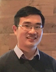 Xiaojiang Li (李小江)合作论文数Urban Spatial Analytics Lab, Department of Geography and Urban Studies, College of Liberal Arts, Temple University;Center for Sustainable Communities, Temple University;Biometeors1Konstantinos Vlachos合作论文数1A. Provenzale合作论文数1Julia Wagemann合作论文数1
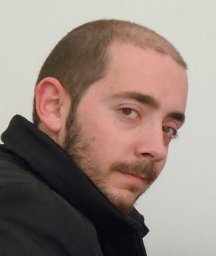 Gianfranco Di Pietro合作论文数Geofunct Srls, Via Luigi Sturzo 71, I-93015 Niscemi, CL, Italy1Mariapaola Ambrosone合作论文数1Meritxell Batalla合作论文数1
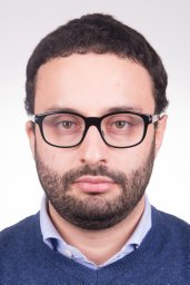 Fabio Rinnone合作论文数Geofunct Srls, Via Luigi Sturzo 71, I-93015 Niscemi, CL, Italy1Firman Wahyudi合作论文数1
 Sara Lafia合作论文数Inter Univ Consortium Polit & Social Res ICPSR, Univ Michigan1




