Hunting is a major driver of global species extinctions, yet the spatial footprint and temporal trends of this threat are lacking at the global scale, limiting our ability to achieve international policy targets. Here we present standardized global maps of hunting probability across the tropics, based on a machine-learning algorithm trained on 2,463 hunted and non-hunted tropical sites, spatially and temporally matched to ecological and socioeconomic predictors. We estimate that the spatial footprint of hunting extends across the entire pantropical zone, with distinct hotspots of high predicted hunting occurrence probability in the Indomalayan realm (for example, China, Sri Lanka, western India), the Brazilian Atlantic Forest and parts of West Africa. Refuges from hunting persist in remote areas of interior Borneo, Papua New Guinea, Central Africa and the western Amazon. Enhanced human accessibility has facilitated the geographic expansion of hunting from 2000 to 2015, most notably in regions historically considered undisturbed and remote such as the Amazon basin, and in areas already facing high pressure such as China and Indonesia. Spatiotemporal dynamics also varied among realms. Our standardized spatiotemporal assessment provides a blueprint to inform conservation, supporting targeted management actions and informed policy interventions to mitigate hunting impacts. Hunting wildlife for food and trade purposes (for example, pets, ornaments) can contribute to species extinctions, warranting informed policy and interventions to curb overexploitation. Towards such goals, the authors here estimate the spatial footprint of hunting probability across the global tropics.
Pulses of plant resources can influence the spatial aggregation and population dynamics of primary consumers, but the extent to which these effects cascade up the food chain to affect secondary consumers remains poorly understood. Mast fruiting events in Southeast Asian dipterocarp forests, for example, are known to impact a wide range of bird and mammal granivores, but it remains unclear whether the predators of these vertebrates are indirectly affected by seed production. Here, we assess bottom-up effects of masting on a suite of primary and secondary consumers in a tropical rainforest in Borneo, using structural equation models to characterize a network of frugivore/granivores and carnivores. The models were parameterized using 10 years of camera trap and seed availability data collected between 2013 and 2024, spanning two major masting events. These models also account for an outbreak of introduced disease (African swine fever) and the reduced abundance of human visitors in the forest during the COVID-19 pandemic. Dipterocarp seed availability was correlated with the intensity of local site use by omnivorous Malay civets (Viverra tangalunga) and bearded pigs (Sus barbatus), but not granivorous murid rodents or pheasants. Leopard cat site use was correlated with murid rodents, but not pheasants. These findings suggest that masting in this ecosystem is associated with site use intensity of some large-bodied primary consumers but not smaller granivores, and therefore did not percolate up the food web to influence the predators of these taxa, in contrast to research from temperate masting systems.
Tropical forests hold most of Earth's biodiversity and a higher concentration of threatened mammals than other biomes. As a result, some mammal species persist almost exclusively in protected areas, often within extensively transformed and heavily populated landscapes. Other species depend on remaining remote forested areas with sparse human populations. However, it remains unclear how mammalian communities in tropical forests respond to anthropogenic pressures in the broader landscape in which they are embedded. As governments commit to increasing the extent of global protected areas to prevent further biodiversity loss, identifying the landscape-level conditions supporting wildlife has become essential. Here, we assessed the relationship between mammal communities and anthropogenic threats in the broader landscape. We simultaneously modeled species richness and community occupancy as complementary metrics of community structure, using a state-of-the-art community model parameterized with a standardized pan-tropical data set of 239 mammal species from 37 forests across 3 continents. Forest loss and fragmentation within a 50-km buffer were associated with reduced occupancy in monitored communities, while species richness was unaffected by them. In contrast, landscape-scale human density was associated with reduced mammal richness but not occupancy, suggesting that sensitive species have been extirpated, while remaining taxa are relatively unaffected. Taken together, these results provide evidence of extinction filtering within tropical forests triggered by anthropogenic pressure occurring in the broader landscape. Therefore, existing and new reserves may not achieve the desired biodiversity outcomes without concurrent investment in addressing landscape-scale threats.
Remote sensing is an important tool for monitoring species habitat spatially and temporally. Species distribution models (SDM) often rely on remotely-sensed geospatial datasets to predict probability of occurrence and infer habitat preferences. Lidar measurements from the Global Ecosystem Dynamics Investigation (GEDI) are shedding light on three dimensional forest structure in regions of the world where this aspect of species habitat has previously been poorly quantified. Here we combine a large camera trap dataset of mammal species in Borneo and Sumatra with a diverse set of geospatial data to predict the probability of occurrence of 47 species. Multi-temporal GEDI predictors were created through fusion with Landsat time series, extending back to the year 2001. The availability of these GEDI-based forest structure predictors and other temporally-resolved predictor variables enabled temporal matching of species occurrences and hindcast predictions of species probability of occurrence at years 2001 and 2021. Our GEDI-Landsat fusion approach worked well for forest structure metrics related to canopy height (relative height of the 95th percentile of returned energy R2 = 0.62 and relative RMSE = 41%) but, not surprisingly, was less accurate for metrics related to interior canopy vegetation structure (e.g., plant area volume density from 0 to 5 m above the ground R2 = 0.05 and relative RMSE = 85%). For the SDM analyses, we tested several combinations of predictor sets and found that when considering a large pool of multiscale predictors, the exact composition, and whether GEDI Fusion predictors were included, didn’t have a large impact on generalized linear modeling (GLM) and Random Forest (RF) model performance. Adding GEDI Fusion predictors to a baseline set only meaningfully improved performance for some species (n = 4 for RF and n = 3 for GLM). However, when GEDI Fusion predictors were used in a smaller predictor set that is more suitable for hindcasting species probability of occurrence, more SDMs showed meaningful performance improvements relative to the baseline model (n = 9 for RF and n = 4 for GLM) and the relative importance of GEDI-based canopy structure predictors increased relative to when they were combined with the baseline predictor set. Moreover, as we examined predictor importance and partial dependence, the utility of GEDI Fusion predictors in hindcast models was evident in regards to ecological interpretability. We produced a catalog of probability of occurrence maps for all 47 mammals species at 90 m spatial resolution for years 2001 and 2021, enabling subsequent ecological interpretation and conservation analyses.
For many wildlife species, reintroduction is necessary to re-establish populations in areas of their historical range where they have been extirpated, but reintroduction efforts are often expensive, time-consuming, and unsuccessful. A more complete understanding of the factors affecting restoration success is important for responsible stewardship and optimizing outcomes. Fishers (Pekania pennanti) are a commonly reintroduced carnivore in North America, but differences in predator and prey assemblages among release sites may contribute to variation in the success rates of such efforts. We examined how predator and prey occurrence and relative abundance influenced survival rates in reintroduced fisher populations in the southern and northern Cascade Mountains, Washington, USA. We compared survival rates from telemetry data between the 2 areas and used independent detections of prey and predators at 190 remote camera stations to assess how sympatric species related to near-term (1-2 years post-release) fisher survival. We released 81 fishers, of mixed age and sex (majority <= 2 years old), into the South Cascades between December 2015 and January 2020 and released 89 fishers into the North Cascades between December 2018 and February 2020. Using radio-telemetry data, we estimated 365-day post-release survival as 0.65 (95% CI = 0.54-0.79) in the South Cascades and 0.31 (0.21-0.48) in the North Cascades. The relative abundance of important fisher prey species was significantly higher in the South than in the North; notably, snowshoe hares (Lepus americanus) were detected at a rate of 5.11 (+/- 0.86 SE)/100 trap nights in the South versus 1.13 (+/- 0.25)/100 trap nights in the North. Relative abundance of potential fisher predators did not differ significantly between study areas. Our findings are consistent with the survival of reintroduced fishers being affected by differences in prey assemblages across release sites, though other differences between the sites may also play a role in fisher survival. Future reintroduction efforts may benefit from preliminary assessment of prey abundance prior to release site selection.
Global biodiversity targets focus on landscape and seascape connectivity as a foundational component of biodiversity conservation, including networks of connected protected areas. Recent advances allow the measurement and prediction of organismal movements at multiple scales. We provide a definition of connectivity that links movement to persistence and ecological function. Connectivity science can guide planning for biodiversity, ecosystem services, ecological restoration, and climate adaptation. Ongoing climate change and land and sea use are closing the window of opportunity for connectivity conservation. A coordinated global effort is required to implement scientific knowledge and to monitor, map, protect, and restore areas that promote movement and maintain well-connected ecosystems for biodiversity in the long term.
Climate change is causing species ranges to shift, expand, and contract, with divergent and underappreciated consequences for local and global biodiversity. Widespread range shifts should increase local diversity in most areas but reduce it in the tropical lowlands. Widespread expansions should maintain diversity at low latitudes while increasing diversity elsewhere, leading to stable global biodiversity. Expansions and shifts are both common responses to climate change now and in the deep past. To understand how changing ranges will reshape Earth's biodiversity, we argue for three research directions: (i) leverage paleontological data to reveal long-term biodiversity responses, (ii) better monitor low-elevation and latitude limits to distinguish shifts from expansions, and (iii) incorporate dispersal barriers that can turn would-be shifts into contractions and extinctions.
Nations recently agreed to set aside 30% of the planet by 2030 as conservation areas (the "30 × 30" goal) necessitating major expansions, not just of traditional protected areas like national parks, but also of 'other effective area-based conservation measures' (OECMs) - areas that provide de facto benefits to biodiversity despite conservation not being the primary management objective. But evidence for whether OECMs achieve positive biodiversity outcomes remains critically needed. Here we quantify how OECMs contribute to biodiversity conservation in the three high-biodiversity countries in which they have been extensively trialed. OECM performance varies across countries; those in South Africa align better with areas that a priori strategic planning identified as important for species conservation and key ecosystem services than those in Colombia and the Philippines. OECMs tend not to cover areas supporting regional connectivity in any of the countries. OECMs have potential to assist conservation, but policy, planning, and coordination at national and international levels would help ensure that new OECMs are strategically established and effectively managed to enhance outcomes for biodiversity conservation and ecosystem service provisioning.
Rewilding is increasingly recognized as an impactful conservation strategy, but a key question remains: how do ecological systems respond to the return of species long absent from the landscape? Predicting these responses is challenging due to complex direct and indirect interactions, especially amid anthropogenic changes. The ongoing range expansion of grizzly bears (Ursus arctos) in western North America offers a unique opportunity to develop and test predictions about the effects of a large, generalist omnivore returning to its historic range. We developed a priori predictions that grizzly recovery would lead to (1) declines in sympatric large carnivores due to competition, (2) mesopredator release, (3) increased top-down control on large herbivores, and (4) stronger effects under anthropogenic stressors. Our fuzzy interaction webs (FIWs) supported these hypotheses, predicting that in habitats where grizzlies reach high density, black bears (Ursus americanus), mountain lions (Puma con-color), coyotes (Canis latrans), grey wolves (Canis lupus), scavenging birds, and ungulates may experience small population reductions through interference competition, exploitation competition, and predation. Small carnivores may increase, while reduced precipitation and human hunting of ungulates may intensify declines in mountain lions and ungulates. While FIWs offer a tractable framework for anticipating community change in complex, data-poor, multitrophic systems, they are still limited by data quality, assumptions of equilibrium dynamics, and the absence of spatial output. Nevertheless, FIWs serve as useful tools for generating testable hypotheses, identifying knowledge gaps, and guiding research and conservation efforts as species recover and ecosystems reorganize under global change.
Changes in species composition and diversity along elevational gradients remain poorly understood for many tropical taxa. Here we elucidate the distribution of mid- to large-bodied mammals along elevational gradients in northwestern Borneo. We deployed camera traps at 209 stations using stratified sampling across seven elevation categories at six protected areas from 2014 to 2017, recording 33 mammal species. Species richness was not statistically related to elevation, but species composition shifted in response to opposing effects of elevation on the occurrence of different taxa. No species were restricted to the lowlands, but occurrence of common palm civets (Paradoxurus hermaphroditus), thick-spined porcupine (Hystrix crassispinis), and long-tailed porcupine (Trichys fasciculata) was higher at low elevations. In contrast, occurrence of masked palm civet (Paguma larvata), pig-tailed macaque (Macaca nemestrina), and Malay weasel (Mustela nudipes) increased with elevation, and two species - Hose's Civet (Diplogale hosei) and Sunda Clouded Leopard (Neofelis diardi) - were only detected in the highlands (> 700 m). Species tended to shift their activity patterns in low versus high elevation forests, though the magnitude of these effects was small. Most species that we detected currently have broad elevational ranges; nevertheless, protecting forest across elevational gradients remains critical so that if climate change forces species to abandon the lowlands, they have habitat connections to higher-elevation refugia.
The 2018 arrival of African swine fever (ASF) in China was followed by reports of wild pig deaths across most countries in Southeast Asia. However, the magnitude and duration of population-level impacts of ASF on wild pig species remain unclear. To elucidate the spatiotemporal spread of ASF in the region for native pig species, we gathered qualitative information on wild pig population dynamics in Southeast Asia between 2018 and 2024 from 88 expert elicitation questionnaires representing sites in 11 countries. Peak reported population declines occurred in 2021 and 2022, with more than half of respondents reporting declining wild pig populations, far higher than in earlier years. The reported declines waned to 44.23% in 2024, whereas simultaneously, the number of populations reported to be "increasing" increased from 11.3%-13.2% in 2019-2022 to 28.9% in 2024. These reports suggest that the ASF outbreak may have peaked for wild boars and bearded pigs in mainland Southeast Asia, Borneo, and Sumatra, with some subsequent recovery. However, the disease is still expanding into the ranges of island endemic species, such as new reports for the Sulawesi warty pig (Sus celebensis) in September of 2024. Island endemics remain particularly vulnerable to extinction from ASF and require urgent monitoring and conservation action.
Information on tropical Asian vertebrates has traditionally been sparse, particularly when it comes to cryptic species inhabiting the dense forests of the region. Vertebrate populations are declining globally due to land-use change and hunting, the latter frequently referred as "defaunation." This is especially true in tropical Asia where there is extensive land-use change and high human densities. Robust monitoring requires that large volumes of vertebrate population data be made available for use by the scientific and applied communities. Camera traps have emerged as an effective, non-invasive, widespread, and common approach to surveying vertebrates in their natural habitats. However, camera-derived datasets remain scattered across a wide array of sources, including published scientific literature, gray literature, and unpublished works, making it challenging for researchers to harness the full potential of cameras for ecology, conservation, and management. In response, we collated and standardized observations from 239 camera trap studies conducted in tropical Asia. There were 278,260 independent records of 371 distinct species, comprising 232 mammals, 132 birds, and seven reptiles. The total trapping effort accumulated in this data paper consisted of 876,606 trap nights, distributed among Indonesia, Singapore, Malaysia, Bhutan, Thailand, Myanmar, Cambodia, Laos, Vietnam, Nepal, and far eastern India. The relatively standardized deployment methods in the region provide a consistent, reliable, and rich count data set relative to other large-scale pressence-only data sets, such as the Global Biodiversity Information Facility (GBIF) or citizen science repositories (e.g., iNaturalist), and is thus most similar to eBird. To facilitate the use of these data, we also provide mammalian species trait information and 13 environmental covariates calculated at three spatial scales around the camera survey centroids (within 10-, 20-, and 30-km buffers). We will update the dataset to include broader coverage of temperate Asia and add newer surveys and covariates as they become available. This dataset unlocks immense opportunities for single-species ecological or conservation studies as well as applied ecology, community ecology, and macroecology investigations. The data are fully available to the public for utilization and research. Please cite this data paper when utilizing the data.
Pangolins are the most trafficked mammals in the world and are severely threatened by poaching the loss, degradation, and fragmentation of habitat. In Malaysian Borneo, conservation initiatives for the Sunda pangolin (Manis javanica) are hindered by a paucity of data on their distribution and population size. Using MaxEnt niche modelling and consolidated species location data, we projected the distribution of Sunda pangolins in Sabah. Additionally, we assessed the accessibility of their forest habitats to humans to understand potential threats. Our model indicated that, as of 2015, approximately half of Sabah’s land area (39,530km²) is suitable for pangolins, with 43% in protected forests, 38% in production forests, and 19% outside of these areas. Alarmingly, our data suggest that nearly all (91%) of these suitable habitats are relatively easily accessible to poachers. Our findings provide a state-level baseline understanding of Sunda pangolin distribution and assess potential threats in Sabah. These can inform short- and long-term conservation management plans for pangolin to safeguard this critically endangered species.
Reliable maps of species distributions are fundamental for biodiversity research and conservation. The International Union for Conservation of Nature (IUCN) range maps are widely recognized as authoritative representations of species’ geographic limits, yet they might not always align with actual occurrence data. In recent area of habitat (AOH) maps, areas that are not habitat have been removed from IUCN ranges to reduce commission errors, but their concordance with actual species occurrence also remains untested. We tested concordance between occurrences recorded in camera trap surveys and predicted occurrences from the IUCN and AOH maps for 510 medium- to large-bodied mammalian species in 80 camera trap sampling areas. Across all areas, cameras detected only 39% of species expected to occur based on IUCN ranges and AOH maps; 85% of the IUCN only mismatches occurred within 200 km of range edges. Only 4% of species occurrences were detected by cameras outside IUCN ranges. The probability of mismatches between cameras and the IUCN range was significantly higher for smaller-bodied mammals and habitat specialists in the Neotropics and Indomalaya and in areas with shorter canopy forests. Our findings suggest that range and AOH maps rarely underrepresent areas where species occur, but they may more often overrepresent ranges by including areas where a species may be absent, particularly at range edges. We suggest that combining range maps with data from ground-based biodiversity sensors, such as camera traps, provides a richer knowledge base for conservation mapping and planning.
Wildlife must adapt to human presence to survive in the Anthropocene, so it is critical to understand species responses to humans in different contexts. We used camera trapping as a lens to view mammal responses to changes in human activity during the COVID-19 pandemic. Across 163 species sampled in 102 projects around the world, changes in the amount and timing of animal activity varied widely. Under higher human activity, mammals were less active in undeveloped areas but unexpectedly more active in developed areas while exhibiting greater nocturnality. Carnivores were most sensitive, showing the strongest decreases in activity and greatest increases in nocturnality. Wildlife managers must consider how habituation and uneven sensitivity across species may cause fundamental differences in human–wildlife interactions along gradients of human influence.
Species distribution modeling (SDM) is a fundamental tool in theoretical and applied ecology. However, relatively little is known about the performance of different approaches for scale optimization, model selection, and algorithmic prediction in the context of nonlinear, multiscale and interactive relationships between environmental variables and species occurrence. Modelers often struggle to optimize a tradeoff between ecological relevance, model robustness, complexity, and overfitting. In this paper, we investigated several methods designed to optimize spatial scale and variable selection in SDMs, in each case evaluating model fitness, parsimony and predictive performance. We used a simulation approach to produce a large pool of alternative underlying habitat relationships that reflect a broad range of realistic habitat associations. We also compared several different modeling algorithms, including logistic regression with a generalized linear model (GLM), Lasso and Elastic-Net Regularized GLMs (GLMNet), and random forest (RF), as well as alternative variable and scale selection methods. We found that GLM methods employing all-subsets dredge routines for variable selection were consistently the best predictors based on all criteria of our model performance assessment and across all attributes of the simulated underlying relationship, including nonlinearity and interaction. We had expected machine learning approaches, such as random forest, to perform better in these more complex forms of species-environment relationships. GLM using dredge variable selection was also the method that included the fewest spurious covariates and included the most correct predictors as a proportion of all predictors. We found that univariate scaling was the most robust method of variable and scale selection, along with Minimal Redundancy Maximal Relevancy (MRMR) which performed equivalently. The simulation experiment presented here provides a robust assessment of simulated multi-species distribution model performance, complexity and fidelity. By simulating a large range of potential habitat relationships with varying spatial scale, effect sizes, linearity, and interactions, we comprehensively evaluated model performance across gradients of complexity of the underlying relationships and violations of classical statistical assumptions. This study provides a valuable assessment and a broader example of the power and utility of controlled simulation experiments in habitat relationships and other ecological spatial predictive modeling.
A fundamental challenge for ecologists is to evaluate the effects of anthropogenic disturbance on ecosystem processes and functions. Tropical rainforests in Borneo are biologically diverse and provide an array of ecosystem functions and services. However, these forests are being logged and converted to agricultural plantations at a rapid pace. While there are numerous studies on the impacts of these land-use changes on biodiversity, there are far fewer that investigate the consequences of forest disturbance for ecosystem functioning. We investigated the impacts of land-use change in Bornean tropical rainforests on invertebrate-mediated functions using a suite of six easily measurable processes that are linked to nutrient cycling and plant regeneration, and which can be used as indicators of the degree of disturbance and the health of the forest. We explored whether the conversion of primary forest to logged, fragmented forest or agricultural plantations altered the ecosystem processes of dung removal, predation of insect herbivores, functional activity of soil invertebrates, bioturbation, seed removal, and decomposition. Overall, ecosystem processes remained resistant to habitat change except for seed removal, which was lower in heavily logged forests and plantations than in primary forests. This suggests that, despite the loss of many species when forests are logged and converted to agriculture, ecosystem processes provided by invertebrates can remain robust across land-use gradients.
Biogeographic history can lead to variation in biodiversity across regions, but it remains unclear how the degree of biogeographic isolation among communities may lead to differences in biodiversity. Biogeographic analyses generally treat regions as discrete units, but species assemblages differ in how much biogeographic history they share, just as species differ in how much evolutionary history they share. Here, we use a continuous measure of biogeographic distance, phylobetadiversity, to analyze the influence of biogeographic isolation on the taxonomic and functional diversity of global mammal and bird assemblages. On average, biodiversity is better predicted by environment than by isolation, especially for birds. However, mammals in deeply isolated regions are strongly influenced by isolation; mammal assemblages in Australia and Madagascar, for example, are much less diverse than predicted by environment alone and contain unique combinations of functional traits compared to other regions. Neotropical bat assemblages are far more functionally diverse than Paleotropical assemblages, reflecting the different trajectories of bat communities that have developed in isolation over tens of millions of years. Our results elucidate how long-lasting biogeographic barriers can lead to divergent diversity patterns, against the backdrop of environmental determinism that predominantly structures diversity across most of the world.
 Jayasilan Mohd-Azlan合作论文数27
 Anthony J. Giordano合作论文数26
 Henry Bernard合作论文数Institute for Tropical Biology and Conservation, Universiti Malaysia Sabah23
 Alys Granados合作论文数Dept Forest Resources Management, Univ British Columbia21
 David Macdonald合作论文数Department of Biology, University of Oxford19
 Hearn Andrew J合作论文数18Ross Joanna合作论文数16
 Andreas Wilting合作论文数Biocentre, University of Würzburg16
 John Mathai合作论文数Leibniz Institute for Zoo and Wildlife Research15O. Helmy合作论文数14Jason Hon合作论文数WWF-Malaysia13
 Matthew S Luskin合作论文数13
 Azlan Mohamed合作论文数13
 Andrew J. Marshall合作论文数Department of Anthropology, University of Michigan;Department of Ecology and Evolutionary Biology, University of Michigan;School of Environment and Sustainability, University of Michigan12
 Eric Post合作论文数Department of Wildlife, Fish, and Conservation Biology, University of California, Davis12Stephanie Kramer-Schadt合作论文数Department of Ecological Dynamics, Leibniz Institute for Zoo and Wildlife Research, Berlin;Technische Universität Berlin12
 Gabriella Margit Fredriksson合作论文数11
 Matthew J Heydon合作论文数Natural England, Blenheim Office Park11
 Susan Cheyne合作论文数Wildlife Conservation Research Unit;Department of Zoology;University of Oxford;Department of Zoology, University of Oxford11
 Hiromitsu Samejima合作论文数11
 Glen Reynolds合作论文数Naval Research Laboratory, Washington, DC 20375-5000, USA11
 Ramesh Boonratana合作论文数10
 Gono Semiadi合作论文数10
 Brent Loken合作论文数9
 Mark Hebblewhite合作论文数Ungulate Ecology Lab, W.A. Franke College of Forestry & Conservation,9Raymond Alfred合作论文数9
 Tim van Berkel合作论文数Biodiversity Inventory for Nature Conservation8
 Oliver R. Wearn合作论文数Imperial College London;Institute of Zoology, Zoological Society of London;Institute of Zoology, Imperial College London8
 Jerrold L. Belant合作论文数Department of Fisheries and Wildlife, College of Agriculture & Natural Resources, Michigan State University8
 David Burslem合作论文数Interdisciplinary Centre for Environment and Biodiversity, University of Aberdeen;School of Biological sciences, University of Aberdeen8Peter Jeffrey Williams合作论文数7
 Mairin C M Deith合作论文数6Jon Hall合作论文数6
 Patrick Burns合作论文数No Arizona Univ, Sch Informat Comp & Cyber Syst, Flagstaff, AZ 86011 USA6
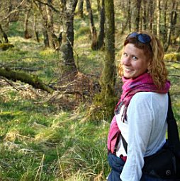 Żaneta Kaszta合作论文数Wildlife Conservat Res Unit, Univ Oxford6
 Slade Eleanor合作论文数Department of Zoology, University of Oxford6
 Haldre S Rogers合作论文数Department of BioSciences, Rice University6
 Scott Goetz合作论文数Global Earth Observation & Dynamics of Ecosystems Lab, Northern Arizona University;School of Informatics, Computing, and Cyber Systems, Northern Arizona University6
 Yoshihiro Nakashima合作论文数6
 Clare E. Aslan合作论文数Environmental Studies Department, University of California, Santa Cruz6
 Patrick Jantz合作论文数Bren School of Environmental Science and Management, University of California–Santa Barbara6
 Benoit Goossens合作论文数Cardiff School of Biosciences, Cardiff University6
 Christopher Hakkenberg合作论文数6Shu Woan Teoh合作论文数5Cheng Chen合作论文数5
 Cole Burton合作论文数Department of Forest Resources Management, Faculty of Forestry, The University of British Columbia5Robert C. Ong合作论文数5
 Patrick A. Jansen合作论文数Wageningen University5
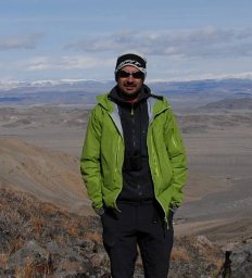 Francesco Rovero合作论文数Museo Tridentino di Scienze Naturali, Trento Museum of Natural Sciences5




