Autonomous off-road navigation requires robots to estimate terrain traversability from onboard sensors and plan motion accordingly. Conventional approaches typically rely on sampling-based planners such as MPPI to generate short-term control actions that aim to minimize traversal time and risk measures derived from the traversability estimates. These planners can react quickly but optimize only over a short look-ahead window, limiting their ability to reason about the full path geometry, which is important for navigating in challenging off-road environments. Moreover, they lack the ability to adjust speed based on the terrain-induced vibrations, which is important for smooth navigation on challenging terrains. In this letter, we introduce TRAIL (Traversability with an Implicit Learned Representation), an off-road navigation framework that leverages an implicit neural representation to model terrain properties as a continuous field that can be queried at arbitrary locations. This representation yields spatial gradients that enable integration with a novel gradient-based trajectory optimization method that adapts the path geometry and speed profile based on terrain traversability.
Belief-space planning under motion uncertainty and state and control constraints remains a fundamental challenge, largely due to the difficulty of establishing reachability guarantees in constrained belief spaces. Existing constrained belief-space planners rely on sampling to construct multi-query belief roadmaps and explicitly find feasible trajectories between sampled nodes to establish reachability. These methods often struggle to cover the belief space or use robust control techniques that improve coverage at the cost of indirect, high-cost trajectories; they also lack finite-time or finite-memory completeness guarantees. We propose PRISM, a multi-query motion planning algorithm for belief spaces with state and control constraints that targets both high coverage and low cost. We present a new result on controllability of the state covariance under constraints, which is used by PRISM to decompose belief-space planning into deterministic mean planning and covariance shrinking. PRISM further includes an online local optimization method that reduces the cost of feasible belief-space trajectories. Under mild assumptions on the start and goal distributions, we prove that PRISM guarantees full coverage (i.e. completeness) despite actuator and obstacle constraints. In challenging simulated scenarios, PRISM achieves substantially higher roadmap coverage than state-of-the-art belief-space planning methods while producing trajectories with lower mean cost and cost variance. For example, PRISM achieves 100
Multi-agent Simultaneous Localization and Mapping (SLAM) and collaborative SLAM (CSLAM) require robots to continuously exchange global descriptors (GDs) to detect inter-agent loop closures (ILCs). While encrypted radios protect this traffic from external eavesdroppers, they offer no protection against a compromised swarm member. We show this threat is concrete by demonstrating how a corrupted agent can reconstruct approximations of an honest agent's imagery and trajectory from its public GD broadcasts. To address this, we propose CILC (Cryptographically-secure Inter-agent Loop Closure candidate detection), a first-of-its-kind system leveraging Secure Multi-Party Computation (SMPC) to detect ILC candidates without exchanging GDs in the clear. Rather than securing the entire CSLAM pipeline, we apply SMPC only to ILC candidate detection (i.e., GD similarity comparison), a privacy-sensitive yet computationally lightweight step, yielding an advantageous privacy-to-overhead trade-off. We validate in both simulation and hardware experiments that CILC remains real-time and communication-feasible across multimodal GDs (visual and LiDAR), while mitigating information leakage to a compromised swarm agent.
The reliable deployment of deep reinforcement learning in real-world settings requires the ability to generalize across a variety of conditions, including both in-distribution scenarios seen during training as well as novel out-of-distribution scenarios. In this work, we present a framework for dynamics generalization in deep reinforcement learning that unifies these two distinct types of generalization within a single architecture. We introduce a robust adaptation module that provides a mechanism for identifying and reacting to both in-distribution and out-of-distribution environment dynamics, along with a joint training pipeline that combines the goals of in-distribution adaptation and out-of-distribution robustness. Our algorithm GRAM achieves strong generalization performance across in-distribution and out-of-distribution scenarios upon deployment, which we demonstrate through extensive simulation and hardware locomotion experiments on a quadruped robot.
Abstract Precise thermospheric density forecasting is critical for mitigating satellite drag in Low Earth Orbit (LEO), but traditional empirical models such as MSIS and JB2008 can fail during geomagnetic storms. To evaluate whether AI can better capture this transient behavior, the 2025 MIT ARCLab Prize for AI Innovation in Space asked participants to forecast orbit‐averaged density 3 days ahead. The training set included 8,118 samples, each with initial orbital parameters, 60 days of contextual space weather indicators, GOES X‐ray flux, OMNI2 solar wind observations, and the corresponding 3‐day density target, plus 4,557 hidden samples reserved for private testing. Submissions were ranked on Codabench using the Orbital Density Root Mean Square Error (OD‐RMSE), a custom metric that emphasizes early‐horizon performance and is benchmarked against MSIS. The competition attracted 145 teams and 973 submissions. Team Bimasakti won with a bias‐corrected ensemble of LightGBM models trained on ratio and log‐ratio features derived from observed and NRLMSIS 2.1 densities, Team Millennial‐IUP placed second with a hybrid CNN‐LSTM‐GRU model over a 30‐day window with physics‐guided scaling, and Team Digantara achieved strong public leaderboard performance with a combined XGBoost and TSLANet approach. Overall, the top approach achieved a 50.8% RMSE reduction versus JB2008 and a 67.7% reduction versus MSIS, although during the May 2024 geomagnetic storm these improvements dropped to 6.1% and 34.7%, respectively.
Safety filters are an effective tool for enforcing constraints in safety-critical systems, but most existing methods assume perfect state information, which is rarely available in practice. Recent work has begun to close this gap by developing filtering mechanisms that are robust to state estimation error, but these methods can still exhibit safety violations or overly conservative behavior as estimation error grows. Focusing on obstacle avoidance, we develop two new control barrier function (CBF) formulations: drift-measurement-robust (DMR)-CBFs and neural measurement-robust (NMR)-CBFs. The DMR-CBF augments the standard CBF condition with an inner optimization over the worst-case uncertainty in the drift dynamics, improving robustness to estimation error. This DMR-CBF then supervises a pretraining phase for the NMR-CBF, which replaces the inner optimization with a learned term. The NMR-CBF is subsequently finetuned through differentiable trajectory rollouts, yielding a filter that achieves empirical safety comparable to the DMR-CBF while reducing both conservativeness and computational cost. We provide theoretical analysis of the DMR-CBF along with numerical results on a planar double integrator and a 12D quadrotor, where both proposed approaches prevent collisions while other robust methods either fail or are overly conservative. Finally, we deployed the NMR-CBF on a Unitree Go2, enabling successful navigation of an obstacle field under odometry errors that caused a standard CBF to collide.
Aerocapture involves converting a hyperbolicapproach trajectory into a captured orbit utilizing the aerodynamic forces generated via a single atmospheric pass. Aerocapture guidance systems must be robust to significant environmental variations and modeling uncertainty, particularly regarding atmospheric properties and delivery conditions. Recent work has shown that controlling both bank angle and angle of attack, a strategy called augmented bank angle modulation (ABAM), can improve robustness to entry state and atmospheric uncertainties. This work derives optimal control solutions for an aerocapture vehicle using ABAM. First, the problem is formulated using a linear aerodynamic model, and closed-form control profiles are derived using Pontryagin's minimum principle. To increase modeling fidelity, a quadratic aerodynamic model is considered, and the solution is obtained directly using the optimality conditions. Both formulations are solved numerically using Gauss pseudospectral methods to validate the analytic solutions. This work then introduces a novel aerocapture guidance algorithm, augmented bank angle modulation guidance plus (ABAMGuid+), which indirectly minimizes propellant usage by mimicking the structure of the optimal control solution, enabling efficient guidance by reducing the problem complexity. Extensive Monte Carlo simulations of a Uranus aerocapture mission demonstrate that ABAMGuid+ increases capture success rates and reduces postcapture propellant requirements relative to previous methods.
In this paper, we study the problem of generating low-altitude path plans for nap-of-the-earth (NOE) flight in real time with only RGB images from onboard cameras and the vehicle pose. We propose a novel training method that combines behavior cloning and self-supervised learning, where the self-supervision component allows the learned policy to refine the paths generated by the expert planner. Simulation studies show 24.7
Successful robot automation requires accurate global localization to support repeatability, task planning, goal specification, and safe operation. However, reliable localization in GNSS-denied environments remains an open problem. Overhead aerial imagery offers a promising solution, but existing approaches primarily target structured urban environments and have been rarely demonstrated in unstructured natural terrain. Limitations of the state-of-the-art include a reliance on models trained for specific environments, as well as difficulty handling repetitive geometries and featureless landscapes commonly found in natural outdoor areas. To overcome these challenges, we present Meridian, a method for matching high-level metric-semantic primitives across aerial images and ground robot RGB-D camera data that achieves accurate global localization and generalizes well across diverse environments, all without any training or algorithmic fine-tuning on area-specific data. We formulate novel consistency metrics to estimate a distribution over robot submap poses and to reject outlier hypotheses in a robust pose graph optimization step for accurate robot trajectory estimation. We demonstrate that our algorithm can localize a ground robot across a wide variety of environments, including an autonomous driving dataset, a park and campus area, and a wilderness camp, with an average optimized trajectory error of 2.4 m over 19 km of ground traversal.
Safety filtering is an effective method for enforcing constraints in safety-critical systems, but existing methods typically assume perfect state information. This limitation is especially problematic for systems that rely on neural network (NN)-based state estimators, which can be highly sensitive to noise and adversarial input perturbations. We address these problems by introducing GUARDIAN: Guaranteed Uncertainty-Aware Reachability Defense against Adversarial INterference, a safety filtering framework that provides formal safety guarantees for systems with NN-based state estimators. At runtime, GUARDIAN uses neural network verification tools to provide guaranteed bounds on the system’s state estimate given possible perturbations to its observation. It then uses a modified Hamilton-Jacobi reachability formulation to construct a safety filter that adjusts the nominal control input based on the verified state bounds and safety constraints. The result is an uncertainty-aware filter that ensures safety despite the use of an NN estimator with noisy, possibly adversarial, observations. Theoretical and numerical results show how GUARDIAN effectively defends systems against adversarial attacks that would otherwise cause violation of safety constraints.
As NASA progresses toward a sustained lunar presence under the Artemis program, global localization is a critical capability for autonomous surface operations where Earth-based infrastructure like GPS is unavailable. Tasks such as regolith excavation, transport, and infrastructure deployment require precise pose estimation over extended durations and varied terrain. Traditional methods such as visual inertial odometry (VIO) suffer from drift accumulation, particularly in visually ambiguous or repetitive lunar environments. We present LunarLoc, a driftfree global localization approach designed for the lunar surface that leverages the underlying structure of the environment (i.e. persistent geological features such as boulders) rather than relying on appearance-based descriptors. Using zero-shot instance segmentation from onboard stereo cameras, LunarLoc detects and localizes boulders without requiring pre-labeled training data or fixed object classes. The system constructs a graph-based representation of these landmarks and performs global data association via geometric consistency with a previously recorded reference map. The graph-theoretic data association optimization finds the largest geometrically consistent set of 3D segment correspondences between a vehicle map and a reference map. Using this approach, LunarLoc achieves centimeter-level multisession localization accuracy using a graph-theoretic optimization over matched landmarks. We validate LunarLoc using a physicsbased simulation environment developed for the NASA Lunar Autonomy Challenge. The simulator incorporates a digital twin of NASA's In-Situ Resource Utilization Pilot Excavator (IPEx) rover operating in a photorealistic $27 \mathrm{m} \times 27 \mathrm{m}$ lunar terrain model. We perform multi-session global localization experiments with varying viewpoints and lighting conditions across multiple traverses spanning from short to long-range exploration. Our system consistently achieves sub-centimeter trajectory localization error, significantly outperforming the current state of the art in lunar localization methods, including image-based matching and crater-referenced geolocation. Beyond static frame alignment, we demonstrate how LunarLoc enables accurate global pose estimation by aligning agent trajectories within a shared map. To quantify this, we present both the transformation accuracy obtained through global localization and the resulting improvement in full trajectory estimation. Specifically, we integrate LunarLoc outputs into a pose graph optimization framework using GTSAM, where localization events are established via boulder-based localization and trajectory priors are provided by ORB-SLAM3. This reduces accumulated drift in VIO and enables agents to maintain globally consistent trajectories over long traverses. The combined system supports persistent, collaborative autonomy in GPS-denied, visually ambiguous lunar environments. In addition to releasing the full dataset and simulation playback tools, we demonstrate the method's robustness to environmental appearance changes and evaluate its real-time performance on CPU and GPU configurations relevant to space-rated computing platforms. LunarLoc enables autonomous agents to localize and re-localize across sessions, demonstrating a promising approach for autonomy on long-duration, collaborative surface missions without dependence on external infrastructure.
Hard-constraint trajectory planners often rely on commercial solvers and demand substantial computational resources. Existing soft-constraint methods achieve faster computation, but either (1) decouple spatial and temporal optimization or (2) restrict the search space. To overcome these limitations, we introduce MIGHTY, a Hermite spline-based planner that performs spatiotemporal optimization while fully leveraging the continuous search space of a spline. In simulation, MIGHTY achieves a 9.3% reduction in computation time and a 13.1% reduction in travel time over state-of-the-art baselines, with a 100% success rate. In hardware, MIGHTY completes multiple high-speed flights up to 6.7 m/s in a cluttered static environment and long-duration flights with dynamically added obstacles.
Global localization is critical for autonomous navigation, particularly in scenarios where an agent must localize within a map generated in a different session or by another agent, as agents often have no prior knowledge about the correlation between reference frames. However, this task remains challenging in unstructured environments due to appearance changes induced by viewpoint variation, seasonal changes, occlusions, and perceptual aliasing in homogeneous environments — known failure modes for traditional place recognition methods. To address these challenges, we propose VISTA (View-Invariant Segmentation-Based Tracking for Frame Alignment), a novel open-set, monocular global localization framework that combines: 1) a front-end, object-based, segmentation and tracking pipeline, followed by 2) a submap correspondence search, which exploits geometric consistencies between environment maps to align vehicle reference frames. VISTA enables consistent localization across diverse camera viewpoints and seasonal changes, without requiring any domain-specific training or finetuning. We evaluate VISTA on seasonal and oblique-angle aerial datasets, achieving up to a 69% improvement in recall over baseline methods. Furthermore, we maintain a compact object-based map that is only 0.6% the size of the most memory-conservative baseline, making our approach capable of real-time implementation on resource-constrained platforms.
Existing 3D Gaussian Splatting (3DGS) systems distribute representation capacity uniformly across a scene, ignoring the fact that many downstream robotic tasks engage only a fraction of the reconstructed geometry. This causes valuable onboard compute to be allocated towards optimizing irrelevant parts of the scene, either limiting online capacity or under-optimizing the most relevant parts of the scene. We introduce GaussLite, a task-driven 3DGS mapping system that conditions its representation density on a natural-language task specification. Given a posed RGB-D stream and a task such as "prepare to pick up the object on the desk," GaussLite uses a one-shot LLM parser to extract target and anchor objects, which are grounded per-frame by an open-vocabulary detector and segmented to produce per-pixel relevance masks in real time. The mapper allocates seeding density, gradient flow and scaling by task relevance. At matched Gaussian budget and real-time mapping at 4 Hz on resource-constrained hardware, GaussLite outperforms baselines on ROI PSNR on the Replica Dataset by an average +2.72 dB and on a real-hardware demonstration in indoor and outdoor settings by +2.23 dB. We further show that two task-specialized agents' maps can be fused into a single shared map via per-voxel voting on active-optimization counts in real time, outperforming concatenation by +3.42 dB while only sharing an average 7.08
We present ROBO (Riemannian Overlapping Block Optimization), a distributed and parallel approach to multi-robot pose graph optimization (PGO) based on the idea of overlapping domain decomposition. ROBO offers a middle ground between centralized and fully distributed solvers, where the amount of pose information shared between robots at each optimization iteration can be set according to the available communication resources. Sharing additional pose information between neighboring robots effectively creates overlapping optimization blocks in the underlying pose graph, which substantially reduces the number of iterations required to converge. Through extensive experiments on benchmark PGO datasets, we demonstrate the applicability and feasibility of ROBO in different initialization scenarios, using various cost functions, and under different communication regimes. We also analyze the tradeoff between the increased communication and local computation required by ROBOs overlapping blocks and the resulting faster convergence. We show that overlaps with an average inter-robot data cost of only 36 Kb per iteration can converge 3.1x faster in terms of iterations than state-of-the-art distributed PGO approaches. Furthermore, we develop an asynchronous variant of ROBO that is robust to network delays and suitable for real-world robotic applications.
Steering-based planners require solutions to state-to-state boundary value problems, which can be inaccessible for nonlinear platforms. Forward propagation evades the steering requirement, but the finite-sample behavior of the associated planners remains uncharacterized and their implementations underperform in practice. This paper develops a propagation-based kinodynamic planner with deterministic finite-sample near-optimality guarantees. We work within the large class of differentially flat nonlinear systems and show that a forward tree of locally dispersive control commands contains a near-optimal trajectory at a certified tree size. We provide a general mechanism to construct dispersive command sets for control-affine systems, which are necessary to implement the search algorithm prescribed by the theory. We show that covering the certified trajectory class irrespective of cost provably demands a tree exponentially sized in the problem horizon, and present a cost-conditioned dominance pruning procedure that retains near-optimality at a tree size polynomial in the horizon. We implement the resulting search algorithm, Dispersive Forward Tree search (DFT*), as breadth-first expansion of the forward tree, which maps naturally onto parallel hardware. We design efficient dispersive samplers for the unicycle, the trailer car, and the quadrotor and evaluate challenging planning tasks for these platforms. DFT* delivers consistently competitive and often substantially better solution quality than state-of-the-art kinodynamic planners at comparable solution times on embedded-tier processors, accelerating further as parallel compute is scaled. We also implement DFT* in a receding-horizon loop to demonstrate real-time planning in dynamic environments at embedded-tier compute budgets.
A central challenge for multi-robot systems is fusing independently gathered perception data into a unified representation. Despite progress in Collaborative SLAM (C-SLAM), benchmarking remains hindered by the scarcity of dedicated multi-robot datasets. Many evaluations instead partition single-robot trajectories, a practice that may only partially reflect true multi-robot operations and, more critically, lacks standardization, leading to inconsistent results across studies. While several multi-robot datasets have recently been introduced, they mostly contain short trajectories with limited inter-robot overlap and sparse intra-robot loop closures. To overcome these limitations, we introduce CU-Multi, a dataset collected over multiple days at two large outdoor sites on the University of Colorado Boulder campus. CU-Multi comprises four synchronized runs with aligned start times and controlled trajectory overlap, replicating the distinct perspectives of a robot team. It includes RGB-D sensing, RTK GPS, semantic LiDAR, and refined ground-truth odometry. By combining overlap variation with dense semantic annotations, CU-Multi provides a strong foundation for reproducible evaluation in multi-robot collaborative perception tasks.
Global data association is an essential prerequisite for robot operation in environments seen at different times or by different robots. Repetitive or symmetric data creates significant challenges for existing methods, which typically rely on maximum likelihood estimation or maximum consensus to produce a single set of associations. However, in these ambiguous scenarios, the distribution of solutions to global data association problems is often highly multimodal, and such single-solution approaches frequently fail. In this work, we introduce a data association framework that leverages approximate Bayesian inference to capture multiple solution modes to the data association problem, thereby avoiding premature commitment to a single solution under ambiguity. Our approach represents hypothetical solutions as particles that evolve via deterministic or randomized updates, naturally parallelizable on GPUs, to cover the modes of the underlying solution distribution. Simulated and real-world experiments with highly ambiguous data show that our method correctly estimates the distribution over transformations when registering point clouds or object maps. Code is available at: https://github.com/mit-acl/mmda.
SANDO is a safe trajectory planner for 3D dynamic unknown environments, where obstacle locations and motions are unknown a priori and a collision-free plan can become unsafe at any moment, requiring fast replanning. Existing soft-constraint planners are fast but cannot guarantee collision-free paths, while hard-constraint methods ensure safety at the cost of longer computation. SANDO addresses this trade-off through three contributions. First, a heat map-based A* global planner steers paths away from high-risk regions using soft costs, and a spatiotemporal safe flight corridor (STSFC) generator produces time-layered polytopes that inflate obstacles only by their worst-case reachable set at each time layer, rather than by the worst case over the entire horizon. Second, trajectory optimization is formulated as a Mixed-Integer Quadratic Program (MIQP) with hard collision-avoidance constraints, and a variable elimination technique reduces the number of decision variables, enabling fast computation. Third, a formal safety analysis establishes collision-free guarantees under explicit velocity-bound and estimation-error assumptions. Ablation studies show that variable elimination yields up to 7.4x speedup in optimization time, and that STSFCs are critical for feasibility in dense dynamic environments. Benchmark simulations against state-of-the-art methods across standardized static benchmarks, obstacle-rich static forests, and dynamic environments show that SANDO consistently achieves the highest success rate with no constraint violations across all difficulty levels; perception-only experiments without ground truth obstacle information confirm robust performance under realistic sensing. Hardware experiments on a UAV with fully onboard planning, perception, and localization demonstrate six safe flights in static environments and ten safe flights among dynamic obstacles.
 Girish Chowdhary合作论文数Agricultural and Biological Engineering, University of Illinois49
 John Vian合作论文数Boeing Research and Technology42
 Han-Lim Choi合作论文数Department of Aerospace Engineering, Korea Advanced Institute of Science and Technology;Laboratory for informationand Control Systems, Korea Advanced Institute of Science and Technology38
 Louis Breger合作论文数Department of Aeronautics and Astronautics, MIT34
 Michael Everett合作论文数Department of Electrical & Computer Engineering, Northeastern University;Khoury College of Computer Sciences, Northeastern University;Autonomy & Intelligence Laboratory, Northeastern University27
 Nicholas Roy合作论文数Department of Aeronautics and Astronautics, School of Engineering, Massachusetts Institute of Technology;Zoox26
 Arthur Richards合作论文数Department of Aerospace Engineering, University of Bristol25
 N. Kemal Ure合作论文数Eatron Technologies;ION AI;Stanford University25
 Miao Liu (刘淼)合作论文数IBM Thomas J. Watson Research Center22
 Alborz Geramifard合作论文数Meta22
 Shayegan Omidshafiei合作论文数Google21
 Yoshiaki Kuwata合作论文数Space Exploration Technologies21Luca F. Bertuccelli合作论文数United Technol Res Ctr21
 Eric Marie Jacques Feron合作论文数Division of Computer, Electrical and Mathematical Sciences and Engineering, King Abdullah University of Science and Technology20Brett Bethke合作论文数20
 Tom Schouwenaars合作论文数Aerospace Controls Laboratory, Massachusetts Institute of Technology20
 Luke Johnson合作论文数Dept Aeronaut & Astronaut, MIT20valenti mario j合作论文数19
 Sameera S. Ponda合作论文数Dept Aeronaut & Astronaut, MIT19
 Andrea Tagliabue合作论文数Dipartimento di Scienza ed Alta Tecnologia, Università degli Studi dell Insubria via Valleggio 918David Miller合作论文数18Joshua Redding合作论文数18
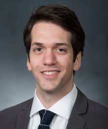 Parker C. Lusk合作论文数Massachusetts Institute of Technology17
 Brandon Douglas Luders合作论文数Dept Aeronaut & Astronaut, MIT17
 Christopher Amato合作论文数Khoury College of Computer Sciences, Northeastern University17
 Yu Fan Chen合作论文数Meta17
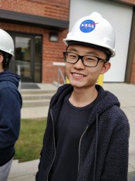 Yulun Tian合作论文数MIT, Lab Informat & Decis Syst LIDS, 77 Massachusetts Ave, Cambridge, MA 02139 USA16
 Kasra Khosoussi合作论文数School of Electrical Engineering and Computer Science, Faculty of Engineering, Architecture and Information Technology, The University of Queensland16
 Golnaz Habibi合作论文数Rice16
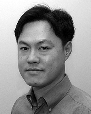 Justin Teo合作论文数16
 John Leonard合作论文数Department of Mechanical Engineering, Massachusetts Institute of Technology;Schwarzman College of Computing Building, Massachusetts Institute of Technology15
 Dong-Ki Kim合作论文数14
 Brett Lopez合作论文数Mechanical and Aerospace Engineering Department, School of Engineering, University of California, Los Angeles14
 Mark Cutler合作论文数Aerosp. Controls Lab., Massachusetts Inst. of Technol.;c;Aerosp. Controls Lab., Massachusetts Inst. of Technol.14
 Georges S. Aoude合作论文数Massachusetts Institute of Technology14
 Ali-akbar Agha-mohammadi合作论文数NASA's Jet Propulsion Laboratory, California Institute of Technology14
 Jesus Tordesillas合作论文数Aerospace Controls Laboratory, MIT13
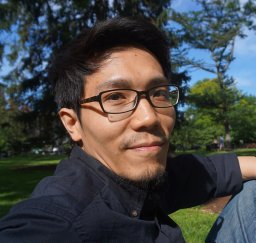 Shih-Yuan Liu合作论文数Dept. of Mech. Eng., Univ. of California;c;Dept. of Mech. Eng., Univ. of California13
 Emilio Frazzoli合作论文数Laboratory for Information and Decision Systems, Massachusetts Institute of Technology;Operations Research Center, Massachusetts Institute of Technology;Eidgenössische Technische Hochschule Zürich13
 Franz Busse合作论文数13Michael Tillerson合作论文数13Mehdi Alighanbari合作论文数Aerospace Controls Laboratory, Massachusetts Institute of Technology13
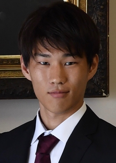 Kota Kondo (近藤耕太)合作论文数Aerospace Controls Laboratory, Massachusetts Institute of Technology;Department of Aeronautics and Astronautics, Massachusetts Institute of Technology12
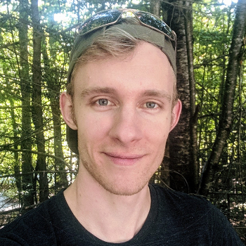 Trevor Campbell合作论文数Department of Statistics, Faculty of Science, University of British Columbia12
 Beipeng Mu合作论文数11
 Xiaoyi Cai合作论文数Dept Aeronaut & Astronaut, MIT11
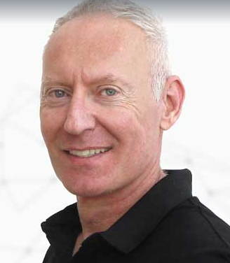 Pini Gurfil合作论文数Department of Aerospace Engineering, Israel Institute of Technology11
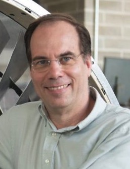 Steven Ray Hall合作论文数Massachusetts Institute of Technology11Matthew A. Vavrina合作论文数11