Very low Earth orbit (VLEO) satellites face marked challenges in downlinking large volumes of data due to short ground station contact windows. To address this, we propose a data relay multisatellite system (DRMSS). In this system, a VLEO satellite transmits data to nearby relay constellation satellites during their own ground passes. These relay satellites buffer and forward the data to ground stations during their passes, thereby extending the downlink window and improving transmission flexibility for VLEO missions. The transmitting satellite optimizes power by adjusting its attitude to maximize solar energy intake, while relay satellites aim to maximize data throughput with ground stations while maintaining alignment with the transmitter. Particle swarm optimization is used to find optimal attitude configurations due to its effectiveness in solving complex nonlinear problems within model predictive control (MPC) frameworks. To support coordinated operation, we implement an asynchronous strategy that assigns different control duties and update intervals based on satellite roles, with shorter cycles for the transmitting satellite. To address onboard computational limitations, we propose a hybrid control framework integrating traditional MPC with multiplexed MPC using asynchronous multimodel coordination. The transmitting satellite uses traditional MPC to achieve power optimization, frequent attitude maneuvers, and precise disturbance rejection. Relay satellites use multiplexed MPC to sequentially update actuator commands, marked reducing computational load while maintaining high-volume data transmission. Hardware-in-the-loop validation demonstrates the feasibility of the proposed data relay multisatellite system for supporting high-throughput VLEO missions.
Autonomous Vehicle Systems (AVSs) are vulnerable to signal obstruction, interference, and spoofing attacks, which can significantly degrade GNSS positioning performance. Resilient GNSS positioning seeks to enhance robustness by leveraging multi-source data fusion and advanced estimation algorithms. Low Earth Orbit (LEO) satellite Signals of OPportunity (SoOP), featuring spectral and geometric diversity, high received power, and rapid orbital motion, have emerged as promising complementary signals for GNSS positioning. However, the effective integration of LEO Doppler measurements into resilient GNSS positioning remains an open challenge. We propose a Successive Convex Approximation-SemiDefinite Programming (SCA-SDP) algorithm to model pseudorange and Doppler measurements with weight and a small search space. The SCA-SDP algorithm utilizes SCA linearization to convexify the pseudorange and Doppler measurements, applies the SDP method to solve the resulting convex problem, and employs parameter recursion to predict the parameters for the next epoch. The Cramer-Rao Lower Bound (CRLB) is presented to assess the feasibility of the LEO and GNSS fusion, pseudorange and Doppler fusion, and recursion. Moreover, the error analysis and computational complexity are analyzed to evaluate the potential performance of the SCA-SDP algorithm. Finally, joint GNSS/LEO field experiments are conducted to evaluate the positioning performance of the proposed SCA-SDP algorithm against other algorithms. The results demonstrate that the proposed algorithm effectively improves positioning accuracy in both multipath and obstruction scenarios.
The extremely low Earth imaging and technology explorer (ELITE), a very low Earth orbit (VLEO) satellite, is expected to face increasingly high-power demands from its electrical propulsion system, due to significant atmospheric drag, and its attitude determination and control system (ADCS), especially during target pointing. This results in significant power-related concerns that have potentially detrimental impacts on the satellite’s mission success. To address these concerns, this paper innovatively proposes power optimization control strategies and algorithms to optimize ELITE’s power generation. The power control strategies are specifically designed for each significant phase of the mission to account for the constraints in the respective phases. The innovatively developed robust piecewise affine multiplexed model predictive control (RPWA MMPC) features a piecewise affine model that breaks down the complex nonlinear dynamics of ELITE into highly accurate linear models, which are further divided into lower dimensional subproblems via the multiplexed feature. This significantly decreases the computational resources required. An observer is also included to account for uncertainties and disturbances for robustness. Meanwhile, differential evolution (DE) has been innovatively integrated into the ADCS to enable the synchronous operations of sun tracking and target pointing, significantly optimizing the power generation of ELITE, potentially marking a breakthrough in the realm of satellite research and development. The efficacy of these strategies and algorithms was validated through hardware-in-the-loop (HIL) experimentation, proving that with these strategies and algorithms, ELITE’s power system has the capability to meet the large power demands required for the mission, and testifying its potential to revolutionize VLEO remote sensing.
Since reaction wheels are sensitive and vulnerable devices, satellites often face significant challenges such as reaction wheel failure and angular momentum saturation during long-term operation. To address these issues, this paper proposes a multiplexed model predictive control (MMPC) method for satellites equipped with two reaction wheels and three magnetorquers, which can achieve both precise attitude control and angular momentum desaturation. Moreover, considering the presence of disturbance torques acting on satellites, the proposed MMPC algorithm is endowed with robustness through the constraint tightening approach, where the set of unknown but bounded disturbance torques is represented using zonotopes. Compared with conventional MPC algorithms that update all control variables simultaneously, the MMPC algorithm described in this paper employs asynchronous control moves on each input channel. By dividing the online optimization into smaller problems for each channel, the MMPC scheme reduces computational complexity and supports faster sampling in multivariable systems, thereby enabling quicker responses to unmeasurable disturbances. Finally, simulation results demonstrate the remarkable performance of the proposed method, including reduced computational time and improved control accuracy.
In response to data anomaly issues encountered during the detection and tracking of objects in complex space environments, conventional tracking filters based on single-step prediction often suffer from track interruption or erroneous tracking. To enhance the continuous and accurate prediction and tracking of moving targets, Moving Horizon Estimation (MHE) is introduced as an online track quality auditor. By comparing the tracker’s output trajectory with a dynamic model within a sliding time window, and given that MHE is fundamentally an optimization problem seeking an optimal solution, the cost of finding this solution—namely, the Optimization Residual—increases when there is a mismatch between the observed trajectory and the dynamic model. The established “verify-and-repair” framework can achieve precise detection and localization of anomalous data when this residual signal peaks. The performance of the MHE-based anomaly detection module is validated through simulations. Experimental results demonstrate that the module achieves high precision and recall in detecting anomalies in typical scenarios of target ID switches and drifts, providing robustness for object tracking and outperforming traditional methods based on innovation checking. This work presents a technical approach for building next-generation intelligent tracking systems capable of self-diagnosis and error correction.
This paper presents a reachability-aware guidance architecture for autonomous approach to a tumbling, uncooperative target under a rotating line-of-sight (LOS) docking corridor. The LOS admissible set rotates with the target body frame, producing time-varying polyhedral constraints in the chaser's relative coordinates. A safe-start region is constructed via two conservative criteria: (i) directional per-constraint erosion, the margin consumed by rotation-induced drift before thrust can arrest it, and (ii) a synchronization range bound r < 2a_max/ω_t^2 ensuring the chaser can cancel the apparent rotational velocity without overshooting the hold point. Closed-loop guidance uses a receding-horizon MPC controller with Clohessy-Wiltshire-Hill (CWH) prediction dynamics and explicit LOS corridor constraints in the quadratic program. Truth propagation uses the exact discrete CWH state-transition matrix with sub-stepping, so feasibility claims are physically honest: no reference blending or state projection is applied. A three-regime tracking law manages the transition from long-range inertial approach to body-frame co-rotation and synchronized hold. The analytical safe-start region is benchmarked against four standard reachability engines (backward and forward polytopic reachable sets, Hamilton-Jacobi level sets, and closed-loop Monte Carlo): the closed-form criteria are 250x faster than Hamilton-Jacobi reachability while predicting closed-loop feasibility with precision 0.80 and recall 0.91 on a 500-case sweep. The residual 6
A spacecraft closing on a target from three hundred kilometres to contact flies one guidance law across five orders of magnitude of range, and a controller that is provably safe at close range can lose that guarantee completely at long range while continuing to fly as though nothing were wrong. This paper derives the range at which the guarantee lapses and uses it as a design rule. The bound compares the prediction model's own linearisation error against the disturbance set the controller was built to reject, and needs only the sampling period, the orbit and that disturbance bound, so it can be evaluated before any simulation. On a Mars Sample Return approach it disqualifies the homing phase, where most of the propellant is spent, and clears the other two. Re-posing the disqualified phase in relative orbital elements restores the guarantee; re-posing a phase the rule already clears, in a frame two orders of magnitude more accurate, changes propellant by under a tenth of one per cent, and it is that second prediction that makes the rule falsifiable rather than descriptive. The constraint tightening also ties the prediction horizon to feasibility, so the horizon search limit becomes a mission parameter rather than a solver setting. Against a reimplementation of a published benchmark that reproduces its propellant to within one per cent, over five hundred dispersed Monte Carlo transfers per case on matched seeds, the controller saves 29
Everything else being equal, operating at a very low Earth orbit (VLEO) gives better ground resolution compared to operating at higher altitudes. However, operating at a VLEO faces marked atmospheric drag and various other uncertain interference factors. In this paper, we describe a pioneering satellite named ELITE (Extremely Low-earth Imaging and Technology Explorer) for high-resolution imaging and solar activity observation in VLEO. ELITE is planned to launch to an altitude of 550 km (Sun-synchronous orbit), then maneuver to a VLEO within the range of 200 to 350 km, and maintain that altitude for a year in VLEO through electrical propulsion. To address the challenges of VLEOs, a multiphase altitude planning framework is proposed, covering 4 critical scenarios that account for atmospheric drag, solar activity forecasts, and the strict requirements of time delay integration imaging. This enables robust and energy-efficient altitude adjustment strategies for stable long-term operation. An atmospheric density model is also developed, integrating solar activity predictions, drag coefficient estimation, public datasets, and onboard measurements, and validated using real VLEO mission data. A risk-aware collision avoidance strategy based on a beta-distributed differential evolution algorithm is introduced to balance safety and fuel efficiency, ensuring fast convergence during different evolutionary stages. These innovations ensure that ELITE can successfully accomplish its VLEO mission objectives: a groundbreaking 0.5-m ground sampling distance in color and innovative measurements of ionospheric intensity and atomic oxygen in VLEO. Our mission planning confirms ELITE’s capability to accomplish its missions, marking an important milestone in the field of VLEO satellites.
Implicit representations for LiDAR-based Simultaneous Localization and Mapping (SLAM) offer significant advantages in storage efficiency and expressive power over traditional explicit maps. However, a critical limitation for implicit SLAM is their deterministic nature, which prevents the quantification of prediction uncertainty in sparse or noisy conditions. Furthermore, the accuracy of the underlying Signed Distance Field (SDF) is often compromised by systematic errors arising from the angular dependency of LiDAR measurements, where oblique incident angles lead to biased distance estimations and degrade map quality. To address these challenges, this paper introduces a framework that enhances the robustness and accuracy of implicit LiDAR SLAM by integrating uncertainty estimation and an adaptive sampling strategy. We propose a neural network-based approach to learn and predict SDF uncertainty, which is then effectively incorporated into both localization and mapping processes. Concurrently, to mitigate incident angle-induced errors, we develop an adaptive sampling scheme that weights LiDAR rays based on surface normal information. Validation on public datasets and a custom experimental platform demonstrates that our approach outperforms baseline methods in terms of localization, mapping accuracy, and robustness.
In low-altitude urban intelligent transportation systems, efficient cooperative task allocation and path planning for multiple unmanned aerial vehicles (UAV) are critical for ensuring the effective execution of complex tasks. This paper proposes a distributed decision-making and autonomous planning framework to achieve cooperative task allocation and path planning for multi-UAVs in low-altitude urban traffic environment. The mission requirements of task allocation and path planning are modeled using evolutionary potential games and show that there exists a Nash equilibrium for the proposed potential function. An Improved Log-linear Learning Algorithm (ILLA) is proposed, and suitable Boltzmann parameters are derived which will enable the proposed ILLA to converge to the optimal Nash equilibrium with a probability one. Furthermore, a Constraint-Based Multi-layer Bidirectional Adaptive A-Star (CBMBA A-Star) algorithm is designed to find optimal and collision free paths for each UAV. Compared with the baseline method, simulation results demonstrate that the proposed approach improves the task reward by 11.67%, reduces the task execution time by 37.41%, and decreases run time by 61.02%, confirming its effectiveness and efficiency in the complex low-altitude urban traffic scenario.
Point cloud map-based pose estimation constitutes the cornerstone of autonomous vehicle navigation systems, yet existing techniques suffer from accuracy degradation that depends on resolution. Excessively dense point clouds impose prohibitively high computational loads, whereas overly sparse representations compromise feature distinctiveness, thereby constraining the reliability of real-time positioning. Implicit neural field map emerges as a promising alternative, offering lightweight representation and high-resolution reconstruction. However, current implicit map-based localization methods struggle with initialization, state estimation accuracy, and real-time performance. To address these challenges, this work proposes a novel LiDAR-inertial localization system for vehicles that leverages implicit neural maps augmented by frequency-domain descriptors. A prior map is firstly constructed using neural point models and corresponding descriptors. During the localization process, point cloud frames are converted into Bird's Eye View (BEV) images, from which descriptors are extracted using frequency domain transformation. These descriptors are then used to search the map database and obtain an initial pose estimate. The scan-to-map registration is performed by aligning the point cloud to the implicit neural model. And the short-term high-precision characteristics of the inertial navigation system are utilized to provide state prediction, improving real-time performance. Finally, the state estimation is refined and output through factor graph optimization. Extensive experiments conducted on both public and custom datasets demonstrate that the proposed algorithm outperforms state-ofthe-art methods in terms of accuracy and efficiency
Precise point positioning (PPP) typically experiences long convergence times, and extended Kalman filters offer only limited robustness in challenging environments. Multiantenna systems enable rigid body localization and vehicle orientation, making them a preferred choice for enhancing positioning accuracy without integrating additional sensors. In this work, we introduce orientation information to constrain velocity estimation, thereby assisting the PPP process. By fusing orientation data and exploiting the robustness of dynamic moving horizon estimation (MHE), we propose an orientation-assisted MHE (OAMHE) algorithm to improve global navigation satellite system (GNSS) positioning performance, particularly in rough terrains with limited GNSS satellites. Meanwhile, we derive the constrained Cram & eacute;r-Rao lower bound and calculation complexity. Finally, the field test results show that the OAMHE algorithm achieves faster convergence at the start of positioning and maintains stable performance without large errors even when GNSS satellite availability is reduced.
This paper presents a low-thrust trajectory optimization strategy to achieve a near-circular lunar orbit for a CubeSat injected into a lunar flyby trajectory. The 12U CubeSat HORYU-VI is equipped with four Hall-effect thrusters and designed as a secondary payload on NASA's Space Launch System under the Artemis program. Upon release, the spacecraft gains sufficient energy to escape the Earth-Moon system after a lunar flyby. The proposed trajectory is decomposed into three phases: (1) pre-flyby deceleration to avoid heliocentric escape, (2) lunar gravitational capture, and (3) orbit circularization to the science orbit. For each phase, an impulsive-burn solution is first computed as an initial guess, which is then refined through finite-burn optimization using Sequential Quadratic Programming (SQP). The dynamical model incorporates Earth-Moon-Sun-Jupiter gravitational interactions and a high-fidelity lunar gravity field. All trajectories are independently verified with NASA's General Mission Analysis Tool (GMAT). Results demonstrate that HORYU-VI achieves lunar capture within 200 days, establishes a stable science orbit at 280 days, and can spiral down to a near-circular 100 km orbit by 450 days, using a total Delta-V of 710 m/s, well within the capability of the electric propulsion system.
Positioning is a critical service for modern societies, supporting many sectors including transportation, logistics, and agriculture. As reliance on accurate positioning continues to grow, the vulnerabilities of Global Navigation Satellite Systems (GNSSs) to jamming and spoofing pose significant concerns. The low Earth orbit (LEO) satellite with high velocity and signal power is a robust and independent alternative. LEO communication signals are regarded as Signals of OPportunity (SoOP) for positioning. LEO SoOP positioning has flourished recently. This survey offers a comprehensive overview of the LEO SoOP positioning, presenting an in-depth review of the current literature. It evaluates the whole process of LEO SoOP positioning, including LEO constellations, instruments, signal processing, measurement sources, error corrections, positioning algorithms, and performance analysis. Furthermore, the survey explores the state-of-the-art strategies to improve positioning performance, such as multiepoch Integration, multiconstellation combination, base station auxiliary, and multisensor fusion. Finally, it outlines challenges and future research.
The Very Low Earth Orbit (VLEO) Satellite, Extremely Low-Earth Imaging and Technology Explorer (ELITE), intends to find out the lowest possible altitudes it can explore. In doing so, the significantly larger atmospheric drag expected necessitates much higher levels of thrust to counteract, resulting in extremely high power consumption levels. Furthermore, increasingly prevalent uncertainties and disturbances will affect the accuracy of ELITE's attitude control, which is complex and computationally intensive from strong nonlinearity. These factors are expected to worsen as ELITE descends to lower altitudes. To address these factors, we developed the robust multiplexed MPC that uses our cooperative distributed piecewise affine model. This model simplifies complex nonlinear attitude dynamics into computationally manageable highly accurate linear models, having different control periods for ELITE's hybrid actuator system to further reduce computational complexity. The coordinated distributed aspect of the model enables the controller to coordinate all control inputs to achieve three-axis control. These control inputs are "multiplexed," being updated individually instead of simultaneously, exploiting the resulting computational simplicity. An observer will be integrated to account for the increasing uncertainties and disturbances, enhancing controller robustness. In addition, we propose the synchronization of sun tracking with thruster firing and target pointing operations, using Beta-distribution differential evolution to optimize the power consumption during these operations, intending to maximize solar power generation. Hardware-in-the-loop experimental results certify the effectiveness of these proposals in enabling ELITE to meet the required operational capabilities in VLEO emergency mode.
The Position information is essential for large-scale Internet of Things (IoT) devices and services. Multipath and nonline-of-sight (NLOS) effects introduce additional delays in pseudorange measurements in urban areas. It is one of the main unmodeled errors in global navigation satellite systems (GNSSs). To mitigate interference, various techniques have been developed, including antenna design and sensor fusion. However, traditional estimation approaches often produce biased estimates under the additional path delays. To improve estimation accuracy and robustness, we present an observation space representation refinement (OSRR) algorithm. The initial position is estimated by least squares without the additional path error. Then, the multipath projection method is used to get possible compensation in pseudorange measurements. Subsequently, the moving horizontal estimation (MHE) is leveraged to get the position with corrected observation space. Field experiments demonstrate that the proposed OSRR algorithm significantly reduces the impact of interference on positioning accuracy. There is no empirical constraint to easily adapt to real-time static and kinematic GNSS pseudorange positioning with unilateral obstruction scenarios.
The coordinated operations of Stealth Unmanned Aerial Vehicle (SUAV) and Swarming Drones (SD) have demonstrated formidable power in the military domain. Efficient path planning is a critical technology that enhances combat effectiveness. This paper proposes a game-theoretic optimization approach to achieve cooperative penetration and target search path planning for swarm UAVs. Multi-task and multi-objective optimization models are developed for complex scenarios whose optimal solutions are NP-hard. Consequently, SUAV and SD are defined as leader and followers, respectively. The formulated Stackelberg game model enables distributed intelligent decision-making for SUAV and SD. We theoretically prove that by selecting an appropriate potential function, subgames within the leader-level and followers-level become an Ordinal Potential Game (OPG) with a Nash equilibrium, thereby ensuring the existence of a Stackelberg Equilibrium (SE) through leader-follower interactions. We propose a Gradient-based Hierarchical Learning and Optimization Algorithm (GHLOA) to achieve SE. At the leader-level, a Stochastic Gradient Ascent (SGA) algorithm optimizes the penetration path for SUAV, while in the followers-level, we demonstrate that the designed Hybrid Learning-based Multimodal Adaptive Pigeon-Inspired Optimization (HLMAPIO) algorithm converges with probability one to the suboptimal solution for each SD. Numerical results indicate that our approach is suboptimal, scalable, and fast adaptable to dynamical scenarios, and it outperforms the state-of-the-art techniques. Note to Practitioners-With the rapid advancement of artificial intelligence technologies, the coordinated operations of stealth unmanned aerial vehicle (SUAV) and swarming drones (SD) have demonstrated immense potential in modern high-tech warfare. This paper investigates a heterogeneous UAV swarm system comprising a single SUAV and several, or even dozens of, SDs deployed in complex, dynamic scenarios with moving threats during the execution of diverse tasks. Our core concept is to propose a game-theoretic swarm intelligence decision-making framework that optimizes the rewards and costs of swarm members. This approach effectively mitigates potential conflicts, ensures suboptimal and collision-free paths, and enhances the scalability, adaptability, and robustness of the swarm system in dynamic environments. Notably, our method theoretically guarantees system stability and solution suboptimality. Numerical results show that the proposed approach significantly improves the swarm system's overall utility while ensuring the safety of individual UAVs. Even when the number of UAVs and targets increase by a factor of five, the computational time remains within an acceptable range. Future work will focus on integrating game theory with reinforcement learning to explore decision-making and autonomous planning technologies for multi-objective and multi-task scenarios across larger-scale scenarios.
Path planning is both a substantial issue and an essential component of intelligent decision-making technology in uncrewed autonomous systems. This article investigates a real-time path planning algorithm for autonomous uncrewed aerial vehicles (UAVs). A cooperative path planning model is proposed that accounts for radar threats, dynamic targets, UAV collaboration, and complex constraints. Then, an event-triggered multimodal adaptive pigeon-inspired optimization (ET-MAPIO) algorithm is proposed. Specifically, a multimodal state update system and adaptive inertia weights are introduced to overcome the issues of local optima and sluggish convergence in existing bioinspired optimization methods. Furthermore, an event-triggered mechanism is developed to facilitate rapid and efficient path replanning in the presence of moving targets. Finally, simulation results demonstrate the optimality, real-time performance, and efficiency of the ET-MAPIO algorithm. Our approach is scalable in larger scale scenarios and outperforms the state-of-the-art technologies.
The global navigation satellite system (GNSS) signals may be unexpectedly blocked in complicated environments with severe obscuration or GNSS interference. The Doppler signal of low-Earth-orbit (LEO) satellites can be utilized as a signal of opportunity (SoOP) to aid the GNSS system. First, we proposed a fusion mathematical model for precise point positioning (PPP) using Doppler of LEO and pseudorange and carrier phase of GNSS to improve the positioning performance in the case of insufficient GNSS satellites. Subsequently, we derived the worst-case influence of the orbit error of LEO and expounded state-space representation (SSR) of GNSS satellite orbit. Meanwhile, the other two ephemerides, including the broadcast ephemeris and ultrafast precise ephemeris, are also attempted to make the LEO-assisted GNSS fusion system flexibly selective under different real-time scenario conditions. Furthermore, we derived the Cramer-Rao lower bound (CRLB) of the LEO-assisted GNSS system and analyzed its usability and convergence. Finally, two field experiments were conducted to verify the performance of the LEO-assisted GNSS fusion system with different ephemerides by using our self-developed LEO-assisted GNSS positioning receiver under insufficient GNSS satellites. The experimental results show that the positioning performance of PPP with SSR corrections is better than the other two ephemerides. Meanwhile, the LEO-assisted GNSS system works better than the stand-alone GNSS system in insufficient GNSS. Furthermore, the effect of LEO satellites on positioning accuracy increases as the number of GNSS satellites decreases and the ephemeris accuracy increases.
The control reliability of model predictive control (MPC) for satellite attitude is inextricably linked to the accuracy of the prediction model describing the satellite dynamics. In contrast to most existing work, which uses mechanism models as prediction models for MPC design, this article proposes a novel nonlinear MPC (NMPC) strategy based on the multivariate radial basis function-based autoregressive model with exogenous inputs (M-RBF-ARX model). To sufficiently learn the satellite dynamic characteristics, a hybrid parameter identification algorithm is presented for the M-RBF-ARX model, which consists of two identification stages: particle swarm iterative identification and multivariate hierarchical multi-innovation stochastic gradient identification. Derived from the identified M-RBF-ARX model, a hybrid two-stage identification-based NMPC strategy is proposed using sequential quadratic programming as the optimization algorithm. To overcome the possible model mismatch problem caused by uncertainty in satellite parameters and external disturbances during on-orbit control, an online parameter correction module is introduced. A simulation study is conducted to verify the feasibility of the proposed strategy in satellite attitude control.
 Jan M. Maciejowski合作论文数Department of Engineering, University of Cambridge32
 Weng Khuen Ho合作论文数Department of Electrical & Computer Engineering, National University of Singapore22
 Zhengliang Lu (陆正亮)合作论文数School of Mechanical Engineering, Nanjing University of Science and Technology12
 Honglei Qin (秦红磊)合作论文数School of Electronic Information Engineering, Beihang University12
 Eng Kee Poh合作论文数12
 Wenhe Liao (廖文和)合作论文数School of Mechanical Engineering, Nanjing University of Science & Technology;College of Mechanical Electrical Engineering, Nanjing University of Aeronautics and Astronautics11
 Wan Sing Ng合作论文数11
 Xiang Zhang (张翔)合作论文数南京理工大学机械工程学院9
 Bhagyesh V. Patil合作论文数8
 Tengpeng Chen (陈腾鹏)合作论文数Department of Instrumental and Electrical Engineering, School of Aerospace Engineering, Xiamen University8Ry Wu合作论文数7
 Tri Tran合作论文数7Ng W S合作论文数7Goh Kiah Mok合作论文数7
 Bing Fang Wu合作论文数6
 Le Yin (殷乐)合作论文数College of Computer and Information Science, Southwest University6
 Remy Rigo-Mariani合作论文数Univ Grenoble Alpes, CNRS, Grenoble INP, G2Elab, F-38000 Grenoble, France6
 Choon Hua Thng合作论文数Academic Medicine, Duke-NUS Medical School6
 Rong Yang (杨溶)合作论文数School of Aeronautics and Astronautics, Shanghai Jiao Tong University6
 Lu Sun合作论文数Nanyang Technological University6Zhong-Qiang Ding合作论文数School of Computer Engineering, Nanyang Technological University6
 Guan Yong Liang合作论文数Energy Research Institute, Nanyang Technological University;School of Electrical & Electronic Engineering, Nanyang Technological University6
 Khiang Wee Lim合作论文数Singapore Institute of Technology;Institute for Engineering Leadership, College of Design and Engineering, National University of Singapore6Xu Weng合作论文数5
 Xin Sun合作论文数SMRT NTU Smart Urban Rail Corp Lab, Nanyang Technol Univ5
 Rong Su合作论文数School of Electrical and Electronic Engineering, College of Engineering, Nanyang Technological University5
 Eric C Kerrigan合作论文数Control and Power, Department of Electrical and Electronic Engineering, Faculty of Engineering, Imperial College London5
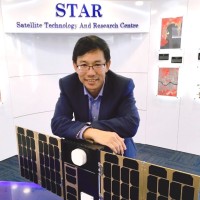 Kay Soon Low合作论文数College of Design and Engineering, National University of Singapore5
 Dang, T.V.合作论文数Interdiscipl. Grad. Sch., Nanyang Technol. Univ.;c;Interdiscipl. Grad. Sch., Nanyang Technol. Univ.5
 Shuo Liu合作论文数Harbin Institute of Technology, Harbin Institute of Technology5
 Peng Liu (刘鹏)合作论文数School of Economics and Management, Beihang University5
 Yun-Chung Chu合作论文数5
 Mark S. K. Lau合作论文数5
 George A. Constantinides合作论文数Early Career Researcher Institute, Imperial College London5Ruoyun Wu合作论文数5
 Yuandong Hu合作论文数4
 Zhe Zhang合作论文数4
 H B Gooi合作论文数School of Electrical and Electronic Engineering, Nanyang Technological University4
 Ju Jiang (江驹)合作论文数College of Automation Engineering, Nanjing University of Aeronautics and Astronautics4
 Ashok Krishnan合作论文数Dept. of Electr. &Electron. Eng., Amrita Univ.;c;Dept. of Electr. & Electron. Eng., Amrita Univ.4
 Chau Yuen合作论文数School of Electrical & Electronic Engineering, Nanyang Technological University4Wei Shao合作论文数4Arthur L Dexter合作论文数4
 King Jet Tseng合作论文数Singapore Institute of Technology4
 Kaiguo Yan合作论文数4Choi Law合作论文数School of Electrical & Electronic Engineering, Nanyang Technological University4
 Vincent John Mooney III (Vincent J. Mooney)合作论文数School of Electrical and Computer Engineering, College of Engineering, Georgia Institute of Technology4
 Kwoh Chee Keong合作论文数College of Computing & Data Science, Nanyang Technological University;School of Computer Science and Engineering, Nanyang Technological University4




