Lane-level localization is critical for autonomous vehicles (AVs). However, complex urban scenarios, particularly tunnels, pose significant challenges to AVs’ localization systems. In this paper, we propose a fusion localization method that integrates multiple mass-production sensors, including Global Navigation Satellite Systems (GNSSs), Inertial Measurement Units (IMUs), cameras, and high-definition (HD) maps. Firstly, we use a novel electronic horizon module to assess GNSS integrity and concurrently load the HD map data surrounding the AVs. This map data are then transformed into a visual space to match the corresponding lane lines captured by the on-board camera using an improved BiSeNet. Consequently, the matched HD map data are used to correct our localization algorithm, which is driven by an extended Kalman filter that integrates multiple sources of information, encompassing a GNSS, IMU, speedometer, camera, and HD maps. Our system is designed with redundancy to handle challenging city tunnel scenarios. To evaluate the proposed system, real-world experiments were conducted on a 36-kilometer city route that includes nine consecutive tunnels, totaling near 13 km and accounting for 35% of the entire route. The experimental results reveal that 99% of lateral localization errors are less than 0.29 m, and 90% of longitudinal localization errors are less than 3.25 m, ensuring reliable lane-level localization for AVs in challenging urban tunnel scenarios.
Accurate, continuous, and reliable positioning is critical to achieving autonomous driving. However, in complex urban canyon environments, the vulnerability of stand-alone sensors and non-line-of-sight (NLOS) caused by high buildings, trees, and elevated structures seriously affect positioning results. To address these challenges, a sky-view image segmentation algorithm based on a fully convolutional network (FCN) is proposed for NLOS detection in global navigation satellite systems (GNSSs). Building upon this, a novel NLOS detection and mitigation algorithm (named S−NDM) uses a tightly coupled GNSS, inertial measurement units (IMUs), and a visual feature system called Sky−GVIO with the aim of achieving continuous and accurate positioning in urban canyon environments. Furthermore, the system combines single-point positioning (SPP) with real-time kinematic (RTK) methodologies to bolster its operational versatility and resilience. In urban canyon environments, the positioning performance of the S−NDM algorithm proposed in this paper is evaluated under different tightly coupled SPP−related and RTK−related models. The results exhibit that the Sky−GVIO system achieves meter-level accuracy under the SPP mode and sub-decimeter precision with RTK positioning, surpassing the performance of GNSS/INS/Vision frameworks devoid of S−NDM. Additionally, the sky-view image dataset, inclusive of training and evaluation subsets, has been made publicly accessible for scholarly exploration.
Sound speed error is the main error source in GNSS-acoustic positioning, which restricts the accuracy of GNSS-acoustic positioning service. Based on the idea of marine space-time frame network, this paper studies the correction method of sound speed error in GNSS-acoustic location service. First, an improved empirical orthogonal function(EOF) method is proposed to construct the sound speed model hierarchically to eliminate the temporal-spatial representation error of sound speed. Then, for the sea area without sound speed profile, the idea of GNSS-acoustic location argument service is proposed based on GNSS tropospheric error processing method. Finally, for the underwater vehicle location argument service, the analysis of the ocean sound speed tomography method is carried out. The above correction idea of sound speed error is verified by using the measured data of 3000 m depth sea area in the South China Sea. The results show that the sound speed field constructed by the improved EOF method can determine the position of seafloor reference station with the decimeter-level accuracy. Based on the seafloor reference stations, the GNSS-acoustic location argument service proposed in this paper can provide decimeter-level accuracy location service for the ship within 3 km. The regional accuracy of the tomographic ocean sound speed profile in the depth interval below the underwater vehicle is better than 3.5 m/s.
Positioning, navigation and timing (PNT) are spatio-temporal location concepts closely related to economic and social activities generated by human beings after long-term perception and cognition of the universe and the relationship with human existence. PNT is also the intelligence that the matter, energy and information on the earth have evolved over hundreds of millions of years to perceive, recognize and position related to space-time, which is called PNT intelligence or space-time intelligence. Intelligence is the sum of the ability to seek benefits and avoid harm that has been inherited and evolved from generation to generation in order to adapt to the environment. It can be called natural intelligence. In this paper, the characteristics of natural intelligence based on the material basis of living body are analyzed, and the characteristics of PNT intelligence of living body are discussed. This paper summarizes the latest achievements, trends and enlightenment of human research on PNT intelligence in living organisms. Among them, interactive intelligence and PNT intelligence played a key role in the evolution of living organisms from lower level to higher level, especially in the evolution of Homo sapiens and the formation of human civilization. With the development and integration of natural intelligence, PNT intelligence and artificial intelligence, the development of PNT technology has entered the stage of intelligent PNT. This paper focuses on the concept, connotation and development trend of intelligent PNT, and discusses the latest progress and influence of intelligent hot topics from two aspects of PNT application and spatio-temporal information infrastructure construction. On this basis, some thoughts and prospects for the development of intelligent PNT are also put forward.
To improve the frequency and accuracy for measuring ocean hurricane intensity, a joint use of cyclone global navigation satellite system (CYGNSS) and soil moisture active and passive (SMAP) satellites data to measure the hurricane intensity was investigated. First, the satellite data characteristics were investigated. introduced. Then, taking Hurricane Florence as an example, a method was proposed by fusing the satellite data to measure the ocean hurricane intensity, including the preprocessing of satellite data, the extraction of high wind speed area using a pixel-level data fusion method, and the measurement of hurricane intensity. Finally, the observation results of ten hurricanes were compared with the highest wind speed measured by the American National Hurricane Center (NHC). The root-mean-square difference, mean absolute error,and correlation coefficient were adopted to analyze the differences among the wind speed measurement results. Results demonstrate that compared with the case of the SMAP satellite data, the proposed method could measure the hurricane intensity at more frequent intervals, and more complete high wind speed area was obtained. The comparison between the hurricane intensity obtained using the proposed method and measured by NHC shows that the mean absolute error ranged between 3.9 and 10.2 m/s, the root-mean-square difference varied between 4.6 and 12.5 m/s, and the correlation coefficient ranged between 0.570 7 and 0.915 2, which confirms the effectiveness of the proposed method in measuring hurricane intensity.Results demonstrate that compared with the case of the SMAP satellite data, the proposed method could measure the hurricane intensity at more frequent intervals, and more complete high wind speed area was obtained. The comparison between the hurricane intensity obtained using the proposed method and measured by NHC shows that the mean absolute error ranged between 3.9 and 10.2 m/s, the root-mean-square difference varied between 4.6 and 12.5 m/s, and the correlation coefficient ranged between 0.570 7 and 0.915 2, which confirms the effectiveness of the proposed method in measuring hurricane intensity.Results demonstrate that compared with the case of the SMAP satellite data, the proposed method could measure the hurricane intensity at more frequent intervals, and more complete high wind speed area was obtained. The comparison between the hurricane intensity obtained using the proposed method and measured by NHC shows that the mean absolute error ranged between 3.9 and 10.2 m/s, the root-mean-square difference varied between 4.6 and 12.5 m/s, and the correlation coefficient ranged between 0.570 7 and 0.915 2, which confirms the effectiveness of the proposed method in measuring hurricane intensity.The comparison between the hurricane intensity obtained using the proposed method and measured by NHC shows that the mean absolute error ranged between 3.9 and 10.2 m/s, the root-mean-square difference varied between 4.6 and 12.5 m/s, and the correlation coefficient ranged between 0.570 7 and 0.915 2, which confirms the effectiveness of the proposed method in measuring hurricane intensity.The comparison between the hurricane intensity obtained using the proposed method and measured by NHC shows that the mean absolute error ranged between 3.9 and 10.2 m/s, the root-mean-square difference varied between 4.6 and 12.5 m/s, and the correlation coefficient ranged between 0.570 7 and 0.915 2, which confirms the effectiveness of the proposed method in measuring hurricane intensity.
为提高海洋飓风强度的观测频次和测量准确度,对综合利用热带气旋全球导航卫星系统(CYGNSS)和土壤湿度主动-被动探测(SMAP)卫星数据监测飓风强度进行了研究.首先,介绍了卫星数据特征;然后,以佛罗伦萨飓风为例,提出了融合这两种卫星数据监测海洋飓风强度的方法,其中包括卫星数据预处理、基于像素级影像融合方法的高风速区域提取和飓风强度测量;最后,将融合两种卫星数据测得的10场飓风的强度与美国国家飓风中心(NHC)提供的飓风最大风速值进行对比分析,并采用平均绝对误差、均方根偏差和相关系数3个指标评价这两种风速测量结果之间的差异.结果表明:与仅利用SMAP卫星数据相比,本文方法能以更高的频次监测飓风强度,可获得更加完整的飓风高风速区域;与美国国家飓风中心提供的飓风最大风速值相比,本文方法监测飓风强度结果的平均绝对误差变动范围为3.9~10.2 m/s,均方根偏差变动范围为4.6~12.5 m/s,相关系数变动范围为0.5707~0.9152,验证了提出的海洋飓风强度监测方法的有效性.
2020年初暴发的新型冠状病毒肺炎(coronavirus disease 2019,COVID-19)疫情给全球人民生命安全和经济发展带来了严重影响。位置服务以庞大的地理空间信息数据库为依托,能向服务对象提供与地理信息相关的便捷、实时、精准的综合性服务,可很好地运用于紧急救灾、大流量人员追踪、复杂环境下的现场人员管控等事件中。事实证明,位置服务的优势特性在2020年春中国COVID-19疫情防控中起到了非常重要的作用。从北斗车联网平台、基于泛在定位的基础服务、时空大数据分析与疫情防控、智能导航机器人参与抗疫等多个方面阐述了中国COVID-19疫情下的位置服务应用。通过对这些应用及技术手段的分析总结,深化位置服务技术的内涵,可以为今后重大公共卫生事件的应急处置提供解决方案。
Communication, positioning, navigation, and decision-making abilities have evolved into Positioning, Navigation, and Timing (PNT) intelligence during the long process of human migration and hence promoted human evolution. This article defines intelligence and smartness from the perspective of biological intelligence. New requirements as a result of the development of communication, navigation, time service, and decision making are identified in this study. The article points out that there are many radio PNT service methods, such as 5G, the new-generation high-speed communication networks and the low-latency and ubiquitous mobile communication networks as well as Global Navigation Satellite System (GNSS), but the integrated application is especially important in providing technical support for the adjustment and control of the physical world by intelligent sensing, cognition, decision-making, and precise coordination. The fusion of 5G and GNSS [including BeiDou Navigation Satellite System (BDS)] information with the corresponding equipment can be embedded into a machine to make it intelligent. Furthermore, the fused information of 5G and GNSS together with the environment information may extend human perception and physical world control ability in terms of time and space scale. It will help to develop critical information infrastructure in the age of intelligence, which will also extend the definition of artificial intelligence. Additionally, the “5G + BDS/GNSS” fusion path is analyzed explicitly herein in terms of realization methods, information processing, and new application services. On the whole, the application of “5G + BDS/GNSS + satellite-based communication” as a critical infrastructure for land, sea, air, space and network spatiotemporal control rights is proposed.
Precise point positioning (PPP) has been suffering from slow convergences to ambiguity-fixed solutions. It is expected that this situation can be relieved or even resolved using triple-frequency GNSS data. We therefore attempt an approach where uncombined triple-frequency GPS/BeiDou/Galileo/QZSS (Quasi-zenith satellite system) data are injected into PPP, whereas their raw ambiguities are mapped into the extra-wide-lane, wide-lane and narrow-lane combinations for integer-cycle resolution at a single station (i.e., PPP-AR). Once both extra-wide-lane and wide-lane ambiguities are fixed to integers, the resulting unambiguous (extra-)wide-lane carrier-phase can usually outweigh the raw pseudorange to improve the convergence of positions and narrow-lane ambiguities. We used 31 days of triple-frequency multi-GNSS data from 76 stations over the Asia Oceania regions and divided them into hourly pieces for real-time PPP-AR. We found that the positioning accuracy for the first 10 min of epochs could be improved by about 50% from 0.23, 0.18 and 0.43 m to 0.12, 0.08 and 0.27 m for the east, north and up components, respectively, once wide-lane ambiguity fixing was achieved for triple-frequency PPP. Consequently, 48% of PPP solutions could be initialized successfully with narrow-lane ambiguities resolved within 2 min, in contrast to only 26% for dual-frequency PPP. On average, 6 min of epochs were required to achieve triple-frequency PPP-AR, whereas 9 min for its dual-frequency counterpart. Of particular note, the more satellites contribute to triple-frequency PPP-AR, the faster the initializations will be; as a typical example, the mean initialization time declined to 3 min in case of 20–21 satellites. We therefore envision that only a few minutes of epochs will suffice to reliably initialize real-time PPP once all GPS, BeiDou, Galileo and QZSS constellations emitting triple-frequency signals are complete in the near future.
The definition and connotation of ubiquitous surveying and mapping are given at first. The differences from the traditional surveying and mapping are analyzed and presented. Since the Internet enables convenient interaction of information between people, the most significant progress of ubiquitous mapping in the Internet age is to meet diverse demands about relations between human beings and the society, as well as human beings and the environment, which means that human beings have become the mapping target. At the same time, ubiquitous mapping also focuses on the dynamic perception of environmental changes, the perception and cognition and corresponding services of the relationship between human beings and the environment. This paper indicates that the Internet cannot meet the demands of coordinated perception to physical world or the coordinated management neither the control of remote wide area due to the virtuality of its position and the too low network time standard. Therefore, the Internet and the Internet of Things shall advance towards the ubiquitous network with the capability of perceiving accurate space-time position. This paper discuss that the ubiquitous network is a perceptive network with space-time characteristics of “Any Time and Any Where” with the evolution of the Internet and the Internet of Things, and is evolving towards “Any Thing and Any Service” with the expansion of the intelligent demands. Currently, only the global satellite navigation system including Beidou, namely GNSS technology, is able to provide the ubiquitous network with space-time position perception and management and control capability in wide area and the global scale. Supported by ubiquitous network, ubiquitous mapping is developing with the characteristics of real-time and accurate space-time perception and control, to realize the perception, cognition, and regulation of land, sea and air network integration, indoor and outdoor integration, and the integration of human beings into physical world and virtual network world as well. As a result, the ubiquitous network will also be the key information infrastructure in the intelligent age. To understand the demands of ubiquitous mapping in the intelligent age, this paper combs through the definition of intelligence, wisdom and artificial intelligence from the perspective of natural intelligence and space-time position. The fundamental, key and coordinated role of ubiquitous mapping is discussed based on the four hot research directions of the new-generation artificial intelligence, including the cross-border integration, human-machine coordination, open collective intelligence and autonomous control, and its application to military, engineering, real-time and high-precision mapping as well as the earthquake early warning. At last, this paper sheds light on the vision of future application trend of ubiquitous mapping to new fields in the intelligent age, such as ubiquitous mapping of the virtual space, construction of digital twin virtual human, and “space and time sovereignty” to national security.
UAV marine aeromagnetic survey has the characteristics of simple operation and high efficiency. Unmanned Helicopter Marine magnetic measurements require accurate position and elevation of magnetic data. Based on this, the application of the airborne Beidou navigation and positioning system in the unmanned helicopter marine aviation magnetic force measurement is discussed. According to the actual working environment of the unmanned helicopter marine aviation magnetic force measurement and the requirement for positioning accuracy, the airborne single-frequency GPS positioning system is designed, and simulation tests and field tests are conducted. The GPS data is processed by using commercial software. The test results show that the airborne GPS positioning system meets the positioning accuracy requirements and can be applied to the unmanned helicopter marine aviation magnetic force measurement.
Internet Plus Intelligent Transportation can promote data and information sharing among traffic facilities during traffic operation. It can also optimize the operation modes of transportation organizations, increase economic and social values, and comprehensively satisfy people’s mobility needs. To actively meet the new development needs, this study clarifies the current development and problems of the Internet Plus Intelligent Transportation model, summarizes its integration trend with other industries and fields, and expounds the architecture of Internet Plus Intelligent Transportation. It is proposed that a travel chain should be created that is ubiquitous, flexible, seamless, trusted, and intelligent, based on the intelligent Transportation as a Service concept (iTaaS) and new critical infrastructures in China with international competitiveness such as the BeiDou satellite navigation system and 5G technology. Moreover, it is also necessary to strengthen the independent innovation and integration of key technologies, establish an Internet of Vehicles with intelligent and precise control while developing intelligent connected vehicles, cultivate an industrial ecology for the Internet of Vehicles, and strengthen policy guarantees.
全球时空基准网是获取地球时空信息的基础设施,它包括地基时空基准网、空间时空基准网和海洋时空基准网3个部分,其中海洋时空基准网的建设尚属起步阶段.先就海洋时空基准网的概念及内涵进行了分析,并从海洋定位导航基准、高精度海洋水平及垂直定位基准等角度介绍并分析了其发展现状及未来趋势.海洋时空基准网的主要构建方式是综合运用GNSS(Global Navigation Satellite System)卫星定位、水下声学定位以及压力传感器等技术将全球统一的时空基准传递到海洋表层、内部和底部.它的建设在我国还属于空白,故需结合国情、配合国家战略规划大力推进;指出当前全球和各国海洋环境监测的需求普遍甚旺,而现有海洋环境监测网多为局域网络,未与时空基准网融合,故海洋环境缓变或快变的时空位置不清楚或不精确,因此,将海洋时空基准网与海洋环境监测网融合起来建设,实现效益、效率和功能的互补提升,显得尤为重要和紧迫.在此基础上还认为,融合后的海洋时空基准网与环境监测网加上通信和数据交换功能,以实现海洋环境精准监测并进行海洋信息传输的目的,进而逐渐推进以形成具有时空位置属性的全球性海洋环境感知认知网络,即为海洋物联网.进一步探讨设想:将海洋物联网与海底通信光缆链接起来,同时通过海面浮标观测舱与通信卫星链接起来,就构成了有时空位置属性的海洋互联网.最后认为,我国应加快建立以中国周边海域为主的精密动态海洋时空基准和环境监测网,并通过国际合作开展全球性海洋时空基准与环境监测网的布设.
"极地遥感"是极地研究领域的一门重要课程.通过该课程的教学和实践,学生能够全面了解极地,了解极地遥感研究的内容和原理,掌握利用遥感手段解决极地问题的方法.本文通过介绍极地遥感课程设置背景,探讨课程的教学内容、教学方式和考核方式,为"极地遥感"课程教学提供具有实践性的方案.
As a key infrastructure to realize autonomous driving, autonomous driving map is crucial to the commercial development of the autonomous driving field in China. Currently, constrained by laws and regulations related to ground mapping, map application, and supervision, the commercialization of autonomous driving maps in China is lagging behind. This paper focuses on the main policy and regulatory issues faced in the development, application, and management of autonomous driving maps in China, i.e., encryption of autonomous driving maps, limitations on geographic information expression, qualifications for geographic information collection and the process for map review, accident liability and insurance issues, as well as autonomous driving map related test specifications and test scenario issues. Meanwhile, combining the development trends of domestic and international autonomous driving fields, this paper proposes four suggestions for accelerating the development and commercialization of autonomous driving vehicles in China: formulating an autonomous driving map management mode, allowing pilot application and orderly opening of autonomous driving maps, appropriately opening up corporate authorization and optimizing the review process, as well as establishing a national-level autonomous driving map platform.
This paper studies the Ultra High Voltage (UHV) power tower target interferometry in TerraSAR Spotlight (TSX-SL) mode SAR images. Based on the 3D point cloud data acquired by high-precision Lidar, the tower target geometric projection and scattering mechanism are analyzed. In the UHV tower cross area of the SAR interferometry, the coherence are stable and the phase are smooth and consistency. However, the accuracy of the tower elevation derived by the phase is not so accurate, which means the phase noise are little bit high. Theoretically, the special designed tower cross's scattering mechanism are dihedral reflection. The test results show that the 10cm thick ice on the tower cross surface damaged the dihedral reflection. The radar scattering signal intensity is decreased nearly 8dB in this condition. This paper testified that the variation of the radar scattering intensity on the tower cross can be used to quantitatively evaluate towers' icing state.
微电子机械系统惯性测量单元(MEMS-IMU)因其精度低且温度敏感性大,以及传统安装方式通常存在航向角不可观等原因,在车载导航和轮式机器人应用场景中表现为定位误差迅速累积.为解决上述问题,设计了一种将MEMS-IMU安装在载体车轮中心的导航方案.利用MEMS-IMU与车轮一起旋转的运动特性,提取出运动速度信息,并结合运动约束构造了三维速度观测信息,从而改善最终的组合导航性能.该方案从安装方式和算法设计层面取代了对里程计传感器的依赖.基于轮式机器人的实测结果表明,该方案的平面定位误差(均方根值)相比于传统安装MEMS-IMU的导航方案降低了58.53%,相比于传统MEMS-IMU和里程计组合导航方案降低了29.67%.
北斗二代系统伪距码中存在与高度角相关的系统性偏差,该偏差会影响高精度的数据处理.基于Melbourne-Wübbena(MW)组合,分别利用现有的伪距码偏差改正模型和实测基线的双差宽巷模糊度残差,分析了伪距码偏差对基线解算的影响.理论分析表明,随着基线长度的增加,伪距码偏差对MW组合确定双差宽巷模糊度的影响越来越大,对300 km基线的影响可达0.36周.实际算例表明,无论基线长短,地球同步轨道(geostationary earth orbit,GEO)卫星的双差宽巷模糊度残差中始终存在偏差;而对于倾斜地球同步轨道(inclined geostationary orbit,IGSO)和中轨(medium earth orbit,MEO)卫星而言,当基线小于300 km时,双差基本可以消除伪距码偏差,其双差宽巷模糊度固定率基本和GPS一致,但当基线超过300 km时,部分卫星的双差宽巷模糊度残差就会存在明显偏差,其双差宽巷模糊度固定率也较低,此时需考虑伪距码偏差的影响.
The sparks of an intelligent revolution,triggered by artificial intelligence,are spreading to all walks of life.The challenges and opportunities for methods,technology,as well as industrial and business models of mapping,surveying,and location based services,are a question that has to be considered in depth.The development paths and trends in artificial intelligence,are discussed for an understanding of the characteristics of the new generation of artificial intelligence.The opportunities and challenges brought by the coming age of intelligence are analyzed.Focusing on the field of mapping,surveying and location based services,this paper argues that this industry will not disappear but has a new impetus towards transformation.The possible paths for transformation are discussed.As an academic discipline,it will not expand,but fuse and cross disciplinary borders.As a career,it will make blue collar work an evaporating endeavor,while a number of makers and thinkers will become leading figures.The mapping,surveying,and location based service industry needs to fully tap their own advantages,with systemic thinking,space-time thinking and creative thinking as the key to open the door of the age of intelligence.Thereby,an overall transformation for mapping,surveying and location based service industry to be green,intelligent,pervasive development can be achieved.
 Jingnan Liu (刘经南)合作论文数School of Geodesy and Geomatics, Wuhan University14
 Chi Guo (郭迟)合作论文数School of Robotics, Wuhan University;Hubet Luojia Laboratory, Wuhan University6
 Shiwei Wang合作论文数Department of Space Physics, School of Electronic Information, Wuhan University, Wuhan 430072, China2
 WenFei Guo (郭文飞)合作论文数2
 GuanXu Chen (陈冠旭)合作论文数2
 Sam Shi (石书祝)合作论文数School of Remote Sensing and Information Engineering, Wuhan University2
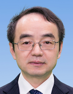 Yiwen Liang (梁意文)合作论文数College Information Science and Engineering, Wuchang Shouyi University2
 Xiaoji Niu (牛小骥)合作论文数Wuhan University2
 Jingsong Cui (崔竞松)合作论文数School of Cyber Science and Engineering, Wuhan University2
 Jianhu Zhao (赵建虎)合作论文数School of Geodesy and Geomatics, Wuhan University2Jingrong Wang合作论文数1
 Menghao Li合作论文数1Jianhui Cui (崔健慧)合作论文数1
 Zhang Pan合作论文数1
 Mengyuan Wang合作论文数1Zhan Jiao合作论文数1Lulu Chen合作论文数1Hongbin Sun (孙宏彬)合作论文数1
 Yarong Luo (罗亚荣)合作论文数School of Robotics, Wuhan University1
 Peng Jiang合作论文数Wuhan University1
 Mingxing Shen合作论文数1Wenwei Zuo (左文炜)合作论文数1Yang Dong合作论文数1
 Yan Liu合作论文数1Nan Wang合作论文数1Qian LIU (刘前)合作论文数1Yuan Fang (方媛)合作论文数1
 Yanxiong Liu (刘艳雄)合作论文数School of Automotive Engineering, Wuhan University of Technology1
 Tao Li (李陶)合作论文数武汉大学卫星导航定位技术研究中心1Wang, Feng合作论文数1
 Chenlong Deng (邓辰龙)合作论文数School of Navigation, Wuhan University of Technology1
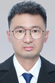 Tao Lu (陶璐)合作论文数School of Resource and Environment Sciences, Wuhan University;GOYUMETA Co., Ltd1
 You Li (李由)合作论文数State Key Laboratory of Information Engineering in Surveying, Mapping and Remote Sensing, Wuhan University1
 Xuewen Xia合作论文数1
 Shanshan Yu合作论文数1
 Yuanxiang Li (李元香)合作论文数School of Computer Science, Wuhan University1
 Shoujian Zhang (张守建)合作论文数School of Geodesy and Geomatics, Wuhan University;MISSION Lab, Wuhan University1
 Bo Xu (徐波)合作论文数School of Materials Science and Engineering, Yanshan University1
 Rongxin Fang (方荣新)合作论文数GNSS Research Center, Wuhan University1
 Tingting Liu (刘婷婷)合作论文数School of Sociology, Wuhan University1
 Jiang Guo (郭江)合作论文数School of Power and Mechanical Engineering, Wuhan University1Zhendong Gao (高振东)合作论文数1
 Chunxia Zhou (周春霞)合作论文数Chinese Antarctic Center of Surveying and Mapping, Wuhan University1Chao Yang合作论文数1
 Hongbin Dong (董红斌)合作论文数College of Computer Science and Technology, Harbin Engineering University1Wenjun Deng合作论文数1
 Jianghui Geng (耿江辉)合作论文数Innovation Academy for Precision Measurement Science and Technology, Chinese Academy of Sciences1
 Hongkuan Yang (杨洪宽)合作论文数Tongji Hospital, Tongji Medical College of Huazhong University of Science and Technology1
 Xiaolin Meng (孟晓林)合作论文数The Sino-UK Geospatial Engineering Centre;Beijing University of Technology1




