This study presents the development and parametrization of an individual-based mechanistic model for Laminaria hyperborea that numerically simulates carbon and nitrogen fluxes from physiological principles. While similar process-based approaches have been previously applied to other kelp species, such as Saccharina latissima, this work represents the first mechanistic model explicitly tailored for L. hyperborea.,The model integrates carbon and nitrogen assimilation pathways, reserve dynamics, and maintenance costs while accounting for environmental drivers such as light, temperature, and nutrient availability. The model was calibrated using empirical growth data from Arisaig, Scotland, and validated against independent data from Normandy, France. Simulations captured depth-dependent growth patterns, seasonal reserve fluctuations, and exudation dynamics, aligning with observed ecological behaviours such as light limitation and temperature-mediated metabolic costs.,Results highlight the importance of light availability in determining growth rates and carbon exudation, while nitrogen dynamics remained primarily influenced by environmental nitrate concentrations. The model successfully reproduced growth curves and internal C:N stoichiometric variations, demonstrating its ability to simulate individual kelp responses to environmental variability. However, discrepancies in younger plant growth suggest the need to incorporate population-level competition effects in future iterations.,This study advances kelp modelling by providing a process-based tool to investigate L. hyperborea physiology under changing environmental conditions, with potential applications in conservation, aquaculture, and climate change impact assessments.
Understanding marine ecosystem responses to climate change is crucial for developing ecosystem-based adaptation strategies. We applied the StrathE2E model to assess climate change impacts on the food web of the St Helena marine protected area (SHMPA). The model was parameterized using two Earth System models (GFDL, CNRM) and two future climate scenarios (SSP1-2.6, SSP3-7.0) from the NEMO-ERSEM model for a baseline period (2010-2019) and future decades up to the 2060s. The SHMPA will become warmer and more oligotrophic, leading to declines in primary producers, fish, and top predators. Despite quantified uncertainty, the direction of change was consistent, with larger declines in CNRM than GFDL. Net primary production is highly sensitive to upwelling and downwelling, with greater stratification under SSP1-2.6 than SSP3-7.0, causing stronger productivity losses. This study presents the first food web model with ecosystem-level assessment of climate change on SHMPA. The projections suggest potential for profound ecosystem-wide transformations posing management challenges.
Climate change and fisheries jointly shape the resilience of the Barents Sea marine ecosystem, yet the recovery of key fish populations to climate and anthropogenic disturbances requires further investigation. This study examines how fishing pressure and climate change, driven by the NEMO-MEDUSA Earth system model, influence the recovery times of Demersal and Planktivorous fish in the Barents Sea. We used the StrathE2EPolar end-to-end ecosystem model to simulate transient dynamics under increasing fishing pressure scenarios, and quantified recovery times for Demersal, Planktivorous, and ecosystem-wide groups relative to a shifting unfished baseline. Recovery times increased with both fishing intensity and climate change, by as much as 18 years for Demersal fish and 54 years for Planktivorous fish across all fishing scenarios. At the ecosystem level, recovery was constrained by the slow rebound of top predators, many of which experienced biomass collapse under climate change, preventing recovery to a shifting baseline. Our results suggest that fishing pressure in tandem with climate change substantially reduces ecosystem resilience, highlighting the importance of sustainable harvest strategies in a changing climate.
Declining body sizes are prevalent in marine fish. While these declines have been suggested to be a response to increasing temperatures, the evidence is mixed and the underlying causes of observed declines often unknown. Here, we explore drivers of spatio-temporal patterns in size in lesser sandeel (Ammodytes marinus), an important prey for seabirds and marine mammals, focusing on ongoing size declines in the North Sea. We combine experimental and field data with ecological theory to develop a biologically realistic dynamic energy budget model that explicitly models feeding, metabolism and energy allocation to produce daily predictions of size during the juvenile growth season from 1979 to 2016. When forced with daily temperature estimates and zooplankton data from the Continuous Plankton Recorder, model predictions reproduce observed spatio-temporal patterns in size well. Our results suggest that the most plausible driver of observed size declines in the western North Sea is declining prey densities. In contrast, the direct effect of temperature on sandeel size is small, but interacts with local prey availability so that the effect varies in both size and direction over space. Our results thus suggest that to understand effects of climate change on fish size we need to account for both direct physiological effects and changes in resource availability. Finally, we use the model to show that early-life phenology and turbidity (via its impact on intake rates in the visually foraging sandeel) may also impact sandeel size, highlighting the importance of broadening our view of potential drivers of size declines. ### Competing Interest Statement The authors have declared no competing interest.
Climate change is causing sea-ice to retreat from Arctic ecosystems. Loss of ice impacts the ecosystem in many ways, reducing habitat area for specialist species like polar bears, releasing freshwater and nutrients, and increasing light penetration into the water column. To explore the interaction of these effects, we implemented a Northeast Greenland continental shelf parameterisation of the end-to-end ecosystem model StrathE2E. We used model output from the NEMO-MEDUSA ocean-biogeochemistry model under Representative Concentration Pathway 8.5 as driving data, which suggests the northeast Greenland continental shelf will become seasonally ice-free by 2050. We simulated half a century of climate change by running the model system to a set of steady states for each decade from the 2010s to the 2050s. Our simulations show sea-ice retreat from the northeast Greenland continental shelf boosts the productivity of the marine food web. Total living mass increases by over 25%, with proportionally larger increases for higher trophic levels. The exception to this is a 66% reduction in maritime mammal mass. Additional network indices reveal that the ecosystem becomes more mature, with future diets more specialized and a lengthening of the food web. Our model provides long-term strategic insight for the management of the northeast Greenland continental shelf, allowing for the quantitative evaluation of conservation goals and the scale of prospective fisheries. Our results present a mixed picture for the future of the Arctic, with growing populations for fish and charismatic megafauna like cetaceans accompanied by the loss of endemic biodiversity such as polar bears.
Climate change is transforming marine ecosystems, opening new fishing possibilities for large-scale trawling vessels in the Arctic. This study investigates the potential for new fishing grounds to emerge in West Greenland. We employed a maximum entropy model to predict fishing suitability based on climatological and time-invariant variables alongside public fishing vessel data. The model, validated with high accuracy, identified maximum depth, ice thickness and ice concentration as the most important predictors of fishing suitability. Results indicate a 6.2% increase in whole domain suitable fishing grounds from the 2010s to the 2040s, and a 11.4% increase from the 2010s to the 2090s. This change is driven by decreasing ice coverage, allowing extended access to the productive shelf edge. Increased fishing suitability could enhance fishing opportunities leading to increased economic benefits. However, the prolonged fishing season also raises concerns about overexploitation, ecological sustainability and sediment dispersion. Earlier access would enable trawling over carbon-rich sediments for extended periods, leading to a resuspension of sediment-bound carbon. Our findings highlight the need for adaptive management strategies to balance economic gains with the protection of marine ecosystems in the face of ongoing climate changes.
Thousands of offshore oil and gas platforms have been installed throughout the world’s oceans and more structures are being installed as part of the transition to renewable energy. These structures increase the availability of ecological niches by providing hard substrate in midwater and complex 3D habitat on the seafloor. This can lead to ‘hotspots’ of biodiversity, or increased densities of flora and fauna, which potentially spill over into the local area. However, the distances over which these higher densities extend (the ‘range of influence’) can be highly variable. Fish aggregate at such structures, but the range of influence and any implications for wider fish populations, are unclear. We investigated the relationship between fish and platform areal densities using high resolution fisheries acoustic data. Data were collected in the waters surrounding the vessel exclusions zones around 16 oil and gas platforms in the North Sea, and throughout the wider area. We estimated densities of schooling fish using echo-integration, and densities of non-schooling fish using echo-counting. At 10 platforms, non-schooling fish densities were elevated near the platform relative to background levels in the equivalent wider area. The range of influence, defined here as the range to which fish densities were elevated above background, varied from 0.8 to 23 km. In areas of high platform density, fish schools were encountered more often, and non-schooling fish densities were higher, when controlling for other sources of environmental variation. This is the first time such long-range effects have been identified; previously, ranges of influence have been reported in the order of just 10s-100s of metres. These findings suggest that the environmental impact of these structures may extend further than previously thought, which may be relevant in the context of upcoming management decisions around the decommissioning of these structures.
Thousands of offshore oil and gas platforms have been installed worldwide and are known to act as artificial reefs. Many platforms are nearing the end of their operational lives and will soon require decommissioning, but uncertainty remains about the impacts of these structures, and their removal, on the environment. Fish aggregate at platforms, but little is known about the extent of these effects in the North Sea and the causes of variability in these associations. Here, an uncrewed surface vessel (USV) was used to collect fisheries acoustic data on distributions of schooling and non-schooling fish around six oil platforms, collecting data within tens of metres of four of the surveyed platforms. In areas with more platforms, more non-schooling fish were found, and the probability of detecting fish schools was higher. Interplatform variability was found in trends in non-schooling fish density with increasing distance from platform, but the relationship was found to be strongest and most negative at the larger platforms. These findings may influence future management decisions around the decommissioning of these platforms, particularly if some structure is to be left in place to maximize the potential benefits associated with these artificial reef effects.
Abstract Seabed sediment maps underpin a variety of marine research endeavours. Seabed mapping data are available for many regions, but these usually provide discrete classifications which obscure underlying continuous properties of the sediments. Other areas are poorly surveyed, e.g., polar regions which are inaccessible due to ice cover. Here, we focus on the inaccessible North East Greenland shelf for which there are almost no seabed sediment data. We trained a random forest model to predict sediment classes from an existing map of the well‐surveyed neighbouring Barents Sea, using data on bathymetry, currents and waves. We then used our model to predict the unknown sediment distributions off East Greenland. In the process, we generated some new spatial data on previously un‐mapped properties of the Barents Sea, such as mean grain size, organic carbon and nitrogen content, porosity and permeability. The maps of both regions are available to support future research activities in the Arctic, e.g., the parameterization of benthic biogeochemistry in ecosystem models, or mapping species distributions.
Ecosystem-based management is mandated by international legislation, including the Marine Strategy Framework Directive (MSFD) in the EU. This introduces a requirement for marine environments to achieve “Good Environmental Status” or GES, implying that the ecosystem is in a healthy and biodiverse state which does not limit the management options of future generations. Indicators of GES typically refer to the current or past state; however, an alternative approach that defines GES in terms of being able to recover to the appropriate reference unperturbed state within 30 years if human activities cease has been suggested. In this study we evaluate this “longest recovery timescales” (LRT) approach using the StrathE2E2 “big picture” model, an end-to-end ecosystem model designed to evaluate both top-down and bottom-up effects at an ecosystem level. We ask whether the approach is enough to prevent severe depletion as well as ensuring recovery at some future time. We also ask whether implementation is practical given uncertainties in defining appropriate baselines for recovery, defining what recovery looks like relative to this baseline, and taking account of natural variability. We find that the main issues with implementation of LRT are a) defining the appropriate baseline for recovery in a changing environment, and b) ensuring that there is stakeholder acceptance of any recommended actions in the event that they differ substantially from current policy. Subject to these two issues, we conclude that the LRT method is a valuable addition to management in support of achieving GES alongside existing methods that focus on current or near-future states.
Most (75%–80%) sebaceous carcinomas (SC) of the eyelid arise from the meibomian glands of the posterior lamella. The upper eyelid is more commonly affected than the lower eyelid (62.6%–32.8%). It is a locally aggressive malignancy with potential for locoregional and distant metastasis. SC can masquerade as other benign tumors, leading to diagnostic and treatment delays and subsequent higher rates of recurrence, metastasis, morbidity, and mortality.
Basal cell carcinoma (BCC) is the most common cancer worldwide. Early identification can be made clinically, aided by dermoscopy, in addition to newer imaging technologies such as reflectance confocal microscopy. BCC most commonly demonstrates an indolent course responsive to local destruction or surgical removal. Mohs micrographic surgery is the most effective treatment, especially for high-risk tumors. Low-risk tumors may be amendable to nonsurgical treatment including topical and destructive therapies. Radiation therapy can be used in patients not amendable to surgery. Advanced and metastatic BCC can be treated with Hedgehog pathway inhibitors and other systemic agents with varying responses.
Projecting the consequences of warming and sea-ice loss for Arctic marine food web and fisheries is challenging due to the intricate relationships between biology and ice. We used StrathE2EPolar, an end-to-end (microbes-to-megafauna) food web model incorporating ice-dependencies to simulate climate-fisheries interactions in the Barents Sea. The model was driven by output from the NEMO-MEDUSA earth system model, assuming RCP 8.5 atmospheric forcing. The Barents Sea was projected to be > 95% ice-free all year-round by the 2040s compared to > 50% in the 2010s, and approximately 2 °C warmer. Fisheries management reference points (FMSY and BMSY) for demersal fish (cod, haddock) were projected to increase by around 6%, indicating higher productivity. However, planktivorous fish (capelin, herring) reference points were projected to decrease by 15%, and upper trophic levels (birds, mammals) were strongly sensitive to planktivorous fish harvesting. The results indicate difficult trade-offs ahead, between harvesting and conservation of ecosystem structure and function.
Abstract For over 50 years, the conceptualisation of low-nutrient oligotrophic systems having longer food chains and thus lower energy transfer to fish than their high-nutrient eutrophic counterparts1 has achieved the status of an ecological paradigm. However, recent global assessments indicate global fish biomass could be much higher than previously thought2–4, suggesting that our traditional understanding of food webs may need to be revisited. Here, we challenge the classical paradigm by exploring the role of zooplankton in food webs across the world’s oceans. Using observed zooplankton size spectra, and output from a size-spectrum model that resolves nine zooplankton groups, we conclude that food chains in oligotrophic (low-nutrient) and eutrophic (high-nutrient) systems have similar lengths. We offer a compelling hypothesis to explain this emergent pattern: self-organisation of zooplankton groups across the global productivity gradient regulates food chain length. We find that in oligotrophic systems the increased carnivory and longer food chains are offset by relatively large gelatinous filter feeders eating the dominant small phytoplankton, resulting in shorter-than-expected food chains, but decreasing food quality for fish. Our findings highlight the pivotal role zooplankton play in regulating energy transfer. Better resolution of zooplankton groups, their feeding relationships and carbon content in models will increase our ability to estimate current global fish biomass 5, project future fish biomass under climate change6–8, and provide more-robust forecasts of nutrient9 and carbon cycling10.
Achieving Good Environmental Status (GES) requires managing ecosystems subject to a variety of pressures such as climate change, eutrophication, and fishing. However, ecosystem models are generally much better at representing top-down impacts from fishing than bottom-up impacts due to warming or changes in nutrient loading. Bottom-up processes often have to be parameterised with little data or worse still taken as a system input rather than being represented explicitly. In this study we use an end-to-end ecosystem model (StrathE2E2) for the North Sea with 18 broad functional groups, five resource pools, and representations of feeding, metabolism, reproduction, active migrations, advection, and mixing. Environmental driving data include temperature, irradiance, hydrodynamics, and nutrient inputs from rivers, atmosphere, and ocean boundaries, so the model is designed to evaluate rigorously top-down and bottom-up impacts and is ideal for looking at possible changes in energy flows and “big picture” ecosystem function. In this study we considered the impacts of warming (2 and 4°C) and various levels of fishing, by demersal and pelagic fleets, on the structure and function of the foodweb. A key aim is to demonstrate whether monitoring of broad ecosystem groups could assist in deciding whether GES was being achieved. We found that warming raised primary productivity and increased the size (total biomass) of the ecosystem. Warming raised metabolic demands on omnivorous zooplankton and reduced their abundance, thus favouring benthivorous and piscivorous demersal fish at the expense of planktivorous pelagic fish but otherwise had modest effects on energy pathways and top predators, whereas changes in fishing patterns could materially alter foodweb function and the relative outcomes for top predators. We suggest that GES should be defined in terms of an unfished state and that abundances of broad groupings and the balance between them can help to assess whether indicator outcomes were consistent with GES. Our findings underwrite the need for an ecosystem approach for the management of human activities supported by relevant monitoring. We also highlight the need to improve our basic understanding of bottom-up processes, improve their representation within models, and ensure that our ecosystem models can capture growth limitation by nitrogen and other elements, and not just food/energy uptake.
Viruses play critical roles in the dynamics of microbial communities. Lytic viruses, for example, kill significant fractions of autotrophic and heterotrophic microbes daily. The dynamic interplay between viruses and microbes results from an overlap of physiological, ecological, and evolutionary responses: environmental changes trigger host physiological changes, affecting the ecological interactions of host and virus and, ultimately, the evolutionary pressures influencing the two populations. Recent theoretical work studied how the dependence of viral traits on host physiology (viral plasticity) affects the evolutionarily stable host cell size and viral infection time emerging from coevolution. Here, we broaden the scope of the framework to consider any coevolutionary outcome, including potential evolutionary collapses of the system. We used the case study of Escherichia coli and T-like viruses under chemostat conditions, but the framework can be adapted to any microbe-virus system. Oligotrophic conditions led to smaller, lower-quality but more abundant hosts, and infections that were longer but produced a reduced viral offspring. Conversely, eutrophic conditions resulted in fewer but larger higher-quality hosts, and shorter but more productive infections. The virus influenced host evolution decreasing host size more noticeably for low than for high dilution rates, and for high than for low nutrient input concentration. For low dilution rates, the emergent infection time minimized host need/use, but higher dilution led to an opportunistic strategy that shortened the duration of infections. System collapses driven by evolution resulted from host failure to adapt quickly enough to the evolving virus. Our results contribute to understanding the eco-evolutionary dynamics of microbes and virus, and to improving the predictability of current models for host-virus interactions. The large quantitative and qualitative differences observed with respect to a classic description (in which viral traits are assumed to be constant) highlights the importance of including viral plasticity in theories describing short- and long-term host-virus dynamics.
The phenology, distribution, and size composition of plankton communities are changing rapidly in response to warming. This may lead to shifts in the prey fields of planktivorous fish, which play a key role in transferring energy up marine food chains. Here, we use 60 + years of Continuous Plankton Recorder data to explore temporal trends in key taxa and community traits in the prey field of planktivorous lesser sandeels (Ammodytes marinus) in the North Sea, the Faroes and southern Iceland. We found marked spatial variation in the prey field, with Calanus copepods generally being much more common in the northern part of the study area. In the western North Sea, the estimated amount of available energy in the prey field has decreased by more than 50% since the 1960s. This decrease was accompanied by declining abundances of small copepods, and shifts in the timing of peak annual prey abundances. Further, the estimated average prey community body size has increased in several of the locations considered. Overall, our results point to the importance of regional studies of prey fields, and caution against inferring ecological consequences based only on large-scale trends in key taxa or mean community traits.
Abstract. The spring phytoplankton bloom is a key event in temperate and polar seas, yet the mechanisms that trigger it remain under debate. Some hypotheses claim that the spring bloom onset occurs when light is no longer limiting, allowing phytoplankton division rates to surpass a critical threshold. In contrast, the Disturbance Recovery Hypothesis (DRH) proposes that the onset responds to an imbalance between phytoplankton growth and loss processes, allowing phytoplankton biomass to start accumulating, and this can occur even when light is still limiting. Although many studies have shown that the DRH explains the spring bloom onset in oceanic waters, it is less certain whether and how it also applies to coastal areas. To address this question at a coastal location in the Scottish North Sea, we combined 21 years (1997–2017) of weekly in situ data with meteorological information. The onset of phytoplankton biomass accumulation occurred around the same date each year, 16 ± 11 days (mean ± SD) after the winter solstice, when light limitation for growth was strongest. Also, negative and positive biomass accumulation rates (r) occurred respectively before and after the winter solstice at similar light levels. The seasonal change from negative to positive r was mainly driven by the rate of change in light availability rather than light itself. Our results support the validity of the DRH for the studied coastal region and suggest its applicability to other coastal areas.
High-quality quantitative maps of seabed sedimentary physical and geochemical properties have numerous research and conservation applications, including habitat and ecosystem modelling, marine spatial planning, and ecosystem service mapping. However, such maps are lacking for many ecologically and economically important marine areas. Using legacy data supplemented by measurements from recent benthic surveys, modelled hydrodynamic variables, and high-resolution bathymetry, quantitative maps for the top 10 cm of seabed sediment were generated via a combination of statistical and machine-learning techniques for the Firth of Clyde, a semi-enclosed coastal sea on the west coast of Scotland. The maps include sediment fractions of mud, sand, and gravel; whole-sediment median grain size; sediment permeability and porosity; rates of natural seabed abrasion; and sediment particulate organic carbon and nitrogen content. Properties were mapped over an unstructured grid so that very high resolutions were achieved close to the coastlines, where sediments may be expected to be spatially heterogeneous. Overall, the maps reveal extensive areas of very low sediment permeability coupled with low rates of natural seabed disturbance. Moreover, muddy sediments in the inner Firth of Clyde, Inchmarnock Water, and the sea lochs are enriched in organic carbon and nitrogen relative to the sediments of the outer Firth of Clyde. As a demonstration of the value of these maps, the standing stock of organic carbon and nitrogen in the surficial sediments of the Clyde was calculated. The Clyde stores 3.42 and 0.33 million t of organic carbon and nitrogen in the top 10 cm of seabed sediment, respectively, substantially contributing to Scotland's coastal and shelf blue carbon stocks. Data products are available from https://doi.org/10.15129/2003faa2-ee93-4c11-bb16-48485f5f136d (Heath and Pace, 2021).
 Douglas C. Speirs合作论文数48
 Alejandro Gallego合作论文数27
 Sigrun H. Jonasdottir合作论文数Sect Oceans & Arctic, Tech Univ Denmark12
 Peter Wright合作论文数Ecology and Conservation Group, Marine Scotland Science12
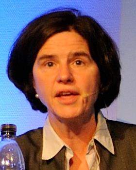 Katherine Richardson合作论文数Section for Biodiversity, Center for Macroecology, Evolution and Climate, Globe Institute, University of Copenhagen12William Gurney合作论文数Department of Applied Physics, University of Strathclyde12S. J. Hay合作论文数10
 J. Rasmussen合作论文数Fisheries Research Services Marine Laboratory10
 William R. Turrell合作论文数Fisheries Research Services Aberdeen Laboratory10Wsc Gurney合作论文数9
 Robert J. Wilson合作论文数Plymouth Marine Lab9
 Neil S Banas合作论文数School of Oceanography;University of Washington;School of Oceanography, University of Washington8
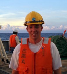 David M Bailey合作论文数Muscle Research Group, Loughborough University8AD Bryant合作论文数6
 a d sabatino合作论文数Dept Math & Stat, Univ Strathclyde6
 Rory B O'Hara Murray合作论文数Scottish Govt, Marine Scotland Sci6
 Sophie Elliott合作论文数Management of Diadromous Fish in their Environment, B-INRAE-Institut Agro-UPPA6
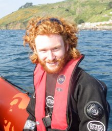 Jack H. Laverick合作论文数Dept Math & Stat, Univ Strathclyde6R. M. Cook合作论文数6
 John K. Pinnegar合作论文数Centre for Environment Fisheries and Aquaculture Science;School of Environmental Sciences, Faculty of Science, University of East Anglia6
 Thorpe Robert B合作论文数Centre for Environment, Fisheries and Aquaculture Science (CEFAS), Lowestoft Laboratory Lowestoft, NR33 0HT, UK.6
 Douglas James Beare合作论文数Agriculture and Fisheries Unit;Commission Joint Research Centre;Agriculture and Fisheries Unit, Commission Joint Research Centre6
 Andrew S. Brierley合作论文数University of St Andrews6
 Astthor Gislason合作论文数Marine Research Institute6Simon P. R. Greenstreet合作论文数6Sarah Wanless合作论文数5
 Alan MacDonald合作论文数5J. Dunn合作论文数5
 Johanna Jacomina Heymans合作论文数5
 Natalia Serpetti合作论文数5
 Chris Mccaig合作论文数5
 Julia L. Blanchard合作论文数Centre for Environment, Fisheries and Aquaculture Science, Lowestoft Fisheries Laboratory5
 Dagmar Hainbucher合作论文数5E. McKenzie合作论文数4
 Deborah Benkort合作论文数Institute for Coastal Systems - Analysis and Modelling, Helmholtz-Zentrum Hereon4
 Andre Visser合作论文数National Institute of Aquatic Resources, Technical University of Denmark4
 Paul Fernandes合作论文数Institute of Marine Research;Fisheries Research Services;Marine Laboratory Aberdeen;Marine Laboratory Aberdeen, Institute of Marine Research4
 Simon N Wood合作论文数School of Mathematics, The University of Edinburgh4Steven Mackinson合作论文数4
 Axel G. Rossberg合作论文数Department of Physics;Kyoto University;Department of Physics, Kyoto University4
 Clive James Fox合作论文数Centre for Environment4Alex G. Ortega-Loayza合作论文数Instituto de Investigaciones Clínicas;Facultad de Medicina;Universidad Nacional Mayor de San Marcos4
 Anna Ingvarsdottir合作论文数4Jan O. Backhaus合作论文数4
 Brian R. Mackenzie合作论文数National Institute of Aquatic Resources, Technical University of Denmark4
 Paul Blackwell合作论文数School of Mathematics and Statistics, Faculty of Science, The University of Sheffield4
 Sophie Fielding合作论文数British Antartic Survey4
 Joanna Waniek合作论文数4




