Lake trophic state is a key ecosystem property that integrates a lake’s physical, chemical, and biological processes. Despite the importance of trophic state as a gauge of lake water quality, standardized and machine-readable observations are uncommon. Remote sensing presents an opportunity to detect and analyze lake trophic state with reproducible, robust methods across time and space. We used Landsat surface reflectance data to create the first compendium of annual lake trophic state for 55,662 lakes of at least 10 ha in area throughout the contiguous United States from 1984 through 2020. The dataset was constructed with FAIR data principles (Findable, Accessible, Interoperable, and Reproducible) in mind, where data are publicly available, relational keys from parent datasets are retained, and all data wrangling and modeling routines are scripted for future reuse. Together, this resource offers critical data to address basic and applied research questions about lake water quality at a suite of spatial and temporal scales.
Limnology and Oceanography BulletinEarly View Meeting Highlights Hacking Limnology Workshops and DSOS23: Growing a Workforce for the Nexus of Data Science, Open Science, and the Aquatic Sciences Michael F. Meyer, Corresponding Author Michael F. Meyer [email protected] orcid.org/0000-0002-8034-9434 U.S. Geological Survey, Madison, WI, USASearch for more papers by this authorMerritt E. Harlan, Merritt E. Harlan orcid.org/0000-0002-4019-4888 U.S. Geological Survey, Denver, CO, USASearch for more papers by this authorRobert T. Hensley, Robert T. Hensley orcid.org/0000-0001-8542-087X National Ecological Observatory Network, Battelle, Boulder, CO, USASearch for more papers by this authorQing Zhan, Qing Zhan orcid.org/0000-0002-1339-3646 The Netherlands Institute of Ecology, Wageningen, The NetherlandsSearch for more papers by this authorNahit S. Börekçi, Nahit S. Börekçi orcid.org/0000-0003-1124-1013 Mersin University, Mersin, TürkiyeSearch for more papers by this authorTuba Bucak, Tuba Bucak orcid.org/0000-0002-6710-0423 Aarhus University, Aarhus, DenmarkSearch for more papers by this authorAlli N. Cramer, Alli N. Cramer orcid.org/0000-0002-0356-5782 University of Washington, Friday Harbor, WA, USASearch for more papers by this authorJohannes Feldbauer, Johannes Feldbauer orcid.org/0000-0002-8238-5375 Technische Universität Dresden, Dresden, GermanySearch for more papers by this authorRobert Ladwig, Robert Ladwig orcid.org/0000-0001-8443-1999 University of Wisconsin—Madison, Madison, WI, USASearch for more papers by this authorJorrit P. Mesman, Jorrit P. Mesman orcid.org/0000-0002-4319-260X Uppsala University, Uppsala, SwedenSearch for more papers by this authorIsabella A. Oleksy, Isabella A. Oleksy orcid.org/0000-0003-2572-5457 University of Colorado—Boulder, Boulder, CO, USASearch for more papers by this authorRachel M. Pilla, Rachel M. Pilla orcid.org/0000-0001-9156-9486 Oak Ridge National Laboratory, Oak Ridge, TN, USASearch for more papers by this authorJacob A. Zwart, Jacob A. Zwart orcid.org/0000-0002-3870-405X U.S. Geological Survey, San Francisco, CA, USASearch for more papers by this authorElisa Calamita, Elisa Calamita orcid.org/0000-0002-2614-2942 Eawag, Dübendorf, SwitzerlandSearch for more papers by this authorNicholas J. Gubbins, Nicholas J. Gubbins orcid.org/0000-0003-0688-3767 Colorado State University, Fort Collins, CO, USASearch for more papers by this authorMary E. Lofton, Mary E. Lofton orcid.org/0000-0003-3270-1330 Virginia Tech, Blacksburg, VA, USASearch for more papers by this authorDaniel A. Maciel, Daniel A. Maciel orcid.org/0000-0003-4543-5908 National Institute for Space Research, São José dos Campos, São Paulo, BrazilSearch for more papers by this authorNicholas S. Marzolf, Nicholas S. Marzolf orcid.org/0000-0001-9146-1643 Duke University, Durham, NC, USASearch for more papers by this authorFreya Olsson, Freya Olsson orcid.org/0000-0002-0483-4489 Virginia Tech, Blacksburg, VA, USASearch for more papers by this authorAudrey N. Thellman, Audrey N. Thellman orcid.org/0000-0003-3716-6664 Duke University, Durham, NC, USASearch for more papers by this authorR. Quinn Thomas, R. Quinn Thomas orcid.org/0000-0003-1282-7825 Virginia Tech, Blacksburg, VA, USASearch for more papers by this authorMichael J. Vlah, Michael J. Vlah orcid.org/0000-0002-6260-2416 Duke University, Durham, NC, USASearch for more papers by this author Michael F. Meyer, Corresponding Author Michael F. Meyer [email protected] orcid.org/0000-0002-8034-9434 U.S. Geological Survey, Madison, WI, USASearch for more papers by this authorMerritt E. Harlan, Merritt E. Harlan orcid.org/0000-0002-4019-4888 U.S. Geological Survey, Denver, CO, USASearch for more papers by this authorRobert T. Hensley, Robert T. Hensley orcid.org/0000-0001-8542-087X National Ecological Observatory Network, Battelle, Boulder, CO, USASearch for more papers by this authorQing Zhan, Qing Zhan orcid.org/0000-0002-1339-3646 The Netherlands Institute of Ecology, Wageningen, The NetherlandsSearch for more papers by this authorNahit S. Börekçi, Nahit S. Börekçi orcid.org/0000-0003-1124-1013 Mersin University, Mersin, TürkiyeSearch for more papers by this authorTuba Bucak, Tuba Bucak orcid.org/0000-0002-6710-0423 Aarhus University, Aarhus, DenmarkSearch for more papers by this authorAlli N. Cramer, Alli N. Cramer orcid.org/0000-0002-0356-5782 University of Washington, Friday Harbor, WA, USASearch for more papers by this authorJohannes Feldbauer, Johannes Feldbauer orcid.org/0000-0002-8238-5375 Technische Universität Dresden, Dresden, GermanySearch for more papers by this authorRobert Ladwig, Robert Ladwig orcid.org/0000-0001-8443-1999 University of Wisconsin—Madison, Madison, WI, USASearch for more papers by this authorJorrit P. Mesman, Jorrit P. Mesman orcid.org/0000-0002-4319-260X Uppsala University, Uppsala, SwedenSearch for more papers by this authorIsabella A. Oleksy, Isabella A. Oleksy orcid.org/0000-0003-2572-5457 University of Colorado—Boulder, Boulder, CO, USASearch for more papers by this authorRachel M. Pilla, Rachel M. Pilla orcid.org/0000-0001-9156-9486 Oak Ridge National Laboratory, Oak Ridge, TN, USASearch for more papers by this authorJacob A. Zwart, Jacob A. Zwart orcid.org/0000-0002-3870-405X U.S. Geological Survey, San Francisco, CA, USASearch for more papers by this authorElisa Calamita, Elisa Calamita orcid.org/0000-0002-2614-2942 Eawag, Dübendorf, SwitzerlandSearch for more papers by this authorNicholas J. Gubbins, Nicholas J. Gubbins orcid.org/0000-0003-0688-3767 Colorado State University, Fort Collins, CO, USASearch for more papers by this authorMary E. Lofton, Mary E. Lofton orcid.org/0000-0003-3270-1330 Virginia Tech, Blacksburg, VA, USASearch for more papers by this authorDaniel A. Maciel, Daniel A. Maciel orcid.org/0000-0003-4543-5908 National Institute for Space Research, São José dos Campos, São Paulo, BrazilSearch for more papers by this authorNicholas S. Marzolf, Nicholas S. Marzolf orcid.org/0000-0001-9146-1643 Duke University, Durham, NC, USASearch for more papers by this authorFreya Olsson, Freya Olsson orcid.org/0000-0002-0483-4489 Virginia Tech, Blacksburg, VA, USASearch for more papers by this authorAudrey N. Thellman, Audrey N. Thellman orcid.org/0000-0003-3716-6664 Duke University, Durham, NC, USASearch for more papers by this authorR. Quinn Thomas, R. Quinn Thomas orcid.org/0000-0003-1282-7825 Virginia Tech, Blacksburg, VA, USASearch for more papers by this authorMichael J. Vlah, Michael J. Vlah orcid.org/0000-0002-6260-2416 Duke University, Durham, NC, USASearch for more papers by this author First published: 20 October 2023 https://doi.org/10.1002/lob.10607 Michael F. Meyer, Merritt E. Harlan, Robert T. Hensley, and Qing Zhan contributed equally and are listed as co-first authors. Read the full textAboutPDF ToolsRequest permissionExport citationAdd to favoritesTrack citation ShareShare Give accessShare full text accessShare full-text accessPlease review our Terms and Conditions of Use and check box below to share full-text version of article.I have read and accept the Wiley Online Library Terms and Conditions of UseShareable LinkUse the link below to share a full-text version of this article with your friends and colleagues. Learn more.Copy URL Share a linkShare onEmailFacebookTwitterLinkedInRedditWechat References Lehmann, M. K., and others. 2023. GLORIA—A globally representative hyperspectral in situ dataset for optical sensing of water quality. Sci. Data 10: 100. doi:10.1038/s41597-023-01973-y. Meyer, M. F., and Zwart, J. A. 2020. Virtual summit: Incorporating data science and open science in aquatic research. Limnol. Oceanogr. Bull. 29: 144–146. doi:10.1002/lob.10411 Meyer, M. F., and others. 2021a. Virtual growing pains: initial lessons learned from organizing virtual workshops, summits, conferences, and networking events during a global pandemic. Limnol. Oceanogr. Bull. 30: 1–11. doi:10.1002/lob.10431. Meyer, M.F., and others, 2021b. The AEMON-J “Hacking Limnology” workshop series & virtual summit: Incorporating data science and open science in aquatic research. Limnol. Oceanogr. Bull. 30, 140–143. doi:10.1002/lob.10475 Meyer, M., and others. 2021c. AEMON-J/DSOS archive: “Hacking Limnology” workshop + virtual summit in data science & open science in aquatic research. doi:10.17605/OSF.IO/682V5. Meyer, M. F., and others. 2022. Hacking Limnology Workshop and DSOS22: Creating a community of practice for the nexus of data science, open science, and the aquatic sciences. Limnol. Oceanogr. Bull. 31: 123–126. doi:10.1002/lob.10525. Thomas, R. Q., and others. 2023. The NEON ecological forecasting challenge. Front. Ecol. Environ. 21: 112–113. doi:10.1002/fee.2616. Vlah, M. J., S. Rhea, E. S. Bernhardt, W. Slaughter, N. Gubbins, A. G. DelVecchia, A. Thellman, and M. R. V. Ross. 2023. MacroSheds: A synthesis of long-term biogeochemical, hydroclimatic, and geospatial data from small watershed ecosystem studies. Limnol. Oceanogr. Lett. 8: 419–452. doi:10.1002/lol2.10325. Early ViewOnline Version of Record before inclusion in an issue ReferencesRelatedInformation
A changing climate and increasing human population necessitate understanding global freshwater availability. To enable assessment of lake water variability from local-to-global and monthly-to-decadal scales, we extended the Global Lake area, Climate, and Population (GLCP) dataset, which contains monthly lake surface area for 1.42 million lakes with paired basin-level climate and population data from 1995 through 2020. In comparison to the previous version of the GLCP, the extended version is monthly and includes information on lake ice cover as well as basin-level snow area, humidity, longwave and shortwave radiation, and cloud cover. The extended GLCP emphasizes FAIR data principles by expanding its scripting repository and maintaining unique HydroLAKES identifiers, which enables the GLCP to be joined with other HydroLAKES-derived products. Compared to the original version, the extended GLCP contains a richer suite of variables that enable disparate analyses of lake water trends at broad spatial and temporal scales.
Human sewage can introduce pollutants into food webs and threaten ecosystem integrity. Among the many sewage-associated pollutants, pharmaceuticals and personal care products (PPCPs) are consistent indicators of sewage in ecosystems and can also cause potent ecological consequences, even at minute concentrations (e.g., ng/L). Despite increased study over the past three decades, PPCPs in terrestrial ecosystems have been less studied than those in aquatic ecosystems. To evaluate PPCP prevalence and drivers in a terrestrial ecosystem, we analyzed managed and native bees collected from agroecosystems in Washington State (USA) for PPCPs. Caffeine, paraxanthine, cotinine, and acetaminophen were detected in all three evaluated taxa ( Bombus vosnesenskii , Agapostemon texanus , and Apis mellifera ), with B. vosnesenskii and A. texanus having a higher probability of PPCP detection relative to A. mellifera . The probability of PPCP presence in all three taxa increased in landscapes with more human development and greater plant abundance, with significant but negative interactions among these factors. These results suggest that human activity, availability of resources, and species-specific pollinator traits affect the introduction and mobilization of PPCPs in terrestrial ecosystems. Consequently, monitoring PPCPs and their ecological responses in terrestrial ecosystems creates opportunities to synthesize effects of sewage pollution across terrestrial and aquatic ecosystem types and organisms.
Algal blooms appear to be increasing on benthic substrates of naturally nutrient-poor lakes worldwide, yet common drivers across these systems remain elusive. The phenomenon has been notable in high-elevation mountain lakes, which is enigmatic given their relative remoteness from human disturbance. We suggest that warming-induced changes in redox conditions that promote nutrient release from sediments warrant more attention. Warming associated with climate change reduces oxygen content and hastens microbial processes, enhancing release of nutrients which can be intercepted by the benthic algae before reaching the water column. Warming effects may be particularly noticeable in high-elevation lakes that hold less oxygen at saturation, are warming more rapidly than lowland lakes, and can receive relatively high solar radiation.
Climate change is reducing winter ice cover on lakes; yet, the full societal and environmental consequences of this ice loss are poorly understood. The socioeconomic implications of declining ice include diminished access to ice-based cultural activities, safety concerns in traversing ice, changes in fisheries, increases in shoreline erosion, and declines in water storage. Longer ice-free seasons allow more time and capacity for water to warm, threatening water quality and biodiversity. Food webs likely will reorganize, with constrained availability of ice-associated and cold-water niches, and ice loss will affect the nature, magnitude, and timing of greenhouse gas emissions. Examining these rapidly emerging changes will generate more-complete models of lake dynamics, and transdisciplinary collaborations will facilitate translation to effective management and sustainability.
Limnology and Oceanography BulletinEarly View Meeting HighlightsOpen Access Pecora 22: Remote Sensing for Freshwater and Marine Environments Michael F. Meyer, Michael F. Meyer [email protected] orcid.org/0000-0002-8034-9434 U.S. Geological Survey, Madison, WI, USA Center for Limnology, University of Wisconsin - Madison, Madison, WI, USASearch for more papers by this authorJeffery J. Danielson, Jeffery J. Danielson orcid.org/0000-0003-0907-034X U.S. Geological Survey, Sioux Falls, SD, USASearch for more papers by this authorMaurice Estes Jr., Maurice Estes Jr. orcid.org/0000-0001-5251-2153 University of Alabama, Huntsville, AL, USA NASA Ecological Conservation Program, Huntsville, AL, USASearch for more papers by this authorKate C. Fickas, Kate C. Fickas orcid.org/0000-0002-6617-2441 U.S. Geological Survey, Sioux Falls, SD, USA Climate Hazards Center, UC Santa Barbara, Barbara, CA, USASearch for more papers by this authorDean Gesch, Dean Gesch orcid.org/0000-0002-8992-4933 U.S. Geological Survey, Sioux Falls, SD, USASearch for more papers by this authorMaria T. Kavanaugh, Maria T. Kavanaugh orcid.org/0000-0001-6126-6177 Oregon State University, Corvallis, OR, USASearch for more papers by this authorTyler V. King, Tyler V. King orcid.org/0000-0002-5785-3077 U.S. Geological Survey, Boise, ID, USASearch for more papers by this authorNima Pahlevan, Nima Pahlevan orcid.org/0000-0002-5454-5212 Science Systems and Applications, Inc., Lanham, MD, USA NASA Goddard Space Flight Center, Greenbelt, Maryland, USASearch for more papers by this authorMonica Palaseanu-Lovejoy, Monica Palaseanu-Lovejoy orcid.org/0000-0002-3786-5118 U.S. Geological Survey, Reston, VA, USASearch for more papers by this author Michael F. Meyer, Michael F. Meyer [email protected] orcid.org/0000-0002-8034-9434 U.S. Geological Survey, Madison, WI, USA Center for Limnology, University of Wisconsin - Madison, Madison, WI, USASearch for more papers by this authorJeffery J. Danielson, Jeffery J. Danielson orcid.org/0000-0003-0907-034X U.S. Geological Survey, Sioux Falls, SD, USASearch for more papers by this authorMaurice Estes Jr., Maurice Estes Jr. orcid.org/0000-0001-5251-2153 University of Alabama, Huntsville, AL, USA NASA Ecological Conservation Program, Huntsville, AL, USASearch for more papers by this authorKate C. Fickas, Kate C. Fickas orcid.org/0000-0002-6617-2441 U.S. Geological Survey, Sioux Falls, SD, USA Climate Hazards Center, UC Santa Barbara, Barbara, CA, USASearch for more papers by this authorDean Gesch, Dean Gesch orcid.org/0000-0002-8992-4933 U.S. Geological Survey, Sioux Falls, SD, USASearch for more papers by this authorMaria T. Kavanaugh, Maria T. Kavanaugh orcid.org/0000-0001-6126-6177 Oregon State University, Corvallis, OR, USASearch for more papers by this authorTyler V. King, Tyler V. King orcid.org/0000-0002-5785-3077 U.S. Geological Survey, Boise, ID, USASearch for more papers by this authorNima Pahlevan, Nima Pahlevan orcid.org/0000-0002-5454-5212 Science Systems and Applications, Inc., Lanham, MD, USA NASA Goddard Space Flight Center, Greenbelt, Maryland, USASearch for more papers by this authorMonica Palaseanu-Lovejoy, Monica Palaseanu-Lovejoy orcid.org/0000-0002-3786-5118 U.S. Geological Survey, Reston, VA, USASearch for more papers by this author First published: 03 March 2023 https://doi.org/10.1002/lob.10549AboutSectionsPDF ToolsRequest permissionExport citationAdd to favoritesTrack citation ShareShare Give accessShare full text accessShare full-text accessPlease review our Terms and Conditions of Use and check box below to share full-text version of article.I have read and accept the Wiley Online Library Terms and Conditions of UseShareable LinkUse the link below to share a full-text version of this article with your friends and colleagues. Learn more.Copy URL Share a linkShare onFacebookTwitterLinkedInRedditWechat Introduction The Pecora 22 conference occurred 24–27 October 2022 in Denver, Colorado. Hundreds of remote sensing experts, practitioners, and end users convened in the same location to share their research, tools, and experiences with the larger community. While session themes spanned a suite of scientific and engineering disciplines, a common thread across all sessions underscored how basic and applied scientists can use remote sensing to identify heterogeneous and dynamic environments at unprecedented spatial and temporal scales. While the conference highlighted the breadth of remote sensing developments and applications, there were several sessions focusing on how remote sensing can further our understanding of water quantity and quality, bathymetry, as well as broadening participation in the remote sensing community. Below, we highlight the topics discussed in five Pecora sessions that pertained to various facets of remote sensing of aquatic systems. By highlighting these sessions, we hope to further bridge remote sensing developments and limnology, thereby expediting cross-pollination between these fields and encourage members of the ASLO community to contact presenters regarding their specific talks (https://pecora22.org/program/). The legacy, challenges, and prospects of remote sensing water quantity and quality Among the talks centered on remote sensing of aquatic systems, Pecora 22 hosted related sessions that focused specifically on cutting edge advances in remote sensing of water quality and quantity. Together, these sessions spanned a range of topics, including calibration and validation of aquatic surface reflectances, detection of chlorophyll and cyanobacterial presence within and across aquatic systems, use of altimetry data to evaluate surface water dynamics, and macroscale syntheses of lake water quality trends. A common goal of these sessions was to highlight the breadth of remote sensing developments that enable more accurate measurements of surface water dynamics and water quality constituents. Here, we detail the range of topics discussed within two of the sessions. From three to many shades of water color: The legacy of Landsat and its prospects This session highlighted the half-century of Landsat satellite sensor observations and what these data have enabled with respect to developing, testing, and validating novel methodologies for studying aquatic ecosystems worldwide. Typically, these advances have included assessments of optically relevant water quality indicators—such as sediment, pigments, and dissolved organic matter—as well as water color. In many cases, the Landsat mission's data has also contributed to advance the characterization and mapping of coral and seagrass assemblages in marine environments, as well as the detection of surface algae and emergent vegetation in freshwater systems. Through Landsat's consistent multi-decadal thermal measurements and the derived high-quality surface temperature products, identifying trends and changes in water surface temperature due to climate variability and extreme weather patterns have also been made possible. Mirroring the diversity of projects that the Landsat mission has empowered, this session emphasized how Landsat data providers and curators are working to correct Landsat reflectance data for aquatic environments, thereby increasing the accuracy of remotely sensed water quality constituents. Beyond data products, this session also showcased how macroscale ecological questions and management applications are already within reach using existing products. In particular, talks focused on detection and chlorophyll and cyanobacterial presence from local-to-national spatial scales and echoed how remotely sensed water quality data can benefit a suite of end users, ranging from lake associations through federal agencies. Power, promise and challenges in remote sensing of water quality This session emphasized the multifaceted developments of remote sensing of water quality, particularly among members of the U.S. Geological Survey's (USGS) Remote Sensing Research and Development Project as well as Colorado State University. The session included talks focused on data product development, such as the creation of the "Potentially Resolvable Waterbodies Dataset" (Hafen and Ducar 2021), as well as the bias-corrected Landsat 8 aquatic surface temperature data product, in addition to presentations expanding on ecological analysis of limnological processes at various scales. At regional scales, presenters demonstrated how they used remote sensing to track trends in chlorophyll concentration across lakes in Colorado and Wyoming (United States) as well as reservoirs in Oklahoma and Texas (United States). Finally, at macroscales, presenters showcased how they used remote sensing imagery to understand beaded stream dynamics across boreal environments, which can be important for mapping endemic species habitat, and to evaluate spatial and temporal trends in lake trophic state across the contiguous United States. Altogether, this session highlighted the true power and promise of how remote sensing can aid managers and researchers alike by offering insights into how lakes, reservoirs, and streams change intensively within individual systems as well as extensively across spatial and temporal scales. Remote sensing of shallow water bathymetry: Methods for a new era Recent interest in remote sensing retrieval of shallow-water satellite-derived bathymetry (SDB) is being driven by the availability of multispectral and stereo satellite imagery, altimetry, and Synthetic Aperture Radar (SAR) satellite data at the global scale and with increased spatial and temporal resolution. Collectively, these datasets and techniques can be combined to map large regions of the littoral zone to help fill critical data gaps not acquired by traditional mapping systems. This session included talks focused on inferring inherent water optical properties from Landsat 8 and 9, ICESat-2, and stereo WorldView satellite imagery to derive SDB. The USGS is currently researching deep-water pixels to derive inherent water optical properties to compute diffuse attenuation in the water column. For shallow water, subsequent non-linear optimization is performed to compute SDB. The ATLAS/ICESat-2 L3A Along Track Inland Surface Water Data, Version 5 (ATL13) is an example of ICESat-2 bathymetry data deliverables for inland and coastal waters. A collaboration between USGS and NASA produced the Satellite Triangulated Sea Depth module (SaTSeaD), which uses stereo satellite imagery to derive seamless topo-bathymetry without external bathymetric calibration. A multi-modal depth retrieval using deep learning, ICESat-2 data, and multispectral imagery to derive SDB was presented by TCarta. The session closed with an assessment of satellite-based observations of bathymetric change, a collaboration between Oregon State University and OregonView/AmericaView Consortium. A common theme among presenters was that identifying areas of bathymetric change is more important than having a single high-quality snapshot of a waterbody's bathymetry. Using earth observations for marine and freshwater applications research This session included projects focused on marine and freshwater ecosystems with the common theme of conserving living marine and freshwater resources for the benefit of society. Presentations focused on the integral role of Earth observations and how the tools and products provided to stakeholders benefit management and conservation decisions. The NASA Ecological Conservation Applications Program, among others, encourages the use of Earth observations to provide a research foundation and the development of products and tools for stakeholders to use for decision-making. Presentations focused on how multivariate and multiscale satellite data are used in the modeling of plankton composition and extents of biofilms in wetlands; modeling wetland change over landscape scales; the extent and dynamics of polynyas in Antarctica; using remote sensing and population analyses to conserve native trout populations, and to understand and track biogeographic changes in coastal and open ocean ecosystems. The presentations generated discussion on the translation of tools and theory from land to water; how scales of change across different systems necessitate the integration of in situ, airborne, and satellite assets; and how ecologists working across these systems are preparing for the next generation of hyperspectral sensors. Broadening participation in remote sensing: The ladies of Landsat Emphasizing diversity, equity, inclusivity, justice, and accessibility (DEIJA) is essential for creating a conference environment in which new ideas and collaborations can grow. The fields of remote sensing and Earth observation have a history of academic and scientific gatekeeping, especially at the academic publishing level (Joyce et al. 2022), which can have clear ties to conference participation. This gatekeeping has the potential to limit the voices and engagement of scientists from traditionally underrepresented groups, thus limiting the possibility for new ideas and science to emerge. The presence and involvement in conference activities from remote sensing affinity groups, such as Ladies of Landsat, Sisters of SAR, Dames of Drones, Women in Geospatial+, GeoChicas, and many more, can help to create a conference atmosphere where early career researchers, students, and underrepresented scientists have a support system of other scientists and participants to champion their work both in front of and behind the scenes. At Pecora 22, Ladies of Landsat was active in creating a welcoming environment for all. They hosted a panel session, "Ladies of Landsat: Power of the Pixel," with remote sensing scientists from the government, industry, academia, and non-profit sectors to discuss opportunities and challenges with remote sensing and DEIJA as well as a coffee social, attended by the U.S. Department of Interior Assistant Secretary for Water and Science, Tanya Trujillo, to create a networking opportunity for conference participants. In addition to this dedicated session as well as the remote sensing for freshwater and marine environments sessions, DEIJA was emphasized in the breadth of career stages presenting, from students to late-career scientists, as well as the geographic spread of research presented. Moving forward Following the Pecora 22 conference, there was an air of enthusiasm and energy with the rapidly progressing developments that are enabling cross-scale analyses of water. While Pecora largely attracted researchers and managers from the remote sensing-based sciences, the joint session conveners are convinced that these combined tools will benefit the limnological and oceanographic communities broadly. As we look forward to ASLO 2023 and skim through upcoming session descriptions, we are encouraged by the range of sessions that integrate remote sensing technologies, and we look forward to further collaborations between these communities. References Hafen, K. C., and S. D. Ducar. 2021. Potentially resolvable National Hydrography Dataset waterbodies and flowlines from Landsat images in the United States (excluding Alaska): U.S. Geological Survey data release. doi:10.5066/P9W3EUF5. Joyce, K. E., C. L. Nakalembe, C. Gómez, G. Suresh, K. Fickas, M. Halabisky, M. Kalamandeen, and M. A. Crowley. 2022. Discovering inclusivity in remote sensing: Leaving no one behind. Front. Rem. Sens. 3. doi:10.3389/frsen.2022.869291. Early ViewOnline Version of Record before inclusion in an issue ReferencesRelatedInformation
Pressing environmental research questions demand the integration of increasingly diverse and large‐scale ecological datasets as well as complex analytical methods, which require specialized tools and resources. Computational training for ecological and evolutionary sciences has become more abundant and accessible over the past decade, but tool development has outpaced the availability of specialized training. Most training for scripted analyses focuses on individual analysis steps in one script rather than creating a scripted pipeline, where modular functions comprise an ecosystem of interdependent steps. Although current computational training creates an excellent starting place, linear styles of scripting can risk becoming labor‐ and time‐intensive and less reproducible by often requiring manual execution. Pipelines, however, can be easily automated or tracked by software to increase efficiency and reduce potential errors. Ecology and evolution would benefit from techniques that reduce these risks by managing analytical pipelines in a modular, readily parallelizable format with clear documentation of dependencies. Workflow management software (WMS) can aid in the reproducibility, intelligibility and computational efficiency of complex pipelines. To date, WMS adoption in ecology and evolutionary research has been slow. We discuss the benefits and challenges of implementing WMS and illustrate its use through a case study with the targets r package to further highlight WMS benefits through workflow automation, dependency tracking and improved clarity for reviewers. Although WMS requires familiarity with function‐oriented programming and careful planning for more advanced applications and pipeline sharing, investment in training will enable access to the benefits of WMS and impart transferable computing skills that can facilitate ecological and evolutionary data science at large scales.
Trophic state (TS) characterizes a waterbody’s biological productivity and depends on its morphometry, physics, chemistry, biology, climate, and history. However, multiple TS operational definitions have emerged to meet use-specific classification needs. These differing operational definitions can create inconsistent understanding, can lead to miscommunication, and can result in siloed management strategies for TS. For example, some regulatory agencies use TS to signify ecological integrity as opposed to biological productivity, where TS classification may trigger intervention efforts. These inconsistencies may be compounded when interdisciplinary projects employ varied TS frameworks. To emphasize the consequences of using multiple TS classification schemes, we present three scenarios for which an improved understanding of the TS concept could advance limnological research, management efforts, and interdisciplinary collaboration. As the field of limnology continues to expand, we highlight the importance of re-evaluating even the most fundamental limnological concepts, such as TS, to ensure congruence with evolving, cutting-edge science.
INTRODUCTION The 2nd Aquatic Ecosystem Modeling-Junior (AEMON-J) Hacking Limnology Workshop and 3rd Virtual Summit: Incorporating Data Science and Open Science in the Aquatic Sciences (DSOS) took place on 25–29 July 2022. These virtual events were developed to bring together researchers from diverse backgrounds to share developments in data-intensive research in the aquatic sciences and train participants in cutting-edge data analysis methods related to remote sensing, data pipelines, and modeling of aquatic ecosystems. Over 525 people from more than 50 countries and six continents registered for the week-long event. As in previous years, there were no registration costs for the workshop or summit. Countries with the highest number of registrants included the United States (49.2%), Canada (7.5%), Germany (7.1%), Brazil (4.7%), and Nigeria (3.0%). The majority of registrants (61.2%) identified themselves as being in early career positions (i.e., graduate students and post-doctoral researchers; Fig. 1A), and workshop registrants also broadly self-labeled themselves as having more intermediate experience with aquatic ecosystem modeling compared to previous years (Fig. 1B). Regardless of whether registrants were able to attend synchronously during the time of the workshop and summit, all recordings and materials were made available on the combined Open Science Framework archive for AEMON-J and DSOS (Meyer et al. 2022) for asynchronous viewing and access. The combined workshop and summit ran over the course of 1 week and expanded on previous years’ successes, while also opening new initiatives. As with previous years, the workshop provided participants with diverse talks and opportunity to learn data-intensive skills through the hands-on coding workshops. While the format, topics, and number of registrants were similar to previous years, AEMON-J and DSOS created a joint social media account (https://twitter.com/HackingLimno), which is designed to promote work, opportunities, and news that intersects with data science, open science, and the aquatic sciences. This social media account is intended to increase engagement with the Hacking Limnology Community year-round. Those interested in being involved at the leadership helm can contact the organizational team.
Limnology and Oceanography BulletinVolume 31, Issue 4 p. 132-133 Community News Building a Worldwide Freshwater Zooplankton Dataset to Synthesize Patterns of Zooplankton Community Structure and Change Stephanie E. Figary, Stephanie E. Figary orcid.org/0000-0002-4876-9850 Department of Natural Resources and the Environment, Cornell University, Ithaca, NY, USASearch for more papers by this authorMichael F. Meyer, Michael F. Meyer orcid.org/0000-0002-8034-9434 U.S. Geological Survey, Madison, WI, USASearch for more papers by this authorWarren J. S. Currie, Warren J. S. Currie orcid.org/0000-0001-7050-1802 Great Lakes Laboratory for Fisheries and Aquatic Sciences, Fisheries and Oceans Canada, Burlington, Ontario, CanadaSearch for more papers by this authorZIG Participants, ZIG Participants Global Lake Ecological Observatory NetworkSearch for more papers by this author Stephanie E. Figary, Stephanie E. Figary orcid.org/0000-0002-4876-9850 Department of Natural Resources and the Environment, Cornell University, Ithaca, NY, USASearch for more papers by this authorMichael F. Meyer, Michael F. Meyer orcid.org/0000-0002-8034-9434 U.S. Geological Survey, Madison, WI, USASearch for more papers by this authorWarren J. S. Currie, Warren J. S. Currie orcid.org/0000-0001-7050-1802 Great Lakes Laboratory for Fisheries and Aquatic Sciences, Fisheries and Oceans Canada, Burlington, Ontario, CanadaSearch for more papers by this authorZIG Participants, ZIG Participants Global Lake Ecological Observatory NetworkSearch for more papers by this author First published: 01 September 2022 https://doi.org/10.1002/lob.10515Read the full textAboutPDF ToolsRequest permissionExport citationAdd to favoritesTrack citation ShareShare Give accessShare full text accessShare full-text accessPlease review our Terms and Conditions of Use and check box below to share full-text version of article.I have read and accept the Wiley Online Library Terms and Conditions of UseShareable LinkUse the link below to share a full-text version of this article with your friends and colleagues. Learn more.Copy URL Share a linkShare onFacebookTwitterLinkedInRedditWechat No abstract is available for this article. Volume31, Issue4November 2022Pages 132-133 RelatedInformation
Sewage released from lakeside development can introduce nutrients and micropollutants that can restructure aquatic ecosystems. Lake Baikal, the world's most ancient, biodiverse, and voluminous freshwater lake, has been experiencing localized sewage pollution from lakeside settlements. Nearby increasing filamentous algal abundance suggests benthic communities are responding to localized pollution. We surveyed 40-km of Lake Baikal's southwestern shoreline from 19 to 23 August 2015 for sewage indicators, including pharmaceuticals, personal care products, and microplastics, with colocated periphyton, macroinvertebrate, stable isotope, and fatty acid samplings. The data are structured in a tidy format (a tabular arrangement familiar to limnologists) to encourage reuse. Unique identifiers corresponding to sampling locations are retained throughout all data files to facilitate interoperability among the dataset's 150+ variables. For Lake Baikal studies, these data can support continued monitoring and research efforts. For global studies of lakes, these data can help characterize sewage prevalence and ecological consequences of anthropogenic disturbance across spatial scales.
Sewage released from lakeside development can reshape ecological communities. Nearshore periphyton can rapidly assimilate sewage-associated nutrients, leading to increases of filamentous algal abundance, thus altering both food abundance and quality for grazers. In Lake Baikal, a large, ultra-oligotrophic, remote lake in Siberia, filamentous algal abundance has increased near lakeside developments, and localized sewage input is the suspected cause. These shifts are of particular interest in Lake Baikal, where endemic littoral biodiversity is high, lakeside settlements are mostly small, tourism is relatively high (similar to 1.2 million visitors annually), and settlements are separated by large tracts of undisturbed shoreline, enabling investigation of heterogeneity and gradients of disturbance. We surveyed sites along 40 km of Baikal's southwestern shore for sewage indicators-pharmaceuticals and personal care products (PPCPs) and microplastics-as well as periphyton and macroinvertebrate abundance and indicators of food web structure (stable isotopes and fatty acids). Summed PPCP concentrations were spatially related to lakeside development. As predicted, lakeside development was associated with more filamentous algae and lower abundance of sewage-sensitive mollusks. Periphyton and macroinvertebrate stable isotopes and essential fatty acids suggested that food web structure otherwise remained similar across sites; yet, the invariance of amphipod fatty acid composition, relative to periphyton, suggested that grazers adjust behavior or metabolism to compensate for different periphyton assemblages. Our results demonstrate that even low levels of human disturbance can result in spatial heterogeneity of nearshore ecological responses, with potential for changing trophic interactions that propagate through the food web.
Groundwater–surface water (GW–SW) interactions represent an important, but less visible, linkage in lake ecosystems. Periphyton is most abundant at the GW–SW interface and can rapidly assimilate nutrients from the water column. Despite the importance of periphyton in regulating whole‐lake metabolism, they are less well studied or monitored in comparison with planktonic taxa and pelagic systems. This is in stark contrast to studies of flowing waters and wetlands, where variability in GW–SW connectivity and periphyton productivity is more often incorporated into study designs. To bridge the gap between groundwater's influence on lake benthic communities, this synthesis aims to prime researchers with information necessary to incorporate groundwater and periphyton sampling into lake studies and equip investigators with tools that will facilitate cross‐disciplinary collaboration. Specifically, we (1) propose how to overcome barriers associated with studying littoral ecological‐hydrological dynamics; (2) summarize field, laboratory, and modeling techniques for assessing spatiotemporal periphyton patterns and benthic hydrological fluxes; and (3) identify paths for hydrological techniques to be incorporated into ecological studies, deepening our understanding of whole‐lake ecosystem function. We argue that coupling hydrological and periphyton measurements can yield dualistic insights into lake ecosystem functioning: how benthic periphyton modulate constituents within groundwater, and conversely, the extent to which constituents in groundwater modulate the productivity of periphyton assemblages. We assert that priming ecologists and hydrologists alike with a shared understanding of how each discipline studies the nearshore zone presents a tangible path forward for both integrating these disciplines and further contextualizing lake processes within the limnological landscape.
Limnology and Oceanography BulletinVolume 31, Issue 4 p. 133-134 Community News Interview with Chris Filstrup: Why be an Editor? Carolina C. Barbosa, Carolina C. Barbosa cbarbosa@uwyo.edu orcid.org/0000-0002-6393-5730 University of Wyoming, Laramie, WyomingSearch for more papers by this authorClara Mendoza-Lera, Clara Mendoza-Lera orcid.org/0000-0002-3222-2498 University of Koblenz-Landau, Mainz, GermanySearch for more papers by this authorMichael F. Meyer, Michael F. Meyer orcid.org/0000-0002-8034-9434 U.S. Geological Survey, Madison, WisconsinSearch for more papers by this author Carolina C. Barbosa, Carolina C. Barbosa cbarbosa@uwyo.edu orcid.org/0000-0002-6393-5730 University of Wyoming, Laramie, WyomingSearch for more papers by this authorClara Mendoza-Lera, Clara Mendoza-Lera orcid.org/0000-0002-3222-2498 University of Koblenz-Landau, Mainz, GermanySearch for more papers by this authorMichael F. Meyer, Michael F. Meyer orcid.org/0000-0002-8034-9434 U.S. Geological Survey, Madison, WisconsinSearch for more papers by this author First published: 13 September 2022 https://doi.org/10.1002/lob.10516Read the full textAboutPDF ToolsRequest permissionExport citationAdd to favoritesTrack citation ShareShare Give accessShare full text accessShare full-text accessPlease review our Terms and Conditions of Use and check box below to share full-text version of article.I have read and accept the Wiley Online Library Terms and Conditions of UseShareable LinkUse the link below to share a full-text version of this article with your friends and colleagues. Learn more.Copy URL Share a linkShare onFacebookTwitterLinkedInRedditWechat No abstract is available for this article. Volume31, Issue4November 2022Pages 133-134 RelatedInformation
For many, 2020 was a year of abrupt professional and personal change. For the aquatic sciences community, many were adapting to virtual formats for conducting and sharing science, while simultaneously learning to live in a socially distanced world. Understandably, the aquatic sciences community postponed or canceled most in-person scientific meetings. Still, many scientific communities either transitioned annual meetings to a virtual format or inaugurated new virtual meetings. Fortunately, increased use of video conferencing platforms, networking and communication applications, and a general comfort with conducting science virtually helped bring the in-person meeting experience to scientists worldwide. Yet, the transition to conducting science virtually revealed new barriers to participation whereas others were lowered. The combined lessons learned from organizing a meeting constitute a necessary knowledge base that will prove useful, as virtual conferences are likely to continue in some form. To concentrate and synthesize these experiences, we showcase how six scientific societies and communities planned, organized, and conducted virtual meetings in 2020. With this consolidated information in hand, we look forward to a future, where scientific meetings embrace a virtual component, so to as help make science more inclusive and global.
Michael F. Meyer , Robert Ladwig , Jorrit P. Mesman , Isabella A. Oleksy , Carolina C. Barbosa , Kaelin M. Cawley , Alli N. Cramer , Johannes Feldbauer , Patricia Q. Tran , Jacob A. Zwart , Gregorio A. L opez Moreira M. , Muhammed Shikhani , Deviyani Gurung, Robert T. Hensley , Elena Matta , Ryan P. McClure , Thomas Petzoldt , Nuria S anchez-L opez , Karline Soetaert , Mridul K. Thomas , Simon N. Topp , and Xiao Yang
Given climatic uncertainty and human population growth, tracking the world's freshwater availability is essential. Fortunately, data necessary to identify surface water patterns are abundant. Wrangling these data into an analytically friendly format, however, can be difficult for researchers not experienced in data manipulation and high-performance computing. To increase data accessibility, we developed the Global Lake area, Climate, and Population (GLCP) dataset. The GLCP offers annually aggregated surface area, temperature, precipitation, and human population estimates for over 1.42 million lakes globally between 1995 and 2015. Our dataset is peer-reviewed and publicly available in a tabular format, enabling researchers with a range of skill levels to effectively work with the data. All aggregation procedures were performed within Google Earth Engine and R, empowering future users to replicate and modify scripts. Three case studies are presented to highlight concrete applications of the GLCP with emphasis on natural resource management at local, regional, and national scales.
 Stephanie Hampton合作论文数Department of Environmental Science & Policy, University of California, Davis13
 Matthew R. Brousil合作论文数Washington State University - Pullman10
 Robert Ladwig合作论文数Univ Wisconsin, Ctr Limnol, Madison, WI 53706 USA9
 Isabella Oleksy合作论文数Cary Inst Ecosyst Studies7
 Carolina Barbosa合作论文数Corresponding author.6
 Xiao Yang合作论文数Univ N Carolina, Dept Geol Sci, Chapel Hill, NC 27515 USA6
 Jacob Zwart合作论文数U.S. Geological Survey6
 Alli N. Cramer合作论文数Friday Harbor Labs, Univ Washington5
 Rachel Pilla合作论文数Section Parasitology, Bernhard Nocht Institute for Tropical Medicine;Section Parasitology, Bernhard Nocht Institute for Tropical Medicine5
 Sapna Sharma合作论文数4
 Jorrit Mesman合作论文数Dept FA Forel Environm & Aquat Sci, Univ Geneva4
 Johannes Feldbauer合作论文数Institute of Hydrobiology4
 Kate Fickas合作论文数U.S. Geological Survey4
 Tyler V. King合作论文数US Geological Survey Idaho Water Science Center4
 Ryan Paul McClure合作论文数Department of Medicine Section of Infectious Disease, Boston University School of Medicine;Department of Microbiology, Boston University School of Medicine;Boston University School of Medicine, Boston University School of Medicine4
 Ted Ozersky合作论文数4
 Aaron W. E. Galloway合作论文数Oregon Institute of Marine Biology, University of Oregon3
 Stephanie Labou合作论文数Univ Calif San Diego3
 Robert T. Hensley合作论文数Battelle Natl Ecol Observ Network3
 R. Iestyn Woolway合作论文数Dundalk Inst Technol, Ctr Freshwater & Environm Studies, Dundalk, Ireland3
 Simon Topp合作论文数3
 Woo Kara H合作论文数Center for Environmental Research, Education and Outreach, Washington State University3
 Stephen M. Powers合作论文数Center for Limnology;University of Wisconsin-Madison;Center for Limnology, University of Wisconsin-Madison3
 Maxim Timofeyev合作论文数Baikalian Research Centre3
 Hilary A. Dugan合作论文数3Dmitry Yu. Karnaukhov合作论文数2J. Padowski合作论文数2Muhammed Shikhani合作论文数2
 Brian P. Lanouette合作论文数2
 Nahit Soner Börekçi合作论文数2
 Kirill Shchapov合作论文数Large Lakes Observ, Univ Minnesota2Deviyani Gurung合作论文数Civil Engn, Washington State Univ2
 Joshua Culpepper合作论文数Global Water Ctr, Univ Nevada2Nuria Sanchez-Lopez合作论文数University of Idaho2
 Jianning Ren合作论文数Dept Nat Resources & Environm Sci, Univ Nevada2Qing Zhan合作论文数2
 Patricia Q Tran合作论文数Dept Bacteriol, Univ Wisconsin Madison2
 Alessandro Filazzola合作论文数Faculty of Science, York University2
 Kaelin Cawley合作论文数2
 Kraemer Benjamin M合作论文数Center for Limnology, University of Wisconsin-Madison2
 Julie B. Schram合作论文数2
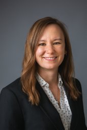 Julie C. Padowski合作论文数Utility Research Center;University of Florida;Utility Research Center, University of Florida2
 Daniel D Snow合作论文数Water Sciences Laboratory, University of Nebraska-Lincoln2
 Catherine Oreilly合作论文数Department of Physiology;Biomedical Imaging Group;Department of Physiology|Biomedical Imaging Group2
 Dina Leech合作论文数Department of Earth & Environmental Sciences;Lehigh University;Department of Earth & Environmental Sciences, Lehigh University2
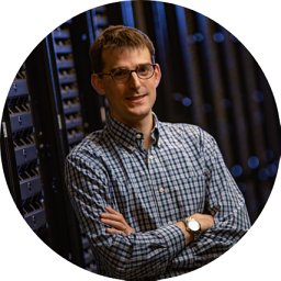 R. Quinn Thomas合作论文数2Amina I. Pollard合作论文数2Don Pierson合作论文数1Raeshelle M Strobel合作论文数1




