Recent advances in numerical modeling have improved the fidelity of coastal wave-propagation simulations, but the high computational solution cost of the governing partial differential equations has motivated parallel solvers on multicore CPUs and GPUs. Simultaneously, researchers are exploring machine-learning methods to achieve comparable efficiency gains, and automatic differentiation (AD) is being incorporated to enable optimization and inverse analyses. This paper introduces CelerisAI, a Python-based implementation of the Celeris nearshore wave model that delivers high-performance execution on multiple CPUs or a GPU and interoperates with machine-learning workflows. CelerisAI exposes the forward simulation to AD, yielding a differentiable solver suited to complex tasks such as inverse problems and data assimilation. We evaluate CelerisAI on standard benchmarks and demonstrate AD-enabled data-assimilation applications. PROGRAM SUMMARY Program Title: CelerisAICPC Library link to program files: (to be added by Technical Editor)Developer’s repository link: https://github.com/wrenteria/CelerisAiLicensing provisions: MITProgramming language: PythonNature of problem:Coastal wave models have achieved high performance in forward prediction. However, usually their design does not allow for interoperability with modern workflows such as machine learning or the incorporation of automatic differentiation for differentiability. Without this capability, the models cannot be used for other types of problems, such as inverse problems or optimization problems. Furthermore, the high computational costs require the use of multiple CPUs or GPUs, and this usually entails maintaining separate codebases for different hardware architectures.Solution method:CelerisAI is a numerical model for simulating nearshore waves. The solver is written in Python and accelerated with the domain-specific language Taichi, allowing a single codebase to run efficiently on both multi-core CPUs and GPUs. CelerisAI incorporates the concept of differentiability through Taichi’s automatic differentiation framework, using a loss function that is evaluated over the simulation horizon and enables the computation of gradients throughout the numerical integration. This architecture facilitates the solution of data assimilation and inverse problems. Interoperability with Python enables seamless integration with NumPy and PyTorch for machine learning applications, enabling the solution of more complex problems.
Celeris-WebGPU (version 1) is a browser-based interactive simulator for nearshore waves, designed to support coastal engineering design and natural hazard education. The system implements two depth-integrated, phase-resolving wave models: a standard mode solving the enhanced Boussinesq equations for weakly nonlinear weakly dispersive waves and a high-order mode solving the fully nonlinear extended Boussinesq equations for improved accuracy. The targeted use for the standard mode is rapid, iterative, and interactive simulations, while the high-order mode is best for design-level simulations in which accuracy is paramount. Both modes use a hybrid finite-volume-finite-difference approach; the standard mode's accuracy is of second-order in space, while the high-order mode's accuracy is of fourth-order. The simulation and visualization pipeline runs on the GPU via WebGPU, enabling faster-than-real-time performance on typical desktop hardware within a web browser. We show the accuracy and capabilities of Celeris-WebGPU with benchmark tests, including regular wave breaking on a beach, solitary wave run-up on a conical island, and nearshore wave transformation at Duck, North Carolina. An example design scenario adding a breakwater offshore of Oceanside, California, is presented, demonstrating the rapid prototyping capabilities of the platform. Results show good agreement with experimental and field data and illustrate how the WebGPU deployment allows interactive modeling with advanced physics directly in a web browser. The accessible framework of Celeris-WebGPU can broaden the use of physics-based wave simulation in both engineering practice and education.
On July 29, 2025, an MW 8.8 Kamchatka earthquake generated a Pacific-wide teletsunami that produced energetic, long-period surges in Crescent City, California, with dominant harbor oscillations at periods of approximately 20, 25, and 40 min. Although water levels were moderate relative to previous tsunamis, currents in the inner boat basin were sufficiently strong to test the post-2011 marina rebuild. This paper documents a rare failure mode observed in situ: temporary submergence of large concrete floating dock modules at H Dock without structural breakup. We present tide-gage records, bathymetry, as-built information, and time-lapse video collected during the tsunami. During a flood surge, visually estimated current speeds of approximately 3.0-4.3 m/s (10-14 ft/s) impinged on H Dock, after which the deck lost freeboard and sank uniformly beneath the water surface. Frame-tracked kinematics indicated an approximately steady descent rate of 2.2 cm/s (0.85 in./s) following a brief approximately 1.3 cm/s2 (0.5 in./s2) acceleration; given the dock mass per unit length, the onset of submergence was consistent with a net downward force of roughly 44 N/m length of dock (3 lb/ft), implying that the flow just exceeded a critical threshold for submergence. The dock remained submerged for approximately 2 min and reemerged with sections misaligned. A mechanism consistent with observations was a negative lift induced by accelerated, constricted underdeck flow (i.e., the Venturi effect) that reduced pressure beneath the float and overcame the residual buoyancy of the float.
Early in the morning of 10 August 2025, a >64 × 106-cubic meter landslide struck Tracy Arm fjord in Alaska. The landslide was preconditioned by glacial retreat caused by climate change. The resulting 481-meter runup megatsunami followed an initial 100-meter-high breaking wave traveling at >70 meters per second. The landslide was preceded by several days of microseismicity, which increased in rate and magnitude until ~1 hour before failure. The landslide produced globally observed long-period seismic waves equivalent in size to a moment magnitude 5.4 earthquake. A long-period (~66 second) global seismic signal, produced by a landslide-induced seiche trapped within the fjord, persisted for up to 36 hours, the second time a days-long seiche had thus been observed. With fjord regions increasingly visited by cruise ships, and climate change making similar events more likely, this unanticipated, near-miss event highlights the growing risk from landslides and tsunamis in coastal environments.
Given a time-series record of ocean surface elevation, spectral analysis is often used to determine characteristic statistics of therecord, such as wave height and mean period. A simple linear analysis shows that the phases of the Fourier components in atime-series have some effect on the value of the resulting characteristic statistics; two records with identical wave components,but different phases, will yield two different sets of bulk statistics (Hm0, Tp, etc.). In the linear sense, this variance from differentphase realizations is due to “spectral leakage”, or the existence of Fourier components with non-integer number of periods inthe record. It is also expected that variance due to nonlinearity should exist in nearshore wave records, as different phaserealizations may lead to different low-frequency motions, which may be poorly resolved in a typical time-series record. Thisphase-driven variance is a type of aleatory uncertainty, and must be quantified statistically. Here, in the context of a high energywave event in Duck, North Carolina, USA, the behavior of phase uncertainty is examined through numerical simulation. Theanalysis indicates that nonlinearity does play a role in uncertainty. The primary outcome of this study are empirical relations forthe expected value of phase-driven variance, which can be used to understand the baseline precision of spectral statisticsderived from time-series records.
A late December 2023 swell in the Pacific impacted Southern California, generating near-record wave heights in the Santa Barbara Channel. We analyze wave conditions and resulting coastal impacts of this event using offshore buoy data, tide gage records, field observations, and numerical modeling. The storm produced significant infragravity (IG; <0.04 Hz) within local harbors. A large “sneaker” wave was observed at Ventura on 28 December, overtopping a beach and seawall during high tide and causing sudden flooding over nearby infrastructure. Post-event surveys documented ~ 25 m of shoreline retreat and 2 m-high erosion scarp near the Ventura Harbor entrance, as well as damage to the Ventura Harbor breakwater and groin. This event was among the largest events on record at buoy measurements in the Santa Barbara Channel, with a significant wave height of 7.8 m and peak wave height of ~ 13 m. A Boussinesq wave model revealed resonant oscillation modes in Santa Barbara between 16–21 minutes and Ventura between 16–20 minutes. Modeled amplification of IG waves likely contributed to extreme runup and observed coastal damage, highlighting long-period wave energy hazard during extreme swell events.
Risk-informed design is typically used for coastal levee projects, which integrate hazards, performance, and consequences. Presently, U.S. practice uses a relationship between overtopping discharge rates and erosion in order to evaluate and design coastal levees. However, excess loading concepts may better characterize physical processes during an erosional event. Herein, high-fidelity modeling and response-based probabilistic methods are combined with an excess loading approach to define levee crest elevations. These response-based methods maintain high statistical and physical fidelities and incorporate uncertainties. An example analysis is used to compare the probabilistic results from overtopping discharge rates and excess loading methods.
This paper evaluates the experimental generation of internal solitary waves (ISWs) in a miscible two-layer system with a free surface using a jet-array wavemaker (JAW). Unlike traditional gate-release experiments, the JAW system generates ISWs by forcing a prescribed vertical distribution of mass flux. Experiments examine three different layer-depth ratios, with ISW amplitudes up to the maximum allowed by the extended Korteweg-de Vries (eKdV) solution. Phase speeds and wave profiles are captured via planar laser-induced fluorescence and the velocity field is measured synchronously using particle imaging velocimetry. Measured properties are directly compared with the eKdV predictions. As expected, small- and intermediate-amplitude waves match well with the corresponding eKdV solutions, with errors in amplitude and phase speed below 10%. For large waves with amplitudes approaching the maximum allowed by the eKdV solution, the phase speed and the velocity profiles resemble the eKdV solution while the wave profiles are distorted following the trough. This can potentially be attributed to Kelvin-Helmholtz instabilities forming at the pycnocline. Larger errors are generally observed when the local Richardson number at the JAW inlet exceeds the threshold for instability.
Volcanic meteo-tsunamis (VMTs) are rare, devastating phenomena first recognised after the 1883 Krakatau eruption in Indonesia and recently quantified following the 2022 Hunga Tonga-Hunga Ha’apai volcanic eruption in the Kingdom of Tonga. While most studies have focused on their fast-moving leading waves, little attention has been given to their trailing free waves, which have been shown in the past to represent a major hazard. We conducted high-resolution simulations of VMTs in the South China Sea, examining their characteristics in Singapore, Manila, and Hong Kong. Our results show a clear separation between forced leading and free trailing waves in large shallow-water areas, confirmed by spectral analysis, which revealed characteristic periods for both types of waves. Temporal gaps between the arrivals of forced and free waves correlate with the continental shelf extent and local bathymetry. These gaps have significant implications for designing VMT early warning systems, and advancements in tsunami hazard assessment.
Interactions between internal solitary waves and floating canopies of varying length and porosity are examined via laboratory experiments and complementary simulations for a miscible, two-layer system. In both approaches, internal solitary waves of varying amplitudes are generated by a jet-array mechanism that is driven by the nonlinear eKdV solution. Pycnocline displacements, phase speeds, and velocity fields are obtained using synchronized planar laser-induced fluorescence and particle imaging velocimetry systems in the experiment. In the simulations, the canopy is represented as a porous zone with prescribed porosity and hydraulic conductivity determined by the Kozeny-Carman model, which is validated by comparing simulated and measured horizontal velocity profiles. The higher-porosity (transitional) canopy produces a nearly monotonic, albeit minor, amplitude reduction and negligible wave energy dissipation after the interaction. However, the shear layer developed at the bottom edge of the lower-porosity (dense) canopy grows to a comparable strength as the shear sustained by the internal solitary wave profile at the pycnocline. The vortex pair generated by this shear accelerates the upper-layer fluid beneath the canopy, leading to complex nonlinear amplitude modulation and significant wave transformation. With an extended canopy length, the internal solitary waves settle to a quasi-steady state with a significant phase speed reduction. Upon the wave exiting the canopy, flow separation at the downstream edge of the canopy again pairs with the shear at the pycnocline, inducing an intensified jet. This complex interaction leads to energy transfer between kinetic and potential energy under the dense canopy.
Virtual reality (VR) has become a transformative force in understanding and responding to natural disasters. The TsuRuni project is at the forefront of this innovation, offering a virtual reality experience that simulates natural hazards, such as tsunamis and flooding, with unprecedented realism and interactivity. By leveraging Unreal Engine and WebGPU technologies, TsuRuni creates digital twins of real- world cities to deliver immersive simulations that are not only visually stunning but also grounded in accurate data representations. TsuRuni’s virtual reality experience offers a first-person perspective, interactive elements for user engagement, and narrative integration, all optimized for a range of VR headsets. This project not only aims to advance public awareness and education regarding natural hazards but also serves as a testbed for developing new coastal protection and disaster preparedness solutions.
ABSTRACT Multi-organizational principal investigators formed a U.S. Geological Survey (USGS) Powell Center Working Group (WG), Tsunami Source Standardization for Hazards Mitigation in the United States, to develop a comprehensive series of sources capable of generating tsunamis that could impact U.S. state and territory coastal areas using probabilistic tsunami hazard analysis (PTHA). PTHA results are commonly used to provide consistent tsunami hazard information for use in engineering and risk assessment and, to a lesser extent, hazard response planning. Following an initial weeklong planning meeting in April 2018, designed to establish the WG’s scope, a series of weeklong meetings devoted to aspects of tsunami hazards placed emphasis on assessment of various tsunami sources, including subduction zones in Alaska, the Atlantic and Caribbean, Cascadia, and the Pacific Basin, as well as landslides in Alaska, the Atlantic, and the Caribbean. The final meeting in the series discussed tsunami sources from crustal faults. These meetings, each with a regional geographic focus, were designed to incorporate reviews and feedback from subject matter experts (SMEs) in academia, private industry, and federal, state, and local governmental organizations. Incorporating consensus from SMEs is important because the results derived from the tsunami source models will be used to inform the public about potential hazards from tsunamis related to safety concerns. This paper describes the USGS Powell Center meeting in March 2023, devoted specifically to developing a PTHA for tsunami sources in the Pacific Ocean Basin other than the Alaska–Aleutian and Cascadia subduction zones that were addressed during previous WG meetings.
The purpose of this Coastal and Hydraulics Engineering Technical Note (CHETN) is to summarize the Boussinesq models FUNWAVE, Coulwave, and Celeris. This CHETN outlines the governing equations and numerical schemes for each model and presents the order of their error terms. A qualitative comparison was completed between the fully nonlinear models, FUNWAVE and Coulwave, and the weakly nonlinear model, Celeris. Results from this comparison demonstrate capabilities for each model by comparing previously published benchmark validation cases. The discussion section highlights additional areas of research and report recommendations.
Internal solitary waves (ISWs) consist of a non-periodic single-crest profile resulting from the balance between non-linearity and dispersion. They can be a significant source of momentum transport in any stratified systems, such as oceans and estuaries. Previous experiments have primarily utilized lock- release mechanisms to generate internal solitary waves in two-layer systems. This provides limited control over wave properties and limits its studies with barotropic wave interactions. The present effort attempts to validate the performance of a new wave generation method, termed the Jet Array Wave Maker (JAW). Experiments show that the JAW system reliably generates ISWs with interfacial displacements and velocity fields in close agreement with theoretical predictions. Future experimental work will target surface solitary waves (SSWs) interaction with ISWs.
The extreme wave hazards caused by typhoons in bays are increasing. An accurate deformation evaluation of typhoon-induced high waves in coastal regions is critical to mitigate disasters. High wave deformation is an intermediate phenomenon rarely modeled by current wave models, the phase-resolving and spectral wave models. This study aims to develop a phase-resolving wave model that considers the development of wind waves in shallow water under strong wind conditions. A wind-wave growth term, which includes the local wave deformation, is introduced into the phase-resolving wave model. XBeach (Roelvink et al.(2009)), an open-source model based on the nonlinear shallow water equation with non-hydrostatic pressure, is used for the numerical calculation. The wind wave growth term is parameterized, and the new momentum expression for wave development is verified through sensitivity experiments. The proposed model simulates the overtopping volume under the calculation condition of typhoon Jebi in 2018.
To quickly estimate tsunami hazards along the coastline, we present a data‐driven transfer function method to reconstruct onshore tsunami hazard curves from offshore hazard curves with corresponding topographic and bathymetric data. The transfer function is approximated by a type of artificial neural network called a variational autoencoder (VAE). The VAE first encodes input data, including offshore hazard curves and topographic and bathymetric data. Once encoded, the data are represented by a normal distribution of latent variables. The VAE then uses a trained decoder to sample the distribution created by the latent variables and reconstruct a continuous hazard function at the onshore location. As a probabilistic distribution represents the encoded values, the resulting hazard curve output has inherent stochasticity. Thus, model variance can be found through many realizations of the transfer function for a single set of inputs. We developed a set of transfer functions to accurately predict the onshore hazard curves for (a) onshore flow depth, (b) Froude number (dimensionless velocity), and (c) dimensionless momentum flux. We construct two flow depth transfer functions with one version utilizing an “anchor point” taken from established site‐specific numerical modeling data. The VAEs to predict velocity and momentum flux incorporate an approach that leverages condensed topographic information around the point of interest (topographic rings). The resulting VAE's provide estimates of tsunami hazard with accuracy sufficient to perform impact and risk assessments. Overall, the transfer function method efficiently estimates onshore tsunami hazard curves, together with model uncertainty quantification, without requiring computationally expensive numerical simulations.
On January 15, 2022, the eruption of the Hunga Tonga-Hunga Ha'apai volcano created a tsunami that reached a height of 20.5 m in the near field. The tsunami impacted the entire Pacific Ocean basin and was the largest tsunami to impact California since the 2011 To over bar hoku tsunami. Videos recorded on surfcams during the event were downloaded from three sites along the California coast (Santa Cruz, Pismo Beach, and Santa Barbara Harbor). Airborne Lidar data, shadow projections, and vessel traffic information was used to rectify imagery instead of traditional field methods. Water level was extracted at 2 Hz based on the change in brightness relative to a fixed background object and filtered to remove swell and tidal influences. Tsunami inundation was captured at all three sites, with image extracted maximum tsunami heights measuring 1.42 m at Santa Cruz, 1.07 m at Pismo Beach, and 0.49 m at Santa Barbara Harbor. Comparisons to nearby in-situ water level measurements were made to calculate the accuracy, with a RMSE of 0.41 m, 0.52 m, and 0.17 m at each site, respectively. Analysis of surfcam extracted water levels measurements show promising results, and in combination with providing holistic monitoring of the scene, suggests an alternative platform for future tsunami events.
Wave runup is a significant portion of total water levels, particularly during storms (Sallenger, 2000). This makes accurate prediction of wave runup paramount. Wave runup can be estimated using simplified empirical models (e.g. Stockdon et al 2006) or simulated using phase-resolved Bousinesq models (Shi et al 2007, Lynett et al 2002) or non-hydrostatic models (e.g. Zijlema et al 2011). These models typically have a variety of offshore boundary input options ranging from spectral to time series, with the most broadly used being spectral parameterizations (e.g. JONSWAP, TMA, etc.) or direct spectral input, both of which neglect phase information at the offshore boundary. Recent research has highlighted the importance of the offshore boundary condition and wave phase at modeling wave runup (e.g. Fiedler et al 2019, Rutten 2021). This work pays careful attention to the consequences of the bound infragravity (IG) wave and explores the influence that unknown phase information can have on predicted wave transformation and resultant wave runup in the context of field observations.
The importance of public awareness in disaster preparation has been emphasized in recent studies (Burningham et al., 2008; Sermet and Demir, 2019). Advances in virtual reality (VR) technology and graphical processor units (GPU) enables simulation of real-world physics and simultaneous visualization within affordable costs. Owing to VR’s high immersiveness, it has been utilized in various fields such as medical sciences, fire dynamics and even disaster experience on the purpose of education and training (Cha et al., 2012; Pottle, 2019). VR-based numerical simulation with various scenarios can provide real-time training on water-related disasters (e.g., storm surge, tsunami, and flood) and invisible risks such as pollutants while ensuring human safety. This study aims to develop a scalar transport model governed by shallow flows using a VR environment.
Real-time tsunami prediction is a required component of a tsunami warning system. Several advances have been made to improve prediction in the tsunami warning process, including precomputed databases and the assimilation of deep-ocean observations (DART buoys) into numerical modeling (Bernard and Titov, 2015). These improvements aim to accurately and quickly predict the time and height of the tsunami wave impact. Here, two deep learning models (DLM) are developed to predict the maximum tsunami height at a local/long shoreline from four time series observations of ocean bottom pressure data.
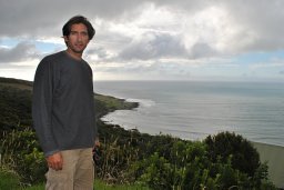 Jose Carlos Borrero合作论文数Department of Civil Engineering;University of Southern California;University of Southern California, University of Southern California29
 Aykut Ayca合作论文数20
 Costas E. Synolakis合作论文数Department of Civil and Environmental Engineering, University of Southern California20
 Sangyoung Son合作论文数School of Civil, Environmental and Architectural Engineering, Korea University19
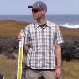 Nikos Kalligeris合作论文数Department of Environmental Engineering, Technical University of Crete19
 Bretwood Higman合作论文数Department of Earth Science, University of Washington18Plf Liu合作论文数16
 Adam Keen合作论文数HDR Engn Inc15Rick I. Wilson合作论文数15Hong Kie Thio合作论文数15
 Robert Weiss合作论文数Department of Geology and Geophysics, Texas A&M University14
 Eric Geist合作论文数Pacific Coastal and Marine Science Center, United States Geological Survey14
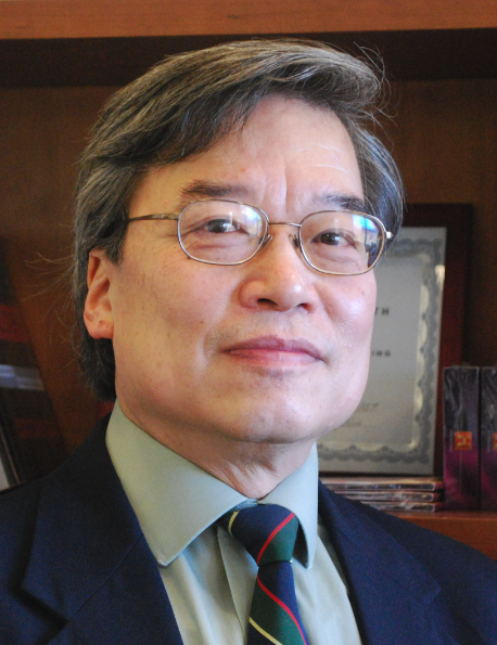 Philip L-F. Liu合作论文数School of Civil and Environmental Engineering, College of Engineering, Cornell University;Institute of Hydrological and Oceanic Sciences, National Central University;Department of Civil and Environmental Engineering, National University of Singapore13
 Kevin M Miller合作论文数12anne wein合作论文数11
 Dmitry Nicolsky合作论文数Permafrost Laboratory, Geophysical Institute, University of Alaska Fairbanks10J. Bwarie合作论文数9
 Luis Montoya合作论文数9
 Nathan J. Wood合作论文数Dept . of Geosciences;Oregon State Univ;Dept . of Geosciences, Oregon State Univ9
 Bruce E. Jaffe合作论文数U.S. Geological Survey9laurie johnson合作论文数8
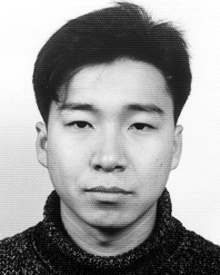 Daehong Kim合作论文数Seoul National University, Seoul, Korea
Jinyong Jung Seoul National University, Seoul, Korea
Sunghyun Lee Seoul National University, Seoul, Korea8
Daehong Kim合作论文数Seoul National University, Seoul, Korea
Jinyong Jung Seoul National University, Seoul, Korea
Sunghyun Lee Seoul National University, Seoul, Korea8 Willington Renteria合作论文数INOCAR, Instituto Oceanografico de la Armada de Ecuador8
 Marten Geertsema合作论文数BC Ministry of Forests and Range8
 Vasily V. Titov合作论文数Department of Civil & Environmental Engineering, University of Washington8
 Sasan Tavakkol合作论文数Google Research;Celeria Labs, LLC8Carl E. Mortensen合作论文数7Kate Long合作论文数7
 A. Barberopoulou合作论文数Department of Civil and Environmental Engineering, University of Southern California7
 Hermann Fritz合作论文数School of Civil and Environmental Engineering, College of Engineering, Georgia Institute of Technology7
 Keith Porter合作论文数Department of Civil, Environmental and Architectural Engineering, College of Engineering and Applied Science, University of Colorado Boulder7
 Dan H. Shugar合作论文数Ctr Nat Hazard Res, Simon Fraser Univ7Maile P. McCann合作论文数6Vassilios Skanavis合作论文数Academy of Athens6
 Göran Ekström合作论文数Department of Earth and Environmental Sciences, Columbia University;Lamont-Doherty Earth Observatory, Columbia University6
 Paul M Whitmore合作论文数6
 Geoffrey S Plumlee合作论文数Armed Forces Institute of Pathology6Charles R. Real合作论文数5Suzanne C. Perry合作论文数5Deborah M. Brosnan合作论文数5Khairil Irfan Sitanggang合作论文数5stephanie l ross合作论文数5Martin L. Eskijian合作论文数5
 Stephen Homer Kirby合作论文数5Donald Korycansky合作论文数Department of Earth Sciences;University of California5Breanyn Tiel Macinnes合作论文数5
 Daniel T. Cox合作论文数Wave Research Laboratory;Oregon State University;Wave Research Laboratory, Oregon State University5
 Hwung-Hweng Hwung (黃煌煇)合作论文数National Cheng Kung University5Lucile M. Jones合作论文数Department of Earth and Planetary Sciences;Massachusetts Institute of Technology;Department of Earth and Planetary Sciences, Massachusetts Institute of Technology5




