Spills of liquid petroleum hydrocarbons are a growing concern worldwide, posing great risks to marine life and community services. Identifying and treating oil spills is operationally and scientifically challenging and compounded by the difficulty in accurately obtaining real-time measurements of the oil thickness slicks. Here, we present a method that allows precise real-time measurement of oil slick thickness, based on active optical interferometry. A series of laboratory experiments with common hydrocarbon pollutant types, namely crude oil and gas condensate, showed that our method yields precise thickness measurements for slicks in the thickness range 0.382 - 23.3 (μm), with an accuracy of 95%. The proposed spectral-domain active interferometric system enables direct and physically grounded retrieval of oil film thickness without mechanical scanning and without reliance on ambient illumination. In principle, the system can be adapted for deployment at sea, opening the way for real-time, in situ thickness measurements that will improve oil-spill mitigation efforts and contribute to a deeper understanding of processes at the ocean-atmosphere interface.
Visibility underwater is challenging and degrades as the distance between the subject and the camera increases. That is why forward-looking underwater computer vision tasks are difficult. We have collected underwater forward-looking stereovision and visual-inertial image sets using two underwater imaging platforms, a stereo camera rig, and an ROV in the Mediterranean and Red Seas. To our knowledge, there are no other public data sets in the underwater environment with this forward-looking camera-sensor orientation that have published ground-truth depth maps as well as pose. These data sets are critical for the development of several underwater applications, including autonomous obstacle avoidance, visual odometry, 3D tracking, Simultaneous Localization and Mapping and depth estimation through deep learning. The stereo data sets contain synchronized stereo images, and the visual-inertial data sets include monocular images and inertial measurement unit (IMU) measurements with millisecond-level timestamp alignment. All data was collected in dynamic underwater environments with objects of known size. Both sensor configurations allow for scale estimation, with the calibrated baseline in the stereo setup and the IMU in the visual-inertial setup. Ground-truth depth maps were created offline for both data set types using a commercial photogrammetry software (Agisoft Metashape). The ground truth is validated with multiple known measurements placed throughout the imaged environment. There are four stereo and 12 visual-inertial data sets in total, each containing thousands of images, with a range of different underwater visibility and ambient light conditions, natural and man-made structures, and dynamic camera motions. The forward-looking orientation of the camera plus the corresponding ground truth makes these data sets unique and ideal for testing underwater obstacle-avoidance algorithms and for navigation close to the seafloor in dynamic environments. We show results from an experiment with a monocular depth estimation algorithm to demonstrate the applicability of the data sets. With our data sets, we hope to encourage the advancement of autonomous functionality for underwater vehicles in dynamic and/or shallow-water environments.
Autonomous Underwater Vehicles (AUVs) operate independently using onboard batteries and data storage, necessitating periodic recovery for battery recharging and data transfer. Traditional surface-based launch and recovery (L&R) operations pose significant risks to personnel and equipment, particularly in adverse weather conditions. Subsurface docking stations provide a safer alternative but often involve complex fixed installations and costly acoustic positioning systems. This work introduces a comprehensive docking solution featuring the following two key innovations: (1) a novel deployable docking station (DDS) designed for rapid deployment from vessels of opportunity, operating without active acoustic transmitters; and (2) an innovative sensor fusion approach that combines the AUV’s onboard forward-looking sonar and camera data. The DDS comprises a semi-submersible protective frame and a subsurface, heave-compensated docking component equipped with backlit visual markers, an electromagnetic (EM) beacon, and an EM lifting device. This adaptable design is suitable for temporary installations and in acoustically sensitive or covert operations. The positioning and guidance system employs a multi-sensor approach, integrating range and azimuth data from the sonar with elevation data from the vision camera to achieve precise 3D positioning and robust navigation in varying underwater conditions. This paper details the design considerations and integration of the AUV system and the docking station, highlighting their innovative features. The proposed method was validated through software-in-the-loop simulations, controlled seawater pool experiments, and preliminary open-sea trials, including several docking attempts. While further sea trials are planned, current results demonstrate the potential of this solution to enhance AUV operational capabilities in challenging underwater environments while reducing deployment complexity and operational costs.
We propose an efficient pipeline to register, detect, and analyze changes in 3D models of coral reefs captured over time. Corals have complex structures with intricate geometric features at multiple scales. 3D reconstructions of corals (e.g., using Photogrammetry) are represented by dense triangle meshes with millions of vertices. Hence, identifying correspondences quickly using conventional state-of-the-art algorithms is challenging. To address this gap we employ the Globally Optimal Iterative Closest Point (GO-ICP) algorithm to compute correspondences, and a fast approximation algorithm (FastSpectrum) to extract the eigenvectors of the Laplace-Beltrami operator for creating functional maps. Finally, by visualizing the distortion of these maps we identify changes in the coral reefs over time. Our approach is fully automatic, does not require user specified landmarks or an initial map, and surpasses competing shape correspondence methods on coral reef models. Furthermore, our analysis has detected the changes manually marked by humans, as well as additional changes at a smaller scale that were missed during manual inspection. We have additionally used our system to analyse a coral reef model that was too extensive for manual analysis, and validated that the changes identified by the system were correct.
We address the problem of looking into the water from the air, where we seek to remove image distortions caused by refractions at the water surface. Our approach is based on modeling the different water surface structures at various points in time, assuming the underlying image is constant. To this end, we propose a model that consists of two neural-field networks. The first network predicts the height of the water surface at each spatial position and time, and the second network predicts the image color at each position. Using both networks, we reconstruct the observed sequence of images and can therefore use unsupervised training. We show that using implicit neural representations with periodic activation functions (SIREN) leads to effective modeling of the surface height spatio-temporal signal and its derivative, as required for image reconstruction. Using both simulated and real data we show that our method outperforms the latest unsupervised image restoration approach. In addition, it provides an estimate of the water surface.
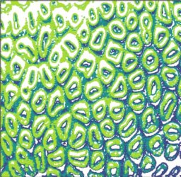
Zooids are the basic modules of colonial organisms. Despite the fact that they are the building blocks of coral colonies and by extension, of coral reefs, the role that zooids play in determining coral colony structure and growth has remained severely overlooked in ecological research. The patterns of addition of zooids (budding mechanics) determine much of the colony’s shape and function. Yet because zooids are small in size and large in numbers, ecological studies often focus on coral colonies as unitary organisms and little is known about how zooids vary within and between colonies and species. Nevertheless, advances in computer vision and deep learning create an opportunity to count and classify zooids on the reef scale and to infer their role in colony growth and structure.Here we present the first quantitative analysis of zooid morphogenesis in two coral genera captured in situ. These genera, Lobophyllia and Dipsastraea, represent two evolutionarily distinct forms of corals. We classified over 6000 zooids according to their developmental phase to study their basic attributes including size, association with structural complexity, and intra-colony neighbor relations. Our findings suggest that the morphogenetic cycle of zooids is conserved and size-dependent, that budding mechanics are associated with structural complexity, and that zooids form coalitions by developmental phase implying concentrated growth and stagnation.The zooid-centric approach is transferable and scalable and can be implemented to track corals in different applications from nurseries to wide scale monitoring programs. It can improve our understanding of coral colony formation, and how coral colonies and individual zooids react to disturbances such as physical damage from storms, coral bleaching, and pollution.This work bridges the gap between theory and in situ observations, making it a valuable resource for informing other research on coral colony formation and growth modeling, self-organization in modular systems, and coral reef restoration strategies. Moreover, our dataset has broad interdisciplinary value, with potential applications ranging from computer graphics and geometric modeling to studies of natural tiling patterns and spatial organization in biological systems.
Artificial reefs are anthropogenic structures that are submerged in purpose to mimic some of the attributes of natural reefs. Here we describe our workflow for 3D mapping of artificial reefs, particularly shipwrecks, and release a dataset containing two 3D models of some of the most epic dive sites in Israel. Our goal is to share our 3D models and protocol with the general public and to enable the scientific and recreational community to document artificial reefs in 3D and use the models in 3D visualization and printing applications. We envision that the models will be used by divers and 3D printing enthusiasts, dive operators, Non-Governmental Organizations, and government agencies dealing with underwater monitoring and marine spatial planning.
Underwater image restoration is a challenging task because of water effects that increase dramatically with distance. This is worsened by lack of ground truth data of clean scenes without water. Diffusion priors have emerged as strong image restoration priors. However, they are often trained with a dataset of the desired restored output, which is not available in our case. We also observe that using only color data is insufficient, and therefore augment the prior with a depth channel. We train an unconditional diffusion model prior on the joint space of color and depth, using standard RGBD datasets of natural outdoor scenes in air. Using this prior together with a novel guidance method based on the underwater image formation model, we generate posterior samples of clean images, removing the water effects. Even though our prior did not see any underwater images during training, our method outperforms state-of-the-art baselines for image restoration on very challenging scenes. Our code, models and data are available on the project’s website.
Calculating the surface area and volume of coral fragments is required in many research and monitoring settings, from ecological studies to university classes. Photogrammetry enables accurate and detailed 3D image based modeling which is perfect for this purpose. However, there is still room to determine the precision of 3D imaging on coral fragments. Moreover, little is known about the accuracy of 3D imaging with phone-based applications for scientific research. To bridge these gaps, we studied the ability of two 3D software platforms in modeling seven coral fragments. Our results show sub-cm precision in measuring surface area and volume of coral fragments. We found that utilizing a phone app enables accurate, high-resolution, 3D modeling of corals within minutes. This is important in light of the demand for such measurements in the coral research community, together with the global demise of coral reefs- urging for new technologies to become standardized.
Elevated sea surface temperatures are causing an increase in coral bleaching events worldwide, and represent an existential threat to coral reefs. Early studies of Mesophotic Coral Ecosystems (MCEs) highlighted their potential as thermal refuges for shallow-water coral species in the face of predicted 21(st) century warming. However, recent genetic evidence implies that limited ecological connectivity between shallow- and deep-water coral communities inhibits their effectiveness as refugia; instead MCEs host distinct endemic communities that are ecologically significant in and of themselves. In either scenario, understanding the response of MCEs to climate change is critical given their ecological significance and widespread global distribution. Such an understanding has so far eluded the community, however, because of the challenges associated with long-term field monitoring, the stochastic nature of climatic events that drive bleaching, and the paucity of deep-water observations. Here we document the first observed cold-water bleaching of a mesophotic coral reef at Clipperton Atoll, a remote Eastern Tropical Pacific (ETP) atoll with high coral cover and a well-developed MCE. The severe bleaching (>70 % partially or fully bleached coral cover at 32 m depth) was driven by an anomalously shallow thermocline, and highlights a significant and previously unreported challenge for MCEs. Prompted by these observations, we compiled published cold-water bleaching events for the ETP, and demonstrate that the timing of past cold-water bleaching events in the ETP coincides with decadal oscillations in mean zonal wind strength and thermocline depth. The latter observation suggests any future intensification of easterly winds in the Pacific could be a significant concern for its MCEs. Our observations, in combination with recent reports of warm-water bleaching of Red Sea and Indian Ocean MCEs, highlight that 21(st) century MCEs in the Eastern Pacific face a two-pronged challenge: warm-water bleaching from above, and cold-water bleaching from below.
Autonomous underwater vehicles (AUVs) are typically programmed to follow routes based on predefined waypoints and depth profiles. However, in complex and unpredictable environments-such as coral reefs, offshore structures, or ship-wrecks-AUVs can encounter unexpected obstacles that pose risks to both the vehicle and its surroundings. To navigate and avoid unexpected obstacles, AUVs operating in such environments are often equipped with forward-looking sonars (FLS). However, standard FLS sensors are typically limited in resolution and can only provide 2D information on bearing and range, restricting their effectiveness in facilitating navigation in complex environments. Vision cameras, on the other hand, offer high-resolution data with bearing and elevation information, but when using a single-camera setup, they cannot reliably provide distance information. This study introduces a comprehensive framework for the fusion of forward-looking camera (FLC) and FLS data, using a projection of FLS data into the FLC frame and incorporating data from a trained self-supervised network.
Extreme weather events are increasing in frequency and magnitude. Consequently, it is important to understand their effects and remediation. Resilience reflects the ability of an ecosystem to absorb change, which is important for understanding ecological dynamics and trajectories. To describe the impact of a powerful storm on coral reef structural complexity, we used novel computational tools and detailed 3D reconstructions captured at three time points over three years. Our data-set Reefs4D of 21 co-registered image-based models enabled us to calculate the differences at seven sites over time and is released with the paper. We employed six geometrical metrics, two of which are new algorithms for calculating fractal dimension of reefs in full 3D. We conducted a multivariate analysis to reveal which sites were affected the most and their relative recovery. We also explored the changes in fractal dimension per size category using our cube-counting algorithm. Three metrics showed a significant difference between time points, i.e., decline and subsequent recovery in structural complexity. The multivariate analysis and the results per size category showed a similar trend. Coral reef resilience has been the subject of seminal studies in ecology. We add important information to the discussion by focusing on 3D structure through image-based modeling. The full picture shows resilience in structural complexity, suggesting that the reef has not gone through a catastrophic phase shift. Our novel analysis framework is widely transferable and useful for research, monitoring, and management.
Research on neural radiance fields (NeRFs) for novel view generation is exploding with new models and extensions. However, a question that remains unanswered is what happens in underwater or foggy scenes where the medium strongly influences the appearance of objects. Thus far, NeRF and its variants have ignored these cases. However, since the NeRF framework is based on volumetric rendering, it has inherent capability to account for the medium's effects, once modeled appropriately. We develop a new rendering model for NeRFs in scattering media, which is based on the SeaThru image formation model, and suggest a suitable architecture for learning both scene information and medium parameters. We demonstrate the strength of our method using simulated and real-world scenes, correctly rendering novel photorealistic views underwater. Even more excitingly, we can render clear views of these scenes, removing the medium between the camera and the scene and reconstructing the appearance and depth of far objects, which are severely occluded by the medium. Our code and unique datasets are available on the project's website.
Refraction is a common physical phenomenon and has long been researched in computer vision. Objects imaged through a refractive object appear distorted in the image as a function of the shape of the interface between the media. This hinders many computer vision applications, but can be utilized for obtaining the geometry of the refractive interface. Previous approaches for refractive surface recovery largely relied on various priors or additional information like multiple images of the analyzed surface. In contrast, we claim that a simple energy function based on Snell's law enables the reconstruction of an arbitrary refractive surface geometry using just a single image and known background texture and geometry. In the case of a single point, Snell's law has two degrees of freedom, therefore to estimate a surface depth, we need additional information. We show that solving for an entire surface at once introduces implicit parameter-free spatial regularization and yields convincing results when an intelligent initial guess is provided. We demonstrate our approach through simulations and real-world experiments, where the reconstruction shows encouraging results in the single-frame monocular setting.
Visibility underwater is challenging, and degrades as the distance between the subject and camera increases, making vision tasks in the forward-looking direction more difficult. We have collected underwater forward-looking stereo-vision and visual-inertial image sets in the Mediterranean and Red Sea. To our knowledge there are no other public datasets in the underwater environment acquired with this camera-sensor orientation published with ground-truth. These datasets are critical for the development of several underwater applications, including obstacle avoidance, visual odometry, 3D tracking, Simultaneous Localization and Mapping (SLAM) and depth estimation. The stereo datasets include synchronized stereo images in dynamic underwater environments with objects of known-size. The visual-inertial datasets contain monocular images and IMU measurements, aligned with millisecond resolution timestamps and objects of known size which were placed in the scene. Both sensor configurations allow for scale estimation, with the calibrated baseline in the stereo setup and the IMU in the visual-inertial setup. Ground truth depth maps were created offline for both dataset types using photogrammetry. The ground truth is validated with multiple known measurements placed throughout the imaged environment. There are 5 stereo and 8 visual-inertial datasets in total, each containing thousands of images, with a range of different underwater visibility and ambient light conditions, natural and man-made structures and dynamic camera motions. The forward-looking orientation of the camera makes these datasets unique and ideal for testing underwater obstacle-avoidance algorithms and for navigation close to the seafloor in dynamic environments. With our datasets, we hope to encourage the advancement of autonomous functionality for underwater vehicles in dynamic and/or shallow water environments.
Depth estimation is critical for any robotic system. In the past years, the estimation of depth from monocular images has shown great improvement. However, in the underwater environment results are still lagging behind due to appearance changes caused by the medium. So far little effort has been invested in overcoming this. Moreover, underwater, there are more limitations to using high-resolution depth sensors, which is a serious obstacle to generating ground truth. So far unsupervised methods that tried to solve this have achieved limited success as they relied on domain transfer from a dataset in the air. We suggest network training using subsequent frames, self-supervised by a reprojection loss, as was demonstrated successfully above water. We propose several additions to the self-supervised framework to cope with the underwater environment and achieve state-of-the-art results on a challenging forward-looking underwater dataset.
The online symposium Shared Visions for Marine Spatial Planning: Insights from Israel, South Africa and the United Kingdom was held from 9–10 March 2021. Insights from this multi-disciplinary and international symposium included 1) current states of marine spatial planning (MSP) in the three countries, 2) how MSP can be a helpful tool to advance marine conservation, 3) the use and challenges of geospatial technologies for MSP, 4) how multidisciplinary, interdisciplinary and transdisciplinary efforts can help improve MSP processes and 5) recommendations for effective and collaborative MSP. Key reflections from the symposium included the need for MSP to be multi-, inter- and transdisciplinary in its stakeholder collaborations and aligned with in-country and area contexts.
The rapid decline of vulnerable coral reefs has increased the necessity of exploring interdisciplinary methods for reef restoration. Examining how to upgrade these tools may uncover options to better support or increase biodiversity of coral reefs. As many of the issues facing reef restoration today deal with the scalability and effectiveness of restoration efforts, there is an urgency to invest in technology that can help reach ecosystem-scale. Here, we provide an overview on the evolution to current state of artificial reefs as a reef reformation tool and discuss a blueprint with which to guide the next generation of biomimetic artificial habitats for ecosystem support. Currently, existing artificial structures have difficulty replicating the 3D complexity of coral habitats and scaling them to larger areas can be problematic in terms of production and design. We introduce a novel customizable 3D interface for producing scalable, biomimetic artificial structures, utilizing real data collected from coral ecosystems. This interface employs 3D technologies, 3D imaging and 3D printing, to extract core reef characteristics, which can be translated and digitized into a 3D printed artificial reef. The advantages of 3D printing lie in providing customized tools by which to integrate the vital details of natural reefs, such as rugosity and complexity, into a sustainable manufacturing process. This methodology can offer economic solutions for developing both small and large-scale biomimetic structures for a variety of restoration situations, that closely resemble the coral reefs they intend to support.
 Matan Yuval合作论文数12
 Yoav Y. Schechner合作论文数Viterbi Faculty of Electrical Engineering, Israel Institute of Technology10
 Yossi Loya合作论文数Department of Zoology, The George S. Wise Faculty of Life Sciences, Tel-Aviv University9
 David I Kline合作论文数Scripps Inst Oceanog, Univ Calif San Diego7
 Derya Akkaynak合作论文数Hatter Department of Marine Technologies, University of Haifa;Hatter Department of Marine Technologies, Interuniversity Institute for Marine Sciences in Eilat;Harbor Branch Oceanographic Institution, Florida Atlantic University;Department of Ecology and Evolutionary Biology, Princeton University;Sistine Solar, Inc7
 Shai Avidan合作论文数Department of Electrical Engineering, Faculty of Engineering, Tel-Aviv University7
 Dan Tchernov合作论文数Leon H Charney Sch Marine Sci Haifa, Univ Haifa6
 Neal Benjamin P合作论文数Global Change Institute, The University of Queensland6
 Oscar Beijbom合作论文数Zoox6
 David J. Kriegman合作论文数Department of Computer Science & Engineering, Jacobs School of Engineering, University of California, San Diego;Sight Commerce, Inc.6
 Greg W. Mitchell合作论文数DEPARTMENT OF BIOLOGY,CARLETON UNIVERSITY6Deborah Levy合作论文数5Morel Groper合作论文数5
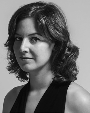 Dana Berman合作论文数Google5
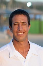 Gal Eyal合作论文数Department of Particle Physics;Weizmann Institute of Science;Department of Particle Physics, Weizmann Institute of Science5Aviad Avni合作论文数4
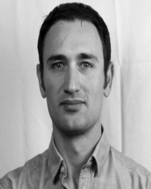 Yevgeni Gutnik合作论文数Hatter Dept Marine Technol, Univ Haifa4
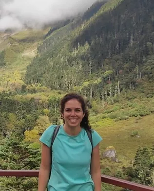 Naama Pearl合作论文数Marine Imaging Lab, University of Haifa;Dept. of Marine Technologies, School of Marine Sciences, University of Haifa4
 Paul L. D. Roberts合作论文数4
 Iñigo Alonso合作论文数HiTZ Center - Ixa, University of the Basque Country3A. D. Mullen合作论文数3Amit Peleg合作论文数3
 Ana C. Murillo合作论文数Dept. Informatica e Ingenieria de Sistemas (DIIS) Escuela de Ingenieria y Arquitectura (EINA) University of Zaragoza (UZ)3
 Dan Rosenbaum合作论文数Department of Computer Science, University of Haifa3Adi Khen合作论文数2
 Raz Tamir合作论文数Interuniv Inst Marine Sci Eilat, Elat, Israel2
 Bar-Massada Avi合作论文数Dept Biol & Environm, Univ Haifa2
 Zachary Murez合作论文数Wayve2
 Jules S. Jaffe合作论文数Physical Lab, Marine;Scripps Institution of Oceanography;Marine Physical Lab, Scripps Institution of Oceanography2
 Oren Levy合作论文数Department of Neurology, Columbia University2
 Simon Korman合作论文数Dept. of Electrical Engineering, Tel Aviv University2Deborah Steinberger-Levy合作论文数1Opher Bar Nathan合作论文数1C Kunz合作论文数1
 Ori Lifschitz合作论文数Viseaon Marine Imaging Lab1Andrea Gori合作论文数1Rivah N. Winter合作论文数1R.L. Brown合作论文数1
 Yonathan Shaked合作论文数1
 Pierre Drap合作论文数1Ofer Berman合作论文数1Shlomi Amitai合作论文数1Chih-Jui Tan合作论文数1N. Faure Beaulieu合作论文数1Ayumi Izioka‐Kuramae合作论文数1
 Yael Bekerman合作论文数1Tim Noyes合作论文数1Shah Selbe合作论文数1
 Stephanie M Sharuga合作论文数1




