Social-ecological systems (SESs) are complex adaptive systems that encompass multiple spatial, temporal, and organisational scales and levels. The dynamics of SESs are driven by interactions among processes occurring both within and across different levels. These multi-level interactions generate patterns of system behaviour that emerge at different spatial, temporal, and organisational levels. This has profound implications for managing SESs. Agent-based models (ABMs) are known for their ability to simulate emergent phenomena and are powerful tools for modelling SESs. However, most multi-level ABMs focus merely on individual/micro-level interactions and aggregated/macro-level interactions and rarely capture the true multi-level dynamics of SESs, which often include effects that cascade across multiple levels. We describe a conceptual framework for multi-level ABMs that couple processes occurring at intermediate levels with those occurring at micro and macro levels, and, more importantly, propose a mathematical construct that embodies the generic features of a truly multi-level ABM. We then discuss our proposed model within the context of past and potential future multi-level agent-based modelling efforts.
Do you want your model findings to be used and have a place in academic or policy discourse? Then PAVE that place. For modelers, PAVE (Purpose, Assumptions, Validity, and Exploration) is a semi-structured method to communicate the suitability of models to inform a particular purpose. For users of model results, PAVE is a method for identifying the strength with which model findings inform a question of interest. For all audiences, PAVE distills more comprehensive model documentation protocols into a simple set of concepts for modelers and users alike to discuss. In doing so, PAVE solves a dilemma: there is an audience for whom formal protocols for documenting model development, testing, and analysis are everything. And there is an audience for whom such technical tools are a terrifying abyss, neither to be approached nor looked upon. PAVE is meant to help these audiences talk to each other about model findings.
Rangelands cover approximately one-third of the earth's land area, at least one billion people depend on these lands for their livelihoods, and most rangelands have been degraded by inappropriate land use practices. Overgrazing and suppression of fire have facilitated encroachment of woody plants in what formerly were more open grasslands. However, proper management of fire and grazing (pyric herbivory) can mitigate woody plant encroachment. Although the basic ecological dynamics of rangeland ecosystems are well known, the long-term effects on local vegetation dynamics of ranch-level management decisions, particularly those involving the use of prescribed fire to limit woody plant encroachment, are less well understood. As a proof of concept, we describe a spatially explicit agent-based model of pyric herbivory that integrates biophysical and managerial components to simulate shifts in canopy cover of woody plants, forage production, and cattle production resulting from ranchlevel management decisions to adjust grazing pressure and prescribed fire regimes. We followed the pattern-oriented modeling approach to evaluate the usefulness of our model in exploring the effects of different pyric herbivory management schemes on a hypothetical 4000-ha ranch in the semi-arid rangelands of the southern Great Plains of the USA. Model evaluation simulations generated the expected shifting landscape mosaics of woody plant canopy cover, forage biomass, and grazing pressure that typify pyric herbivory. The most noticeable trend emerging from model application simulations was the effect of the relative sensitivity of adaptive management rules to changing ranch conditions on the ecological condition (an index of potential forage productivity) of the ranch and on the sale weight of calves. At relatively lower stocking rates, there was a noticeable increase in both ecological condition and sale weight of calves as adaptive changes to stocking rates or burning thresholds decreased in sensitivity to changing ranch conditions. However, these trends were not noticeable at relatively higher stocking rates. These results, while ecologically interpretable, are not realistic within a real-world ranch management context and we do not intend for our model application simulations to serve as a basis for real-word management recommendations. Nonetheless, we suggest that these simulations provide a proof of concept regarding the usefulness of spatially explicit, agent-based models, which explicitly integrate biophysical and managerial system components, in exploring the management of pyric herbivory.
In this paper, we illustrate the use of mediated modeling and collaborative learning as a framework for good modeling practice. We describe facilitatation of local stakeholder involvement in developing policy recommendations for managing important estuaries along the Texas Gulf Coast. We designed a shared system of learning among local stakeholders and scientists, and via a series of workshops integrated that shared learning into a quantitative computer model. The quantitative model that emerged focused on estuary components of greatest interest to participants. Workshop participants initially developed a conceptual model of two adjacent Texas Gulf Coast (USA) estuaries, which are part of the Mission Aransas National Estuarine Reserve. We then formalized the conceptual model into a quantitative model representing the spatial-temporal dynamics of one of the estuaries. Engagement in this collaborative modeling process enabled workshop participants to understand more fully what is known, suggest ways to fill important knowledge gaps, and to experiment with the quantitative model to project possible futures for the selected estuary.
Cattle fever ticks (CFT), Rhipicephalus (Boophilus) annulatus and R. (B.) microplus, threaten the economic security of the USA cattle industry as vectors of Babesia bigemina and B. bovis. Of the two CFT, R. microplus has a more invasive biology and thrives in tropical and subtropical ecosystems. The U.S. Cattle Fever Tick Eradication Program successfully eliminated CFT from the southern USA and has since prevented CFT re-establishment by operating surveillance and quarantine in South Texas, including the permanent quarantine zone along the Texas-Mexico border. However, introductions and successful establishment of alternate CFT hosts, including white-tailed deer (Odocoileus virginianus) and nilgai (Boselaphus tragocamelus) in the Tamaulipan biome, have complicated eradication efforts. We used location intelligence and a spatially explicit, individual-based model to simulate potential impacts of wildlife hosts on R. microplus infestation/eradication dynamics in the Laguna Atascosa National Wildlife Refuge that encompasses a brushland ecosystem with diverse coastal habitats, including parts of a lagoon in South Texas. Results of our hypothetical eradication scenarios suggest that even sparse populations of wildlife hosts can maintain R. microplus populations in habitat-specific refugia during eradication efforts. The present model version is the first to have incorporated a georeferenced representation of a real landscape and to have integrated site-specific field data on climatic conditions and cattle movement patterns. Model forecasts of spatially explicit chronologies of changes in R. microplus densities can aid in a priori evaluation of field sampling strategies and treatment applications in specific landscapes under specific environmental conditions.
Knowledge gaps on the dynamics of cattle fever tick-cattle-habitat-climate interactions in South Texas and their influence on the efficacy of treatments to eliminate infestations with the Rhipicephalus (Boophilus) microplus prevent optimal interventions by the Cattle Fever Tick Eradication Program (CFTEP). The CFTEP has been operating in the USA since 1907. This study applied the concept of location intelligence to examine movement, habitat use and selection by cattle in a highly heterogeneous coastal landscape infested with R. microplus. Cattle interface with white-tailed deer and nilgai, which are alternate wildlife hosts of R. microplus, in this unique South Texas landscape. Location intelligence data obtained from GPS collars placed on steers between August and December 2019 that were treated as part of the protocol to eradicate R. microplus were used to track their movement in the tick-infested rangeland of the Laguna Atascosa National Wildlife Refuge. GIS spatial analyses were conducted to determine time-of-day (morning, midday, evening, midnight), and seasonal differences in: (i) distance of cattle movements; (ii) cattle habitat use and selection; (iii) spatial spread of cattle; and (iv) distance to closest watering site. Cattle movement patterns, habitat use and selection, spatial spread, and distance to closest watering sites were significantly different between the summer and autumn periods. These variables were also significantly different by time-of-day periods within and between seasonal periods. Habitat use and selection by steers are discussed in the context of range sites and vegetation types. Nine ixodid tick species were documented through the inspection of hosts (cattle, nilgai, and white-tailed deer). Rhipicephalus microplus was collected from white-tailed deer and nilgai during cull hunts, as well as from project cattle that missed one anti-tick treatment due to adverse weather conditions. Tick-host-habitat-climate interactions involving cattle and wildlife, future grazing strategies for anti-tick treated cattle, and potential impacts of tick-refugia are discussed in the context of location intelligence. Spatiotemporal patterns of cattle habitat use and selection across an infested coastal landscape in South Texas revealed by location intelligence could inform adaptive operations of the CFTEP to keep the USA free of R. microplus.
We describe an agent-based model purposed for social learning, which was developed by stakeholders, with the technical assistance of professional modelers, to facilitate stakeholder involvement in modeling issues related to the development of an adaptive environmental management plan for the Texas Gulf Coast (USA) estuaries. Stakeholders developed the model during six workshops that spanned a three-year period, and used the model to simulate the population dynamics (recruitment, growth, movement, and mortality) of blue crabs (Callinectes sapidus) in the Aransas and Copano Bays in response to various freshwater inflow and harvest scenarios. Results of scenarios representing normal, low, and high harvest levels indicated little effect on blue crab abundances, but harvests increased ≈75 % when harvest level was doubled and decreased ≈50 % harvest level was halved. These results failed to confirm the perceptions of stakeholders. However, upon more thorough consideration of the scientific bases for the quantitative representation (by the modelers) of the processes they wanted to include in the model, most stakeholders realized their initial perceptions were inconsistent with current data-based knowledge. • The agent-based model is described using the ODD protocol. • The brief model user's guide is provided. • The model calibration, verification, and technical evaluation are described.
Global water systems are facing unprecedented pressures, including climate change-driven drought and escalating flood risk, environmental contamination, and over allocation. Water management and governance typically lack integration across spatial scales, including relationships between surface and ground water systems. They also routinely ignore connectivity across temporal scales, including the need for intergenerational water planning. As a global and interdisciplinary group of scientists, we seek to highlight how power and scale dynamics influence and determine water outcomes. We argue that attending to complex water systems challenges requires understanding the function and influence of power at different temporal and spatial scales. Building this understanding is key to designing multi-scalar, reflexive, and pluralistic policy solutions that avoid ineffective or unintended outcomes. We use a co-learning process to reveal important lessons for the challenge of interdisciplinary research and set a pluralist agenda for understanding power and scale in future water governance. This article is categorized under: Human Water > Water Governance Human Water > Water as Imagined and Represented Human Water > Methods
Abstract Human impacts on aquatic ecosystems have resulted in systemic declines of global freshwater species abundance and richness. Conservation and governmental groups worldwide have designated protected areas to preserve the remaining diversity. The biodiversity hotspot approach, which designates areas based on high levels of species richness, has been useful for identifying areas to protect both terrestrial and aquatic species. However, for freshwater species, additional approaches are warranted to identify specific stream reaches for protection and/or restoration. To address this issue, we present a methodology to create a Gridded River Identification System (GRIS) for river segments based on 30 arc‐second grids (~0.9 km) using the USGS National Hydrography High Resolution Dataset. To demonstrate the utility of this approach, we obtained occurrence data for six imperiled freshwater mussel species in Texas and created ensemble species distribution models (ESDMs) based on climate and topographical variables. Predicted occupancies were overlayed onto the GRIS in Texas. The predicted occupancies were rank ordered from 1 to 5, with 1 being the lowest probability of occupancy and 5 being the greatest. The rank‐ordered segments were then used to identify reaches for conservation and restoration activities. Our approach is novel and widely applicable to other freshwater species so long as distribution information is available. The GRIS can also be easily developed for stream systems outside of the current study area. Future studies could build upon our framework by incorporating additional taxa data and projected changes in climate and land use.
‘Early detection and rapid response’ (EDRR) is the most successful framework for preventative invasive species management, but prioritizing localized EDRR actions with limited resources is challenging. An approach that ranks individual locations, such as waterbodies, for EDRR by combining an invasive species' establishment risk with the practicality of managing it could help set reasonable priorities. Here, we worked with regional practitioners in Arkansas, USA, and the broader Southeastern USA to co‐produce a workflow for preventative aquatic invasive species management that (1) estimates establishment risk under current and future climates with a species distribution model, (2) scores waterbodies according to difficulty of eradicating an aquatic invasive species if it were introduced and (3) combines establishment risk and eradication difficulty scores to rank waterbodies according to preventative management priority. As our focal species, we used giant salvinia (Salvinia molesta), a floating aquatic fern ranked among the worst weeds in the world due to its negative socio‐ecological impacts and difficulty to eradicate once established. Current establishment risk is low for much of our study area, but under future climate scenarios (RCP 8.5), areas with >60% giant salvinia establishment risk increased from 546 km2 to 30,219 km2 between 2023 and 2040 in Arkansas. We found giant salvinia establishment risk and eradication difficulty are independent of each other (r = 0.28), and it follows that, alone, early detection tools such as species distribution models are insufficient for managers to prioritize sites for EDRR. Practical implication: We envision our approach fitting into a potential EDRR workflow that cascades from broad‐ to local‐scale. To illustrate, (1) horizon scanning and/or climate matching generates lists of high‐risk invasive species; (2) species lists are narrowed according to eradication feasibility scores; (3) for all remaining species, all waterbodies across a geography of interest receive prioritization rankings based on establishment risk and eradication difficulty scores. Given that climate change makes predicting invasive species' distributions a moving target, combining co‐produced eradication difficulty scoring with species distribution modelling will balance rigour with practicality when prioritizing locations for EDRR.
Invasions of nonnative species have multiple implications, including modification of biogeochemical cycles, inhibition of natural regeneration of native species, and loss of ecosystem biodiversity and productivity. Japanese honeysuckle (Lonicera japonica Thunb.) is a vigorous invader of the southern forestlands of the United States (U.S.). Our objectives were to document changes in the distribution of Japanese honeysuckle since the turn of the century, identify climatic variables correlated with its successful invasion, and project its potential future distribution under climate change. To accomplish this, we analyzed the most recent U.S. Forest Service field measurements of Japanese honeysuckle in the southern U.S. Our analysis indicated that the number of sampled plots invaded by Japanese honeysuckle from 2009 to 2017 increased by approximately 53
The metaphor of the Medawar zone describes the relationship between the difficulty of a scientific problem and the potential payoff of solving it. This zone represents the realm where questions offer high benefits relative to the effort required to address them. By harnessing the power of mechanistic modelling, scientists can navigate towards this zone, moving beyond known unknowns to discover unknown unknowns. This requires models to be realistic and reliable. Model usefulness, impact, and predictive power can be enhanced by achieving intermediate model complexity, where the trade-off between the realism and tractability of a model is optimised. To achieve these goals, we use the pattern-oriented modelling strategy (POM) to direct research into the Medawar zone by steering model structure towards intermediate complexity. We illustrate this strategy with a detailed conceptual process. Using example models from agri-ecological systems, we demonstrate how intermediate complexity can be attained through POM, and how pattern-oriented models of intermediate complexity that reproduce multiple patterns can uncover both known unknowns and unknown unknowns, which ultimately advances our understanding of complex systems and facilitates groundbreaking discoveries. In addition, we discuss the multidimensionality of the Medawar zone in the context of modelling philosophy and highlight the challenges and imperatives for achieving coherence in the modelling discipline. We emphasize the need for collaboration between end-users and modellers and the adoption of systematic modelling strategies such as POM.
Landscape evolution is often driven by the bioengineering activities of multiple species interacting with one another, which modify the Earth's surface topography and processes. In this study, we used a spatially explicit, individual-based simulation model to investigate potential biogeomorphological coevolutionary feedback relationships. Specifically, we examined how pocket gophers, grassland vegetation, and associated bioengineered soil landscapes may co-define and co-adjust with each other. The model used in this study was parameterized to represent a hypothetical grassland ecosystem typical of those found in California, USA. We found that, as pocket gopher preference for annual plants increased, (i) the number of mounds constructed by these animals increased, (ii) the length of the burrow systems increased, (iii) the complexity of the burrow systems increased, and (iv) the area supporting perennial plants decreased. Collectively, these results would lead to greater food availability (i. e., annual plants) and a more favorable habitat for foraging, breeding, raising offspring, and evading predators. Therefore, the emerging habitat conditions engineered by pocket gophers are expected to eventually enhance their fitness when they increasingly burrow under areas dominated by annual vegetation. As traits associated with preference for annual plants are favored and passed on to future generations, a reinforcing feedback loop between preference for annuals and gopher fitness is anticipated to develop and persist over evolutionary timescales. Our model provides a comprehensive overview by integrating three types of selection pressures: environmental conditions, species interactions, and habitat conditions modified by multiple coevolving engineer species. We anticipate that this study will motivate geoecologists, evolutionary biologists, and geomorphologists to expand their focus beyond their traditional domains within the biological and physical sciences, encouraging exploration of the integrative discipline of biogeomorphology.
Error propagation is an important consideration in individual-based modeling, but it has been considered insufficiently studied. We investigated the propagation of error due to uncertainty in initial conditions using a previously published spatially-explicit individual-based model that simulates infestation of sorghum by an invasive pest aphid, Melanaphis sorghi (Theobald) [sorghum aphid; previously published as sugarcane aphid, Melanaphis sacchari (Zehntner)]. We initialized the model with aphids in three alternative initial infestation locations using one of three neighboring cells and analyzed the resulting model outputs in three pairwise scenario comparisons. The spatio-temporal patterns of aphid infestation, as estimated by timing and probability of first infestation, were statistically significantly different between the scenarios, but the differences were locally restricted and scenario-dependent. In particular, the two pairwise differences between scenarios originating from neighboring cells indicated that error propagation through the studied system depends not only on the physical distance between the alternative initialization cells (i.e., the extent of the initial spatial uncertainty), but also on the actual location of the model initialization cells, likely reflecting differences in the environmental characteristics of those locations. Despite the statistical significance, the differences were small from the perspective of practical application with few highly localized exceptions. The spatio-temporal trajectories of the propagating error indicate that, within the examined range, the spatial uncertainty in model initialization has a low effect on the timing and probability of first infestation, and the propagation of the error in the observed variables is limited by the system itself.
Models of socio-environmental or social-ecological systems (SES) commonly address problems requiring interdisciplinary scientific expertise and input from a heterogeneous group of stakeholders. In SES modelling multiple interactions occur on different scales among various phenomena. These scale phenomena include the technical, such as system variables, process detail, inputs and outputs, which most often require spatial, temporal, thematic and organisational choices. From a good practice and project efficiency perspective, the problem scoping and conceptual model formulation phase of modelling is the one to address well from the outset. During this phase, intense and substantive discussions should arise regarding appropriate scales at which to represent the different phenomena. Although the details of these discussions influence the path of model development, they are seldom documented and as a result often forgotten. We draw upon personal experience with existing protocols and communications in recent literature to propose preliminary guidelines for documenting these early discussions about the scale(s) of the studied phenomena. Our guidelines aim to aid modelling group members in building and capturing the richness of their rationale for scoping and scale decisions. The resulting transcripts are intended to promote transparency of modelling decisions and provide essential support for the justification of the final model for its intended use. They also facilitate adaptive modifications of the pathway of model development via retracing decisions and iterative reflection upon alternative scale options.
Bacillus anthracis, the causative agent of anthrax in humans, livestock, and wildlife, exists in a community with hundreds of other species of bacteria in the environment. Work on the genetics of these communities has shown that B. anthracis shares a high percentage of chromosomal genes with both B. thuringiensis and B. cereus, and that phenotypic differences among these bacteria can result from extra-chromosomal DNA in the form of plasmids. We developed a simple hypothetical individual-based model to simulate the likelihood of detecting plasmids with genes encoding anthrax toxins within bacterial communities composed of B. anthracis, B. thuringiensis, and B. cereus, and the surrounding matrix of extra-cellular polymeric substances. Simulation results suggest the horizontal transfer of plasmids with genes encoding anthrax toxins among Bacillus species persisting outside the host could function as a proximate factor triggering anthrax outbreaks.
 Wang Hsiao-Hsuan合作论文数Department of Wildlife and Fisheries Sciences;M University;Department of Wildlife and Fisheries Sciences, Texas A&M University107
 Koralewski Tomasz E合作论文数Department of Ecosystem Science and Management, Texas A&M University;Department of Ecosystem Science and Management, Texas A&M University22
 Pete Teel合作论文数Department of Entomology, College of Agriculture & Life Sciences, Texas A&M University20
 John K. Westbrook合作论文数11
 Michael J. Brewer合作论文数Integrated Pest Management Program, Michigan State University10Norman C. Elliott合作论文数USD10
 Todd M. Swannack合作论文数Texas A&M University, Texas A&M University9Zakary Derouen合作论文数8Robert L. Lochmiller合作论文数8
 William E. Rogers合作论文数Department of Ecology;Rice University;Department of Ecology, Rice University8Michael Mogg合作论文数7Jennifer Borski合作论文数7
 Adalberto Perez De Leon合作论文数San Joaquin Valley Agricultural Sciences Center, United States Department of Agriculture7
 Alexandra Bishop合作论文数6Teague Richard合作论文数Texas A&M AgriLife Research Center;Ecosystem Science and Management, Texas A&M University;Texas A&M AgriLife Research Center, Texas A&M University6
 Eric C. Hellgren合作论文数Southern Illinois University at Carbondale6
 Tarla Rai Peterson合作论文数Texas A & M University6e k pedersen合作论文数5heriberto diaz solis合作论文数5Adam Baker合作论文数5
 Miranda Peterson合作论文数Ecol Syst Lab, Texas A&M Univ5
 Gary McCracken合作论文数Department of Ecology & Evolutionary Biology, College of Arts and Sciences, The University of Tennessee, Knoxville5
 Carissa Wonkka合作论文数West Florida Research and Education Center, Univeristy of Florida;School of Forestry, Fisheries, and Geomatic Sciences, Univeristy of Florida5Thomas G. Hallam合作论文数5
 Thomas H. Kunz合作论文数Department of Biology,Boston University5M.M. Kothmann合作论文数5
 Markus J. Peterson合作论文数Department of Wildlife and Fisheries Sciences;Texas A&M University;Department of Wildlife and Fisheries Sciences, Texas A&M University5
 Rodrigo A. Medellín合作论文数Instituto de Ecología, Universidad Nacional Autónoma de México5
 Margrit Betke合作论文数Department of Computer Science, Boston University Arts & Sciences;Faculty of Computing & Data Sciences, Boston University5
 Taylor G Donaldson合作论文数Department of Entomology, Texas A&M AgriLife Research4s marin合作论文数4Arnulfo Moreno-Valdez合作论文数4
 Chris Sansone合作论文数4Kimberly H. Lohmeyer合作论文数4Michael E Kjelland合作论文数4
 Urs P. Kreuter合作论文数Department of Rangeland Ecology and Management, Texas A&M University4
 S. Thomas Purucker合作论文数4
 Miguel A. Mora合作论文数Department of Wildlife and Fisheries Sciences, Texas A&M University and United States Geological Survey4
 X. Ben Wu合作论文数Texas A&M University4Paula Federico合作论文数4
 M. R. J. Forstner合作论文数4
 Cutler John Cleveland合作论文数Department of Earth and Environment, Arts & Sciences, Boston University/Institute for Sustainable Energy, Boston University4virginia vargas tristan合作论文数3florencio briones encinia合作论文数3abelardo saldivar fitzmaurice合作论文数3eduardo gomez de la fuente合作论文数3
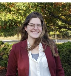 Samantha Heldman合作论文数Institute of Environmental Health Sciences and Department of Pharmacology, Wayne State University3
 A M Faris合作论文数Dept Entomol, Texas A&M AgriLife Res & Extens Ctr3
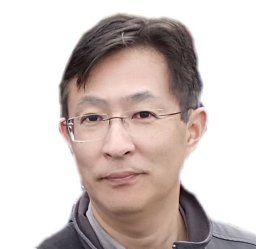 Fujiwara Masami合作论文数3




