The deliberate burial of dingoes by Aboriginal people is a widespread and significant Late Holocene practice in Australia, yet the details of this practice remain poorly understood, in part due to the scarcity of well-documented archaeological excavations. Here, we report on the excavation of a dingo burial in Kinchega National Park on Barkindji Country, in the Menindee Lakes region of western New South Wales. First identified by Barkindji Elders in the eroding face of a road cut, the skeletal remains were excavated and examined at the request of the Menindee Aboriginal Elders Council. The Garli (Barkindji for dingo) represents the first published dingo burial from the Baaka (Darling River) region. Buried nearly 1,000 years ago, the Garli was interred within a riverside midden that continued to be added to by Barkindji Ancestors for approximately 500 years thereafter. This finding extends the known northern and western limits of pre-colonial dingo burial practices in the Murray-Darling Basin. Analysis of the dentition and postcranial skeleton suggests the dingo was tamed: it was male, of advanced age for a dingo (4-7 years), consumed a diet with relatively high abrasive content, and had healed traumatic injuries to the ribs and lower leg. Lesion-like features at several limb joints, along with other superficial modifications, suggest a complex taphonomic history following burial. This excavation provides new insights into dingo burial practices in Australia and attests to the close relationship between Aboriginal ancestors and their dingoes.
Widgingarri Shelter 1 (WS1) is a rock shelter site within a small escarpment and preserves evidence of late Pleistocene and Holocene human activity. The site was first excavated in 1985 and again in 2022. Here, we present the stratigraphy and chronology following the latter excavation. Site context and stratigraphy were investigated through field observations of the landscape, site and soil micromorphology. A chronological framework was established from optical dating of 37 sediment samples, dated using the optically stimulated luminescence (OSL) signals from individual grains of quartz. These datasets were combined to develop a chronostratigraphic framework for the site, which is used to present a site formation history. Four phases of site formation were identified that encompass the period between similar to 64,000 years ago and the present, including a lacuna between similar to 40,000 and similar to 23,000 years ago. The shelter space formed under a collapsed escarpment block, and the collapse likely overlapped with the period when people used this space. The sandy sediment that accumulated inside the shelter is extensively reworked. We present an approach for pairing the information obtained from single-grain OSL dating with geoarchaeological observations to disentangle the complicating effects of postdepositional sediment mixing.
Pinnacle Point Site 5-6 (PP5-6) is a key archaeological and paleoenvironmental site located on the edge of the Palaeo-Agulhas Plain along the southern Cape coast of South Africa. Construction of high-resolution chronologies for archaeological sites beyond the range of radiocarbon dating is challenging. Geochronological methods such as optical dating are hampered by the availability of applicable materials that are directly associated with the events of interest. Optical dating relies on assumptions made about time-dependent changes and is made up of a series of measurements each with its own random and systematic uncertainties that together make up the age estimates. In this study, we explicitly took on the challenge to systematically produce a high-resolution chronology for PP5-6 made up of 197 individual age estimates of which 169 were input into a Bayesian age model. PP5-6 is ideal because of its fine-scale stratigraphy and use of modern excavation techniques and detailed recording of stratigraphy and plotted finds. Excavations and dating took place concurrently over almost two decades to inform the dating strategy, contextualise sample choice and data analysis, and to bring the scales of analysis of different proxies closer together. Here we present the optical dating process, including sensitivity tests of our instruments, data analysis procedures and modelling approach. We then construct a final timeline for comparisons with other proxy data and interpretation of the sedimentary sequence and occupation of PP5-6 over an interval of similar to 60,000 years from similar to 110,000 to similar to 50,000 years ago. We show how closely linked sediment deposition is to changes in global climate and sea-level, identify a few Pleistocene and Holocene erosional events that modified the site post-depositionally and place a variety of interconnected causes and effects coincident with different types of occupation on this timeline. This approach opens up opportunities to reduce the resolution of chronologies closer to the human timescales required to improve our understanding of changes through time and to make more direct comparisons between other sites and proxies that contain similarly highly resolved archives of human occupation and change.
Denisova Cave in southern Siberia is the only site known to have been occupied by Denisovans, Neanderthals and modern humans. The cave consists of three chambers (Main, East and South), with the archaeological assemblages and remains of hominins, fauna and flora recovered from Main and East Chambers being the most thoroughly investigated to date. Here we report the results of analyses of the Palaeolithic artefacts, faunal remains and hominin and mammalian mitochondrial (mt) DNA recovered from renewed excavations in South Chamber. We construct a calendar-year time scale for the stratified Pleistocene deposits from optical dating of the sediments. The timing of hominin occupation and major turnovers in the mtDNA of Denisovans and large mammals largely accords with the patterns detected in Main and East Chambers. Time gaps in those sequences are partly filled by the South Chamber data and the sediment DNA record of Denisovans after 80,000 years ago is more than doubled in size. We combine the sediment dating and DNA records for all three chambers to reveal the whole-of-cave history of this unique site and the climatic conditions experienced by hominins and fauna over the past 300,000 years, including potential changes in habitat suitability for Denisovans and Neanderthals.
Nearly two thirds of the world's population depend on monsoon rainfall, with monsoon failure and extreme precipitation affecting societies for millennia. Monsoon hydroclimate is predicted to change as the climate warms, albeit with uncertain regional trajectories. Multiple glacial-interglacial terrestrial records of east Asian monsoon variability exist, but there are no terrestrial records of equivalent length from the coupled Indo-Australian monsoon at its southern limit - Australia. We present a continuous 150,000-year lacustrine record of monsoon dynamics from the core monsoon region of northern Australia based on the proportion of dryland tree pollen in the total dryland pollen spectra and the hydrogen isotope composition of long chain n-alkanes. We show that rainfall at the site depends strongly on sea level, which changes proximity of the coast to the site by 320 km over the last glacial-interglacial cycle. Long-term trends in rainfall are broadly anti-phased with the east Asian monsoon modulated by coastal proximity. The record also contains multiple, short intervals (similar to 2 to < 10,000 years) of large changes in tree cover (from 5 to 95 % tree pollen over 3000 years in one instance). Changes in tree cover are frequently but not always, accompanied by synchronous large changes in the other hydroclimate proxies. While these wetter periods cannot be easily ascribed to orbitally induced changes in insolation or coastal proximity, they are correlated with most Heinrich events. This relationship implies that strong asymmetry in inter-hemispheric monsoon rainfall might be one outcome of the current weakening in the strength of the Atlantic meridional overturning circulation, through a reduction in oceanic heat transfer from the Southern to the Northern Hemisphere.
Knysna Eastern Heads Cave 1 (KEH-1), a south-facing archaeological site on the southern coast of South Africa preserves the first record directly relevant to the lives and environments of people living on the edge of the Palaeo-Agulhas Plain (PAP) from later Marine Isotope Stage (MIS) 3 after-45 thousand years ago (ka) and continuing throughout the Last Glacial Maximum (LGM, 26.5-19 ka). This stratified deposit dated from at least-45 ka until-15 ka (modelled ages), includes periods of intensive site use by human forager populations from-34 ka to-19 ka and during the Holocene. Here we present a synthesis of the stratigraphy, chronology, and archaeological find distribution, including estimates of relative find density over time. We show that forager populations exploited coastal resources during late MIS 3. This contrasts with a subsequent and prolonged period of intensive site use during the LGM when foragers shifted their focus more to terrestrial resources. KEH-1 bridges a critical chronological gap between key Middle Stone Age (MSA) and Later Stone Age (LSA) archaeological sites along the southern coast and provides the first evidence of an intensive and continuous record of occupation on the edge of the PAP near the end of the Pleistocene. This result provides the first archaeological record explicitly tested against a recently published dynamic model of the PAP ecosystem that predicts relatively high concentrations of human foragers on the plain during the LGM. Given the continuity of the KEH-1 archaeological record and its contemporaneity with multiple technological transitions known from archaeological sites across southern Africa, the site is important to interpretations of the MSA to LSA transition. Further, the temporal overlap between KEH-1 and the deep inland sequence at Boomplaas Cave, as well as the later MIS 2 deposits at nearby Nelson Bay Cave provides an important expansion of the Western Cape regional archaeological record.
At the time of European arrival on the Australian continent, sophisticated Indigenous societies practiced land management across Australia’s extensive tropical savannahs. Fire was one of the main tools people used to manipulate fuel loads and connectivity to reduce uncontrolled wildfire, maintain vegetation structure and enhance biodiversity. When this alteration of a ‘natural’ fire regime to a human-dominated fire regime occurred is not known. Here we assessed fire incidence and intensity over the past 150,000 years through a continuous lacustrine record by comparing the accumulation rates of micro-charcoal and stable polycyclic aromatic hydrocarbon that form during the combustion of vegetation. We also compared grass (mainly C 4 ) pollen as a percentage of total dryland pollen with the carbon isotope composition of the stable polycyclic aromatic hydrocarbon. We established with high statistical certainty that a change in fire regime occurred at least 11,000 years ago from less-frequent, more-intense fires to more-frequent, less-intense fires. This change marked the overprinting of a largely natural fire regime by one at least modulated by Indigenous management. Our findings demonstrate that human fire use has modified fire regimes throughout the Holocene and also show how people have managed the potential for the type of high-intensity fires that are likely to increase in the future.
Southern Africa features an intensively studied Stone Age sequence, though one with geographical and temporal gaps. The archaeology of Marine Isotope Stage (MIS) 3 remains understudied, particularly between ~ 50 − 25 ka. This period encompasses numerous ecological, demographic and behavioural changes, most notably the passage from Middle Stone Age (MSA) to Later Stone Age (LSA) technologies. In western South Africa, previous research postulated a hiatus in the cultural sequence during the second half of MIS 3, potentially reflecting depopulation due to hyperarid environments. Here we document rare occupations during this period in the Western Cape at Mertenhof Rock Shelter (MRS) by providing new chronometric and technological data. OSL estimates suggest two pulses of low-density occupations at ~ 50 ka and 41 − 37 ka, allowing for a diachronic assessment of technological changes. These sporadic MSA occupations complement the more widespread occurrence of open-air settlements along the Doring River during ~ 50 − 35 ka. At MRS, knappers procured local rock types and produced small flakes and some blades via platform and bipolar reduction but without Nubian methods. The retouched pieces feature splintered pieces and denticulates but mostly lack points. Notable differences to sites in eastern southern Africa underscore ongoing technological regionalization and demographic partitioning during MIS 3. The temporal changes in the sequence show no consistent trajectory towards the ELSA in the region that appears around 25 ka. Lithic and chronometric evidence from MRS supports scenarios of a long persistence of the MSA within MIS 3 in southern Africa and a late emergence of the LSA after 35 ka.
The distribution of equivalent dose (De) values of individual feldspar grains is affected by a range of variables, including internal and external dose rates, residual doses, and uncertainties associated with luminescence behaviours and measurement errors. The distributions of these variables may be non-Gaussian, resulting in a complex De distribution pattern that may be challenging to interpret and analyse using conventional statistical models. To address this problem, we present an empirical Bayesian hierarchical age model for feldspar (BHAM-F), which integrates all key components involved in the optical dating of individual feldspar grains. The model is based on application of the standardised growth curve and LnTn methods to obtain a full distribution of single-grain De values, and use of prior information about major sources of uncertainty that can be obtained experimentally or theoretically. A Bayesian outlier model is also adopted to detect and deal with outliers. We test and validate the BHAM-F using an experimentally gathered dataset obtained from a sediment sample and various simulated datasets. Our results show that the BHAM-F provides a robust and flexible way to hierarchically deal with data obtained in single-grain optical dating of feldspars.
Secure archaeological evidence for human occupation on the eastern seaboard of Australia before ~ 25,000 years ago has proven elusive. This has prompted some researchers to argue that the coastal margins remained uninhabited prior to 25 ka. Here we show evidence for human occupation beginning between 30 ± 6 and 49 ± 8 ka at Wallen Wallen Creek (WWC), and at Middle Canalpin Creek (MCA20) between 38 ± 8 and 41 ± 8 ka. Both sites are located on the western side of Minjerribah (North Stradbroke Island), the second largest sand island in the world, isolated by rising sea levels in the early Holocene. The earliest occupation phase at both sites consists of charcoal and heavily retouched stone artefacts made from exotic raw materials. Heat-treatment of imported silcrete artefacts first appeared in sediment dated to ~ 30,000 years ago, making these amongst Australia’s oldest dated heat-treated artefacts. An early human presence on Minjerribah is further suggested by palaeoenvironmental records of anthropogenic burning beginning by 45,000 years ago. These new chronologies from sites on a remnant portion of the continental margin confirm early human occupation along Sahul’s now-drowned eastern continental shelf.
In applications of optically stimulated luminescence (OSL) dating to unconsolidated sediments, the burial age of a sample of grains is estimated using statistical models of the distribution of the experimentally determined equivalent doses of the grains, together with estimates of the environmental dose rate. For grains that have been vertically mixed after deposition (e.g., due to bioturbation), existing dose models may fail to appropriately account for the complexity of the mixing process, thus producing inaccurate age estimates of the original time of deposition of the 'native' grains in any particular sample (usually the quantity of most interest). Here we introduce a new dose model, the asymmetric Laplacian mixture model (ALMM), developed for vertically mixed samples with single -grain dose distributions. The approach is based on a continuous statistical mixture that models the displacement of grains in both upward and downward directions. The central dose of the native grains in each sediment sample is estimated by the ALMM, as well as the parameters associated with overdispersion of single -grain dose distributions and the (modelled) mixing process. Using Bayesian methodology, we apply the model to two series of vertically contiguous samples collected at the site of Nawarla Gabarnmang in northern Australia. Independent age estimates obtained from radiocarbon dating of charcoal fragments support the OSL ages for the native grains estimated by the ALMM. Moreover, our study includes sensitivity analyses that show the model is robust to variation in the experimental error of the OSL data, as well as a simulation study that demonstrates the model's good ability to recover the simulated central dose and its excellent coverage properties. The ALMM is introduced in the context of compound Gaussian distributions, a broadly encompassing statistical framework that includes many of the most commonly used dose models. This unifying and accessible perspective on the statistical modelling of dose distributions will support practitioners in selecting an appropriate model for samples affected by post -depositional mixing, and hopefully stimulate further theoretical developments. A new R package rstanosl is provided that fits the ALMM and other commonly used dose models using Hamiltonian Monte Carlo methods via the Stan programming language.
Optically stimulated luminescence (OSL) dating of quartz using the single-aliquot regenerative-dose (SAR) procedure requires construction of dose -response curves (DRCs). The shapes of DRCs and their characteristic saturation doses (D 0 values) are well-known to be highly variable between samples and among individual grains from the same sample, but the factors that control DRC characteristics are imperfectly understood. Here we report correlations between OSL DRC shapes and thermoluminescence (TL) glow curve characteristics for a sample of quartz from northern Australia. Individual grains were measured using the SAR procedure and one of two preheat temperatures (160 degrees C and 260 degrees C), and grouped according to similarities in their DRC shapes. Grains from each DRC group were then physically transferred onto a separate disc for TL measurement as a multi -grain aliquot. A strong correlation was observed between DRC group and laboratory-irradiated TL glow curve shapes, along with some differences between the two preheats. Irrespective of the selected preheat, earlier saturating DRC groups are associated with the most intense 110 degrees C TL signal, and the least intense 325 degrees C TL signal, which corresponds to the main OSL trap. Later saturating DRC groups generally show the opposite trend. There are also trends within other regions of the glow curve and DRC group, such as prominent TL responses at 140 -160 degrees C, 220 -240 degrees C and 390 -410 degrees C. We assessed the effect on the accuracy of equivalent dose (D e ) estimation using an associated radiocarbon age as an independent cross -check of the OSL ages for the DRC groups. D e over- and under-estimates were obtained for some DRC groups. Most notably, grains preheated to 160 degrees C displayed a pattern of D e values which decreased with an increase in D 0 . We relate this to variable concentrations of charge at the -230 degrees C TL trap prior to regenerative dose OSL measurements. OSL ages for most DRC groups preheated to 260 degrees C are close to the radiocarbon age, as are those of later saturating DRC groups preheated to 160 degrees C; the latter DRC groups have the smallest TL signals at -230 degrees C relative to the TL peak at 325 degrees C. The results of this study suggest that correlations between single -grain D e and D 0 values can occur due to underlying differences in the TL characteristics of grains with different DRC shapes. In the absence of independent age control and prior to measuring multi -grain aliquots of quartz, we recommend that OSL dating practitioners screen their samples for any single -grain patterns of D e as a function of DRC shape, to determine the optimal SAR measurement conditions and data -analysis procedures for D e estimation.
The authors have requested that this preprint be removed from Research Square.
Abstract Nearly two thirds of the world’s population depend on monsoon rainfall. Monsoon failure and extreme precipitation have affected societies for millennia. The distribution and amount of monsoon precipitation is predicted to change as the climate warms, albeit with uncertain regional trajectories. Multiple glacial-interglacial terrestrial records of east Asian monsoon variability have been developed, but there are no terrestrial records of equivalent length of the coupled Indo-Australian monsoon at the southern monsoon limit — Australia. Here we present a continuous, absolute-dated, 150,000-year record of monsoon dynamics from a permanent lagoon in the core monsoon region of northern Australia. We show that Australian rainfall is broadly anti-phased with the East Asian monsoon. We identify periods of intense monsoon activity associated with high local insolation in Marine Isotope Stage 5 during ‘megalake’ phases in Australia’s arid interior. We also identify periods of monsoon intensification that are associated with Heinrich events and coincide with weak monsoon events in East Asia. The results suggest that strong asymmetry in inter-hemispheric monsoon rainfall might accompany the current weakening in the strength of the Atlantic meridional overturning circulation. This asymmetry will involve drying in the heavily populated regions north of the equator, and intensification of rainfall in northern Australia.
Robe Range is a coastal barrier that extends for over 155 km along the modern coastline of the Coorong Coastal Plain in southern Australia, a region renowned as preserving one of the world's longest records of Quaternary eolian dune deposition. Previous research has shown that the late Pleistocene dune development in this barrier structure is linked with sea-level highstands, particularly warm interstadials of marine isotope stage (MIS) 5. To better understand the principal depositional phases and sediment provenance of the dune successions of Robe Range, we use a combination of amino acid racemization analyses on the foraminifer Lamellodiscorbis dimidiatus and optically stimulated luminescence dating of associated quartz sand. The new and previously published optical dating results indicate that phases of dune formation correlate with MIS 5c-a (ca. 105-75 ka) and early in MIS 3 (ca. 61-53 ka). More importantly, the distribution of the extent of amino acid racemization on singleforaminifers reveals that the overall barrier successions have complex sources of carbonate sediment, principally derived from contemporaneous inner shelf temperate carbonate factories and reworked skeletal grains from the erosion of older marginal marine successions. The regional narrowing of the Bonney Shelf restricted the degree of lateral changes of the shoreline in response to the glacial-interglacial cycles, in contrast to the wider Lacepede Shelf to the north. The characteristics of offshore shelf topography allow wind-driven onshore transport and delivery of bioclastic sand from mixed-age carbonate sources to onshore coastal dunes during lower sea levels, particularly in association with the intensified wind regime of early MIS 3. This points to other factors influencing coastal dune emplacement besides simply glacio-eustatic sea-level changes, and relates to the availability of biogenic particles and the delicate balance between shelf topography and wind regimes during the interstadials of the late Pleistocene.
Reliable chronological frameworks for archaeological sites are essential for accurate interpretations of the past. Geochronology represents the core of interdisciplinary research because it allows integration of diverse data on a common timeline. Since the radiocarbon revolution in Australian archaeology in the 1950s, thousands of ages have been produced across Sahul (combined landmass of Australia and New Guinea). Methods such as thermoluminescence (TL) and optically stimulated luminescence (OSL) have also been used on Australian archaeological deposits and enabled the study of the deep past beyond the limits of radiocarbon dating. After seven decades, these geochronological methods no longer provide just a 'date', but instead, the geochronological community is focussed on providing the most reliable, precise, and reproducible ages. These aspects of age estimation are central to the framework of the SahulArch geochronological database. SahulArch is a new publicly available continental-scale dataset in which context and quality assurance criteria of each dated sample are considered as important as the age itself. SahulArch contains a total of 10,717 ages (9,504 radiocarbon, 973 OSL, and 240 TL) from 2,318 sites across the Sahul landmass. We describe the structure of SahulArch, types of auxiliary data collected, and provide a summary of the data in SahulArch.
 Richard W. Roberts合作论文数Department of Chemistry, Dornsife College of Letters, Arts and Sciences, University of Southern California;Viterbi School of Engineering, University of Southern California;ReoLab35
 Bo Li (李波)合作论文数25
 Curtis William Marean合作论文数School of Human Evolution and Social Change, Arizona State University/Institute of Human Origins, Arizona State University23
 Erich Fisher合作论文数Department of Anthropology, University of Florida16
 Panagiotis Karkanas合作论文数Malcolm H. Weiner Laboratory for Archaeological Science, American School of Classical Studies at Athens15
 T. J. Cohen合作论文数GeoQuest Res Ctr, Univ Wollongong12
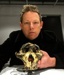 Andy I R Herries合作论文数School of Medical Sciences, The University of New South Wales12
 Nathan R. Jankowski合作论文数School of Earth and Environmental Sciences, The University of Wollongong12
 Anatoly P Derevianko合作论文数11
 Paul Goldberg合作论文数Institute of Archaeological Sciences, University of Tubingen;Arts & Sciences, Boston University;Geoarchaeology Field School11
 Corey Bradshaw合作论文数College of Science and Engineering, Flinders University10
 Michael Bird合作论文数Centre for Tropical Environmental and Sustainability Science, College of Science & Engineering, James Cook University10
 Lyn Wadley合作论文数Evolutionary Studies Institute, University of the Witwatersrand10
 Kieran O'Gorman合作论文数Sch Earth Atmospher & Life Sci, Univ Wollongong9
 Frederik Saltre合作论文数CEFE UMR 5175, CNRS - Université de Montpellier - Université Paul-Valéry Montpellier - EPHE;School of Earth and Environmental Science, The University of Adelaide;CNRS - Université de Montpellier, The University of Adelaide9
 Michael V. Shunkov合作论文数9
 Teresa E. Steele合作论文数Department of Anthropology, University of California, Davis9
 Maxim Kozlikin合作论文数8
 Christopher Clarkson合作论文数School of Social Science, Faculty of Humanities and Social Sciences, University of Queensland, Australia.8
 Slon Viviane合作论文数Dept Anat & Anthropol, Tel Aviv Univ8
 Ann Wintle合作论文数Department of Geography and Earth Sciences, Prifysgol Aberystwyth University8Matthias Meyer合作论文数Institute for Evolutionary Anthropology8
 Janet Kelso合作论文数South African National Bioinformatics Institute, University of the Western Cape8
 Kasih Norman合作论文数ARC Centre of Excellence for Australian Biodiversity and Heritage, University of Wollongong7
 Mackay Alex合作论文数School of Earth and Environmental Sciences, University of Wollongong7
 Marie Soressi合作论文数Institute for Evolutionary Anthropology;Institut de Préhistoire et de Géologie du Quaternaire;Institute for Evolutionary Anthropology, Institut de Préhistoire et de Géologie du Quaternaire7
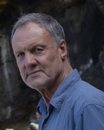 Christopher Stuart Henshilwood合作论文数School of Geography, Archaeology and Environmental Studies, University of the Witwatersrand;Department of Archaeology, History, Cultural Studies and Religion, University of Bergen;Centre for Early Sapiens Behaviour, University of Bergen7Jocelyn Bernatchez合作论文数6
 Mike W Morley合作论文数6
 Hayley C Cawthra合作论文数6
 Aldeias Vera合作论文数Department of Human Evolution, Max Planck Institute for Evolutionary Anthropology, Deutscher Platz 6, D-04103 Leipzig, Germany;Department of Earth and Environmental Sciences, University of Pennsylvania;Max Planck Institute for Evolutionary Anthropology, University of Pennsylvania6
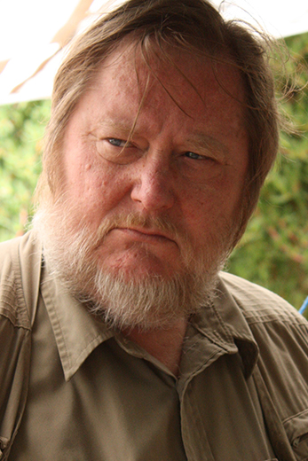 Harold Lewis Dibble合作论文数Department of Anthropology, University of Pennsylvania6
 Ben Marwick合作论文数Department of Anthropology, University of Washington6
 Geoff Duller合作论文数Department of Geography and Earth Sciences, Aberystwyth University6
 Sean Ulm合作论文数Studies Unit;University of Queensland;Studies Unit, University of Queensland6
 Shenghua Li合作论文数Research Division for Earth and Planetary Science, Faculty of Science, The University of Hong Kong6
 Gavin J. Prideaux合作论文数School of Biological Sciences Flinders, University of South Australia6
 Christian S. M. Turney(Chris Turney)合作论文数Earth and Sustainability Science Research Centre, School of Biological, Earth and Environmental Sciences, Faculty of Science, The University of New South Wales6
 David Roberts合作论文数Department of Computer Science, College of Engineering, North Carolina State University6Emily Y. Hallett合作论文数Department of Anthropology, Loyola University Chicago5Sarah Nagel合作论文数5Anna Schmidt合作论文数5
 Elena Essel合作论文数Max Planck Institute for Evolutionary Anthropology5
 Bence Viola合作论文数Department of Anthropology, Faculty of Arts and Science, University of Toronto5Tiina Manne合作论文数School of Social Science, Faculty of Humanities and Social Sciences, The University of Queensland5
 Kelsey M. Lowe合作论文数School of Social Science, The University of Queensland;Department of Treaty, Aboriginal and Torres Strait Islander Partnerships, Communities and the Arts, The University of Queensland5
 Ceri Shipton合作论文数Institute of Archaeology, Faculty of Social & Historical Sciences, University College London5
 Ash Parton合作论文数Regent's Park College, University of Oxford;Research Laboratory for Archaeology & the History of Art, University of Oxford;Oxford Brookes University5




