The flush air data sensing (FADS) method based on artificial neural networks (ANNs) has been widely studied and applied in air data sensing for advanced aircraft. Most current methods focus more on numerical fitting but lack analysis and discussion of the physical meaning of the fitting process. That makes the fitting process highly susceptible to the quality of the training data, imposes high requirements for the training data, and creates more uncertainties in practice. In this article, the FADS method based on the geometric feature-fitting neural network (GFFNN) is proposed to optimize performance under conditions of limited training data and improve the interpretability of the fitting process. The GFFNN is constructed to fit the aerodynamic angle in the air data and the pressure parameters in the air data are calculated in the analytical method. For that, a new dimensionless normalization method is proposed to enhance the geometric distribution feature of the neural network's input and the fitting process is decoupled to reduce the complexity of the fitting objective. To validate the accuracy and stability of the proposed method, three distinct training-testing datasets combinations were constructed based on wind tunnel test data to simulate various real-world scenarios. Experiment replications are conducted to mitigate instability in training results, ensuring a more accurate assessment of the method's effectiveness. The results show that the proposed method achieves superior stability in air data errors across diverse simulated scenarios. The stability is increased by 24.5% to 83.7% compared to the current methods with comparable or even higher accuracy, and the advantages would become more pronounced under stringent conditions.
Simultaneous Localization and Mapping (SLAM) has always been a hot topic in the fields of intelligent industry and mobile robotics. To effectively limit drift caused by large-scale operation, we can introduce sensors that offer absolute measurements, such as GNSS. However, GNSS will have no signal, resulting in large positioning errors, due to challenging environments such as occlusion and shielding. Thus, we proposed a landmark-based multi-sensor fusion SLAM algorithm to solve the question of carrier’s location in GNSS-denied. During GNSS-denied, we use relative information between landmarks and carrier to constraint the poses of carrier, thereby effectively eliminating pose drift and achieving high-precision autonomous positioning. Additionally, we consider three elements, landmarks distribution, the number of landmarks and the style of relative information, may influence the performance of proposed algorithm, we conducted multiple experiments in two-dimensional (2-D) and three-dimensional (3-D) spaces to verify its impact on pose estimation.
The flow angles such as the angle of attack and the angle of slip are the important air data for the aircraft. For the present advanced aircraft, the flush air data sensing (FADS) system is widely used and the artificial neural network is one of the important methods to estimate the air data for FADS. However, the most present ANNs for FADS are more prefer to fit the relationship in the mathematical sense within the training set and the physical and geometric senses are easy to ignore. That makes the estimation accuracy of the ANN strongly limited with the amount and the range of the training set. In this paper, a new flow angle estimation ANN is proposed. Which is decoupled from the pressure parameters estimation such as static and dynamic pressure by the surface pressure distribution model analysis. The input of this method is constrained by this model to eliminate the influence of the pressure parameters. Two different experiments are designed based on the wind tunnel experiment data to verify the performances of the method in different aspects. The results show that, by the new method, when the training set could cover the test set, the maximum error of angle of attack and angle of slip estimation is less than 0.12°. When the test set is out of the training set’s range, the maximum error for the above estimation could be limited below 1°.
Purpose First, the head-direction cell model, using a continuous attractor neural network, integrates self-motion cues [e.g. information from inertial navigation systems (INS)] and external perception information [e.g. information from global navigation satellite systems (GNSS)] to generate precise firing rates, which determine the yaw angle. Second, a three-dimensional periodic grid cell information fusion model is proposed, designed to efficiently integrate the decoded yaw angle, self-motion cues and external perception information. The external perception information is encoded using a Gaussian function and subsequently integrated into the original grid cell model as an additional activity. Finally, a method for decoding the periodic firing rates of grid cells is introduced, enabling the precise determination of the specific positions of quadrotor aircrafts. Design/methodology/approach Most existing brain-inspired navigation models rely on vision as the primary source of information; however, other sensors can also provide spatial position perception. This study aims to enhance the compatibility of brain-inspired navigation models with unmanned aerial vehicles equipped with universal sensors, such as INS and GNSS, by proposing a novel INS/GNSS brain-inspired positioning model. Findings The INS/GNSS brain-inspired positioning model uses navigation information from INS and GNSS to determine positions and enhance the navigation system’s positioning performance. Originality/value The proposed model serves as a valuable reference for the development of brain-inspired navigation works and expands the ideas for novel unmanned aerial vehicle navigation methods.
The recently discovered social place cells and grid cells in hippocampal formation are believed to be the neural basis underlying relative navigation of conspecifics. In this paper, we propose a new brain-inspired relative navigation model in a large-scale 3D environment for collective UAVs that translates the neurodynamics of the social place cell–grid cell circuit to robotic relative navigation algorithm for the first time. Our approach comprises three key parts: (1) a 3D isotropic Gaussian function-based cube social place cell network (cube-SPCNet), (2) a 3D continuous attractor neural network-based cube grid cell network (cube-GCNet), and (3) a population vector-based neural decoding module. The resulting brain-inspired relative navigation model incorporates the good relative information abstraction capabilities of the cube-SPCNet with the powerful temporal filtering capabilities of the cube-GCNet, yielding robustness and accuracy performance improvement for relative navigation. Experimental results show the new method can provide more robust and precise relative navigation results than its conventional counterpart, displaying a possible brain-inspired solution for relative navigation enhancement for collective UAVs.
The mammalian brain manages navigational behavior by processing sensory information. A brain-inspired multisensor navigation information fusion model is developed based on discovered neural mechanisms. The architecture of this model is inspired by the information transmission method of a part of the brain, which integrates navigation information from multiple sensors to provide the position of unmanned systems. First, the brain-inspired multisensor information fusion architecture is established based on the anatomical structure of hippocampal formation. Then, continuous attractor neural networks (CANNs) are used to model head-direction cells (HDCs), 3-D grid cells (GCs), and 3-D place cells (PCs). These spatial representation cell models integrate external perceptual information and self-motion cues to generate firing rates, which realizes navigation information fusion and accurate spatial cognition for unmanned systems. Finally, the methods of decoding the firing rates of these spatial representation cells are proposed to obtain navigation parameters. The proposed model is verified on the simulated data, the KITTI dataset, and the unmanned ground vehicle. The experiments demonstrate that the proposed brain-inspired model can fuse multisensor information, leading to more accurate positioning than traditional navigation models.
The design of 3-D intelligent navigation system, which is accurate and robust as flying animals do, is an open challenge that can benefit from neural basis of spatial cognition of the brain. Here, we draw inspiration from the neural computation of multimodal and multiscale fusion of hippocampal place cells and entorhinal grid cells to develop a brain-inspired heterogeneous multimodal 3-D navigation framework for unmanned aerial vehicles (UAVs) in outdoor large environment. Multiscale place cell networks are constructed to represent external sensory cues with uncertainty. Multiscale recurrent grid cell networks with attractor dynamics are then introduced to integrate internal self-motion cues and feedforward inputs of place cells. Multiscale population vector decoding is then designed to read out the multiscale grid cells for positioning. Simulation and real data experiment results show the improved performance of the proposed method in accuracy and robustness compared to its conventional counterparts, displaying possible brain-inspired solution for navigation enhancement for UAVs.
Accurate and stable positioning is significant for vehicle navigation systems, especially in complex urban environments. However, urban canyons and dynamic interference make vehicle sensors prone to disturbance, leading to vehicle positioning errors and even failures. To address these issues, an adaptive loosely coupled IMU/GNSS/LiDAR integrated navigation system based on factor graph optimization with sensor weight optimization and fault detection is proposed. First, the factor nodes and system framework are constructed based on error models of sensors, and the optimization method principle is derived. Second, the interactive multiple-model algorithm based on factor graph optimization (IMMFGO) is utilized to calculate and adjust sensor weights for global optimization, which will reduce the impact of disturbed sensors. Finally, a multi-stage fault detection, isolation, and recovery (MSFDIR) strategy is implemented based on the IMMFGO results and IMU pre-integration measurements, which can detect significant sensor faults and optimize the system structure. Vehicle experiments show that our IMMFGO method generally obtains better performance in positioning accuracy by 23.7% compared to adaptive factor graph optimization (AFGO) methods, and the MSFDIR strategy possesses the capability of fault sensor detection, which provides an essential reference for multi-source vehicle navigation systems in urban canyons.
To address the issue of traditional factor graph methods being unable to handle the dynamic change in sensor measurement accuracy during the operational process, an adaptive weight function is introduced and an improved factor graph method based on adaptive weight is proposed. By calculating the residual between the predicted value of inertial preintegration and the measured value of auxiliary sensors in real-time, the fusion information weight of the corresponding factor nodes are dynamically adjusted. Compared with traditional factor graph algorithms, this method can improve the optimization accuracy and robustness of factor graph algorithms in the situation of step faults, gradual faults, or rejection faults in auxiliary sensors. The simulation experimental results show that when the auxiliary sensor produces measurement faults, compared with traditional factor graph method, the improved factor graph method based on adaptive weights has higher robustness and accuracy. When measurement faults occur in auxiliary sensors, its position, velocity, and attitude estimation accuracy RMSE values have been improved by more than 45%.
In light of the satellite rejection environment and how aircraft can obtain high-precision positioning, this paper proposes a collaborative correction algorithm for aircraft based on the rank-defect network. Aiming at the problem of insufficient anchor points, which result in insufficient observations and the divergence of aircraft inertial navigation errors, this algorithm can effectively improve the navigation performance of cluster aircraft. On the basis of the observation information provided by the anchor aircraft, the observation information between aircraft is fully utilized to improve the observability of the aircraft cluster positioning method. At the same time, the pseudo-observation equation of heterogeneous aircraft cluster positioning is introduced, and the divergence of inertial navigation positioning errors caused by insufficient observations is suppressed by the pseudo-observation solution. On the basis of introducing the pseudo-observation equation, the inertial navigation error is solved and corrected by the Newton iterative method and the divergence of the inertial navigation position error is restrained. Compared with an aircraft cluster positioning method that does not use the inertial navigation error co-correction based on the pseudo-observation solution, this paper can achieve better overall cluster positioning accuracy when the available observations are insufficient, which is suitable for practical applications.
In recent years, multi-UAV collaborative cluster technology has attracted more and more attention from domestic and foreign researchers, and multi-UAV collaborative navigation is a crucial part of cluster collaborative technology. In many complex environments, GNSS signal rejection may occur, making it difficult for UAVs to achieve precise positioning and navigation solely relying on inertial navigation. In this case, multi-UAV collaboration can effectively suppress the divergence of UAV inertial navigation errors. However, considering factors such as communication range and capacity, electromagnetic interference, and sudden faults, sometimes the collaborative connection of UAVs is constrained. This article analyzes the collaborative connection strategies of UAV clusters under the premise of limited collaborative connections, proposes three collaborative connection strategies, namely RS, RL, RH, and proposes a “RLH” collaborative connection optimization method that alternates the use of “RL” and “RH” strategies, which improves and stabilizes the optimized collaborative navigation and positioning performance.
The collaboration among swarmed aircraft can provide additional observation to improve the integrity of its onboard navigation systems. But due to the limitation on relative communicating and measuring burdens, adopting all the observations between aircraft in the swarm is inefficient. The geometry of the collaborated partners is a key factor that influences the effectiveness of the navigation integrity augmentation, which needs to be optimized in collaborative integrity augmented navigation. In this paper, the integrity augmented navigation method for aerial swarm based on collaborative partner optimization is proposed. The geometry constructed by the GNSS satellites and the cooperative partners in the aerial swarm are analyzed dynamically, and the augmented integrity protection levels with different collaborative relationships are predicted to distinguish the partner essential for navigation integrity augmentation. Then the collaborative partner makes a key contribution to integrity augmentation adopted in collaborative navigation integrity monitoring, improving the efficiency of the collaborative navigation. The simulation results indicate the effectiveness of the proposed cooperative partnership optimization strategy, as well as the superiority of the proposed method compared with the traditional independent integrity framework in improving the integrity protection level and fault detection capacity.
The geometry of the collaborating partners is one of the factors that influence the effectiveness of collaborative resilient navigation. In this chapter, an improved geometric dilution of precision is introduced to quantitatively evaluate geometric configurations in collaborative resilient navigation fusion. The influence of geometry on the accuracy of collaborative resilient navigation fusion is discussed in both the GNSS-augmented and GNSS-denied situations. Geometry optimization algorithms based on a geometric analysis method and an algebraic search method are proposed, with simulated examples.
Cooperation between UAVs can significantly improve overall positioning accuracy of unmanned aerial swarm, which is of great importance to swarm navigation. In complex terrain environment, positioning signals from navigation satellites and partner UAVs are often blocked, resulting in mixed presence of relative range and angle observation, causing serious reduction in positioning accuracy of some UAVs. In order to improve their positioning accuracy, this paper proposes a cooperative navigation enhancement method based on hybrid linearization belief propagation, which utilizes hybrid relative observations of range and range/angle between swarm UAVs. Simulation experiment is carried out in a complex-terrain environment based on 3D map to simulate signal blockage. Simulation result shows that the algorithm can utilize hybrid relative observations between swarm UAVs, has a good effect on the mitigation of inertial navigation position error, and is of great significance to navigation of swarm aircraft in GNSS-challenging environment.
In the cooperative mission of swarm aircraft, UAV, a new tool with low cost and high efficiency, is highly flexible in location technique and covers a wide area, which can improve the success rate of the execution of the mission. However, during the process of performing missions, there is the problem of low positioning accuracy and reduced efficiency of some air vehicles due to the complexity of the environment and some unexpected factors. Therefore, this paper proposes a UAV cluster cooperative navigation and positioning method based on relative distance difference, aiming to enhance the regional cooperative navigation capability and solve the problem of position loss in areas without satellite navigation signals under unexpected situations. The solution is practically feasible after the simulation and actual test verification.
The collaborative localization-based framework is one of the typical approaches used to realize resilient navigation fusion. In this approach, the relative observations from collaborating anchor members are first utilized to solve for the locations of label members who suffer from navigation degradation, and the results are then fused with the local measurements of these label members to realize navigation augmentation. This chapter discusses collaborative localization algorithms. The online estimation of the collaborative localization covariance is investigated. Resilient fusion models and processes for obtaining collaborative localization solutions are introduced with simulated examples.
There are several possible structures for the organization of the members of an aerial swarm, indicating different collaborative relationships. Meanwhile, there are different frameworks for fusing observations in collaborative navigation. These structures and frameworks determine the various approaches for realizing resilient navigation fusion through collaboration in an aerial swarm. This chapter discusses the leader–follower, parallel, and hierarchical collaborative navigation structures. Additionally, collaborative localization-based and collaborative observation-based fusion frameworks for resilient navigation are proposed.
An important research direction in the field of traffic light recognition of autonomous systems is to accurately obtain the region of interest (ROI) of the image through the multi-sensor assisted method. Dynamic evaluation of the performance of the multi-sensor (GNSS, IMU, and odometer) fusion positioning system to obtain the optimum size of the ROI is essential for further improvement of recognition accuracy. In this paper, we propose a dynamic estimation adjustment (DEA) model construction method to optimize the ROI. First, according to the residual variance of the integrated navigation system and the vehicle velocity, we divide the innovation into an approximate Gaussian fitting region (AGFR) and a Gaussian convergence region (GCR) and estimate them using variational Bayesian gated recurrent unit (VBGRU) networks and a Gaussian mixture model (GMM), respectively, to obtain the GNSS measurement uncertainty. Then, the relationship between the GNSS measurement uncertainty and the multi-sensor aided ROI acquisition error is deduced and analyzed in detail. Further, we build a dynamic estimation adjustment model to convert the innovation of the multi-sensor integrated navigation system into the optimal ROI size of the traffic lights online. Finally, we use the YOLOv4 model to detect and recognize the traffic lights in the ROI. Based on laboratory simulation and real road tests, we verify the performance of the DEA model. The experimental results show that the proposed algorithm is more suitable for the application of autonomous vehicles in complex urban road scenarios than the existing achievements.
Fault diagnosis is a key component of navigation integrity assurance for aerial swarms. The redundancy of a navigation system is enhanced with the introduction of observations from optimally configured collaborative partners, thus improving the capabilities of fault detection, identification, and isolation. In this chapter, fault detection, identification, and exclusion based on collaborative integrity augmentation are discussed. Multifault detection based on multiple hypothesis solution separations in collaborative resilient navigation fusion for an aerial swam is proposed, with simulated examples.
Aiming at the problem that it is challenging to extract visual features from images under different light conditions effectively, a kind of image enhancement algorithm based on adaptive gamma transformation is proposed in this paper. First, the image is transformed from RGB space to HSV space to obtain the feature map of brightness. According to the brightness of the image, a kind of adaptive gamma transformation function is constructed to adjust the brightness of the image. And then, the CLAHE algorithm is used to enhance the brightness of the image and increase the contrast of the image further. The results show that the algorithm effectively improves the chroma and entropy of the image under different luminance conditions while improving the adaptability to the lighting luminance effectively.
 Zhi Xiong (熊智)合作论文数College of Automation Engineering, Nanjing University of Aeronautics and Astronautics228
 Rongbing Li (李荣冰)合作论文数College of Automation Engineering, Nanjing University of Aeronautics and Astronautics119
 Jizhou Lai (赖际舟)合作论文数南京航空航天大学自动化学院113
 Rong Wang (王融)合作论文数Department of Automatic Control, College of Automation Engineering, Nanjing University of Aeronautics and Astronautics80
 QingHua Ceng (曾庆化)合作论文数71
 Qinghua Zeng (曾庆化)合作论文数College of Automation Engineering, Nanjing University of Aeronautics and Astronautics63
 Yongrong Sun (孙永荣)合作论文数College of Automation Engineering, Nanjing University of Aeronautics and Astronautics61
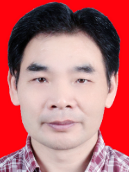 Wei Zhao (赵伟)合作论文数College of Automation Engineering, Nanjing University of Aeronautics and Astronautics57
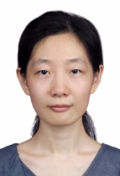 Rui Xu (许睿)合作论文数College of Automation Engineering, Nanjing University of Aeronautics and Astronautics26
 Shenglin Fan (范胜林)合作论文数College of Automation Engineering, Nanjing University of Aeronautics and Astronautics25XueYuan Lin合作论文数24
 Qian Meng (孟骞)合作论文数School of Instrument Science and Engineering, Southeast University21
 Ruihua Liu (刘瑞华)合作论文数College of Electronic Information and Automation, Civil Aviation University of China21
 Wu Chen (陳武)合作论文数Research Institute for Artificial Intelligence of Things, Department of Land Surveying and Geoinformatics, Hong Kong Polytechnic University20
 Lily Li合作论文数School of Engineering & Information Technology, The University of New South Wales Canberra19
 Feng Yu (郁丰)合作论文数College of Astronautics, Nanjing University of Aeronautics and Astronautics18Jian Xiong合作论文数18
 Bing Hua (华冰)合作论文数College of Astronautics, Nanjing University of Aeronautics and Astronautics17
 Weixing Qian (钱伟行)合作论文数NARI School of Electrical and Automation Engineering, Nanjing Normal University17
 Yanhua Zhu (祝燕华)合作论文数School of Instrument Science and Engineering, Southeast University17HAN Zhifeng (韩志凤)合作论文数15Fang Duan合作论文数15Yaling Du合作论文数14YongJun Yu (于永军)合作论文数14Pin Lv (吕品)合作论文数14
 Shaojun Feng (冯绍军)合作论文数School of Instrument Science and Engineering, Southeast University;Department of Civil and Environmental Engineering, Faculty of Engineering, Imperial College London;Qianxun Spatial Intelligence Inc.;Nanjing University of Aeronautics and Astronautics14Yijun Hang (杭义军)合作论文数12JianXin Xu (许建新)合作论文数12
 Ling Zhang (章玲)合作论文数College of Economics and Management, Nanjing University of Aeronautics and Astronautics12谢征合作论文数College of Automation Engineering, Nanjing University of Aeronautics and Astronautics12WeiNa Chen (陈维娜)合作论文数11
 Xuefei Leng (冷雪飞)合作论文数College of Astronautics, Nanjing University of Aeronautics and Astronautics11
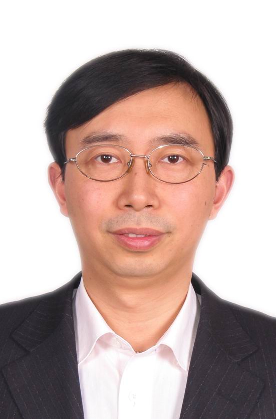 Bin Jiang (姜斌)合作论文数College of Automation Engineering, Nanjing University of Aeronautics and Astronautics11Chuang Yang合作论文数11
 Guanglou Zheng合作论文数Secur Res Inst, Edith Cowan Univ11
 Yunshu Wang合作论文数10
 Zhaihe Zhou (周翟和)合作论文数College of Automation Engineering, Nanjing University of Aeronautics and Astronautics10
 Dan Li (李丹)合作论文数School of Electrical and Information Engineering, Anhui University of Technology10Jianfeng Miao合作论文数10
 Guohua Kang (康国华)合作论文数Nanjing University of Aeronautics and Astronautics10TingWan Lei (雷廷万)合作论文数9LiNa Zhong (钟丽娜)合作论文数9Kecheng Sun合作论文数8Huizhe Wang合作论文数8
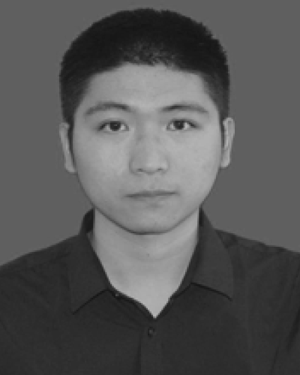 Jun Xiong合作论文数School of Internet of Things, Nanjing University of Posts and Telecommunications8Pin Lyu合作论文数7Shanshan Gu合作论文数7Li-juan SHI (施丽娟)合作论文数7
 Ruizhi Chen (陈锐志)合作论文数State Key Laboratory of Information Engineering in Surveying, Mapping and Remote Sensing, Wuhan University7




