This study investigates the carbonate system in the northern South China Sea shelf off the Pearl River estuary during the spring of 2023. Contrary to the typical distribution pattern observed in river-dominated coast where dissolved inorganic carbon (DIC) increases offshore, field observations revealed higher DIC in inshore waters (> 1980 µmol kg- 1) than in offshore seawaters (< 1970 µmol kg- 1), with DIC in the coastal zone being 20.9±8.8 µmol kg- 1 higher than that offshore. An end-member mixing model indicated that the high DIC coastal water was primarily attributed to mixing with the remnant high-DIC southward winter China Coastal Current water. In addition, biological processes and air-sea CO2 exchange also played important roles. Two representative regions were examined: the inshore high-DIC region and the offshore low-DIC region. In the inshore high-DIC region, biological processes and air-sea CO₂ exchange increased DIC by 11.6 ± 3.0 (relative to air-sea CO2 equilibrium) and 1.1 ± 7.0 µmol kg- 1 (relative to conservative mixing), respectively. In the offshore low-DIC region, biological processes decreased DIC by 5.1 ± 3.5 µmol kg- 1, whereas air-sea CO2 exchange increased DIC by 9.9 ± 2.8 µmol kg- 1. Overall, this study highlights the dominant role of the cross-seasonal influence of the remnant water of the coastal current, as well as the secondary but significant contributions of biological activity and air-sea CO2 exchange to the DIC distribution in coastal regions.
Air-sea CO2 flux in marginal sea is an important component of the global ocean carbon cycle. Located between the East China Sea and the northern South China Sea shelves which are both CO2 sinks, the southeastern coast of Mainland China has large potential of CO2 sequestration, but studies on air-sea CO2 fluxes in this region are very limited. Surface water CO2 partial pressure (pCO2) and auxiliary parameters from 51 cruises conducted in 2001–2022 were integrated to estimate the air-sea CO2 fluxes. Surface water pCO2 exhibited conspicuous spatial and temporal variabilities. The lowest pCO2 occurred in winter (349 ± 20 μatm), gradually increased in spring (357 ± 21 μatm) and summer (371 ± 35 μatm), and reached a peak in fall (392 ± 27 μatm). Surface water pCO2 was primarily modulated by vertical mixing and cooling during cold seasons, and by coastal upwelling and biological CO2 uptake in warm seasons. Vertical water mixing and temperature effect induced highest pCO2 in fall. Air-sea CO2 fluxes also exhibited strong seasonal variations. The study area acts as a moderate to strong CO2 sinks of 9.4 ± 5.5 and 3.7 ± 3.9 mmol m−2 d-1 in winter and spring, respectively, and a CO2 source of 3.8 ± 7.0 mmol m−2 d-1 in fall. In summer, the surface water CO2 is near equilibrium with the atmosphere with an air-sea CO2 flux of −0.6 ± 2.8 mmol m−2 d-1. The annual average air-sea CO2 fluxes is −2.6 ± 6.8 mmol m−2 d-1, indicating the study area acting as a weak to moderate sink annually. pCO2 difference between the surface water and the atmosphere is the main factor regulating the seasonal variations of air-sea CO2 flux, and wind speed also played an important role, enhancing CO2 sink in winter.
Salinity shapes ocean circulation and marine biogeography, yet its long-term spatiotemporal variability and ecological impacts in marginal seas remain poorly constrained. We reconstruct a high-resolution sea surface salinity dataset (2000-2020) for the China Seas using a machine learning framework that integrates in situ cruises and buoys with satellite observations and diagnose drivers with an eigen microstates approach. The El Ni & ntilde;o/Southern Oscillation (ENSO) is the dominant control, modulating evaporation-precipitation, river discharge and Kuroshio intrusion. During El Ni & ntilde;o, sea surface salinity increases by up to 25% in ocean-dominated regions but decreases up to 21% in river-dominated zones, amplifying meridional salinity contrasts. Species-distribution models indicate a southward habitat shift up to 2.5 degrees latitude for 90% of key fish species. Under projected ENSO intensification, salinity inhomogeneity and associated ecological impacts are likely to strengthen. These results support an 'ENSO forcing-salinity-fishery' positive feedback framework and call for integrating salinity dynamics into adaptive, climate-informed fisheries management.
Macroalgae aquaculture ecosystems have been increasingly recognized as coastal biogeochemical hotspots of air–sea net ecosystem carbon dioxide (CO 2 ) exchange; however, their roles in regulating the temporal variability of net ecosystem methane (CH 4 ) exchange (NME) receive little attention mainly due to very limited data availability. Here, we applied the eddy covariance (EC) technique to acquire 1‐yr (June 2023 to May 2024) NME measurements, over a subtropical macroalgae aquaculture ecosystem in southeast China, to examine the temporal variability of NME across time scales and its contribution to net radiative forcing. The results indicated that (a) this ecosystem acted as a CH 4 source in most months with the summer accounting for about two‐thirds of annual NME of 0.40 g C m −2 yr −1 ; (b) the inclusion of annual NME increased the sustained‐flux global warming potentials (SGWPs) by 11.0% from 219.3 (CO 2 only) to 243.4 g CO 2 ‐eq. m −2 yr −1 for a 100‐yr time horizon; (c) NME and its radiative contribution varied across seasons, farming periods, and growth stages, with the temporal fluctuations mainly controlled by temperature and tidal activities; (d) bimodal varying patterns across tidal levels were identified with larger fluxes occurring when tidal level changed most rapidly. This is the first EC study to confirm that CH 4 emission intensifies the warming effect of CO 2 efflux from macroalgae aquaculture ecosystems. The observed strong temporal variability of CH 4 and CO 2 fluxes and their asynchrony highlight the importance of high‐frequency and continuous flux measurements in accurately assessing their net radiative forcing at both short‐ and long‐term scales.
This study investigates the seasonal dynamics, environmental drivers, and assembly mechanisms of picoeukaryotic communities in the hydrographically complex Changjiang River Estuary and adjacent East China Sea. Using 18S rRNA gene high-throughput sequencing and concurrent environmental profiling, we found pronounced differences in picoeukaryotic assemblages between the winter and summer surveys that were associated with contrasting hydrodynamic conditions. During winter, strong vertical mixing weakened environmental differentiation among water masses, and geographical distance was identified as the strongest correlate of picoeukaryotic community variation. Community assembly was predominantly associated with stochastic processes, particularly dispersal limitation and ecological drift, together with broader ecological niche breadths. In contrast, summer stratification strengthened environmental differentiation among water masses and increased the contribution of heterogeneous selection to community assembly. Taxonomic and network analyses revealed that communities were predominantly composed of Syndiniales-affiliated sequences. Co-occurrence networks demonstrated that parasitic Syndiniales and other potential parasitic groups acted as crucial keystone taxa (hubs and connectors) across seasons, suggesting significant host-parasite co-adaptation and their potential role in carbon transfer within the microbial loop. Notably, these keystone taxa transitioned from widespread, cosmopolitan distributions during winter mixing to highly compartmentalized, water-mass-specific niches during summer stratification. Collectively, our observations suggest that the contrast between winter mixing and summer stratification can alter the selective pressures and spatial gradients governing picoeukaryotic communities. This study underscores the critical importance of seasonal sampling to evaluate microbial interactions and assembly mechanisms in highly dynamic estuary-sea systems.
The Northwestern Pacific Ocean is one of the most important carbon sink regions globally. However, spatial variability and seasonal amplitude of surface water CO2 partial pressure (pCO2) and air-sea CO2 fluxes remain unresolved. Surface seawater pCO2 and auxiliary parameters were investigated in the Northwestern Pacific (10–33°N, 120–158°E) during spring, summer and winter in 2019 and 2020. The air-sea CO2 fluxes exhibited pronounced seasonal variability, acting as a CO2 sink of 5.0 ± 4.1 mmol m−2 d−1 in winter and a CO2 source of 1.7 ± 1.6 mmol m−2 d−1 in summer. In summer, the CO2 source increased with latitude, with the 10–14°N sub-region near equilibrium with the atmosphere (0.6 ± 0.6 mmol m−2 d−1) and the 27–33°N sub-region displaying the strongest source (3.6 ± 2.1 mmol m−2 d−1). The air-sea CO2 flux is primarily driven by variability in surface water pCO2. During summer, surface water pCO2 increases with latitude (408.4 ± 5.1, 418.2 ± 9.0 and 455.5 ± 12.4 μatm in 10–14°N, 14–27°N and 27–33°N, respectively), showing a “strange” pattern inverse with sea surface temperature. Temperature normalized pCO2 (NpCO2) also increases with latitude. In winter, surface water pCO2 generally decreases with latitude (379.4 ± 3.8, 372.9 ± 9.1 and 354.5 ± 3.6 μatm in 10–14°N, 14–27°N and 27–33°N, respectively), but NpCO2 increased with latitude (356.7 ± 7.7, 387.2 ± 13.1 and 434.4 ± 4.4 μatm in 10–14°N, 14–27°N and 27–33°N, respectively). In addition to the dominating temperature effect, different sub-regions have their own unique processes that affect the pCO2 behavior which in turn influences the air-sea CO2 fluxes. In the western zone (west of 130°E) of the 10-14°N sub-region, precipitation reduces pCO2 by 12.4 ± 5.2 μatm in summer and 14.8 ± 4.4 μatm in winter. In the 14-27°N sub-region, the relatively high NpCO2 is primarily driven by evaporation, with elevated salinity increasing surface water NpCO2 by 11.1 ± 12.7 μatm in summer and 7.7 ± 15.3 μatm in winter. The 27–33°N sub-region is located in the Subtropical Mode Water and atmospheric CO2 intrusion (increasing pCO2 by 44.2 μatm) also have important contributions to the high NpCO2. Under the context of global warming, the regional changes, such as variations in evaporation and precipitation, have the potential to significantly alter global ocean CO2 sink/source patterns and weaken the surface ocean’s CO2 sequestration ability.
Macroalgae aquaculture has been increasingly recognized as a promising nature-based solution to enhance carbon sinks towards climate change mitigation. However, a limited understanding of the temporal patterns of air-sea carbon dioxide (CO2) fluxes and their environmental controls across time scales poses an enormous obstacle to the carbon sink potential assessment of macroalgae aquaculture. Here, we utilized the eddy covariance (EC) approach to acquire continuous and high-frequency measurements of net ecosystem exchange (NEE) of CO2 over the macroalgae aquaculture in a subtropical enclosed bay in southeast China, throughout one full year from April 2023 to March 2024. The results showed (a) this ecosystem acted as a CO2 source in most months with the strongest source and sink occurring at the beginning of autumn and winter, respectively; (b) annually this ecosystem emitted 58.9 g C m-2 of CO2 into the atmosphere with nighttime source contributing 84.7 %; (c) macroalgae aquaculture of Saccharina japonica and Gracilariopsis Lemaneiformis tended to reduce CO2 emission from this ecosystem, while the extent of the reduction varied with aquaculture types and growth stages; (d) temporal variability of NEE was most correlated with air temperature, while faster tidal currents tended to stimulate CO2 emission during both flood and ebb tides. The strong temporal variability of NEE highlights the importance of high-frequency EC measurements in improving the understanding of temporal patterns of air-sea CO2 fluxes over the macroalgae aquaculture ecosystems. This study suggests that macroalgae aquaculture has the potential to mitigate CO2 emission, although the ecosystem itself overall functions as a net CO2 source on an annual time scale.
By resolving spatiotemporal variations in sea surface partial pressure of CO2 (pCO2) based on multiple-year underway measurements, we quantified basin-scale air–sea CO2 exchange flux on the China side of the South Yellow Sea between 2005 and 2011, and compared it with the result obtained between 2011 and 2018. Over the three subregions under study, the area-weighted average of the CO2 influx rate was estimated to be 1.1 ± 1.5 mol m−2 yr−1 during 2005–2011, which is only half the annual CO2 influx rate over the adjacent East China Sea shelf but not remarkably different from the rate (0.4 ± 2.1 mol m−2 yr−1) estimated for almost the same sea area during 2011–2018. Over central and western parts of the South Yellow Sea, subregion-specific fitting curves of monthly variations in air–sea CO2 flux during 2005–2011 were consistent with those monthly variations during 2011–2018. However, over the southern part of the South Yellow Sea near the Changjiang Estuary, the fitting curve of monthly variations in air–sea CO2 fluxes during 2005–2011 located systematically on one side of the monthly variation estimated for 2011–2018, indicating that annual CO2 uptake had weakened in this subregion. Both cases were different from some other ocean margin areas characterized by enhanced CO2 uptake following rise in atmospheric CO2. To study the potential shift in terms of shelf CO2 sources and sinks over multiple decades and under environmental changes, further field observations and data-based research are needed on several large continental shelves.
We examined the sub-seasonal to interannual variability and multi-year trend of sea surface CO2 partial pressure (pCO2) and air-sea CO2 flux at a coastal site of the East China Sea (31⁰N, 122.8⁰E) based on high-frequency time-series data collected by a buoy since 2013. Seasonal average sea surface pCO2 was highest in autumn, but the lowest value can appear in winter or spring, depending on the biological productivity in spring. The seasonal amplitude of pCO2 was up to 123 μatm. Based on property-property relationships and a simple mass budget model, we found that temperature change, biological activity, water mixing and air-sea CO2 exchange all made significant contributions to the seasonal variation of pCO2. From winter to summer, seasonal warming and atmospheric CO2 uptake elevated the pCO2, while net biological production, weakened vertical mixing and the retreat of the Yellow Sea Coastal Water (YSCW) lowered the pCO2. Conversely, from summer to winter, seasonal cooling and CO2 emission lowered the pCO2, while respiration, enhanced vertical mixing and the YSCW intrusion raised them up. Over short-term timescale, biological production and respiration frequently drew down or elevated the pCO2 by 150-400 μatm within 5-10 days during warm months. When biological activity was suppressed during cold months, such short-term variations were dominated by water mixing with a smaller pCO2 amplitude of 5-60 μatm within 2-6 days. This site was a sink of atmospheric CO2 in winter and spring, but a CO2 source in summer and autumn. Annually, it was a moderate CO2 source in 2014 (air-sea CO2 flux was 2.88 ± 11.02 mmol m−2 d−1), a weak CO2 sink in 2016 (-0.21 ± 12.23 mmol m−2 d−1), and a weak CO2 source in the combined year of the first half of 2017 and the second half of 2018 (0.40 ± 9.11 mmol m−2 d−1). The relatively high CO2 source in 2014 was likely due to the weaker biological production in spring and more typhoon passage in autumn. From 2013 to 2019, the wintertime sea surface pCO2 didn’t follow the increasing trend of the atmospheric pCO2, leading to an enhancing carbon sink in winter.
The North Pacific Subtropical Gyre (NPSG), the largest continuous marine ecosystem, significantly influences the cycling of trace elements through biological and seawater interface processes. Understanding these processes, particularly their seasonal impacts, is crucial for tracing oceanic dynamics, yet remains underexplored. In this context, rare earth elements (REEs) in seawater serve as valuable tracers for studying these processes. This study presents the spatiotemporal distribution of dissolved REE concentrations based on two GEOTRACES-CHINA process study cruises (GPpr15) conducted in summer and winter, along with published results from a GEOTRACES-CHINA cruise (GP09) during spring. Above the depth of chlorophyll maxima (DCM), REE levels were lowest in winter compared to summer, reflecting enhanced scavenging of REEs by particulate matter, primarily driven by increased chlorophyll-alpha during winter. In subsurface to intermediate waters (150-1000 m), release efficiencies (similar to 0.04 pmol Nd/mu mol apparent oxygen utilization) exhibited no seasonal variations in the NPSG. These efficiencies were consistent with those in the North Atlantic Gyre at similar latitudes, but differed from those at higher latitudes (similar to 0.15), which may be attributed to variations in the plankton community structure across regions. Furthermore, inputs of slope sediments to intermediate waters (500-1000 m) off the Philippine Islands were identified using Ce anomalies and Yb/Nd ratios. These inputs peaked during winter, with Nd contribution from slope sediment accounting for 15-43 % of the total Nd concentration. In deep waters (>4500 m) of the Philippine Basin (stations K2/K2b, K3, K13/13a, and K14), elevated REE concentrations indicated extra inputs from the seafloor and lateral transport from the Philippine Islands, contributing 17 +/- 6 % of Nd. The contributions of Nd from settled particles and water mass mixing were estimated at 10 +/- 5 % and 73 +/- 3 %, respectively. Additionally, Yb reliably traced the distribution of lower circumpolar deep water in the Philippine Basin. In summary, these findings highlight the significant influence of biogeochemical processes on seasonal variations of REEs above the DCM and underscore the potential of REE in tracking deep water transport.
Horizontal/Vertical nutrient supply in the upper ocean of the North Pacific Subtropical Gyre (NPSG) plays a pivotal role in biogeochemical cycling and CO2 uptake. However, research quantifying water/nutrient transport based on direct chemical observations and measurements is limited. Based on observations made during three GEOTRACES cruises in spring, summer, and winter, we identified horizontal and vertical water sources and quantified the water and nutrient supply, applying modified Optimum Multiparameter (OMP) analysis based on iterative calculation, in which rare earth elements (REEs) were used as quasi-conservative chemical tracers. The mean quantification results with a depth of <= 200 m show that Equator-derived water (Nutrient fraction: 51% +/- 37%) and vertical supply (31% +/- 33%) are the dominant nutrient sources; northern NPSG-derived water (0%+/- 1%) has little influence; North Equatorial Current-derived water shows a higher contribution at 200-300 m (38% +/- 26%) than the shallow layers (10% +/- 19%); coast-derived water (7% +/- 15%) contributes to NPSG in an inconsistent way. In addition, the enhanced vertical nutrient supply during the sampling period, which is more significant in spring, is likely to be attributed to the influence of what are considered different types of eddies based on the sea surface height. The vertical fluxes of dissolved inorganic nitrogen in the bottom eupho-tic layer at stations near warm, cold, and no eddies were estimated to be 0.10-0.76, 0.21-2.13, and 0.066-0.53 mmol m(-2)d(-1), respectively, which are 1-100 times the supply from nitrogen fixation. These nutrient fluxes could explain 5-169 mg C m(-2)d(-1) of the carbon fixation in the euphotic zone.
This study reports the surface water partial pressure of CO2 (pCO2) and air-sea CO2 fluxes on the East China Sea shelf off the Changjiang estuary in August 2023. Surface water pCO2 ranged from 110 μatm to 910 μatm with an average value of 427±154 μatm. Air-sea CO2 fluxes in the surveyed area ranged from −20.6 mmol m−2 d−1 to 35.9 mmol m−2 d−1 and averaged 3.0±8.9 mmol m−2 d−1 (a moderate source), which was contrary to this region generally being a CO2 sink during summer. Changjiang discharge played a key role in regulating surface water pCO2; the decreased Changjiang discharge in August 2023 increased surface water pCO2 on the adjacent inner shelf substantially, and the high sea surface temperature further elevated the surface water pCO2. The combined effect of drought and high temperatures in August 2023 turned the study area from a CO2 sink to a CO2 source. Under the context of global change, climate events such as floods, droughts and heatwaves occur more frequently, which will continue to add more complexity to CO2 sink/source evaluations in large river-dominated marginal seas and suggest further research is needed.
Propagation of anticyclonic eddies (ACEs) facilitates the lateral transport of dissolved organic matter (DOM). However, the transformation of DOM within ACEs and its regulation of lateral fluxes of dissolved organic carbon (DOC) remain unclear. High-resolution sectional distribution of DOC and humic-like fluorescent DOM (FDOMH) were investigated across a Kuroshio-derived ACE (K-ACE) on the slope of northern South China Sea (SCS). A two-endmember isopycnal mixing model revealed higher Kuroshio water fraction (0.59 +/- 0.13) in K-ACE than non-eddy region. DOC removal (maximum 6%) was identified in the upper 200 m of K-ACE. The shallower mixed layer (<50 m) also revealed signals of FDOMH photobleaching (8%-34%). However, the substantial production of FDOMH (36%-43%) happened below the mixed layer (50-250 m). The regression slope between net FDOMH and apparent oxygen utilization in this layer was steeper in K-ACE than in non-eddy region and dark oceans, suggesting K-ACEs had higher microbial-mediated in situ production efficiency and rate of refractory DOM. This enhancement could be attributed to increased biogenic particle export, more Kuroshio-derived DOM transport, and higher oxygen utilization rate at warmer condition within K-ACE. Analysis of 27-year (1993-2020) daily eddy data revealed that K-ACE-induced lateral transport DOC flux to the northern SCS slope (1.8 +/- 0.2 Tg C yr(-1)) constitutes half of the external DOC flux via cross-shelf transport, highlighting the importance of K-ACEs in connecting carbon cycles between west Pacific and the northern SCS slope and even shelf areas.
Hypoxia and acidification are universal environmental issues in coastal seas, especially in large river dominated shelves, and the East China Sea shelf is a typical case among them. However, the responses of status of hypoxia and acidification in coastal seas to the extremes of river discharges are still to be revealed. This study surveyed the influences of a summer drought on the status of hypoxia and acidification on the inner East China Sea shelf off the Changjiang estuary. In August of 2023 during a summer drought, carbonate system parameters and dissolved oxygen (DO) were surveyed on the East China Sea shelf off the Changjiang estuary. As expected, dissolved inorganic carbon (DIC) removal (up to >40 mu mol kg(-1) ) and DO over-saturation (up to >110 %) accompanied by high pH (up to >8.15) in the surface water were observed. However, low DO (32-172 mu mol kg(- 1) ), low pH (7.63-8.04) and low saturation state index of aragonite (Omega(Ar)) (1.34-3.06) in the bottom water were observed. Relationships of Excess DIC with DO consumption, and pH and Omega(Ar) with Excess DIC indicated that the hypoxia and acidification in the bottom water was due mainly to the remineralization of the marine-sourced organic matter. Nevertheless, both hypoxia and acidification were mitigated, i.e. the hypoxic area was smaller, the minimum DO concentration, pH and saturation state index of aragonite were higher in August of 2023 than under the general summer condition. The lower Changjiang discharge (similar to 60 % of the long-term monthly average) mitigated eutrophication of the East China Sea shelf and decreased the phytoplankton biomass in the surface water and subsequently the hypoxia and acidification in the bottom water. However, acidification of the bottom water on the East China Sea shelf was still severe even during the summer drought. Regulating the anthropogenic impact on the coastal marginal seas is still urgently needed to mitigate the acidification status.
In this study, a terrestrial-estuarine-ocean biogeochemical modeling system (DLEM-ChesROMS-ECB) was used to investigate the impact of prevailing spring-to-summer winds on hypoxia in Chesapeake Bay. The modeling system was run continuously from 1985 to 2005 under realistic wind conditions. Correlation analysis based on the 21-year simulation results revealed that the durations of spring northeasterly winds and summer southerly winds were both positively correlated with the volume of summer hypoxia. Conversely, the duration of summer northeasterly winds was negatively correlated with hypoxia. We then conducted multiple idealized sensitivity experiments to explore the underlying mechanisms governing these relationships. The results indicated that prolonged northeasterly winds in spring promoted along-channel transport of oxygen-consuming materials from the upper to the lower Bay, leading to a higher level of oxygen consumption via water column respiration (WCR). This may have led to more severe hypoxic events in the following summer. During summer, northeasterly winds increase vertical mixing as the riverine freshwater is mostly restricted to the western bank, thereby preventing the occurrence of hypoxia. Furthermore, strengthened vertical mixing increased light availability, resulting more nutrients taken up by phytoplankton. Consequently, more dissolved oxygen was produced. When comparing the differences in mass budget terms under southerly winds, the oxygen production accounted for approximately 60% of the WCR. In contrast to previous studies that mostly examined the short-term episodic effects of wind, our study underscores the importance of the impact of prolonged seasonally variable winds and biological feedback on hypoxic volume in Chesapeake Bay, which helps in the development of appropriate nutrient management strategies in a changing climate.
In the North Pacific Subtropical Gyre, which is one of the largest oligotrophic regions, there is a lack of information regarding the sources and transport of trace metals through water mass mixing. Rare earth elements (REEs) are essential for tracing lithogenic sources and water mass transport. In this study, we present dissolved REE concentrations and the factors controlling their distributions in the northwest Pacific during a GEOTRACES cruise (GP09). In the surface water along 11°N, we observed input signals from the Philippine and the Hawaiian Islands, characterized by positive Eu anomalies and slightly elevated REE concentrations. By incorporating our data and published REE data from the northwest Pacific to the southeast Pacific (40°N–40°S), we demonstrated that the REE concentrations and Yb/Nd ratios can distinguish North Pacific Intermediate Water (NPIW), Antarctic Intermediate Water (AAIW), and modified AAIW. By estimating the ratio of water mass mixing, we suggest that heavy REEs are predominantly contributed by water mass mixing (e.g., 93 % ± 4% for Yb) and can be used as semi-conservative tracers to quantify the mixing of NPIW and modified AAIW at the potential density of 27.2 kg/m3. At ∼800 m depth at stations K12, K13, and K14, weak negative Ce anomalies (>0.1) were observed, indicating the lateral transport of water masses imprinted with sediment signals from the Philippine Islands. In the deep waters (>1500 m) at the Luzon Strait (station K1), we propose that the weak Ce negative anomalies (>0.08) and low Yb/Nd ratios (<5), combined with the low beam transmission, are the result of particle resuspension and release. In deep water (>2000 m), combining high-resolution REE measurements with water mass analysis, our research reveals that dissolved REEs (except Ce) are dominantly controlled by water mass mixing (e.g., 80 %∼100 % for Yb and 70 %∼100 % for Nd). For the non-conservative behavior, which is not explained by water mass mixing, the residual fraction of heavy REEs (<20 % for Yb) originates from release of sinking particles (organic matter and siliceous particles), while the remaining concentrations of light REEs (<30 % for Nd) may be influenced by a combination of particle release and scavenging processes. These findings highlight valuable information about lithogenic sources and the proportions of REE distributions that are controlled by physical and biogeochemical processes. Moreover, it emphasizes the applicability of heavy REEs as effective tracers for understanding basin-scale water mass mixing in the northwest Pacific.
Rapid mariculture expansion has raised concerns about coastal eutrophication. This study assesses nutrient cycling in Sansha Bay, China, a eutrophic semi-enclosed bay with intensive mariculture. A two-endmember mixing model showed significant additions of dissolved inorganic nitrogen (DIN; 6.9 ± 4.1 μmol L-1) and phosphorus (DIP; 0.45 ± 0.29 μmol L-1) in May 2020, mainly from mariculture. Estimated N and P inputs from fish farming were 7789 ± 361 tons and 1497 ± 91 tons in spring, respectively, with N mainly in dissolved form and P in particulate form. And, trash fish feed caused higher nutrient release than formulated feed. Of the feed input, 52.8 ± 4.7 % of DIN and 33.0 ± 3.7 % of DIP were released into environment, exceeding riverine input and offshore exchanges. Co-culturing kelp and oysters removed 1079 ± 11 tons of N and 156 ± 8 tons of P. Therefore, adjusting feed types and planning co-cultivation strategies could alleviate eutrophication resulting from mariculture expansion.
The development of field-deployable methods and instruments for the measurement of pH and other carbonate parameters is important for the assessment of the marine carbon cycle, ocean acidification and marine carbon dioxide removal techniques. In this study, a high-precision fully automated integrated syringe-pump-based environmental-water analyzer for pH ( i SEA-pH) was developed. The pH is determined spectrophotometrically using purified indicator dye with a high precision (better than +/- 0.001) and high frequency (3.5 min/sample). For the short-term analysis, the measurement frequency was 18 h-1 , which revealed pH = 7.8148 +/- 0.0005 (n = 104) for aged surface seawater (S = 35) from the western Pacific. For long-term analysis, the measurement frequency was 2 h-1 for 4 days, and the results showed that pH = 7.8148 +/- 0.0010 (n = 200). Three commonly used pH indicators (meta-cresol purple, thymol blue and phenol red) were purified with improved flash chromatography procedures. The autonomous i SEA-pH can automatically correct for the influence of temperature, salinity and other factors on pH measurements to achieve rapid and accurate on-site measurements, which meet the "climate" goal of the Global Ocean Acidification Observing Network (uncertainty is +/- 0.003). Three identical i SEA-pH systems were developed and successfully applied in mesocosm experiments and several coastal and open ocean cruises with excellent in field performance.
The South China Sea (SCS) is the largest marginal sea of the North Pacific Ocean, where intensive field observations, including mappings of the sea surface partial pressure of CO2 (pCO2), have been conducted over the last 2 decades. It is one of the most studied marginal seas in terms of carbon cycling and could thus be a model system for marginal sea carbon research. However, the cruise-based sea surface pCO2 datasets are still temporally and spatially sparse. Using a machine-learning-based method facilitated by empirical orthogonal function (EOF) analysis, this study provides a reconstructed dataset of the monthly sea surface pCO2 in the SCS with a reasonably high spatial resolution (0.05∘ × 0.05∘) and temporal coverage between 2003 and 2020. The data input to our model includes remote-sensing-derived sea surface salinity, sea surface temperature, and chlorophyll, the spatial pattern of pCO2 constrained by EOF, atmospheric pCO2, and time labels (month). We validated our reconstruction with three independent testing datasets that are not involved in the model training. Among them, Test 1 includes 10 % of our in situ data, Test 2 contains four independent in situ datasets corresponding to the four seasons, and Test 3 is an in situ monthly dataset available from 2003–2019 at the South East Asia Time-series Study (SEATs) station located in the northern basin of the SCS. Our Test 1 validation demonstrated that the reconstructed pCO2 field successfully simulated the spatial and temporal patterns of sea surface pCO2 observations. The root mean square error (RMSE) between our reconstructed data and in situ data in Test 1 averaged ∼10 µatm, which is much smaller (by ∼50 %) than that between the remote-sensing-derived data and in situ data. Test 2 verified the accuracy of our retrieval algorithm in months lacking observations, showing a relatively small bias (RMSE of ∼8 µatm). Test 3 evaluated the accuracy of the reconstructed long-term trend, showing that, at the SEATs station, the difference between the reconstructed pCO2 and in situ data ranged from −10 to 4 µatm (−2.5 % to 1 %). In addition to the typical machine learning performance metrics, we assessed the uncertainty resulting from reconstruction bias and its feature sensitivity. These validations and uncertainty analyses strongly suggest that our reconstruction effectively captures the main spatial and temporal features of sea surface pCO2 distributions in the SCS. Using the reconstructed dataset, we show the long-term trends of sea surface pCO2 in five subregions of the SCS with differing physicobiogeochemical characteristics. We show that mesoscale processes such as the Pearl River plume and China coastal currents significantly impact sea surface pCO2 in the SCS during different seasons. While the SCS is overall a weak source of atmospheric CO2, the northern SCS acts as a sink, showing a trend of increasing strength over the past 2 decades. The data used in this article are available at https://doi.org/10.57760/sciencedb.02050 (Wang and Dai, 2022).
 Minhan Dai (戴民汉)合作论文数College of Ocean and Earth Sciences, Xiamen University;State Key Laboratory of Marine Environmental Science, Xiamen University43
 Weidong Zhai (翟惟东)合作论文数Institute of Marine Science and Technology, Shandong University20
 Lifang Wang (王丽芳)合作论文数State Key Laboratory of Marine Environmental Science, Xiamen University;College of Ocean & Earth Sciences, Xiamen University16
 Yan Li (李炎)合作论文数College of the Environment & Ecology, Xiamen University10
 Kuanbo Zhou (周宽波)合作论文数State Key Laboratory of Marine Environmental Science, College of Ocean and Earth Sciences, Xiamen University9
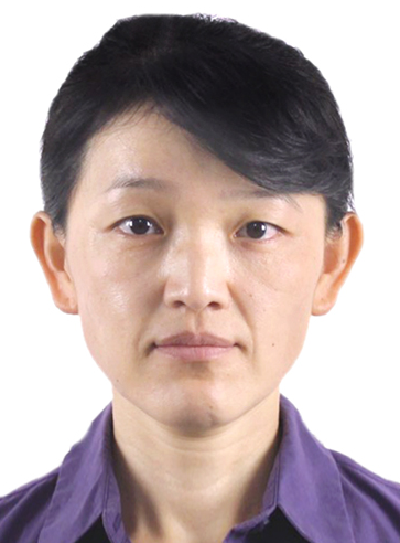 Guizhi Wang (王桂芝)合作论文数State Key Laboratory of Marine Environmental Science, Xiamen University9
 Tao Huang (黄韬)合作论文数State key Laboratory of Marine Environmental Science, Xiamen University8
 Yi Xu (许一)合作论文数State Key Laboratory of Estuarine and Coastal Research, East China Normal University8
 Yongchen Wang合作论文数7
 Yan Bai (白雁)合作论文数State Key Laboratory of Satellite Ocean Environment Dynamics, Second Institute of Oceanography, Ministry of Natural Resources;School of Oceanography, Shanghai Jiao Tong University7
 Zhimian Cao (曹知勉)合作论文数State Key Laboratory of Marine Environmental Science, Xiamen University7
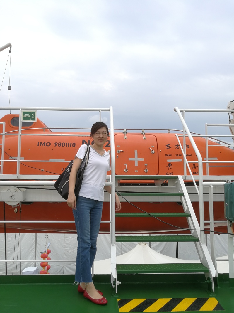 Qian Liu (刘茜)合作论文数Key Laboratory of Marine Chemistry Theory and Technology, Ministry of Education, Ocean University of China6Xinping Hu合作论文数5
 Liguo Guo (郭利果)合作论文数Ocean Carbon Group, State key Laboratory of Marine Environmental Science, Xiamen University;Marine Bioelements Lab, Xiamen University5
 Chuanjun Du (杜川军)合作论文数State Key Laboratory of Marine Resources Utilization in South China Sea, School of Marine Sciences, Hainan University5
 Xin Liu (柳欣)合作论文数College of the Environment and Ecology, Xiamen University5
 Kunshan Gao (高坤山)合作论文数State Key Laboratory of Marine Environmental Science, Xiamen University5
 Jianping Gan (甘劍平)合作论文数Department of Mathematics, Hong Kong University of Science and Technology;Division of Environment and Sustainability, Hong Kong University of Science and Technolog;Center for Ocean Research in Hong Kong and Macau, Hong Kong University of Science and Technolog;Department of Ocean Science, Hong Kong University of Science and Technolog;Joint Lab for Coastal Observation and Modeling, Hong Kong University of Science and Technolog5
 Yihua Cai (蔡毅华)合作论文数College of Ocean and Earth Sciences, Xiamen University5
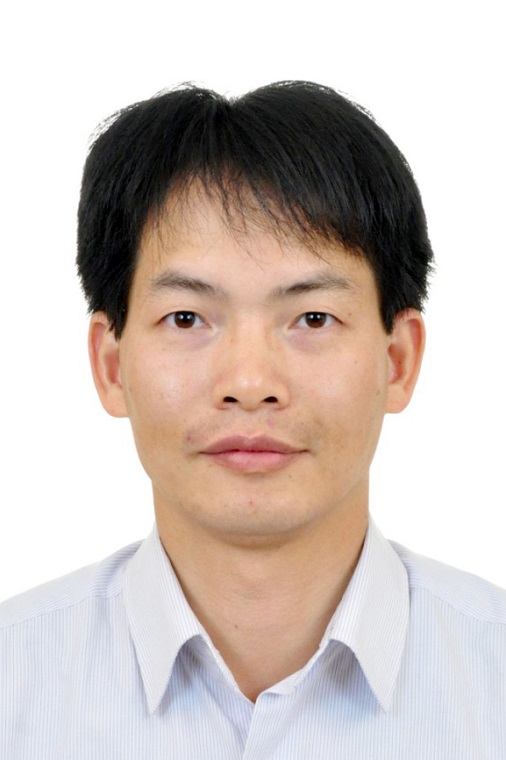 Xianqiang He (何贤强)合作论文数State Key Laboratory of Satellite Ocean Environment Dynamics, Second Institute of Oceanography, State Oceanic Administration, Ministry of Natural Resources;Donghai Laboratory;School of Oceanography, Shanghai Jiao Tong University5Zhixuan Wang合作论文数4
 Tifeng Wang合作论文数4Zhiqiang Yin合作论文数Xiamen University, Xiamen University4
 Jing Zhang (张经)合作论文数State Key Laboratory of Estuarine and Coastal Research, East China Normal University4Biyan He (何碧烟)合作论文数集美大学港口与环境工程学院4
 Wei Yang (杨炜)合作论文数Department of Mechanical and Electrical Engineering, School of Aerospace Engineering, Xiamen University4
 Baoshan Chen合作论文数State Key Laboratory of Marine Environmental Science, Xiamen University4
 Steven E Lohrenz合作论文数Stennis Space Center, University of Southern Mississippi4Youchang Zheng合作论文数3
 Huade Zhao (赵化德)合作论文数State Key Laboratory of Marine Resources Utilization in South China Sea, School of Marine Sciences, Hainan University3
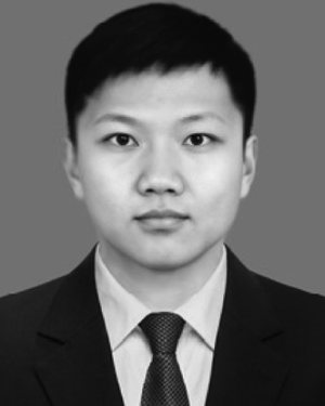 Zigeng Song合作论文数3Jia-Zhen Sun合作论文数3
 Shujie Yu合作论文数Zhejiang Univ, Ocean Coll, Zhoushan 316021, Peoples R China3
 Jianzhong Su (苏剑钟)合作论文数State Key Laboratory of Marine Resources Utilization in South China Sea, School of Marine Sciences, Hainan University3
 Yang Feng合作论文数3Ying Gao合作论文数3Wenjing Huang合作论文数Graduate University of Chinese Academy of Sciences, Graduate University of Chinese Academy of Sciences3
 Yanping Xu (许艳苹)合作论文数State key Laboratory of Marine Environmental Science, Xiamen University3
 Qing Li (李青)合作论文数School of Public Administration and Policy, Renmin University of China3
 Jinshun Chen (陈进顺)合作论文数State key Laboratory of Marine Environmental Science, Xiamen University3
 Xudong Zhu (朱旭东)合作论文数State Key Laboratory of Marine Environmental Science, Xiamen University;College of the Environment & Ecology, Xiamen University3
 Michael C. Murrell合作论文数National Health and Environmental Effects Research Laboratory, US EPA3
 Jianyu Hu (胡建宇)合作论文数State Key Laboratory of Marine Environmental Science, Xiamen University3Wei-Jen Huang合作论文数2Zhentong Yao合作论文数2
 Shengyao Sun合作论文数2Yaohua Luo合作论文数2




