Most existing deep reinforcement learning (DRL) methods for traffic signal control rely on a high-frequency, second-by-second phase switching paradigm. While this paradigm often demonstrates superior performance in simulations, it faces significant challenges in real-world implementation. Traffic management practitioners prefer a cycle-based control paradigm, which, however, presents two fundamental challenges: (1) the curse of dimensionality in the action space, and (2) the difficulty of representing traffic states effectively given the long control intervals. This paper introduces TAHALight, a Temporal-Aware, Hybrid-Action Reinforcement Learning approach, that overcomes these obstacles through dedicated designs for the action space and state representation. To tackle the dimensionality curse, we propose a hierarchical hybrid action space. In this framework, a high-level policy selects a discrete cycle length from a predefined set, while a low-level policy determines the corresponding splits. This decomposition significantly reduces the action space dimensionality, thereby enhancing learning efficiency. To address the state representation challenge, we devise a state observation mechanism based on multi-period sampling and employ a Transformer-based state encoder. This encoder leverages a multi-head attention mechanism to model the spatio-temporal dependencies of traffic flow, enabling proactive and context-aware decision-making. Comprehensive 24-hour experiments conducted on both synthetic and real-world scenarios demonstrate that TAHALight can dynamically adapt to traffic flow variations. It significantly outperforms baseline methods in the synergistic optimization of cycle length and splits, reducing average delay and queue length by over 10% compared to both fixed-time control and state-of-the-art DRL baselines.
Automatic Number Plate Recognition (ANPR) is widely deployed on urbanarterials, but its completion-based event structure introduces an observation delay between upstream entry and downstream label availability thatconstrains real-time reliability information to travelers and operators. Thispaper develops an observability-aware probabilistic forecasting workflow thattranslates these sensing constraints into traveler-facing reliability artifactsunder a deployment-grade compute envelope. The sensing model formalizes the completion-based information set under strict leakage control andderives two observability descriptors, a lag-intensity proxy and a matchcompletion ratio, summarizing label latency and local matching performance.Tree-based and mixture-density components are evaluated under identicalinformation-set rules with proper scoring and dependence-aware resampling.A case study on 113,006 matched trajectories over ten consecutive days ona signal-controlled corridor in Hangzhou shows that, after Holm–Bonferronicorrection, snapshot-conditioned components match or outperform recurrentencoding on probabilistic accuracy and calibration. The snapshot tree-basedcomponent publishes 90% prediction intervals at 0.89 empirical coverage and41.2 s mean width, against 133.3 s for the recurrent component at comparablecoverage, with sub-millisecond to a-few-milliseconds CPU inference latency.A sensing-state decision rule with validation-frozen thresholds switches theservice between a broadcast mode, where the snapshot tree-based componentpublishes 39 s buffer intervals at 0.87 empirical coverage on 41% of cycles, anda fallback mode, where a 117 s marginal-Gaussian safety net covers the remaining cycles. The workflow yields reliability statements with prototype-gradebuffer time and refresh latency for matched-trajectory traveler informationservices on commodity hardware.
The recent strict enforcement of “complete pedestrian priority” at unsignalized midblock crosswalks in China has substantially improved pedestrian safety but has also introduced new traffic bottlenecks and considerable vehicle delays. Existing system-delay models generally assume either vehicle priority or equal right-of-way between pedestrians and vehicles and are therefore not directly applicable to this operating condition. This study develops a novel analytical framework for estimating vehicle delay under absolute pedestrian priority. The framework integrates M/G/1 queueing theory with gap-acceptance theory by modeling the stochastic pedestrian stream as an interruption to vehicle service. A closed-form formulation is derived to estimate vehicle delay at unsignalized crosswalks, including queueing delay and deceleration–acceleration delay caused by stochastic pedestrian interruptions. The resulting delay formulation is further combined with a signalized-intersection delay model to support signal warrant evaluation. The proposed model is calibrated and validated using drone-based field data collected at a midblock crosswalk in Hangzhou, China. Its predictions agree well with VISSIM microsimulation results, yielding a mean absolute percentage error of approximately 15% across a wide range of pedestrian and vehicle demand levels. The model is subsequently used to establish a data-driven signal warrant criterion by comparing system-wide per-capita delays before and after signalization. The results demonstrate that the proposed method generates flexible critical-flow curves for signal installation, providing a more context-sensitive alternative to conventional fixed-threshold warrants. The proposed framework offers traffic engineers an analytical tool for evaluating the operational performance of unsignalized crosswalks and supporting informed decisions regarding traffic control upgrades.
Queue spillover is a primary contributor to regional traffic congestion in urban networks. Traditional detection methods, however, often rely on fragile loop detectors and are limited to qualitative assessments. To address these limitations, this paper proposes a novel, real-time method for spillover detection and duration estimation using License Plate Recognition (LPR) data. The core of our method is to first reconstruct vehicle trajectories from LPR data and subsequently a new methodology is proposed for estimating queuing shockwave speeds specifically under spillover conditions, which enables the real-time estimation of the farthest queue position for each signal cycle. The occurrence of a spillover event is found to induce a distinct and predictable fluctuation pattern in the time series of the farthest queue lengths. Based on this finding, we introduce the Queue-Comparison-based (QC) method, which identifies spillover events by detecting this characteristic fluctuation pattern. Furthermore, the QC method can quantitatively calculate the duration of spillover event and semi-quantitatively track the evolution of subsequent occurrences. The proposed method was comprehensively validated using both microscopic traffic simulation data and real-world LPR data collected from an intersection in Hangzhou, China. The calculated spillover duration exhibit an error of less than 19.2% compared to ground truth, and the method effectively tracks the dynamic evolution of these events. Moreover, the intermediate outputs of the method, such as the reconstructed trajectories and estimated shockwave speeds, show high fidelity with the process data from the validation cases.
ABSTRACT Mobile phone signalling data (MPSD) has become a valuable resource for driving numerous urban applications. However, due to high collection costs and strict privacy constraints, the scarcity of labelled datasets limits its broader application. To address this challenge, we reframe the problem from pure generation to a reality‐preserving simulation. This study proposes a deep reinforcement learning framework that synthesises MPSD trajectories by learning a policy to translate high‐fidelity GPS data into realistic cell tower connection sequences. The framework employs proximal policy optimisation (PPO) to learn a sophisticated connection policy, guided by a composite reward function that jointly optimises for point‐level accuracy and trajectory‐level distributional similarity, effectively capturing physical phenomena like connection hysteresis. A comprehensive evaluation across micro‐ (continuity) and macro‐ (distributional) levels demonstrates that our model outperforms state‐of‐the‐art baselines. The synthetic trajectories achieve high fidelity, with an effective point ratio of 0.97 (ground truth: 1.0), an average temporal sampling rate nearly identical to real data (79s vs. 77s), and low divergence in spatiotemporal distributions. Crucially, our approach enables lossless transfer of semantic labels (e.g., travel mode and purpose) from the source GPS data, directly addressing the label scarcity problem. The practical utility of the synthetic data is validated on two downstream tasks—map matching and travel mode identification—where models trained on our data achieve performance comparable to those trained on real data. This work presents a scalable solution to the data and label scarcity problem in mobility research, providing a robust method for generating semantically enriched, application‐ready MPSD for advancing large‐scale urban mobility analysis.
The impact of traffic incidents in urban road networks often propagates beyond the affected segment, causing performance degradation at adjacent intersections and leading to network-level congestion. To address this challenge, this paper proposes a novel method for real-time incident detection and impact quantification using license plate recognition (LPR) data. The key ideas of this method is: 1) Incident-induced queue spillback often results in a Green Phase Failure (GPF) at upstream intersections, and the delays of vehicles experiencing this failure inherently contain information about the GPF duration. 2) By leveraging LPR data to reconstruct vehicle trajectories and establish a baseline of historical queuing information, the GPF duration can be accurately derived from the delay of a subsequent vehicle. 3) The proposed Delay-Discrepancy-Detection (3D) method performs a vehicle-by-vehicle analysis of delay discrepancies to achieve real-time identification of GPFs and calculation of their duration, achieving automated incident detection and real-time impact analysis. The proposed method was validated using both simulation data and field data collected in Hangzhou, China. Qualitatively, the results demonstrate that our method can promptly and accurately detect the occurrence of incident-induced GPFs. Quantitatively, the method exhibits high precision, with calculated GPF duration errors not exceeding 5.5 seconds in field tests and 8.5 seconds in simulation scenarios, confirming its capability for precise incident impact quantification.
Estimating instantaneous traffic flow $q(t)$ from discrete event times is a core estimation problem in emerging transport systems, where widely deployed point detectors must operate alongside connected, automated, and data-driven control components. Common approaches, especially the reciprocal of headway ($q=1/h$), can systematically overestimate flow under stationary renewal assumptions because of Jensen's Inequality, and the issue becomes pronounced when traffic is highly variable ($\kappa \le 1$). This paper places several smoothing approaches within a kernel intensity estimation view, and shows that causal exponential smoothing can be interpreted as a steady-state scalar Kalman filter. Building on this link, we develop a second-order observer with an adaptive bandwidth by using a relative process-noise model ($Q \propto q^2$) together with Poisson-like measurement noise ($R \propto q$). The resulting observer responds quickly when flow is high and applies stronger smoothing when observations are sparse. Controlled simulation studies with known intensity profiles validate the bias analysis and demonstrate improved tracking under nonstationary conditions. For event-only field deployment, where instantaneous-flow ground truth is not directly observable, we also formalize a validation framework based on predictive consistency, calibration, and operational indicators. This validation framework supports real-time use under partial observability and provides observable predictive diagnostics for monitoring, adaptive control, and traffic management analytics.
To facilitate the gradual integration of autonomous vehicles (AVs) into society and assess their capabilities, numerous trials of autonomous taxis (ATs) in urban settings are conducted. Experienced consumers' evaluations of AT rides are vital for the advancement of both the industry and related policies. This study aims to reveal the factors that influence the continuous use intention of ATs. A questionnaire survey was implemented and gathered 600 valid responses from Chinese urban residents who have prior experience riding ATs, encompassing four key aspects: sociodemographic and mobility attributes, perceived satisfaction with AT services, properties of the last AT trip, and AT use experiences and outlooks. The analysis was conducted using the LightGBM ensemble learning method, and the interpretation was based on SHAP algorithms. The findings indicate that the most crucial factor is the number of AT rides taken, with three experiences serving as a threshold for promoting the willingness to continue using ATs. Trip durations of 25 min influence respondents' expectations of AT pricing, with shorter trips anticipated to be priced similarly or lower than traditional taxis and ride-hailing services. The peak AT-hailing hours are between 11:00 and 15:00. Enhancing the dynamic performance of ATs is crucial for improving user experience and intention. Furthermore, for individuals under 32 years old, ATs represent a novel, high-tech, and appealing mode of transport. Older adults are less inclined to consider ATs as an alternative to their current transport modes. User satisfaction with in-vehicle interactions can mediate the impact of overall trip satisfaction on the continuous use intention of ATs. Regarding future activity scenarios with ATs, respondents express a willingness to use them for commuting and leisure but strongly oppose their use for picking up children. The paper concludes by presenting theoretical and industrial implications, along with strategies to enhance the continuous use intention of ATs.
Travel Mode Identification (TMI) using mobile phone signalling data (MSD) has garnered significant attention. Previous work primarily focused on coarse-grained identification (e.g., public vs. private transport) due to MSD's low spatial accuracy, irregular temporal features, and lack of labelled data. To tackle these challenges, this paper proposes a novel fine-grained TMI framework with transfer learning. It consists of two stages, where the first stage applies heuristic rules fused with GIS information to identify metro. The second utilizes a Multi-Head Attention-Conditional Random Field (MACRF) model with transfer learning for point-level identification of walk, bike, bus, and car. Novel features are designed to counter spatio-temporal uncertainty. Extensive evaluation with ground truth in Hangzhou shows the approach significantly boosts accuracy over baselines via transfer learning. Moreover, comprehensive analysis offers valuable insights. The framework exhibits great generalisation capability and holds potential for large-scale travel demands survey in cities.
Deep Reinforcement Learning (DRL) is prevalent in traffic signal control. However, the training process often encounters slow learning rate and unstable convergence due to limited state representation and exploratory learning. Inspired by human learning, we incorporate expert guidance in the exploration process to accelerate convergence and enhance performance. The proposed framework, termed Expert-Guided Light (EGLight), contains three moudles. The state perception module combines statistical features with cellular features to enhance model robustness. The decision-making module employs expert-guided learning to promote the learning efficiency. In the learning module, four distinct loss functions are employed to make full use of the interaction experience and update the agent's policy. Extensive tests demonstrate EGLight's superior convergence speed and effectiveness over traditional methods. The analysis shows that the precise feature design is helpful for the agent and proper expert guidance is crucial for the convergence of agent learning process.
Accurately analyzing the level of service (LOS) of signalized intersections is vital for evaluating signal control strategies. Currently, most research on LOS focuses on the factors that influence commuters' perceptions. However, these methods lack immediacy and universality, making them challenging to apply to dynamic and real-time scenarios. This study proposes an innovative framework for dynamically analyzing the LOS at signalized intersections using license plate recognition data (LPR data). This framework integrates free-flow speed estimation, average vehicle delay calculation from LPR data, unreasonable delay correction within windows, and dynamic LOS evaluation at signalized intersections according to Highway Capacity Manual (HCM). Specifically, Gaussian mixture models are employed for estimating free travel time at signalized intersections and calculating average vehicle delays using LPR data. The day is segmented into 144 10-min windows for LOS assessment, with each window's average vehicle delay determining the intersection's LOS according to HCM. The Local Outlier Factor algorithm is used to detect unreasonable abrupt changes in delays, then smoothing with Loess regression, ultimately achieving dynamic intersection delays calculation and LOS evaluation throughout the day. The method's efficacy and universality are validated using simulation data from SUMO and LPR data from three signalized intersections with different traffic patterns in Xiaoshan District, Hangzhou, China. The method's effectiveness in dynamically calculating intersection delays and evaluating service levels throughout the day underscores its potential for widespread use in traffic management and control strategies.
Accurate macroscopic evaluation of urban traffic networks is essential for effective traffic management. Building on the classical two-fluid theory, this paper develops a network-level traffic state evaluation model that uses the number of in-network vehicles (N) as the traffic parameter and vehicle-kilometres ( $ P $ P) as the indicator for characterise overall traffic state. The theoretical model is first validated through simulation experiments. Then, using automatic license plate recognition (ALPR) data, N is estimated with a dwell-point judgment strategy. Model calibration with ALPR datasets from three Chinese cities of differing scale yields consistently high $ {R<^>2} $ R2 values and Root Mean Square Relative Error (RMSRE) across multiple days, demonstrating the model's precision and stability. The key contribution of this study is the seamless integration of large-scale ALPR data with a proven theoretical framework to deliver a robust, interpretable, and practical tool for urban traffic network evaluation, validated across diverse real-world scenarios.
GPS-based travel surveys, coupled with automatic Travel Mode Identification (TMI) techniques, have emerged as effective tools for capturing travel details while reducing participant annotation burdens. However, existing models typically identify travel modes on a per-trip basis without considering individual travel regularity. More importantly, incorrect identification increases modification burdens, an issue that has not been adequately assessed or addressed. We propose a novel TMI scheme for travel surveys: participants enumerate their used travel modes before TMI, and the History and Annotation Informed Network (HAIN) model integrates individual historical travel information and enumerated annotations to infer the current travel mode chain, thereby improving accuracy and reducing the need for modifications. The designed history and annotation fusion modules in HAIN are plug-and-play and can operate separately. Additionally, we introduce the “number of edits” to quantitatively assess user annotation burden. We divide data by travelers and conduct three-fold cross-validation to approximate real-world scenarios. Results show that the accuracy of the state-of-the-art model is 83.14%; it reaches 86.3% when identifying trips sequentially with previously inferred histories; using corrected histories improves accuracy to 88.26%; and incorporating enumerated annotations raises it to 96.03%. Correspondingly, the annotation burdens are reduced to 43.8%, 39.9%, 36.6%, and 24.3% of what they would be without TMI. The two fusion modules also enhance the performance of baseline models. The history fusion improves model robustness when incorrect annotations occur. Comprehensive experiments indicate that the proposed scheme significantly enhances data collection efficiency and improves user experience.
Autonomous vehicles (AVs) may exacerbate traffic congestion due to zero-occupant cruise to avoid parking and save parking fees. Congestion pricing strategies are considered as important solutions to reduce traffic congestion. However, there is still insufficient research on the congestion pricing strategy on zero-occupancy AVs, which we refer to as the cruise pricing strategy. Therefore, this paper explores and optimizes the impact of cruise pricing strategies on AVs cruise-induced traffic congestion. A Multi-Agent-Based Model (ABM) is constructed to simulate the parking and cruising behavior of zero-occupancy AVs and evaluate the impact of different cruise pricing strategies on traffic systems. Previous research on AVs cruise pricing strategies has largely overlooked actual travel patterns and road network conditions. In this paper, we use real traffic network and trip data in Hangzhou as a real-world case study, finding that AVs push the system into congestion in a completely self-interested way to save individual travel costs, which results in an additional 63.0% increase in the average travel time for travelers and a 58.7% increase in the total network Vehicle Kilometers Traveled (VKT). Compared to baseline pricing methods, the proposed link-based cruise pricing strategy can effectively minimize AVs cruise-induced traffic congestion while maintaining a balance between individual benefits and system-optimal goals.
Assessing the coverage of metro stations is crucial for evaluating and guiding metro construction. Existing methods mainly rely on surveys to obtain the coverage radii by fitting the first-mile distance distribution of metro passengers, which is costly and time-consuming to capture the spatiotemporal heterogeneity at the urban scale. Daily generated multi-source mobility data offers the possibility of a broad and low-cost assessment. This study proposes a framework to assess the coverage radius of metro stations using metro smart card data and Baidu population heatmap data. First, we build a nested logit model to model travelers' mode choice and station selection behaviors, considering both the competitiveness of the metro over other modes and travelers' sensitivity to first-mile distance. We then establish the relationship between choice probability and metro station inflows, calibrating the parameters through a genetic algorithm-based bi-objective optimization. Finally, we propose a novel metro station coverage assessment method using a distance-decay function that describes the cumulative mode choice proportions. An empirical analysis is conducted using Hangzhou, a sizeable monocentric city in China. The results reveal significant tidal patterns in travel behavior parameters. During the morning peak, suburban travelers rely more on the metro, whereas evening peak reliance is more pronounced among urban center travelers. This aligns with Hangzhou's commuting patterns. Moreover, significant differences occur in attraction patterns between downtown and suburban stations. Suburban metro stations exhibit larger coverage radii due to the lack of convenient alternative transport modes, a result that existing methods fail to capture. This evaluation framework can be extended to other cities, offering valuable insights for enhancing metro services.
Mobile Phone Signaling (MPS) data record the daily traces of urban residents, offering a cost-effective means to obtain travel information for urban traffic management and planning at low cost. However, despite the vast amount of data available, there remains a lag in the development of techniques for identifying fine-grained information such as travel modes. On the one hand, the high positioning error and irregular collection frequency make the identification of fine-grained modes challenging. On the other hand, the difficulties in collecting real labeled data limit the training and evaluation of advanced models. In this paper, we present an advanced Travel Mode Identification (TMI) framework and collect real labeled MPS data for evaluation. Specifically, a fast smoothing method is proposed to enhance noise reduction in large-scale trajectories while effectively mitigating positioning errors. We propose novel point-level bus route alignment features for advanced deep-learning models to improve differentiation between motorized modes. Furthermore, a deep learning model with ensembled feature encoding modules is designed to overcome training instability due to limited data amount. Our proposed framework achieves an accuracy of 83.06% in identifying fine-grained travel modes, including walking, riding, bus, car, and metro, with recall rates exceeding 78% for all modes except walking. We analyze the relationship between accuracy and the spatiotemporal characteristics of trajectories, revealing a significant impact from the collection frequency, while showing insensitivity to distance gaps and positioning errors. This study demonstrates the potential of MPS for TMI and promotes its application in intelligent transportation systems.
Accurate prediction of downstream vehicle arrivals is pivotal for intelligent signal control, yet many advanced controllers depend on high-resolution trajectories that are rarely available outside connected-vehicle settings. We present a deployable alternative that converts ubiquitous Automatic License Plate Recognition (ALPR) timestamps into the predictive inputs required by modern controllers. The method couples a Hidden Markov Model (HMM) for separating free-flow samples from signal-induced delays with a dynamic platoon-dispersion model that is re-estimated online in a rolling window to forecast downstream arrival profiles in real time. In a Simulation of Urban Mobility (SUMO) corridor testbed, the proposed framework consistently outperforms fixed-kernel dispersion and fixed-travel-time baselines, reducing RMSE by 57–75% and MAE by 53–73% across demand levels; ablation results confirm that HMM-based filtering is the dominant contributor to the gains. Robustness experiments further show stable parameter estimation under low ALPR matching rates, indicating suitability for real-world conditions where data quality fluctuates. Because it operates with existing roadside cameras and lightweight inference, the framework is readily integrable into adaptive signal strategies and broader smart-city traffic management. By turning discrete ALPR events into reliable arrival predictions, it bridges the gap between advanced signal control and today’s sensing infrastructure, enabling cost-effective real-time signal optimization in data-constrained urban networks.
Multi agent reinforcement learning based on centralized training with decentralized execution has emerged as an efficient approach for optimizing multi-intersection signal control. However, existing methods often overlook the correlations between intersections, treating all agent relationships equally during global optimization, which limits efficiency and performance. To address this, this paper proposes a subarea-based multi-agent signal control method, comprising two key modules: (1) a subarea partitioning module and (2) a hierarchical optimization module. The subarea partitioning module calculates intersection correlation degrees and identifies potential community structures using community detection algorithms. The hierarchical optimization module decomposes the global value function into subarea value functions and local agent value functions through a hierarchical decomposition framework, which accelerates global value function learning. Furthermore, we design an encoder-decoder to guide agents' decision-making based on subarea-level context, and introduce a more compact input to speed up the fitting process of the global value function. Numerical experiments demonstrate that our method achieves a 7 % improvement in key metrics compared to baseline RL methods, and outperforms actuated control methods by over 40 %.
Vehicle re-identification aims to match and identify the same vehicle crossing multiple surveillance cameras and obtain traffic information such as travel time. The Automatic License Plate Recognition (ALPR) data are widely employed in urban surveillance. However, vehicle re-identification based on ALPR data is challenging due to license plate recognition errors and unrecognized issues. This paper proposes a vehicle matching algorithm designed to maximize the travel time probability using ALPR data, while accounting for recognition errors and unrecognized issues. The proposed algorithm consists of several modules, including the estimation of travel time distribution, computation of travel time probability, calculation of travel time confidence intervals and matching time window size, restricted fuzzy matching, and vehicle matching optimization. To evaluate the effectiveness of the proposed algorithm across varying lighting and weather conditions, ALPR data was collected from a survey road in four scenarios: sunny day, sunny night, rainy day, and rainy night. The results indicate that when compared to a sunny day scenario, severe lighting and adverse weather conditions lead to decreased matching accuracy and increased matching accuracy errors for all methods evaluated. However, our proposed model outperforms benchmark algorithms in both scenarios, demonstrating its superior performance.
 Sheng Jin (金盛)合作论文数Institute of Intelligent Transportation Systems, College of Civil Engineering and Architecture, Zhejiang University57
 Dongfang Ma (马东方)合作论文数Ocean College, Zhejiang University54
 Zhengyi Cai合作论文数Inst Intelligent Transportat Syst, Zhejiang Univ32
 Yiming Bie (别一鸣)合作论文数Transportation College of Jilin University28
) Hongsheng Qi (祁宏生)合作论文数College of Civil Engineering and Architecture, Zhejiang University25
Hongsheng Qi (祁宏生)合作论文数College of Civil Engineering and Architecture, Zhejiang University25 Xianmin Song (宋现敏)合作论文数Transportation College, Jilin University18
) Lihui Zhang (章立辉)合作论文数College of Civil Engineering and Architecture, Zhejiang University17
Lihui Zhang (章立辉)合作论文数College of Civil Engineering and Architecture, Zhejiang University17 Zhaowei Qu (曲昭伟)合作论文数Transportation College, Jilin University12
 Mengwei Chen (陈梦微)合作论文数12
 Jiaqi Zeng合作论文数11
 Fengjie Fu合作论文数11
 Yilin Sun (孙轶琳)合作论文数College of Civil Engineering and Architecture, Zhejiang University11
 Zhenyu Mei (梅振宇)合作论文数College of Civil Engineering and Architecture, Zhejiang University11Cheng Xu (徐程)合作论文数10QIAN Guo-min (钱国敏)合作论文数9
 Edward Owen D. Waygood合作论文数University of the West of England, University of the West of England9
 Xiaoqin Luo合作论文数Civil Engineering and Architecture, Zhejiang University, Hangzhou, Zhejiang, China8LingJuan Chen (陈玲娟)合作论文数8
 Xiaobo Qu (曲小波)合作论文数School of Vehicle and Mobility, Tsinghua University8
 Pengfei Tao (陶鹏飞)合作论文数Transportation College of Jilin University8
 Yi Yu合作论文数7Weiwei Guo合作论文数7
 Xiaolong Ma (马晓龙)合作论文数Qingdao Hisense TransTech Co., Ltd.7
) Fujian Wang (王福建)合作论文数College of Civil Engineering and Architecture, Zhejiang University7GuoZheng Zhang (张国政)合作论文数6
Fujian Wang (王福建)合作论文数College of Civil Engineering and Architecture, Zhejiang University7GuoZheng Zhang (张国政)合作论文数6 Peng Chen合作论文数Nagoya University, Nagoya Univ6
 Zhihui Li (李志慧)合作论文数Transportation College of Jilin University6
 Hongyu Hu (胡宏宇)合作论文数College of Automotive Engineering, Jilin university6
 Ronghan Yao (姚荣涵)合作论文数School of Transportation & Logistics, Dalian University of Technology6Chunguang He合作论文数5dan zhou合作论文数5Jiong Dai (代炯)合作论文数5Pingfan Li合作论文数5
 Yanlei Cui合作论文数4ZHAO Ying-ying合作论文数4Qiang Wei合作论文数4
 Weihao Ma (马伟皓)合作论文数School of Navigation, Wuhan University of Technology4Weiming Zhao (赵伟明)合作论文数4ChunYan Liang (梁春岩)合作论文数4Ying Ye合作论文数4
 Yongheng Chen (陈永恒)合作论文数Transportation College of Jilin University4
 Dayi Qu (曲大义)合作论文数School of Mechanical & Automotive Engineering, Qingdao University of Technology4
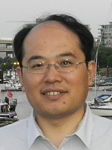 Jian Sun (孙剑)合作论文数College of Transportation, Tongji University;Key Laboratory of Road and Traffic Engineering, Department of Traffic Engineering, Tongji University4
 Feng Sun (孙锋)合作论文数College of Instrumentation & Electrical Engineering, Jilin University4Di Sun合作论文数4Xirui Yang合作论文数4
) Yibing Wang (王亦兵)合作论文数College of Civil Engineering and Architecture, Zhejiang University4Manchu Xiong合作论文数3Yue Gong合作论文数3
Yibing Wang (王亦兵)合作论文数College of Civil Engineering and Architecture, Zhejiang University4Manchu Xiong合作论文数3Yue Gong合作论文数3




