The phase change of repeat-pass interferometric synthetic aperture radar (InSAR) observations has been applied to the monitoring of surface deformation, forest biomass, soil moisture, and snow water equivalent (SWE) in the past two decades. The InSAR phase measurement accuracy depends on the interferometric coherence of radar signals from repeat passes. In this article, we presented theoretical modeling of the interferometric coherence of synthetic aperture radar (SAR) observations, applicable to bistatic forward-looking signals of opportunity (SoOp), as well as the backscatter geometries, with a primary focus on low microwave frequency (<5 GHz) for terrestrial snow remote sensing. The theoretical expression can account for the temporal and spatial variabilities of surface roughness and snow depth (SD) within a footprint and the domain for multilook averaging. We applied our model to the analysis of interferometric coherence caused by SD changes for a range of surface roughness. The temporal and spatial characteristics of SD were based on a set of airborne LiDAR SD acquired at the Grand Mesa, Colorado, which showed that SD can vary from a few cm to 50 cm in standard deviation and a spatial correlation length of a few to 40 m. In addition, the characteristics of soil surface roughness were also estimated based on airborne LiDAR surveys. According to the observed characteristics of SD and rough surface variability, we find that the theoretical interferometric coherence varies with the correlation length and root mean square (rms) of the SD, and also soil surface roughness. An increase in soil surface roughness will reduce the area of contribution to the interferometric coherence integral, thus reducing the effect of subfootprint variability and leading to an increase in coherence. Our theoretical formulation goes beyond the independent scattering assumption used in the past theoretical modeling for temporal decorrelation of repeat-pass radar observations and can be used to assess the confounding effects of soil surface roughness, SD, and spatial resolution. Numerical examples have been presented for two SAR configurations, including an L-band backscatter SAR and a P-band forward-scattering SAR.
This article presents a comprehensive analysis of L-band SAR backscatter (sigma) from the soil moisture active passive (SMAP) mission with respect to soil moisture in terms of the real part of soil dielectric constant, vegetation water content (VWC), and surface topography represented by the standard deviation of slope (STD slope). We examine backscatter response across seven landcover types and four major regions globally, employing a two-dimensional (2-D) binned framework to isolate the individual impacts of soil moisture and surface roughness under a range of VWC. Results show that radar backscatter increases substantially with the STD slope and soil moisture, with the strongest response under low VWC conditions. The radar backscatter also shows a general increase with VWC for VWC below 5 kg/m(2). A piecewise linear function is used to model the relationship between STD slope and backscatter, as the rate of change is higher at lower STD slope ranges. Under low vegetation conditions (VWC < 0.25 kg/m(2)), the backscatter sensitivity to STD slope [partial derivative sigma/partial derivative(STD slope)] is approximately 1 dB/degrees for STD slopes less than 8 degrees and about 0.3 dB/degrees for slopes between 8 degrees and 16 degrees, while the sensitivity becomes negligible when VWC approaches 5 kg/m(2). We also utilize the semiempirical water cloud model of the vegetated soil surfaces to quantify the attenuation and volume scattering by vegetation. The results reveal an exponential decay of vegetation attenuation with increasing VWC and a nonlinear increase in volume scattering, consistent with prior theoretical and experimental studies.
Abstract Interferometric Synthetic Aperture Radar (InSAR) offers a potential pathway for measuring seasonal snow water equivalent (SWE) and snow depth at spatial and temporal scales needed for basin‐scale hydrology. First proposed for seasonal snow more than 25 years ago, InSAR uses repeat‐pass radar phase differences to estimate changes in SWE or depth caused by microwave propagation through snow. This review synthesizes InSAR‐based snow monitoring from early theoretical and satellite demonstrations through recent tower, airborne, and spaceborne studies. We summarize the retrieval physics, evaluate published validation results, compare performance across wavelengths and snow environments, and identify barriers to operational implementation. The literature shows that InSAR can provide high‐resolution, spatially distributed information on snow accumulation and ablation, especially under dry‐snow conditions when temporal coherence is maintained and snow phase can be separated from atmospheric, vegetation, soil‐moisture, and other non‐snow contributions. Longer wavelengths, particularly L‐band, help maintain coherence, reduce phase‐wrapping ambiguity, and support retrievals in some vegetated environments, making the NASA–ISRO Synthetic Aperture Radar (NISAR) mission a timely opportunity for basin‐scale testing. Remaining challenges include correcting ionospheric and tropospheric delays; defining stable reference phases; identifying, correcting, or flagging coherence loss and phase‐unwrapping errors; accounting for forest‐canopy interactions; collecting spatially distributed validation data; and scaling site demonstrations to regional or global products. Operational use will require algorithmic maturation, robust validation, and integration with other remote sensing and modeling approaches. If these challenges are addressed, InSAR‐capable satellites could become an important component of an integrated global snow observation suite.
The NASA-ISRO Synthetic Aperture Radar (NISAR) mission will advance global soil moisture monitoring through high-resolution L-band observations. However, accurate fine-scale retrieval remains challenging due to the 12-day revisit interval and complex, scale-dependent influences of vegetation and surface roughness on backscatter. This study introduces the SMAP-AVS (Attenuation-Volume scattering-Surface scattering) model, a semi-empirical framework evaluated using ALOS-2 PALSAR observations. Formulated within the Water Cloud Model framework, the methodology moves beyond conventional land-cover-based parameters by adopting pixel-wise parameterization. Leveraging soil moisture temporal stability, the framework assumes strong correlation between coarse-scale (9 km) SMAP L3 products and fine-scale (1 km) variations, enabling separation of vegetation and surface roughness contributions to the SAR signal. The SMAP-AVS framework is resolution-agnostic; while demonstrated at 1 km, it scales to meter-resolution expected from NISAR. Once parameterized, the model operates in snapshot retrieval mode, deriving soil moisture from single SAR acquisitions and NDVI data without further temporal information. Validation across four hydro-climatically diverse U.S. regions (2021-2024) included temporal comparison against International Soil Moisture Network observations and spatial validation using Multi-Radar Multi-Sensor precipitation fields to distinguish physical moisture heterogeneity from artifacts. SMAP-AVS resolves rainfall-driven patterns often missed by coarser products, with spatial correlation coefficients exceeding 0.5 in semi-arid and agricultural regions, demonstrating that the framework captures physically significant hydrological variability and offers a scalable methodology for operational high-resolution soil moisture products.
Abstract. Active microwave measurements, including those using interferometric synthetic aperture radar (InSAR) techniques, have shown promise for characterizing seasonal snowpacks at high spatial resolution. This study demonstrates a Bayesian InSAR phase data assimilation framework for estimating snow water equivalent (SWE) changes (dSWE) and SWE accumulation from dry-snow phase delay measurements at C-, L-, and P-band wavelengths. Two idealized synthetic end-member observing system simulation experiments (OSSEs) were performed in the context of a deep snow year at sites in the Tuolumne watershed. A baseline case with 6-day temporal repeat was used to evaluate the Bayesian framework relative to a deterministic retrieval approach under the two end-member cases where: (i) phase delay data is perfectly unwrapped and (ii) phase delay data is wrapped. In the case of perfectly unwrapped phase measurements, the deterministic retrieval and Bayesian approaches both show good estimation of dSWE across all three wavelengths (< 23 mm RMSE). The Bayesian approach shows reduced RMSE in dSWE (~63-74% of deterministic retrieval RMSE) and SWE (~5-34% of the deterministic retrieval RMSE). The primary source of error in SWE for the retrieval estimates is at the site where a month-long gap in measurements, due to wet snow early in the accumulation season, leads to missing dSWE events that result in SWE underestimation. In the case of fully wrapped phase measurements, ambiguity due to wrapping leads to very large (bias) errors in deterministically retrieved dSWE. The Bayesian framework uses an appropriate likelihood function to account for phase wrapping so that, when combined with the prior information provided by the modeling framework, results show minimal degradation to the perfectly unwrapped case in most test cases (except for the C-band case with a long temporal measurement gap). Tests examining the sensitivity to measurement error standard deviation and temporal repeat highlight the ability of the Bayesian approach to add value to the retrieval of dSWE and SWE across a range of cases. Future work should test the Bayesian framework with real InSAR phase data (e.g. Sentinel-1 C-band and NISAR L-band) across the range of physiographic and snow characteristics and phase retrieval error expected in mountain snow domains.
L-band airborne synthetic aperture radars were deployed over California shrublands and temperate forests in the US New England to better understand the effects of soil and vegetation on backscattering coefficient (sigma(0)). For the shrubs, the changes in vegetation water content (VWC) were observed to occur primarily in thin leaves that do not meaningfully influence absorption and scattering. Accordingly, unlike in the past literature, the VWC input of the plant to the model was formulated as a function of plant's dielectric property (water fraction) while the plant geometry remains static in time. A physically-based model for single scattering by discrete elements of plants successfully simulated the magnitude of the temporal variations in HH, VV, and HH/VV with a difference of less than 0.9 dB. For the forest, sigma(0) in spring decreased in time while soil moisture stayed wet. Observations showed drying trunks and thickening foliage. Reduced scattering by the drying trunks and enhanced attenuation by leaves may explain the s0 observations. These simulation and observations suggest that dielectric changes, rather than plant geometry growth, have sizeable contributions to the variations in sigma(0).
Forests are one of the most essential components of the Earth system. They account for a large part of the total global photosynthetic activity, store a significant amount of the total carbon, and provide a habitat for countless species. At the same time, they offer critical resources to anthropogenic activities, such as timber, food, and firewood. Soil moisture (SM) plays a pivotal role in the processes governing all these functions. Low-frequency remote sensing is the only way to acquire a large spatial distribution of the forest SM because of its ability to carry the signal from the forest floor through the forest canopy to the satellite. Studies have shown that NASA's SMAP (Soil Moisture Active Passive) mission, measuring brightness temperature at 1.4 GHz (L-band), is sensitive to SM changes in forests despite the interference by the forest canopy. The challenge is to accurately account for the attenuation, scattering, and emission by the canopy. The SMAP Validation Experiment 2019-2022 (SMAPVEX19-22) in the temperate forests of the northeast US collected a vast amount of in situ and other experimental data to improve SMAP's SM and L-band vegetation optical depth (L-VOD) retrievals in forested areas. The results from the experiment have shown that the transmissivity is substantially higher in the spring no-leaf conditions than later in the season, suggesting that the seasonal water content changes and phenology significantly affect L-band TB. While the effect is seasonal, substantial changes in the L-VOD response occurred within days as the water content and phenological changes occurred harmoniously across the large SMAP footprint (tens of km). Moreover, the frozen season effect on the tree permittivity affected the SMAP L-VOD at daily timescales as the trees within the SMAP footprint underwent changes between frozen and thawed states. The results underline the need for the SM and L-VOD retrieval algorithms to account for the short-timescale changes.
Satellite-based retrieval of forest soil moisture (SM) and vegetation optical depth (VOD) are two long-standing unresolved issues hindering advances in hydrology, ecology, and Earth system science. A key obstacle is the lack of adequate reference data in forested regions. NASA's Soil Moisture Active Passive (SMAP) mission, with its partners, conducted the SMAP Validation Experiment 2019-2022 (SMAPVEX19-22) to improve the SMAP SM and VOD retrievals in temperate forests of the northeastern USA. The scope and scale of the campaign exceeded anything done thus far to develop forest satellite-based SM and VOD retrieval algorithms. The field campaign measured SM, surface conditions, and vegetation properties, with results demonstrating the value of tree sensors with SM measurements and destructive sampling of the vegetation water content of branches and leaves to capture the water distribution in soil and trees. Using low-cost zenith-pointing cameras proved effective in tracking vegetation phenology, aiding the interpretation of brightness temperature (TB). Airborne and mobile terrestrial laser scanning measurements captured the three-dimensional forest structure necessary for microwave measurement interpretation. Challenges included characterizing SM in organic forest soils and determining volumetric SM due to spatially variable soil bulk density. Comparisons of the field measurements with SMAP data revealed its ability to retrieve the soil permittivity (correlation of 0.68 and 0.75 for the two experiment sites) alongside VOD, including the frozen conditions. The findings indicated that L-band scattering albedo is temporally variable, and L-band TB is sensitive to deciduous forest leaves, influencing the development of SM and VOD retrieval algorithms.
Data from the NASA Cyclone Global Navigation Satellite System (CYGNSS) mission have shown promise for the retrieval of soil moisture, and many soil moisture products using CYGNSS data have been developed. In this work, we present a merged product that combines several CYGNSS soil moisture products using a Minimum Variance Estimator (MVE). The MVE identifies an optimal weighted averaging scheme based on the error covariance characteristics of the CYGNSS soil moisture products. The error covariance matrix is computed using two reference datasets: soil moisture data from the Soil Moisture Active Passive (SMAP) radiometer and in situ soil moisture data. The results from each of these provide insights into both the performance of the merged product and the individual input CYGNSS products. Overall, the merged product offers better performance than any individual CYGNSS product while also offering better temporal resolution than SMAP. The results of this work also demonstrate that the use of the MVE is a compelling technique for soil moisture applications.
Soil moisture retrievals based on rigorous physical backscattering models require a comprehensive description of the vegetation structure and biophysical parameters, including the density of the scatterers, height, and vegetation water content. Semiphysical models, such as the water cloud model, are also extensively used and rely on estimates of vegetation water content or biomass derived from optical vegetation indices, such as LAI and NDVI. However, such indices only contain parts of the true variability of vegetation structure and how it changes across various land-cover types. In this study, we introduce radiative transfer neural network (RTNet), which combines a parameterized first-order radiative transfer model with four scattering components (surface, volume, double-bounce, and triple-bounce scattering components) and deep residual neural networks for the soil moisture retrieval. The input features consist of the HV backscattering coefficient, vegetation water content, and several other information categories, such as soil texture and weather data. The RTNet is optimized to minimize the difference between the estimated and measured HH total backscattering. After imposing a physical constraint on the RTNet outputs, they are then applied to the ensemble random forest machine learning regressor to retrieve the volumetric soil moisture. The proposed framework is validated using the SMAPVEX12 L-band UAVSAR data, aggregated to a resolution of 100 m, which is finer than the NISAR level 3 soil moisture product (200-m resolution). The estimated HH total backscattering coefficients show a high agreement with the UAVSAR-measured HH backscattering with a root-mean-square error (RMSE) of approximately 3 dB across the entire image in nonforested regions. The retrieved volumetric soil moisture also shows a very high agreement with the in situ soil moisture, achieving the RMSE of 5.65% and R2 of 0.7.
The phase change of repeat-pass Interferometric Synthetic Aperture Radar (InSAR) observations has found applications to monitoring of surface deformation, forest biomass, soil moisture and snow water equivalent. The InSAR phase measurement accuracy depends on the interferometric coherence of radar signals from repeat passes. The temporal decorrelation of radar signals can be influenced by many factors, including the signal to noise ratio of radar observations and geometry offset as well as natural variability of terrain surfaces, such as surface elevation, snow and vegetation cover within the radar footprint.
Airborne SAR observations of soil moisture conditions at 6-m resolution are analyzed over deciduous and evergreen forests in the U.S. Northeast during the 10-day spring and 14-day summer periods in 2022. During the summer, the dynamic range of HH is about 1 dB, associated mostly with soil moisture changes. Larger changes in backscattering are found between the two seasons, reflecting the vegetation effect. In spring, backscattering decreases in time, suggesting the impact of drying trunks and thickening foliage. In summer, sigma degrees correlates highly with in situ soil moisture, consistently between ascending and descending viewing geometry on flat terrain and on slopes only when imaged at similar incidence angles. The consistency benefits NISAR's retrieval by allowing more frequent consistent retrievals of soil moisture. Soil moisture was retrieved using HH to replicate NISAR observations and its accuracy in the eight sites is 0.067 m(3)/m(3) in unbiased RMSE, assessed over a 140-m domain per in situ site. The results are very encouraging as an independent test of the retrieval algorithm under the challenging conditions of surface slope or forest vegetation. Deficiencies in the retrieval algorithm appear to originate from the modeling of vegetation effect and topography. As long as the two causes are temporally static, they introduce a bias error. However, the temporal range of the retrieval is the most useful property for applications and matches well with in situ observations.
Estimating the landscape and soil freeze-thaw (FT) dynamics in the Northern Hemisphere is crucial for understanding permafrost response to global warming and changes in regional and global carbon budgets. A new framework is presented for surface FT-cycle retrievals using L-band microwave radiometry based on a deep convolutional autoencoder neural network. This framework defines the landscape FT-cycle retrieval as a time series anomaly detection problem considering the frozen states as normal and thawed states as anomalies. The autoencoder retrieves the FT-cycle probabilistically through supervised reconstruction of the brightness temperature (TB) time series using a contrastive loss function that minimizes (maximizes) the reconstruction error for the peak winter (summer). Using the data provided by the Soil Moisture Active Passive (SMAP) satellite, it is demonstrated that the framework learns to isolate the landscape FT states over different land surface types with varying complexities related to the radiometric characteristics of snow cover, lake-ice phenology, and vegetation canopy. The consistency of the retrievals is evaluated over Alaska, against in situ ground-based observations, showing reduced uncertainties compared to the traditional methods that use thresholding of the normalized polarization ratio.
The timing and progression of the spring thaw transition in high northern latitudes (HNL) coincides with warmer temperatures and landscape thawing, promoting increased soil moisture and growing season onset of gross primary productivity (GPP), heterotrophic respiration (HR), and evapotranspiration (ET). However, the relative order and spatial pattern of these events is uncertain due to vast size and remoteness of the HNL. We utilized satellite environmental data records (EDRs) derived from complementary passive microwave and optical sensors to assess the progression of spring transition events across Alaska and Northern Canada from 2016 to 2020. Selected EDRs included land surface and soil freeze-thaw status, solar-induced chlorophyll fluorescence (SIF) signifying canopy photosynthesis, root zone soil moisture (RZSM), and GPP, HR, and ET as indicators of ecosystem carbon and water-energy fluxes. The EDR spring transition maps showed thawing as a precursor to rising RZSM and growing season onset. Thaw timing was closely associated with ecosystem activation from winter dormancy, including seasonal increases in SIF, GPP, and ET. The HR onset occurred closer to soil thawing and prior to GPP activation, reducing spring carbon (CO2) sink potential. The mean duration of the spring transition spanned similar to 6 +/- 1.5 weeks between initial and final onset events. Spring thaw timing and maximum RZSM were closely related to active layer thickness in HNL permafrost zones, with deeper active layers showing generally earlier thawing and greater RZSM. Our results confirm the utility of combined satellite EDRs for regional monitoring and better understanding of the complexity of the spring transition. The transition from winter to spring in high northern latitudes coincides with warming and thawing temperatures, the release of soil moisture, and the start of the growing season. The pattern of spring transition events is hard to monitor due to vast size and remoteness of Arctic tundra and boreal forest. Here, we used environmental data records (EDRs) from recent satellite observations (2016-2020) to map spring transition events across Alaska and Northern Canada. The EDRs included surface and soil freeze-thaw status, soil moisture, vegetation productivity and soil respiration, and evapotranspiration. The EDRs were used to classify the timing and order of spring activation in these processes. Spring thawing was closely linked with increased soil moisture, which coincided with the start of growing season. Rising carbon dioxide (CO2) emissions from thawing soils generally preceded ecosystem uptake of CO2 from photosynthesis, reducing the spring carbon sink for atmosphere greenhouse gas emissions. On average, the spring transition spanned similar to 6 weeks between initial and final onset events, with earlier timing in boreal forests than tundra. Earlier spring thawing and greater soil moisture levels also coincided with more extensive permafrost thawing. The satellite EDRs were effective in capturing multiple spring transition events and their climate sensitivity. Satellite monitoring of complex of spring transition events in high northern latitudes Spring metrics linked with thaw-related shifts in soil moisture and respiration, productivity, and water and energy fluxes Spring transition spans almost 6 weeks between initial landscape thaw and final growing season onset
This paper presents a refined Active and Passive (AP) algorithm from the Soil Moisture Active Passive (SMAP) mission, highlighting the progressive enhancements made to the passive algorithm over the years. The primary focus centers on the process of disaggregating coarse brightness temperature (TB) directly measured from the radiometer to attain fine-resolution TB, subsequently enabling the retrieval of soil moisture and vegetation optical depth. Throughout the operational phase of the SMAP SAR instrument, approximately 2.5 months of global SAR backscattering data were acquired simultaneously with TB data. With the imminent launch of the NASA-ISRO Synthetic Aperture Radar (NISAR) mission, the availability of continuous L-band SAR data will see a significant boost. The original SMAP SAR data encompassed four polarizations (VV, HH, HV, and VH), which prompted an examination of three disaggregation combinations: 1) The original SMAP AP algorithm, which utilizes HH, VV, and cross-polarization (X-pol) data (averaged from cross-polarizations). 2) Sole reliance on HH and X-pol data, a configuration that aligns with the capabilities of the NISAR mission, offering global coverage. 3) VV and X-pol data, aiming to provide a more comprehensive analysis. Across these three combinations, similar accuracy was observed at the core study sites, affirming the feasibility of utilizing NISAR HH/HV data exclusively for the AP algorithm. Additionally, this paper also demonstrates both the snapshot method and time-series method for parameter determination and engages in the discussion of their respective advantages and disadvantages.
We have developed a fast method of using Multiple Scattering Theory-Broadband Green's Function (BBGF-MST) for band field calculations. In this paper, we successfully extended the method to the vector electromagnetic case of 3D periodic structures. In the MST-BBGF approach, the broadband transformation to vector spherical waves for 3D is derived using the Broadband Green's function. The band eigenvalue problem is expressed in terms of the single scatterer T' matrix which is independent of the periodic lattice nor the Bloch vector. For the first five bands, the dimension of the KKR eigen equation is merely 6, as 6 vector spherical waves are utilized for the scattered waves. We make extensive comparisons of the results with the commercial software COMSOL in both accuracy and computation efficiency. The CPU requirement on a standard laptop for the MST-BBGF method is merely 0.309 seconds for the first 5 bands. The MST-BBGF method is accurate and is at least two orders of magnitude faster than commercial software COMSOL. In the band field calculations, we employ the approach of extended coefficient to use the low order eigenvector of 6 to extend to 240 vector spherical wave coefficients without the need of recalculating the eigenvalue nor the eigenvector of the KKR equation. The extended coefficients approach gives accurate band field solutions for the entire (0, 0, 0) cell.
Observations recorded by the NASA Cyclone Global Navigation Satellite System (CYGNSS) mission have demonstrated significant sensitivity to soil moisture, motivating the development of several soil moisture products. An assessment of these products was conducted by the CYGNSS science team. The results of the assessment showed that the accuracy of each product may vary based on environmental factors such as surface roughness, vegetation, or terrain complexity. The varied responses led to an effort to combine these products into a single blended product, such that the best features of each product can be used to construct one optimum product. To achieve a preliminary result, five different CYGNSS soil moisture products were combined using a minimum variance estimator (MVE). This approach used in situ soil moisture data to compute the covariance matrix of the soil moisture error for the products. From this, a weighted averaging scheme was derived that minimizes the variance of the blended soil moisture values and therefore the root-mean-square error (RMSE). The performance of the blended product produced by this work appears to be comparable to the performance of the Soil Moisture Active Passive (SMAP) radiometer products.
 Simon Yueh合作论文数Jet Propulsion Laboratory, California Institute of Technology53
 Leung Tsang合作论文数Department of Electrical Engineering and Computer Science, College of Engineering, University of Michigan45
 Andreas Colliander合作论文数NASA Jet Propulsion Laboratory, California Institute of Technology30
 Rashmi Shah合作论文数Sch. of Aeronaut. & Astronaut., Purdue Univ.;c;Sch. of Aeronaut. & Astronaut., Purdue Univ.28
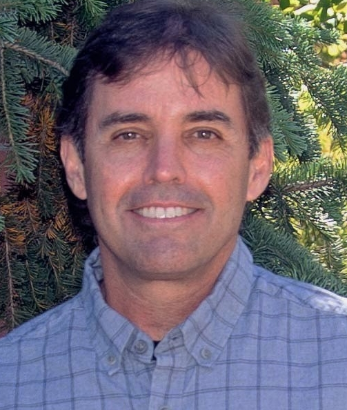 John S. Kimball合作论文数Department of Ecosystem and Conservation Sciences, WA Franke College of Forestry and Conservation, University of Montana17
 Kelly Elder合作论文数Institute for Computational Earth System Science;University of California , Santa Barbara;Institute for Computational Earth System Science, University of California , Santa Barbara16
 Chris Derksen合作论文数Climate Research Division, Environment and Climate Change Canada15
 Youngwook Kim合作论文数Numerical Terradynamic Simulation Group, The University of Montana14
 R. Scott Dunbar合作论文数12
 Shurun Tan (谭述润)合作论文数Zhejiang University-University of Illinois Urbana-Champaign Institute9
 Dara Entekhabi合作论文数Department of Civil and Environmental Engineering, School of Engineering, Massachusetts Institute of Technology;Department of Earth, Atmospheric, & Planetary Sciences, School of Science, Massachusetts Institute of Technology9
 Huanting Huang合作论文数8
 Edward G. Josberger合作论文数7
 Tien Hao Liao合作论文数7
 Seungbum Kim合作论文数Jet Propulsion Laboratory, California Institute of Technology6
 Ding Liang合作论文数6
 Michael H Cosh合作论文数Hydrology and Remote Sensing Laboratory, Beltsville Agricultural Research Center, Agricultural Research Service, U.S. Department of Agriculture6
 Mehmet Kurum合作论文数6
 Julian Chaubell合作论文数6
 Hanspeter Marshall合作论文数Dept Geosci, Boise State Univ6
 Jongwoo Jeong合作论文数5
 Banning Starr合作论文数USDA, US Forest Serv5
 Jiyue Zhu合作论文数Radiat Lab, Univ Michigan5
 Eni G. Njoku合作论文数Jet Propulsion Laboratory5
 Konstantinos M. Andreadis合作论文数Jet Prop Lab, CALTECH5
 Paul Siqueira合作论文数5
 Yunjin Kim合作论文数Jet Propulsion Laboratory;California Institute of Technology;Jet Propulsion Laboratory, California Institute of Technology5
 Kung-Hau Ding合作论文数air force research laboratory5
 S. Dunbar合作论文数4
 Haokui Xu合作论文数Univ Michigan, Dept Elect Engn & Comp Sci, Radiat Lab, Ann Arbor, MI 48109 USA4
 Steven Margulis合作论文数Civil and Environmental Engineering Department, School of Engineering, University of California, Los Angeles4
 Wenmo Chang合作论文数4
 Akiko Hayashi合作论文数4
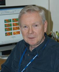 Thomas Jackson合作论文数Hydrology and Remote Sensing Laboratory, Beltsville Agricultural Research Center, Agricultural Research Service, United States Department of Agriculture4
 Chunsik Chae合作论文数4
 Juha Lemmetyinen合作论文数Finnish Meteorol Inst4
 Joel T. Johnson合作论文数Department of Electrical and Computer Engineering, Ohio State University4
 Alexandre Roy合作论文数UMR1019, INRA4
 Aaron Berg合作论文数Department of Geography, Environment & Geomatics, College of Social and Applied Human Sciences, University of Guelph;Hydrology and Remote Sensing Lab, University of Guelph4
 Mahta Moghaddam合作论文数Microwave Systems, Sensors, and Imaging Lab, Ming Hsieh Department of Electrical Engineering, University of Southern California4
 Steven A. Margulis合作论文数Department of Civil and Environmental Engineering;University of California , Los Angeles;Department of Civil and Environmental Engineering, University of California , Los Angeles4
 Manuela Girotto合作论文数Department of Environmental Science, Policy and Management, College of Natural Resources, University of California, Berkeley3
 Dennis Lettenmaier合作论文数Department of Geography, Division of Social Sciences, College of Letters and Science, University of California, Los Angeles3
 Shaowu Huang合作论文数Univ. Washington, University of Washington3
 Clara C. Chew合作论文数3
 Rolf H Reichle合作论文数Global Modeling and Assimilation Office, Goddard Space Flight Center, National Aeronautics and Space Administration3
 Narendra N. Das合作论文数3Michael Durand合作论文数2
 Chad A. Baldi合作论文数2




