Background:Automated myocardial pathology segmentation in multi-sequence cardiac magnetic resonance (CMR) imaging plays an indispensable role in assessing myocardial viability and managing patients with myocardial infarction (MI). However, precise delineation remains exceptionally challenging due to low soft tissue contrast, highly irregular pathological geometries, residual cross-modal spatial misalignments, and scarcity of labeled datasets. This study aimed to develop a highly accurate, stable, and unified single-stage deep learning framework to simultaneously segment the left ventricular (LV) blood pool, right ventricular (RV) blood pool, left ventricular normal myocardium (LVM), myocardial edema, and myocardial scars from multi-sequence CMR images. Methods:We propose the Multimodal CMR Image Pathological Segmentation Network (MCIPS-Net), an end-to-end framework built upon a five-layer U-Net architecture. To address inter-modal intensity distribution heterogeneity among balanced steady-state free precession (BSSFP), late gadolinium enhancement (LGE), and T2-weighted (T2) sequences, a plug-and-play multimodal feature fusion (MFF) module was introduced in the encoding path to independently extract and cascade modality-specific semantic features. Furthermore, an efficient channel attention (ECA)-based fusion module was embedded before upsampling to strengthen region of interest (ROI) focus. Training stability and performance under extreme class imbalance were optimized using a multi-scale deep supervision (DS) strategy and an adaptive composite loss function merging Dice and Focal losses. Center-cropped images (256×256 pixels) were expanded 15-fold via geometric and elastic data augmentations, and post-processing was executed to eliminate minor isolated prediction artifacts. Results:Evaluated on the MyoPS 2020 Challenge test set (20 cases, 72 slices), MCIPS-Net achieved an average Dice score of 0.655±0.238 for scar segmentation and 0.714±0.086 for edema and scar joint segmentation, yielding a comprehensive average Dice score of 0.685. Ablation studies revealed that the MFF module contributed the most significant gain, increasing the baseline average Dice score by 4.5% (from 0.574 to 0.619). On the official leaderboard, our single-stage method outperformed the leading advanced single-stage method by 0.7% while demonstrating performance equivalent to the official second-place multi-stage pipeline. Crucially, the model exhibited the lowest standard deviation (SD) in Dice scores among all participating top algorithms, highlighting its superior stability. Conclusions:The proposed MCIPS-Net establishes a simple, efficient, and robust single-stage solution that bypasses complex localization networks or cumbersome model integration. By effectively capitalizing on cross-modal complementary features, this stable pipeline offers a high-performance clinical tool for precise infarct size quantification and myocardial viability assessment.
The application of multimodal data in heart failure (HF) diagnosis research is relatively limited. Chest X-rays and clinical texts are crucial auxiliary diagnostic tools that provide essential visual and textual information. A multimodal HF diagnosis model, biomedical modality interaction contrastive learning (BioMICL), is introduced in this work, which creates a dataset of chest X-ray and clinical text pairs. By using Biomedical Bidirectional Encoder Representations from Transformers (BioBERT) and Residual Neural Network-152 (ResNet-152) to extract text and image features, BioMICL constructs a dual-stream network. The model introduces a modality interaction unit that explores the intrinsic correlations between features. Additionally, the model incorporates a similarity-based contrastive learning loss to enhance its ability to extract and fuse multimodal clinical data features. Experimental results show that BioMICL achieves an area under the receiver operating characteristic curve of 0.9797, an accuracy of 93.255%, a precision of 94.725%, a recall of 92.661%, and a specificity of 93.952% in HF diagnosis, outperforming both traditional baseline models and current HF diagnosis models.
Currently, the extraction of the size characteristics of a tropical cyclone (TC) from satellite data is mainly based on subjective human experience and archived satellite data. Few objective methods have been developed to estimate the size of a TC. To overcome this problem, this study introduces a new deep learning (DL) model, called a TC multitask estimation (TCMSE) model. The goal of using the model is to accurately extract the spatiotemporal characteristics of the size of a TC from infrared satellite images acquired during the current and previous three moments, combined with a multitask learning (MTL) approach and physically assisted task learning, to produce more reliable estimates of the wind radii of a TC. We used the TCMSE model to estimate the TC wind radius on the infrared satellite image of the Northwest Pacific Ocean to verify the performance of the model. The experimental results show that the proposed deep spatiotemporal feature extraction network, which combines MTL and physically assisted tasks, is superior to existing methods for estimating the wind radii of a TC. More specifically, the TCMSE model reduces the MAE error in estimating the TC wind radii by 6%, compared to the MTL approach, and 14%, compared to separately learning a single wind radii task.
Tropical cyclone (TC) is a highly catastrophic weather event, and accurate estimation of intensity is of great significance. The current proposed TC intensity estimation model focuses on training using satellite images from single or two channels, and the model cannot fully capture features related to TC intensity, resulting in low accuracy. To this end, we propose a double-layer encoder-decoder model for estimating the intensity of TC, which is trained using images from three channels: infrared, water vapor, and passive microwave. The model mainly consists of three modules: wavelet transform enhancement module, multichannel satellite image fusion module, and TC intensity estimation module, which are used to extract high-frequency information from the source image, generate a three-channel fused image, and perform TC intensity estimation. To validate the performance of our model, we conducted extensive experiments on the TCIR dataset. The experimental results show that the proposed model has MAE and RMSE of 3.76 m/s and 4.62 m/s for TC intensity estimation, which are 15.70% and 20.07% lower than advanced Dvorak technology, respectively. Therefore, the model proposed in this article has great potential in accurately estimating TC intensity.
Accurately forecasting abrupt changes in tropical cyclone (TC) intensity—including rapid intensification (RI) and rapid weakening (RW)—is essential for improving the overall accuracy of intensity-change predictions. Most existing studies emphasize the detection and prediction of RI, whereas systematic research on RW remains limited. Although RI garners substantial attention due to its direct link to extreme-storm risk, the predictability of RW is equally important from both scientific and operational perspectives: reliable RW prediction can optimize resource allocation and emergency response, reduce unnecessary economic losses and public alarm, and enhance understanding of the TC life cycle while improving overall forecast skill. Advancing RW prediction—particularly through modern observing technologies such as satellite imagery—is therefore indispensable for a comprehensive characterization of rapid intensity evolution. In this study, we propose a deep learning-based framework to predict the occurrence of RW from satellite imagery: infrared and microwave images at historical and current time steps are assembled into sequential features and fed into the model, which learns the spatiotemporal evolution encoded in the image sequences to enable RW detection and prediction.
Objective Based on the current research status, this paper proposes a deep learning model named Covid-DenseNet for COVID-19 detection from CXR (computed tomography) images, aiming to build a model with smaller computational complexity, stronger generalization ability, and excellent performance on benchmark datasets and other datasets with different sample distribution features and sample sizes. Methods The proposed model first extracts and obtains features of multiple scales from the input image through transfer learning, followed by assigning internal weights to the extracted features through the attention mechanism to enhance important features and suppress irrelevant features; finally, the model fuses these features of different scales through the multi-scale fusion architecture we designed to obtain richer semantic information and improve modeling efficiency. Results We evaluated our model and compared it with advanced models on three publicly available chest radiology datasets of different types, one of which is the baseline dataset, on which we constructed the model Covid-DenseNet, and the recognition accuracy on this test set was 96.89%, respectively. With recognition accuracy of 98.02% and 96.21% on the other two publicly available datasets, our model performs better than other advanced models. In addition, the performance of the model was further evaluated on external test sets, trained on data sets with balanced sample distribution (experiment 1) and unbalanced sample distribution (experiment 2), identified on the same external test set, and compared with DenseNet121. The recognition accuracy of the model in experiment 1 and experiment 2 is 80% and 77.5% respectively, which is 3.33% and 4.17% higher than that of DenseNet121 on external test set. On this basis, we also changed the number of samples in experiment 1 and experiment 2, and compared the impact of the change in the number of training set samples on the recognition accuracy of the model on the external test set. The results showed that when the number of samples increased and the sample features became more abundant, the trained Covid-DenseNet performed better on the external test set and the model became more robust. Conclusion Compared with other advanced models, our model has achieved better results on multiple datasets, and the recognition effect on external test sets is also quite good, with good generalization performance and robustness, and with the enrichment of sample features, the robustness of the model is further improved, and it has better clinical practice ability.
This paper presents a deep learning model, termed TCRGF, developed to predict the rapid growth of tropical cyclone (TC) outer size over the Northwestern Pacific basin. TCs as highly destructive meteorological phenomena, frequently cause substantial economic losses in coastal regions. The outer size of a TC is a critical parameter for assessing its overall destructive potential. Therefore, accurate forecasting of the rapid growth of TC outer size is of considerable importance. However, few existing objective approaches are capable of effectively predicting such rapid growth events. To address this challenge, we propose the TCRGF model, which efficiently extracts and integrates spatiotemporal representations of TC outer size from multi-source heterogeneous data, thereby enabling more accurate and robust forecasts. The performance of the proposed model is evaluated using a self-constructed TC dataset designed for outer-size rapid growth prediction. Experimental results demonstrate that TCRGF achieves superior predictive performance, with ROC-AUC and PR-AUC values of 0.8383 and 0.4555, respectively.
This study develops a risk prediction model for muscular calf vein thrombosis (MCVT) after lower limb fractures by integrating wavelet transform with an improved Vision Transformer (ViT). A multidimensional clinical dataset of 527 patients was converted into grayscale images. Discrete wavelet transform decomposed images into low-frequency and high-frequency subbands, with coefficients amplified by 1.5 before reconstruction to enhance local features. The ViT architecture was optimized via three synergistic modifications: (1) adding a Squeeze-and-Excitation module to recalibrate feature importance; (2) replacing the CLS token with global average pooling; (3) adopting learned positional encodings. The best-performing model (ViT+Wavelet+SE-V) achieved 98.78% accuracy, significantly surpassing the baseline (95.53%). Visualization via Attention rollout identified critical predictive regions. This approach provides a high-accuracy and interpretable tool for optimizing postoperative thromboprophylaxis.
Current deep learning methods for predicting tropical cyclone intensity are restricted by inadequate utilization of climate factors, insufficient feature fusion, and the inability to automatically adapt input data to changes in the scale of cyclone structures. To address these challenges, this article proposes a multimodal data fusion model guided by sequential infrared satellite images (IRGMF). The IRGMF model integrates a broader range of climate factors for a more comprehensive, enriched feature representation of tropical cyclone intensity. In addition, we designed a temporal attention module that allows the model to focus on critical moments in the sequential data for a more precise capture of the dynamic features of climate factors as they evolve. To enhance prediction accuracy, we also developed an attention-cropping module that adaptively crops irrelevant information outside the scale of a tropical cyclone from reanalysis data. To validate the effectiveness of the proposed model, we conducted experiments on multiple datasets, including CMA-BST, ERA5, and GridSat-B1. Experimental results show that, compared to existing methods, the proposed IRGMF model demonstrates significant advantages in predicting tropical cyclone intensity and provides superior accurate information for meteorological forecasting and decision support.
Computer-aided diagnosis of heart failure is of significant clinical importance for implementing effective treatment. However, existing heart failure diagnosis studies rarely consider using multimodal data when analyzing data, whereas doctors usually refer to various resources when treating patients. In heart failure diagnosis, chest X-rays are essential as they reflect thoracic diseases, and radiology reports are also crucial for doctors’ diagnoses. This paper proposes a multimodal heart failure diagnosis model, ResBioBERT, which combines radiology reports, clinical symptoms, and medical history texts with chest X-rays. The model uses ResNet-152 to extract features from chest X-rays and maps the dense multimodal features into BioBERT’s embedding space to achieve modality fusion, utilizing the fused features for heart failure diagnosis. To verify the effectiveness of this model in heart failure diagnosis, we compared it with existing heart failure diagnosis models. Experimental results show that the proposed multimodal heart failure diagnosis method, ResBioBERT, can effectively fuse multimodal features from clinical texts and chest X-rays, significantly improving the model’s heart failure diagnosis performance.
Predicting survival in patients with heart disease clinically is a challenging task. In this paper, we propose a prediction model for the survival of heart failure patients based on deep learning combined with clinical data of heart failure patients. The proposed model is named DU-ResNet which is designed by combining ResUNet with ResNet50. In this paper, the clinical data of all original patients with heart failure were normalized first, and then, each normalized clinical data point was placed in a certain area of the grid image. Therefore, according to the value of each clinical data point, a gray image with different brightness regions was constructed. After data enhancement was performed on the constructed image dataset of clinical data of heart failure patients to expand the number of samples, DU-ResNet is used to binary classify the expanded dataset, and ten-fold cross-validation and ablation experiments are performed on the dataset. Then, ten-fold cross-validation was used to verify the performance of the proposed DU-ResNet model. The results show that the proposed DU-ResNet model has the best result with the use of four features, with the accuracy was 96.47%, the Specificity was 97.22%, the Sensitivity was 95.71%, the Precision was 96.87%, the F1-score was 96.27% and the MCC was 92.97% after ten-fold cross-validation.
Different channels of satellite images can provide different tropical cyclone (TC) characteristics, while infrared (IR) channel satellite images reflect cloud top IR radiation and temperature distribution. The satellite images of the water vapor (WV) channel reflect the spatial distribution of WV in the atmosphere. Passive microwave (PMW) signals can penetrate clouds, providing information on eye wall structure and precipitation distribution. Therefore, compared to single channel data, multi-channel data can better provide feature information closely related to TC intensity. This article proposes a deep learning based fusion model for IR, WV, and PMW satellite images, which improves its accuracy in TC intensity estimation while ensuring the quality of the generated fusion images. We design a dual encoding and decoding structure and design different loss functions for each encoding and decoding model according to the factors affecting TC intensity estimation to guide the training process of the model. In addition, we improved the L1-norm fusion strategy to further improve its fusion effect. To demonstrate the effectiveness of the fusion images generated by our model, we compare its performance with four other fusion models. The comparative experimental results show that our proposed model not only effectively retains the information of multi-channel satellite images, but also improves the estimation accuracy of TC intensity by fusion satellite images.
Background Heart failure is a syndrome with complex clinical manifestations. Due to increasing population aging, heart failure has become a major medical problem worldwide. In this study, we used the MIMIC-III public database to extract the temporal and spatial characteristics of electrocardiogram (ECG) signals from patients with heart failure. Methods We developed a NYHA functional classification model for heart failure based on a deep learning method. We introduced an integrating attention mechanism based on the CNN-LSTM-SE model, segmenting the ECG signal into 2 to 20 s long segments. Ablation experiments showed that the 12 s ECG signal segments could be used with the proposed deep learning model for superior classification of heart failure. Results The accuracy, positive predictive value, sensitivity, and specificity of the NYHA functional classification method were 99.09, 98.9855, 99.033, and 99.649%, respectively. Conclusions The comprehensive performance of this model exceeds similar methods and can be used to assist in clinical medical diagnoses.
Accurate tracking of tropical cyclones (TCs) can provide regions of interest for intelligent forecasting of TC tracks and intensity. There have been few studies on algorithms for automatic TC tracking. This study proposes an effective TC tracking method based on deep learning combined with infrared satellite images. The study first constructed a TC tracking dataset based on the infrared images of the China Fengyun-2D geostationary satellite covering six different TC intensity levels between 2009 and 2012. This included 47 complete cases (video sequences) of TCs from generation to extinction. Based on deep learning, the visual tracking algorithm SiamRPN was used as the model framework. Combining Bi-GRU and TC cloud spatiotemporal evolution characteristics to improve the performance of the SiamRPN network, the SiamTCNet target-tracking model was designed to track TCs automatically. Considering that the shape and scale of TC changes with time, a TC is regarded as a typical non-rigid object with obvious timing characteristics, so the first frame of a TC video sequence is combined with the satellite images of the first three frames of the current frame as inputs to the proposed SiamTCNet model, which then extracts the evolution of the TC's spatial structure and its bidirectional temporal change information. The experimental results show that the TC tracking of the proposed model is a significant improvement over the original SiamRPN model.
Tropical cyclone (TC) monitoring relies heavily on remotely sensed observations as they generally form and move through remote oceanic areas. This is an important part of monitoring the TC current intensity. In this study, a hybrid model (TCIC-SC-RNet) based on transfer learning, consisting of a cascade of classification, fi cation, secondary correction classification, fi cation, and regression modules, is proposed to estimate the intensity of TCs in the northwest Pacific fi c basin. We used 1023 TCs (1979, 1981-2019), totaling 23 629 infrared satellite images, to train and test the TCIC-SC-RNet model. First, an improved Swin Transformer network is used to divide TCs into three categories according to intensity levels. Then, the primary classification fi cation result combines with direct intensity estimation results of the RegNet model input into the secondary correction classification fi cation module to classify further TCs, so as to reduce the misclassification fi cation errors and improve the model effect. Finally, the corrected TC intensity classification fi cation results are sent to the corresponding RegNet regression network to output the estimated TC intensity. The results show that the total root-mean-square error (RMSE) and mean absolute error (MAE) of our model were 7.47 and 5.60 kt (1 kt approximate to 0.51 m s(-1)), respectively, compared with the TC best track, which is competitive among current TC intensity estimation models.
Tropical cyclones (TC) are major devastating natural disasters that lead to property destruction worth billions of dollars and threaten millions of lives. However, rapid changes in TC are the main source of the current TC forecast error. This study proposes a model for estimating the rapid weakening (RW) of TC intensity based on deep learning using infrared satellite images and sea surface temperature (DEEP_RW_TCIE). This model is in two parts: a many-to-many TC intensity estimation network, composed of spatiotemporal code and decode; and a network with multilayer perception as the core for constraining TC intensity estimation sequence, based on sea surface temperature (SST) and intensity change rate (ICR). We investigated the effects of different time series lengths, different ranges of SST, and different feature vector composition methods on the effect of the RW of the TC intensity estimation model. Moreover, we verified the rationality and feasibility of the proposed method through the analysis of experimental methods. The results show that the TC intensity at several moments before rapid TC weakening is of great significance for estimating a current rapid TC weakening, SST, and ICR. Our method greatly reduces the estimating error of the rapid TC weakening intensity. The mean of absolute errors and the root-mean-square error are 6.68 kt and 8.68 kt, respectively, which decrease by over 10%, compared to the benchmark convolutional neural network TC model.
Currently, size feature extraction for tropical cyclones (TCs) from satellite data is largely based on subjective human experience and archived satellite data. There are few objective methodologies for estimating the size of a TC. To overcome this, in this paper, we introduce a novel deep learning model, which we call TCSE_BiLSTM. The model is designed to fully extract the spatial-temporal characteristics of TC size from infrared satellite images using the current and previous three intervals. To verify the model’s performance, we conducted experiments on TC wind radii estimation using the TCSE_BiLSTM model on infrared satellite images of the Northwest Pacific region. Our experiments showed that the proposed deep spatial-temporal feature extraction network has advantages in estimating TC wind radii over current methods. Therefore, it can be used for fully automated TC wind radii estimation.
A tropical cyclone (TC) is a meteorological disaster that occurs over tropical or subtropical oceans. Automatic TC identification from a satellite image is essential to the subsequent automatic intelligent determination of TC positioning and intensity. Few recent studies have examined the automatic detection of TCs from satellite images. In this paper, wavelet (W) transformation, efficient (E) channel attention mechanism and YOLOX (Y) are combined to construct a deep learning model for TC detection, referred to as WEY-TCNet. WEY-TCNet automatically detects TCs from infrared satellite images. To improve the detection accuracy, a discrete wavelet transform is first used to decompose the infrared satellite image, after which the horizontal high-frequency components, including the TC rainband structure and inner core area, are extracted and fused with the original image. This step enhances the TC structure and brightness temperature gradient characterization. The fused image is then used as the input to WEY-TCNet. The ECANet channel attention mechanism was added to the original YOLOX-S network structure to focus on the key features of TC, such as structure and brightness temperature while suppressing invalid features and noise. This study constructed a satellite image dataset based on the infrared images of the Chinese Fengyun2D geostationary satellite. The dataset contains infrared satellite images of TCs in various life cycle stages, from generation to extinction. Our experiments showed that the WEY-TCNet model proposed in this paper achieves 91.49% detection mAP on the TC dataset, compared with the 86.69% detection mAP of the original YOLOX-S model, significantly improving it.
The prediction of rapid intensification (RI) is an important part of tropical cyclone (TC) intensity change prediction task, RI is defined as TC subsequent intensity change increase greater than a certain threshold. Accurately predicting RI can help improve the accuracy of TC intensity prediction, thereby reducing people's economic and property losses. In recent years, an increasing number of researchers have started to use satellite imagery for RI prediction. In this study, deep learning is utilized to combine infrared with microwave satellite images for RI prediction of TCs. The core idea can be formulated as follows: The residual image between feature of historical satellite image sequence and current satellite image is taken as the final feature matrix. Multilayer ConvLSTM is used to extract the features of historical satellite image sequence (time resolution is three hours), the residual image between the generated feature and the current satellite image is taken as the feature matrix. Finally the feature matrix is input into the classifier to predict RI. Experiment shows that in the prediction problem of RI for TCs (when the RI threshold is 35kt) our method on the test dataset has reached 0.552 at probability of detection (POD), and the false alarm ratio (FAR) reached 0.847, and heidke skill score (HSS) reached 0.186. Compared with the current methods only using satellite images to the prediction of RI, our method reduced FAR by 1.7%, improved POD by 15.4% and HSS by 13.4%.
 Haoran Zhang (张浩然)合作论文数Zhejiang Normal University41Xiaodong Wang合作论文数32
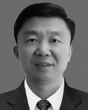 Lei-Ming Ma (马雷鸣)合作论文数18
 Xiaoqin Lu合作论文数15Cungui Cheng合作论文数14Jinshan Wang合作论文数11CuiFang Zhao (赵翠芳)合作论文数11
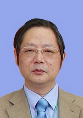 Zuomin Wen (温作民)合作论文数College of Economics and Management, Nanjing Forestry University11
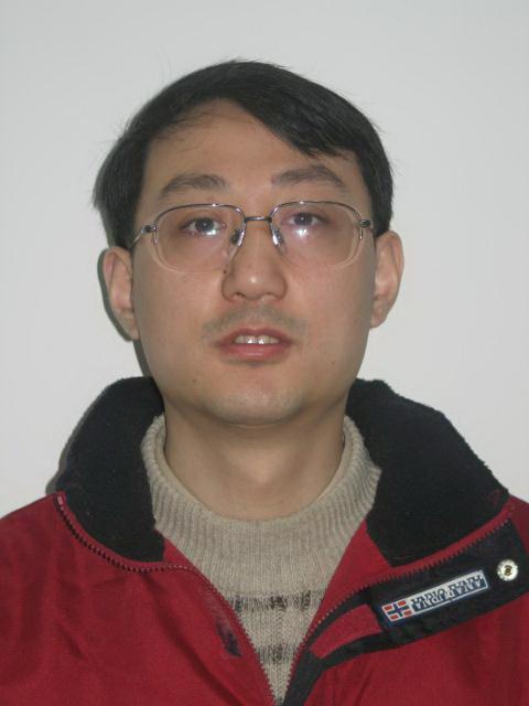 Chunjiang Duanmu (端木春江)合作论文数Zhejiang Normal University9
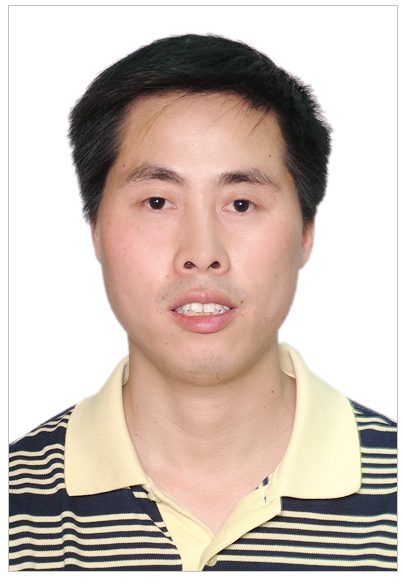 Ganyun Lv (吕干云)合作论文数Graduate School Of Nanjing Institute Of Technology%_%School of Electric Power Engineering, Nanjing Institute of Technology8
 Lijie Dai合作论文数7Wang Xiaodong合作论文数7Juan Lu合作论文数7
 Zhiguang Zhang (张智光)合作论文数College of Economics and Management, Nanjing Forestry University7Xd Wang合作论文数6Hui‐Yuan Wang合作论文数6Mei Jin (金梅)合作论文数6Minlan Jiang (蒋敏兰)合作论文数6Xiushan Cai (蔡秀珊)合作论文数浙江师范大学数理与信息工程学院6Licheng Xue合作论文数5Hu Min合作论文数5Yuan Chen合作论文数5Jinfang Qian合作论文数4Xl Xu合作论文数4Fuqin Tang合作论文数4Xiang Zhang合作论文数4Bo Yang合作论文数4CHEN Jun (陈军)合作论文数4
 Caicheng Shi (史彩成)合作论文数School of Life Sciences, Beijing Institute of Technology4
 Yumei Tian (田玉美)合作论文数College of Chemistry, Jilin University4
 Qi Luo合作论文数3QiHong Zhang (张启鸿)合作论文数3Xueyou Huang (黄学优)合作论文数3
 Jing Zeng合作论文数3Guan Li合作论文数Chinese Acad Sci, Comp Network Informat Ctr, Beijing, Peoples R China3XiaoDong Wang (汪晓东)合作论文数3
 Jianbin Wu (吴建斌)合作论文数College of Physical Science and Technology, Central China Normal University3Leiming Ma (马雷鸣)合作论文数上海中心气象台3Han Wei合作论文数3Mingchao Fang (方明超)合作论文数3Meiying Ye (叶美盈)合作论文数3
 Huajun Feng (冯华君)合作论文数College of Optical Science and Engineering, Zhejiang University3
 Xiuling Xu合作论文数Science China Press3Liu Zhang合作论文数2Changguang Feng合作论文数2
 Xionggang Tu (屠雄刚)合作论文数Zhejiang Industry Polytechnic College2




