Navigation errors due to drifting in inertial systems using low-cost sensors are some of the main challenges for land vehicle navigation in Global Navigation Satellite System (GNSS)-denied environments. In this paper, we propose an autonomous navigation strategy with a wheel-mounted microelectromechanical system (MEMS) inertial measurement unit (IMU), referred to as the wheeled inertial navigation system (INS), to effectively suppress drifted navigation errors. The position, velocity, and attitude (PVA) of the vehicle are predicted through the inertial mechanization algorithm, while gyro outputs are utilized to derive the vehicle’s forward velocity, which is treated as an observation with non-holonomic constraints (NHCs) to estimate the inertial navigation error states. To establish a theoretical foundation for wheeled INS error characteristics, a comprehensive system observability analysis is conducted from an analytical point of view. The wheel rotation significantly improves the observability of gyro errors perpendicular to the rotation axis, which effectively suppresses azimuth errors, horizontal velocity, and position errors. This leads to the superior navigation performance of a wheeled INS over the traditional odometer (OD)/NHC/INS. Moreover, a hybrid extended particle filter (EPF), which fuses the extended Kalman filter (EKF) and PF, is proposed to update the vehicle’s navigation states. It has the advantages of (1) dealing with the system’s non-linearity and non-Gaussian noises, and (2) simultaneously achieving both a high level of accuracy in its estimation and tolerable computational complexity. Kinematic field test results indicate that the proposed wheeled INS is able to provide an accurate navigation solution in GNSS-denied environments. When a total distance of over 26 km is traveled, the maximum position drift rate is only 0.47% and the root mean square (RMS) of the heading error is 1.13°.
Inertial Measurement Units (IMUs) are a fundamental sensing modality for attitude estimation in aerospace and robotic systems. When external aiding sensors, such as Global Navigation Satellite Systems (GNSS) or magnetometers, experience short-term outages or performance degradation, the ability to maintain reliable attitude information becomes critical for system stability and operational safety. This paper proposes an end-to-end deep learning framework for continuous and accurate attitude estimation that relies exclusively on raw six-axis IMU measurements. The method delivers robust, low-latency estimates of pitch and roll angles and is suitable for real-time applications with bounded processing delay. It is intended as a safety–critical redundancy solution under dynamic operating conditions. The proposed network architecture integrates Convolutional Neural Networks (CNN) for local feature extraction with a Bidirectional Long Short-Term Memory (Bi-LSTM) network to capture long-term temporal dependencies. Residual connections are incorporated throughout the network to mitigate gradient degradation and improve training stability. The proposed model is evaluated using publicly available benchmark datasets and compared against representative classical and learning-based approaches. Experimental results show that the method achieves a median attitude estimation error within 3°, corresponding to an accuracy improvement exceeding 10% relative to competing methods. These findings demonstrate the effectiveness, robustness and practical potential of the proposed approach for reliable IMU-based attitude estimation in challenging dynamic environments.
To address the simultaneous challenges of global navigation satellite system (GNSS) signal degradation and cumulative error drift in pedestrian dead reckoning (PDR) within complex pedestrian environments, a PDR/GNSS integrated positioning approach is developed in this work based on adaptive and robust factor graph optimization. Within a unified factor graph framework, PDR state transition factors and GNSS observation factors are constructed, reformulating multi-source constraints as a nonlinear least-squares optimization problem. A residual-driven adaptive noise modeling strategy combined with robust kernel functions is introduced to dynamically suppress non-Gaussian measurements and outliers. Meanwhile, anisotropic PDR error modeling and trajectory smoothing constraints are incorporated to enhance the geometric consistency and global stability of state estimation. Two real-world datasets collected on a standard running track and around a dormitory building were utilized for performance evaluation. Experimental results show clear improvements compared with the KF-based fusion, KF-RTS smoothing, and standard FGO methods, particularly in terms of positioning accuracy and error distribution stability, achieving 18%-57% reductions in mean error and root mean square error. The ablation study further verifies the effectiveness of adaptive weighting, robust residual suppression, and trajectory regularization within the proposed framework. These results further support the robustness and practical applicability of the proposed approach in complex pedestrian environments.
This paper presents a measurement-oriented monocular global navigation satellite system (GNSS)–visual–inertial fusion framework for road-constrained platforms operating on approximately planar roads. The goal is to improve first-level visual–inertial estimation under challenging visual conditions and to improve long-horizon trajectory consistency on the tested road-constrained campus route with time-varying GNSS quality. Built on VINS-Fusion, the framework adopts a two-level design. The first level enhances local estimation through confidence-aware image correspondences and a soft inertial-measurement-unit bias prior while preserving the optimization-based back end. The second level introduces camera–ground geometric regularization into the local sliding-window estimator and incorporates synchronized GNSS position observations as quality-aware GNSS position factors in a reduced east–north–up (ENU) pose graph. In this way, the method explicitly coordinates observation reliability, local geometric regularity, and GNSS quality, rather than simply improving navigation accuracy. Experiments on the EuRoC benchmark support the effectiveness of the first enhancement level in reducing trajectory error under challenging visual–inertial conditions, with an average root-mean-square absolute trajectory error reduction of 20.59% relative to VINS-Fusion. Compared with DL-VINS on a representative closed-loop campus route collected at the Harbin Institute of Technology, the complete framework reduces the whole-trajectory 2D RMSE from 16.011 m to 3.284 m and the 2D loop drift from 10.959 m to 1.755 m. The current implementation uses GNSS position solutions as quality-aware GNSS position factors rather than performing raw-GNSS state estimation.
As a fundamental method for integrated indoor positioning, Ultra wideband (UWB)/ Inertial Measurement Unit (IMU) offers more stable performance compared to separate UWB sensor and IMU sensor positioning and uses the least squares (LS) and extended Kalman filter (EKF) for positioning processing, however, the performance of conventional LS and EKF will be seriously affected when the contamination rate of measurement noise is high. To address this problem, this paper proposes a robust extended Kalman filter (REKF) based algorithm for robot-integrated indoor positioning, which combines UWB and IMU positioning methods to obtain a more robust system performance and optimal positioning accuracy. In this paper, a vehicle equipped with a UWB/IMU sensor and four anchor points is set up to perform linear, circular, and trajectory motions in an experimental environment with visible obstacles. The experimental results show that compared with EKF, REKF improves the localization precision and accuracy in the three motions by 20.98%, 35.51%, and 47.06%, respectively. REKF effectively improves the accuracy and robustness of the robot's indoor positioning, and provides an improved and practical method for integrated indoor positioning algorithms to make indoor positioning more accurate and reliable.
Cooperative positioning technology based on multi-vehicle information fusion is essential for advanced applications in intelligent transportation systems (ITS). The integration of global navigation satellite systems (GNSS), inertial navigation system (INS), and ultra-wideband (UWB) technology holds significant promise for enhancing the continuity and reliability of vehicle cooperative positioning. In tightly coupled GNSS/INS/UWB integration, the tolerance against measurement outliers and state model perturbations is pivotal for fulfilling the specific requirements of critical ITS applications. To optimize the comprehensive performance of vehicle cooperative positioning under uncertain sensor observation environments, this paper proposes a robust multiple fading factors unscented Kalman filtering (RMFUKF) algorithm based on adaptive cost function. The proposed solution incorporates Huber M-estimation with an adaptive tuning strategy to perform measurement-specific outliers processing. Furthermore, the improved multiple fading factors based on an exponential weighting method are implemented to mitigate the effects of dynamic model mismatches. Experimental results from vehicular field experiments demonstrate that the proposed RMFUKF scheme significantly improves the robustness and adaptive performance of vehicle cooperative positioning under unpredictable, real-world operating conditions.
Vehicular attitude can be estimated using micro-electro-mechanical systems (MEMS) based magnetic, angular rate, and gravity (MARG) sensors or global navigation satellite systems (GNSS). In challenging environments external accelerations, magnetic distortions, and failure of GNSS will result in significant attitude estimation errors. We proposed a hybrid attitude estimation algorithm based on the low-cost dual-antenna GNSS/MEMS MARG sensor integration, in which the two GNSS antennas are connected to two separate low-cost receivers. Heading and pitch angles are obtained from the moving baseline spanned by the two antennas. An error state Kalman filter is built for data fusion, the filter shares the identical kinematic model but switches the measurement model according to the valid aiding sources. Six possible measurement update schemes are conditioned on the availability of GNSS-derived angles and the disturbances detected in the MARG sensor data. The accuracy degradation of attitude estimation caused by disturbances is alleviated by adjusting the measurement covariance matrix adaptively. A land vehicle-based dynamic experiment was performed to assess the proposed algorithm. Compared to the MARG sensor alone method, the root mean square errors of the proposed GNSS/MARG sensor integrated method were reduced by 38.9
This contribution presents a vehicular heading and pitch angles estimation method based on the dual-antenna GNSS scheme, the baseline length is investigated as a priori nonlinear constraint to improve the estimation accuracy. The coordinates of the formed moving baseline are estimated first, the baseline length is exploited to enhance the ambiguity resolution process, and then its corresponding attitude angles are determined. The capability and reliability of the proposed algorithm are assessed by a real car-borne experiment with off-theshelf, low-cost GNSS receivers. The driving trajectory contains both stationary periods and dynamic situations under the open sky and dense community environments. The experimental results show that, compared to the classical method that does not consider the baseline length constraint, the accuracy improvements of the proposed method on attitude angles range from 16.7% to 84.0% in different observation conditions, and the attitude errors of ambiguity fixed solutions are dominantly less than 5 degrees.
Accurate relative positioning is essential for the deployment of an intelligent transportation system. However, in complex environments such as urban canyons and tunnels, the global positioning system (GPS) signals are often blocked or interrupted, resulting in decreased or invalid positioning accuracy. To meet the demand for accurate vehicle positioning in complex environments of urban roads, this article proposes a deep learning model for GPS pseudo-range and Doppler shift prediction based on the fusion of the animated oat optimization (AOO), a convolutional neural network (CNN), a bidirectional gated recurrent unit (BiGRU), and an attention mechanism. CNN is applied to capture spatiotemporal features from the input sequence, while BiGRU explores the long-term dependencies in the data. The attention assigns varying weights according to the importance of input data, enabling the model to focus more effectively on critical parts. To improve predictive accuracy, the AOO algorithm is employed for hyperparameter optimization. Then, the predicted GPS pseudo-range and Doppler shift are used for GPS/ultrawide band (UWB) tightly coupled cooperative positioning by utilizing the characteristics of UWB technology that can provide high-precision ranging information. The results of the experiment show that the proposed fusion model improves the relative positioning accuracy by 13%, 29%, 33%, and 50% over CNN-BiGRU-Attention, CNN-BiGRU, BiGRU, and GRU models, respectively, during a GPS signal loss-of-lock environment, which significantly enhances the stability of vehicle positioning in complex environments.
With the rapid deployment of autonomous micro-UAVs in dynamic environments, path planning must ensure both safety and real-time performance under stringent onboard computational constraints. This paper proposes a dynamic path planning method based on the reciprocal velocity obstacles algorithm, enabling micro-UAVs to safely and efficiently accomplish flight tasks in complex environments. In three-dimensional space, we introduce the Velocity-Obstacle Spherical Crown (VOSC) model to delineate safe and feasible velocity boundaries, thereby ensuring reliable avoidance of moving obstacles. Within this velocity domain, a minimum-deflection-angle replanning strategy generates smooth and dynamically feasible trajectories. For multi-obstacle scenarios, we design a critical-curve-based avoidance scheme that allows the UAV to flexibly select feasible maneuvers along the curve, improving efficiency and robustness. Simulation results demonstrate that, compared with traditional methods, the proposed approach significantly reduces planning time while enhancing trajectory smoothness. Moreover, the algorithm runs online on micro-UAV hardware, highlighting its potential for warehouse navigation, low-altitude urban transport, and other real-time missions.
Despite the significant impacts of biomass burning (BB) on global climate change and regional air pollution, there is a relative lack of research on the temporal trends and geographic patterns of BB in Northeast China (NEC). This study investigates the spatial–temporal distribution of BB and its impact on the atmospheric environment in the NEC region during 2004 to 2023 based on remote sensing satellite data and reanalyzed data, using the Siegel’s Repeated Median Estimator and Mann–Kendall test for trend analysis, HDBSCAN to identify significant BB change regions, and Moran’s Index to examine the spatial autocorrelation of BB. The obtained results indicate a fluctuating yet overall increasing BB trend, characterized by annual increases of 759 for fire point counts (FPC) and 12,000 MW for fire radiated power (FRP). BB predominantly occurs in the Songnen Plain (SNP), Sanjiang Plain (SJP), Liaohe Plain (LHP), and the transitional area between SNP and the adjacent Greater Khingan Mountains (GKM) and Lesser Khingan Mountains (LKM). Cropland and urban areas exhibit the highest growth in BB trends, each surpassing 60% (p < 0.05), with the most significant growth cluster spanning 68,634.9 km2. Seasonal analysis shows that BB peaks in spring and autumn, with spring experiencing the highest severity. The most critical periods for BB are March–April and October–November, during which FPC and FRP contribute to over 80% of the annual total. This trend correlates with spring planting and autumn harvesting, where cropland FPC constitutes 71% of all land-cover types involved in BB. Comparative analysis of the aerosol extinction coefficient (AEC) between areas with increasing and decreasing BB indicates higher AEC in BB increasing regions, especially in spring, with the vertical transport of BB reaching up to 1.5 km. County-level spatial autocorrelation analysis indicates high–high clustering in the SNP and SJP, with a notable resurgence of autocorrelation in the SNP, suggesting the need for coordinated provincial prevention and control efforts. Finally, our analysis of the impact of BB on atmospheric pollutants shows that there is a correlation between FRP and pollutants, with correlations for PM2.5, PM10, and CO of 0.4, 0.4, and 0.5, respectively. In addition, the impacts of BB vary by region and season, with the most significant impacts occurring in the spring, especially in the SNP, which requires more attention. In summary, considering the escalating BB trend in NEC and its significant effect on air quality, this study highlights the urgent necessity for improved monitoring and strategic interventions.
High-accuracy positioning information plays an important role in the field of autonomous driving, where both the visual and inertial sensors have been widely noticed because of the virtue that they do not rely on external information. However, the accumulation of sensor errors degrades system positioning accuracy in complex environments due to the fixed system model and variable measurement noise in traditional visual inertial odometry (VIO). A novel VIO based on interactive multiple model (IMM) and multistate constrained Kalman filter (MSCKF) is proposed. First, the trifocal tensor model constructed from three consecutive images is used as the measurement model of the system, and the corresponding position and orientation information are added to the filter state vector to form an MSCKF, which is then combined with the IMM to form an IMM-MSCKF algorithm to interactively fuse the inputs and outputs of multiple subfilters to improve the positioning accuracy of the VIO. The proposed method is validated by selected urban environment and highway area data from publicly available datasets. The experimental results show that the proposed algorithm effectively improves the positioning accuracy of integrated navigation while reducing the positioning error of a single sensor compared to the conventional VIO.
Multisensor information fusion has been extensively used in the fields of navigation and localization. Inertial and visual sensors are combined for vehicle navigation in unfamiliar environments, leveraging their complementary strengths. However, during data collection, the complex and dynamic motion environment introduces measurement noise, which reduces positioning accuracy. Traditionally, measurement noise is assumed to be uniformly distributed white Gaussian noise with constant mean and covariance. In practice, however, the measurement noise varies considerably, severely impacting positioning accuracy. To address this issue and enhance the positioning accuracy of visual-inertial navigation systems, this study proposes a monocular visual-inertial odometer based on the adaptive variational Bayes algorithm. This approach accounts for unknown measurement noise by modeling the probability density function (pdf) of the system's measurement noise matrix using the inverse Wishart distribution with a summed mean. This method modifies the Gaussian characteristics of the measurement noise to more accurately represent the real noise. To further enhance system accuracy and avoid measurement bias associated with using only a monocular camera, the high error measurements are mitigated using an innovation chi-square test. This approach reduces the number of iterative approximations while improving accuracy. The proposed algorithm was validated using data from public datasets in various environments. The results demonstrated that the proposed algorithm achieves higher accuracy and better positioning performance compared to the visual-inertial multistate-constrained Kalman filter (MSCKF) fusion algorithm.
Unmanned aerial vehicles (UAVs) have become the focus of current research because of their practicability in various scenarios. However, current local path planning methods often result in trajectories with numerous sharp or inflection points, which are not ideal for smooth UAV flight. This paper introduces a UAV path planning approach based on distance gradients. The key improvements include generating collision-free paths using collision information from initial trajectories and obstacles. Then, collision-free paths are subsequently optimized using distance gradient information. Additionally, a trajectory time adjustment method is proposed to ensure the feasibility and safety of the trajectory while prioritizing smoothness. The Limited-memory BFGS algorithm is employed to efficiently solve optimal local paths, with the ability to quickly restart the trajectory optimization program. The effectiveness of the proposed method is validated in the Robot Operating System simulation environment, demonstrating its ability to meet trajectory planning requirements for UAVs in complex unknown environments with high dynamics. Moreover, it surpasses traditional UAV trajectory planning methods in terms of solution speed, trajectory length, and data volume.
Huber M-estimation, as an estimation method based on mixed norm as cost function, provides an effective method for robust filtering to deal with measurement outliers. Based on the statistical linear regression model approximating nonlinear measurement model, an M-estimation algorithm is used to realize measurement update of states. However, when the measurement noise pollution rate is high, the filtering performance will be seriously degraded. In order to further improve the actual performance of data fusion under abnormal measurement noise, a vehicle cooperative positioning scheme based on adaptive M-estimation robust unscented Kalman filter (AMRUKF) was proposed. This algorithm combines Huber’s linear regression problem with covariance matching method and calculates the adaptive matrix through the innovation covariance estimator based on fading memory index weighting to adaptively adjust the measurement noise covariance used in the Huber M-estimation method. The analytical and experimental results of tightly coupled vehicle relative positioning show that the proposed AMRUKF method can effectively improve the robustness and accuracy of relative positioning and provide a practical control scheme for vehicle cooperative positioning.
Abstract In order to solve the project problems of low accuracy of extraction of forestry information, small extraction area and incomplete extraction results in traditional methods, a forestry slope position information extraction method based on hyperspectral remote sensing technology was proposed here to select the study area and analyse its geographic profile. The data used in the study was Digital Elevation Model (DEM) raster data with a resolution of 25m, and the gradient information of the slope position was vaguely expressed. We calculated the fuzzy membership degree of the position to be inferred relative to each typical position in the type of slope position, and then synthesized the fuzzy membership degree of the position to be inferred relative to each typical position to obtain the gradient information of the slope position. Using hyperspectral remote sensing technology to identify forestry slope position, we matched the identified forestry slope position information, and finally extracted forestry slope position information based on statistical analysis technology. The experimental results showed that the forestry information extraction accuracy of the method in this paper is higher, the extraction area is larger and the extraction results are more comprehensive, indicating that our proposed method effectively improves the effect of forestry information extraction.
针对无人机全自主飞行对目标检测的实时性与准确性需求不断提升的现状,对现有YOLOv4网络进行优化,提出采用轻量型MobilenetV3网络取代原始模型中的主干特征提取网络,并在特征金字塔结构中利用深度可分离卷积模块取代传统卷积,实现了保证模型检测精度的同时减少模型参数的目的.通过采用CIOU位置回归损失函数,促使目标框回归变得更加稳定,采用的数据增强方法进一步提高了目标检测算法的鲁棒性.在相同配置条件下的对比实验结果表明,改进YOLOv4模型损失小幅精度却实现检测速度的大幅提升,其中参数容量减少82%,仅44.74 M,FPS提升69%并达到22帧/s,验证了所提算法的有效性.
The application of UWB in indoor positioning will be affected by NLOS environment, resulting in the weakening or even loss of positioning performance. In view of this phenomenon, a UWB/INS combined location based on Kalman filter is proposed after identifying the NLOS signal by using power gain decision and probability statistics method. By using INS system to solve UWB position information in NLOS environment, NLOS indoor positioning is realized. In NLOS environment, INS system is used to solve UWB position information to realize indoor positioning in non line of sight scene. The simulation results show that the positioning errors of X,Y and Z axes obtained by extended Kalman filter can be controlled within 0.5 m, but the positioning performance is unstable; The positioning errors of X,Y and Z axes obtained by unscented Kalman filter can be controlled within 0.3 m, and the positioning performance is stable. The results provide technical support for UWB indoor positioning in non-line-of-sight environments.
Aimed at the problem of filter divergence caused by unknown noise statistical characteristics or variable noise characteristics in an MEMS/GNSS integrated navigation system in a dynamic environment, on the basis of revealing the parameter adjustment logic of covariance matching adaptive technology, a fusion adaptive filtering scheme combining innovation-based adaptive estimation (IAE) and the adaptive fading Kalman filter (AFKF) is proposed. By setting two system tuning parameters, for the process noise covariance adaptation loop and the measurement noise covariance adaptation loop, covariance matching is sped up and achieves an effective suppression of filter divergence. The vehicle-mounted experimental results show that the mean square error of the combined attitude error obtained based on the fusion filtering method proposed in this paper is better than 0.5°, and the mean square error of the heading error is better than 1.5°. The results can provide technical support for the continuous extraction of low-cost attitude information from mobile platforms.
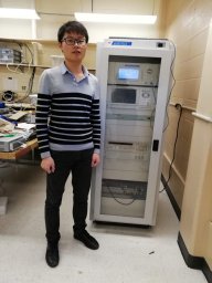 Wei Ding (丁伟)合作论文数辽宁工程技术大学测绘与地理科学学院34
 Aigong Xu (徐爱功)合作论文数辽宁工程技术大学测量工程系16
 RuiBao Li (李瑞豹)合作论文数12
 Shunli Duan (段顺利)合作论文数School of Marine Science and Technology, Northwestern Polytechnical University11Li Yadan (李亚丹)合作论文数9HuiFang Yan (闫慧芳)合作论文数9
 Yang Gao (高扬)合作论文数Department of Geomatics Engineering, Schulich School of Engineering, University of Calgary9LiNa Che (车莉娜)合作论文数8
 Feng Sun (孙枫)合作论文数6Zenglin WU (吴增林)合作论文数4Heng Huang (黄恒)合作论文数4Yihan YANG (杨一涵)合作论文数4Yuhang WANG (王宇航)合作论文数4
 Shuang Du (杜爽)合作论文数School of Aeronautics and Astronautics, University of Electronic Science and Technology of China4
 Jingang Zhao合作论文数3
 Jiaji Wu合作论文数3Pei-Lun Sun合作论文数Coll Med, Chang Gung Univ3Ruyi SONG (宋如意)合作论文数3Xinru FU (付心如)合作论文数3Da-xue WANG (王大雪)合作论文数3Ying KONG (孔莹)合作论文数3Jing Chu (初婧)合作论文数3Siao LIU (刘思奥)合作论文数2Pengxiang SUN (孙鹏翔)合作论文数2Liu Jingzhou (刘经洲)合作论文数2
 Zhe Yue合作论文数2Jianwen JIN (金建文)合作论文数2Shihan GENG (耿诗涵)合作论文数2Depeng LIU (刘得朋)合作论文数2Jian WEN (文剑)合作论文数2GuoBin Li (李国斌)合作论文数2Song Li (李松)合作论文数2
 Li, Guoyuan合作论文数2
 Lihua Liang (梁利华)合作论文数College of Intelligent Systems Science and Engineering, Harbin Engineering University2Ye Wang (王野)合作论文数2YAO Jiaqi (么嘉棋)合作论文数1
 Jingzhou Liu合作论文数1
 Jin Yinbao合作论文数1Xinyu Chen合作论文数1Xingwei GAO (高星伟)合作论文数1Jiang Wei (姜伟)合作论文数1LIU Xing-ming (刘兴明)合作论文数1
 Samireh Kadaei合作论文数Cent Tehran Branch, Islamic Azad Univ1
 Wanqiu Li合作论文数1
 Chenhao Ouyang合作论文数1dayong guo (郭大勇)合作论文数1Yuanjia LIU (刘原嘉)合作论文数1




