气候变化背景下,长江源区水资源条件发生了较大变化,由此导致河川基流也产生相应改变.以长江源区为研究区域,利用1957~2020年实测水文数据和气象数据,采用改进加里宁法计算长江源区河川基流,分析基流变化规律,探讨影响基流变化的气象因素及相应的影响程度.研究结果表明:长江源区直门达水文站1957~2020年多年平均河川基流量为53.4亿m3,2008年以后长江源区基流呈现突变增加的趋势.长江源区基流增加原因主要包括两部分:一部分是降水增加引起的径流增加从而导致基流增加,一部分是气温升高引起的基流增加.长江源区近20 a来整体呈现暖湿化趋势,降水是河川径流的主要来源,降水增加直接造成地下水补给量增加,而气温升高有助于冰川、积雪和冻土融化,对基流的补给起到促进作用.研究成果可为揭示气候变化条件下长江源区河川径流组成及其水文响应规律提供科学依据.
针对河流天然来水丰枯情况不同的特征,提出了一种考虑年内径流变化程度的生态需水计算方法—变区间阈值法,在枯水期生态需水仅设定下阈值,丰水期则须同时设定上、下阈值.通过与Tennant法和分布流量法对比分析,结果表明:变区间阈值法性能不弱于分布流量法,且非劣解集的分布较Tennant法更均匀;在2月份水位有所下降,有利于抵御咸潮入侵;在3-5月份出库流量较大,有利于生态环境和鱼类产卵期产卵;降低了枯水期对径流资料的依赖,便于计算.丰富了现有生态需水计算方法,可为相关研究提供技术支持和参考依据.
分析了乐平市乐安河流域在水环境、水生态、水土保持方面存在的主要问题.以问题为导向,从水污染治理、水源地保护、水生态修复、水土保持、水生态环境管理能力建设等方面提出治理思路与对策措施,以期为乐安河流域保护与治理工作提供支撑.
为更好地认识2020年主汛期长江流域的暴雨特性,利用长江流域701个测站多年6~8月逐日降水资料、常规探空资料、美国NCEP逐日再分析资料,对2020年主汛期(6~8月)长江流域降水异常特征及其成因进行了诊断分析.主要结论如下:①主汛期期间,长江流域有2个明显的降水时段和3个降水中心,分别为6月中旬至7月中旬、8月中旬和长江中下游干流、鄱阳湖水系、嘉岷流域.②主汛期期间,长江流域具有入梅早、出梅晚、梅雨量大,暴雨强度大、范围广、极端性强,暴雨阶段性分布明显、各阶段强雨区重叠度高等特征.③6~7月,欧亚中高纬度为稳定的两脊一槽双阻型态,西太平洋副热带高压脊线位置长时间持续异常,多次北跳未成,导致切变线和梅雨锋长时间维持在长江干流沿线附近;来自南海及太平洋上的东南气流异常强盛,加上极地冷涡活跃、高空冷槽活动频繁,导致了长江中下游暴雨频繁.④8月,欧亚中高纬度转换为两槽一脊的环流形势,四川盆地附近处于副热带高压边缘,来自孟加拉湾和南海的暖湿气流偏强,受多个西南涡及多轮冷空气的影响,加上地形和台风的助力作用,导致8月中旬嘉岷流域的极端性强降水持续时间长、位置稳定.
一、研究背景 全面推行河湖长制是解决我国复杂水问题、维护河湖健康生命的有效举措,是完善当前水治理体系、保障国家水安全的制度创新.水文不仅是防汛抗旱的"耳目"、水利建设的"尖兵",随着大水文观的深入实践,水文作为水量水质监测与评价的技术部门,也是维护、诊治江河湖泊健康的"哨兵"和"大夫",是各级河湖长的参谋助手.
In order to satisfy the demands of the operation and management of massive new hydrologic network and the development of "big hydrology",to improve human resource allocation efficiency,on the basis of multi-year experience in Yangtze River hydrology′s development and innovation,we put forward to set up four systems of hydrological monitoring innovation,which included the hydrological monitoring and management system,the hydrological monitoring service system,the hydrological monitoring technology supporting system,and the hydrological monitoring quality control system.At the same time,we also expounded the facing new problems and new directions of hydrology under the current background of the New Normal of China and at the sides of water environment ecological monitoring,medium-long term prediction of precipitation,hydrological information construction and sponge city and urban development,etc.
Higher technical requirements are placed to water resources evaluation in planning by the most strict water resources management system,since the publication of No.1 Document of Central Government in 2011 and promulgation of Guidelines for Implementation of the most strict Water Resources Management System by the State Council in 2012.Given the case of water resources evaluation in four cascade power station and navigation project at the Minjiang River downstream,the discussion is focused on controlling index of water resources evaluation under the "three redlines" approach and water resources monitoring under the most strict management system.
Through studying the laws of flood composition and encounter of upper Yangtze River,a theoretical basis for developing regulation scheme of the controlling projects(such as TGP) on Yangtze River can be provided.According to the measured data of the representative stations,such as annual maximum flood and its occurrence time,considering the propagation time of the flood,the possibilities of flood encounter of Jinsha River and Minjiang River,Yangtze River and Jialing River,Yangtze River and Wujiang River,are analyzed year by year,so is the probabilities and magnitudes of the encountered floods.The results show that the probabilities of flood encounter of Yangtze River and Minjiang River,Yangtze River and Jialing River are relatively high,and magnitudes of encounter floods are generally small,except individual years.The probability of flood encounter of Yangtze River and Wujiang Rive is low and all encountered floods are small or medium-sized.The probability of flood encounter of all tributaries and main streams in upstream of the Yangtze River at the same time is very low.
Based on the observed from 3 hydrological stations and 80 rainfall stations in the Wujiang River Basin,Mann-Kendall test and Kendall-τ association test were used to analyze the variation trend of the annual runoff in the Wujiang River,and the factors and contribution rate to the variation were discussed according to the relationship between rainfall and precipitation.The results show that the river runoff has several alternate variation processes from the middle 20 century to early 21 century.The association test indicates that there is a close relation between runoff and precipitation,and there is an effect of the underlying surface and human activities on the variation of the annual runoff.Because of daily regulating and incomplete annual regulating operation,the reservoirs in the Wujiang River Basin have more impact on annual runoff distribution than that on interannual variation.
To solve the problems of errors increasing with the extension of the forecast cycle and inadequate protection against random factor interference when using the existing models for multi-cycle urban water demand forecast,an equidimensional information renewal radial basis function neural network model was proposed,and the clustering approach was used for system learning.This model was applied to the annual water demand forecast in Dongguan City.The results show that the model has higher forecast accuracy than the fundamental radial basis function neural network model,and its forecast errors do not increase with the extension of the forecast cycle.
This paper introduced the main function of the water resources management and decision-making support system for the Yangtze River Basin,which is based on water resources allocation model.The whole system consists of four subsystems:water resources information inquiry and management subsystem,water resources allocation subsystem,water control subsystem and water pollution emergency simulation subsystem.The system has been initially applied in the Hanjiang River Basin.This paper focused on the theory,procedures and methods of the water resources allocation model for the Hanjiang River Basin.Based on the control total water quantity project for the area above the Three Gorges,this paper put forward construction ideas of water resources allocation model for the area above Three Gorges.Finally,this paper pointed out the existing problems of the Hanjiang River Basin water resources allocation model,and put forward prospects of water resources model for future research and application.
This paper explored how to simulate hydrological data series which were observed after technical innovation in hydrometry.Due to changes in the patterns or reduce number of observation,the error of hydrological data increase is the prerequisite for simulating hydrological data series after innovation.Firstly,this paper analyzed errors distribution characteristics and errors adding form for different types of hydrological data,selected the typical hydrological stations and used Monte Carlo stochastic simulation method to test.The results show that instantaneous flow innovation series after innovation(e.g.peak,low water flow) and total volume series after innovation(e.g.flood volume,annual runoff) can be simulated by adding errors following a normal and binomial distribution into in the original series separately.
In order to research how to hydrometry for meeting the requirement of hydrological analysis and calculation,10 typical hydrometric stations in the Yangtze River basin were chosen with the design flood peaks,design annual runoff and design annual minimal discharge as the study factors.At first,the error distribution characteristics of the concerned hydrological series were analyzed,and then observed hydrological series were put into the simulated terms to construct the new hydrological series.The original frequency design values were compared with the values of simulated hydrological time series,and then the allowed upper limit of errors that can be add into hydrological data was given according to the standard,i.e.relatively error should not be more than 5% under 95% confidence level.Finally,the demanded upper limit of errors of the 10 stations can be acquired by envelope method.
The concept of blue water and green water is introduced in water right allocation.Two models,one of which only considers blue water and another considers both blue and green water,have been set up to realize the water resources allocation.The interregional water transport volume is further discussed,and the practical significance of this parameter in water transfer(intraregional and interregional water transfer) is illustrated.The models are applied in water resources allocation of the Hanjiang River Basin,and in the light of the practical condition of the Hanjiang River,the treatment methods for the basin of bifurcated rivers are put forward.The water right allocation results for each division area of the models are obtained under different rules,providing scientific theory base for the initial water allocation scheme of the Hanjiang River Basin.
选取汉江作为示范流域,基于MIKE BASIN软件构建了汉江流域水资源配置模型,介绍了该系统的重要特征,探讨了系统内部各组成部分间相互联系;将所建模型与NAM模型的预测结果进行耦合,并分析了2006年皇庄以上汉江流域水资源供需平衡。结果表明:汉江流域内(至皇庄)生活用水、工业用水基本满足要求;农业灌溉、河道内生态用水缺水率为35.8%、25.7%,整体缺水率为22.2%。
以汉江流域为典型流域,利用先进的MIKE BASIN软件,构建汉江流域水资源配置模型。选取长江流域水资源综合规划2000年的水文资料和需水资料,验证模型的合理性,并由模型运行结果得到全流域供需水平衡数据,流域整体缺水率为1.60%,城镇工业、农村灌溉和河道内生态用水缺水率分别为1.68%、9.79%和0.46%。模型的建立为今后汉江流域水资源配置模型打下了良好的基础,随着资料的积累,已建的模型将得到不断完善。
 HongGang Zhang (张洪刚)合作论文数4MingXin Li (李明新)合作论文数3SunYun Lv (吕孙云)合作论文数2KeXu Fan (范可旭)合作论文数2Jun Shao (邵骏)合作论文数2Jun Wang (王俊)合作论文数2
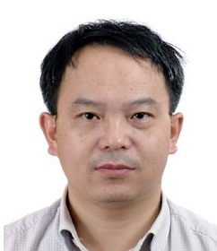 Yadong Mei (梅亚东)合作论文数School of Water Resources and Hydropower Engineering, Wuhan University2
 Mingbo Zhang (张明波)合作论文数Institute of Geographic Sciences and Natural Resources Research, Chinese Academy of Sciences;State Key Laboratory of Resources and Environmental Information System, Chinese Academy of Sciences2chang jiang xu (徐长江)合作论文数1Yinshan Xu (许银山)合作论文数1Jianping Bing合作论文数1
 Xianxun Wang (王现勋)合作论文数1HE Qikai (何奇锴)合作论文数1Zhenhui Wu合作论文数1
 Huaming Yao (姚华明)合作论文数1WANG Le (王乐)合作论文数1WenHui Xing (邢雯慧)合作论文数1ZhengXiang Wang (王政祥)合作论文数1HaiJin Guo (郭海晋)合作论文数1XinTian Zhang (张新田)合作论文数1Hui Qiu (邱辉)合作论文数1Jing Zhang (张晶)合作论文数1Na Li (李娜)合作论文数1




