Black carbon (BC) is an atmospheric pollutant that adversely affects air quality, global climate, and human health. As an important BC source region, China has achieved substantial emission reductions over the past decade through stringent clean air policies, offering a unique opportunity to study changes of BC sources and properties under rapid emission changes. Concurrently, BC research in China has progressed rapidly, shifting from studying emission sources toward atmospheric processes and health impacts. This review focuses on five key topics in BC research, including ambient concentrations, emission sources, atmospheric aging, mixing state, and health effects. Ground observation networks and gridded datasets have shown a significant decrease in BC concentrations due to clean air policies, particularly in Northern and Eastern China. Emission inventories and source apportionment studies consistently identified fossil fuel combustion as the dominant BC source in China. Laboratory, field, and modeling studies have advanced understanding of BC aging and mixing state. The health evidence from China has linked BC exposure to respiratory, cardiovascular, and neurological diseases. The rapid expansion and heterogeneity of datasets underscore the urgent need for measurement standardization and cross-regional dataset comparison. In addition, this review calls for stronger integration of measurement and modeling to better study BC sources, aging, and mixing states, and highlights the need for assessing source-specific health impacts and understanding how atmospheric aging modifies BC toxicity.
Ozone (O3) pollution in eastern China has been worsening in recent years despite the implementation of effective control measures. Reactive chlorine plays a key role in regulating O3 formation by modulating atmospheric oxidative capacity. However, its impact on O3 formation in the context of land-sea interaction and long-range transport has not been fully explored in eastern China. In this study, we combined a chemical transport model (CTM) with meteorological and O3 observations, as well as backward trajectory analyses, to identify a typical long-range O3 transport episode in eastern China in autumn 2018. Three representative cities-Shanghai, Fuzhou, and Shenzhen-experienced significant regional transport impacts. During the typical transport episode, chlorine emissions aggravated O3 pollution, with peak increases exceeding 10, 12, and 8 mu g m-3 in Shanghai, Fuzhou, and Shenzhen, respectively. Marine-derived chlorine dominated this contribution, accounting for 55.8%, 63.3%, 69.5% of the total chlorine impact in the above three cities. These findings highlight the critical role of chlorine emissions, particularly from marine sources, in enhancing coastal O3 levels.
Column-averaged dry air mole fraction of carbon dioxide(XCO2) data is of great significance for addressing global climate change, monitoring carbon emissions. Currently, satellite XCO2 exhibit significant spatial discontinuity, which makes it difficult to meet the needs of research at small spatial scales. Although machine learning methods have been widely used to fill the gaps in satellite XCO2 data, mainstream methods are mostly data-driven mode, which, to some extent, limits the accuracy and generalization ability of the models. Given the limitations of existing studies in mining the spatiotemporal characteristics of XCO2, this study innovatively proposes a new spatiotemporal XGBoost model(XGBKT) to generate high-resolution XCO2 dataset covering the entire territory of China. This model focuses on the three major spatiotemporal characteristics of XCO2, namely spatial correlation, temporal heterogeneity, and temporal periodicity. Through the spatiotemporal encoding strategy, these characteristics are skillfully transformed into features that the XGBoost model can efficiently utilize, thereby enabling the model to explore the spatiotemporal distribution pattern of XCO2 and significantly improve its estimation accuracy and reliability. The research results indicate that: The XGBKT model significantly enhances the estimation performance and generalization ability of machine learning models, demonstrating clear advantages compared to mainstream machine learning methods; The XGBKT model validates the effectiveness of spatiotemporal characteristics, thereby further strengthening the interpretability of machine learning models. Overall, XGBKT is an effective method for accurately estimating XCO2, providing a reliable data foundation for the fine-scale quantification of regional carbon cycling.
Investigating multiple source apportionment methods and quantitatively characterizing heavy metal contamination in soils are of critical importance for effective pollution control and prevention. This study systematically investigates multiple source apportionment methods for soil heavy metals, with quantitative characterization of contamination features crucial for effective pollution control. Taking Jingxi City in Guangxi, China, as a case study, we conducted a comprehensive analysis of 8816 soil samples using multi-source big data integration. By synergistically applying machine learning algorithms, the potential ecological risk index, and bivariate local Moran’s index, we achieved dual objectives: quantitative inversion of eight heavy metal concentrations and simultaneous ecological risk assessment with pollution source identification. Through comparative model evaluation, the XGBoost algorithm demonstrated optimal predictive performance. Contribution analyses revealed that soil properties (Fe2O3, Al2O3, and phosphorus content), road distribution, and elevation significantly regulate heavy metal accumulation. Spatial risk mapping identified cadmium, mercury, and arsenic contamination hotspots as critical environmental threat zones. The bivariate local Moran’s index model elucidated spatial coupling characteristics between ecological risks and environmental drivers, providing spatially explicit decision-making support for precision environmental management. Our multidimensional analytical framework incorporates spatial visualization of heavy metal distribution, hierarchical ecological risk assessment, and pollution source contribution analysis, ultimately establishing a scientific decision-making system for land safety utilization and pollution risk management. This integrated approach offers methodological references for regional heavy metal pollution control in karst environments.
Recently, deep learning (DL) techniques have been routinely applied to improve chemical weather forecasts of fine particulate matter (PM2.5) based on chemical transport models (CTMs), usually taking the form of bias correction. However, their opaque nature hinders diagnostic analysis of their improvements to identify the key atmospheric processes responsible for CTM forecast errors. Here we propose leveraging interpretability methods as diagnostic tools to identify candidate targets for CTM refinements. We connect a convolutional neural network (CNN) to a CTM, and apply the Deep Learning Important FeaTures (DeepLIFT) interpretability method for diagnosis. The CNN learns the mapping from gridded surface forecast fields of PM2.5, ozone (O3), nitrogen dioxide (NO2), sulfur dioxide (SO2), and ammonia (NH3) to PM2.5 concentration observations across 180 monitoring sites in the Yangtze River Delta (YRD) of China. Trained on a two-year dataset (2017-2018), our CTM-CNN hybrid achieves 16.8-34.7% error reductions compared to the standalone CTM for PM2.5 forecast cases. The DeepLIFT method quantifies comparable contributions from O3 (25.9%), SO2 (22.2%), and NO2 (17.6%), with PM2.5 as the dominant contributor (38.5%) and NH3 exhibiting a modest influence (−4.2%). Interpretability analysis suggests CTM refinements targeting SO2-sensitive and NO2-NH3-coupled secondary PM2.5 formation in the ammonia-poor YRD region, and on O3-related mechanisms affecting secondary PM2.5 formation in coastal areas. We position this integration study as a step towards more general, iterative, and bidirectional hybrid modeling frameworks, where the merits and potentials of both CTMs and DL techniques can be fully explored to ultimately break conventional limits in medium-term regional PM2.5 forecasting.
Nitrate (NO3-), sulfate (SO42-), and ozone (O3) are key atmospheric pollutants, yet the underlying mechanisms of their interactions are highly complex and remain insufficiently characterized from a quantitative perspective. This study conducted a comprehensive field observation in Tianjin, a typical megacity in the North China Plain, from 2022 to 2023, focusing on the dynamic evolution of the NO3--SO42--O3 system. The NO3-/SO42-ratio effectively delineates distinct regimes of pollutant interactions: at low ratios, strong photochemistry drives O3 production while suppressing secondary inorganic aerosol formation; as the ratio increases, accumulated nitrate and sulfate progressively enhance heterogeneous reaction pathways under elevated humidity, consuming gas-phase oxidants and intensifying aerosol radiative extinction, thereby suppressing O3 while promoting further nitrate accumulation. The Positive Matrix Factorization (PMF) receptor model was applied to quantify the contributions of six emission sources to PM2.5, and a Random Forest model combined with SHAP analysis was employed to quantitatively assess the contributions of environmental factors and source contributions to NO3-, SO42-and O3 concentrations. Machine learning quantitatively confirms that temperature, source contribution, and aerosol liquid water content are dominant regulators, while sulfate and nitrate exhibit competition at the source level. These findings provide a mechanistic basis for the coordinated control of PM2.5 and O3 in regional air quality management.
China has implemented a series of clean air policies that have significantly improved air quality. However, their combined effects on air pollutant and greenhouse gas (GHG) emissions in the Guangdong-Hong Kong-Macao Greater Bay Area (GBA), as well as their interactions with rapid socioeconomic development remain poorly understood. Here we integrate a unified emission inventory for the GBA and apply additive logarithmic mean Divisia index (LMDI) decomposition to investigate the drivers of changes in air pollutant and GHG emissions across major sectors between 2010 and 2020. Between 2010 and 2020, emissions of air pollutants in the GBA decreased substantially: SO2 by 87%, PM2.5 by 68%, NOx by 48%, NH3 by 27%, and VOCs by 25%, respectively. LMDI analysis indicates that changes in emission and energy intensity were the primary drivers of emission reductions, with the most pronounced effects observed in the industrial and power sectors. In the transportation sector, the effectiveness of changes in emission intensity weakened, whereas changes in energy intensity and adjustments in transport structure became the main drivers of emission reductions. For the residential and commercial, and agricultural sectors, emission reduction was relatively limited, primarily due to insufficient end-of-pipe measures. Since 2010, GHG emissions (including CO2, CH4, and N2O) have increased by 20%, with changes in energy intensity acting as the main mitigation driver but insufficient to offset the continuous growth in energy consumption. This study reveals how emission intensity, energy intensity, and socioeconomic development shape changes in air pollutants and GHG in the GBA, providing insights for more effective air quality and low-carbon policies.
Since the implementation of China's Air Pollution Prevention and Control Action Plan (APPCAP) in 2013, particulate matter pollution has been significantly curtailed, while ozone (O3) pollution has intensified. Although the Chinese government has prioritized the synergistic control of air pollutants and carbon emissions as a core objective for the next phase of air quality management, the impact of APPCAP on terrestrial ecosystem carbon sink capacity remains scientifically unevaluated. In this study, the GEOS-Chem model was employed to quantitatively assess the effect of APPCAP on O3-induced damage to gross primary productivity (GPPd) in southern Chinese megacities and its evolution under various dual-carbon pathways. Our results show that imbalanced VOC and NOx emission reductions drove the GPPd increase in VOC-limited megacities during APPCAP, an effect substantially modulated by meteorological variations. Interestingly, APPCAP implementation enabled GPPd to enter a declining trajectory more rapidly, resulting in a more pronounced decrease in GPPd for an equivalent amount of emission reductions. The adverse GPPd increase resulting from BVOC-enhanced O3 formation could be counteracted by synergistic NOx reductions, with reductions of 50% in Wuhan and 60% in Guangzhou. In Shanghai, however, a stronger VOC-limited regime necessitates even greater NOx abatement to achieve a similar effect. This study provides evidence of the profound impact of APPCAP on carbon source-sink patterns, emphasizing that under the dual-carbon vision, enhancing carbon sinks through increased green space must be accompanied by sustained and deep NOx reductions to curb O3 photochemical formation, thereby maximizing the mitigation of O3-induced damage to ecosystem carbon sinks.
Oxygenated organic molecules (OOMs) are critical intermediates in particle growth and secondary organic aerosol (SOA) formation in megacities. Here, we present comprehensive measurements of OOMs using three state-of-the-art mass spectrometers in Beijing winter. We demonstrate distinct differences in the extent of OOM formation and their contribution to particle growth under clean versus polluted conditions. The formation of organic nitrate (ON) OOMs shows a nonlinear dependence on NOx levels, with concentrations increasing as the NO/NO2 ratio rises from similar to 0.1 to 1. Under polluted conditions, daytime photochemical processes primarily drive OOM formation, while high-NO2 chemistry (NO/NO2 < 0.1) enhances ON production through nighttime oxidation under clean conditions. Aerosol growth model simulations reveal that low-volatility organic compounds account for 69-77% of particle growth in the 3-15 nm range, with SOA formation primarily driven by OOM condensation. Our results provide significant insights into urban air pollution dynamics, advancing our understanding of aerosol formation in megacities.
An online coupled regional climate-chemistry-aerosol model (RIEMS-Chem) was applied to investigate the direct radiative effect of crop residue burning (CRB) aerosols and feedbacks on meteorology during CRB events in June 2015. Model validation against observations demonstrates a generally good model ability in reproducing meteorological variables, PM2.5 and its chemical components, and aerosol optical depth (AOD). On average, CRB aerosols contributed approximately 35 50
The North China Plain (NCP) faced severe summer ozone pollution in 2023, exacerbating risks to public health and crop yield. Accurate county-level ozone source attribution is essential for precise air quality management, yet conventional city-scale source modeling often overlooks heterogeneity in intra-urban contributions. Here, the Nested Air Quality Prediction Modeling System (NAQPMS), coupled with an online tracer-tagging module, was employed to quantify ozone sources and crop impacts, successfully reproducing spatiotemporal ozone variations across the NCP. The results showed that regional transport dominated summer ozone formation; emissions within 200 km contributed 43%-49% to the site-averaged maximum daily 8-h average (MDA8) O3, rising to 77%-91% at the 800 km scale. Local priority control zones shifted substantially when evaluated against site-average, site-maximum, and maximum population-weighted metrics. Notably, Beijing's maximum noontime ozone peaks (MNP) differ distinctly from MDA8 O3: local emissions contribute 44% to MNP versus 26% to MDA8 O3, whereas 200-500 km transport dominates MNP in Zhengzhou and 500-800 km transport in Shijiazhuang, reflecting intensified midday photochemistry and precursor transport. Furthermore, AOT40-based assessments estimate 21% relative maize yield losses (RYL) across the NCP, primarily attributable to regional transport. In Beijing, local emissions contribute 22% to maize RYL, with urban sources accounting for 26% of local emission-induced RYL. These findings underscore the need for coordinated regional controls to curb long-range ozone transport alongside localized precision interventions, providing a scientific basis for integrated air quality and agricultural management.
Brown carbon (BrC), a subset of light-absorbing organic aerosols, contributes significantly to global warming not only by absorbing atmospheric radiation but also by accelerating snowmelt in the cryosphere through reducing surface albedo. However, accurately quantifying its global distribution and absorption remains challenging for numerical models, stemming from its complex composition, variable optical properties, and dynamic atmospheric transformations. This study developed an absorptivity basis set module for BrC (ABS-BrC) simulation, which categorizes BrC into four classes based on light-absorbing ability and accounts for chemical aging processes to better represent the variability in BrC absorption. Global simulations using ABS-BrC reveal notable disparities between source contributions to BrC concentrations and their associated absorption aerosol optical depth (AAOD). While secondary formation dominates global BrC concentrations (45.8%), its contribution to AAOD is disproportionately small (16.6%). In contrast, wildfire-sourced BrC, despite contributing less than a third of the total concentration, is responsible for the majority (54.2%) of global BrC AAOD. Notably, dark BrC (d-BrC), a strongly absorbing and water-insoluble subset, contributes 30-64% to global BrC AAOD. Its contribution is particularly critical in the Arctic during JJA and SON, where it accounts for 67% of BrC absorption, highlighting its critical role in polar warming. Implementing the ABS-BrC module in Earth system models is recommended for a more accurate assessment of BrC's radiative impact on the atmosphere and cryosphere.
The air pollution prevention and control actions implemented since 2013 have not effectively controlled the increase of ozone (O3) concentration in Southwest China. The O3 pollution characteristics and the role played by meteorological conditions when pollution occurs are still unclear. Therefore, this study systematically investigated the spatiotemporal variations and potential source transport of O3 across Southwest China from 2013 to 2022, identified the dominant synoptic patterns and meteorological features during O3 pollution events, and further quantified the individual meteorological contributions to O3 variability. The results indicated that regional annual mean O3 concentrations after 2017 were apparently 10.38 μg m−3 higher than those in the first four years. Additionally, the mean O3 concentration exhibited significant seasonal diversity, with means of 98.78, 89.31, 78.76, and 74.26 μg m−3 in spring, summer, autumn, and winter, respectively. Source apportionment results for major cities within the study domain highlight the critical role of atmospheric transport, in which O3 pollution occurred in the three cities in Yunnan Province mainly associated with air masses from west and southwest in spring and summer, while for the city that located in Sichuan Basin, local activities contributed more dominantly to O3 pollution in all seasons. Furthermore, the occurrence of O3 pollution in different seasons corresponded to different synoptic patterns. Overall, meteorological conditions had a promoting effect on O3 pollution in Southwest China, and positive contributions of meteorological conditions to O3 concentrations were always accompanied by higher temperatures, stronger solar radiation, higher boundary layer height, and lower relative humidity.
Abstract. The rapid development of Graphics Processing Units (GPUs) has established new computational paradigms for enhancing air quality modeling efficiency. In this study, the heterogeneous-compute interface for portability (HIP) was implemented to parallel computing of the piecewise parabolic method (PPM) advection solver (HADVPPM) on China’s domestic GPU-like accelerators (GPU-like), resulting in a GPU-accelerated version denoted as GPU-HADVPPM4HIP V1.0. Computational performance was enhanced through three strategic optimizations: reducing the central processing unit (CPU) and GPU (CPU-GPU) data transfer frequency, thread-block coordinated indexing, and the Message Passing Interface (MPI) and HIP (“MPI+HIP”) hybrid parallelization across heterogeneous computing clusters. Following validation of the GPU-HADVPPM4HIP V1.0 program’s offline computational consistency and the pollutant simulation performance of the Emission and atmospheric Processes Integrated and Coupled Community version 1.6.0 (EPICC-Model V1.6.0) on the Earth System Numerical Simulation Facility (EarthLab), comprehensive performance testing was conducted. Offline benchmark results demonstrated that GPU-HADVPPM4HIP V1.0 achieved a maximum speedup of 556.5x on a GPU-like using the compiler optimization option compared to the Fortran HADVPPM baseline compiled option for a data size of 108. Integrating GPU-HADVPPM4HIP V1.0 into EPICC-Model V1.6.0 yielded three distinct versions: the initial HIP-based version (HIP-Ori), a version optimized for CPU and GPU communication frequency (HIP‑Opt1), and a further-optimized version employing a thread‑block coordinated indexing strategy (HIP‑Opt2). Compared to the HIP‑Ori version, HIP‑Opt1 achieved a model‑level computational efficiency improvement of 17.0x. Building upon HIP‑Opt1, HIP‑Opt2 delivered an additional 1.5x enhancement in computational efficiency. At the module level, including CPU and GPU data transfer overhead, the GPU implementation improves computational efficiency of the advection module by 39.3 %; when communication cost is excluded, the advection module attains a 20.5× acceleration relative to its CPU counterpart. This coupling establishes a foundational framework for adapting air quality models to GPU-like architectures and identifies critical optimization pathways. Moreover, the methodology provides essential technical support for achieving full-model GPU implementation of the EPICC-Model, addressing both current computational constraints and future demands for high-resolution air quality simulations.
China’s atmospheric environment modeling has advanced rapidly in response to intensifying air pollution challenges, emerging scientific needs, and growing international engagement. This review synthesizes advances across the historical evolution of model systems, key innovations in mechanisms and technologies, and emerging strategic directions. We trace the development from early offline models to fully coupled meteorology–chemistry systems, culminating in high-resolution, multi-pollutant platforms increasingly integrated with artificial intelligence. These models have improved the representation of key processes such as heterogeneous chemistry, secondary aerosol formation, and ozone photochemistry, and have enhanced forecasting capacity through ensemble approaches, data assimilation, and decision-support applications. However, significant challenges remain, including the incomplete simulation of multiphase and feedback processes under compound extremes, limited computational scalability for high-resolution and ensemble use, and fragmented integration of multi-source observations. To address these challenges, this review highlights four priorities: (1) incorporate machine learning into mechanistic modeling; (2) advance open-source and internationally aligned platforms; (3) develop flexible numerical schemes for multi-scale coupling; (4) embed atmospheric chemistry into Earth system models. China’s experience illustrates not only a national transformation from model adaptation to innovation but also provides transferable insights for the global modeling community.
Underlying surface conditions significantly affect the formation and transport of dust storms. Their impact on dust emission is straightforward, but the limiting effect on transport remains unclear. In this study, a machine learning surface classification framework was developed to quantify changes in dust source underlying surfaces between 2001 and 2023, and sensitivity simulations using WRF-Chem were conducted to isolate the impacts of surface changes under identical meteorological conditions. The results show that the bare land area of the major dust sources in East Asia decreased by 19.7% in 2023 compared with 2001. This decrease reduced the surface albedo by 0.021 and led to an increase in sensible heat flux by 3.33 W m-2, enhancing atmospheric convergence and strengthening cold high-pressure near dust sources in a dust storm event on March 19-23, 2023. The intensified high-pressure circulation initially promoted stronger uplift and horizontal transport near source regions but ultimately suppressed eastward long-range transport, which led to a 5.3 degrees westward shift of the eastern boundary of high dust concentrations.
 Zifa Wang (王自发)合作论文数Institute of Atmospheric Physics, Chinese Academy of Sciences;University of Chinese Academy of Sciences205
 Yele Sun (孙业乐)合作论文数State Key Laboratory of Atmospheric Boundary Layer Physics and Atmospheric Chemistry, Institute of Atmospheric Physics, Chinese Academy of Sciences;University of Chinese Academy of Sciences112
 Xiaole Pan (潘小乐)合作论文数中国科学院大气物理研究所60
 Pingqing Fu (傅平青)合作论文数Institute of Surface-Earth System Science, School of Earth System Science, Tianjin University;Tianjin University Library59
 Xueshun Chen (陈学舜)合作论文数Institute of Atmospheric Physics, Chinese Academy of Sciences;University of Chinese Academy of Sciences55
 Wenyi Yang合作论文数52
 Zhe Wang合作论文数Department of Earth System Science and Technology, Interdisciplinary Graduate School of Engineering Sciences, Kyushu University44
 Baozhu Ge (葛宝珠)合作论文数Institute of Atmospheric Physics, Chinese Academy of Sciences36Weiqi Xu合作论文数33
 Qizhong Wu (吴其重)合作论文数Faculty of Geographical Science, Beijing Normal University32Huiyun Du合作论文数31
 Qingqing Wang合作论文数26Huansheng Chen (陈焕盛)合作论文数26Lei Kong合作论文数21Hang Liu (刘航)合作论文数20
 Jinyuan Xin (辛金元)合作论文数Institute of Atmospheric Physics, Chinese Academy of Sciences;University of Chinese Academy of Sciences18
 Yin Wang (汪印)合作论文数中国科学院城市环境研究所18Wei Wang合作论文数17
 Wei Zhou合作论文数17
 Zhiwei Han (韩志伟)合作论文数Institute of Atmospheric Physics, Chinese Academy of Sciences17
 Jiang Zhu (朱江)合作论文数University of Chinese Academy of Sciences;Institute of Atmospheric Physics, Chinese Academy of Sciences17
 Joshua S. Fu合作论文数Department of Civil and Environmental Engineering, University of Tennessee;Bredesen Center for Interdisciplinary Research and Graduate Education, University of Tennessee;Computational Sciences and Engineering Division, Oak Ridge National Laboratory17
 Ting Yang合作论文数16
 Xiao Tang (唐晓)合作论文数EarthLab & LAPC, Institute of Atmospheric Physics, Chinese Academy of Sciences;University of Chinese Academy of Sciences16Shandong Lei合作论文数15Yuting Zhang合作论文数15Wending WANG (王文丁)合作论文数15
 Guangwei Yu (余广炜)合作论文数中国科学院城市环境研究所15
 Lin Wu (吴琳)合作论文数College of Environmental Science and Engineering, Nankai University15
 Shengyu Xie (谢胜禹)合作论文数中国科学院大学中国科学院14Yu Tian合作论文数School of Electronic, Electrical and Communication Engineering, University
of Chinese Academy of Sciences;Key Laboratory of Network Information System Technology, Aerospace
Information Research Institute, Chinese Academy of Sciences14
Shengyu Xie (谢胜禹)合作论文数中国科学院大学中国科学院14Yu Tian合作论文数School of Electronic, Electrical and Communication Engineering, University
of Chinese Academy of Sciences;Key Laboratory of Network Information System Technology, Aerospace
Information Research Institute, Chinese Academy of Sciences14 Wei Lianfang合作论文数13Weijie Yao合作论文数13
 Tingting Han (韩婷婷)合作论文数School of Atmospheric Sciences, Nanjing University of Information Science & Technology13
 Dongsheng Ji (吉东生)合作论文数Institute of Atmospheric Physics, Chinese Academy of Sciences;University of Chinese Academy of Sciences13
 Tatsuya Nagashima (永島達也)合作论文数National Institute for Environmental Studies13
 Kazuyo Yamaji合作论文数Kobe University13
 Yingjie Zhang合作论文数12Chunxing Li合作论文数12
 Fuyou Tian合作论文数State Key Lab Remote Sensing Sci, Aerosp Informat Res Inst12
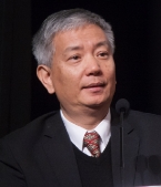 Tao Wang (王韬)合作论文数Department of Civil and Environmental Engineering, The Hong Kong Polytechnic University12
 Conghui Xie合作论文数11
 Lan-Jia Pan合作论文数11
 Jian Zhao (赵建)合作论文数Suzhou Institute of Biomedical Engineering and Technology, Chinese Academy of Sciences11
 Junji Cao (曹军骥)合作论文数Institute of Earth Environment, Chinese Academy of Sciences;University of Chinese Academy of Sciences11
 Gregory Carmichael合作论文数Department of Chemical & Biochemical Engineering, University of Iowa11
 Xuemei Wang (王雪梅)合作论文数College of Environment and Climate, Jinan University11
 Syuichi Itahashi合作论文数Department of Earth System Science and Technology, Kyushu University11




