Real-time prediction of dynamic origin–destination (OD) passenger flows is essential for efficient passenger flow management in urban rail transit (URT) systems. Existing studies have primarily focused on commuting OD flows, which exhibit strong regularity and are supported by abundant data samples. In contrast, non-commuting OD flows—especially those generated by irregular passengers with limited historical data—are characterized by high stochasticity and data sparsity and have received relatively little attention, with existing studies often reporting unsatisfactory predictive performance. To address these challenges, this study proposes a novel real-time OD flow prediction framework for irregular non-commuting passengers through multi-source data fusion and feature extraction. Specifically, individual-level spatiotemporal behavioral features are extracted from metro AFC data using a density-based clustering algorithm. Land-use and geo-economic data are then integrated to characterize individual travel preferences and construct a multidimensional behavioral indicator system. Building upon these features, hierarchical clustering and machine learning models are employed to perform personalized destination prediction. Empirical experiments conducted on Nanjing Metro data demonstrate that the proposed framework substantially improves prediction accuracy for non-commuting passengers and provides new insights into dynamic OD modeling. The results highlight the strong applicability and potential of the method for real-time passenger flow prediction in complex urban rail systems.
Electric vehicle charging station location optimization (EVCSO) often involves multiple stakeholders, each with distinct objectives. This can be formulated as multi-view multi-objective optimization problems (MVMOPs) to provide a systematic and scientific scheme. However, no research has yet been conducted on MVMOPs within the context of EVCSO. To fill this gap, this paper models a tri-view tri-objective optimization problem. It is difficult to find a set of public Pareto-optimal solutions for the modeled MVMOP, therefore, a knowledge-sharing evolutionary algorithm is proposed. This includes a combination strategy to transfer knowledge between views, along with a two-layer decision strategy and weight vector update strategy to balance exploration and exploitation. A series of experiments are conducted to validate the feasibility and efficiency of the proposed model and algorithm. The proposed algorithm outperforms three state-of-the-art peer algorithms on test problems with respect to two indicators, e.g., it obtains 71.4% the best instances on the seven test MVMOPs, positioning itself as a promising tool for tackling MVMOPs. Moreover, compared to five conventional algorithms, the proposed method yields a more balanced and rational layout for electric vehicle charging stations, increasing revenue by 28.57% and reducing queueing time by 1.7% relative to the second-best algorithm.
Human mobility varies significantly across temporal and spatial scales and exhibits distinct characteristics. However, precise methods and metrics for measuring human mobility are still lacking and the underlying mechanisms across different spatiotemporal scales and social groups remain unexplored. To uncover the regularity of urban travel patterns, we propose statistical methods focused on different types of entropy values. We introduce the concepts of mobility chains and travel motifs to provide diversified perspectives to observing users’ travel behaviors, choices, preferences and other characteristics. Our findings reveal that users with the same travel motifs share similar proportions in each city and follow consistent travel regularities within their motif categories. Given the importance of understanding human mobility, we emphasize the need for quantitative models that account for the statistical characteristics of individual human trajectories. To address this, we introduce the Preferential Return (PR) model, which explains the observed scaling laws and analytically simulates users’ travel behaviors. Our model and associated rules establish an underlying mechanism at the individual level, capable of explaining a variety of human mobility behaviors with different travel characteristics. These analyses and explanations have significant applications in reproducing human movement patterns. Our study provides a scientific basis for understanding and optimizing urban traffic management, enhancing public service efficiency, and promoting sustainable urban development. We believe these insights will contribute to the harmonious progress of society.
Subway systems playa vital role in facilitating mobility within cities. However, the complex, nonlinear interactions between subway stations are difficult to capture using traditional approaches, which typically focus on static network structures or absolute passenger flow. These methods fail to adequately address the dynamic nature of subway systems and hinder cross-city comparisons. In this study, we integrate perspectives from dynamics and system science to quantify the relative influence between subway stations, accounting for both network connectivity and dynamic characteristics. This approach effectively eliminates biases related to city scale, allowing for meaningful cross-city comparisons. Additionally, we develop a simulation model that links individual travel behavior with collective-level phenomena, shedding light on the intrinsic mechanisms governing passenger flow. By analyzing relative influence, we define a station importance metric that reveals the functional roles of stations within the network. Empirical analyses of subway systems in Beijing, Chongqing, Nanjing, and Suzhou demonstrate consistent patterns in relative influence distributions across cities and time periods. These patterns align with a time-based, two-step preferential attachment mechanism governing passenger travel. A comparison of our proposed station importance metric with traditional centrality measures further validates its effectiveness. This research provides valuable insights into subway network operations, contributing to the optimization of system resilience and management strategies.
As a key connection point between cities, the transportation hub must be resilient enough to withstand external disturbances and disruptive events. However, most existing studies evaluate the resilience of systems under disturbances using static approaches, with few studies establishing dynamic indicators to assess the resilience of transportation hubs. Therefore, this study proposes a comprehensive assessment model that integrates dynamic and static resilience, considering robustness, redundancy, resourcefulness, and rapidity. The model quantitatively assesses the resilience of transportation hubs from a dual 'passenger-infrastructure' perspective. The dynamic resilience is measured by evaluating real-time passenger congestion and queuing within the hub, with a focus on the efficiency of passenger spatial mobility, while static resilience is assessed by examining the configuration of infrastructure and resources in response to external disturbances and disruptive events. By designing typical disturbance scenarios, this study develops operational scenarios for transportation hubs and computes the corresponding resilience indicators. The research findings provide a scientific basis for planning and management, focussing on the development of resilient and efficient transportation hubs.
Assessing the resilience of urban rail transit systems helps to identify potential vulnerabilities and facilitates the implementation of measures to strengthen the system’s ability to respond to emergencies. This paper presents a comprehensive literature review on assessing the resilience of urban rail transit systems, introducing the concept of resilience and its quantitative measurement methods. First, this research explores the definition of resilience in urban rail transit and clarifies related concepts. Second, this review classifies commonly used resilience metrics into three main categories: network topology metrics, supply–demand-based metrics, and comprehensive metrics. Next, this paper summarizes common resilience measurement approaches in urban rail transit, including the topological, data-driven, optimization, and simulation approaches. Finally, this review discusses strategies and recommendations to improve the resilience of urban rail transit and suggests topics for future research.
Predicting short-term passenger flow in urban rail transit is crucial for intelligent and real-time management of urban rail systems. This study utilizes deep learning techniques and multi-source big data to develop an enhanced spatial-temporal long short-term memory (ST-LSTM) model for forecasting subway passenger flow. The model includes three key components: (1) a temporal correlation learning module that captures travel patterns across stations, aiding in the selection of effective training data; (2) a spatial correlation learning module that extracts spatial correlations between stations using geographic information and passenger flow variations, providing an interpretable method for quantifying these correlations; and (3) a fusion module that integrates historical spatial-temporal features with real-time data to accurately predict passenger flow. Additionally, we discuss the model's interpretability. The ST-LSTM model is evaluated with two large-scale real-world subway datasets from Nanjing and Chongqing. Experimental results show that the ST-LSTM model effectively captures spatial-temporal correlations and significantly outperforms other benchmark methods.
Passenger transit hub is a quintessential complex system, characterized by intricate interactions among humans, facilities, and the surrounding environment. External disturbances often precipitate crowd congestion and safety risks. Modeling the spatial-temporal distribution of passenger flow within the hub is an important element in operational management. Prevailing research predominantly focuses on static models or monitoring data to assess the spatial- temporal characteristics of passenger flow throughout the hub. Nevertheless, few studies have been found in modeling passenger flow distribution for passenger transit hub from the vantage point of traveler behavior in the intricate 'human -facility -environment' complex network. Thus, this paper proposes a computational model for the passenger flow spatial-temporal distribution based on traveler behavior. First, combining consideration of critical spatial facilities and passenger flow streamlines, a passenger flow network is established. Second, the instantaneous travel times of link and node are defined while considering queuing and congestion at crucial facilities in the hub. Then, a passenger flow spatial-temporal distribution model for the passenger transit hub is constructed, which consists of dynamic route choice model and dynamic passenger flow loading model. A solution algorithm is simultaneously designed. Finally, the effectiveness of the model and algorithm are verified by a numerical example. The results show that the proposed model can effectively capture real-time congestion and the dynamic distribution of passenger flow in the hub. Therefore, this study contributes to the safety management and layout optimization of the hub, holding significant importance for improving hub operational efficiency and service levels.
This paper introduces an inverse optimization method to uncover commuters’ schedule preference and crowding perception based on aggregated observations from smart card data for an urban rail corridor system. The assessment of time-of-use preferences typically involves the use of econometric models of discrete choice based on detailed travel survey data. However, discrete choice models often struggle with potential endogeneity issues in behavioral observations when estimating individual samples from massive transit data with limited exogenous identifying information. This motivates us to employ an equilibrium modeling approach to capture the dynamism hidden in commuters’ departure time decision-making from aggregations. Assuming user optimality in observed choices, an inverse optimization method is proposed to find a set of preference parameters in the stochastic user equilibrium-based morning commuting model with heterogeneous commuters so that the resulting equilibrium pattern best approximates the observed departure rate distribution over time. The proposed inverse optimization problem can be formulated by a bi-level programming model and a sensitivity analysis-based solution framework is further designed for model estimation. Lastly, the smart card data and train timetable data from the rail corridor along the Beijing Subway Batong Line are synthesized for a case study to estimate commuters’ departure time choice preferences during morning peak periods, as well as to validate the robustness and practicality of the proposed method.
Short-term prediction of origin–destination (OD) flow is a primary but complex assignment to urban rail companies, which is the basis of intelligent and real-time urban rail transit (URT) operation and management. The short-term prediction of URT OD flow has three special characteristics: data lag, data dimensionality, and data malconformation, distinguishing it from other short-term prediction tasks. It is essential to propose a novel prediction algorithm that considers the special characteristics of the URT OD flow. For this purpose, based on deep learning methods and multi-source big data, a modified spatial–temporal long short-term memory (ST-LSTM) model is established. The proposed model comprises four components: (1) a temporal feature extraction module is devised to extract time information within network-wide historical OD data; (2) a spatial correlation learning module is introduced to address the data malconformation and data dimensionality problems, which provides an interpretable spatial correlation quantization method; (3) an input control-gated mechanism is originally proposed to solve the data lag problem, which combines the processed available OD flow and real-time inflow/outflow; (4) a fusion module combines historical spatial–temporal features with real-time information to achieve accurate OD flow prediction. We also further discuss the interpretability of the model in detail. The ST-LSTM model is evaluated by sufficient experiments on two large-scale actual subway datasets from Nanjing and Beijing, and the experimental results demonstrate that it can better learn the spatial–temporal correlations and exceed the rest benchmarking methods.
The multi-objective directed acyclic graph scheduling problem (MDAGSP) is prevalent in cloud scheduling systems, involving the selection, assignment, and execution of multiple tasks/jobs with complex coupling interdependencies. High-quality solutions can yield substantial economic benefits. However, prevailing methods face challenges in obtaining a set of superior solutions for MDAGSP, due to the multifaceted nature of its variables, objectives, constraints, and heterogeneity. Firstly, this paper formulates a three-objective MDAGSP that includes makespan, energy costs and revenue, to model cloud scheduling systems. Subsequently, we propose a composite algorithm consisting of a selection phase and an assignment phase to automatically generate an efficient scheduling policy for this model. During the selection phase, a graph convolutional neural network learns high-level features to extract complex dependencies between tasks. During the assignment phase, an adaptive evolutionary algorithm assigns tasks to the appropriate executors. Finally, a series of experiments are conducted to validate the model’s accuracy and assess the algorithm’s efficiency. Compared to heuristic approaches, the algorithm achieves at least a 20.1% makespan reduction and 3.17% revenue increase. Remarkably, the algorithm obtains at least an 8.86% reduction in energy costs over the eleven baselines. In conclusion, the proposed algorithm provides decision-makers with a global view of scheduling plan.
This paper proposes a method for calculating transport networks capacity in dealing with multimodal transfers. Multimodal networks are represented by a modified 'supernetwork', while the passenger's travels are defined as 'superpaths'. Within this framework, the relation between the travel demand from O-D matrices and the resulting link flows in the supernetwork is modelled as a relationship matrix to describe urban mobility by using a logit-based stochastic user equilibrium. Based on this relationship matrix, an approximate iteration algorithm (AIA) is developed. Our numerical results show that the AIA performs better than the sensitivity analysis-based algorithm (SAB) and genetic algorithm (GA) regarding the execution-time, and that the capacity of multimodal transport networks can be underestimated if the combined travels are neglected.
In the extensive urban rail transit network, interruptions will lead to service delays on the current line and spread to other lines, forcing many passengers to wait, detour, or even give up their trips. This paper proposes an event-driven simulation method to evaluate the impact of interruptions on passenger flow distribution. With this method, passengers are regarded as individual agents who can obtain complete information about the current traffic situation, and the impact of the occurrence, duration, and recovery of interruption events on passengers' travel decisions is analyzed in detail. Then, two modes are used to assign passenger paths: experience-based pre-trip mode and response-based entrap mode. In the simulation process, the train is regarded as an individual agent with a fixed capacity. With the advance of the simulation clock, the network loading is completed through the interaction of the three agents of passengers, platforms, and trains. Interruption events are considered triggers, affecting other agents by affecting network topology and train schedules. Finally, taking Chongqing Metro as an example, the accuracy and effectiveness of the model are analyzed and verified. And the impact of interruption on passenger flow distribution indicators such as inbound volume, outbound volume, and transfer volume is studied from both the individual and overall dimensions. The results show that this study provides an effective method for calculating the passenger flow distribution of an extensive urban rail transit network in the case of interruption.
Most of the existing studies on modeling rail transit commute behavior did not consider the impact of the time-varying time utility preference, and the empirical results were mainly derived from the stated preference survey data. With the analysis of morning rail transit commuters’ time-of-use decisions, multinomial logit, mixed logit and nested logit models are formulated to describe morning rail transit commuters’ discrete choice of arrival time under the constant-step and constant-affine travel utility preference assumptions, and the smart card data and train timetable data from Tuqiao Station to Sihuidong station on the Beijing Subway Batong Line in October 2017 are synthesized for model validation and parameter estimation. By distinguishing between two riding behaviors at the starting station, i.e., taking the latest train or waiting for the second train to get a seat, the model can address self-selection bias caused by directly using the revealed preference data of smart card for parameter estimation, i.e., commuters would prefer to depart at the time when the train is more crowded. Econometric results show that the models under constant-step travel utility preference perform better than that under constant-affine according to the value of goodness of fit, and the estimation results of the three discrete choice models are relatively consistent. That is, the unit time cost of arriving late is greater than that of arriving early and the in-vehicle crowding cost per unit time is about 11% of in-vehicle travel cost when standing 5 passengers per square meter. The impact of commuter heterogeneity in daily commuting features on travel utility preference is also discussed.
The mismatch between passenger flow demand and train capacity during peak hours can easily cause passengers to stay at the platform for a long time. Collaborative passenger flow control is an effective method to manage inbound passenger flow, reduce platform congestion and reduce operational risk. In this paper, a new metro passenger flow collaborative control model is proposed, which explicitly considers the dynamic characteristics of inbound passenger flow and the impact of platform constraints on inbound passenger flow. To describe the dynamic change of inbound passenger flow, nonlinear constraints are introduced into the model. Therefore, a linearization operator is proposed in this study to overcome the difficulty of solving the nonlinear model. Finally, a case study based on the Batong line of the Beijing Subway is conducted, and the results validate the effectiveness of the model and linearization operator proposed.
Many companies that conduct a perishable product delivery face a practical problem when an increasingly congested road setting exists. An inappropriate routing scheme not only leads to higher delivery costs but also results in customers' dissatisfaction. The previous literature paid limited attention to the time-dependent difference among paths (between distribution centres and customers or between customers and customers). We developed a time-dependent vehicle routing model considering the differences among paths on the congested road (TDVRP-DP) for perishable product delivery. Given the availability of road setting-related data, we proposed a method to obtain the time-dependent travel time based on the historical traffic index. We built a TDVRP-DP model to minimize the total cost and minimize the dissatisfaction of customers. Solution algorithms with a dichotomy strategy for DP and new evolutionary operators based on several multiobjective evolutionary algorithms (MOEA) were proposed. The computational results of different sizes of problems show that the dichotomy strategy for DP saves about 50% of the computation time and the new evolutionary operators improve the performance of the algorithm slightly in most cases; the NSGA-III-DN performs well for small size (with 20 customers) problems, and the RVEA-DN exhibited better performance for larger (with 50, and 100 customers) ones.
As the scale of the network expands and the line relationship becomes more complicated, the performance of the traditional shortest path algorithm is degraded. How to design a fast shortest algorithm is full of challenges. A lot of research is dedicated to improving the search ability of the shortest path algorithm. As an alternative way, the rail network contraction has attracted few attention. Meanwhile, the research is preliminary since it lacks a complete theoretical basis and its design is too complicated. In this paper, a hierarchical network framework based on topology and restoration (HTNR) is proposed to search the expected path. First, the homeomorphic open rectangular sets are established by using the topological transformation. Then, the types of stations are simplified by extracting non-transfer stations, which adopts the 9-intersection model. Next, the shortest path is searched by executing the search_restoration algorithm. Finally, to verify the effectiveness and efficiency of the proposed HTNR, a series of experiments are implemented on multiple test rail networks. The results show that the proposed framework has obvious superiority or competitiveness over state-of-the-art algorithms.
停车换乘选址问题是城市交通网络设计研究的重点领域,已有研究的优化目标多集中在系统总费用方面,而对交通可持续发展方面考虑不足.为此,提出综合考虑多方面目标的停车换乘设施选址优化模型及其求解算法.首先,基于超网络理论,提出多方式城市交通系统的超网络模型并定义O-D(Origin-destination)间的超路径、有效超路径及子路径,结合出行者出行过程及交通网络拥挤特征,给出超路径费用的数学表达;其次,基于多方式交通网络随机均衡配流结果,构建交通总阻抗、污染物排放量以及交通系统公平性等系统优化指标的计算模型,并建立用以描述停车换乘设施选址问题的多目标优化模型;进而,以多 目标系统优化模型为上层问题,以超网络下满足Logit分配的多方式交通网络配流模型为下层问题,构建描述城市多方式交通系统停车换乘设施选址问题的双层规划模型,并基于模型特征,结合"记录-搜索"思想设计非支配排序遗传算法进行求解;最后,基于Sioux Falls网络设计算例.研究结果表明:算法能够在有限的步骤内搜索到90%以上的Pareto最优解;平均而言,停车换乘措施使得交通总阻抗减小了 0.31%,污染物排放量减少了7.32%;被优化的3个目标之间无直接关联,说明将停车换乘选址问题建立为多 目标模型是必要的.模型与算法可为现实城市中的停车换乘设施选址优化设计提供解决思路.
As a popular research direction in the field of intelligent transportation, various scholars have widely concerned themselves with traffic sign detection However, there are still some key issues that need to be further solved in order to thoroughly apply related technologies to real scenarios, such as the feature extraction scheme of traffic sign images, the optimal selection of detection methods, and the objective limitations of detection tasks. For the purpose of overcoming these difficulties, this paper proposes a lightweight real-time traffic sign detection integration framework based on YOLO by combining deep learning methods. The framework optimizes the latency concern by reducing the computational overhead of the network, and facilitates information transfer and sharing at diverse levels. While improving the detection efficiency, it ensures a certain degree of generalization and robustness, and enhances the detection performance of traffic signs in objective environments, such as scale and illumination changes. The proposed model is tested and evaluated on real road scene datasets and compared with the current mainstream advanced detection models to verify its effectiveness. In addition, this paper successfully finds a reasonable balance between detection performance and deployment difficulty by effectively reducing the computational cost, which provides a possibility for realistic deployment on edge devices with limited hardware conditions, such as mobile devices and embedded devices. More importantly, the related theories have certain application potential in technology industries such as artificial intelligence or autonomous driving.
This study analyzed the influence of psychological latent variables, urban agglomeration, emergencies and other factors on intercity travel mode choices in large cities. Data from the Beijing-Tianjin-Hebei urban region was used to estimate an integrated choice and latent variable (ICLV) model for the empirical analysis. The results show that the goodness-of-fit of the ICLV model, which included convenience and ride experience, is better than that of the traditional discrete choice model. Origin and destination, travel distance and frequency of train services all significantly impact the choice of travel mode. The probability of train use in hazy weather increased by 25.69%, the probability of car use in rainy weather increased by 31.63%, the probability of car use in snowy weather decreased, and the probability of car use when the trains were blocked increased. These results are helpful for understanding intercity travel mode choices and provide a scientific basis for predicting travel volume and demand control for intercity travel during emergencies.
 Ziyou Gao (高自友)合作论文数School of Traffic and Transportation, Beijing Jiaotong University45
 Xiaobao Yang (杨小宝)合作论文数School of Traffic and Transportation, Beijing Jiaotong University32
 Ming Zhong (钟鸣)合作论文数Intelligent Transportation Systems Research Center, Wuhan University of Technology15
 Liang Gao (高亮)合作论文数Key Laboratory of Transport Industry of Big Data Application Technologies for Comprehensive Transport, School of Traffic and Transportation, Beijing Jiaotong University14
 Hualing Ren (任华玲)合作论文数School of Traffic and Transportation, Beijing Jiaotong University8
 Hongmeng Cui合作论文数6MingQing Jiang (蒋明清)合作论文数6Fang Zhao合作论文数5
 Xiaomei Zhao (赵小梅)合作论文数School of Traffic and Transportation, Beijing Jiaotong University5Yuanyuan Hao合作论文数4Chunliang Zhao合作论文数Sun Yat Sen Univ, Sch Comp Sci & Engn, Guangzhou 510006, Peoples R China4Bo-yang CHEN (陈伯阳)合作论文数4
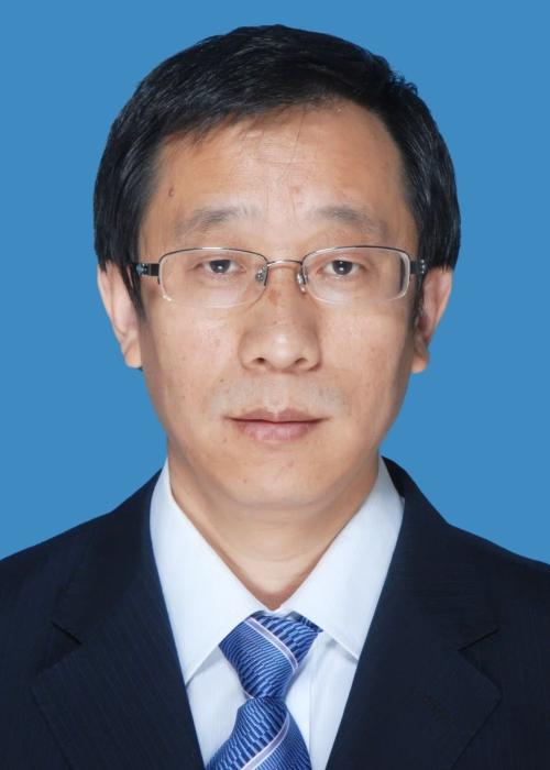 Jianjun Wu (吴建军)合作论文数School of Economics and Management, Dalian University of Technology3LIU Jian-feng合作论文数3
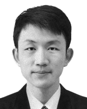 Tianwei Lu合作论文数Beijing Normal Univ, Coll Global Change & Earth Syst Sci, Beijing 100875, Peoples R China3Zhan LIN (林湛)合作论文数3XingQiang Lin (林兴强)合作论文数3Jiuran He (何九冉)合作论文数3Kun Zhi合作论文数2yanan miao合作论文数2shiguang zhu (朱士光)合作论文数2sajad shiravi合作论文数2
 Zhong Li合作论文数Fernuniv, Fac Math & Comp Sci, D-58084 Hagen, Germany2
 Ben Y. Zhao合作论文数SAND Lab, University of Chicago;Department of Computer Science, University of Chicago2吴建军合作论文数国家重点实验室2
 Baohua Mao (毛保华)合作论文数School of Traffic and Transportation, Beijing Jiaotong University2
 Zhengbing He合作论文数2
 Tianliang Liu (刘天亮)合作论文数School of Economics and Management, Beihang University2
 Liping Fu合作论文数Department of Civil and Environmental Engineering, University of Waterloo2
 Zhuangzhi Sun (孙壮志)合作论文数北京市交通委员会路政局2Mei Huan (环梅)合作论文数2Dongchi Yang (杨东赤)合作论文数2Xuanchuan Zheng (郑宣传)合作论文数Beijing Urban Construction Design & Development Group Co., Limited2
 JianFeng Liu (刘剑锋)合作论文数北京城建设计发展集团股份有限公司2
 Yang Gu合作论文数2
 Huijun Sun (孙慧君)合作论文数College of Pharmacy, Dalian Medical University2
 Meng Xu (徐猛)合作论文数State Key Laboratory of Rail Traffic Control and Safety, School of Traffic and Transportation, Beijing Jiaotong University2
 Haozhi Zhang合作论文数2Weiting Pan合作论文数1
 José Fernando Mendes合作论文数Department of Physics, University of Aveiro1Kai Zhang合作论文数1Di Liu合作论文数1Bushi Liu合作论文数1Xing-shui ZU (祖兴水)合作论文数1LIU Xin-hua合作论文数1Song Yifan (宋一凡)合作论文数1
 Dongdong Song合作论文数1




