This paper investigates the formation-containment control problem for PDE-based multi-agent systems under input delays and spatial information decay. A novel three-layer hierarchical control framework is proposed, with particular emphasis on stabilizing the α -leader–a key agent subject to delayed control inputs. An integral-type delay compensation law is constructed using kernel functions derived from backstepping transformations and equivalence principles. The leader dynamics are governed by a reaction–diffusion–advection partial differential equation (PDE). Rigorous theoretical results establish the boundedness, invertibility, and exponential stability of the closed-loop error system. Numerical simulations validate the effectiveness of the proposed strategy, demonstrating accurate convergence to the desired encirclement formation under dual damping boundary conditions and time-delay effects. The findings offer valuable insights into the design of robust and scalable formation control strategies for spatially distributed multi-agent systems operating under realistic constraints.
To enhance the aerodynamic parameter identification capabilities of morphing air-craft under complex flight conditions, this paper proposes a modeling method based on Physics-Informed Neural Networks (PINNs). By embedding physical constraint equations derived from aircraft dynamics into the loss function of the neural networks, the approach combines data-driven learning with prior physical knowledge, enabling efficient identification related parameter of aerodynamic forces and moments. The framework integrates both Computational Fluid Dynamics (CFD) data and flight simulation data to construct a unified model applicable to various flight configurations. This method ensures physical consistency and strong generalization ability, maintaining high modeling accuracy even under limited data conditions. Compared with traditional empirical or purely data-driven models, the proposed approach significantly reduces the dependence on large-scale experimental data and improves interpretability.
Deep learning-based object detection is essential for aerial surveillance systems, yet it remains critically vulnerable to adversarial attacks. While adversarial patches can conceal objects, current attack methods often lack consistent effectiveness across varying object scales, which poses a fundamental limitation for their robustness in practical aerial scenarios. To address this challenge, we propose the Vanishing-Truth Attack, a novel adversarial patch framework that specifically optimizes a single patch to remain effective across continuous scale changes. Our approach integrates a geometry-aware adaptive scaling (GAAS) mechanism with a tailored objective function, enabling robust dynamic adaptation without requiring multiple patch instances. We evaluate our method on three anchor-based YOLO detectors: YOLOv3, YOLOv5s, and YOLOv5l. Experiments on the challenging multiscale MAR20 dataset demonstrate that our attack achieves a high success rate in concealing objects across all three models, outperforming the compared baseline methods. This work highlights a critical vulnerability in AI perception and provides foundational insights for developing more robust and certifiably secure AI systems.
Most adversarial attack methods achieve high success rates under the white-box setting. However, these methods often lack transferability when targeting other deep neural network (DNN) models. Momentum-based attacks have emerged as an effective strategy to enhance transferability by incorporating a momentum term to stabilize update directions. While simple constant-momentum methods (e.g., MI-FGSM) or advanced variants (e.g., NI-FGSM, VMI-FGSM) have shown promise, they either use a single momentum decay factor or introduce significant computational overhead. To address this, we propose a novel plug-and-play momentum aggregation framework named AggMo-Attack. Our key insight is that a single momentum term with a fixed decay factor cannot optimally capture the multi-scale temporal correlations in gradients during adversarial optimization. Inspired by the Aggregated Momentum (AggMo) optimizer, we designed a multi-momentum aggregation module that maintains and weightedly combines multiple velocity vectors with different decay factors. This framework can be seamlessly integrated into existing momentum-based attack methods (e.g., MI-FGSM, NI-FGSM, VMI-FGSM) as a drop-in replacement for their standard momentum update step. Extensive experiments demonstrate that integrating our AggMo module significantly improves adversarial transferability. Our work provides a versatile and effective tool for enhancing momentum-based adversarial attacks and opens a new direction for designing adaptive attack strategies.
In recent years, the technology for autonomous exploration by UAVs has developed rapidly, leading to the emergence of various methods. However, most of these methods assume drift-free localization, which is impossible to achieve in real environments. This results in poor map reconstruction quality and can even affect the safety of UAV flight. In this work, we propose a systematic exploration and loop closure planning framework that ensures exploration efficiency while minimizing the impact of localization drift, thereby achieving better map reconstruction results. We propose a loop closure strategy based on deep reinforcement learning, which can actively perform loop closures to correct localization errors in cases of severe drift, ensuring both mapping quality and flight safety. Extensive experiments in simulations have demonstrated the effectiveness of the proposed system and strategy.
In recent years, the UAV has become a convenient platform to obtain multiangle reflectance observations and study bi-directional reflectance distribution function (BRDF) characteristics at a higher spatial resolution than satellite. However, only a few vegetation types were concerned in previous studies, leading to a lack of BRDF knowledge for various objects and preventing further recognition application. In this study, UAV-based multiangle observations were collected for six typical natural and artificial targets including larch forest, grass, artificial turf, asphalt road, cement hut, and model plane. First, fitting accuracy of directional reflectance was calculated, and then we analyzed the variance patterns of spectral and anisotropic indices along with spatial resolutions (i.e., 1-100 m). The results show that: 1) The RTLSR_C kernel-driven model is still applicable for UAV with fitting RMSEs of reflectance less than 0.05, showing multiscale adaptability for both UAV and satellite; 2) for grass and artificial turf, the normalized difference vegetation index (NDVI) decreases as spatial resolution increases, and a significant change with view zenith angle can be observed with the minimum at the hotspot; 3) The anisotropic flat index (AFX) varies with ground types, light, shadows, and sample spatial homogeneity. Notably, there is a sudden change in AFX for larch forest at 5 m near canopy width. Similar NDVI and AFX values are found between grass and artificial turf. This study further reveals BRDF patterns for new target types at varying spatial scales, providing evidence for the applicability of the kernel-driven model at high spatial resolution and target camouflage.
In this paper, we consider a position estimation problem for an unmanned aerial vehicle (UAV) equipped with both proprioceptive sensors, i.e. IMU, and exteroceptive sensors, i.e. GPS and a barometer. We propose a data-driven position estimation approach based on a robust estimator which takes into account that the UAV model is affected by uncertainties and thus it belongs to an ambiguity set. We propose an approach to learn this ambiguity set from the data.
Considering the simplicity of flight route planning, orthorectified images obtained from nadir observations are widely used in remote sensing. However, they are always insufficient to represent the anisotropic reflectance and three-dimensional (3D) structural information of objects. Therefore, multi-angle observation information can enhance target information and potentially improve the accuracy of target classification and recognition. In this study, we investigated the potential of anisotropic reflectance information in land cover classification. By employing the DJI P4M multispectral observation system, multi-angle multi-spectral reflectance images for five land cover types were captured at bare soil, concrete roads, grassland, apricot tree, and red broom cypress areas. Subsequently, the AFX-based BRDF archetypes model and the kernel-driven model were used to reconstruct the bidirectional reflectance distribution function (BRDF). Finally, land cover classification was performed using three types of machine learning algorithm considering different BRDF features and band combinations. The results indicate that, compared to nadir directional reflectance, multi-angle feature sets can improve the overall classification accuracy up to 24%. Compared to using single-band information, band combinations can also improve that up to 54%. The overall accuracy using the feature set of kernel-driven model parameters and nadir reflectance was also enhanced significantly, which can reach 86% using green-red-near infrared band combinations. This work demonstrates the contribution of multi-angle multi-spectral information to natural and artificial land cover classification.
Inconsistency in the structural strengths of a membrane wing under positive and negative loads has undesirable impacts on the aeroelastic deflections of the wing, which results in more significant flight control system modeling errors and worsens the performance of the aircraft. In this paper, an integrated dynamic model is derived for a membrane-wing aircraft based on the structural dynamics equation of the membrane wing and the flight dynamics equation of the traditional fixed wing. Based on state feedback control theory, an autopilot system is designed to unify the flight and control properties of different flight and wing deformation statuses. The system uses models of different operating regions to estimate the dynamic response of the vehicle and compares the estimation results with the sensor signals. Based on the compared results, the autopilot can identify the overall flight and select the correct operating region for the control system. By switching to the operating region with the minimum modeling error, the autopilot system maintains good flight performance while flying in turbulence. According to the simulation results, compared with traditional rigid aircraft autopilots, the proposed autopilot can reduce the absolute maximum attack angles by nearly 27% and the absolute maximum wingtip twist angles by nearly 25% under gust conditions. This enhanced robustness and stability performance demonstrates the autopilot’s significant potential for practical deployment in micro-aerial vehicles, particularly in applications demanding reliable operation under turbulent conditions, such as military surveillance, environmental monitoring, precision agriculture, or infrastructure inspection.
In the cooperative search for dynamic targets by multiple UAVs, target uncertainty and system complexity pose significant challenges to cooperative decision-making. Multi-agent reinforcement learning (MARL) technology can be used for cooperative policy optimization, but it suffers from convergence difficulties and low policy quality in reward-sparse environments such as dynamic target search. To address this issue, this paper proposes a Multi-Potential-Field Fusion Reward Shaping MAPPO (MPRS-MAPPO) algorithm. First, three potential field functions are constructed for reward shaping: probability edge potential field, maximum probability potential field, and coverage probability sum potential field. Subsequently, an adaptive fusion weight mechanism is proposed to adjust fusion weights based on the correlation between potential field values and advantage values. Furthermore, a warm-up phase is introduced to improve training stability. Extensive experiments, including multi-scale and physical tests, demonstrate that MPRS-MAPPO significantly improves convergence speed, detection rate, and stability compared with MAPPO, MASAC, QMIX, and Scanline. Detection rates increased by 7.87–29.76%, and training uncertainty decreased by 7.43–56.36%, validating the algorithm’s robustness, scalability, and real-world applicability.
Considering the simplicity of flight route planning, orthorectified images obtained from nadir observations are widely used in remote sensing. However, they are always insufficient to represent the anisotropic reflectance and 3-D structural information of objects. Therefore, multiangle observation information can enhance target information and potentially improve the accuracy of target classification and recognition. In this study, we investigated the potential of anisotropic reflectance information in land cover classification. By employing the DJI P4M multispectral observation system, multiangle multispectral reflectance images for five land cover types were captured at bare soil, concrete roads, grassland, apricot tree, and red broom cypress areas. Subsequently, the anisotropic flat index (AFX)-based bidirectional reflectance distribution function (BRDF) archetypes model and the kernel-driven model were used to reconstruct the BRDF. Finally, land cover classification was performed using three types of machine learning algorithm considering different BRDF features and band combinations. The results indicate that, compared to nadir directional reflectance, multiangle feature sets can improve the overall classification accuracy up to 24%. Compared to using single-band information, band combinations can also improve that up to 54%. The overall accuracy using the feature set of kernel-driven model parameters and nadir reflectance was also enhanced significantly, which can reach 86% using green-red-near infrared band combinations. This work demonstrates the contribution of multiangle multispectral information to natural and artificial land cover classification.
To address the issue of acquiring the desired relative position information between individual unmanned aerial vehicle and target in multi-unmanned aerial vehicle (UAV) system circumnavigation, this paper designs a distributed control law under chain communication topology based on the partial differential equation (PDE) model. Through the discrete form of PDE, the non-endpoint drones only require the state information of neighboring drones without the need for self and target relative position information. Additionally, a Kalman filter is designed to estimate the absolute position of the target, eliminating the impact of communication delay and noise on target information transmission. Finally, numerical simulations verify the correctness and fleet performance of the designed control law. This paper explores a distributed solution without global information for multi-unmanned aerial vehicle system circumnavigation, which has theoretical and application value.
The camouflaged object segmentation model (COSM) has recently gained substantial attention due to its remarkable ability to detect camouflaged objects. Nevertheless, deep vision models are widely acknowledged to be susceptible to adversarial examples, which can mislead models, causing them to make incorrect predictions through imperceptible perturbations. The vulnerability to adversarial attacks raises significant concerns when deploying COSM in security-sensitive applications. Consequently, it is crucial to determine whether the foundational vision model COSM is also susceptible to such attacks. To our knowledge, our work represents the first exploration of strategies for targeting COSM with adversarial examples in the digital world. With the primary objective of reversing the predictions for both masked objects and backgrounds, we explore the adversarial robustness of COSM in full white-box and black-box settings. In addition to the primary objective of reversing the predictions for masked objects and backgrounds, our investigation reveals the potential to generate any desired mask through adversarial attacks. The experimental results indicate that COSM demonstrates weak robustness, rendering it vulnerable to adversarial example attacks. In the realm of COS, the projected gradient descent (PGD) attack method exhibits superior attack capabilities compared to the fast gradient sign (FGSM) method in both white-box and black-box settings. These findings reduce the security risks in the application of COSM and pave the way for multiple applications of COSM.
Attacking mobile and intelligent target is a challenging problem for interceptor missile because of the classical guidance law of missile will lead to large miss distances. Unlike traditional guidance law, this paper proposes a game guidance law method based on model predictive control theory in order to improve the interception effect of intercepting missile striking unknown maneuvering penetration target. Firstly, the pursuit-evasion game model of missile and target is constructed in a two-dimensional plane, and the payoff function is constructed based on the terminal miss distance and control energy consumption. The Nash equilibrium solution of the pursuit-evasion game model is solved by using the model predictive control method, and the corresponding optimal strategies of missile and target during the attacking process are obtained. At last, a two-dimensional simulation is carried to validate the theoretical analysis. The result shows that the game guidance law proposed in this paper is more effective than traditional guidance law.
This paper presents a three-layer hierarchical formation-containment control framework based on partial differential equations (PDEs). The framework is specifically designed to stabilize and deploy a formation of agents, with a special focus on the leading agent, termed the α-leader. The α-leader employs an integral-type delayed compensation input control to ensure the stability and coordination of the entire formation. The hierarchical structure organizes formation leaders into a one-dimensional chain-like topology, categorizing them as formation leader agents, anchor agents, and α-leader agents based on their roles and positions. Using the proposed algorithm, a two-dimensional surface boundary formation is achieved. Within this structure, follower agents use consensus control under a fixed topology, converging to the convex hull formed by the leader agents and thus creating an internal two-dimensional surface. A significant contribution of this work is the derivation of a distributed control law for the formation leaders from the discrete form of the PDEs that govern the deployment of the formation. Additionally, the α-leader’s control input is enhanced by an integral-type delayed compensation mechanism, designed using a kernel function derived through backstepping and system equivalence principles. The paper also addresses the numerical solution of the kernel function, providing an approximate estimation of the PDE model and offering a distributional interpretation of the kernel function solution. Finally, simulation examples are presented to validate the theoretical findings, demonstrating the efficacy and robustness of the proposed framework.
Formation-containment control in multi-agent systems faces a critical challenge: how to stabilize all formation leaders when the $\alpha -$ leader’s influence diminishes over topology distance, especially under input delays? This challenge is particularly acute in PDE-based models, where information decay is intrinsic, making it difficult for the $\alpha -$ leader—a leader among leaders—to affect far-away agents, especially under speed constraints.Our work tackles this challenge by proposing a three-layer hierarchical control framework based on Partial Differential Equations (PDEs). Our key innovation is an integral-type delayed compensation input specifically designed for the $\alpha -$ leader. This control law uses kernel functions derived from backstepping transformation and equivalence principles, tailored to compensate for input delays. By providing the $L^{2}$ space expansion of these kernel functions, we show that formation control error for finite agents is acceptable, even with approximations.We organize formation leaders into a one-dimensional chain-like topology, categorizing them as leaders, anchors, or $\alpha -$ leaders based on their roles. For other agents, we derive distributed control laws from the discrete form of PDEs governing formation deployment. Followers converge to the convex hull spanned by leaders, forming an internal two-dimensional surface. This PDE-based approach ensures invariance in translation, rotation, and expansion.Our work also contributes to the mathematical foundations of PDE-based multi-agent systems. We discuss the numerical solution of kernel functions, offer a distributional interpretation, and—critically—analyze the discretization error between PDE and ODE models. This analysis reveals the relationship between stability, time step, spatial step, and control laws, addressing an often-ignored issue in the field.Simulation examples validate our theoretical findings, showing effective formation-containment control under our framework.
To address the challenges of reduced localization accuracy and incomplete map construction demonstrated using classical semantic simultaneous localization and mapping (SLAM) algorithms in dynamic environments, this study introduces a dynamic scene SLAM technique that builds upon direct sparse odometry (DSO) and incorporates instance segmentation and video completion algorithms. While prioritizing the algorithm’s real-time performance, we leverage the rapid matching capabilities of Direct Sparse Odometry (DSO) to link identical dynamic objects in consecutive frames. This association is achieved through merging semantic and geometric data, thereby enhancing the matching accuracy during image tracking through the inclusion of semantic probability. Furthermore, we incorporate a loop closure module based on video inpainting algorithms into our mapping thread. This allows our algorithm to rely on the completed static background for loop closure detection, further enhancing the localization accuracy of our algorithm. The efficacy of this approach is validated using the TUM and KITTI public datasets and the unmanned platform experiment. Experimental results show that, in various dynamic scenes, our method achieves an improvement exceeding 85% in terms of localization accuracy compared with the DSO system.
This paper investigates the formation‐containment problem for a multiagent system, where the agents are classified into containment followers, formation leaders, anchor leader, and ‐leader. The ‐leader stabilizes formation leaders to desired formation deployment, while formation leaders adopt local state feedback distributed control law without desired formation position and the anchor leader fixes to its desired position. The containment followers adopted consensus distributed control law and converge to the convex hull spanned by the leader agents. Formation leaders' distributed control law parameters are proposed based on the discrete form of the desired partial differential equation (PDE) formation deployment, which is stabilized by the ‐leader agent and transited by communication topology. Based on its neighbor leader agent's delay state, ‐leader control law designed an integral‐type delay‐compensated control law by the backstepping method and the equivalence principle. In order to prove the rightness and existence of delay‐compensated control law, the well‐posedness of kernel functions are given by semigroup perturbation theory and solutions in the sense of distribution. Finally, a simulation example is given to verify the theoretical results.
The intrinsic similarity between camouflaged objects and background environment impedes the automatic detection/segmentation of camouflaged objects, and novel network architectures for deep learning are promising to overcome this challenge and improve detection accuracy. However, these existing network architectures for distinguishing between camouflaged objects and their backgrounds do not account for the constraint of detection speed, which results in high computational complexity and the inability to meet the requirements of rapid detection. Therefore, based on the human visual system, this study proposes a single-stage lightweight camouflage object detection network using multilevel feature fusion, integrating features of various feature layers and receptive field sizes. Using three benchmark datasets for normal camouflaged objects, the lightweight network (LINet) model demonstrated an accuracy superior to those of six existing mainstream camouflaged object detection methods. Its detection speed, 126.3 frames per second, is significantly higher than those of the existing mainstream methods, enabling rapid detection with a maximum increase of 187.62%. The accuracy of LINet is the minimum and maximum for Resnet101 and Resnet152, respectively. These findings pave the way for diverse applications of camouflaged target detection algorithms.
In this paper, we present a low-bandwidth centralized collaborative direct monocular SLAM (LCCD-SLAM) for multi-robot systems collaborative mapping. Each agent runs the direct method-based visual odometry (VO) independently, giving the algorithm the advantages of semi-dense point cloud reconstruction and robustness in the featureless regions. The agent sends the server mature keyframes marginalized from the sliding window, which greatly reduces the bandwidth requirement. In the server, we adopt the point selection strategy of LDSO, use the Bag of Words (BoW) model to detect the loop closure candidate frames, and effectively reduce the accumulative drift of global rotation, translation and scale through pose graph optimization. Map matching is responsible for detecting trajectory overlap between agents and merging the two overlapping submaps into a new map. The proposed approach is evaluated on publicly available datasets and real-world experiments, which demonstrates its ability to perform collaborative point cloud mapping in a multi-agent system.
 fan ningjun合作论文数25
 Yanxuan Wu (吴炎烜)合作论文数School of Mechatronics Engineering, Beijing Institute of Technology18
 Shijun Guo合作论文数Cranfield University11TianQiao Zhang (张天桥)合作论文数9Quanpan Liu合作论文数8Hongbao DU (杜宏宝)合作论文数8Qiaoyi Li合作论文数7
 Wei Li (李炜)合作论文数School of Aeronautics and Astronautics, Sichuan University7Zhide ZHANG (张之得)合作论文数6Huan Wang合作论文数6ChunXia Tong (童春霞)合作论文数5
 Yue Wang (王玥)合作论文数School of Mechatronics Engineering, Beijing Institute of Technology4Haozhe Cao合作论文数3Ji-hong LI (李霁红)合作论文数3Feng Zhou合作论文数3Wenming Dong合作论文数3Guohui WU (武国辉)合作论文数3
 Xiaoning Zhang (张小宁)合作论文数清华大学医学院3Zhe Yang合作论文数3
 Shuo Zhang (张硕)合作论文数School of Mechanical Engineering, Beijing Institute of Technology3
 Ziti Jiao (焦子锑)合作论文数Faculty of Geographical Science, Beijing Normal University3Josephine Plested合作论文数2Yang Yu合作论文数2Chen Yang合作论文数2Jiantong Liu合作论文数2Xutan Lu (陆胥坛)合作论文数2
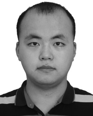 Hao Chen合作论文数2
 Yue Yao (姚越)合作论文数School of Airspace Science and Engineering, Shandong University2
 Jin Yu合作论文数2Weilin Huang (黄伟林)合作论文数2
 Yulong Gao合作论文数2Yuchi Liu合作论文数2Yang Chen (陈洋)合作论文数2
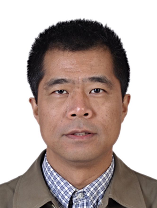 Jie Li (李杰)合作论文数School of Mechatronics Engineering, Beijing Institute of Technology;Intelligent Unmanned System Group, Beijing Institute of Technology2Jing Lu合作论文数2Chen Fan (范晨)合作论文数2Jia-yuan SHAN (单家元)合作论文数1Xiaolong Zhu合作论文数1Zhijun Liu合作论文数1Si-cheng RAO (饶思成)合作论文数1Di Zhang合作论文数1Yang Wang合作论文数1YinDi Sun (孙银娣)合作论文数1Rui Long (龙锐)合作论文数1




