Achieving real-time indoor 3D reconstruction using low-cost devices in GNSS-denied environments is highly valuable for applications such as indoor navigation, indoor spatial measurement, and augmented reality guidance. However, vision–IMU-based real-time indoor 3D reconstruction inevitably involves repeated scanning of the same scene regions. When pose inconsistency exists among repeated observations, the same structures may be incorrectly fused into different locations, leading to artifacts such as surface layering and ghosting, which are further amplified by accumulated estimation errors. These artifacts are not caused by errors in a single module, but are closely related to pose estimation, topological relationships, and reconstruction error propagation, which severely degrade the geometric reliability, measurability, and task usability of indoor maps. To address these issues, this paper proposes an end-to-end real-time 3D reconstruction framework that reduces artifacts from three aspects: encoder enhancement, structural relationship constraints, and adaptive reconstruction. Specifically, IMU measurements are encoded into tokens and injected into a Vision Transformer to improve pose estimation accuracy. Then, a Fiedler-vector-based topological region partitioning strategy is introduced to incorporate global scene connectivity into the end-to-end pipeline, thereby limiting artifact propagation across different regions. Finally, each segmented region is reconstructed through adaptive neural point-cloud reconstruction and global optimization to further improve local geometric consistency. Extensive quantitative, qualitative, and ablation experiments are conducted on multiple self-collected and public datasets, together with a comprehensive comparison against existing state-of-the-art vision-based end-to-end and 3DGS-based indoor reconstruction methods. The experimental results demonstrate that the proposed method achieves clear advantages in artifact suppression, geometric accuracy, reconstruction quality, and real-time performance. This method provides a new solution for improving the reliability and practical usability of real-time indoor 3D reconstruction in GNSS-denied environments. The source code and supplementary data are available at: https://github.com/starlingonearth/end-to-end-artifact-suppression-real-time-3d-reconstruction.
Cities and social systems are undergoing fundamental transformations driven by digitalization, as technology interacts with and integrates into traditional urban social processes in complex ways, significantly reshaping spatial structures. While prior research has yielded valuable theoretical insights and case studies, a broadly comparable and replicable research paradigm remains elusive. This gap underscores the need to explore and construct an effective framework that connects historical and contemporary research streams to promote the systematic development of the field. This study addresses this gap by reporting relevant knowledge through quantitative and qualitative analyses and integrating a complex network theoretical framework. The results indicate that 2022 marked a research inflection point; 50% of studies are concentrated in two countries; urban studies journals are the primary contributors; and 76% of the research supports the technology embedding perspective. Based on these findings, this study explores the "space-element-structure" systemic composition of urban spatial structures in the digital era. It further constructs a research roadmap centered on four dimensions-"node-link-network-dynamic"-and proposes key future research topics and directions. This study aims to provide systematic knowledge and establish a foundational framework and pathway for emerging research needs, thereby advancing the field toward a data- and model-driven research paradigm.
3D building models play a critical role in smart cities and strongly support applications in urban planning, augmented reality and urban event simulation. Urban scale city modelling with City Geography Markup Language (CityGML) LOD2 building models have been constructed in over several developed cities due to their significant role and relatively high cost. However, existing single-building reconstruction methods for LOD2 models are unsatisfactory in preserving roof details, and large-scale 3D building reconstruction still requires extensive manual editing. This paper proposes a fully automated framework for generating CityGML LOD2 building models with preferred roof details from photogrammetric point clouds from aerial oblique images, aiming to address two key challenges: (1) difficulties in LOD2 building model generation caused by missing facade photogrammetric point clouds, and (2) insufficient fidelity of building roof details. Based on the observation that buildings have typical “roof-vertical walls-ground” structures, this paper infers facade areas by height maps generated from roof point clouds. Besides, the Hypothesis-Selection-Based (HSB) polygon surface reconstruction frameworks are extended by introducing a novel voxel depth index to measure the importance of each candidate planar unit in preserving roof details. Experimental comparison with existing HSB methods and deep-learning-based methods revealed that the reconstruction of proposed methods achieves the best geometry accuracy in Root Mean Squared Error (RMSE) ranging from 0.157m to 0.660m, and also achieves the best model coverage that is between 75.14
Visual-Linguistic large models (V-LLMs) have demonstrated strong semantic understanding capabilities in understanding visual open-world scenes. However, there is limited research on how to effectively integrate these models with traditional deep learning networks for classify and segment 3D point clouds. This paper explores the joint training mechanisms of V-VLLMs and Convolutional Neural Networks (CNNs), constructing a pluggable module that enhances 3D object classification and component segmentation using 2D images, 3D point clouds, and language descriptions. The idea of this pluggable module is to employ contrastive learning between the generalized features extracted by large models from text and image features extracted by the CNN to enhance the robustness and understanding accuracy of the original CNN-based point cloud network. For experiments, we validated the effectiveness and accuracy of the proposed pluggable module using multiple point cloud classification frameworks, based on datasets such as ModelNet40, ScanObjectNN, and ShapeNetCore. The experimental results demonstrate that the multimodal contrastive learning pluggable module significantly enhances performance across various deep learning frameworks, resulting in significant enhancements in classification and segmentation precision. Additionally, for the multiscale feature PointNet++ framework, the proposed multiscale contrastive learning mechanism provides further performance gains. The Code is available at .
Based on methods such as airborne oblique photogrammetry and laser scanning, high-precision urban 3D point clouds can be obtained. However, existing airborne 3D data acquisition techniques are prone to interference from dense building occlusions or vegetation cover, making it difficult to capture complete building point clouds. To address this issue, this paper proposes a sky-ground cross-perspective collaborative method for building point cloud completeness detection and autonomous completion. The core idea of this method is to use aerial point clouds as a basis, conducting completeness detection of airborne building point clouds to identify missing regions in both point and surface forms. Subsequently, aerial point cloud priors are employed to guide global and local route planning for ground platforms. Finally, an autonomous completion of building point clouds is achieved through a multi-objective TARE exploration method. The proposed method is evaluated through experiments conducted in both simulation and real-world scenarios. Effectiveness analysis is performed from the perspectives of point cloud completeness and building model reconstruction accuracy. The results show that the proposed sky-ground cross-perspective collaborative point cloud completion method can acquire building point clouds with higher completeness and significantly improve the modeling accuracy of building point clouds.
The under-canopy environment, which is inherently inaccessible to humans, necessitates the use of unmanned aerial vehicles (UAVs) for data collection. The implementation of UAV autonomous navigation in such environments faces challenges, including dense obstacles, GNSS signal interference, and varying lighting conditions. This paper introduces a UAV autonomous navigation method specifically designed for under-canopy environments. Initially, image enhancement techniques are integrated with neural network-based visual feature extraction. Subsequently, employs a high-dimensional error-state optimizer coupled with a low-dimensional height filter to achieve high-precision localization of the UAV in under-canopy environments. Furthermore, proposes a boundary sampling autonomous exploration algorithm and an advanced Rapidly exploring Random Tree (RRT) path planning algorithm. The objective is to enhance the reliability and safety of UAV operations beneath the forest canopy, thereby establishing a technical foundation for surveying vertically stratified natural resources.
In this paper, we consider the problem of joint state estimation and topology inference for a class of graphical dynamical systems, where the graph topology matrix is involved in the dynamical systems. A non-convex objective function, containing an equality constraint on the row sum of the topology matrix, is established with respect to the state and the topology, in which the estimated node states and observations at the historical time steps are used to infer the graph topology, and a regularization term is designed to enhance the sparsity of the graph topology. Then, the state estimation and topology inference are obtained by solving two convex subproblems in manner of using the Kalman filtering and the alternating direction method of multipliers (ADMM) algorithms, respectively. Specially, by separating the non-differentiable regularization term and utilizing a proximity operator, we derive an iterative solution with high computational efficiency to infer the graph topology in the ADMM algorithm. To verify the effectiveness of the proposed algorithm, simulation with a car-following model is carried out.
Spatial analysis, a cornerstone of urban research, has been widely recognized for its contributions to urban governance, environmental protection, and spatial planning. The advent of artificial intelligence is revitalizing urban spatial research. Research on the integration of AI technology and urban spatial research is emerging, and research reviews have been conducted in many application areas; there is still a need to provide a comprehensive knowledge and identify trends from a technological perspective. This paper addressed this gap by constructing a methodological framework that integrates bibliometrics and qualitative technical review. It systematically mapped the existing knowledge, reviewed current research themes, and analyzed patterns in AI-driven spatial analysis. Then, we further identified the development potential of various research themes and suggested future research directions. This study provides insights into the intersection of AI and urban spatial analysis, aiming to inform the development of related theories, methodological models, and applications.
As urban redevelopment becomes an essential instrument for further urban development, the spatial outcomes of these redevelopment activities exert an increasingly profound impact on urban development. Unlike past state-dominated urban redevelopment, current market-oriented redevelopment activities are becoming more active, while the government continues to play an important role through various forms of intervention. To optimise the development of urban space, a comprehensive understanding of the effect of government interventions on the spatial variations of market-oriented redevelopment activities is required. Against the background of Shenzhen's market-oriented urban village redevelopment, this study formulated a theoretical framework to identify the core government interventions in terms of urban planning, development intensity control, and decentralisation, and then analysed how they affect the market-oriented redevelopment activities from a spatial perspective. Ordinary least squares regression and geographically weighted regression models were employed to conduct an empirical analysis to measure the specific impact of diverse government interventions. The results show that the planned transport routes, public facilities, and density zones can effectively guide the urban village redevelopment projects towards the future core development areas of a city. The introduction and implementation of Shenzhen's decentralisation of urban redevelopment have promoted urban village redevelopment and have resulted in significant differences in redevelopment activities dominated by market forces across administrative districts. It provides practical implications for implementing proper government interventions for the sustainable spatial development of redevelopment activities.
Trees are an important part of the cityscape,and 3D models of trees are indispensable for real-time 3D design,construction of vir-tual geographic environments,and construction of digital twin cities.Current 3D models of trees are reconstructed based on images or model libraries.The former show cluttered triangular network clusters,and the latter are vastly different from the real situation in terms of geomet-ric expression and realism,which makes directly using the reconstructed tree models in the practical applications of smart cities difficult.Therefore,in this paper,a bionic reconstruction method for 3D tree models is proposed based on high-precision laser scanning point cloud data for building realistic scenes in virtual geographic environments,which enables the automated reconstruction of 3D tree models at mul-tiple levels of detail while preserving morphological features. First,a skeleton-based parametric tree model reconstruction method that extracts branch geometry by generalized cylinder fitting and extracts the trunk,main branches,models of fine branches,and crown elements in a hierarchical manner according to the growth parameters of the tree is proposed.Second,the refinement requirements of modeling distinct parts of trees are considered,and a refined tree geometry reconstruction method by integrating the conformal Poisson network and parametric fitting is presented.Finally,the texture mapping method is applied to map the texture of multilevel tree branches automatically to achieve a detailed 3D reconstruction of tree models by considering the texture extension of the tree structure.Based on the laser point cloud acquired with a backpack or station,this method can produce a re-fined 3D tree model with high accuracy of morphological features. The overall geometric error of the model is better than 10 cm,and the geometric error of the trunk model is better than 3 cm.Under the same data conditions,the method has the highest degree of reproduction of 3D tree morphology and real texture compared with various mainstream tree modeling methods.Based on the results of this paper,the method can further advance the extraction of tree structure infor-mation and the calculation of 3D green volume for the realistic 3D China and national strategies such as green low-carbon development,which have great practical value. This paper proposes a 3D bionic reconstruction method for constructing high-fidelity scenes in virtual geographic environments to achieve highly accurate geometric reconstruction and texture mapping of individual tree roots,trunks,branches,and leaves.The core of the method is to consider the requirements of distinct parts of the tree reconstruction at multiple levels of detail and integrate Poisson mesh and parameter fitting to complete the 3D reconstruction of the tree with high accuracy.The experimental results show the proposed tree 3D re-construction method provides a highly accurate reconstruction of the tree geometry and texture.The research results are used for the accurate extraction of tree parameters,which can provide an important basis for tree structure information extraction,3D green volume calculation,and realistic modeling and simulation of virtual geographic environments.
The spatial structure inherently reflects a region's pattern and developmental processes. Understanding the rationality behind this structure and identifying optimization directions are pivotal for macro-level regulation of regional development and collaborative efforts. This study initiates a discussion on the composition and optimization mechanisms inherent in spatial structures. Adopting a spatial network perspective, we interpret the interaction dynamics within regional morphological structures as the consumption of resources through flows. We transform structural optimization into an equilibrium matching process of resources and establish a quantitative research framework that integrates network modeling, structural issue identification, and optimization strategies. Then, we selected the Guangdong-Hong Kong-Macao Greater Bay Area as our empirical subject, and obtained three important results: (1) Before optimization, we identified structural spatial imbalance characteristics; (2) We explored the evolutionary trend of optimization and delineated four main optimization stages; (3) The spatial structure of the region was improved, and significant benefits in equilibrium and resource utilization was achieved. Finally, we discussed the feasibility of the framework and the necessity to integrate policy networks, hoping to assist regional managers in macro-governance and enhance the rationality of regional planning and coordination.
Understanding the economic impact of COVID-19 is the foundation for formulating targeted policies promoting economic recovery. This study uses panel data of the county economy in the Guangdong–Hong Kong–Macao Greater Bay Area (GBA) from 2017 to 2022. Firstly, the evolution characteristics of the economic structure in the GBA were analyzed using the standard deviation ellipse, geographical concentration, and spatial autocorrelation methods. Then, we revealed the changes in various economic indicators. Finally, a spatial Durbin model was constructed to study the factors affecting economic growth and spatial spillover effects in different periods. The results reveal that the economic distribution in the GBA presents a “core–edge” structure. The FDI, consumption, and exports of the Greater Bay Area fluctuate greatly, while investment growth is relatively stable. There is a significant spatial spillover effect in the county economy of the GBA. Investment, consumption, exports, labor, and innovation all have significant positive effects on economic growth, with investment having the greatest impact, while FDI has a significant negative impact. The impact of COVID-19 on the economy of the GBA is mainly reflected in the weakening of spatial spillovers, the strengthening of economic agglomeration, the decline in factor growth, and the change in the driving effect of factors on the economy. These findings can provide a reference for formulating targeted economic development policies.
The development and governance of modern cities have gradually broken through the boundaries of administrative units. In recent times, with intercity ecological space becoming the focus of a series of development and conservation actions, identifying the intercity ecological synergy regions (maintaining connectivity within the ecological space to ensure the continuity of species migration and landscape) and realizing its collaborative governance has become extremely important to maintain sustainable regional development. Cross-border ecological governance involves many actors and forms a complex relationship network. At present, there are few quantitative evaluation methods for this problem, which limits our ability to manage the ecological space between cities. This paper uses the network method to establish and analyze the related ecological and policy networks in Shenzhen. The study results show that the ecological synergy regions are locally concentrated along the fringes of Shenzhen City, and the links between different levels of actors in the policy network are relatively weak. The action objects of ecological governance designated by different cities form convergence or divergence patterns, making it challenging to organize spatially integrated actions among different cities. Finally, suggestions for structural optimization are proposed concerning the policy network associated with the ecological synergy regions from the aspects of spatial implementation pathways and planning strategies.
With the rapid development of autonomous driving and SLAM technology, the perception system of a vehicle heavily relies on laser and image sensors to capture the real-world scenario and avoid obstacles autonomously. To achieve accurate and robust multi-sensor fusion computation, high-precision extrinsic calibration of camera and laser scanner is a necessary requirement. Traditional multi-sensor calibration methods based on manual features rely on specific scenarios and may not provide feature information over long distances. In this paper, we present a novel approach for robustly calibrating the extrinsic parameters of a solid-state(SS) lidar-camera system in a natural environment. Our proposed method begins with obtaining robust line feature information. we first innovatively employ a super-voxel clustering method to extract global 3D line features from the complete point cloud and then back-project these 3D line features into 2D space. Afterward, a transformer-based edge detection network, EDTER, is used to detect the edge features and estimate the probability pixel-by-pixel. To consider the uncertainty of two-dimensional line features and the inconsistency of residuals at different distances, we construct a line feature weight model for line feature residual calculation. Finally, we minimize the residual errors using least squares optimization to recover the relative pose of the camera and the lidar sensor. We conducted a performance study to compare our proposed method against existing targetless calibration methods on various natural scenarios. The experimental results demonstrate that our proposed method achieves higher robustness, accuracy, and consistency, making it suitable for real-world applications.
Disparities between the supply of nighttime economic services and the demand of local residents have caused a series of problems. By linking massive mobile phone data and an anchor-based activity inference algorithm, we propose a data-driven framework to quantify the separate development of the nighttime economy and housing from a human activity standpoint. The framework includes three perspectives: individual travel distance, imbalance ratio distribution, and the spatial structure of the nighttime economy-housing interactions. Using the city of Shenzhen as the case study area, we explored the corresponding nighttime economy-housing separation patterns. A series of comparative analyses with the job-housing separation were conducted for comparison. The analysis results indicate that the separate development of the nighttime economy and housing is a common and alarming phenomenon. Over 15 % of the nighttime economic activities occurred over 5 km from the residents' homes. Residents preferred to conduct their nighttime economic activities closer to home than commuting for the same. Residents' nighttime economic activities have formed a relatively fixed spatial structure. The possible causes are explored in terms of economic development, scale effects, and administrative divisions. This study contributes to a more holistic understanding of the nighttime economy. Our findings can promote the nighttime economy development and inform urban renewal policy.
Understanding the spatial differences and evolutionary characteristics of urban economy and exploring the impact of industrial agglomeration and industrial proximity on urban economic convergence are the bases for scientifically formulating policies for coordinated regional economic development. This study used QGIS 3.10.10 software and the Theil index to analyze the spatial distribution characteristics and regional disparities of urban economy. Then, a spatial econometric model was constructed to analyze the convergence and influencing factors of Guangdong’s urban economy. The results indicate that from 2006 to 2020, Guangdong’s urban economy grew rapidly and the degree of economic agglomeration gradually weakened, but its economic pattern always maintained the “Core-Edge” structural feature. The interval disparities between the Pearl River Delta Urban Agglomeration (PRD) and the edge area have always been greater than the intra-regional disparities, so they are main source of disparities in Guangdong. In Guangdong’s urban economy, σ-convergence and β-convergence coexist. The conditional β-convergence rate is 0.96~1.53%, and the half-life cycle is 45.4~72.36 years. Compared to the PRD, the economic disparities in the edge area are smaller but the convergence speed is faster and the half-life cycle is shorter. Both industrial agglomeration and industrial proximity have a significant impact on the economic convergence of Guangdong’s cities. Among them, industrial agglomeration has a positive impact, while industrial proximity has a negative impact. There is spatial heterogeneity in the impact of industries on economic development. Industrial agglomeration has a positive impact on the overall economic development of Guangdong, but it is not significant within the regions. Industrial proximity has significant negative externalities in the PRD region, and its impact is not significant in the edge area.
As one of the supporting technologies of the Internet of Thing (IOT), the indoor positioning method has attracted much attention from industry. To meet a variety of different demands especially in the era of artificial intelligence (AI), it is of significance to develop an intelligent and low-cost indoor positioning method. One noteworthy application is found within the domain of smart city initiatives, where voice interaction represents a critical mode of human-machine communication. As a kind of voice, locality description appears in human daily communication, in which near relationship is used frequently and has much potential in positioning. Wi-Fi and pedestrian dead reckoning (PDR) positioning methods have attracted much attention because of the widely deployed infrastructures available in the smart-city related scenarios. In this study we proposed a near relationship enhanced multisourced data fusion method for voice-interactive indoor positioning. Our method begins with the establishment of a voice interaction framework, wherein voice inputs are transcribed into textual forms. Subsequently, these locality descriptions are classified based on the number of near relationships. Then, the characteristics and modeling of near relationship are discussed thoroughly. Moreover, a novel method base on Hidden Markov model (HMM) is developed to fuse data from multiple source. The transition probability distribution is modeled by displacement ranging. The emission probability consists of received signal strength indicator (RSSI) and near relationship. To facilitate more efficient computation, the near region and its related probability are preprocessed and stored in a database. By incorporating the information of near regions, searching of reference locations can be narrowed to generate a candidate set, which can further improve the efficiency of real-time computing. Specifically, the data revealed that in 80% of the test cases, our proposed method was capable of achieving a positioning accuracy of 1.95 m.
Multi-layer networks could reveal the carbon emission structure of urban traffic formed after residents choose the means and purpose of trips. In this paper, a multi-layer network model was proposed and the carbon emission characteristics of urban trips were analyzed. In addition, the carbon reduction potential assessment methods based on nodes and edge feature indexes to identify the carbon reduction areas of the trip network. An empirical study was carried out on Shenzhen and the results showed that: 1) The carbon emission in Shenzhen is unbalanced in spatial and is dense in the west and sparse in the east, but the carbon emission of different networks shows a similar fluctuation trend over time; 2) multi-layer network represents community structure, while communities of "residence-enterprise" network and "residence-park" network are internally closely connected; 3) the carbon emission reduction potential of residential nodes is low in the west and high in the east. The mode of the urban trip and the law of geographical space connection expressed by it were understood by establishing a multi-layer network embedded in geographic space in this paper. The conclusions hereof are of supportive significance for the formulation of space emission reduction policies.
Exploring the coupled relationship between the potential laws of a region and the actual spatial model and identifying regional development trends and the rationality of the model structure are important for realizing integrated development and regional coordination. In this study, we first expounded the basic connotation of regional spatial structure and flow, reviewed the relevant research, and discussed the potential interaction and flow calculation. Supported by the theory of "space of places" and "complex network"; we then proposed a quantitative research framework to identify the regional structural characteristics, differences and responses in structure under the regional potential model and the real model. Second, we selected Guangdong-Hong Kong-Macao Greater Bay Area as a representative study object. Our results showed that the potential model and the real model is relatively similar in network structure and is mismatched in space. We further defined this response characteristics through the three states of "overloaded, balanced and surplus". Specifically, the Great Bay Area is characterized by overloaded of the inner ring, balanced of the outer ring and local surplus. We designed different network robustness simulation experiments to study their overall network difference, hoping to help improve the rationality of decision-making in urban spatial planning and governance.
针对现有通过检测窗户角点实现窗户检测方法中存在窗户误检的问题,该文在窗角点分组阶段,以建筑物立面窗户的分布规律及其自身的几何结构特征为依据,提出一种参数自适应的窗角点分组方法.该方法是在使用深度学习方法获取窗户4个角点坐标的基础上,结合窗户角点及其连线的空间位置关系、平行垂直关系,建立窗角点分组判别依据,实现对窗角点检测结果的准确划分,进而得到有效窗户检测结果.为验证该方法的有效性,选用4个公开数据集进行窗户检测实验,结果表明:该方法可有效支持多类图像数据、实现全自动化运行,且与现有方法相比,具有更高的检测精度.
 Weixi Wang (王伟玺)合作论文数School of Architecture & Urban Planning, Shenzhen University74
 Renzhong Guo (郭仁忠)合作论文数School of Architecture & Urban Planning, Shenzhen University;Research Institute for Smart Cities, Shenzhen University47
 Shengjun Tang合作论文数School of Architecture and Urban Planning, Shenzhen University40
 Zhihan Lyu (吕智涵)合作论文数School of Computer Science and Technology, Xidian University30
 Linfu Xie (谢林甫)合作论文数School of Architecture & Urban Planning, Shenzhen University21
 Jinxing Hu (胡金星)合作论文数Shenzhen Institutes of Advanced Technology, Chinese Academy of Science;School of Artificial Intelligence, University of Chinese Academy of Sciences;Shenzhen University of Advanced Technology13
 Baoyun Zhang合作论文数Guangzhou Institutes of Biomedicine and Health, Chinese Academy of Sciences13
 Shengzhong Feng (冯圣中)合作论文数Shenzhen Institutes of Advanced Technology, Chinese Academy of Sciences10
 Wuyang Hong (洪武扬)合作论文数School of Architecture & Urban Planning, Shenzhen University10
 Yankun Wang合作论文数Shenzhen Key Lab Spatial Smart Sensing & Serv, Shenzhen Univ9Chuangchang Liao合作论文数8You Li合作论文数8
 Wenqun Xiu合作论文数Research and Development Center, Shenzhen Urban Public Safety and Technology Institute, Shenzhen, China7
 Ling Yin (尹凌)合作论文数High Performance Computing Center, Shenzhen Institutes of Advanced Technology, Chinese Academy of Sciences;University of Chinese Academy of Sciences7
 Jizhe Xia (夏吉喆)合作论文数School of Architecture & Urban Planning, Shenzhen University7
 Biao He (贺彪)合作论文数6JianGuo Qian (钱建国)合作论文数6
 Han Hu (胡翰)合作论文数Department of Surveying, Mapping and Remote Sensing, Faculty of Geosciences and Engineering, Southwest Jiaotong University6
 Zhilu Yuan (原志路)合作论文数School of Architecture & Urban Planning, Shenzhen University5Yeting Zhang (张叶廷)合作论文数State Key Laboratory of Information Engineering in Surveying, Mapping and Remote Sensing, Wuhan University5
 Li Liang (梁莉)合作论文数School of Basic Medical Science, Southern Medical University5
 Zhigang Zhao (赵志刚)合作论文数College Of Optoelectronic Engineering,Shenzhen University5Hongsheng Huang合作论文数4X H Zhu合作论文数4Yunjie Zhang合作论文数4
 Ding Ma (马丁)合作论文数School of Architecture & Urban Planning, Shenzhen University4Ye Zheng合作论文数Shenzhen Univ, Sch Architecture & Urban Planning, Res Inst Smart Cities, Shenzhen 518060, Peoples R China4Han GUO (郭晗)合作论文数4WeiPing Xu (许伟平)合作论文数4Ren Xiaoli合作论文数4
 Qing Zhu (朱庆)合作论文数Faculty of Geosciences and Environmental Engineering, Southwest Jiaotong University4
 Wu Chen (陳武)合作论文数Research Institute for Artificial Intelligence of Things, Department of Land Surveying and Geoinformatics, Hong Kong Polytechnic University4
 Yong Fan合作论文数Institute of Automation, Chinese Academy of Sciences4
 Junjie Huang合作论文数3Siqi Du合作论文数3YAO Mengmeng (姚萌萌)合作论文数3J Hu合作论文数3
 Haibin Lv合作论文数3
 Minmin Li合作论文数3
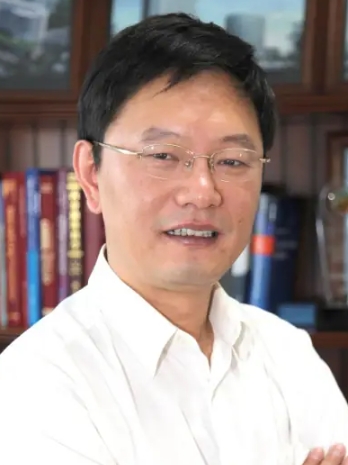 Yuqiang Ding (丁玉强)合作论文数Institutes of Brain Science, Fudan University3
 Chen Zhong合作论文数3
 Li You (尤力)合作论文数National Mobile Communications Research Laboratory, School of Information Science and Engineering, Southeast University3
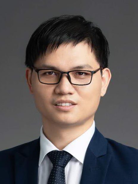 Wei Tu (涂伟)合作论文数School of Architecture & Urban Planning, Shenzhen University3
 Yunsheng Zhang (张云生)合作论文数School of Geosciences and Info-Physics, Central South University3W. Wang合作论文数2H. S. Huang合作论文数2
 Siyang Chen合作论文数2Yulei Li合作论文数2Wenhua Guo合作论文数2




